Originally posted by David K
| Quote: | Originally posted by DianaT
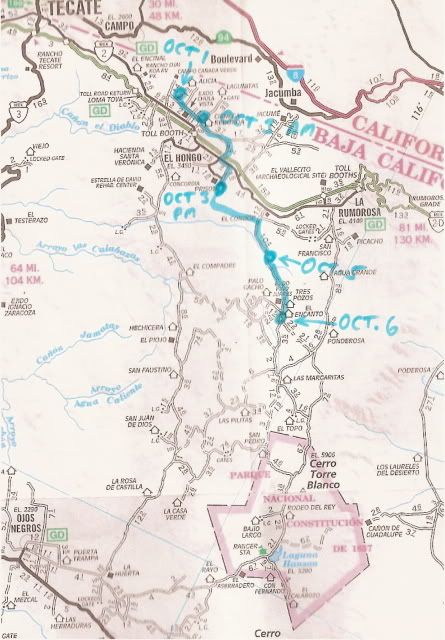
Using a map like that will be interesting to follow their progress, and it will be interesting to see how close David is in marking his course.
How Mike and all the animals are enjoying the journey. |
The SPOT data comes to me on Google Earth, so the location is 'spot on'. You can zoom in and see the road they are on, so it is pretty easy for me to
either find that road on the AAA map or add it in.
His Oct. 3 PM location was just outside (southeast of) the big prison at El Hongo. Not shown on the AAA map, but clearly seen from space is a road
that continues south from there then turns east to meet the road running south of El Condor... which is what I added in. |


 Oct. can be iffy on the plateau.


