El Jefe - 7-5-2007 at 09:05 PM
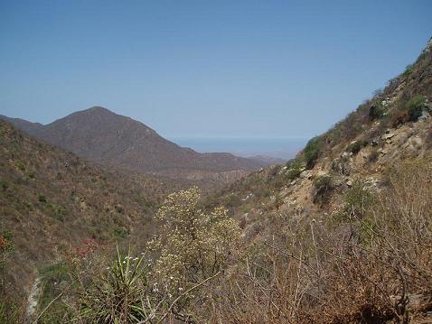
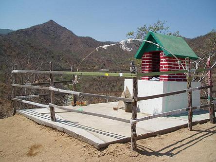
We drove the Naranja Road through Rancho Cieneguita over and back today. That was a first for us. Great views up there! The road was passable with 2WD
both ways, but limited slip and high ground clearance helps a lot especially east bound. From the turnoff from Hwy 1 north of Santa Anita to Hwy 19 at
Rancho Nuevo just south of Pescadero is about 33 miles. It took us a couple of hours each way.
It is easy to see why this road goes away after a healthy rainstorm. There are some beautiful ranchitos up there that must get awful lonely after the
big one hits.

El Jefe - 7-5-2007 at 09:06 PM
one more photo

David K - 7-6-2007 at 08:35 AM
Great to hear Tom... Thank you!
Could you show us more photos?
bajajudy - 7-6-2007 at 10:58 AM
Jefe
Havent made that trip is years. It is beautiful for sure. The last time we made the trip was in our GMC crew cab long bed truck, 19 feet long. I
got out a couple of times just in case the truck went over...no sense in both of us crashing and burning. There is a cave painting on that road, did
you by chance stop there?
El Jefe - 7-6-2007 at 01:17 PM
Didn't know about the cave paintings Judy. That would have been a stop for sure. I can see how the crew cab would have been quite a challenge around
some of those curves!
Here is a shot of the road just as it leaves Hwy 1. The power lines go to what looks to be a new slaughter house at the base of the mountains.
[Edited on 7-6-2007 by El Jefe]
trying to get the photo posted. otra vez
[Edited on 7-6-2007 by El Jefe]
no luck today
[Edited on 7-6-2007 by El Jefe]
David K - 7-6-2007 at 03:32 PM
It is possible the photo that won't post is over 50 kbs in file size... See this tutorial: http://forums.bajanomad.com/viewthread.php?tid=24603
El Jefe - 7-7-2007 at 07:52 AM
Thanks David. I was getting an error message, but the file is only 32KB. One more try.........
[Edited on 7-7-2007 by El Jefe]
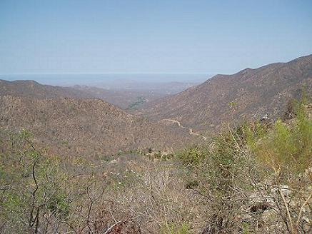
OK, so there is something weird with the other photo I wanted to post. Who knows? This one is showing the Pacific in the distance and a little bit of
the road down, down, down in the valley.
[Edited on 7-7-2007 by El Jefe]

sneezerdog - 7-7-2007 at 02:29 PM
Judy is this the "road" we took one time when I was there? Going from east to west over the mountains ending up at the Pacific ocean? That was a fun
trip to be sure!
Dave
bajajudy - 7-7-2007 at 03:11 PM
Dave
I think the we took the San Felipe road out of Guamitas.
Did we see the huge Virgen de Guadalupe on the side of a rock?
Yo no recuerdo
sneezerdog - 7-8-2007 at 02:35 PM
I don't recall any rock image, I just remember taking some dirt road west off the highway running north from the airport. It wasn't too far north I
don't think. We came out at some subdivision on the pacific coast I thought.
bajajudy - 7-8-2007 at 02:58 PM
That is Narajanas.
We came out at Magrino, I think
