
David K - 3-4-2009 at 05:50 PM
The trail was hiked in 2004 by Nomads Jack Swords, Taco de Baja, Mexitron and Pappy
Their map and GPS data is in our Baja Missions page at VivaBaja.com
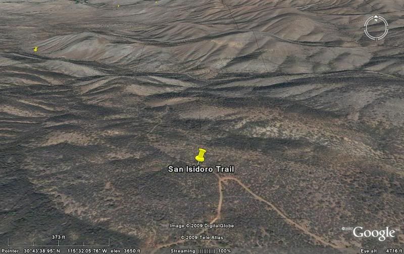
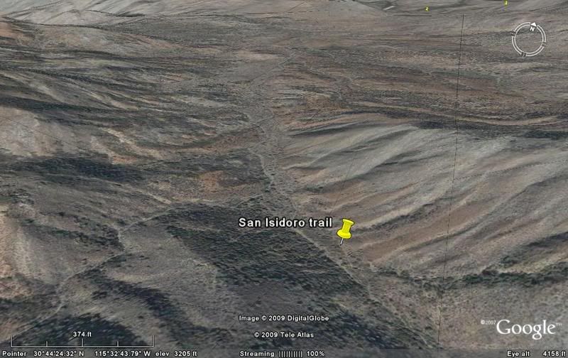
The traditional way to get to the mission from the west is to reach San Isidoro after a long hike from San Antonio and the road south of Santa Cruz.
Now, with a graded road into the foothills coming up from San Quintin, via Rancho Nueva York, the hike to San Isidoro is GREATLY reduced!
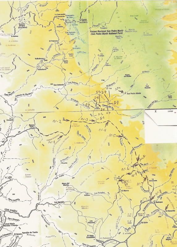
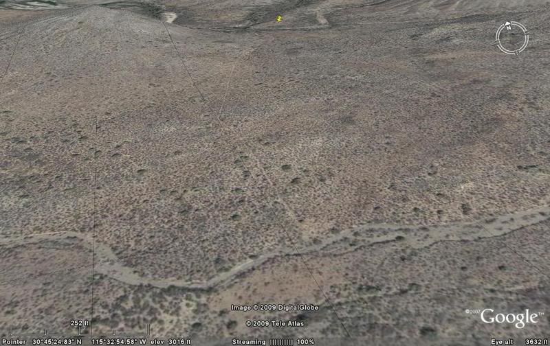
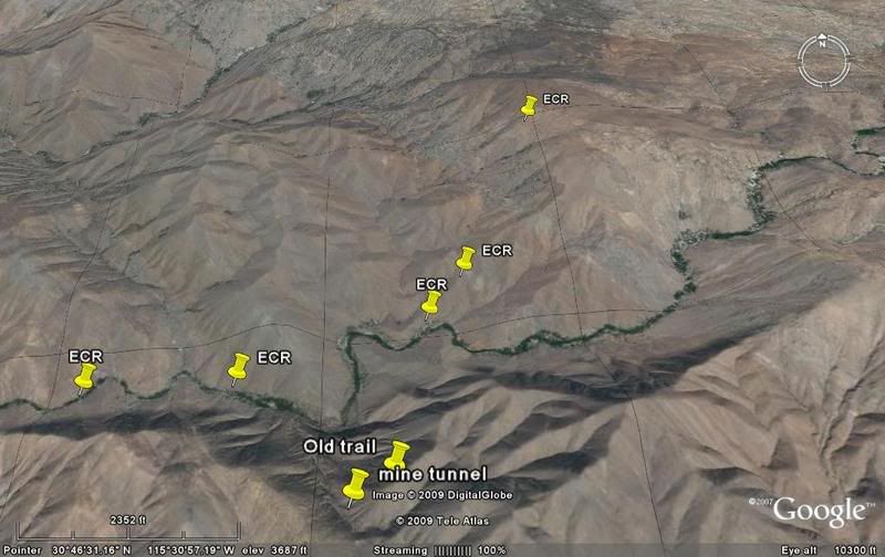
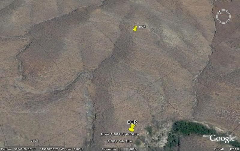
Here is the overall area... near the top left corner is The Meling Ranch... see Santa Cruz and San Antonio southeast of there... The new road is
dashed and pointed out with arrows marked nr-1 to nr-10. The San Isidoro trail head is nr-3 and a higher trail begins at nr-4.
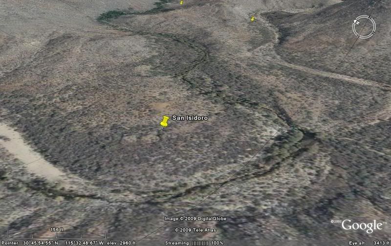
Now a close up of the mission trail region:
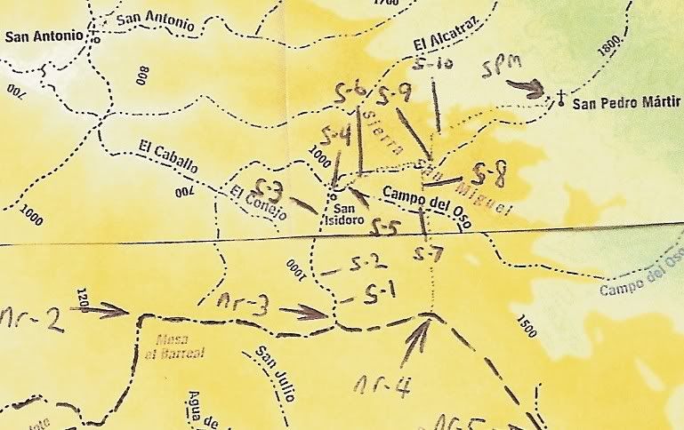
Images marked by s-1 to s-10 +
S-1)
S-2)
S-3)
S-4 San Isidoro)
Overview from San Isidoro up a bit on the trail:
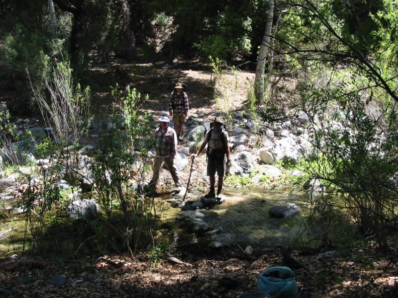
S-5) The trail begins in the stream to the south (Arroyo Campo del Oso), but crosses to Arroyo el Horno here:
S-6)
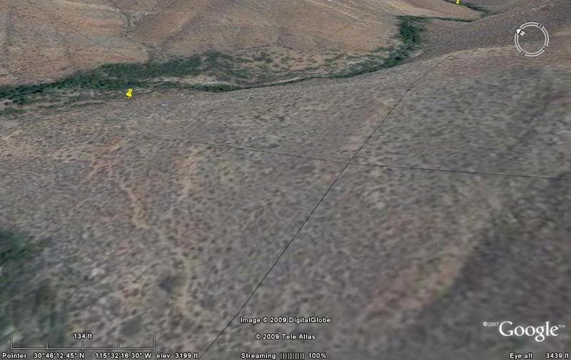
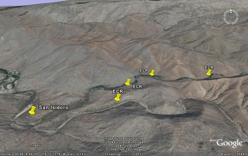
On overview of the area where the two trails meet, and beyond to the palisades (steep mountain face):
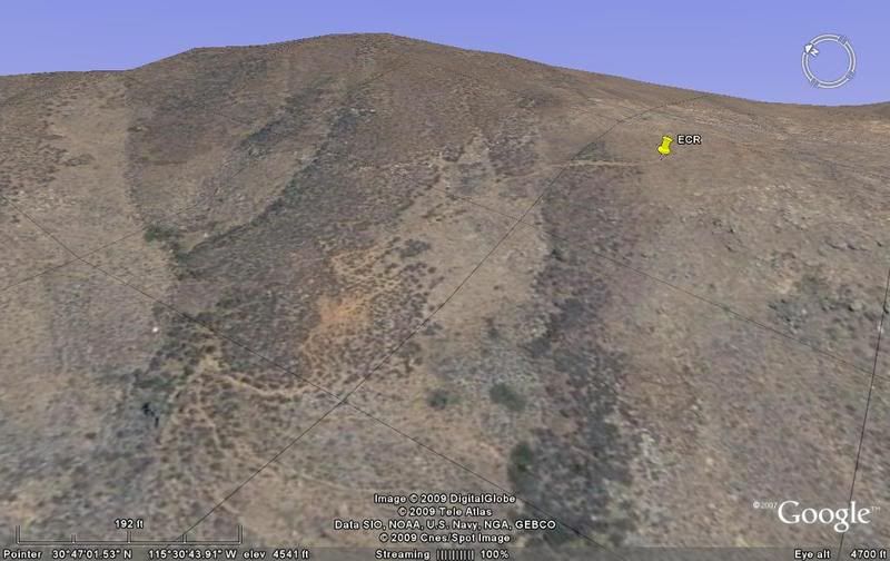
S-7) Here is the higher access trail that comes north from nr-4:
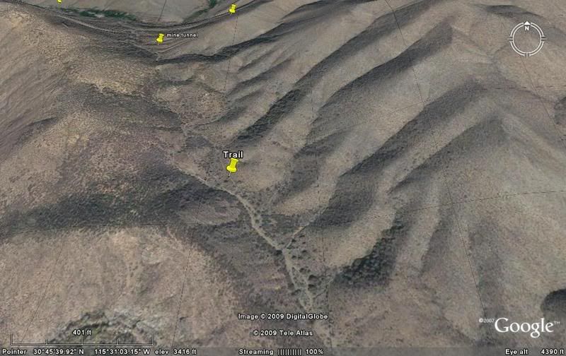
S-8) A mine entrance is along this trail between the two arroyos. Also, an old trail is seen going along the mountain ridge, uphill. :
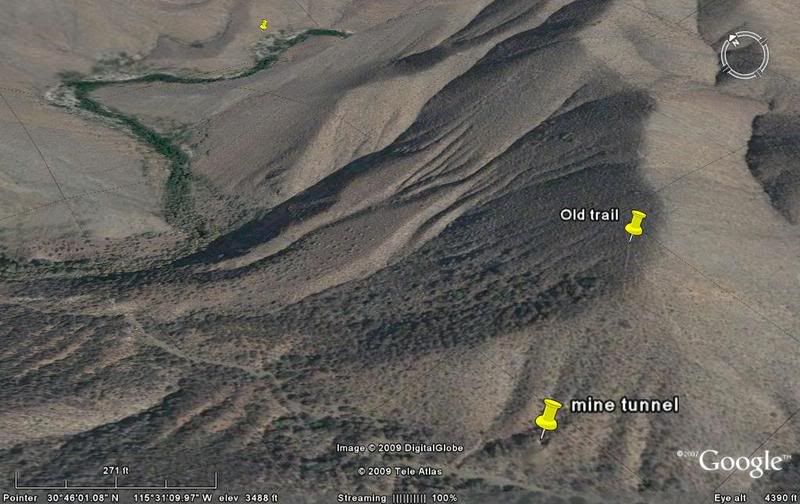
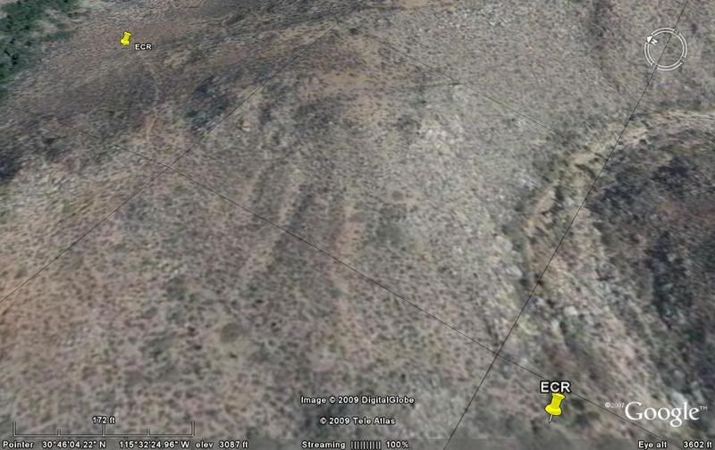
S-9) The mission road now leaves the Arroyo and begins the steep climb up to the plateau above:
S-10)
Up the face of the palisades:
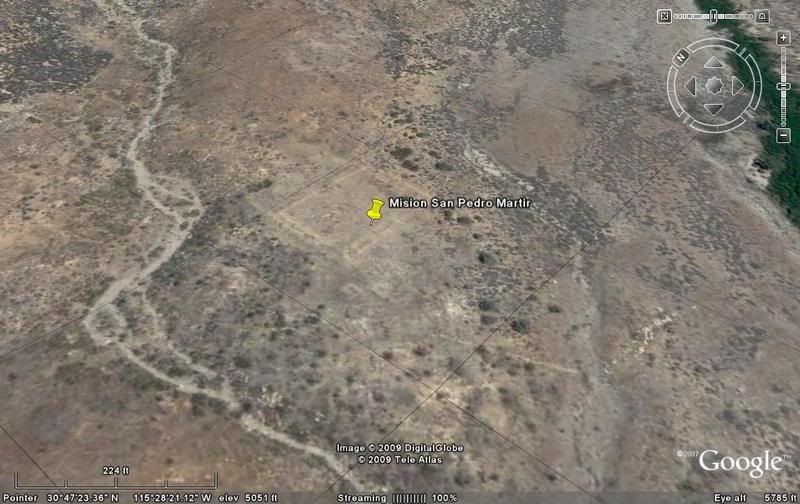
MISION SAN PEDRO MARTIR site:
[Edited on 3-5-2009 by David K]
2004 trip map
David K - 3-4-2009 at 05:58 PM
The 2004 expedition remained in the Campo del Oso stream all the way from San Isidoro to the higher cross over trail that comes up from nr-4.
More from the 2004 trip, and mission details here: http://vivabaja.com/missions2/page9.html

[Edited on 6-13-2015 by David K]
David K - 3-17-2009 at 05:53 PM
Jack Swords, Mexitron, Taco de Baja, Pappy... since you guys made this climb in 2004... I would like to hear about the choice of trails... did you not
see the one that returned to Arroyo Horno after a short distance in Arroyo Campo del Oso... Did you see the mine on the cross-over trail?
Thanks..
Jack Swords - 3-17-2009 at 06:24 PM
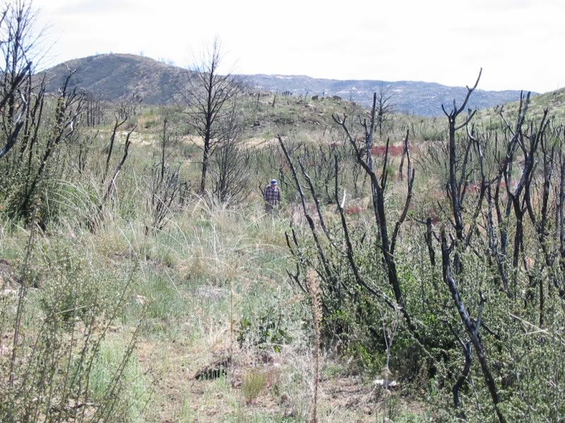
For most of the trail either we were in arroyos or in heavy vegetation, or in heavy vegetation in arroyos. The trail selected was a result of a fire
that had cleared out brush and trees, otherwise the lower trail we took to the mission would have been impassable. Photos of the plateau where the
mission is located shows tree and brush skeletons resulting from the fire. It made a great opportunity to photograph the ruins that would have been
obscured by brush prefire. I remember Isadora where the brush obscured the whole area and I wanted to explore this old gold mining area. All we could
do was zig-zag around the brush. This is a fascinating area with mature trees, flowing streams, (we had to walk in the center of some as the sides
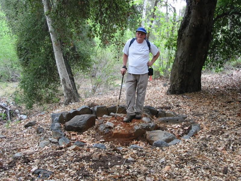
were brushed in) and lots of ups and downs. We did find an arrastra that was about 8 ft. in diameter with the holed stones for the burro/donkey. Did
not see a soul on the trip, except one grave at the marijuana plantation.
Jack Swords - 3-17-2009 at 07:16 PM
See if this photo posts: Evidence of the fire, but still brushy.
Jack Swords - 3-17-2009 at 07:17 PM
Stream crossing:
An arrastra
Jack Swords - 3-17-2009 at 07:19 PM
Gold mining arrastra
[Edited on 18-3-2009 by Jack Swords]
Neal Johns - 3-17-2009 at 08:08 PM
Arrastra
To remove gold from the rock it is in, you need to make big rocks mined into small pieces. This produced more surface area for any treatment (mercury
or cyanide) or breaks out the gold pieces for panning.
An arrastra starts as a round pit lined or paved by smooth rocks on sides and bottom. Stick a vertical pole in the center (missing in the picture),
then attach a horizontal pole to the top of the center pole long enough to reach to the outside of the pit and free to rotate around the pit like the
hand of a horizontal clock (also missing). Don't forget to tie a heavy stone to the center of the horizontal pole so it will drag around and around
the pit as the hand of the horizontal clock spins. You now have an arrastra.
Attach a burro to the outside-of-the-pit end of clock hand/horizontal pole and sweet talk him into walking in a circle around and around the outside
of the pit (arrastra), throw in some large rocks and many revolutions later the heavy dragging stone will grind them into gravel with lots of surface
area, then pan the gold out of the gravel and wait a century or two for cyanide to be used to dissolve the gold for later separation. 
Neal Johns - 3-17-2009 at 08:12 PM
On Jack's left, (right in the picture) in the circle is the drag stone, identified by the two holes in it used to attach the chain or rope going to
the horizontal pole.
Jack Swords - 3-17-2009 at 08:19 PM
Thanks Neal! Here is a lengthy explanation with modern modifications. We have found smaller mortars or arrastras in Pozo Aleman and at Desegaño and
Yubay. Each of these used a steel center post. More modern gold mining techniques used stamp mills.
http://www.csuchico.edu/~rcooke/rastra.html
Neal Johns - 3-17-2009 at 08:26 PM
Sorry, Jack,
I thought you old guys went to bed early.
Two more years and I will be 80. Then I can really pick on people!!!
Jack Swords - 3-18-2009 at 06:40 AM
Hey Neal, jump in anytime! You can pick on people now! Thanks for the additional inormation. I guess I was up later than usual.
David K - 3-18-2009 at 09:14 AM
Love this... thanks Jack and Neal!
Yubay's gold
Jack Swords - 3-18-2009 at 10:55 AM
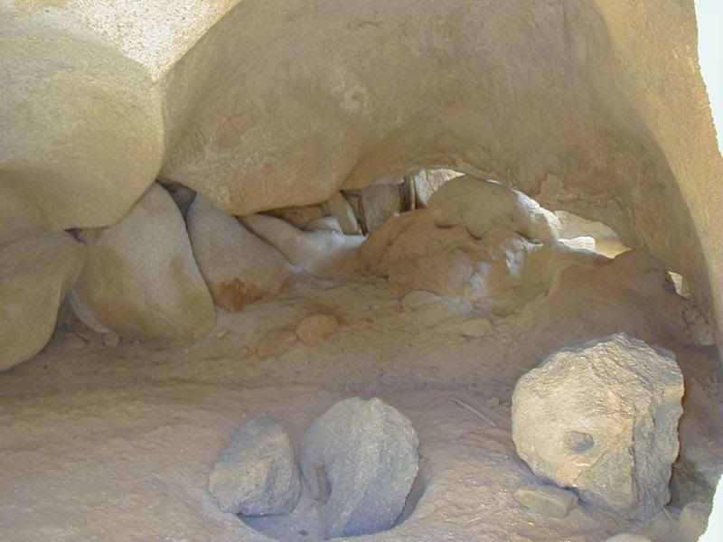
At Yubay there are several small arrastras or mortars for grinding ores. These are all using a steel center and the grinding rock has a hole in it.
One has a hole in it for a stick for a handle. This particular one in the photo is inside a cave. There is another one on the outside of the cave
also.
shari - 3-18-2009 at 11:32 AM
Thanks for explaining what that thing was...very very intruiging....gotta try that with our burro...making gravel...could be a new business
opportunity!
Mexitron - 3-18-2009 at 11:57 AM
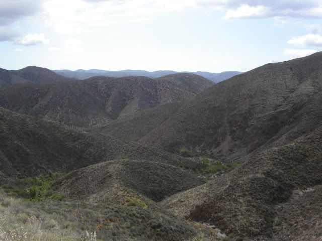
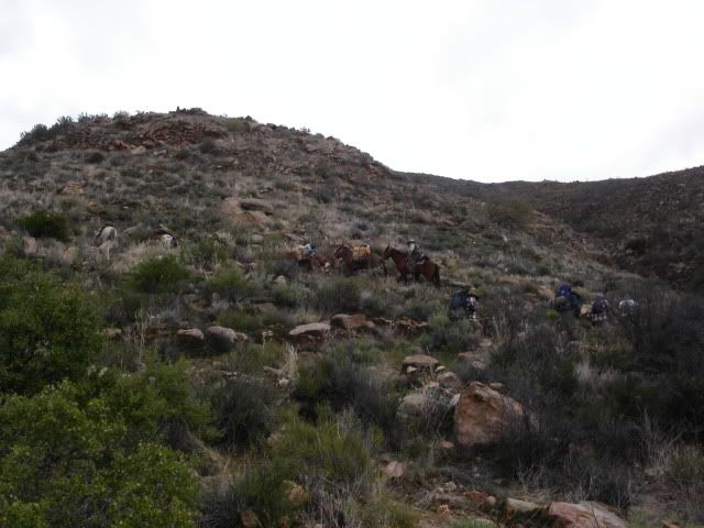
Here's looking down at the Rio El Horno where the trail left to head up the steep Sierra San Miguel climb.
Mexitron - 3-18-2009 at 11:59 AM
This is further up the San Miguel...
Mexitron - 3-18-2009 at 12:02 PM
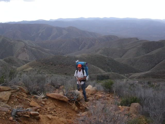
And here's Brooks,er, Taco de Baja near the top of the mountain and just another mile or two to the Mission SPM on the high tablelands.
David K - 3-18-2009 at 12:35 PM
Thanks for sharing these (never before seen?) on Nomad photos!
Mexitron - 3-19-2009 at 04:50 AM
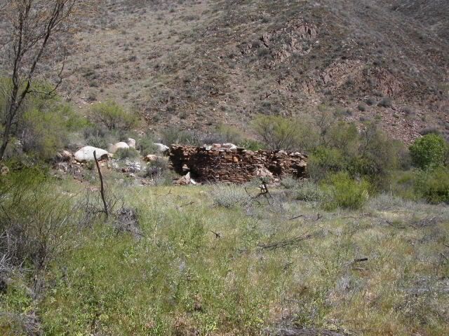
This is what's left of a little casita in the middle of the pot farm area...
Mexitron - 3-19-2009 at 04:57 AM
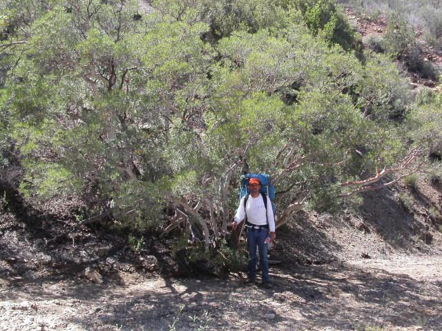
This is Taco De Baja on the mine trail...and for any botanists out there the tree he is standing in front of is Ornithostaphylos oppositifolia, part
of the Manzanita tribe but with white bark...nice plant!
David K - 7-20-2020 at 03:43 PM
A classic Nomad adventure... hiking to Mission San Pedro Mártir! Bummer on Photobucket watermarks when they went from free hosting to pay hosting.
Reading our late Nomad, Neal Johns is heartwarming.