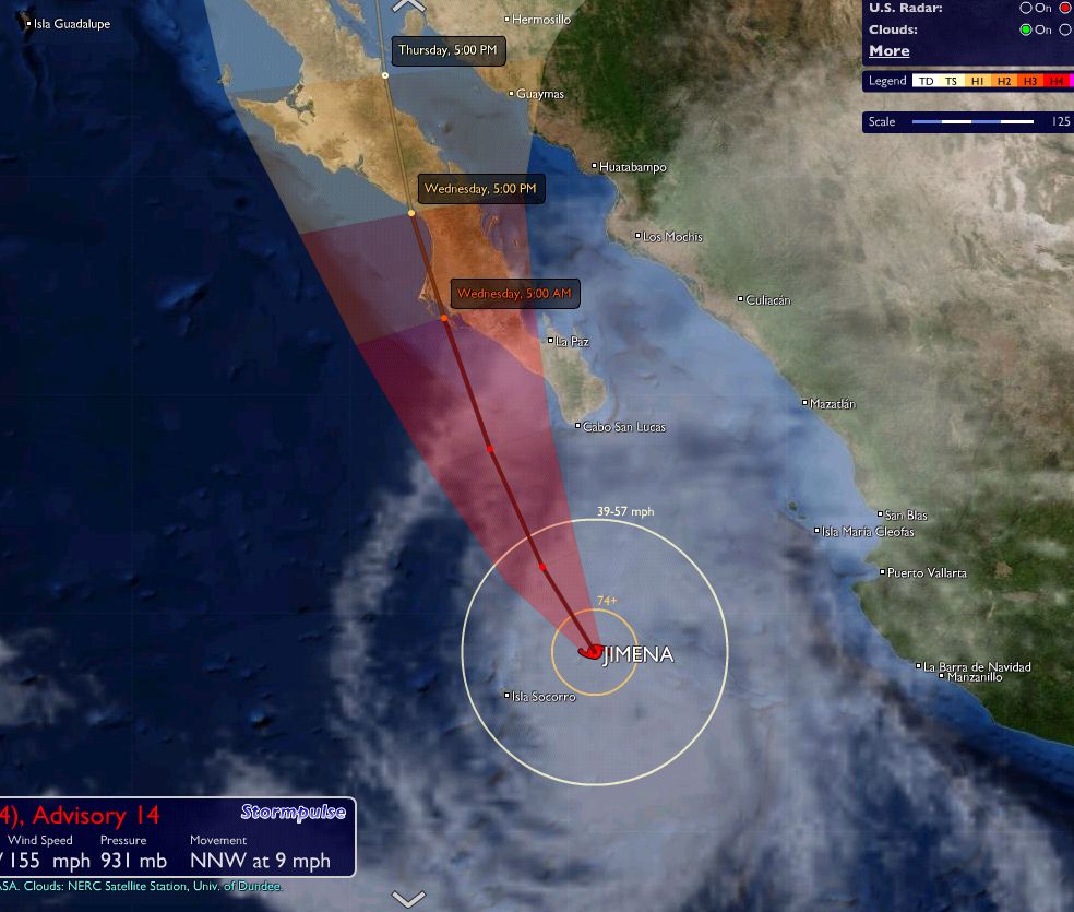
Originally posted by HaciendaCerritos
Thanks everyone, I'll keep an update going as long as this Telcel 3G stays available. We're watching the storm closely.
Loretena: You are 100% right, but I am concerned about the palapa and of course everything else, including the villas on the beach. We're pushing to
get finished and then hurry-up and wait begins.
Good luck to all. |