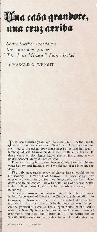
This is another gem from my collection of Choral Pepper's saved Baja magazine articles!
This article called 'Una casa grandote, una cruz arriba (Some further words on the controversy over "The Lost Mission" Santa Isabel)' by Harold O.
Weight was published in the September, 1967 issue of Westways Magazine.
It is the best Santa Isabel, found story I think I have read so far!
If the text is too small to read, I will break up the pages and zoom in to make them bigger! SEE NEXT REPLY, BELOW TO READ...
[Edited on 10-22-2009 by David K]
EASIER READING...
David K - 10-21-2009 at 06:55 PM
Isn't that great!?
[Edited on 10-22-2009 by David K]David K - 10-21-2009 at 07:22 PM
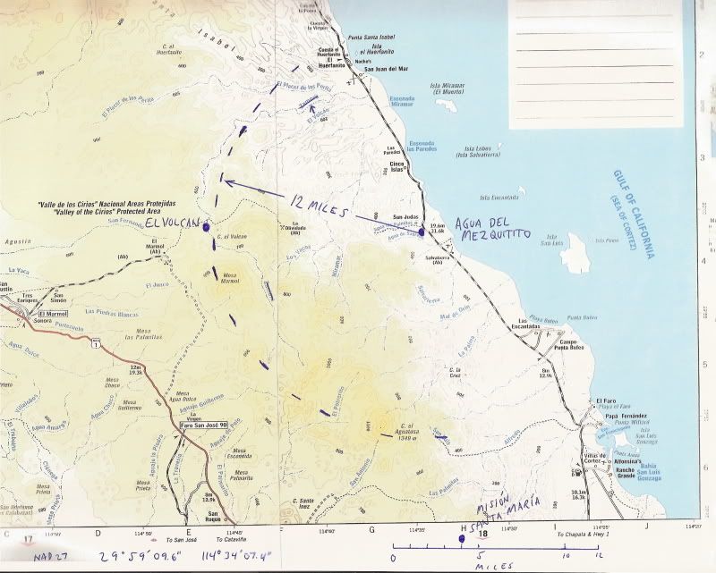
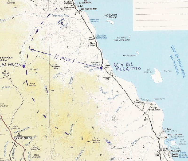
Of interest, here is the spring from the story: Agua del Mezquitito (2.4 miles south of Okie Landing/ 15 miles north of Gonzaga Bay)...
This is me (age 16) in 1974 on my first Baja trip without parents. I returned here in 2002 and a corral of tires was made around the water hole.Mexitron - 10-21-2009 at 07:31 PM
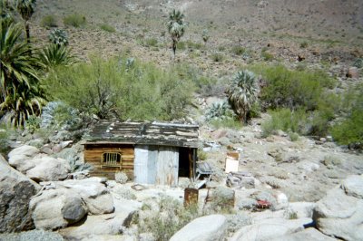
Nice story...makes you wanna load up the truck right now and go looking for that casita, eh?
I'm always amazed at what one finds in the outback...seemingly narrow barren canyons open up to a palm grove and water...and there's so many canyons
to explore...
Thanks for posting David.David K - 10-21-2009 at 07:40 PM
Quote:
Originally posted by Mexitron
Nice story...makes you wanna load up the truck right now and go looking for that casita, eh?
I'm always amazed at what one finds in the outback...seemingly narrow barren canyons open up to a palm grove and water...and there's so many canyons
to explore...
Thanks for posting David.
My pleasure Steve... You know, the area you have hiked to Cerro Matomi is not that far away from the location described! Parral Ranch road is where we
met, in fact!
Now, is there a 300 ft. waterfall south of Parral and Matomi? What does Montinée mean?
Oh, this is fun!David K - 10-22-2009 at 08:50 AM
Here is the area with the water hole plotted and a 12 mile radius out drawn in...
Let the hunt begin! David K - 10-22-2009 at 04:41 PM
Of course, the doce millas quoted by the old timer needs to be considered approximate... Could it have been doce kilometers? (7.4 miles)
elinvesti8 has been in the area (Mina La Olividada) with Soni Espinoza, and posted photos on Nomad... rugged country east of El Volcan!bajalera - 10-22-2009 at 05:05 PM
Interesting story, DK--and thanks for the larger type.mtgoat666 - 10-22-2009 at 05:28 PM
Quote:
Originally posted by David K
Of course, the doce millas quoted by the old timer needs to be considered approximate... Could it have been doce kilometers? (7.4 miles)
elinvesti8 has been in the area (Mina La Olividada) with Soni Espinoza, and posted photos on Nomad... rugged country east of El Volcan!
dk:
quite a story, but your locations and maps are all wrong. take the distances with a grain of salt, they are obviously wrong, and look northward, lost
one. no more will i say. good luck. happy hunting.David K - 10-22-2009 at 08:37 PM
Maps are all wrong? No, I am sure where Agua del Mezquitito is (I GPS'd it in 2002)... and I am sure I read 12 miles... so, the map is for fun to show
a 12 mile radius from the spring where the story is based.
Further north? Maybe, but the old timer was clear it was not 50 miles north at Rancho Parral. Here is a photo of the view at Rancho Parral (in
2004)... pretty nice for a Baja desert, no?
David K - 10-22-2009 at 08:43 PM
Here is Rancho Parral... a few miles north of Matomi:
RANCHO EL PARRAL 30°29.42', 115°06.97'
--------------------------------------------------------------------------------
Here is the upper Matomi canyon with its blue palms... Photo from Mexitron, 2004:
Santa Isabel could be just around the bend?Mexitron - 10-23-2009 at 05:01 AM
I haven't done any exploring within that 12 mile radius David, except of course for seeing El Vulcan---and yes it is very rugged country! Be fun to
take a year off and go searching!
I 've never seen a 300 foot waterfall around Matomi.... .....I'll say this though--when he was talking about the canyon trail going down a
steep dropoff I thought of the palisades around Mesa Matomi, which we explored on our Don Quixote mission to find the lost plane Its not a far reach to think that farther up Arroyo Matomi there's a dropoff of
water from the palisade, but it couldn't be much volume as the mesa is pretty dry.
The Matomi Mesa is punctuated by miles of ravines, many of which have more plant growth than the surrounding mesa-lands...Arroyo Grande is the main
drainage there and isn't too far away from the site...................???Mexitron - 10-23-2009 at 05:14 AM
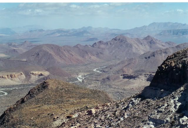
This would be the view from the palisades above Arroyo Matomi looking northeast-ish, Parral and Berrendo would be on the left, for orientation:
David K - 10-23-2009 at 07:24 AM
Yes, I love that photo... Arroyo Matomi below and Valle Chico beyond... I would say your camera is almost pointed directly towards San Felipe.
The Baja 1000 next month is running down the valley and into Matomi, then east to Hwy. 5, and back north through San Felipe. Score calls Matomi Wash
'The Best of Baja'...David K - 11-12-2009 at 10:37 AM
Standby for another Lost Mission of Santa Isabel story, from a 1941 book!


 Its not a far reach to think that farther up Arroyo Matomi there's a dropoff of
water from the palisade, but it couldn't be much volume as the mesa is pretty dry.
Its not a far reach to think that farther up Arroyo Matomi there's a dropoff of
water from the palisade, but it couldn't be much volume as the mesa is pretty dry.