BajaNomad

HURRICANE WARNING FOR BAJA - ODILE - AFTERMATH

 Pages:  1    3  ..  8

bajabuddha - 9-8-2014 at 06:41 AM

http://www.wunderground.com/hurricane/eastern-pacific/2014/I...
Another tropical low pressure is forming, and computer tracks are pointing north-westward again. Forewarned is forearmed. It'll take 3-4 days for definitive dangers and results; Buena suerte, Baja.

[Edited on 9-8-2014 by bajabuddha]


[Edited on 9-9-2014 by BajaNomad]

[Edited on 9-10-2014 by bajabuddha]

[Edited on 9-10-2014 by bajabuddha]

[Edited on 9-13-2014 by bajabuddha]

[Edited on 9-14-2014 by BajaNomad]

[Edited on 9-14-2014 by bajabuddha]

[Edited on 9-14-2014 by bajabuddha]

[Edited on 9-14-2014 by bajabuddha]

[Edited on 9-15-2014 by bajabuddha]

[Edited on 9-16-2014 by bajabuddha]

woody with a view - 9-8-2014 at 07:02 AM

http://www.stormsurfing.com/cgi/display.cgi?a=npac_height

VERY different from 24 hours ago. yesterday it showed a MASSIVE storm following the paths of Marie and Norberto. watch til the end.

[Edited on 9-8-2014 by woody with a view]

shari - 9-8-2014 at 07:17 AM

why am I not surprised...tick tick tick

BajaParrothead - 9-8-2014 at 07:17 AM

Quote:
Originally posted by woody with a view
http://www.stormsurfing.com/cgi/display.cgi?a=npac_height

VERY different from 24 hours ago. yesterday it showed a MASSIVE storm following the paths of Marie and Norberto. watch til the end.

[Edited on 9-8-2014 by woody with a view]


Woody, yours seems to indicate something hitting the tip and East Cape in about 7 days.:?:

LAUNDRY ALERT! LAUNDRY ALERT!

Mulegena - 9-8-2014 at 08:04 AM

Get 'er done while it's hot, boy 'n girls.

micah202 - 9-8-2014 at 10:31 AM

.
.....my hunch,,,and it's only a hunch,,,is that a sacrifice of seven sister goats at seven equidistant points on the seventh day of the ninth month might have a beneficent effect ............ohhh,waidaminute :wow::smug::o:(


...I'd suggest we not 'lend attention' to those -little disturbances- until they organize more....let them figure things out for themselves!:rolleyes:

[Edited on 9-8-2014 by micah202]

woody with a view - 9-8-2014 at 11:37 AM

Quote:
Originally posted by BajaParrothead
Quote:
Originally posted by woody with a view
http://www.stormsurfing.com/cgi/display.cgi?a=npac_height

VERY different from 24 hours ago. yesterday it showed a MASSIVE storm following the paths of Marie and Norberto. watch til the end.

[Edited on 9-8-2014 by woody with a view]


Woody, yours seems to indicate something hitting the tip and East Cape in about 7 days.:?:


like I said, VERY different from yesterday. the models are only really accurate inside 3.5 days or so.

woody with a view - 9-8-2014 at 03:22 PM

now it's back to its original model forecasted run. BIG one coming but wait until about 3.5 days out for better accuracy.

anybody looking at the "new storm" a comin ?

cj5orion - 9-9-2014 at 05:37 AM

this Wednesdays forecast

http://sailflow.com/en-us/Search/ViewResults.aspx#16.801,-10...


Tuesday forecast Sept 16 !!!!
as yet....a unspoken of,unnamed... ?

http://sailflow.com/en-us/Search/ViewResults.aspx#24.922,-10...

bajajudy - 9-9-2014 at 06:51 AM

000
ABPZ20 KNHC 091138
TWOEP

TROPICAL WEATHER OUTLOOK
NWS NATIONAL HURRICANE CENTER MIAMI FL
500 AM PDT TUE SEP 9 2014

For the eastern North Pacific...east of 140 degrees west longitude:

An area of low pressure located a couple of hundred miles south of
Acapulco, Mexico has changed little in organization overnight.
Environmental conditions are expected to be conducive for
development, and the low is likely to become a tropical depression
in the next couple of days while it moves slowly northwestward just
off the southwestern coast of Mexico.
* Formation chance through 48 hours...high...60 percent.
* Formation chance through 5 days...high...80 percent.

$$
Forecaster Cangialosi

danaeb - 9-9-2014 at 07:06 AM

Quote:
Originally posted by cj5orion

Tuesday forecast Sept 16 !!!!
as yet....a unspoken of,unnamed... ?


If she is a contender, her name will be "Odie".

[Edited on 9-9-2014 by danaeb]

watizname - 9-9-2014 at 07:16 AM

Every storm track this year has gotten closer and closer to Baja. This one may just go "downtown". I hope not. Cross your fingers boys and girls. :?::?:

bajajudy - 9-9-2014 at 07:51 AM

Odile will be the name.
It is too early to tell what she will do.
Got my fingers crossed anyway!

shari - 9-9-2014 at 08:14 AM

Jeepers...at this rate we might even get a Hurricane Zeke this season!!!

2014
Amanda
Boris
Cristina
Douglas
Elida
Fausto
Genevieve
Hernan
Iselle
Julio
Karina
Lowell
Marie
Norbert
Odile
Polo
Rachel
Simon
Trudy
Vance
Winnie
Xavier
Yolanda
Zeke

micah202 - 9-9-2014 at 09:42 AM

.
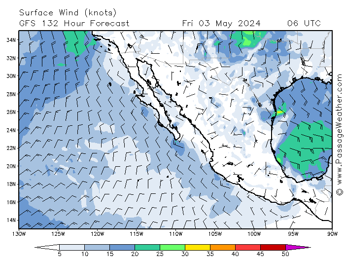
.....hmmm,,early animations from http://passageweather.com/#
don't look very good. :no::(

This model was showing some very accurate details for Norbert up to 5 days in advance


.........too bad about the goats :no::no::no:

.

[Edited on 9-9-2014 by micah202]

Hurricane Odile gestation

CaboDreamer - 9-9-2014 at 12:33 PM

It looks like Hurricane Norbert could be a dry run for his bigger sister Hurricane Odile.

This wind forecast model seems to have a good track record. Keep the boards and plywood handy for this weekend.

http://magicseaweed.com/MSW-Surf-Charts/19/?chartType=WMAG

shari - 9-9-2014 at 03:22 PM

Odile will be really interesting and hard to now if she will go into the gulf or up the middle or west coast but bound to be a pain in the burro if not downright dangerous. This week we will be installing anchors to tie the roof down and organizing thicker plywood for the windows...just in case. Yes Norbert got our attention of what could be.....
In the meantime I am on my way to Ensenada between hurricanes to visit Sirenita & Izaak...anybody want to get together there?

Bob53 - 9-9-2014 at 03:32 PM

Please let me know what shape highway 1 is in.

shari - 9-9-2014 at 04:20 PM

roger wilco....I am hoping for dry arroyos and clear sailing all the way

Cisco - 9-9-2014 at 04:31 PM

Black's has been sweet for the last week.

Keep em' comin.

bajajudy - 9-9-2014 at 04:42 PM

Not Odile yet


000
ABPZ20 KNHC 092332
TWOEP

TROPICAL WEATHER OUTLOOK
NWS NATIONAL HURRICANE CENTER MIAMI FL
500 PM PDT TUE SEP 9 2014

For the eastern North Pacific...east of 140 degrees west longitude:

Low pressure centered a couple hundred miles south-southwest of
Acapulco, Mexico, continues to show signs of organization.
Environmental conditions are conducive for additional development,
and a tropical depression could form later tonight or on Wednesday
while the low moves slowly northwestward just offshore the
southwestern coast of Mexico.
* Formation chance through 48 hours...high...70 percent.
* Formation chance through 5 days...high...90 percent.

A small area of low pressure located about 875 miles
south-southwest of the southern tip of the Baja California
peninsula has become a little better organized during the day.
However, significant development of this system is not anticipated
while it moves generally northward and then northeastward during the
next couple of days.
* Formation chance through 48 hours...low...20 percent.
* Formation chance through 5 days...low...20 percent.

$$
Forecaster Berg

BajaNomad - 9-9-2014 at 04:54 PM

http://www.wunderground.com/hurricane/eastern-pacific/2014/I...

chuckie - 9-9-2014 at 05:08 PM

Wrong storm

bajajudy - 9-9-2014 at 05:22 PM

Quote:
Originally posted by chuckie
Wrong storm

Nope...right one

chuckie - 9-9-2014 at 05:26 PM

Eastern North Pacific?Nah....NHC shows easter pacific mess at 90% But....

chippy - 9-9-2014 at 05:47 PM

I guess if all goes as predicted I´ll get to see 9 meter surf here on sat/sun:o

[Edited on 9-10-2014 by chippy]

woody with a view - 9-9-2014 at 05:51 PM

120hr run shows it going up the gulf! this time tomorrow should be pretty accurate.....

LOOK OUT BELOW!!!
http://www.stormsurfing.com/cgi/display.cgi?a=npac_height

vandenberg - 9-9-2014 at 06:22 PM

Even the latest weatherunderground has this storm going up the Sea.
Sure hope they're wrong!!

micah202 - 9-9-2014 at 10:22 PM

.
.......YEEPS!!...now 3 of 5 projections are going that way :o:o:o


...edit...this chart self-updates....the 2am update is showing a hopeful addition of an added possible track to the west

[Edited on 9-10-2014 by micah202]

ViajeraGal - 9-9-2014 at 10:55 PM

Sure hoping this girl/Odile behaves herself; I'm due to return to SJD afternoon of Fri/12th after two months in Asia.......and our casa is on the beach north of Los Barriles.

micah202 - 9-9-2014 at 11:41 PM

.
....I'd have to say I'm rather more concerned with the prospects of the native population....they generally have a few less options than us gringo's

....altered plans vs altered -lives- :O

landyacht318 - 9-9-2014 at 11:47 PM

The model predictions have been pretty unreliable this year even at 3 days out. Something to keep in mind, cause what they are saying now is not looking good.

I'd prefer they all mimic Marie's track and intensity and flip the alphabet instead of Strafing all of Baja sur.

http://magicseaweed.com/MSW-Surf-Charts/19/?chartType=WMAG

bajabuddha - 9-10-2014 at 06:01 AM

This morning Odile is looking like becoming a 'named' storm for sure by this afternoon, and is not going to be a favorite Tourist of Baja. Another system, 95E is out another 500 miles west, and the 'puter ensembles for that one are NERTZ! There are three graphs; one says west to sea, one says north with hook-back to Baja and a third says 'right-turn, Clyde' and maybe hook up with future Odile. It's going to be a circus to watch over the next few days. TD 15E (future Odile) says Tropical Storm by Friday, Cat-1 Saturday and South Cape landfall by Monday. All a crap-shoot, but i'd be doing windows and buying water.... again...
Buena Suerte Sureños.... via con Dios. :wow:

http://www.wunderground.com/hurricane/eastern-pacific/2014/T...

http://www.wunderground.com/hurricane/eastern-pacific/2014/I...

chuckie - 9-10-2014 at 06:24 AM

And we'll be having our first snow in Colorado....

micah202 - 9-10-2014 at 06:59 AM

.
.....the odds-makers are only putting it at 5% to be a hurricane hitting Cabo,,40% for a TS---I'll go with that!:rolleyes:;):smug:

...still a chance that house-fans,fridges,hopes and prayers can make a difference.... ..I perceive that TS's can be particularly modest during the formulation period--perhaps it'd help if we all strip and spin clockwise! :yes::yes:

http://www.nhc.noaa.gov/refresh/graphics_ep5+shtml/084129.sh...

.


[Edited on 9-10-2014 by micah202]

From Baja Insider

bajajudy - 9-10-2014 at 07:11 AM

Wednesday, September 10, 2014 6:22 AM MDT We just finished with Hurricane Norbert battering the Pacific coast of the Baja peninsula, now we need to be on alert for the threat of another this coming weekend. Tropical Depression 15E has formed off the southern coast of Mexico and is forecast to head straight for us here in Baja California Sur late in the weekend. The is still some question as to the destination of this storm as in the initial forecast it is only moving at 1kt and it has a great deal of land interaction to endure before making the jump across the open water from the mainland to the Baja peninsula before we can tell for certain if and where landfall might occur and at what intensity the system will bring, five days in the future. TD 15E is forecast to become Tropical Storm Odile as early as the 9AM forecast release. Folks with interests in the southern state of Baja California Sur should follow the development of TD15E closely through the week. Much of the peninsula has enjoyed some cooler temps over the last few days, caused by the passage of Hurricane Norbert. It is common for the weather to cool after the passage of a storm, but don't be fooled, we still have another month of summer heat yet to endure.
In Baja California, Ensenada along the Pacific coast is looking for partly cloudy skies today and temps in the mid 70's, clearing tomorrow and temps will rise through the weekend in to the mid 80's for some very summer like weather along the coast. Inland, Mexicali will be relatively cool today with temps right around 100°F, but warming into the weekend close to 108°on Thursday. Along the Sea of Cortez, San Felipe will enjoy mostly sunny skies and temps in the low 90's, but summer will return by the weekend and we can look for temps back around the century mark before the end of the week.
In Baja California Sur, Guerrero Negro and the Pacific coast is still drying out and catching up with repairs following Norbert, but today will be under partly cloudy skies and temps in the upper 80's to low 90's, cooling a bit more tomorrow, but then the temps will begin to rise again. Along the eastern side of the peninsula, Loreto will have sun through the early weekend and temps climbing from the low 90's to the upper 90's by Saturday. There is a forecast threat of thunderstorms on Sunday, likely associated with the arrival of what will then be Tropical Cyclone Odile. In La Paz it will be sunny today with temps in the mid 90's through the weekend, increasing clouds by Saturday and the direct threat of Odile Sunday and moving into the week ahead. Cabo San Lucas is expecting mostly sunny skies today and temps in the upper 80's, climbing into the low 90's on Saturday with increasing humidity, Sunday's forecast appears a bit grim, with the forecasted landfall of Odile and temps falling to the mid 80's. It is still very early in the long range forecast of TD15E but remain alert to the weather as the weekend approaches. There is a great deal of warm water south of the peninsula and TD15E could gather a great deal of strength once it leave the Mexican mainland late Thursday. It would be wise for folks on the tip of the peninsula to begin looking at preliminary storm preparations by tomorrow morning.
On our Tropical Watch we have of course, TD 15E which is the most direct threat to the peninsula on the horizon. The system is forecast to follow a very similar course to Norbert, shifted a hundred miles or so to the east. This puts us right in the cross-hairs so stay tuned to the BajaInsider for the latest tropical threat information. Enjoy your day...

micah202 - 9-10-2014 at 08:45 AM

Quote:
Originally posted by micah202
.
.....the odds-makers are only putting it at 5% to be a hurricane hitting Cabo,,40% for a TS---I'll go with that!:rolleyes:;):smug:

...still a chance that house-fans,fridges,hopes and prayers can make a difference.... ..I perceive that TS's can be particularly modest during the formulation period--perhaps it'd help if we all strip and spin clockwise! :yes::yes:

http://www.nhc.noaa.gov/refresh/graphics_ep5+shtml/084129.sh...


.
.....^^...........it's WORKING!!!!.....we need more people,,,spinning -faster-!!!:bounce::yes::smug::tumble:

,

bajabuddha - 9-10-2014 at 09:58 AM

ODILE'S FOR REAL; now a named Tropical Storm, will be CAT-2 and dead-on for the south cape by Sunday night/ Monday morning.

micah202 - 9-10-2014 at 10:08 AM

Quote:
Originally posted by bajabuddha
ODILE'S FOR REAL; now a named Tropical Storm, will be CAT-2 and dead-on for the south cape by Sunday night/ Monday morning.


too soon to say for sure,,,but projections have changed a LOT in 18hours....there's beginning to be hope of it just being a glancing blow-40knots---SPIN HARDER FOLKS!!! :yes::yes::yes:


...here's a revised ...PROJECTION.....


[Edited on 9-10-2014 by micah202]

vandenberg - 9-10-2014 at 10:31 AM

Predicted rainfall along the track of Odile from the 06Z (2 am EDT) September 10, 2014 run of the GFDL model. The model predicted that TD 15-E would be a strong tropical storm or Category 1 hurricane as it brushed the coast of Mexico this week, bringing widespread rains of 8 - 16" along the coast from Acapulco to Manzanillo.

Odile.gif - 30kB

Cypress - 9-10-2014 at 10:43 AM

Good luck on this storm. Odile is heading for Baja, could be a bad one. Been lucky down on the bayou, nothing has threatened the LA/MS/AL coast this hurricane season. Been hurricane-free ever since Katrina.

woody with a view - 9-10-2014 at 11:28 AM

http://www.stormsurfing.com/cgi/display.cgi?a=npac_height

Bajaboy - 9-10-2014 at 12:50 PM

Quote:
Originally posted by woody with a view
http://www.stormsurfing.com/cgi/display.cgi?a=npac_height


Doh!

StuckSucks - 9-10-2014 at 04:25 PM

As of September 10, 2014; 5:34 PM ET


chuckie - 9-10-2014 at 05:05 PM

Gets worse...NHC is saying that the other big mess to the west of Odile, now has a 90% chance of development, and will likely turn East and be absorbed by Odile on Friday...lots more water...

David K - 9-10-2014 at 05:07 PM

Cool maps amigos!

shari - 9-10-2014 at 05:37 PM

Holy snappin laundry...things are gonna get....uuuuuuuugly. Maybe I'll just spin away up here in Ensenada!

micah202 - 9-10-2014 at 05:44 PM

.
..... http://passageweather.com/ is still sticking with the curves west scenario....I'm still hoping,,spinning(clockwise) and praying!

torch - 9-10-2014 at 06:58 PM

oh boy, I vote for it to turn more west. abreojos here we come.

BajaParrothead - 9-10-2014 at 09:29 PM

From the Baja Insider tonight:

TS Odile is forecast to continue to develop in the very warm waters of the southern coast of Mexico through Saturday morning, moving at a very slow pace. Then on Saturday the system is forecast to kick it into high gear and cross the open waters between the mainland and the Baja peninsula. The entire time the system will remain over waters that are more than sufficient to allow the storm to continue to gather strength. The good news is the rapid forward movement often restricts the overall intensity development. Current forecasts call for Odile to arrive at the tip of the peninsula at the high end of a Category 2 Hurricane intensity.

Folks with interests in the southern most portions of Baja California Sur should remain informed through the first of next week as to the progress of this system.

Because Tropical Storm Odile is barely moving there are yet a number of factors that could dramatically affect the path of the storm and where and how much it will impact our peninsula.

Zola - 9-10-2014 at 11:09 PM

The latest National Hurricane Center discussion indicates that Odile's most likely path will be well west of Baja and headed northwest. It projects that its maximum winds will be 105 mph at this time, and that parts of southern Baja might be exposed to winds of 34 knots or higher.

The NHS also said that Odile might combine with or subsume anther tropical depression to the west that is forming right now. I am not sure what the effect would be.

This one might pass by harmlessly out at sea, but everyone should keep a close on eye on Odile's progress. Here is a site that shows Odile's projected path. The cone does not show the entire area that might be affected by the storm, but only where the storm is expected to go and what will be its intensity at each stage. http://eebmike.com/

[Edited on 9-11-2014 by Zola]

chuckie - 9-11-2014 at 01:43 AM

At least for Mulege, it aint about the hurricane path, its about the water. If memory serves, when the last 2 floods occurred the actual storms were off the west coast. 16 inches of rain in the mountains? Big problem....Good luck, all....stay safe..

woody with a view - 9-11-2014 at 06:20 AM

this one looks nasty....

http://www.stormsurfing.com/cgi/display.cgi?a=npac_height

Bullseye

SFandH - 9-11-2014 at 06:39 AM

Hurricane Jimena - 2009


bajabuddha - 9-11-2014 at 07:21 AM

If memory serves me right (I wish) Jimena made landfall around Mag Bay from the west, so it's still a crapshoot. The smaller storm 95 E might be a big player in how much wet comes with. It's all a matter of steerage now; Baja coco-palms, HANG ON TO YOUR NUTS.
:o

willardguy - 9-11-2014 at 07:39 AM

What if hurricane Grace runs smack into it? Add to the scenario this baby off Sable Island scrounging for energy. She'll start feeding off both the Canadian cold front and hurricane Grace. You could be a meteorologist all your life, and never see something like this. It would be a disaster of epic proportions. It would be the perfect storm.

micah202 - 9-11-2014 at 08:10 AM

Quote:
Originally posted by willardguy
What if hurricane Grace runs smack into it? Add to the scenario this baby off Sable Island scrounging for energy. She'll start feeding off both the Canadian cold front and hurricane Grace. You could be a meteorologist all your life, and never see something like this. It would be a disaster of epic proportions. It would be the perfect storm.


....perhaps the earthquake belts will all start shakin-loose at the same time!
--the HORROR of it all!!!:o :O:o:wow::o


.:P


[Edited on 9-11-2014 by micah202]

vandenberg - 9-11-2014 at 08:18 AM

It may show Odile going on a westerly tack, but GFDL still shows it coming up the sea. And they have for the last several years by far been the most accurate.

GFDL on Odile.gif - 28kB

Katiejay99 - 9-11-2014 at 08:44 AM

Look out for the one that is forming up just southeast of Cabo. Remember Juliette last summer? It has an eye in it.

[Edited on 9-11-2014 by Katiejay99]

StuckSucks - 9-11-2014 at 10:05 AM


jakethedog - 9-11-2014 at 10:13 AM

Quote:
Originally posted by vandenberg
It may show Odile going on a westerly tack, but GFDL still shows it coming up the sea. And they have for the last several years by far been the most accurate.


Agreed! But I must say it seems the Canadian guy is always right eh? Most Canadians seem to know more about "The Baja" than everybody else.
After lurking here for a while it appears nobody responds much to these folks who sit all day and tell everbody else how it is from 3,000 miles away.

Just sayin' :barf:

chuckie - 9-11-2014 at 10:24 AM

The way this works, is, you look at a lot of sites until you find one that disagrees with most of the others, and post it...That way evreyone gets to argue about it....Equal opportunity forcasting...

mikeymarlin - 9-11-2014 at 10:47 AM

Quote:
Originally posted by chuckie
The way this works, is, you look at a lot of sites until you find one that disagrees with most of the others, and post it...That way evreyone gets to argue about it....Equal opportunity forcasting...


chuckie--you are SOOOOO correct -- arguments are not productive in this case--- only MR. ODILE nows where he is going

monoloco - 9-11-2014 at 11:07 AM

It's hard to make predictions, especially about the future.:lol:

Feathers - 9-11-2014 at 11:54 AM

Quote:
Originally posted by mikeymarlin
Quote:
Originally posted by chuckie
The way this works, is, you look at a lot of sites until you find one that disagrees with most of the others, and post it...That way evreyone gets to argue about it....Equal opportunity forcasting...


chuckie--you are SOOOOO correct -- arguments are not productive in this case--- only MR. ODILE nows where he is going


UMMM, I believe that would be MISS ODILE, Mister mikey. :P

woody with a view - 9-11-2014 at 11:58 AM

o-duh-lay-he-hoo.....

[Edited on 9-11-2014 by woody with a view]

woody with a view - 9-11-2014 at 12:01 PM

getting better. POLO looks like it will sling ODILE to the west, at least until the next model run in 6 hours.

http://www.stormsurfing.com/cgi/display.cgi?a=npac_height

watizname - 9-11-2014 at 12:16 PM

MARCO ?!?!?!?!?!:D:D:D:D

chuckie - 9-11-2014 at 01:11 PM

(Chicken dance) Never trust a hurricane or a woman named Odile

mikeymarlin - 9-11-2014 at 01:56 PM

Quote:
Originally posted by Feathers
Quote:
Originally posted by mikeymarlin
Quote:
Originally posted by chuckie
The way this works, is, you look at a lot of sites until you find one that disagrees with most of the others, and post it...That way evreyone gets to argue about it....Equal opportunity forcasting...


chuckie--you are SOOOOO correct -- arguments are not productive in this case--- only MR. ODILE nows where he is going


UMMM, I believe that would be MISS ODILE, Mister Mike. :P


well, thanks for correcting me ---ya know, sometimes I have trouble identifying gender ---

Mexitron - 9-11-2014 at 02:47 PM

Latest forecast shows CAT3 by Sunday

bajajudy - 9-11-2014 at 03:06 PM

Wondering what Odile means???? Probably not. But I am going to tell you anyhoo.

It is a French girl's name and was the name of the black swan in Swan Lake.

Mexitron - 9-11-2014 at 03:17 PM

Quote:
Originally posted by bajajudy
Wondering what Odile means???? Probably not. But I am going to tell you anyhoo.

It is a French girl's name and was the name of the black swan in Swan Lake.


...and pronounced oh'-deal.....looked it up, I thought it was more like oh-dill-ee

chuckie - 9-11-2014 at 03:19 PM

I think Buddha dated her sister....

bajabuddha - 9-11-2014 at 03:46 PM

Quote:
Originally posted by chuckie
I think Buddha dated her sister....

:lol:
only if she's an 80 y.o. heart patient with a bad cough that owns her own chain of liquor stores.... and Chuck's just jealous....
:cool:

StuckSucks - 9-11-2014 at 03:56 PM

000
WTPZ45 KNHC 112036
TCDEP5

TROPICAL STORM ODILE DISCUSSION NUMBER 7
NWS NATIONAL HURRICANE CENTER MIAMI FL EP152014
200 PM PDT THU SEP 11 2014

Conventional satellite imagery shows a sheared tropical storm with
the center of circulation just beneath the northeastern edge of the
deep convective cloud canopy. Although the shear appears to have
increased a bit this afternoon, convective spiral banding features
have become better organized, and a blend of the latest Dvorak
satellite intensity estimates reflect this overall improvement.
Subsequently, the initial intensity is raised to 50 kt. The
intensity forecast remains unchanged for this advisory with the
northeasterly shear relaxing in 24-36 hours. Through the remaining
portion of the forecast, the global models and the SHIPS intensity
model indicate an upper-wind environment conducive for strengthening
through day 5. The official intensity forecast shows this
intensification trend with Odile becoming a major hurricane in 3
days.

The initial motion is slightly left of the previous track and is
estimated to be toward the west-southwest or 255/02. This general
motion, although somewhat erratic, should continue during the
next 12-24 hours at which time Odile should begin a northwestward
motion in response to a mid-level ridge building to the northeast
of the cyclone. Odile is forecast to maintain this northwestward
track with a gradual increase in forward speed through the
remainder of the forecast period. The official NHC forecast is
again shifted a bit to the left of the previous forecast track
and splits between the TVCE and GFEX dynamical consensus models.

FORECAST POSITIONS AND MAX WINDS

INIT 11/2100Z 15.1N 104.7W 50 KT 60 MPH
12H 12/0600Z 15.1N 104.7W 60 KT 70 MPH
24H 12/1800Z 15.3N 105.1W 70 KT 80 MPH
36H 13/0600Z 15.7N 105.7W 85 KT 100 MPH
48H 13/1800Z 16.6N 106.8W 90 KT 105 MPH
72H 14/1800Z 19.4N 110.1W 100 KT 115 MPH
96H 15/1800Z 22.2N 113.7W 90 KT 105 MPH
120H 16/1800Z 24.0N 117.0W 80 KT 90 MPH

$$
Forecaster Roberts

CaboDreamer - 9-11-2014 at 08:18 PM

Odile and friends spotted at secrect Baja surf spot.

http://www.youtube.com/watch?v=qglzkAsgfR0

bajabuddha - 9-11-2014 at 09:50 PM

SHE'S UP !! SHE'S DOWN !! SHE'S... aw heck, just shows to go ya, YOGI WUZ RIGHT.... it ain't over 'till it's over. Downgraded to a possible class 2 tonight, you dwellers of duelle... wishers of washers... wanters of wanton waste... still cool to watch The Mother in action though. Nature's wonders in motion. All be well, plee-uzz.
bb:coolup:

micah202 - 9-11-2014 at 10:19 PM

.
......can I stop spinininining yet!?:biggrin::tumble::yes::bounce::tumble: :(

Mulegena - 9-11-2014 at 10:31 PM

Yes, it's September and down here ya' gotta be ready.

We put another coat of impermeabilizante on the roof today as extra precaution.

Yes, please keep on spinning -- extra, extra mojo.

micah202 - 9-12-2014 at 07:15 AM

Quote:
Originally posted by Mulegena
Yes, it's September and down here ya' gotta be ready.
We put another coat of impermeabilizante on the roof today as extra precaution.

....noice!...would it also be a worthy addition to margaritas? :tumble:


...quite a surprising fizzle in the projections,,,,a reminder of just how much of a guessing game that 'forecasting' is---could go either way,,,,,but those B'tards are sensitive vulnerable to various influences ;D;D


[img]http://www.nhc.noaa.gov/storm_graphics/EP15/refresh/EP1514_PROB50_F120_sm2+gif/115638.gif[/img]


....Laundry should be good-to-go through the weekend,,,with a Hurricane travelling off the coast next week,substantial surf--up to 8meters! up the BajaSur,another TS in the works for late next week.

...precipitation is looking 'spotty'--for the mostpart--precip is looking that it'll be in the 'welcome' range


[Edited on 9-12-2014 by micah202]

StuckSucks - 9-12-2014 at 11:40 AM


bajabuddha - 9-13-2014 at 04:24 AM

Oh-fishul, CAT 1 status this morning with CAT 2 potential for Sunday/Monday. Should reach South Cape by Monday, and looks to be a carbon copy of the last two; but you know how FICKLE females can be! Gitcher laundry done. One computer model shows a possible hook inland over San Ignacio area, which will threaten Mulege with big rains. 3 others say 'up the coast and dissipate'.

Stay safe, y'all.
http://www.wunderground.com/hurricane/eastern-pacific/2014/H...

chuckie - 9-13-2014 at 06:38 AM

I have noticed that so far, none of the forecasts have made mention of severe rains or potential flooding? 30 degrees here in the high country, headed for 75.....peeling apples, off a tree, a real tree...for apple crisps ...

bajajudy - 9-13-2014 at 07:05 AM

When I go to the Weather Channel and look at the forecast for San Jose, it is calling for 90% chance of rain Monday, 80% Tuesday. It sure looks like a big storm. I am sure we will get rain and some wind here.

micah202 - 9-13-2014 at 07:17 AM

.
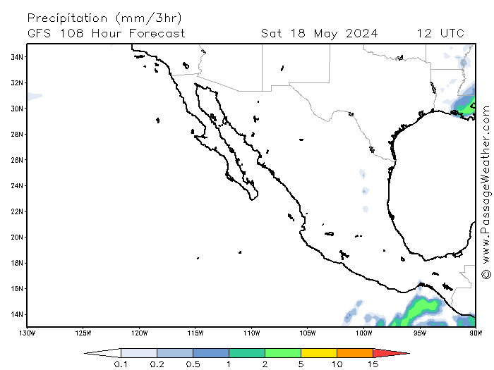
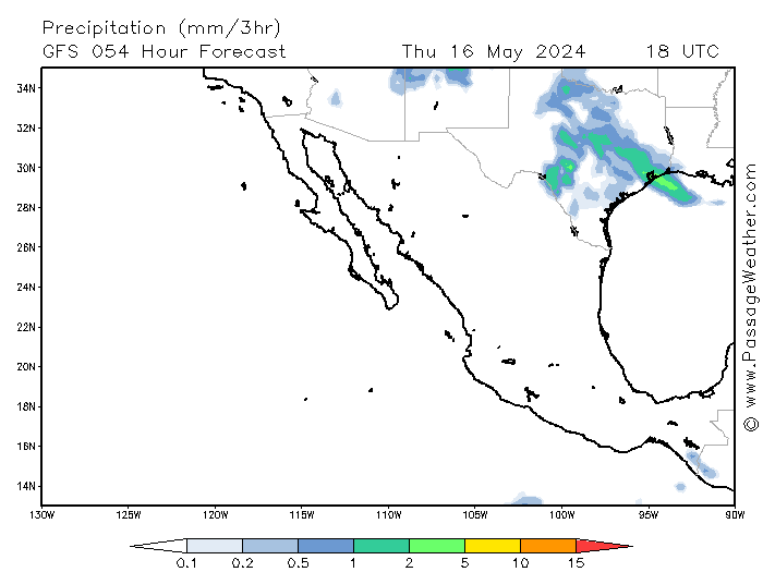
....here's the rain chart...showing the only moment that any more than 5mm/3hrs is predicted.,but otherwise it's 'spotty'.
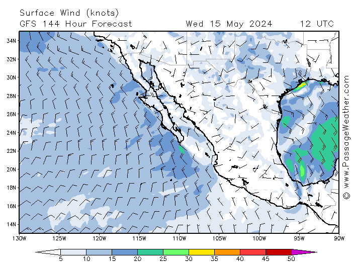
....wind-wise,,the most that passage weather shows is ~30 to 35 knot winds hitting Cabo late sunday,,early monday,,with up to 8meter waves,,,,but just 3-4m by Asuncion.
....all said,,it's still a lot of intensity not far offshore,,one bit of high pressure eases** and things could change dramatically!


....**....keep spinning!:yes:


[Edited on 9-13-2014 by micah202]

bajajudy - 9-13-2014 at 07:35 AM

Tropical storm winds 205 miles from center...that is a BIG storm

bajajudy - 9-13-2014 at 02:52 PM

3:00update
We are now in the tropical storm WARNING.
La Paz to Santa Fe.
And a HURRICANE WATCH

I am starting to get nervous.

Clear and sunny here now. Calm.

[Edited on 9-13-2014 by bajajudy]

Hurricane Watch for BCS

bajajudy - 9-13-2014 at 03:01 PM

Need I say more.
I know this will be incorporated into the other thread
Yo Buddha, can you change your title so we can get the word out
Hold on!

[Edited on 9-13-2014 by bajajudy]

Katiejay99 - 9-13-2014 at 03:02 PM

Hey Bajajudy, I'm getting pretty nervous over here in Todos Santos, too. It's a gorgeous day today here. Not too hot and very little wind.

Stay safe.

bajabuddha - 9-13-2014 at 03:02 PM

Latest news update an hour ago says she'll chug along the coast like the other two did, and then spin westward out to sea, and will gain a little more strength from assimilating the other smaller storm today, going to CAT 2... so they say... i'd expect the same kind of shore/wave damage and flooding, maybe even a little more so with the breakwater damage already done. Be safe. I'm kind of amazed at people 'getting soaked by big waves' standing on the shore to view the spectacle; one rogue wave is all it'll take... time to bring in the warshing.

pauldavidmena - 9-13-2014 at 03:03 PM

Here's hoping Odile doesn't turn into an Ordeal for BSC.

bajabuddha - 9-13-2014 at 03:04 PM

Change it to what??

Hurricane watch issued for BCS

bajajudy - 9-13-2014 at 03:14 PM

Quote:
Originally posted by bajabuddha
Change it to what??


Hurricane watch issued for BCS

[Edited on 9-13-2014 by bajajudy]

chippy - 9-13-2014 at 03:15 PM

We are getting some wind, rain and a swell increase right now at 19.2 and 104.6:bounce::bounce:

More info at

bajajudy - 9-13-2014 at 03:16 PM

http://www.nhc.noaa.gov/text/refresh/MIATCDEP5+shtml/132045....

chippy - 9-13-2014 at 03:20 PM

They also changed the rainfall amount:O:O


[Edited on 9-13-2014 by chippy]

[Edited on 9-13-2014 by chippy]

pauldavidmena - 9-13-2014 at 03:22 PM

@micah202 - where did you get that rain chart? that's a nice, graphical way to represent some very specific data.

WeatherUnderground shows Odile becoming Category 3 by 2PM on Sunday. Cuídate, amigos.

bajajudy - 9-13-2014 at 03:26 PM

000
WTPZ45 KNHC 132045
TCDEP5

HURRICANE ODILE DISCUSSION NUMBER 15
NWS NATIONAL HURRICANE CENTER MIAMI FL EP152014
200 PM PDT SAT SEP 13 2014

Odile is continuing to intensify this afternoon with visible
satellite pictures showing an intermittent eye. The latest
intensity estimates are between 77-84 kt, and 80 kt is chosen as
the initial wind speed. With the hurricane moving over very warm
waters within light shear for the next day or so, steady or rapid
intensification seems likely. Despite the seemingly favorable
environment, it is peculiar that none of the deterministic guidance
brings Odile to a major hurricane. However, the SHIPS rapid
intensification index shows about a 50/50 shot of Odile having a 30
kt increase in wind speed during the next 24 hours. After
considering the environment and the SHIPS-RI guidance, the latest
NHC forecast is above all of the objective guidance during the
first 24 hours, and could still be too low. After that time, Odile
is forecast to weaken by late Monday since it is forecast to
pass near the cold wake of Norbert, with cooler waters also expected
after that time. The NHC forecast philosophy is the same as the
previous one, using a blend of the previous interpolated NHC
prediction and the intensity consensus.

After moving erratically earlier today, Odile appears to be
moving more steadily to the northwest at about 5 kt. The hurricane
should accelerate northwestward by late today due to a ridge
strengthening over the southern United States. Guidance has shifted
toward the northeast, closer to Baja California Sur, with generally
less ridging predicted over northwestern Mexico. The new forecast
is adjusted in that direction, roughly 30 n mi to the north of the
previous forecast during Odile's closest approach to Baja California
Sur, and is close to a blend of the dynamical model consensus and
the ECMWF model. The long-term forecast is also adjusted eastward
closer to Baja California, reflecting the latest consensus aids.

A hurricane watch and tropical storm warning has been issued for
portions of Baja California Sur. A hurricane warning could be
issued later tonight or early tomorrow if the northward trends
in the model guidance continue.

Moisture from a disturbance over northeastern Mexico and the Pacific
ITCZ is forecast to be advected by Odile's circulation northwestward
across Mexico into the southwestern United States for early next
week. This could result in heavy rains and life-threatening
flash flooding in those areas. Please see information from your
local weather office for more details.


FORECAST POSITIONS AND MAX WINDS

INIT 13/2100Z 17.0N 106.2W 80 KT 90 MPH
12H 14/0600Z 18.0N 107.2W 90 KT 105 MPH
24H 14/1800Z 19.8N 108.8W 100 KT 115 MPH
36H 15/0600Z 21.6N 110.5W 90 KT 105 MPH
48H 15/1800Z 23.0N 112.0W 80 KT 90 MPH
72H 16/1800Z 25.0N 114.4W 65 KT 75 MPH
96H 17/1800Z 27.0N 116.5W 50 KT 60 MPH
120H 18/1800Z 28.0N 117.0W 35 KT 40 MPH

$$
Forecaster Blake

bajajudy - 9-13-2014 at 03:28 PM

I particularly don't like this:

A hurricane watch and tropical storm warning has been issued for
portions of Baja California Sur. A hurricane warning could be
issued later tonight or early tomorrow if the northward trends
in the model guidance continue.

 Pages:  1    3  ..  8