BajaNomad

2015 Baja Pole Line Road 4x4 Run (April 4th, 5th, 6th - 2015)

 Pages:  1  2  

Ken Cooke - 2-28-2015 at 01:42 PM

My wife finds the Pole Line Road to be enjoyable. She thought that Mission Impossible was hazardous.

David K - 2-28-2015 at 01:58 PM

Quote: Originally posted by Ken Cooke  
My wife finds the Pole Line Road to be enjoyable. She thought that Mission Impossible was hazardous.


Was that when you were in 2WD or driving up boulders for photos?

In low range 4WD, it is pure fun... and the reward at being at a place that was the center of a European colony outpost in the 1700's, with all that water in the middle of a desert... and blue palm trees... oh wow, I want to go back!.. but that's just me.

:light:

TMW - 2-28-2015 at 04:52 PM

The PLR and the mission road are somewhat similar except for the water in the misson road. The mission road is much more difficult coming out than the PLR is because of the widow maker hill.

David K - 3-1-2015 at 10:39 AM

Quote: Originally posted by TMW  
The PLR and the mission road are somewhat similar except for the water in the misson road. The mission road is much more difficult coming out than the PLR is because of the widow maker hill.


So PLR should be a piece of cake for anyone who has mastered the Widowmaker (and the other drop offs near the missions)? Yes, the bog when it's 2-3 feet deep is a whole different kind of challenge! The one vehicle without a locker (or A-TRAC) was BajaTripper's 4Runner, and only he needed a pull to get through the bog going to the mission. Tripper climbed the Widowmaker without a locker just fine.

bajatrailrider - 3-1-2015 at 12:16 PM

Wow you 4x4 all the way to Mission. Last time we where there on dirt bikes.The deep water just before mission,took one bike out.Then to return back up rock face.Most of us made it,but one rider.The bike made it to top,but with no rider on it.When you where there did you Visit Ralf. That lives in side of mountin North of road to start to Mission.

David K - 3-1-2015 at 01:11 PM

Quote: Originally posted by bajatrailrider  
Wow you 4x4 all the way to Mission. Last time we where there on dirt bikes.The deep water just before mission,took one bike out.Then to return back up rock face.Most of us made it,but one rider.The bike made it to top,but with no rider on it.When you where there did you Visit Ralf. That lives in side of mountin North of road to start to Mission.


Please enjoy the web page I made of that epic Nomad trip to the mission: http://vivabaja.com/msm2010/

There are also many pages of photos posted here on Nomad, of that trip too.

No, I have never driven over to Ralph's house nor seen him on the trail the 4 times I have been to the mission.

[Edited on 3-1-2015 by David K]

Ken Cooke - 3-1-2015 at 04:52 PM

Quote: Originally posted by David K  
Quote: Originally posted by Ken Cooke  
My wife finds the Pole Line Road to be enjoyable. She thought that Mission Impossible was hazardous.


Was that when you were in 2WD or driving up boulders for photos?


Neither - One of the Jeeps on our run developed a fuel deliver issue. I had the task of pulling him up and over boulders while he had his foot on the brake, in park, and/or both. It was hazardous. He finally took his Jeep out of park, after letting it cool, and drove out just fine. He made it that evening with his friend to Mama Espinozas motel. From there, they drove back home to the High Desert area where they live. Leidys and I drove to Ensenada and spent the rest of our trip there. We had planned to meet you and Baja Lou out in the desert, but I was low on cash, our provisions were mostly used up, and we needed to get cash in San Quintin before we could do anything.

Ralph Shoemaker and his wife were away from their home at the time. Leidys and I had the option of driving to the mission to camp - alone. But, alone is never a good idea - especially when the Shoemakers are away. I drove the Jeep down the Widowmaker and back up to the top of it on that trip. No A-Trac, just good, old-fashioned air-locked Dana 44 axles.

David K - 3-1-2015 at 06:16 PM

A-TRAC is a Toyota/Lexus 4WD system using Bosch German technology, so your front and rear lockers are the closest equivalent traction. A Rubicon would be the only Jeep I would consider owning, just like an Off Road TRD 4WD is the only Toyota truck I would own.

Traction: better to have it and not need it... than to need it and not have it! :cool::light:

Rain

bajatrailrider - 3-2-2015 at 02:40 PM

Ken First hand report.No rain in Guadalupe Victoria ( about hour south west of Mexicali. So will hope dry lake is still dry.:D

David K - 3-2-2015 at 04:27 PM

The dry lake bed also gets water from flash floods out of the 5,000 ft. Sierra Juarez, where it does rain and snow. There is no need to drive on the lake bed as roads avoid it when wet.

bajatrailrider - 3-2-2015 at 06:41 PM

Just got new from other people living in Mexicali.It rained there Sat and Sun. I know that dry lakes around Camilu and San Quentin.When it rains,avoid it for at least 3/4 months. When we cross them we stay close to shore line,never down middle.

Ateo - 3-2-2015 at 07:10 PM

That report on your website highlighting the Mission trip was great. The Widowmaker looks doable coming down but must've been pretty rough going up. You guys have some sack.

Neal Johns - 3-2-2015 at 08:05 PM

The Pole Line Road has changed since I originally ran it (some places better, some worse).


Basketball Hill

BBH6 05 (Copy).JPG - 98kB

TMW - 3-2-2015 at 08:51 PM

Did she move the rocks or did you? People want to know.

That's Neal!

John M - 3-2-2015 at 09:03 PM

In his younger days he wore a blond wig when out in public - his job required he hide his appearance due to the number of female co-workers he had, and the secrecy of their job related relationships.

He probably won't remember that though!

John M (arid guy in training)

David K - 3-4-2015 at 08:14 AM

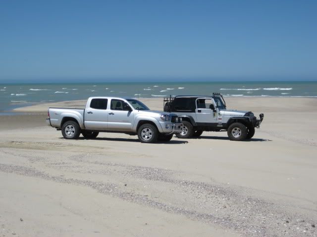
Silver 4x4s Unite!


TMW - 3-4-2015 at 11:17 AM

Do either one go off road? They look too clean.

David K - 3-4-2015 at 11:21 AM

No dust on the beach at Shell Island!

You baiting me to post photos of my Tacoma on the Widowmaker, or coated with Laguna Salada mud??? LOL

(screams from Nomads heard... I won't) :lol:

OH NO! not more photos!

John M - 3-4-2015 at 12:21 PM

How about coming along DK and get a photo or two on the pole line trip? I recall you thought there was a chance you'd make it this year

John M

David K - 3-4-2015 at 01:38 PM

We shall see... I want to go...
Ken planned this on Easter Sunday weekend, and that is a problem for us grandpas... and Baja Angle bought us tickets to Wonder-Con on Saturday (before realizing Ken's event was the same day).
The draw of Baja is very strong with me, as you know... but the worst weekend for family conflicts! Family comes first.

bajatrailrider - 3-5-2015 at 09:50 AM

Great Video David. The first time we did it,Years ago.We went to visit Ralf to ask him,about ride to Mission.It was 3 in the afternoon.We asked him, (it was in Dec) If its only 13 miles dont we have plenty of time before dark.He said make sure your headlight works,It will be the longest 13 miles you have done. Last few miles back it did get dark.About the guy with 4x4 Chev Camper van.With out your picture,I would of said No way will he get out of there.Great job;)

David K - 3-5-2015 at 10:18 AM

Quote: Originally posted by bajatrailrider  
Great Video David. The first time we did it,Years ago.We went to visit Ralf to ask him,about ride to Mission.It was 3 in the afternoon.We asked him, (it was in Dec) If its only 13 miles dont we have plenty of time before dark.He said make sure your headlight works,It will be the longest 13 miles you have done. Last few miles back it did get dark.About the guy with 4x4 Chev Camper van.With out your picture,I would of said No way will he get out of there.Great job;)


Not sure what video you saw, but hbmurphy did put a few up on YouTube from our 2010 trip.

The 13 miles from Ralph's to the mission would take at least 2 hours without stops, 2.5 is more realistic, however.

The guy with the Chevy Van Motorhome is Art, and his Nomad handle is 'edm1'. He amazed us all! For sure, we knew he would be the first to turn around, get stuck, break... NOT SO! While he did have a tire come off the rim (too low pressure), his rig was amazing and his driving skill as well.

CG (Dodge Dakota) was the first incident when one of his new tires got destroyed by a rock. Next was BajaTripper in the bog, as he had no lockers or traction control beyond the 4WD on his 4Runner... so he got pulled through the bog with its 2 ft. deep water. My bumper got snagged within eyesight of the mission on a steep gully.

On the way out, the next day, Neal Johns' heavy camper/Tacoma with tricked our rear differential, exploded (internally) and the front wheel drive alone was not powerful enough to pull him through the bog and up the Widowmaker or beyond... that turned into a LONG night... we all just slept in our trucks, about 8 miles from Santa Ynez, at 2 am.

Art had another tire issue just out of the bog and by using gasoline to blow the tire back onto the rim (a Mexican trick, I employed with success) we got him under way... and he pulled Neal up the mountain from there.

Ken Cooke - 3-5-2015 at 02:19 PM

Quote: Originally posted by David K  
We shall see... I want to go...
Ken planned this on Easter Sunday weekend, and that is a problem for us grandpas... and Baja Angle bought us tickets to Wonder-Con on Saturday (before realizing Ken's event was the same day).
The draw of Baja is very strong with me, as you know... but the worst weekend for family conflicts! Family comes first.


This weekend was better for those running the trail. Coincidentally, we last ran the Pole Line Road in 2013 on Easter weekend. Wonder-Con? Is that a comic book convention? Sell the tickets on Craigslist or 'gift' them to some friends - We're talking the Laguna Salada, the Pole Line Road, and RIO HARDY!

There are between 8-10 parties/vehicles going on this trip. We have a good Mexican food brunch planned in Progreso (Hwy 2), scenic 4WD driving, a good night camping and another along the Rio Hardy!

Barry A. - 3-5-2015 at 02:32 PM

"Camping" along the Rio Hardy????? You might want to re-think that, Ken. I did that several times, and we were always overwhelmed by mosquitos--------possibly not a problem this time of year?!?!?!?!?

Just something to consider?!?!?!?

Barry

David K - 3-5-2015 at 02:39 PM

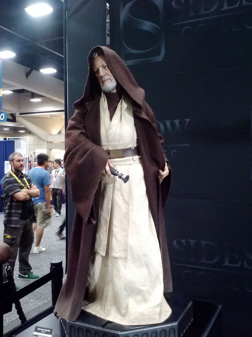
Sounds great Ken... Elizabeth is not going no matter what, so if I do go, she will go to Wonder-Con with her daughter or son maybe. Yes, it is like Comic-Con, but none of the crowds... same vendors, etc. We both like sci-fi and action/adventure movies. Comic-Con is a gas, but wow, too many people!

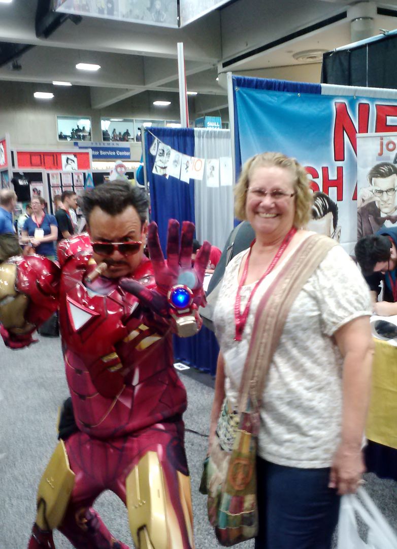
Comic-Con 2014, San Diego...


and when not Iron Man... it's Tony Stark!


David K - 3-5-2015 at 02:54 PM

Quote: Originally posted by Barry A.  
"Camping" along the Rio Hardy????? You might want to re-think that, Ken. I did that several times, and we were always overwhelmed by mosquitos--------possibly not a problem this time of year?!?!?!?!?

Just something to consider?!?!?!?

Barry


They are going to Mick's place on Rio Hardy after the run... I will be going to find a conquistador from the 1540's!

Three leaders affiliated with the Coronado Expedition were able to reach the Colorado River. The first was Hernando de Alarcon, then Melchior Diaz and lastly Don Garcia Lopez de Card##as. Alarcons fleet was tasked to carry supplies and to establish contact with the main body of Coronados expedition, but was unable to do so because of the extreme distance to Cibola. He traveled up the Colorado river until the river entered the lower half of the Grand Canyon. In this exploration he hauled some supplies for Coronado, but eventually he buried them with a note in a bottle. Melchior Diaz was sent down from Cibola by Coronado to take charge of the camp of Corazones and to establish contact with the fleet. Soon after arriving at the camp he set out from the valley of Corazones in Sonora and traveled overland in a north/northwesterly direction until he arrived at the junction of the Colorado River and Gila River. There the local natives, probably the CocoMaricopa, told him that Alarcons sailors had buried supplies and left a note in a bottle. The supplies were retrieved and the note stated that Alarcons men had rowed up the river as far as they could, searching in vain for the Coronado expedition. They had given up and decided to return to their departure point because worms were eating holes in their ships. Diaz named the river the Firebrand (Tison) River because the natives used firebrands to keep their body warm in the winter. Diaz died on the trip back to the camp in the valley of the Corazones. Don Garcia Lopez de Card##as saw the Colorado River from the South Rim of the Grand Canyon while looking for a route that would connect them with Alarcon's fleet.


bajatrailrider - 3-5-2015 at 02:57 PM

If it only 2.5 miles to mission,my memory fading.We made it there in 45min.Then to water pools past Mission.There where small fires all around us.It was great ride.Ralf told us to make sure when we came out to let him know we where Ok.We hotel-ed that night as we where riding from San Vicente all off road.Tired,wet, Hot food,hot shower good thing.

David K - 3-5-2015 at 03:02 PM

Quote: Originally posted by bajatrailrider  
If it only 2.5 miles to mission,my memory fading.We made it there in 45min.Then to water pools past Mission.There where small fires all around us.It was great ride.Ralf told us to make sure when we came out to let him know we where Ok.We hotel-ed that night as we where riding from San Vicente all off road.Tired,wet, Hot food,hot shower good thing.


2.5 HOURS normal, fun off road rolling over the boulders. I say 3 from Santa Ynez, and you could do it in 2 if you just kept moving, or maybe less... but risk damage if you aren't careful.

EDIT: you said "riding", so on motorcycles? Different ball game... I am talking 4WD trucks... and mostly in low range... sometimes with lockers.

[Edited on 3-5-2015 by David K]

bajatrailrider - 3-5-2015 at 03:11 PM

Yes I understand your driving trucks.What that means is you guys are even crazier then us on Bikes.;)

Ken Cooke - 3-5-2015 at 03:55 PM

Quote: Originally posted by bajatrailrider  
Yes I understand your driving trucks.What that means is you guys are even crazier then us on Bikes.;)


For fun, I took the Baja Grande group up to the swamp and back at night after dinner for a night run. 10 Jeeps looking for crazy action on the Mission Impossible trail. Yes! Verifiable crazy people!

David K - 3-5-2015 at 04:13 PM

Quote: Originally posted by bajatrailrider  
Yes I understand your driving trucks.What that means is you guys are even crazier then us on Bikes.;)


Turn on your speakers and drive through the bog with hbmurphy and Zoom... hb (Paul) is in a 2009 Tacoma Off Road with an ARB front locker and Toyota rear locker. He is in the lead of our 6 car caravan... all got through on their own except the one vehicle without a locker, so he got a pull.


Here is the video coming down the Widowmaker (which is before the bog):


The next day, see Art and his motorhome CLIMB up the Widowmaker (it is exciting!)...


Viva El Widowmaker! Loco in a Lobo

David K - 3-5-2015 at 04:22 PM

See how the Mexicans do it... Funny watching the gear bounce out of their trucks... Fun times in La Baja! It's an honor that they have adopted the name I gave it in '99 after BajaMur and I spilled our blood on those rocks!!


and the fun continues...


[Edited on 3-5-2015 by David K]

Ken Cooke - 3-5-2015 at 05:31 PM

Quote: Originally posted by David K  
Quote: Originally posted by Barry A.  
"Camping" along the Rio Hardy????? You might want to re-think that, Ken. I did that several times, and we were always overwhelmed by mosquitos--------possibly not a problem this time of year?!?!?!?!?

Just something to consider?!?!?!?

Barry


They are going to Mick's place on Rio Hardy after the run... I will be going to find a conquistador from the 1540's!


If you like, we could go in late November '15 - spend 4 days exploring 4 possible areas of where Francisco Coronado's party may have traveled. I'm suggesting this because it sounds like a trip specifically meant for Jeeps.

David K - 3-5-2015 at 06:07 PM

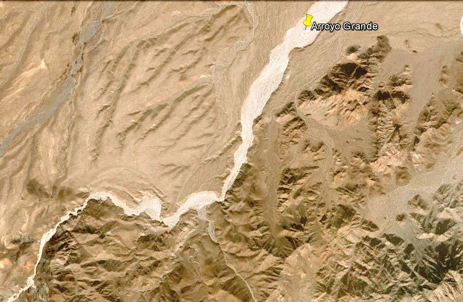
Perhaps... I want to at least drive up Arroyo Grande from the Pole Line Road crossing to see if I can find the geology Henderson described.


My target area is the bottom left after the big double bend in A, Grande.

MICK - 3-5-2015 at 07:17 PM

Ken. Bill and I are thinking about staying out and doing the side trip with David k Will this mess up anyone wanting to stay here? I was also thinking it might be good to have two nights out.
David k, are you thinking your side trip would be just Monday returning Monday night or were you thinking more nights?
Mick

David K - 3-5-2015 at 07:23 PM

Quote: Originally posted by MICK  
Ken. Bill and I are thinking about staying out and doing the side trip with David k Will this mess up anyone wanting to stay here? I was also thinking it might be good to have two nights out.
David k, are you thinking your side trip would be just Monday returning Monday night or were you thinking more nights?
Mick


Hi Mick,
As I am not 100% please don't change your plans or just be flexible as I try to.
I am thinking if I go, on the second day (Easter Sunday) when the Pole Line Road reaches Arroyo Grande (south of the wells, that are west of La Ventana) I would turn right... There was a steel cable blocking the way back in 2012 when I last tried to drive up. I do not know where Ken's caravan is planning on leaving the Pole Line Road to head to Hwy. 5... In the past they went way up to Ejido Saldana and then out to the sand dunes on Hwy. 5., and didn't get close to Arroyo Grande or La Ventana.

MICK - 3-5-2015 at 07:45 PM

I am very flexible. Just thinking now that a couple of nights out might be fun


Options open

John M - 3-5-2015 at 08:14 PM

Mick and DK - I'll have time to spend another day or two as well.

Lets see how the trip works out.

John M

MICK - 3-5-2015 at 09:30 PM

When all else fails be spontaneous !!! I like it

Ken Cooke - 3-5-2015 at 10:30 PM

Quote: Originally posted by MICK  
When all else fails be spontaneous !!! I like it


Two nights sounds like fun. I return to work on that Tuesday. Let's see if Baja Angel approves this weekend. I'd like to keep the Conquistador helmet when I locate it.

Telling Secrets... hoping to find this before I die! LOL

David K - 3-6-2015 at 09:01 AM

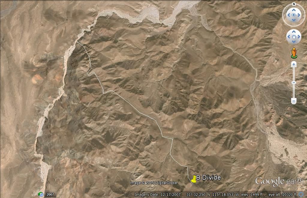
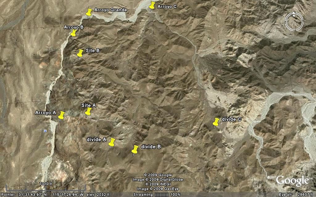
OK, here is the wash I have the most confidence in being the one Henderson walked down to Arroyo Grande in... I call it 'B Wash'... after making a list of possible westward flowing washes using letters. I drew a line over (not perfectly) the wash from the top to Arroyo Grande.


In Henderson's letter, he said they took the most obvious course to head NW towards the Sierra Tinajas, which was their target. They realized they started too far south to hike there in the 2 day period they had to explore in. So After sleeping in Arroyo Grande the first night, they went south to (what Henderson calls) the base of Borrego Mountain, then back over the saddle to the Model A (parked in Arroyo Arrajal at the entrance to the Sierra Pinta hills).

Now, there is a clear description Henderson provides of where the rock-pile wash meets Arroyo Grande, and the B wash junction is the only one TW didn't get a photo of, but even if he did, it may take a personal visit to see the detail? Perhaps landslides since the 1930's have destroyed the wall he describes? Just a fun adventure... like our Santa Isabel Lost Mission hunt of 2011 in Arroyo el Volcan (thanks to elbeau).

Rio Hardy

Ken Cooke - 3-6-2015 at 11:03 AM

MICK - If David K isnt able to attend our Pole Line Road trip, we would like to stay in luxury on the river one night. Maybe we could set up a special trip in November to this region? David K would need to organize the routes.

David K - 3-6-2015 at 02:38 PM

No organizing needed. The route is either down Arroyo Grande or up from Arroyo Arrajal from the race course crossing north of Borrego pit on Hwy. 3. We know Arroyo Grade road is open now. Not known is how far up we can drive from Arrajal to the B Divide. Hiking in the desert to find a pile of rocks is not fun for most. Mick, isn't one of the campgrounds open on Rio Hardy that Ken's city slickers can chill at if you won't be at your digs?

[Edited on 3-6-2015 by David K]

Ken Cooke - 3-6-2015 at 03:54 PM

How about rentals in the Rio Hardy area??

MICK - 3-6-2015 at 05:46 PM

No rentals I know of but your welcome to camp out here. We should be here around that time

Back to the roots...

David K - 3-10-2015 at 05:46 PM

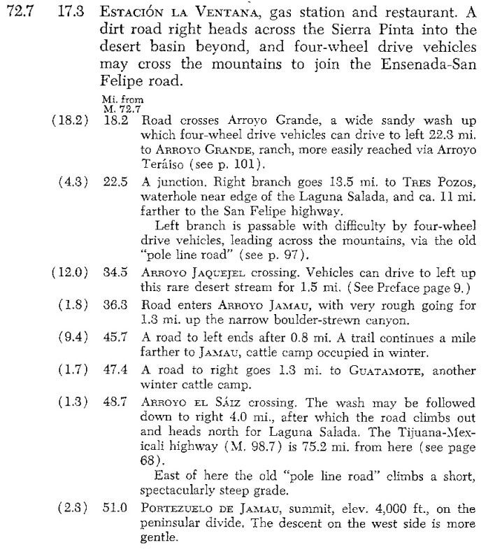
It was Neal Johns who got curious while reading the Lower California Guidebook...

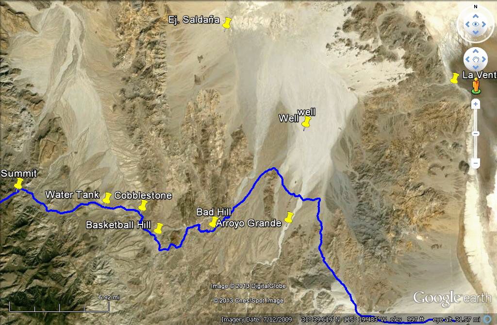
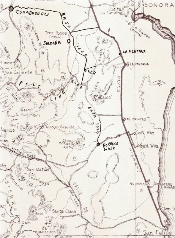
Here is the page with the road from La Ventana on Hwy. 5, west to the Pole Line Road, then following it west to the summit:


Here is the other part from the Ensenada-San Felipe Road (Hwy. 3 today) to the summit...


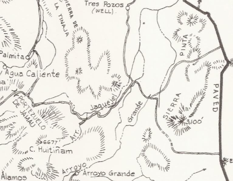
Map from La Ventana (the paved road and center dirt road junction) to the summit...


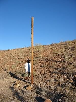
Ken Cooke at one of the World War II telephone poles...


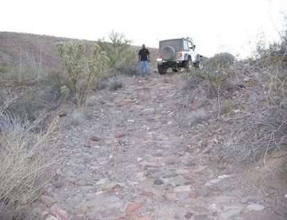
Ken Cooke on the WWII cobblestone road...


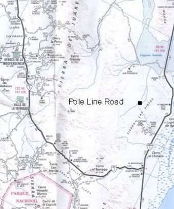
The Auto Club does not show the Pole Line Road!...


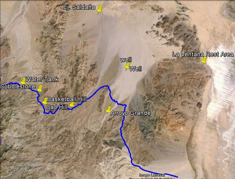
The black square is about were the wells (pumps) are.

[Edited on 3-11-2015 by David K]

PaulW - 3-11-2015 at 10:54 AM

Several GPS maps show a road that follows Jaquegel. Unreliable because the PLR enters and leaves the canyon. Also shown is access to Jaq from the north at the east end of Jaq. Do know if that road is accurate?

TMW - 3-11-2015 at 12:41 PM

Paul are you talking about the road from Saldana to Jaquegel? If so that is the way Ken normally has exited after his PLR runs. You can see it on page 4 of the almanac.

PaulW - 3-11-2015 at 03:18 PM

Quote: Originally posted by TMW  
Paul are you talking about the road from Saldana to Jaquegel? If so that is the way Ken normally has exited after his PLR runs. You can see it on page 4 of the almanac.

=
Yes, I am not familiar with that road. I should drive it. It is a short distance from Arroyo Grande to that Tee intersection that heads north. I just drove past it on my last trip.
A friend said he has a track from the mine wells leading west to the subject road. Its on my to do list.

David K - 3-11-2015 at 03:37 PM

Quote: Originally posted by TMW  
Paul are you talking about the road from Saldana to Jaquegel? If so that is the way Ken normally has exited after his PLR runs. You can see it on page 4 of the almanac.


Correct, but if you stayed on the Pole Line Road 4.3 more miles east to south, you would reach Arroyo Grande... from there you can drive north to the wells, then easy out to Hwy. 5 by La Ventana... or south in Arroyo Grande... or cross over to the other side of Arroyo Grande to head towards San Felipe on the Pole Line Road or to Borrego Wash on the race course.

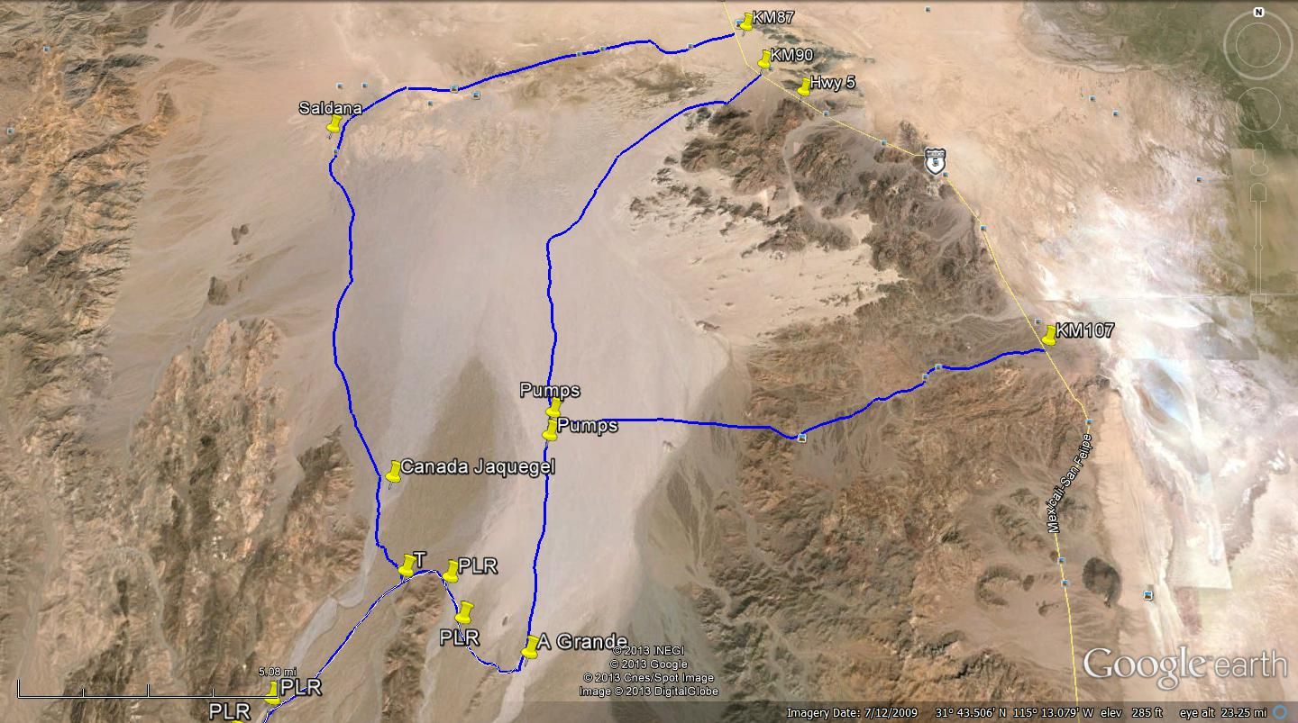
Here is TW's map showing the T junction north via Saldana as well as Pole Line Road to Arroyo Grande then up to the wells, and out east to La Ventana...


My maps with Pole Line Road route out to Hwy. 5...


PaulW - 3-11-2015 at 03:50 PM

David, Good mapping. What is missing is the track due west from the wells to the far west track from Saldana. That track crosses the Jaquegel drainage and the guy said he got that track from a San Felipe old timer. He drove that track 2/2014 when his group did the PLR. Soon I will make contact and get that track into my database.
PW

David K - 3-11-2015 at 04:56 PM

Quote: Originally posted by PaulW  
David, Good mapping. What is missing is the track due west from the wells to the far west track from Saldana. That track crosses the Jaquegel drainage and the guy said he got that track from a San Felipe old timer. He drove that track 2/2014 when his group did the PLR. Soon I will make contact and get that track into my database.
PW


Hi Paul,
I just searched the desert west of the wells on Bing and GE and can see no tracks crossing over to Jaquegel from Grande anywhere near the wells...? I hope you can find it.

TWO ADVENTURES?

John M - 3-11-2015 at 06:30 PM

So David - is this looking like two separate adventures? A pole line trip and an exploratory trip? Maybe the threads ought to each be on their own?

Pole Line is less than a month away and I'd like to see a thread (Ken) focusing on that trip - of course if it is one combined trip tnen I recant my suggestion.

So Ken, Barb and I will be gone almost ten days, getting home one or two days before leaving for PLT - and we won't have internet most of the ten days so maybe any details needed could be posted sooner rather than later?

John M

Ken Cooke - 3-11-2015 at 07:48 PM

Quote: Originally posted by John M  
So David - is this looking like two separate adventures? A pole line trip and an exploratory trip? Maybe the threads ought to each be on their own?

Pole Line is less than a month away and I'd like to see a thread (Ken) focusing on that trip - of course if it is one combined trip tnen I recant my suggestion.

So Ken, Barb and I will be gone almost ten days, getting home one or two days before leaving for PLT - and we won't have internet most of the ten days so maybe any details needed could be posted sooner rather than later?

John M


John -- Lets transition the planning of this trip to the following link:

http://forums.bajanomad.com/viewthread.php?tid=78026#pid9682...

Have a great time on your vacation. Please U2U me your current email address. My cell phone # is included in the thread if you need to reach me.


David K - 3-12-2015 at 08:25 AM

Where the Pole Line Rd meets Arroyo Grande, I would be going south and those that aren't would drive north to the wells and out to Hwy. 5.

Ken Cooke - 3-12-2015 at 07:06 PM

Quote: Originally posted by David K  
Where the Pole Line Rd meets Arroyo Grande, I would be going south and those that aren't would drive north to the wells and out to Hwy. 5.


Gasoline would be a problem for the Jeeps. The run allows for a Jeep on 33" tires carrying an additional 10 gallons of fuel to run the Pole Line Road and make it into South Mexicali before running out of gasoline. That is one area your Toyota's have us beat.

A more southern PEMEX was recently destroyed by the great Earthquakes that so decimated entire swaths of Mexicali turning many buildings there into ruins.

[Edited on 3-13-2015 by Ken Cooke]

David K - 3-12-2015 at 07:50 PM

Where are you leaving PLR, at the T junction and up through Saldana?

The Arroyo Grande wash is just 4.3 miles further.

At that point you can drive the 6 or so miles north to the wells, then the fast 12 mile graded road to La Ventana on Hwy. 5... Overall, fewer dirt miles, more highway miles and less gas needed to Mexicali.

Ken Cooke - 3-12-2015 at 08:43 PM

Quote: Originally posted by David K  
Where are you leaving PLR, at the T junction and up through Saldana?

The Arroyo Grande wash is just 4.3 miles further.

At that point you can drive the 6 or so miles north to the wells, then the fast 12 mile graded road to La Ventana on Hwy. 5... Overall, fewer dirt miles, more highway miles and less gas needed to Mexicali.


Traveling north to the area you described is along the way towards Mexicali. One consideration will need to be running out of daylight on Day#2. I will want to return to Mexicali on Monday morning before mid day. It was about 90 degrees on Saturday near the Salton Sea.

David K - 3-13-2015 at 08:13 AM

The gas station at La Puerta on Hwy. 5 is also 15 miles closer, than any near Mexicali.

So either you hit Hwy. 5 at La Ventana (shorter, less dirt road) via Arroyo Grande and the well road or you go further north in dirt via Saldana to the sand dunes at Hwy. 5... you still drive north on Hwy. 5 to La Puerta Pemex.

Are you still camping Sunday night at Rio Hardy, south of La Puerta?


[Edited on 3-13-2015 by David K]

PaulW - 3-13-2015 at 08:30 AM

David Wrote:
..... There was a steel cable blocking the way back in 2012 when I last tried to drive up.... [/rquote]
=====
I saw the cable in the Jan 2012 time frame. No issue it was sticking up about a foot and I drove parallel to it and found it buried and then continued south. That trip I found it when I crossed from the SCORE road to AG. This would be on the far east of the AG wash. Since then I have not seen the cable in that specific area. Now days to get into AG canyon or even to PLR access we travel on the west side of AG when the race whoops start. This is for access from the wells driving south.

Anyway, when leaving the PLR to enter AG travel N or S and you will not see the cable.
My suspicion was that back in the 70s SCORE used AG and that is when the cable was added. I still have not found and records to document this. Old SCORE was not aware of the cable.

David K - 3-13-2015 at 09:11 AM

Thanks Paul, yes people have driven up (south) AG from the PLR in years past (Neal Johns, etc.) and I knew the 2012 cable was gone because others (TW, etc.) have been up (south) AG since.

Rather Ken and the Jeep people head to Rio Hardy from the T Junction or the Arroyo Grande junction, I hope to drive up AG to 'Wash B' and take a 2-3 mile hike, and look for a pile of rocks. If others (John M, etc.) want to join me, terrific!

Rather we find it or not, I know Choral Pepper will be smiling down upon us, as she did when I found her mystery walls/ lost mission back in 2009.... http://vivabaja.com/109

TMW - 3-13-2015 at 12:01 PM

If things workout I hope to join DK.

David K - 3-13-2015 at 12:39 PM

OK, that helps to know... joining me after Ken's Pole Line Road run:
John M
TMW
PaulW (yes?)


This would be Sunday afternoon we go to the Arroyo B junction with Arroyo Grande... GPS (WGS84) in decimal degrees:
31.54925, -115.31957 OR in decimal minutes: 31 degrees 32.955'N 115 degrees 19.174'W

If we discover that is not a possible wash, due to waterfalls. cliffs, etc. not matching the Henderson letter, there is a second good wash, Arroyo A:
31.524526, -115.32323 OR 31 degrees 31.454'N, 115 degrees 19.408'W

The hike would probably be Monday morning, 4 hours (in and out) so we could be done by noon... naturally, it is Baja, and I am flexible and this is in good fun as our Santa Isabel lost mission hike was in 2011.

Lots of water, snake bite kit, cameras, GPS are what we need to enjoy and record the discovery.

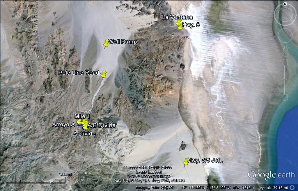
The map below shows A, B and a C arroyo. B has the best odds for walking from the Model A as a natural path up and over the divide, I think. Arroyo A was my second choice. Arroyo C I have dismissed, too far north.

Sites A and B are just in the wash up the canyons, and not more than that. Henderson said the rock pile was 1/4 to 1/3 down the wash from the divide towards Arroyo Grande.


If it is the 1541 grave of Melchior Diaz, it would change popular historic thought on his expedition and prove him to be the first European to walk into California.

[Edited on 3-13-2015 by David K]

PaulW - 3-13-2015 at 03:07 PM

Quote: Originally posted by David K  
OK, that helps to know... joining me after Ken's Pole Line Road run:
John M
TMW
PaulW (yes?)

==
Not PaulW during Easter weekend.
To many conflicts at our end. We will be in Moab by then.
Back in Baja on October to follow up.
Doing PLR the week of the 3/23 with local guys. Going E to W
Another AG trip is still in the cards before we head north?
PW

[Edited on 3-13-2015 by PaulW]

David K - 3-13-2015 at 03:15 PM

Bummer, I would like to meet you... next time perhaps?

GPS stuff David

John M - 3-13-2015 at 03:16 PM

Hey David - I notice on the google earth map you posted it displays Degrees, Minutes, Seconds whereas in your message you are using Decimal Degrees. Most everything else, all my maps, most all guide books and I think the waypoints Paul has sent is in the more common Degree, Decimal Minutes.

My suggestion is to pick one format for everything - I suggest Degree, Decimal minutes.

John

David K - 3-13-2015 at 03:25 PM

Quote: Originally posted by John M  
Hey David - I notice on the google earth map you posted it displays Degrees, Minutes, Seconds whereas in your message you are using Decimal Degrees. Most everything else, all my maps, most all guide books and I think the waypoints Paul has sent is in the more common Degree, Decimal Minutes.

My suggestion is to pick one format for everything - I suggest Degree, Decimal minutes.

John


I was on FlashEarth (which uses newer Bing images of Baja): http://www.flashearth.com/

It only offers decimal degrees, and like you I usually post with decimal minutes, as in Geocaching.

However changing to decimal degrees (or other formats) on Google Earth is easy!!!
Here are the steps:
TOP OF PAGE:
Click TOOLS
Click OPTIONS
(it should be right there on the 3D View menu)
Second box down, says 'Show Lat/Lon' ... choose decimal degrees (top choice)
CLICK OK!


TMW - 3-13-2015 at 03:34 PM

David that is odd because when I'm on it, it shows Hr-Min-Sec.

David K - 3-13-2015 at 03:34 PM

John, I edited the post to include decimal minutes... because the new Nomad software still doesn't like degree symbols, I wrote the word degrees in that place.

PaulW - 3-13-2015 at 03:39 PM

Bing is difficult
Good pictures and no help.
I was driven to deg and decimal minutes in order to plot on the Topos deg and I will stay with decimal minutes to make as easy as possible.
So what I do is take coords off my desktop GPS and plot them on the topos or enter on GE set for the same for viewing there.
PW


[Edited on 3-13-2015 by PaulW]

David K - 3-13-2015 at 03:39 PM

Quote: Originally posted by TMW  
David that is odd because when I'm on it, it shows Hr-Min-Sec.


On FlashEarth? Interesting, I never saw or touched a setting choice.

Oh guess what?! When you click your mouse on the lon and lat numbers on FlashEarth, it switches between decimal degrees and degrees, minutes and seconds (no decimal minutes). :light:

[Edited on 3-13-2015 by David K]

David K - 3-13-2015 at 03:41 PM

I just measured the distance in Arroyo Grande from Arroyo B to Arroyo A and it is 2.0 miles. In fact, one could do a full circle as the top (divide) for A and B are almost next to each other... up one and down the other.

PaulW - 3-13-2015 at 03:50 PM

Quote: Originally posted by David K  
John, I edited the post to include decimal minutes... because the new Nomad software still doesn't like degree symbols, I wrote the word degrees in that place.

======
Best to show both. Degrees are as hard to plot as deg,min,sec

PaulW - 3-13-2015 at 04:03 PM

So C is toms T4, B is S of T6 and A must be T7 or 8
I think I have lost track?
My GPS track is done and uses T designation
Confirm and I will change my GPS.

David K - 3-13-2015 at 04:09 PM

I think it's time to start a new thread 2015 Hike for Henderson?

Here it is, maps included... http://forums.bajanomad.com/viewthread.php?tid=78057

[Edited on 3-14-2015 by David K]

Ken Cooke - 3-13-2015 at 08:25 PM

Quote: Originally posted by PaulW  
Quote: Originally posted by David K  
OK, that helps to know... joining me after Ken's Pole Line Road run:
John M
TMW
PaulW (yes?)

==
Not PaulW during Easter weekend.
To many conflicts at our end. We will be in Moab by then.
Back in Baja on October to follow up.
Doing PLR the week of the 3/23 with local guys. Going E to W
Another AG trip is still in the cards before we head north?
PW

[Edited on 3-13-2015 by PaulW]


Sorry you can't make my run, Paul. U2U me a mailing address for your Pole Line t-shirts, and I'll see you on the next run.

Ken Cooke - 3-13-2015 at 09:12 PM

Quote: Originally posted by David K  
The gas station at La Puerta on Hwy. 5 is also 15 miles closer, than any near Mexicali.

So either you hit Hwy. 5 at La Ventana (shorter, less dirt road) via Arroyo Grande and the well road or you go further north in dirt via Saldana to the sand dunes at Hwy. 5... you still drive north on Hwy. 5 to La Puerta Pemex.

Are you still camping Sunday night at Rio Hardy, south of La Puerta?

[Edited on 3-13-2015 by David K]


La Puerto es finito. The closest Pemex station is either in Ejido Durango or along Hwy 5 where the Toll Road intersects with it.

As for Rio Hardy - MICK has been real gracious to let us stay there. I have to see the day of the run during our drivers meeting what everyone agrees to.

Ken Cooke - 3-14-2015 at 06:56 PM

Quote: Originally posted by David K  
Quote: Originally posted by Ken Cooke  
Quote: Originally posted by David K  
The gas station at La Puerta on Hwy. 5 is also 15 miles closer, than any near Mexicali.

So either you hit Hwy. 5 at La Ventana (shorter, less dirt road) via Arroyo Grande and the well road or you go further north in dirt via Saldana to the sand dunes at Hwy. 5... you still drive north on Hwy. 5 to La Puerta Pemex.

Are you still camping Sunday night at Rio Hardy, south of La Puerta?

[Edited on 3-13-2015 by David K]


La Puerto es finito. The closest Pemex station is either in Ejido Durango or along Hwy 5 where the Toll Road intersects with it.

As for Rio Hardy - MICK has been real gracious to let us stay there. I have to see the day of the run during our drivers meeting what everyone agrees to.


Seriously??? It was a huge and busy place last year...??? La Puerta, about 25 miles south of the border.


I'm refering to the smaller place that only had 4 pumps that looked like it was constructed in the 1950s. I have photographs taken there, at night. So, you can't make out the building too well.

David K - 3-14-2015 at 06:58 PM

The town had only one station, on the west side, north end of town... always busy. Perhaps the San Felipe regulars can confirm if it is open?

[Edited on 3-15-2015 by David K]

MICK - 3-15-2015 at 06:29 AM

The gas station in La Puerta is still open. Got gas there two days ago.

PaulW - 3-15-2015 at 07:02 AM

As posted on the planning thread
FYI
PMEX
Mx3K120.5, new one 2 blocks S 1 block W in V Trinidad
Mx2 K15
Mx5 K10.4, and 15.5, and 31.1
All these PMEX places were in operation last week.

Other noted places
La Ventana Mx5K106/106.5
W to Saldana Mx5K89.3
W to L salida Mx5K48.8,and k40
Durango Jct Mx5 K31.3
MX2/Mx5 Jct Mx2k12, Mx5K8

Ken Cooke - 3-15-2015 at 08:44 AM

What is the closest PEMEX to the La Ventana/Hwy 5 location where our tires will hit the road?

Hwy 5 - K105?

David K - 3-15-2015 at 09:16 AM

Ken, It sounds like Paul says it is at Km. 31?
La Ventana jcn. is Km. 106 (106-31=75 kms. or 46.5 miles.)

Good Sunday Morning to you, and at this point I am go for PLR 2015.

Ken Cooke - 3-15-2015 at 10:21 AM

Quote: Originally posted by David K  

Good Sunday Morning to you, and at this point I am go for PLR 2015.


Great news!! Let's sell some books down in Baja!:cool:

David K - 3-16-2015 at 04:54 PM

Quote: Originally posted by MICK  
The gas station in La Puerta is still open. Got gas there two days ago.


Thank you Mick! Ken, are you seeing this? La Puerta will be the closest Pemex to the Pole Line Road.

Ken Cooke - 3-16-2015 at 07:28 PM

Quote: Originally posted by David K  
Quote: Originally posted by MICK  
The gas station in La Puerta is still open. Got gas there two days ago.


Thank you Mick! Ken, are you seeing this? La Puerta will be the closest Pemex to the Pole Line Road.


This is great news. There's nothing like someone on the ground who can confirm speculation. Thanks, MICK.

Photo links

Ken Cooke - 3-25-2015 at 09:38 PM

From: BAJA POLE LINE GROUP/FACEBOOK

"New" Locked gate:
https://fbcdn-sphotos-d-a.akamaihd.net/hphotos-ak-xpa1/t31.0...

Ranchers gate:
https://fbcdn-sphotos-h-a.akamaihd.net/hphotos-ak-xpf1/t31.0...

https://scontent-sjc.xx.fbcdn.net/hphotos-xpa1/t31.0-8/89204...

Basketball Hill "new bypass":
https://scontent-sjc.xx.fbcdn.net/hphotos-prn2/v/t1.0-9/r270...

Arroyo Grande dropoff:
https://scontent-sjc.xx.fbcdn.net/hphotos-xpf1/t31.0-8/89329...

https://scontent-sjc.xx.fbcdn.net/hphotos-xap1/t31.0-8/88700...

2013 BAJA POLE LINE GROUP at CAMPO MICKEY:
https://scontent-sjc.xx.fbcdn.net/hphotos-xpf1/t31.0-8/89340...

David K - 3-26-2015 at 08:50 AM

Just over a week to go, and I got my camping gear all ready... traveling light, so no wet bar and hot tub like at Shell Island, Ken! LOL Oh, don't forget the cappuccino machine for Leidys!

[Edited on 3-27-2015 by David K]

Ken Cooke - 3-26-2015 at 04:00 PM

Leidys has joined the ranks of the working professionals, so she cannot attend the run this time.

David K - 3-26-2015 at 06:39 PM

Is Neal Johns going to co-pilot instead??? :light::biggrin:

I was looking forward to talking with her, last time (2010 Shell Island) it was only in Spanish. Is she handling English well now?

Ken Cooke - 3-26-2015 at 08:15 PM

Quote: Originally posted by David K  
Is Neal Johns going to co-pilot instead??? :light::biggrin:

I was looking forward to talking with her, last time (2010 Shell Island) it was only in Spanish. Is she handling English well now?


I plan on driving solo. That way, I can keep the weight down for better performance on the trail. Leidys speaks 100% English at work and 100% Spanish away from work.

David K - 3-27-2015 at 03:21 PM

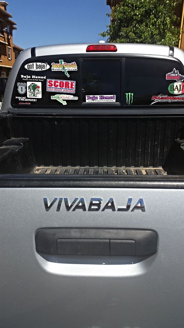
Well, my custom Tacoma car name badge arrived... so if my plethora of Baja stickers on my back window are blocked by camping gear... there will be no mistaking whose silver Tacoma you are behind!


bajatrailrider - 3-27-2015 at 08:59 PM

Ken those pictures are great,good looking landscape.

David K - 3-28-2015 at 10:52 AM

One week from today folks! We should be done with tacos and heading down Laguna Salada or the graded Guadalupe Canyon road about now?

David K - 3-28-2015 at 11:26 AM

Those who are joining us on the Henderson Rock-Pile Hike, please see the thread in the hiking forum: http://forums.bajanomad.com/viewthread.php?tid=78057

4x4abc - 3-28-2015 at 06:51 PM


I'll be coming from the south to join your group

what day, what hour and where do I meet the group on MEX5?
with other words - where is the turn off into the big adventure?
HAM/business band - what frequency? FRS/GMRS - what channel?

traveling east to west - right?
or the other way around?

dogs OK?

do I have to bring my own beer?

who is cooking for me?

a consolidated, updated information page would be great for an organized event like this

David K - 3-28-2015 at 07:18 PM

The Pole Line Group is traveling south from Hwy. 2 at Laguna Salada, past Cohabuzo Jcn. to the base of the old summit (Jamau) road (Pole Line Road) and joining it going from WEST to EAST.

Saturday Night we will be in the middle of the 20-30 mile WWII road run.

Sunday the run finishes at the T Jcn. to Saldaņa to the sand dunes on Hwy. 5, or at Arroyo Grande to La Ventana on Hwy. 5.

However, the Melchior Diaz Grave (Henderson Rock-Pile) search group will go south in Arroyo Grande to 'Arroyo A' jcn. where we will camp and hike on Monday morning up Arroyo A and ??? Depending on the time we finish hiking, we will camp Monday night there or leave Monday afternoon?

Dogs are okay with me, bring your own beer (you are German, after all), and I am bringing just basic food and water... on a budget!


Getting to Arroyo A by 4WD:

0.0 Hwy. 5, Km. 107 (1 km. south of La Ventana), go west.
6.0 Water Pipe Road, turn west.
12.2 Fork, go left (southwest).
12.8 Well/ Pump, turn south (Score road/ Arroyo Grande)
Keep towards right side of wide arroyo for less whoops.
17.7 Pole Line Road from Ensenada drops into Arroyo Grande here.
Arroyo Grande now between high sides and soon enters mountain canyon.
25.2 Arroyo B junction... continue south in Arroyo Grande.
27.2 Arroyo A junction N31-31.454', W115-19.408'

[Edited on 3-29-2015 by David K]

4x4abc - 3-28-2015 at 07:39 PM

will meet you at Cohabuzo Junction between 10:00 and 12:00
location correct?


David K - 3-28-2015 at 07:44 PM

Quote: Originally posted by 4x4abc  
will meet you at Cohabuzo Junction between 10:00 and 12:00
location correct?


YES, that IS Cohabuzo Jcn.... if Ken's Jeep club is on target, they (and us Tacomas) should be there before noon SATURDAY.


[Edited on 3-29-2015 by David K]

Ken Cooke - 3-29-2015 at 12:00 AM

Quote: Originally posted by 4x4abc  

I'll be coming from the south to join your group

what day, what hour and where do I meet the group on MEX5?
with other words - where is the turn off into the big adventure?
HAM/business band - what frequency? FRS/GMRS - what channel?

traveling east to west - right?
or the other way around?

dogs OK?

do I have to bring my own beer?

who is cooking for me?

a consolidated, updated information page would be great for an organized event like this


Our group will travel along Colegio Militar in Mexicali south to Hwy 2 to the Laguna Salada on Saturday, April 4th.

PLEASE NOTE: If our group needs to get FMM papers, we may have long lines to stand in, and our times may be off by up to 2 hours. The times below are estimations without having to endure the lengthy FMM process we may have to participate in. Call me at 01.951.255.1589 at 8:30 a.m. and I will give you an update on Saturday morning regarding our ETA at COHABUZO JUNCTION.

Our first possible meeting place is Pemex in Progreso on Hwy 2 - at the four-way signal light at 0900.

Our second possible meeting place is at Asadero Morlan #2 (not #3) - about 2 blocks WEST of the Pemex in Progreso on Hwy 2 at 0930.

We will have Breakfast in a leisurely fashion before departing for the Laguna Salada. Once there, we will travel to our lunch stop at Cohabuzo Junction - Cohabuzo Junction N31 55.744 W115 36.263

Our group will monitor CB Channel 4. When you see our group arrive at Cohabuzo Junction between the hours of 1230 - 1300, give us a call out on your radio.

We will have traveled 57 miles from Hwy 2/Laguna Salada to reach Cohabuzo Junction. Therefore, we may reach Cohabuzo Junction sometime between 1230 - 1300. If you prefer to meet up with us in Progreso, please do so, because I cannot guarantee that our group will reach Cohabuzo Junction at the above time.

MICK has agreed to meet us at Cohabuzo Junction, and I informed him to meet us at this above time. He will be driving from his home in Rio Hardy.

**PLEASE come with full Jerry cans, provisions for the drive from west to east. The Jeeps will be carrying 10 additional gallons of fuel in addition to full tanks of gasoline. Having to tow a vehicle up Hwy 5 may result in the driver being cited for 'Unapproved Towing Apparatus'. This happened to me in Dec. 2007 by Mexicali's finest. The fine was $160 USD.:!:

Dogs are fine - except there will be a small breed dog being brought by John M. In 2013, a Rottweiler bit me in Tijuana. As a result, I don't like that breed.

Do you have to bring your own beer? Yes, and enough for the entire BAJA POLE LINE GROUP.

Who is cooking for you? David K :lol:

A consolidated, updated information page: www.justruns.com RUN SCHEDULE/EVENT INFORMATION

Additional information will be provided at the meeting place: Pep Boys (Calexico, CA) and Asadero Morlan #2 (Progreso/Mexicali) in the form of a Drivers Package. This will provide answers to questions about our route, mileage numbers (in miles, not KM), trail descriptions (incl. new route bypass to gain access to the POLE LINE ROAD), etc. I am intentionally vague with route details and times to discourage drivers from skipping drivers meetings, and arriving ill-equipped for the run.

*For $15, your Drivers Package will include a t-shirt of the event (100% t-shirt money donated to support Fortuna victim) - http://www.times-standard.com/general-news/20150326/donation...
http://www.times-standard.com/general-news/20150323/fortuna-...


[Edited on 3-29-2015 by Ken Cooke]

 Pages:  1  2