BajaNomad

Isabel Canyon - El Mano Canyon - Laguna Hanson

Emerson - 5-13-2015 at 03:09 PM

Last Thursday night a group of 4 cars including my own started the route from Laguna Salada all the way up to Laguna Hanson; here are some details.

Rigs participating:
- 2012 Ford F250 Superduty
- 1998 Jeep Cherokee
- 1996 Toyota Land Cruiser
- 1994 Toyota Land Cruiser

Thursday PM
We met in our usual Costco parking lot, by 9pm we were airing down at the Laguna Salada entrance; very strong wind, almost a sand storm was blowing from the west; I ingested a significant amount of sand while airing down all four tires.

Once we begun driving on the lake basin, the wind calmed down, and once we approached Ejido Guardianes de la Patria from the Laguna Flats, the wind was almost none; the floor was softer, probably some rain had fallen in the last weeks or so.

We continued west until we reached Isabel Canyon, all roads were within normal conditions; we camped in the Old Governors House, some wind was blowing, but nothing tragic.

Friday AM
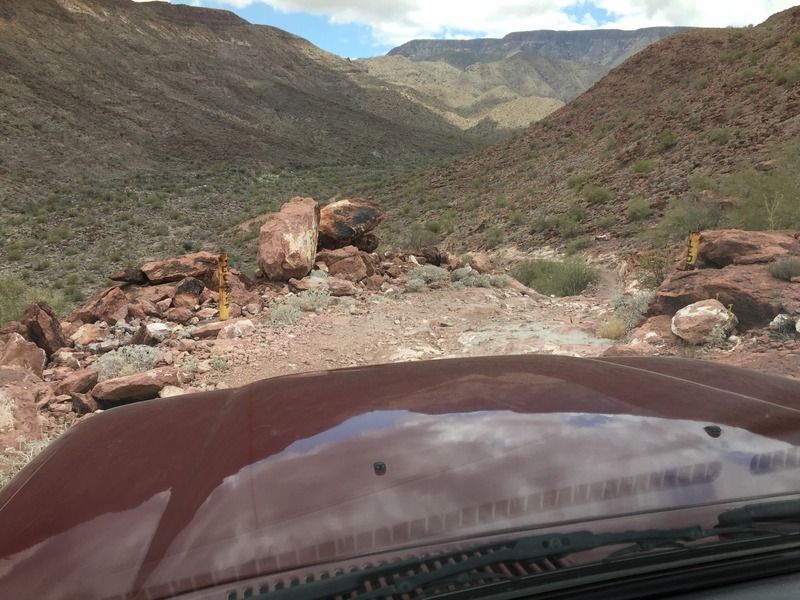
After breakfast and packing up we started our way east to the main road and then south to find our way to the Mano Canyon Junction, by noon we were heading up the first hills, and man, I keep forgetting how tiresome that first part is, really slow creeping up very hard terrain a lot of secondary bypasses have been made thru the years, but there all the same! Several bales of hay were laying around like if the fell from a truck that recently travelled that path.

The remains of the once active pool and secret weekend lodge, really well built in order to sustain so many years without any kind of maintenance.


Smallest of the two lodges, every inch of metal was stripped away by force.


Nice view into the mountain range, up above, Santa Isabel Nuevo ranch is nearby.


Santa Isabel Canyon


Old water pump enclosure.


Biggest of the lodges, also stripped.


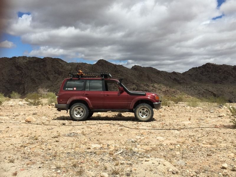
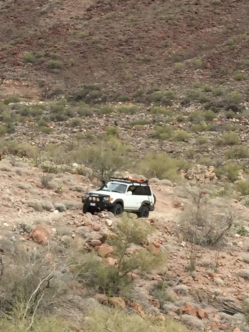
My weekend warrior, this rig keeps surprising me with its endless reliability.


Not the wrong way! at least for us!


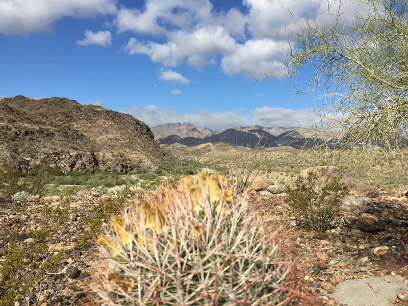
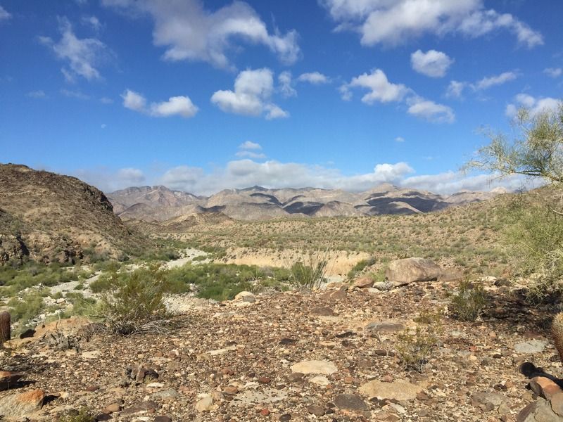
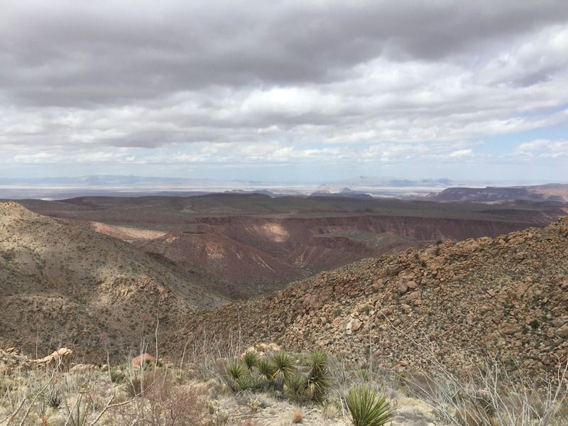
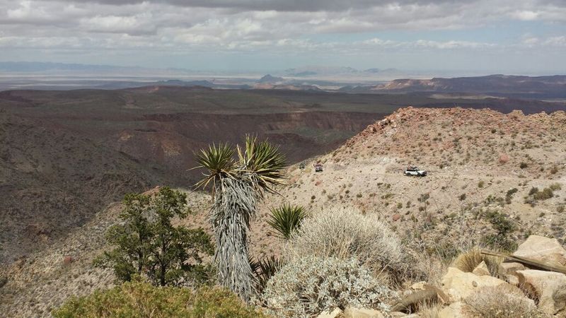
Starting the tiresome part of the trail, very nice view, green everywhere!


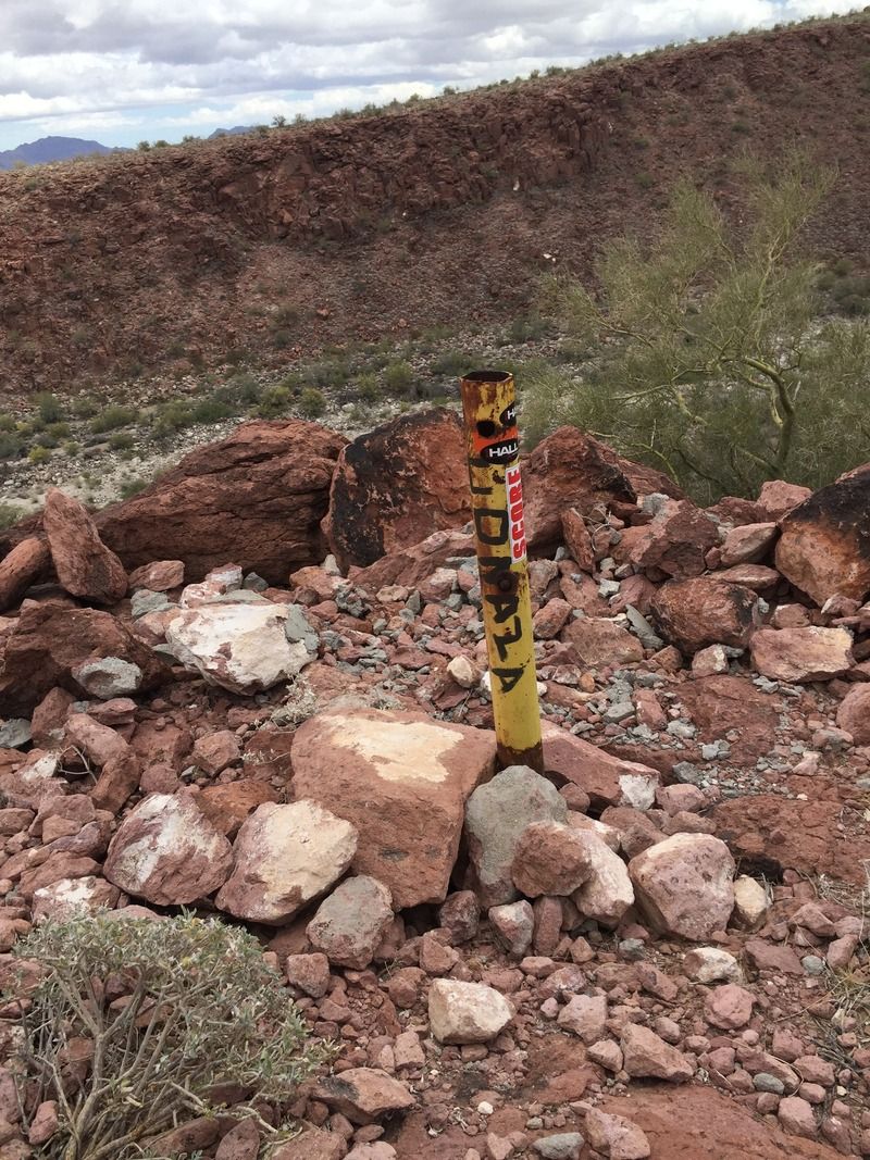
After a while, the tiresome terrain faded into a normal trail, we kept pushing forward, the lower section where the steel wire used to be was wide open. On previous trips I never noticed the "CONAZA" text written on them. CONAZA (Comision Nacional de Zonas Aridas / National Arid Zone Commission) was the government department that carved and built the trail in the 1970's.

Aproaching the lower gate, no steel cable present.


CONAZA text on the pillars


We took a small rest on the rancho on the bottom of the canyon, this is called "Molina de Abajo", two houses are present in the same Rancho, the bigger one was built recently by the Molina Family, who acquired the land in the 50's or 60's; the smaller shack is from the first person to reside in the canyon, he was called "Mano" some say he arrived in the canyon during the gold rush era, and never left, he eventually passed away, and the Canyon adopted his name.

Molina de Abajo Ranch, El Mano Shack


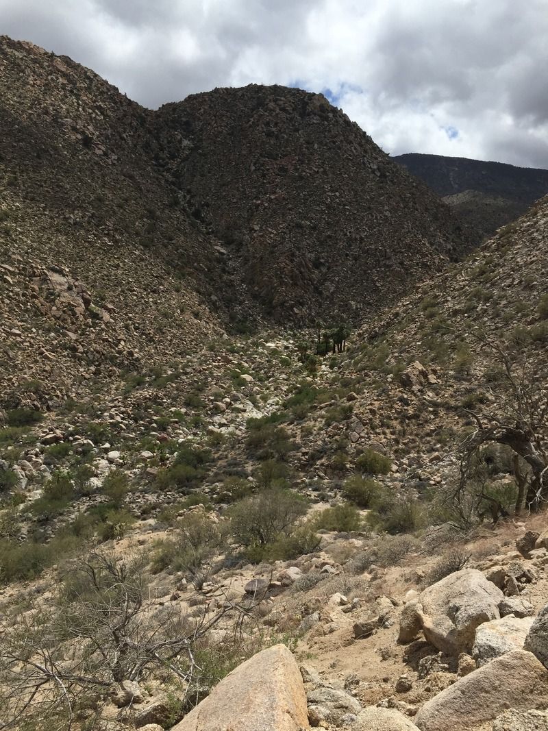
Some Palms in the distance on El Mano Canyon


We continued gaining altitude on the trail; there was a particular section, after the burned and abandoned suburban where I felt my mobile phone vibrate, and upon checking it I was surprised to see I had Telcel signal, and a couple of voicemails; we stopped in a nice photogenic section and I could actually call my wife to check in, im still impressed.

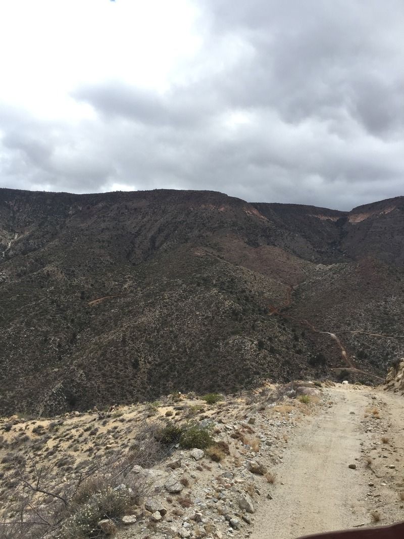
Climbing the Trail


Nice Photo spot, with Telcel coverage included.


The climb continues


After a while some pine trees became visible and the landscape changed faster into pine forest; on the top, theres a lot of road building, I think is to continue extracting vegetation from the mountains, the roads I observed didn't had any kind of direction or path, they just simply climbed hills and dead ended suddenly, with a lot of redundancy among them, weird.

New roads are being built...


We then arrived to the upper ranch called "Molina de Arriba" (Abandoned), and a couple of miles after to Rancho Tres Pinos (habited), we continued and found a locked gate, we backtracked to the ranch, and talked with them, first a lady just said 10 dollars per car; then a guy came from inside the house and said it was OK to just go thru the other unlocked gate closer to their house; we proceded without problems.

Molina de Arriba Ranch


Up in the plateau, we did encounter a couple of closed but unlocked gates, unfortunately, the path to laguna Hanson is now longer, since a increased number of locked gates that prohibits going north sooner, we just continued and found a free path up north that connects into the main Laguna Hanson trail; by then, we had suffered from a popped turbo hose; rain, and 3 degree weather, all that combined with more than 6 hours of driving.

In Laguna Hanson, we opted for a cabin due to the constant rain, we quickly started a fire and the BBQ.

Next day, the trip back to la Rumorosa was uneventful, the road is in good conditions; we arrived at Mexicali around 3pm, just in time to get a good rest and celebrate mothers day on Sunday.

-Emerson

TMW - 5-13-2015 at 03:31 PM

Excellent, thanks for sharing. Pictures are great.

David K - 5-13-2015 at 03:33 PM

Super report and photos! Thank you...

I have gone into Mano twice... the first time coming down from the top (June 2003) and the second time going up from below, but just to the canyon entrance, with Ken Cooke and his Jeep club following. That LONG rough climb from the sandy desert floor to the canyon entrance sounds like it has not improved!

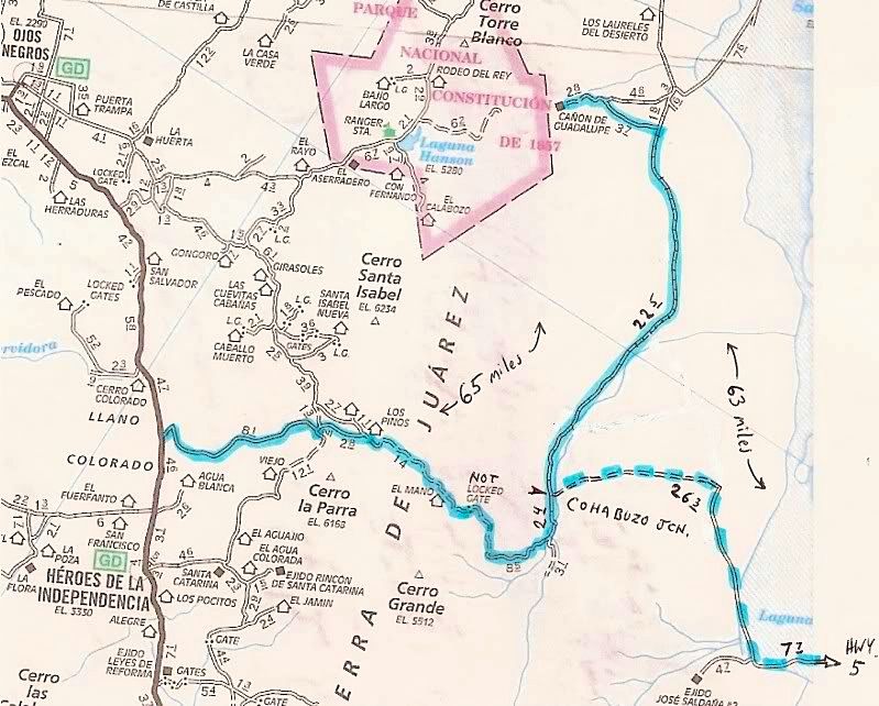
Here is a map I made showing the run from Hwy. 3 or Hwy. 5 to Guadalupe Canyon from the south. The former general's (or governor's) hide-a-way is just west of Cohabuzo Junction to give a location on the map:


PaulW - 5-13-2015 at 04:25 PM

Emerson -- I like

StuckSucks - 5-13-2015 at 04:45 PM

WOW - looks like a fun trip, lots of great scenery!

Mexitron - 5-13-2015 at 07:41 PM

Beautiful country on that road, thanks for the pics and report!

The squarecircle - 5-13-2015 at 11:02 PM

Greetings >>>> Nice report >>>> Just lost a 1 hour write on the Gov's party villa. My reportage just vanished like a fart in the wind!!!>>> I know that area well. Thank you the memories.>>> Regards sq.

bajatrailrider - 5-13-2015 at 11:50 PM

Great post,pictures.Thank you

David K - 5-14-2015 at 08:06 AM

Quote: Originally posted by The squarecircle  
Greetings >>>> Nice report >>>> Just lost a 1 hour write on the Gov's party villa. My reportage just vanished like a fart in the wind!!!>>> I know that area well. Thank you the memories.>>> Regards sq.


Roy, if I can help with your lost post on the desert hide-a-way, let me know! I think it may be interesting to read... There was even a landing strip so he and his 'guests' could fly in for a little R & R out of the view of the voters.

PaulW - 5-14-2015 at 08:53 AM

A history account would be an interesting read. The place had a lot of infrastructure.

David K - 5-14-2015 at 02:43 PM

Quote: Originally posted by The squarecircle  
Greetings >>>> Nice report >>>> Just lost a 1 hour write on the Gov's party villa. My reportage just vanished like a fart in the wind!!!>>> I know that area well. Thank you the memories.>>> Regards sq.


Roy called... he had a nice report on the history of the hide-a-way mansion for the ex-governor. Then the Nomad page he was typing to vanished/timed out/ ?

In a nutshell, Roy had been in there about three times when it was recently completed, and saw the pool full of clean water. The airstrip was well maintained. There were gates and signs to stay away... but that is like an invite to curious Roy. This was in the 1990's.

The dozed road up the mountain going south and west from the mansion was made by a big bulldozer that was abandoned for some time up on the ridge, but eventually removed. The road never went anywhere.

Roy thinks the governor went to jail for using public funds for his playboy mansion... or other wrong doings.

bajaguy - 5-14-2015 at 03:25 PM

Would like to see that information

Quote: Originally posted by The squarecircle  
Greetings >>>> Nice report >>>> Just lost a 1 hour write on the Gov's party villa. My reportage just vanished like a fart in the wind!!!>>> I know that area well. Thank you the memories.>>> Regards sq.

David K - 5-14-2015 at 04:57 PM

Quote: Originally posted by bajaguy  
Would like to see that information

Quote: Originally posted by The squarecircle  
Greetings >>>> Nice report >>>> Just lost a 1 hour write on the Gov's party villa. My reportage just vanished like a fart in the wind!!!>>> I know that area well. Thank you the memories.>>> Regards sq.


I told Roy on the phone today that if wants to type it all over again, he can email it to me and I will post on Nomad. He has photos too... but it sounds like he will need to hand them to me if they are ever going to make an appearance on Nomad...? Roy knows I like details, and what I posted just above after he called, are the only details I got from his chat.

TMW - 5-14-2015 at 06:08 PM

Roy needs to get his Land Rover ready as I would like to go back in there and see the place. Also check out the 3rd summit trail. I may be ready the end of May around the Baja 500 time frame.

Ateo - 5-14-2015 at 06:40 PM

Thanks for taking the time to bring us along wit your words and photos! Gracias.

The squarecircle - 5-14-2015 at 10:07 PM

Quote: Originally posted by TMW  
Roy needs to get his Land Rover ready as I would like to go back in there and see the place. Also check out the 3rd summit trail. I may be ready the end of May around the Baja 500 time frame.
Tom, >>> You are right! Tomorrow I'll connect the trickle charger up on the old English ford and get it running again. Hope the newer electronics are better than older Lucas (Prince of darkness) you know OFF/DIM/DIMMER. >>>> Need to get a list started of those interested in the Cowboy Ranch(3rd summit trail) and get it done. >>> Good time of the year to have a Baja adventure, don't you think??? Best Regards, sq.

David K - 5-15-2015 at 08:46 AM

I would love to go too... but I won't know if I can until a week before any trip. Not retired yet, like you lucky guys!

Emerson - 5-18-2015 at 10:35 AM

If the date lines up with my schedule, I'll be happy to join.

BornFisher - 5-18-2015 at 10:46 AM

Thanks for the report Emerson. What a great trip and report!!

The squarecircle - 5-19-2015 at 06:45 PM

Greetings, Emerson >>>Those two Toyota Land Cruisers look great comfortable and capable to go anywhere! >>> Lets do the #3 summit and have a look at the Cowboy Canyon as another escape up the mountain and out of the desert. >>>> IF we can all agree on a time of somewhere around last of May or first week of June maybe we can get 'er' done! Should be a an interesting trip. Approach route is up for grabs. >>>> Enter thu Ej. Jose Saldana/ La Ventana ie. run the pole Line backwards (E. to W.) or La Ponderosa/Poso Salado to start of PLR at the base of the El Mano or hit the PLR coming down El Mano from above or Arroyo Grande entering at Guata off M3 or the Ej. Heroes DE LA Independencia thu to Puertozualo (sp) high route.>>>>> Interested partisans so far are >> 1. David K >> 2. TW>> 3. sq.(me) >> 4.Emerson and anybody else that is up to a challenge. >>>>Regards, sq.

[Edited on 5-20-2015 by The squarecircle]

[Edited on 5-21-2015 by The squarecircle]

David K - 5-19-2015 at 07:40 PM

Ej Saldana road is washed out to Pole LINE (see Ken's trip report). La Ventana/Arroyo Grande is the way. Another issue on your dates is Baja 500 race or pre running.

Emerson - 5-20-2015 at 11:33 AM

A option would be to leave Mexicali a Friday afternoon, drive as far as we can up the PLR and Saturday morning we arrive at Canyon Jamau, and we can explore options all day long, if we can get thru we can sleep in the canyon, if we dont, we can go up the Sainz Summit (#2 I believe).

So theres basically 2 options in dates I can see:
May 29-30-31
June 5-6-7 (Baja 500 Weekend)

Is the Baja course running close to our routes?

TMW - 5-20-2015 at 12:11 PM

The Baja 500 comes down the La Rumorosa grade to Laguna Salada and down the middle of it keeping to the east. That may change if the dry lake bed is wet.

Emerson - 5-20-2015 at 12:15 PM

La rumorosa grade?
I believe they run south, right?

http://score-international.com/46th-tecate-score-baja-500-ma...

[Edited on 5-20-2015 by Emerson]

[Edited on 5-20-2015 by Emerson]

TMW - 5-20-2015 at 12:58 PM

Yes they run south. Here is the map.

http://forums.bajanomad.com/viewthread.php?tid=78830

Emerson - 5-20-2015 at 01:21 PM

Duh! I had the 2014 map.
Nice course, la Rumorosa grade will be exciting for sure, the dropoffs are very steep.
The road on the Laguna Salada is very very wet, last sunday I drove by the entrance and 3 Jeeps had back tracked, and by the mud in their rigs, I dont think that is race worthy, you can actually see the puddles for miles, it rained very hard last weekend in the area.

PaulW - 5-20-2015 at 02:35 PM

Some thoughts:
The Mexicali route Hwy 5 should be OK when heading for the PLR. You will be on the race track from the wells southin AG for a bit, but then keep right and get off the race track.
We are all betting the race track will be revised where the flooding is, but that supposedly is north of the wells.
Beware there are no reports for Jaquegel and if it received half as much rain as parts north then there will be problems getting through. Even with no flooding that would be a pretty slow way to get to the 3 summits.

The long route would be to head for the 3 summits would be from Valley Trinidad or Indepencia. No reports of flooding in that region. Adds more time? for the trip. Hwy 5 then hwy 3. Not a good way during prerunning or race day.

Waiting until after the race and there will be good road condition reports and no conflict with racers.

David K - 5-22-2015 at 08:35 AM

Quote: Originally posted by PaulW  
Some thoughts:
The Mexicali route Hwy 5 should be OK when heading for the PLR. You will be on the race track from the wells southin AG for a bit, but then keep right and get off the race track.
We are all betting the race track will be revised where the flooding is, but that supposedly is north of the wells.
Beware there are no reports for Jaquegel and if it received half as much rain as parts north then there will be problems getting through. Even with no flooding that would be a pretty slow way to get to the 3 summits.

The long route would be to head for the 3 summits would be from Valley Trinidad or Indepencia. No reports of flooding in that region. Adds more time? for the trip. Hwy 5 then hwy 3. Not a good way during prerunning or race day.

Waiting until after the race and there will be good road condition reports and no conflict with racers.


Paul, are you saying there is new flash flooding in Jaquegel since we all were there last month (Easter)?

I agree it would be a the long way (time wise) from La Ventana/ Hwy. 5 if getting to the summits was the sole purpose. The Pole Line Road's Basketball Hill and Caņada de Enmedio are real slow/ low range sections of crawl. However, the road is super interesting given its history and seeing phone poles installed by our boys in 1942 for the defense of California is really thrilling, 73 years later.

Ken Cooke - 5-23-2015 at 08:13 AM

The Mano Canyon trail is incredibly scenic. Your longer wheelbases made the tricky stairstep portion much easier - this was one of the steepest sections of trail I have ever driven my Jeep. Kinda scarry. :O

The PLR to Ejido Saldaņa is completely washed out, like David K said. Our Jeeps on 35s had difficulties locating a viable trail with all of the tall channels the recent floods had carved into the wash. :!: