
David K - 5-8-2016 at 10:05 AM
Naturally, this link that is on my VivaBaja.com website is also in my new book, and the link has been just changed!
Here is the link name as it appears on VivaBaja.com:
Harry Crosby's Photos and El Camino Real Details
The (now bad) link that was ben good for over 10 years: https://www.sandiegohistory.org/journal/77winter/bajamaps.ht...
[this link is also on page 26 of my new book]
The new link:
https://web.archive.org/web/20160329013158/http://www.sandie...
Sadly the extra enlargement feature of the maps was removed. Just one bump up in size is all that is offered now.
I had saved the maps to my Photobucket Maps sub-album "ECR"...
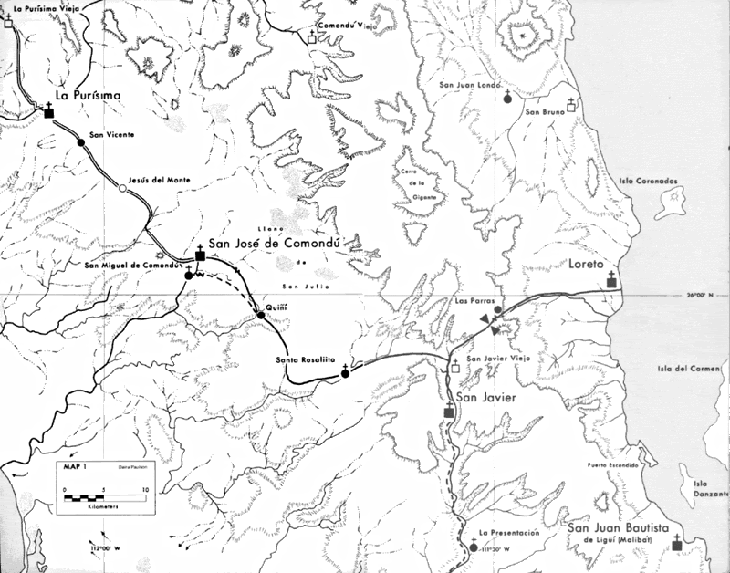
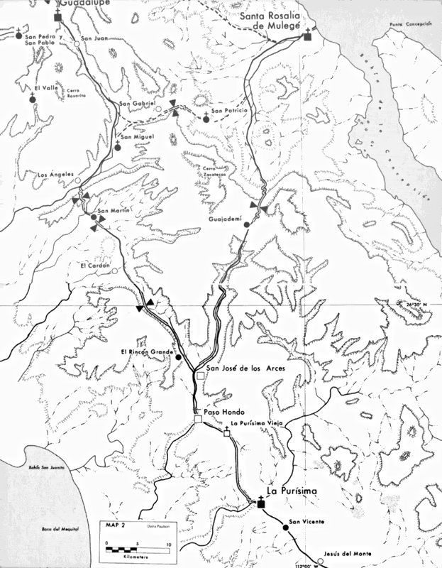
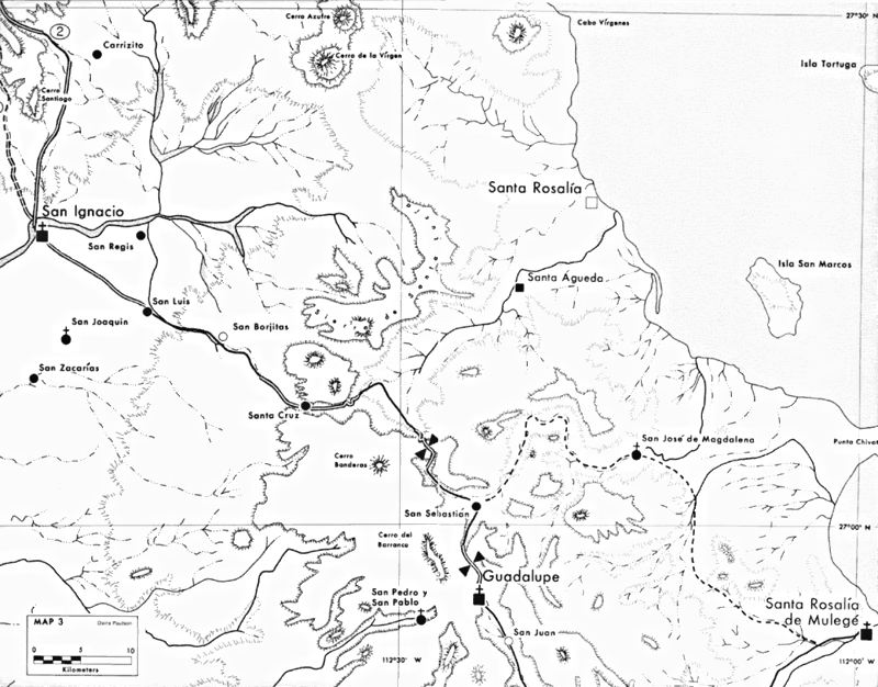
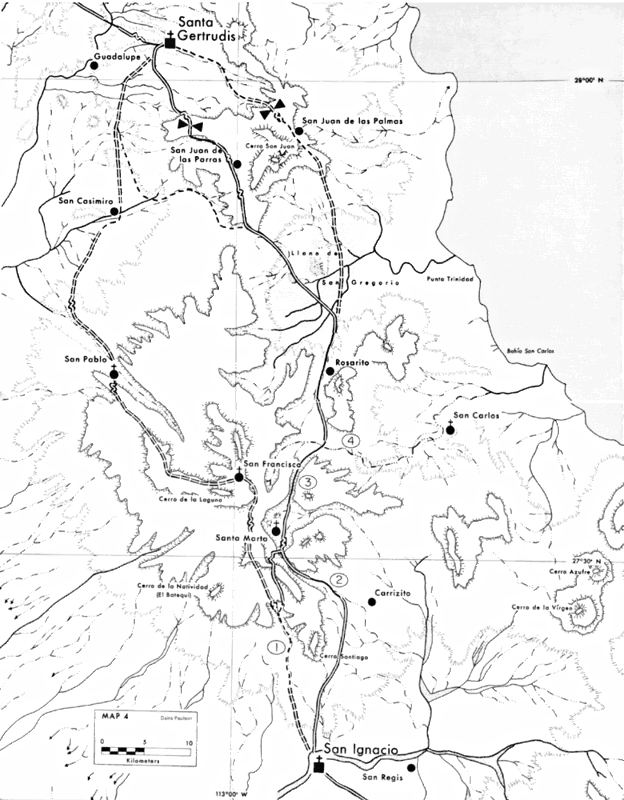
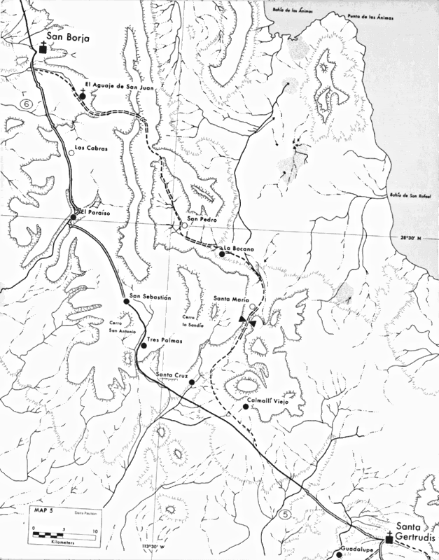
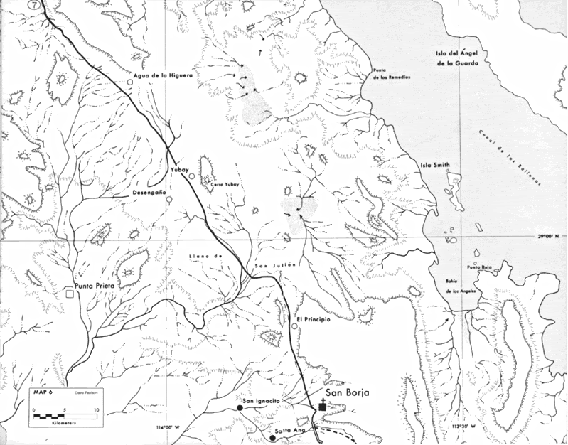
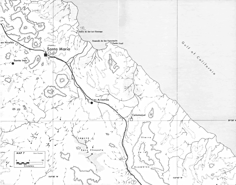
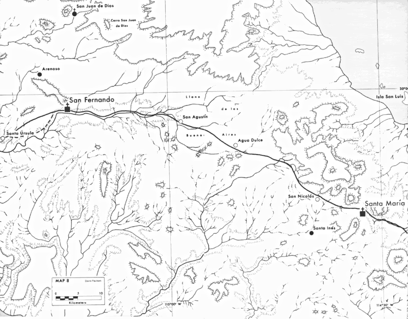
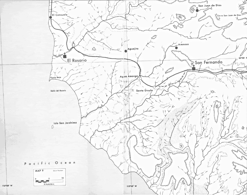
MISSION LORETO NORTH TO EL DESCANSO (north of Ensenada).
Here are the maps from Loreto to El Rosario... will add the rest later. These maps were made in 1977.
Double (parallel) lines are the Camino Real where the original road is easily visible today (or at least in 1974 when Harry wrote his book). Harry
began hi actual ride on the Camino Real in Comondú, so the display is a single line on Map 1 from Loreto to Comondú even though some original road is
visible today... a single line beyond Comondú is the route location, but perhaps original road building is not visible any linger. Dashed single or
double lines are alternate routes from the one Harry traveled.
[Edited on 5-8-2016 by David K]


