
PaulW - 11-1-2016 at 08:19 AM
Studying the 1977Baja 1000KM Mapa
And I see a 4x4 access roads.
One goes from the bottom of the summit and follows the pole line. It cuts across the Jaquegel delta toward a location north of the wells.
Another one leads from La Ventana and follows Arroyo Grande to Hwy 3
So in 1977 both roads were in use. This explains the reference to these roads from the racers of that era. Of course until recent years I thought
those roads were impassable.
To lazy to look it up, but when was the first recent record of the pole line traverse?
David K - 11-1-2016 at 08:49 AM
Hi Paul,
I first saw the Pole Line Road described in the Lower California Guidebook. In the first edition (1956) it is mentioned and partially mapped. By the
third edition (1962), Howard Gulick had traveled and mapped the entire section from the summit to Arroyo Grande (Ken Cooke's Run section).
Also, it appears on a 1953 Desert Magazine article map (although not accurately located):
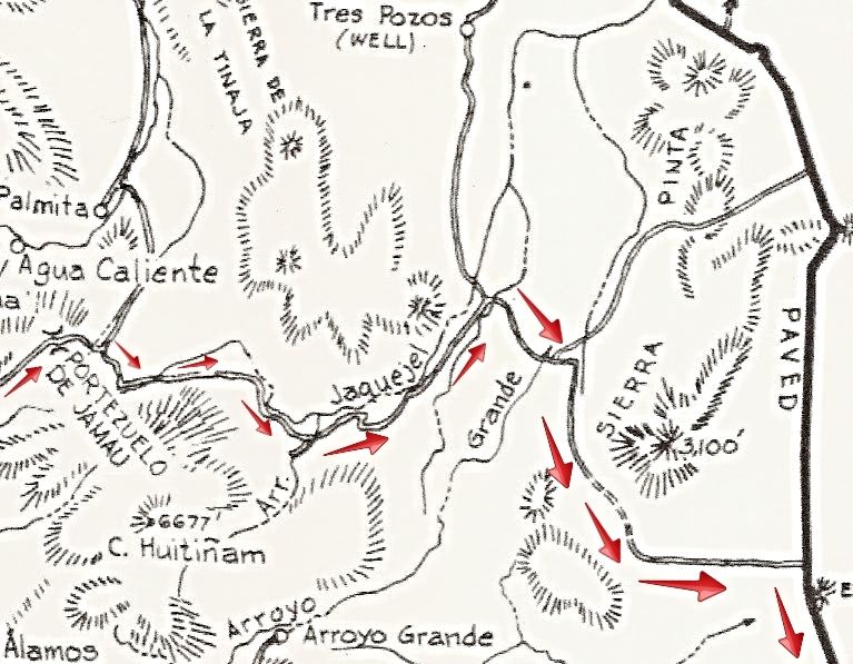
Here is Gulick's 1962 map close up of the road from the summit to Hwy. 5 (with arrows added along the Pole Line):
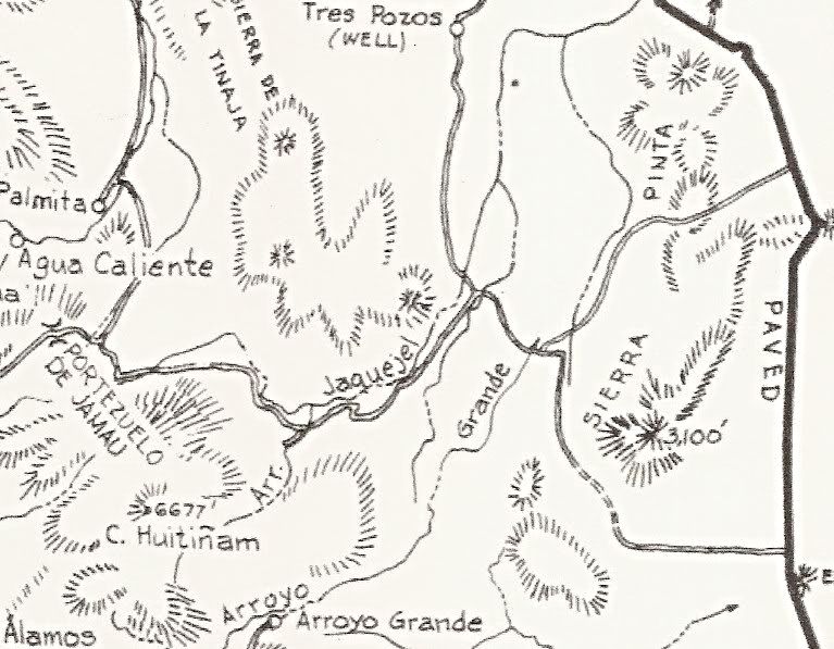
No arrows:
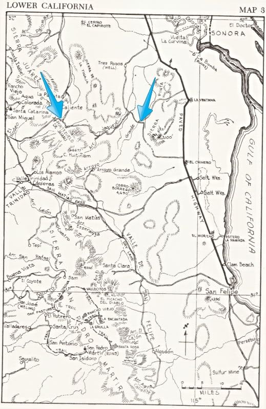
The entire map with arrows at the start and end of Ken Cooke's section of PLR:
Here is the Desert Magazine article (in part). Their trip was in November, 1952:
We continued along an unimproved
and winding desert trail through ironwood,
palo verde and smoke trees for
24 miles, bearing always to the south
and coming finally to a telephone pole
line which crosses the arroyo at right
angles. This telephone, now abandoned,
was built by the U. S. armed
forces during World War II, to connect
San Felipe with Ensenada on the
Pacific coast. It was feared that Japanese
submarines might establish contact
with secret agents by way of the
Gulf of California, and this communication
line was deemed necessary for
the national security.
Where this military phone line
crosses the Arroyo Grande another
great dry watercourse comes in from
the west as a tributary. This is the
Arroyo Jaque'el.
Continuing upstream along the Arroyo
Grande dry channel the mountains
soon began to close in and our
broad arroyo became a high-walled
gorge. This is the beginning of Arroyo
Grande proper. Beyond this point we
continued for another 22.7 miles before
the gorge became too narrow...
[Edited on 11-1-2016 by David K]
David K - 11-1-2016 at 09:07 AM
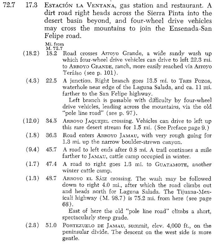
Here is what Howard Gulick wrote for the 1962 Lower California Guidebook:
Ensenada-San Felipe Road section:
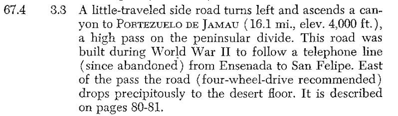
==============================================================
Mexicali-San Felipe Road section:
PaulW - 11-1-2016 at 09:54 AM
Desert Mag in 1953
Guilck in 1962
SCORE in 1977
I am surprised there are not more citations.
Can anyone find citation before 1980? I sure cannot.
David K - 11-1-2016 at 11:14 AM
Neal Johns' article published by Discover Baja Travel Club, late 1990s, I think (Ken has shared it here).
Here is my article from 2015: https://www.bajabound.com/bajaadventures/bajatravel/pole_lin...
I don't know of any other Baja publications about the Pole Line Road, Bruce Barber doesn't mention it when he was nearby searching for the 1541
Melchior Diaz grave.
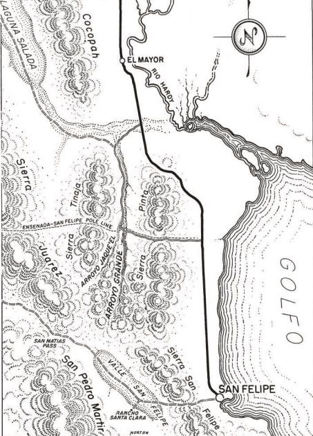
1977 Baja 1000 Map
David K - 11-1-2016 at 11:39 AM
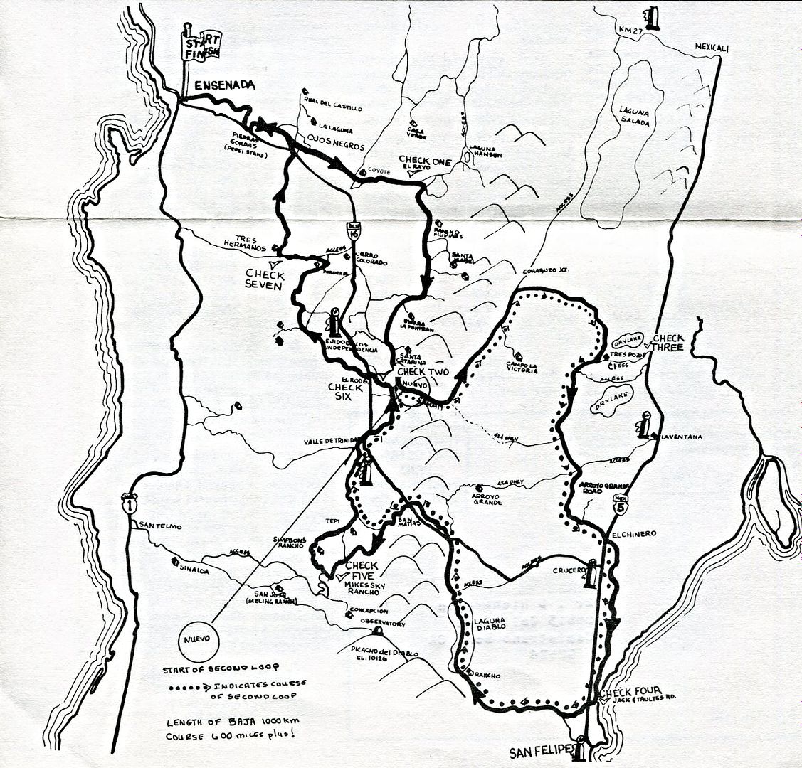
PaulW - 11-1-2016 at 08:27 PM
The 77 map shows the real meaning of a loop race.
Probably not to be seen again.


