
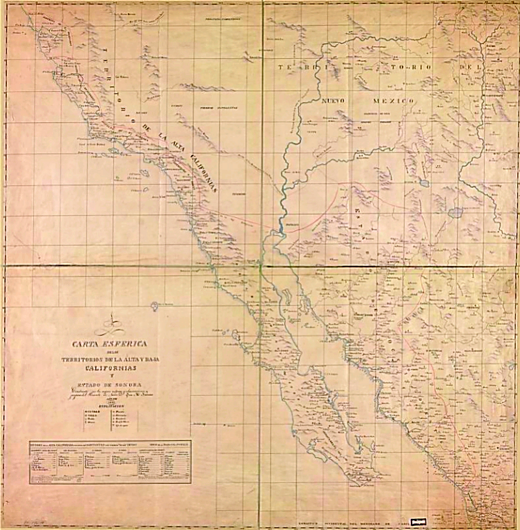
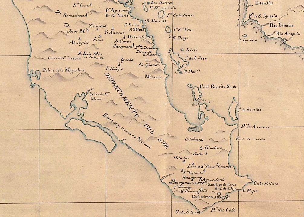
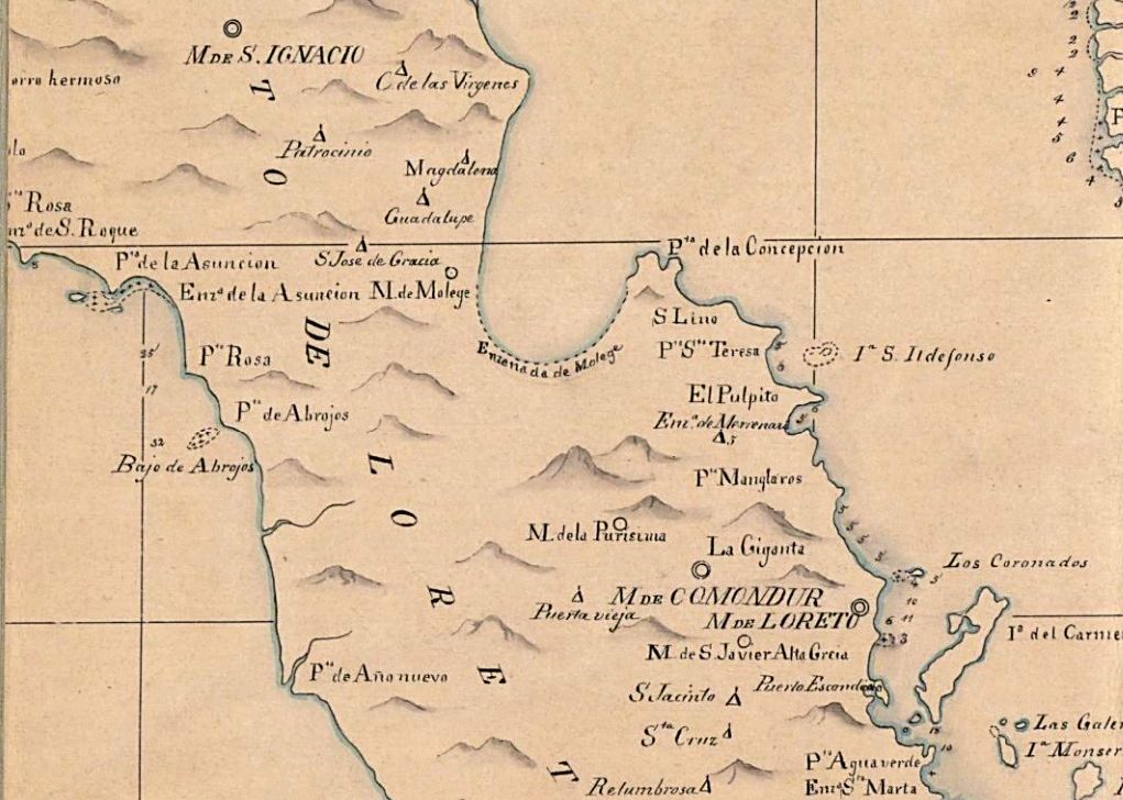
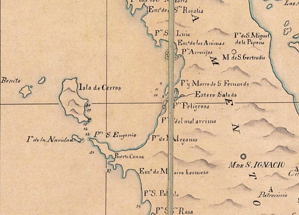
David K - 9-1-2017 at 10:29 AM
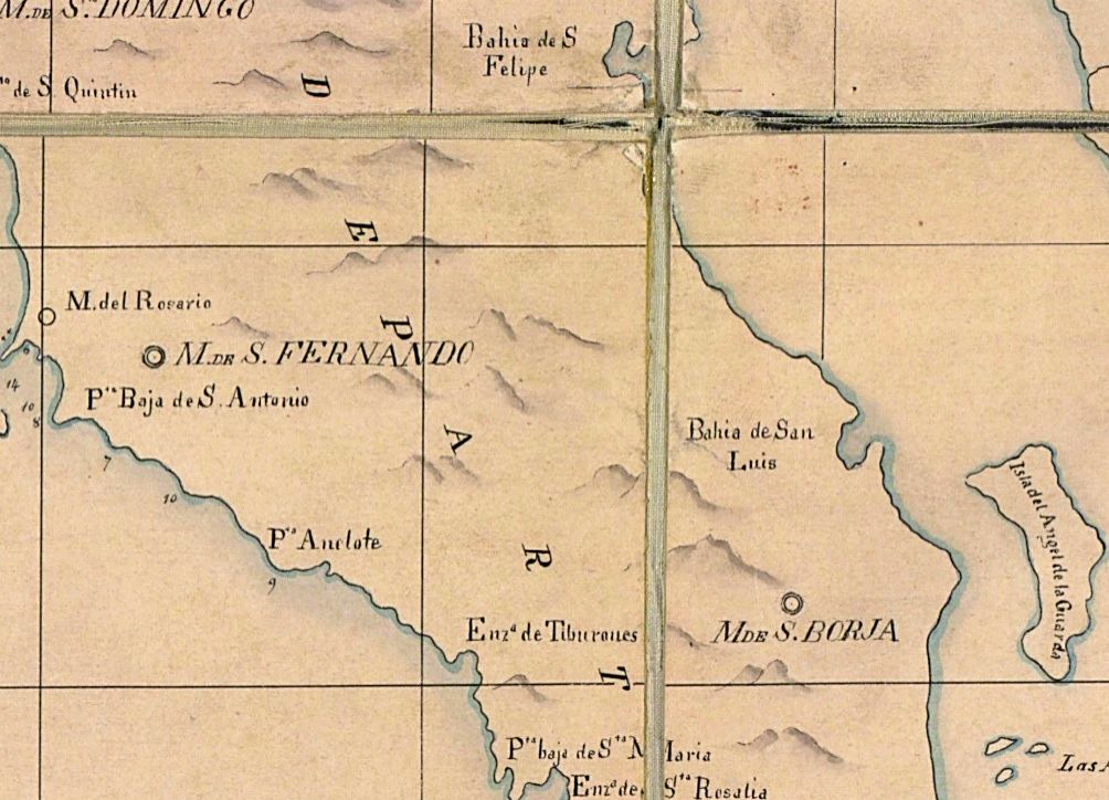
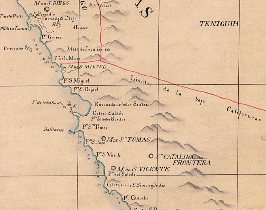
Nomad member John M sent me a link to a different copy of the 1823 map than I had seen before. I have part of that map in my book, as it shows the
missions open that year, quite well.
Here is that map, new version, for your interest. First the overall map, which is both Californias and New Mexico and Sonora, etc. I then did a zoom
in on Baja in 5 sections... from Cabo San Lucas to San Diego.
Please let me know if there is a region you would like that is not included or an even closer zoom in.
Remember that 1823 was the first FULL year that Mexico was in charge of the Californias. Spanish authorities were still active in early 1822, even
though the war had ended in 1821. Communication was slow!
To view this map
John M - 9-1-2017 at 10:58 AM
I found this from the Library of Congress website
https://www.loc.gov/item/99446199/
High resolution images available for download, no cost
John M


