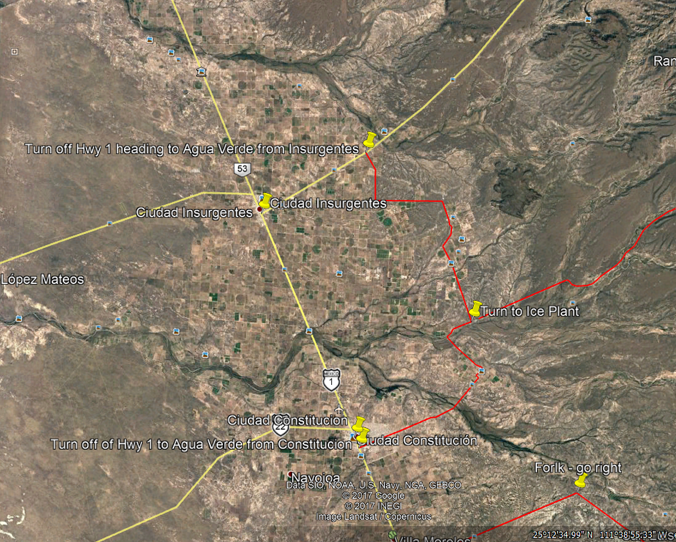
I missed the turn for the ice plant when I did it. Saw it , but didn't take it..
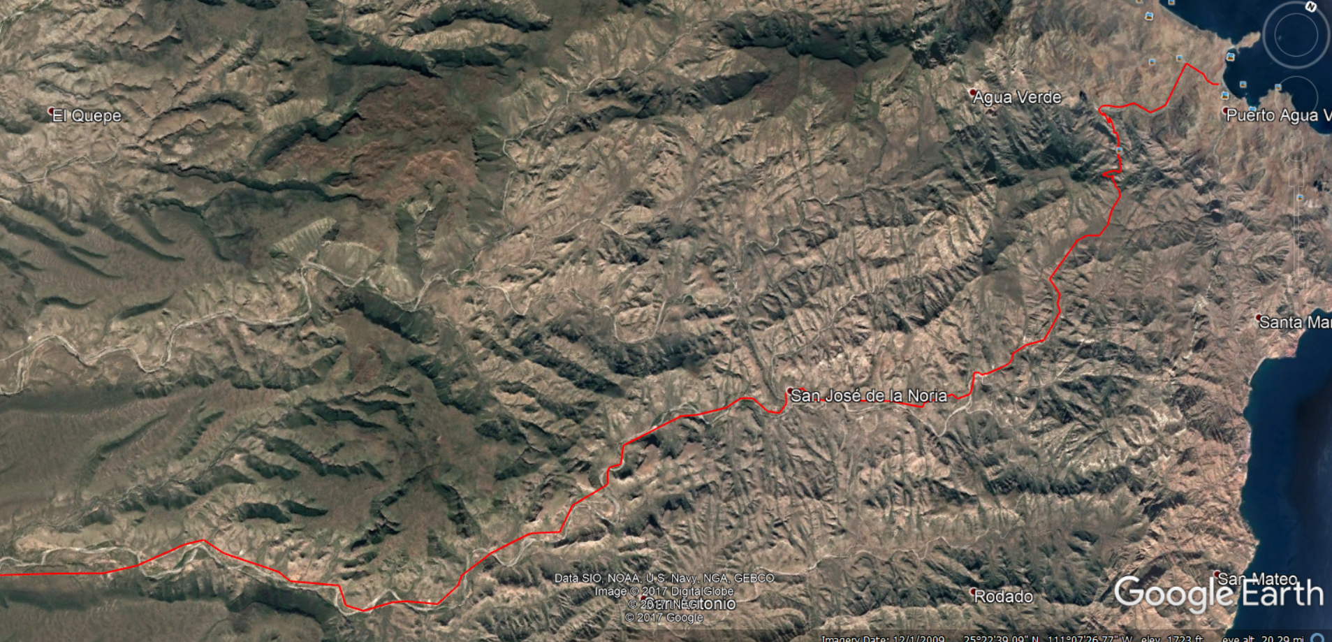
You have the route out nailed. Whether or not you find the ice plant road, you have already done the good stuff. If you are going back towards loreto
the cut off will save some time.. Don't have the gps cords but it is in the almanac.. First major road to the right after leaving insurgentes.. Have
fun! Would love to hear about the condition of the road after the storm.. Also the effects of the storm in AV.. Say hello to Tio Jaun in AV for me
please!
TT |