
bike4mee - 9-6-2017 at 03:05 PM
Hey
I'm new to the site. Thanks to all contributors. Planning on going down this January for a month or more. Just wanted a map to start planning with.
What has the best updated road conditions. The nat geo map is from 2008. What else?
thanks
BK
David K - 9-6-2017 at 03:12 PM
2010 AAA Baja Map (was the last edition, and mostly revised 2003-2007 research).
2009 Baja California Almanac, has far more roads than the AAA map and topography. Some errors, but many maps do have errors as well as being obsolete
the minute after they are made... when a storm changes a road or a new road is made.
I am traveling most of the main roads and several interesting side roads in 2017 to create a new Baja road guide and a map is in the works. My new
road information has been shared here in the Baja Trip Reports forums (See TRIP #1-#6). These trips are sponsored by a sponsor of Baja Nomad: Baja
Bound Insurance.
I am always happy to help a fellow Baja traveler if I can.
If you have an area of interest and need help finding details, just ask or email/ u2u me. Other Baja Nomads often can give the most up-to-date road
info here, as well!
JZ - 9-6-2017 at 03:23 PM
If Android, use Back Country Navigator. If iPhone, use MotionX. Both have most of the major dirt roads.
Look at Google Earth. Download way points and tracks from GE to either app.
Back Country Navigator makes it easier for you to import.
[Edited on 9-7-2017 by JZ]
BigBearRider - 9-6-2017 at 03:35 PM
Are you riding a motorcycle, or bicycle? Or a car? On or off road?
Good points made by posters above.
I like maps. I've gotten the sense that DK (David K) may also like maps.
I picked up an old AAA map from 1984 this weekend in great condition. It's pretty close to the 2010 AAA map that I also have.
I have the 2009 Baja Almanac. It's great. (Although I assume they made up some of the thousands of names for various locations.)
I also have a few wall maps for dreaming away when not in Baja. There is a rolled up map for sale at some gas stations and OXXOs and such, sponsored
by Almar dive shop in Ensenada. It's nice. The same map source has been used for some other printed maps as well.
I have a cheap Garmin Nuvi GPS that does a surprisingly good job in Baja. It's got most of the roads, but not all the cities/towns.
TMW - 9-6-2017 at 03:38 PM
You don't need no stinking map, just cross the border and get lost. That is where the fun it.
Just kidding. If you can get a copy of the 2003 almanac it would be helpful, easier to carry than the 2009 version. If you do get lost ask a local.
Maps
John M - 9-6-2017 at 04:00 PM
Tom (TW) is right - no maps needed!
But, just in case you do not share Tom's "I'm never really lost" thinking then if you send me your mailing address I will mail you an early 2000's
Auto Club map - I'll look for one without a bunch of highlighting - I am sure I have spares. Just look at the top of the nomad site and follow the U2U
directions and it'll be in the mail right away.
I believe as David K wrote, most are pretty decent showing lots of dirt roads, and even a 2000 map is still very good, to start with
John M
bike4mee - 9-6-2017 at 04:06 PM
Thanks
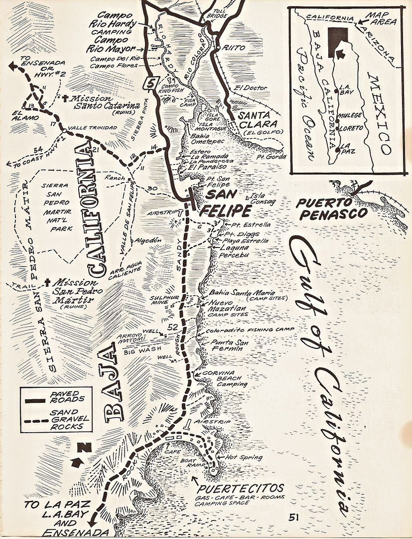
Most dont show the road south of san Felipe as being paved. I had a friend just come back and she said its all paved now except fo 30 miles. Sounds
like a great way to get south fast
I have tundra w/ camper and plan on pulling a 17' inflatable boat on trailer
Thanx
BigBearRider - 9-6-2017 at 04:28 PM
The road south of Puertecitos to a little past Gonzaga Bay has been paved for about 10 years or so. It may be the best road in all of northern Baja,
depending on your criteria. I have some maps that I bought recently, where the road isn't indicated as paved...
I, like many others, prefer heading south on Mex 5 even though there is about 23 miles of dirt between Gonzaga Bay and Laguna Chapala. The reason is
that there is less traffic, fewer trucks, no San Quintin congestion, etc. It's also prettier, IMO, and you can stop by Coco's Corner. Watch out for
vados south of SF though, and a couple of sharper turns that may not be well-marked.
David K - 9-6-2017 at 06:20 PM
Well, you know I am going to be picky on historical stuff, right?
The road south of San Felipe was paved to Puertecitos, poorly almost 30 years ago. It was finally repaved by 2007.
The NEW PAVED road from Puertecitos to Gonzaga (45 miles/73 kms.) and beyond was begun in 2007 and only advanced about 6-7 miles a year and reached
Gonzaga in late 2013.
The paving ends 20 kms. south of the Gonzaga Bay Pemex (Alfonsina's road), and has since 2014, although I was able to drive an additional 1 km. a
couple weeks ago, just opened up!
23 miles are unpaved to reach Hwy. 1 (Laguna Chapala).
SFandH - 9-6-2017 at 06:45 PM
I like these maps
https://www.amazon.com/s/ref=nb_sb_noss?url=search-alias%3Ds...
Samples
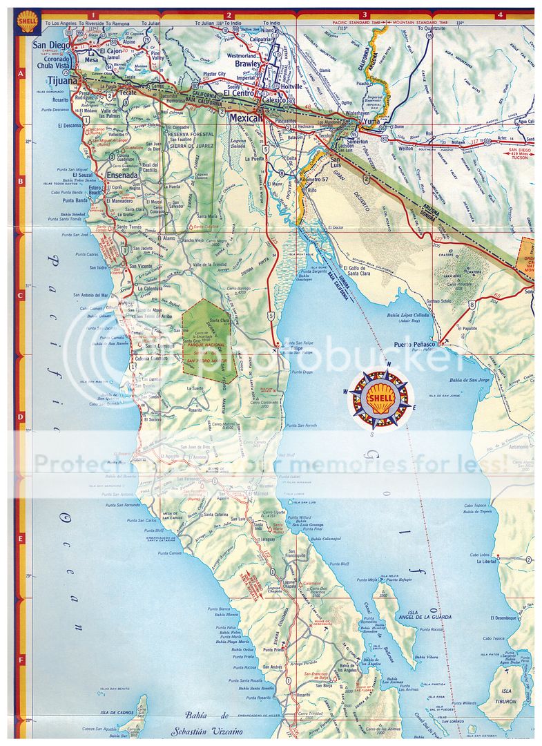
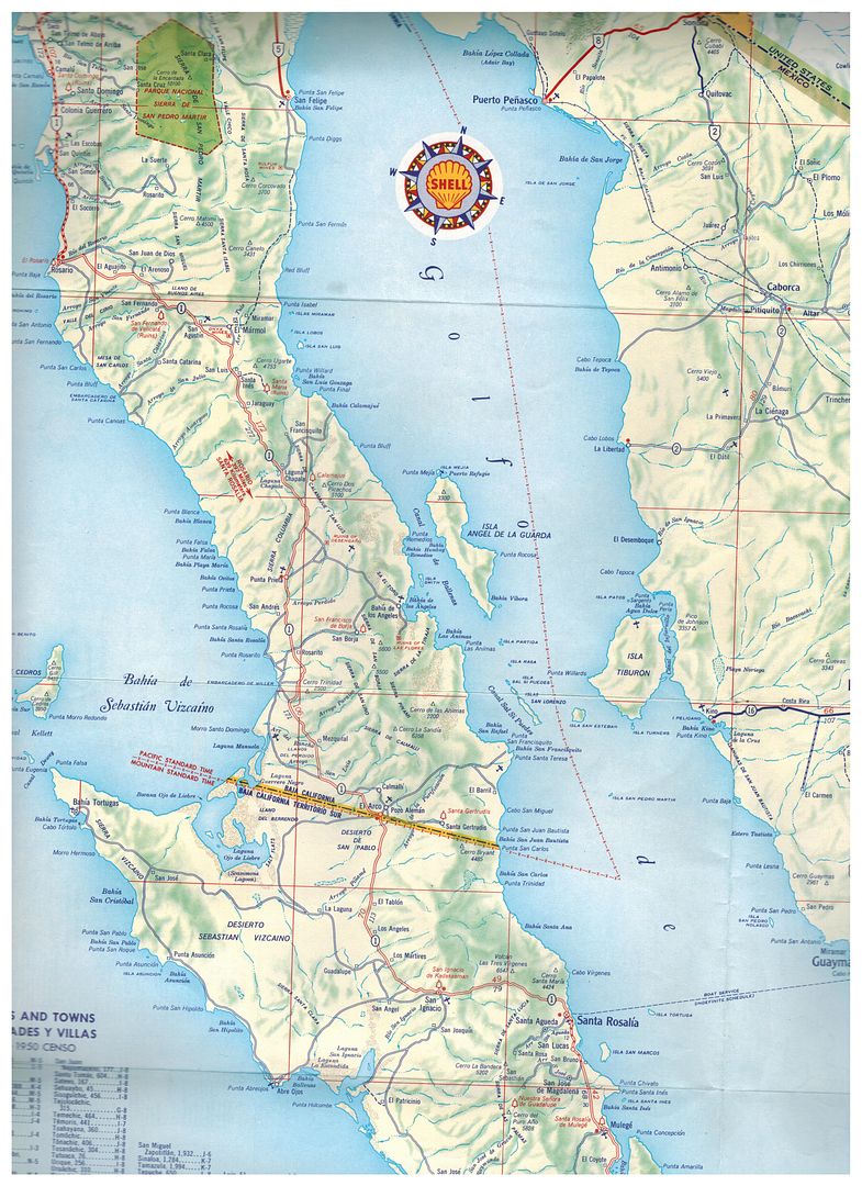
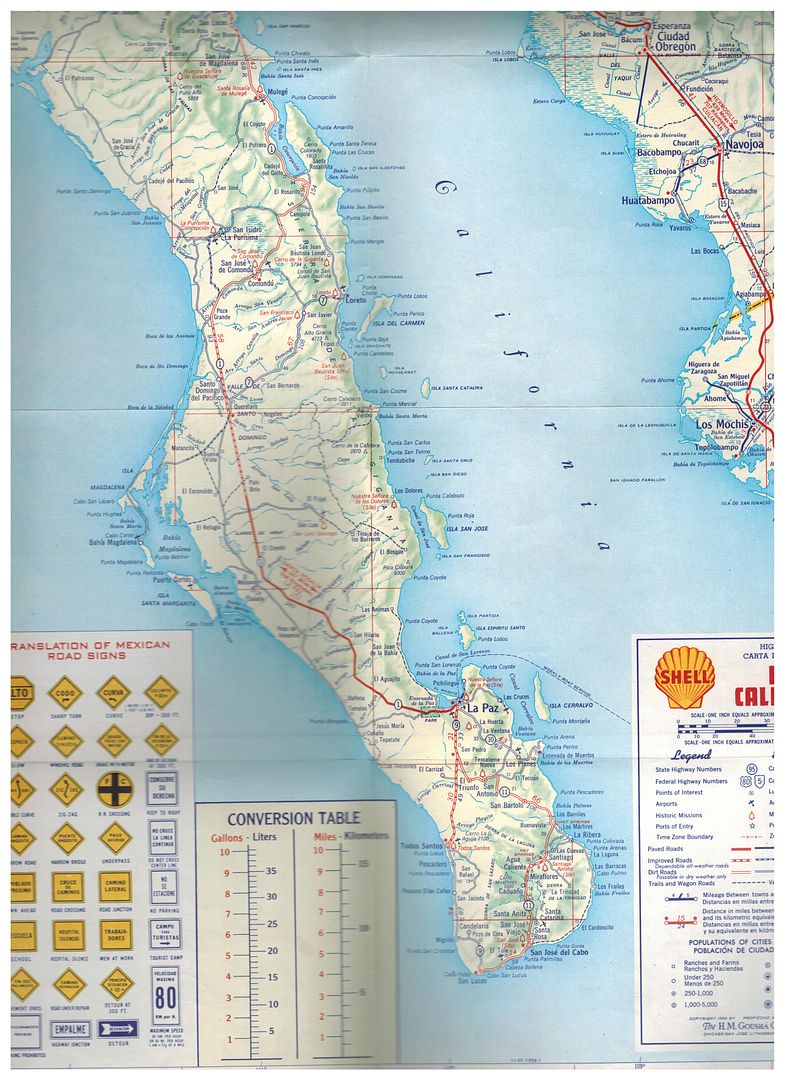
David K - 9-7-2017 at 12:24 AM
1958 Shell Map: Pretty good for a gas station map!
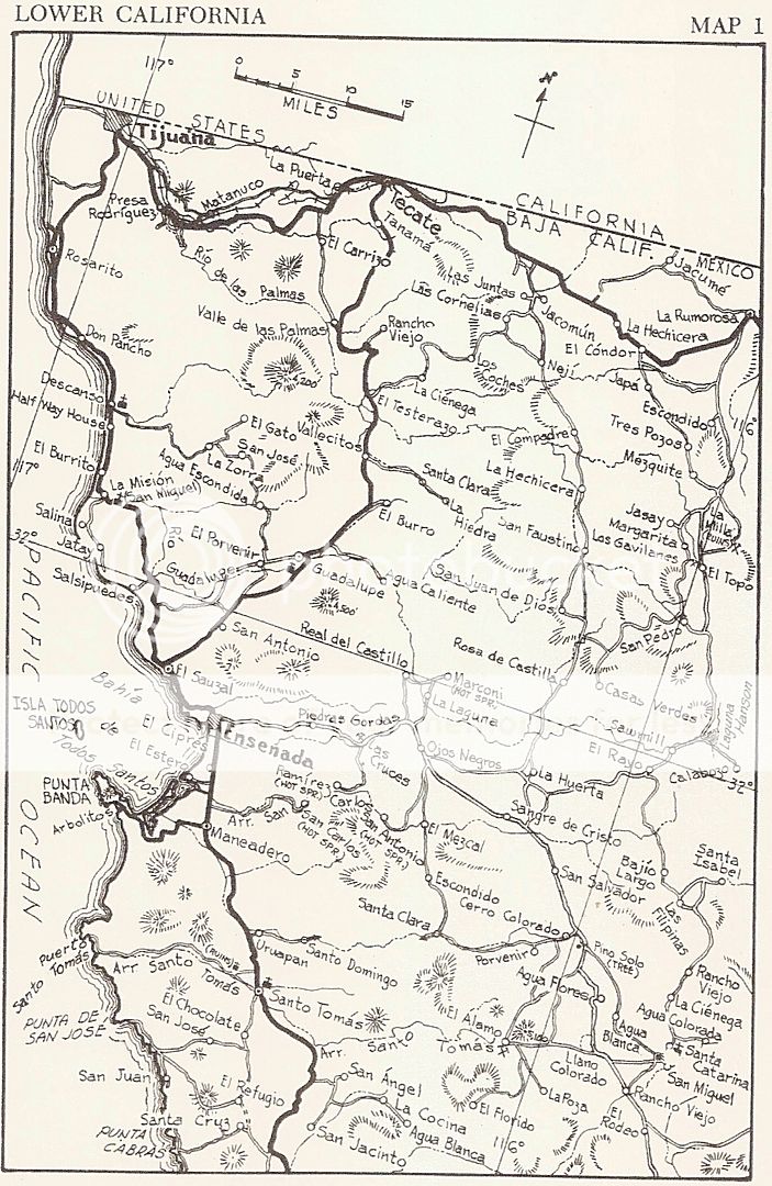
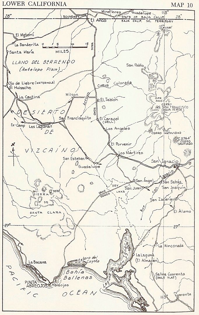
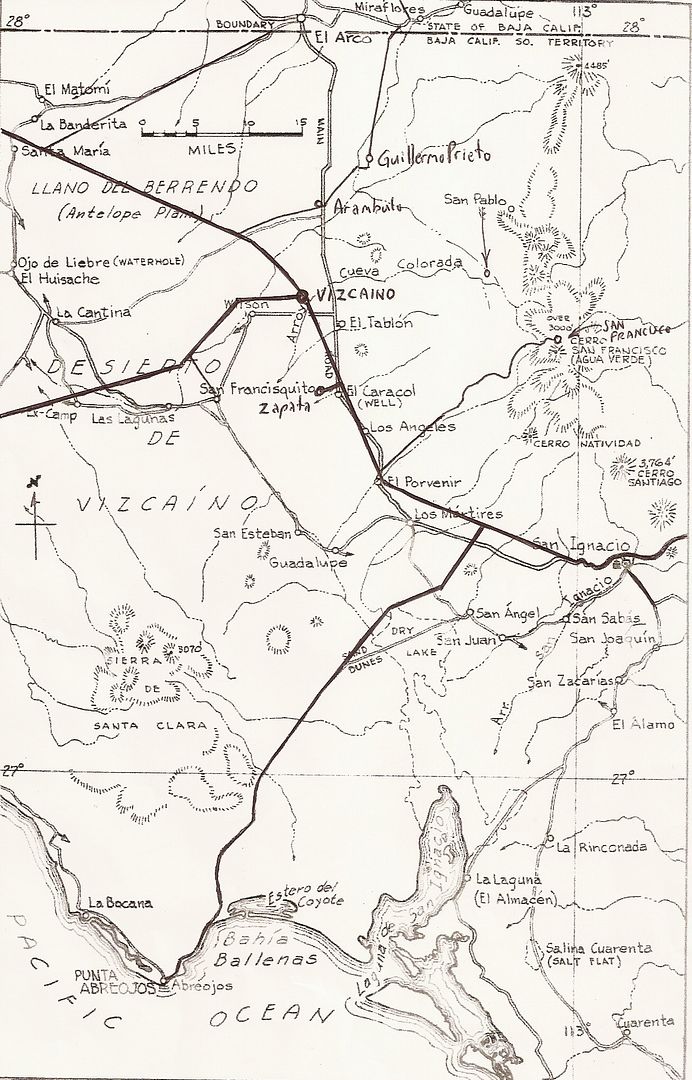
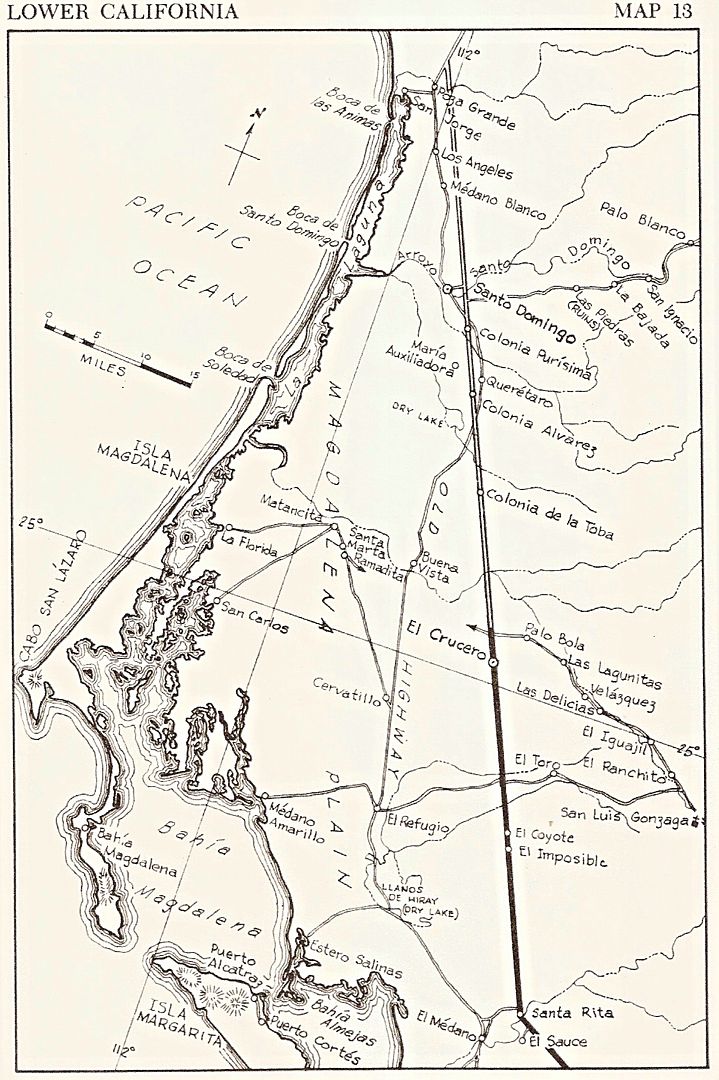
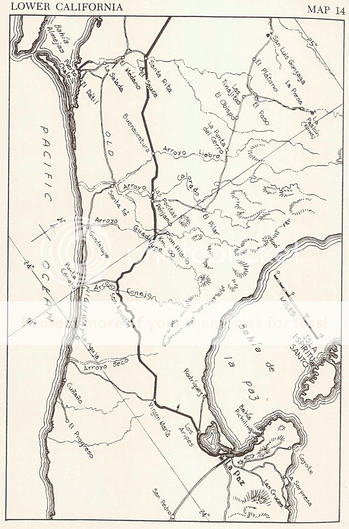
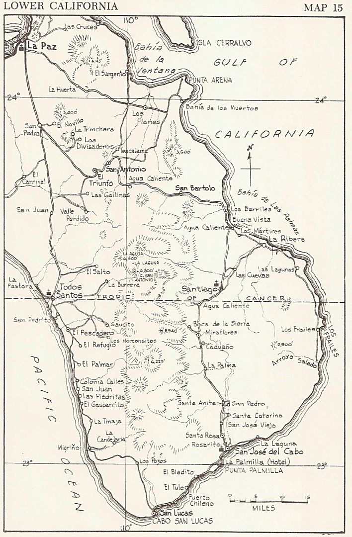
1962 Howard Gulick (Lower California Guidebook) Maps: The gold standard for hand drawn, accurate mapping!
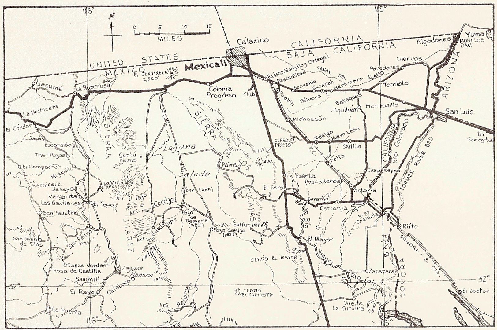
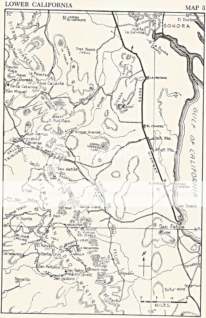
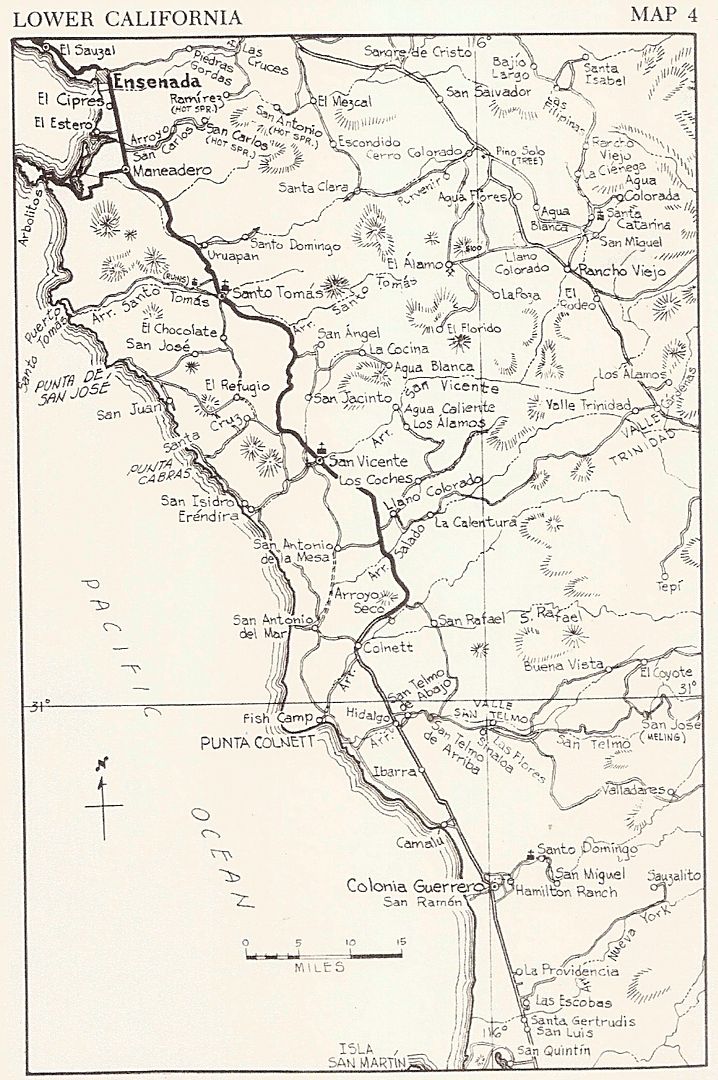
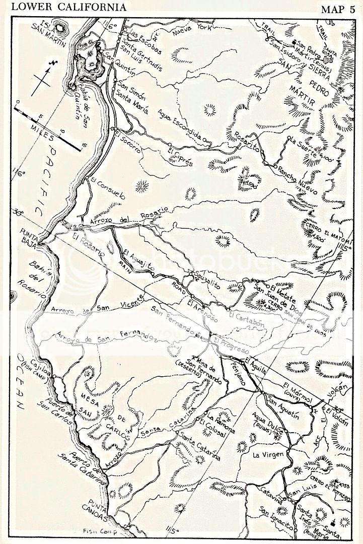
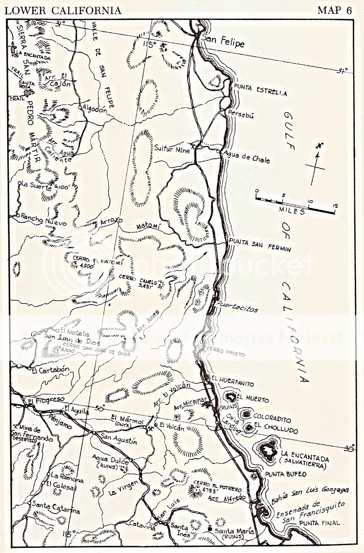
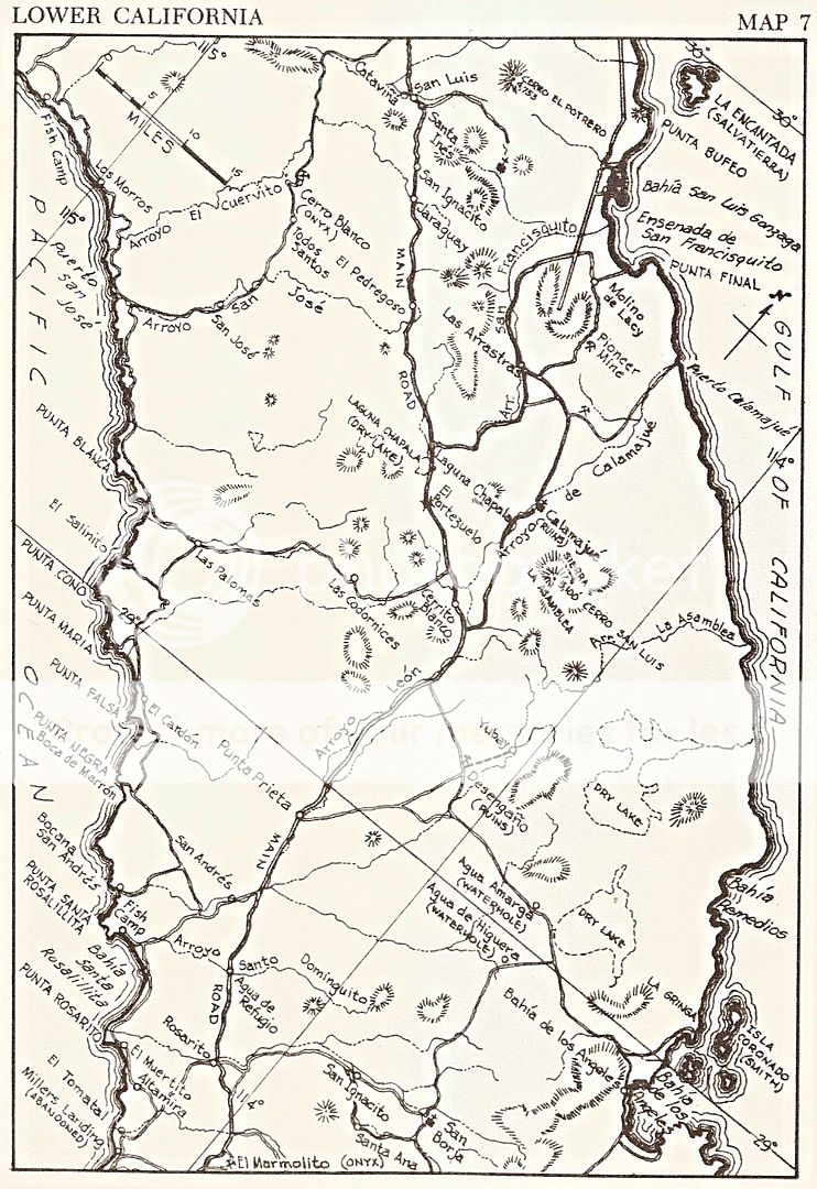
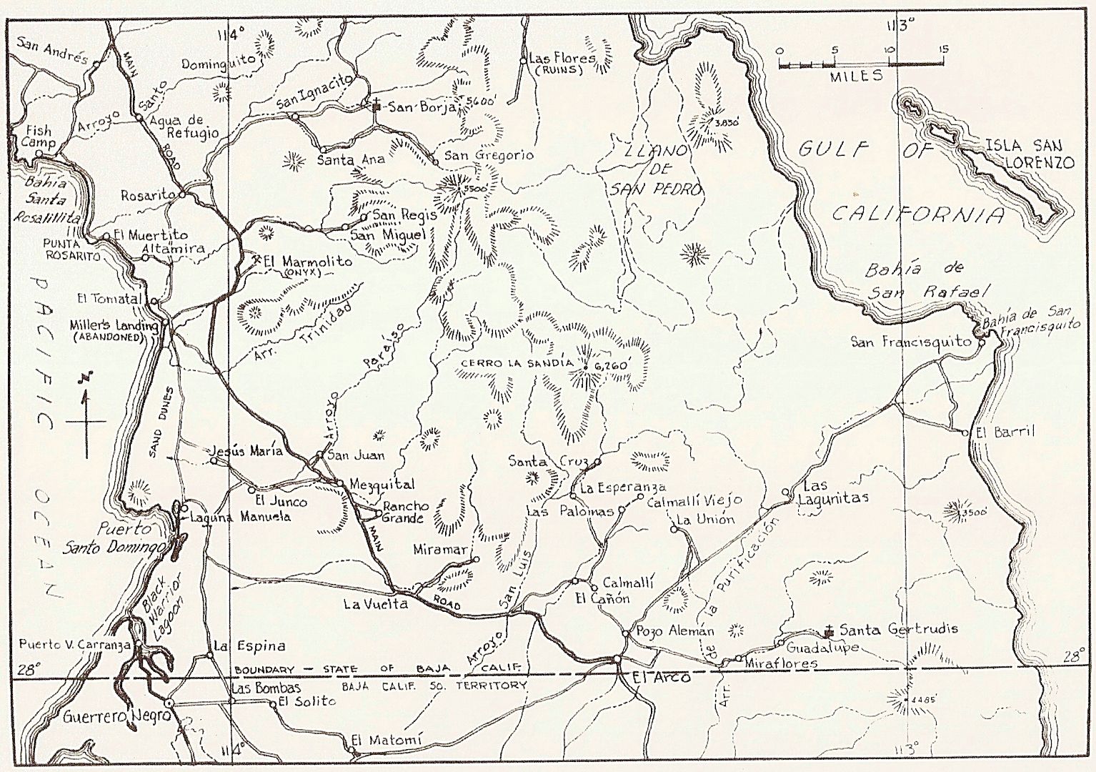
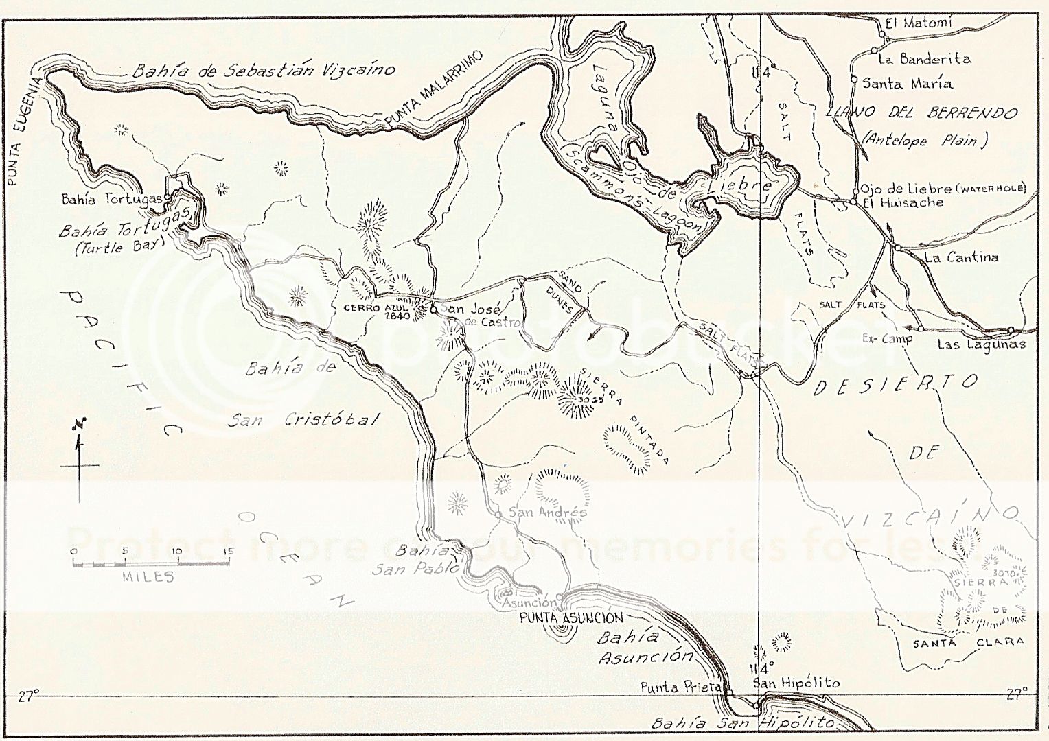
Here's that map with new roads drawn in:
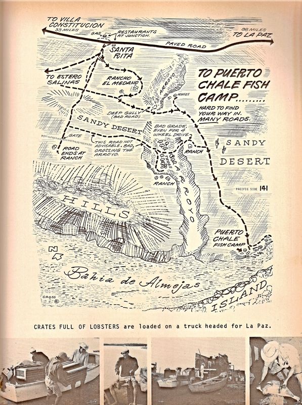
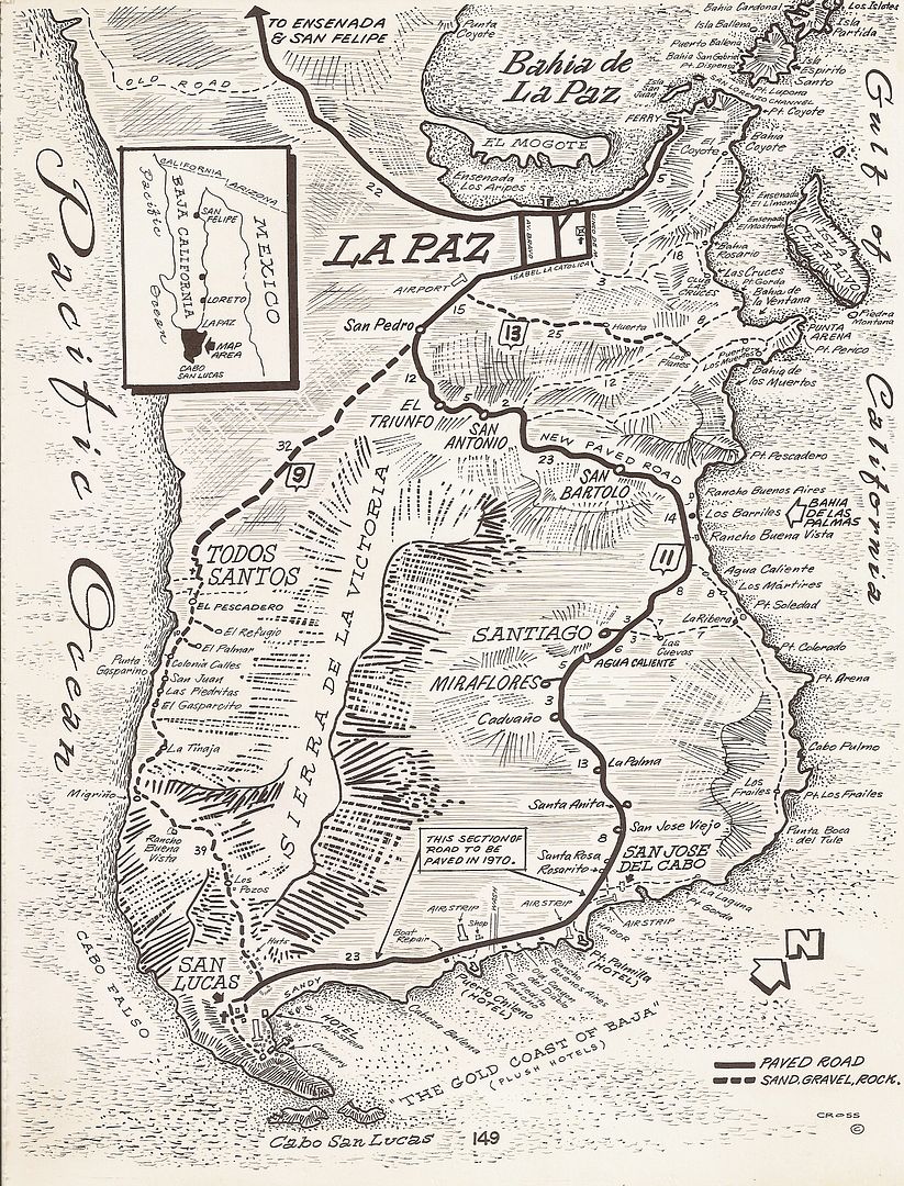
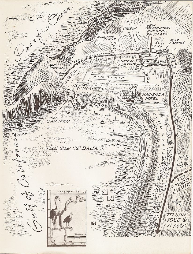
Everyone loves Cliff Cross's 1970 Baja Guide Maps... with 'Bird's Eye View' features allowing anyone to read them!
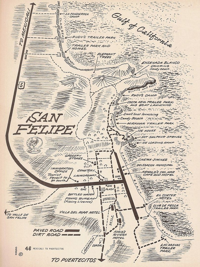
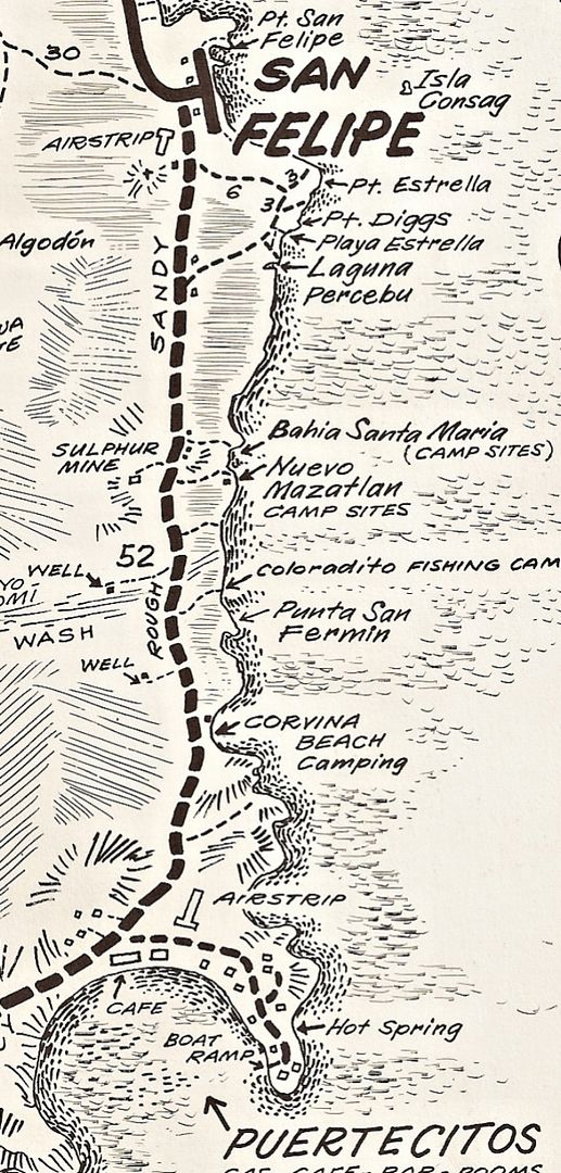
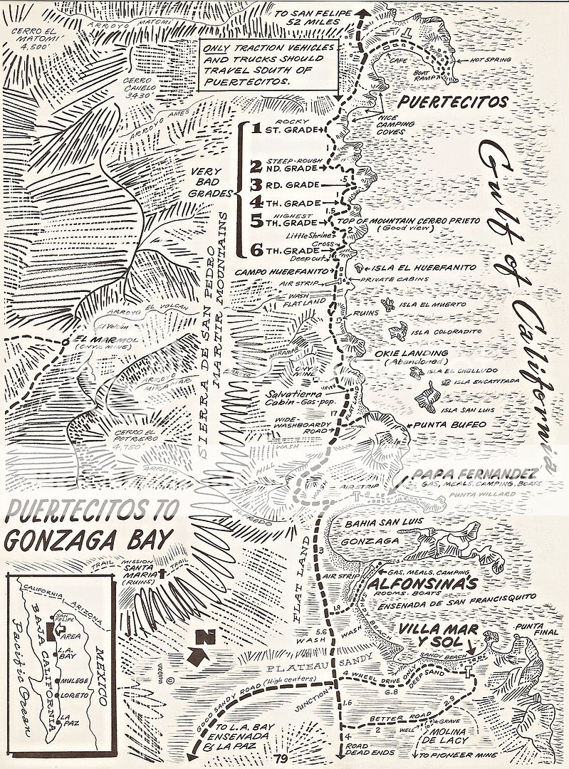
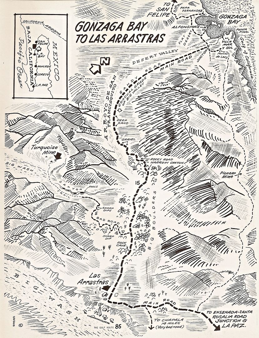
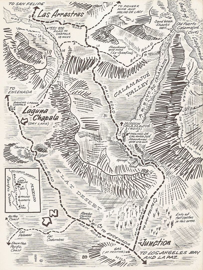
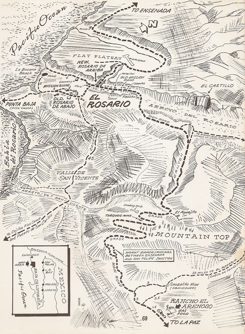
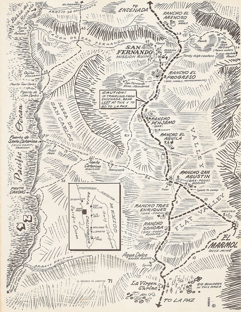
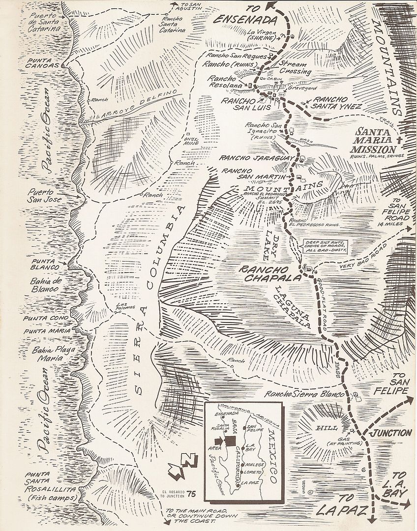
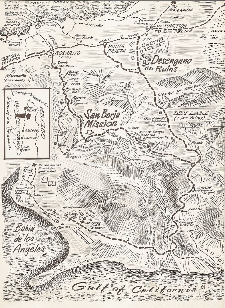
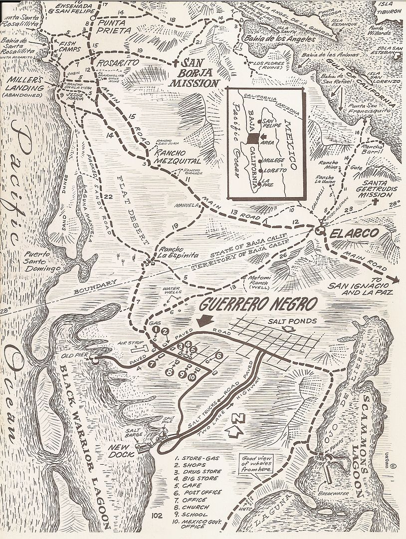
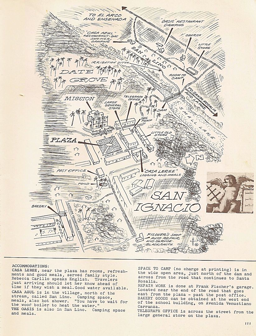
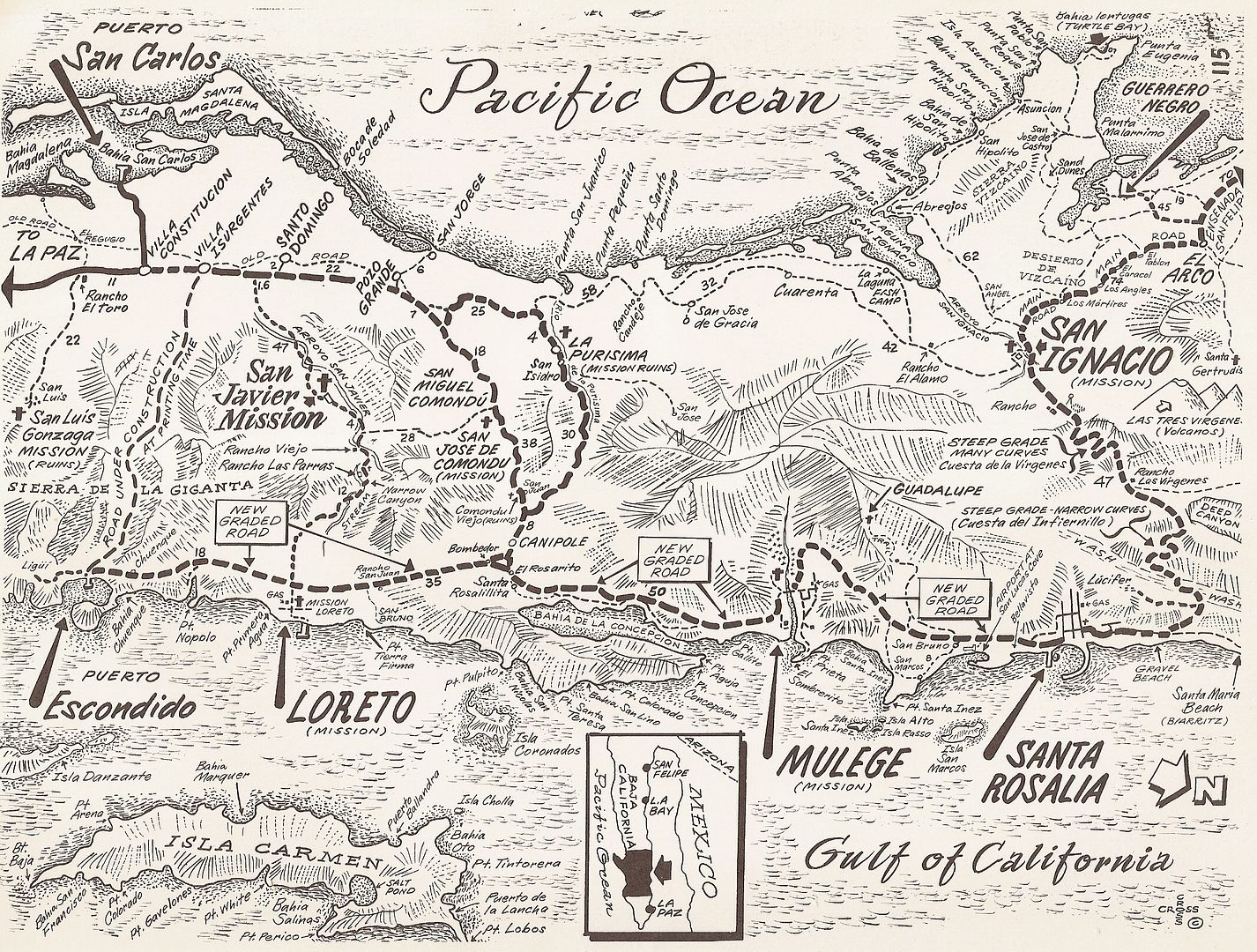
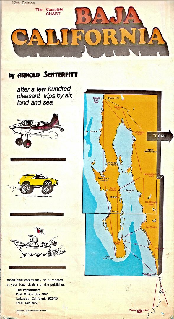
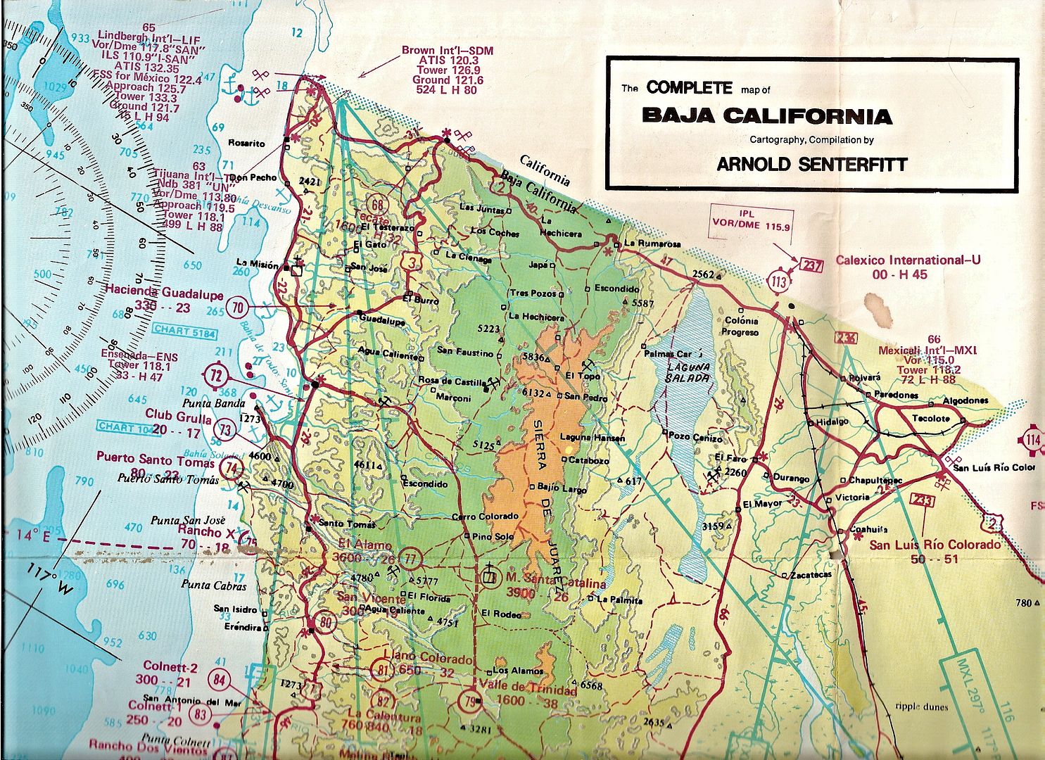
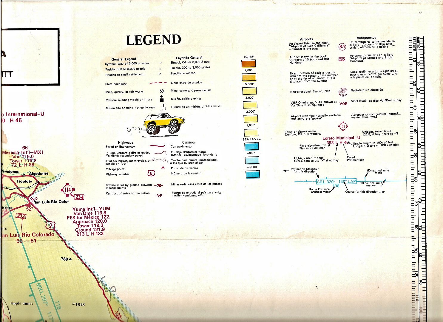
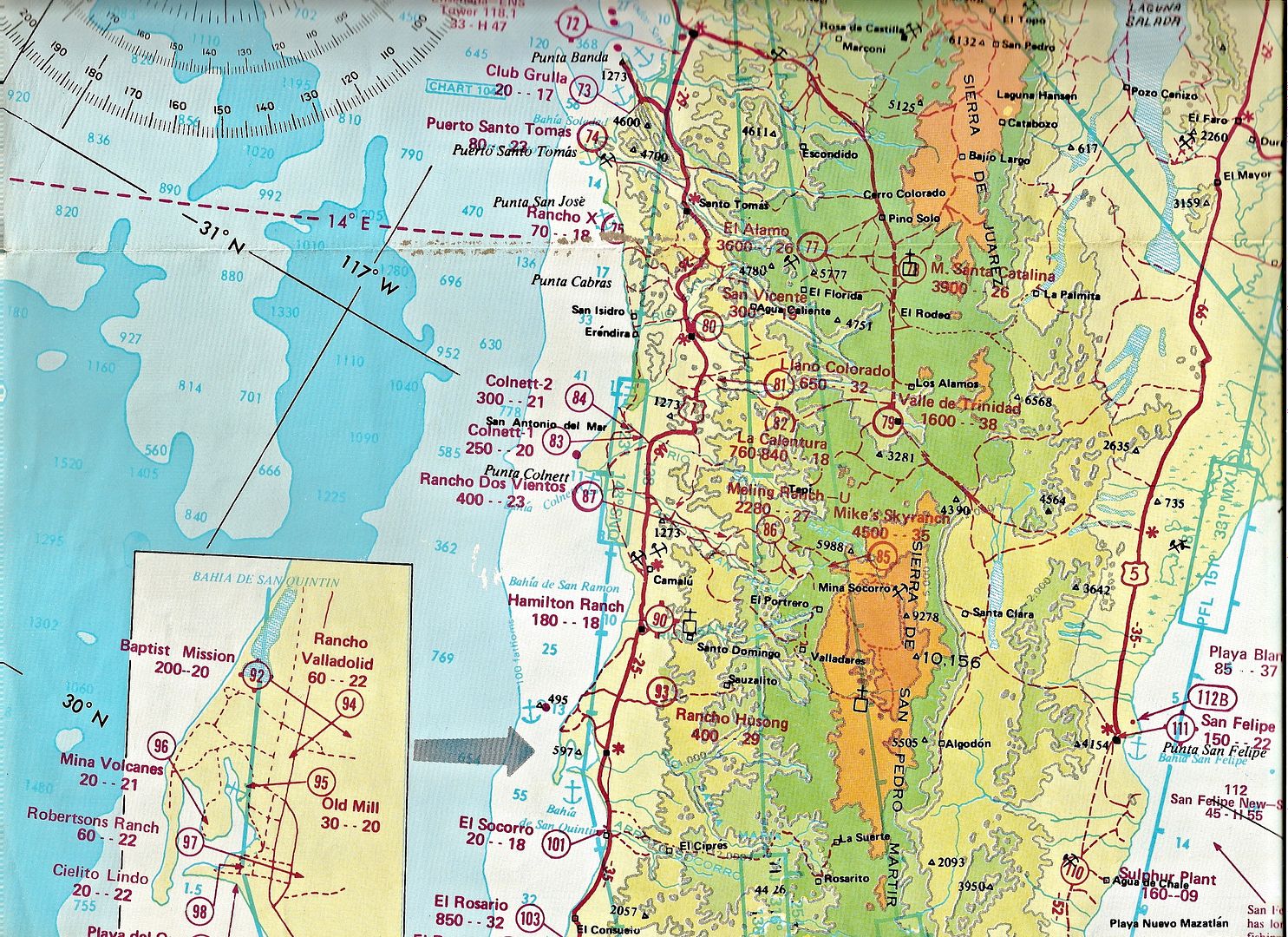
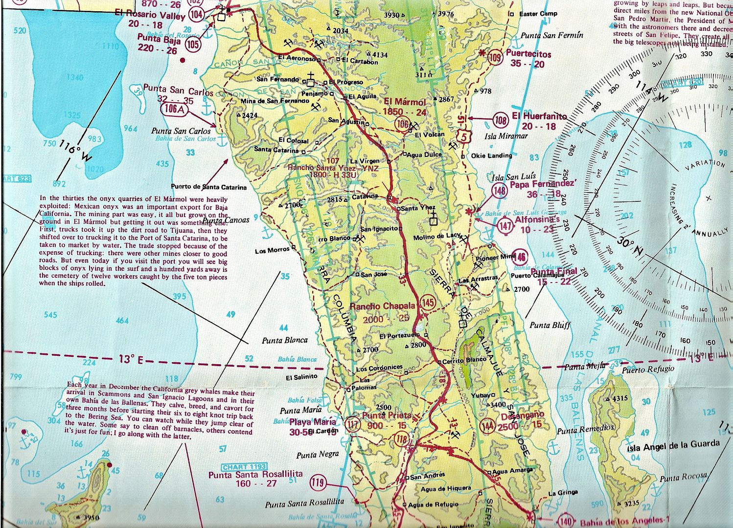
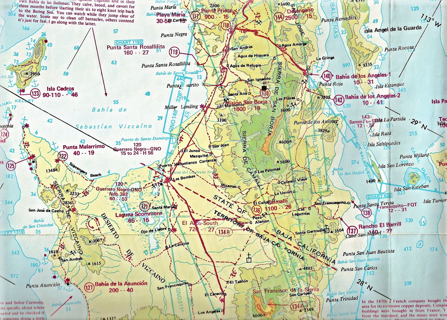
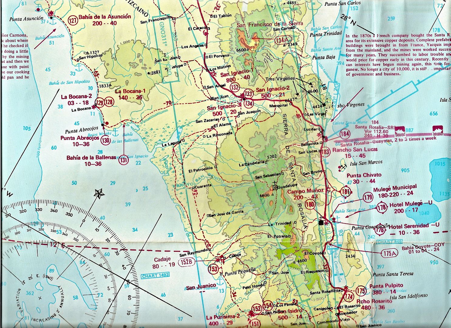
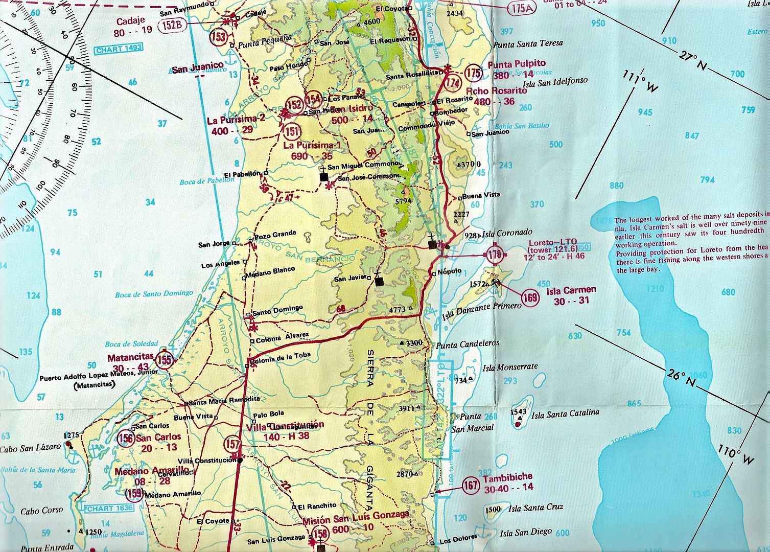
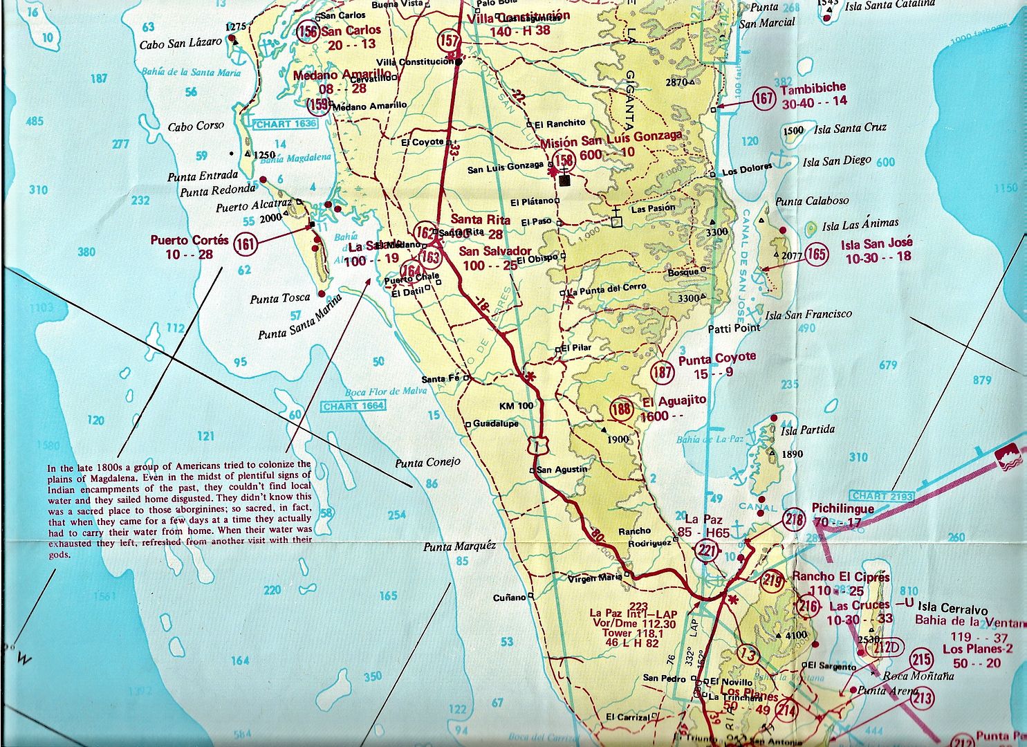
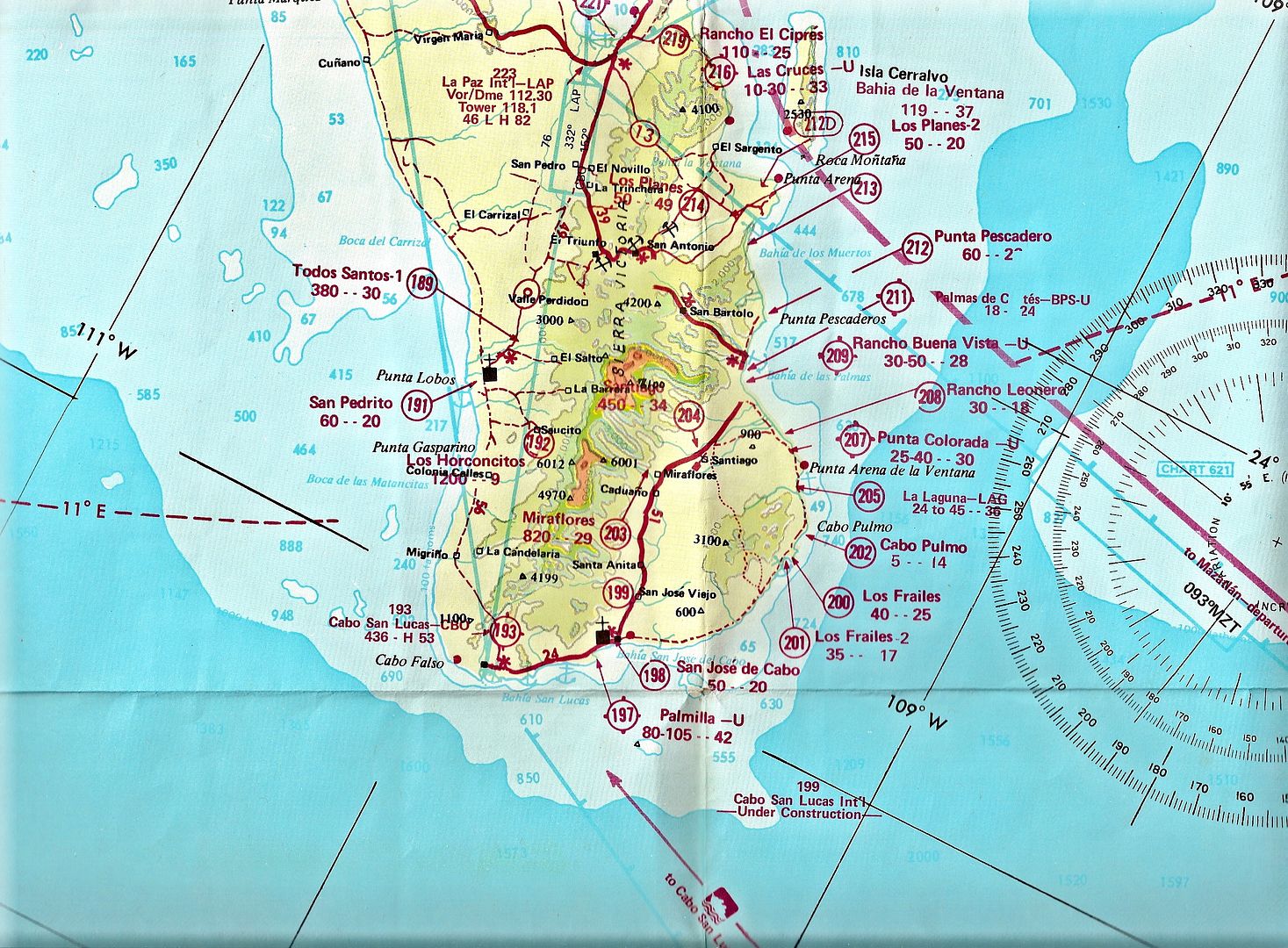
Then there was the Arnold Senterfitt Airports of Baja maps of the 1970s...
The numbers inside the circles were airports... Baja had hundreds.
bryanmichaelmeyer - 9-11-2017 at 01:44 PM
i like this one. I bought a used one on amazon: http://www.baja-almanac.com/


