
David K - 9-21-2017 at 02:48 PM
So much happened in one year (1973)!
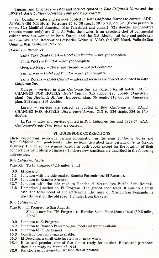
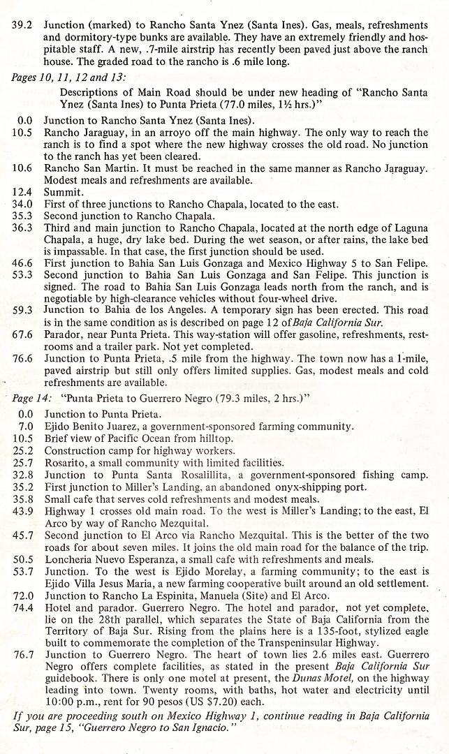
Before the 1974 Auto Club guidebook could be published, the club produced this handout (2 of 4 pages shown) to allow members to have the latest
revisions if they (as so many of us did) headed south to check out the new highway.
The supplement paper does not have a date, but mentions "as of December 1973, the paradores (rest stops, gas stations, trailer parks) were not yet
finished but should be by March 1974".
Paradores were built at San Quintin (Santa María), Santa Ynez (Ines) [not yet renamed 'Cataviña'], near Punta Prieta, the Eagle Monument (North 28°
parallel), and San Ignacio. They were designed to provide needed traveler services until local businesses were created along the highway. Hotels (El
Presidente) were also located at those locations except for Punta Prieta.
-----------------------------------------------------------------------------------------------------------------
------------------------------------------------------------------------------------------------------------------
I have the 1972 Baja California Sur guide, but not the 1973 one. In 1972, the main road still passed through El Arco. Per this update, it sounds like
for the 1973 guidebook issue has the new road from San Ignacio to Guerrero Negro and north to Rosarito. This section, I traveled in July 1973, and it
was, and most of it was paved.
If anyone has the 1973 Baja California Sur Auto Club of Southern California book, I would appreciate it if you could scan the El Rosario to San
Ignacio pages, thanks!

