BajaNomad

TRIP #7 (OCT 2017) Tijuana to San Quintin & San Pedro Mártir Observatory

David K - 10-16-2017 at 11:16 PM

EDIT: Report & Photos sized for message boards and no watermarks are here: https://www.tacomaworld.com/threads/2017-baja-expedition-7-t...

What was supposed to be a 7 day, final trip, to collect data on the remaining areas of Baja of interest for the road guide and map project... turned out to be a 6 day trip and missed doing Hwy. 3 from Ensenada to Valle de Trinidad plus Laguna Hanson to La Rumorosa.

Why? See this post: http://forums.bajanomad.com/viewthread.php?tid=87975

OK... I will start from the beginning with all my data for those interested:

Left my north San Diego County home at 9 am on Tuesday, October 10. I stopped at Costco, Chula Vista (I-5, exit Palomar street, east to Broadway, north to Costco). Got gasoline and then into the store to exchange dollars for pesos. The rate was 17.40 pesos per dollar. [It was 17.35 last August and 20.20 last January; 18.80 last March; 17.70 last April; 17.80 last June].

My FMM had expired so I stopped at the Tijuana border crossing INM counter to get a new one. 500 pesos and good for 180 days. It took longer than at Mexicali or Tecate as the INM agent does not collect the money as at the other places. One must take the form and walk inside the building to a bank counter to pay, then back to the INM desk.

Maybe 15-20 minutes overall as the banker was not at his desk for a few minutes.

To get the FMM, stay in the right lane, as you are nearing the border... drive over to the giant flagpole and see the covered parking area in front of a large, blue building and park. Walk into the building and through it to the other side and just outside the doors, on the left are the INM counters. Have your passport and reading glasses if you need them. The print is tiny to fill out the form. When you are done simply drive back to the lanes of traffic crossing south then seek out the signs for PLAYAS DE TIJUANA, SCENIC ROAD, ROSARITO once you pass the red light/ green light gate. Red light means you have been selected for a search.

I took notes on the mileage and kilometer markers going south. I used the toll (Scenic) road (Hwy. 1-D) first (a 33 pesos toll) then exited on the south side of Rosarito onto the free road (Hwy. 1).

The road to the south first goes west, along the U.S. border before climbing a steep hill and joins the highway in 3.9 miles. The Playas de Tijuana exit is at 5.1 miles (from the border crossing) and a Km. 9 post is at 5.3 miles. The kilometers are measured along the street through town and not the border wall expressway, so a 1/10 mile difference. The first toll booth is at Km. 11 and I exit the toll road at Km. 34.5... not need to bore you further, as I will add this data to the Baja Nomad Kilometer list thread! The free road has different Kilometer markers, as it uses a shorter route to the border (Km. 0).

Just beyond the Cantamar sand dunes, see a church sign (at Km. 49) that points the way to the mission site of El Descanso. This was the first 'Mexican Baja California mission' as it was founded after Mexico's independence from Spain. Originally, Descanso was a new location for Mission San Miguel in late 1809 or early 1810 when floods destroyed the fields there. In 1830, Padre Caballero established El Descanso as a new mission. It was short-lived. In 1834, he founded his next mission at Guadalupe and abandoned Descanso and San Miguel.

The mission is located next to a modern church, located just a half mile from Hwy.1 on a dusty road, beyond a school. Park at the church and walk behind it to see the archeological excavation, partially protected by a steel awning.


The original site date, once believed to be 1817, was corrected in 1960 by new research that has escaped many. The padre who moved San Miguel to the hillside just south of here wrote a letter to his superiors that he did so shortly after he arrived at San Miguel (in 1809). An author of Dominican mission history did not have that letter when he was published in the 1930s, and simply guessed it was about 1817. We now know that in 1817, that padre had already transferred to southern Baja California.


The worker was taking a siesta... He never knew I was there, I don't think.


After taking photos and continued south and noted the locations for Splash and the Halfway House, two popular restaurants... very close to each other (around Km. 52.5.)

The next California mission going south is not far away and right on Hwy. 1... STAY TUNED!


[Edited on 6-5-2021 by David K]

David K - 10-17-2017 at 10:20 AM

Staying on the free road, it goes from 4 lanes to 2 lanes just before the Descanso mission road and gives you an early taste for the highway south of Ensenada and Maneadero.

The town of La Misión is at Km. 65 and the mission, for which the town gets its name is at Km. 65.5, on the left, in a schoolyard. It is fenced off from the kids, but to get close to it, you need to enter the school grounds. When I was there, the kids were at recess and playing all around. So, I walked alongside the mission and took photos through or over the chain-link fence.


Mission San Miguel Arcángel was founded in 1787 by the Dominican missionary Luis Sales, 7 miles east of here, overlooking an oak tree canyon. At the invitation of an Indian chief who was bitten by a rattlesnake and treated by the padre, the mission moved to his village the following year. That location was known as San Juan Bautista by the Franciscans who passed through in 1769 on their way to establish San Diego. The native name was Ja-kwatl-jap (for the tribe's hot springs there).

It is this fascinating history that inspired me to write Baja California Land of Missions, published last year. Baja continues to be a source of interest!

Passing on from La Misión, the paved cut across road to Guadalupe Valley and Hwy. 3 is at Km. 83.

The free road and toll roads merge just after Km. 95, and the next kilometer marker is on the 4 lane highway and is Km. 100, in reality just a half kilometer southbound from Km. 95 on the free road.

Km. 101.5 is the junction with Hwy. 3 to Tecate.

Km. 107 is the split in the highway with the Tourist Zone and San Quintín or San Felipe bound travelers recommended to take the right fork.

Km. 110 post is just as you near the Ensenada harbor and 1/2 mile ahead is the fork (and first signal light in this city), right to parallel the waterfront and continue south (a Pemex station is over on the left of this Y in the road.

The signed Hwy. 3 to San Felipe is 1.5 miles from the signal at the Y and 0.4 mile beyond is the left turn to get on Hwy. 1 south. It is signed here for La Bufadora and the street name is Estancia. This seems to be the newer, less congested way to get south. A right turn is made in another 0.4 mile (Pemex on the right and a Soriana store is across the intersection). Now you are back on Highway 1, southbound!

Crossing any city is not fun with traffic and so many stop lights... which all seem to turn red when you arrive!

I made more mileage notes heading south (Estero Beach access, Baja Country Club, and San Carlos Hot Springs road) as I did not see any kilometer markers until Maneadero. Very likely they were hidden by parked cars or simply not there, as is the case in other populated areas.

'bajaguy' invited me to stop by and show me the hot springs. Sadly, I was running about 2 hours behind schedule and had to get a rain check.

The highway from Maneadero to Punta Banda and La Bufadora is just over 13 miles, and the tourist shops at the end of the road were just a zoo. There were busloads of tourists there, so I just GPS'd the spot and made a U-Turn as soon as I could!


Next, I pulled off at Ejido Uruapan (Km. 41.5) to take a quick look at the hot springs advertised there. The pavement ends in 0.8 mile, turn left (well signed) and 1.9 miles from Hwy. 1 you arrive at the hot springs. There are bathhouses for men and for women, a few palapas for picnicking, and several washing machines and clotheslines! I guess hot water here is more prized for laundry use than for soaking!


The sun was dropping and I had to see one other spot before arriving at my destination for the next two nights, La Bocana at the end of Arroyo Santo Tomás. The road is at Km. 47 and once beyond the ejido at the junction (El Ajusco) the graded dirt road was very smooth. There was a lot of traffic that afternoon and lots of blind curves, so no high speed. It is 28 kms. or about 17 miles from Hwy. 1 to the beach at La Bocana. The location was almost ghostly with empty homes, yet there is so much potential here.


Good road!


Scenic estuary or river mouth (La Bocana).


Beach was across the estuary. A road south (for Punta China) branched 1.5 mile before La Bocana and would get to that beach.


On the way out, I was saddened to find that the oak tree picnic area (fork 3.6 miles from Hwy. 1) and location of the first Santo Tomás mission has been closed and fenced off. The creek that once ran by it was dry and sadly we come to realize that things don't always last. One must enjoy places while they are available!

The second Santo Tomás mission site was in a plowed field on the north side of the road (2.8 miles from Hwy. 1)... It has been obliterated by farming. I took photos of the remains in 2009 and saw on 2012 satellite imagery that the pepper fields looked freshly plowed and no longer was the soil and rocks from the adobe mission visible as on previous satellite images.

The third and final mission location (near the El Palomar campground in the town of Santo Tomáa) is also nearly vanished. I had lunch there a few months ago. All three mission locations for this, the last mission to be operational in the Californias (abandoned in 1849), will be only saved in photos... too bad INAH or private concerns did nothing to preserve the ruins of these sites.

From earlier trips:
SITE 1 (1791-1794):

Photo from 2011

SITE 2 (1794-1799):

Photo from 2009

SITE 3 (1799-1849):

Photo from 2017

My destination tonight was San Vicente, another Spanish mission colony, founded in 1780. A very nice motel called El Camino is on the left, on the far side of town.

Stay tuned for much more...


bajatrailrider - 10-17-2017 at 11:33 AM

The work and time and effort you put in Thank you David.

DAY 2: San Vicente Area

David K - 10-17-2017 at 12:14 PM

I met 'bajatrailrider' (Larry) on Ken Cooke's 2015 Pole Line Road run. Larry lives full time in San Vicente and has been providing off-road motorcycle guide service for many years. Larry was kind enough to insist I be his (and Andrea's) guest and he would show me a few sites in the area that may make interesting material for the Baja Bound Road Guide I have been producing this year.

Rancho Agua Caliente and at least three source hot springs are 12 miles by 4WD road from San Vicente. The hot springs have been published as far back as the 1958 edition of the Lower California Guidebook. The ranch there is not occupied but is owned by a friend of Larry's in San Vicente.

Here it is, pointed out, on a 55-year-old map:

1962 Lower California Guidebook map, by Howard Gulick. Notice the pavement south ending before Colonet! There is a now more direct road to Agua Caliente than this 1958 & 1962 edition map shows.

The hot springs are not developed at all. So, bring picks and shovels if you want to bathe here! They are along the south bank of Arroyo San Vicente and another, not as hot spring is by the ranch on the north side of the arroyo. The south springs felt to me to be about 90°-100° and the water rises in the pool with enough force to cause the sand to spin. There are some gas bubbles as well. No sulfur odor was detected, which is a nice surprise.


A pool is crossed driving up the arroyo road from San Vicente.


The first source spring is not very attractive!

About 1000 feet downstream (west) one comes to...


A hot stream drops down to a cool mountain stream... Natural hot and cold running water!:


Looking upstream where the hot wayer meets the cold water.


This is the warm spring by the ranch.


Cows grazing in Arroyo San Vicente/Cañon Agua Caliente.

We drive out on the road to the south and return to San Vicente for lunch at an excellent place, Mi Ranchita. It is located on the road to the mission (Km. 88.5), north of the highway bridge...


After lunch, we visit the town museum... Did you know San Vicente has a museum? Turn west at the north side of the town plaza and it is down on the right.


Who remembers these pumps from the 70s and 80s?


Larry guides me down the river valley towards Erendira to these ruins...


We return to town via another route. Here is my GPS track of the area and routes to the hot springs:


There are forks, open gates, etc. This map is to give you a general idea where the springs are and how far from Hwy. 1.

A great day in Baja does not have to be far from the border or from the highway... Good to have local friends who like to do loco things!

Stay tuned for Day 3, to Erendira, Coyote Cals, and points south... plus I get caught speeding on radar by a Federale! It is all good... Viva Baja!


DAY 3 (Thursday Oct. 12, 2017)

David K - 10-18-2017 at 05:09 PM

I say goodbye to Larry and Andrea's hospitality and drive north 7 miles to Km. 79 and get on the paved Ejido Eréndira road.

At Km. 10 is the dirt road left that goes directly back to San Vicente, passing those ruins we looked at yesterday. If you go that way, turn right at 0.3 mi and cross the arroyo (the road straight ahead dead ends at a ranch). The ruins are 1.0 mile from the paved Eréndira road.

Km. 16.5+ is the road south to Malibu Beach Sur, once a popular RV park and now more of a vacation home area.

Km. 17 Enter Ejido Eréndira, a large farming town.

Km. 19 Motel Eréndira at the far side of town, pavement ends in 500 feet.

In 0.7 mile from the pavement is Castro's sportfishing center (motel rooms, guided fishing trips).

1.0 mile from the pavement is 'Camping Manriquez'.

1.8 miles from the pavement is Coyote Cal's Hostel and Camping and Massage. Operated by Rick and Ta with immaculate services for off-the-grid conditions. The bar here is fully stocked and the food service sounds amazing. I suggest you visit their website: www.coyotecals.com
This establishment is friendly to both hitchhikers and off-road racers, as well as all other world travelers.

PHOTOS:


The coast by Ejido Eréndira, looking towards Castro's Camp (Puerto San Isidro).


Rick runs a tight ship but has the Baja attitude down!


That's Cameron Steele's trophy truck!


Wide tequila selection!


Just one of the many reasons to stay at Coyote Cals!


Thank you for your time and conversation, Rick!

After leaving Coyote Cal's I return to Highway 1 via the dirt road past the ruins. I heard there were pictographs along the north side of the canyon but after some searching, I had to move on!

Traveling south, my next sideroad to check was to San Antonio del Mar, west of Colonet.

This was a popular place my family went fishing to, in the 1960s. I remember giant sand dunes sliding down when I wasn't catching corbina in the surf with mom and dad! The pavement south of Ensenada ended a few miles north of Colonet back then. Bradley's Service Station and the Flying Samaritans clinic was at the junction back then.

Today, the road is unmarked except for a poorly placed sign on the highway, well north of the actual road. The road is at Km. 126.5+ and just north of the bridge over the San Rafael Riverbed. The main part of the town of Colonet is south of the bridge. The road is an easy graded one and crosses a mesa before dropping down to a crossroad at Mile 4.5. To the right is the Johnson Ranch (The original San Antonio Del Mar) that dates back to the early 1900s when the Johnson and Meling families came to this part of Baja California.


At Mile 5.1 is a Y. The right fork goes west to the beach at the abandoned fish camp San Antonio del Mar and just beyond, near the sea is a mining operation extracting titanium (?) from beach sand.


I read many years ago that rich titanium deposits were found in the beach sand here. However, I have not confirmed that is what these centrifuges are extracting.

I go back to the fork in the road, and go 1.3 miles on the left (south) fork and pass the big sand dunes I remember as a kid and there is a burro eating some grass here.


I remember playing here, 50 years ago.
The last time camping here was in 1980.
The fish camp is gone and the nearby beach mining is new, otherwise it still looks about the same!


Where we used to fish, 1967-1969. This is looking south towards Punta (Cabo) Colonet.


Looking north, the sand dunes and beyond is the beach mining area and beyond that a few homes.

To be continued (Cuatro Casas, Punta San Jacinto Ship Wreck, Mission Santo Domingo, and I get caught speeding!)...


David K - 10-19-2017 at 07:45 AM


David K - 10-19-2017 at 03:02 PM


It is an easy 5.2-mile drive from Km. 146, Jaramillo, on Hwy. 1 to the coast. The road is the signed turnoff for CUATRO CASAS. However, at the end of the road is just a rocky beach and NO CASAS ;)
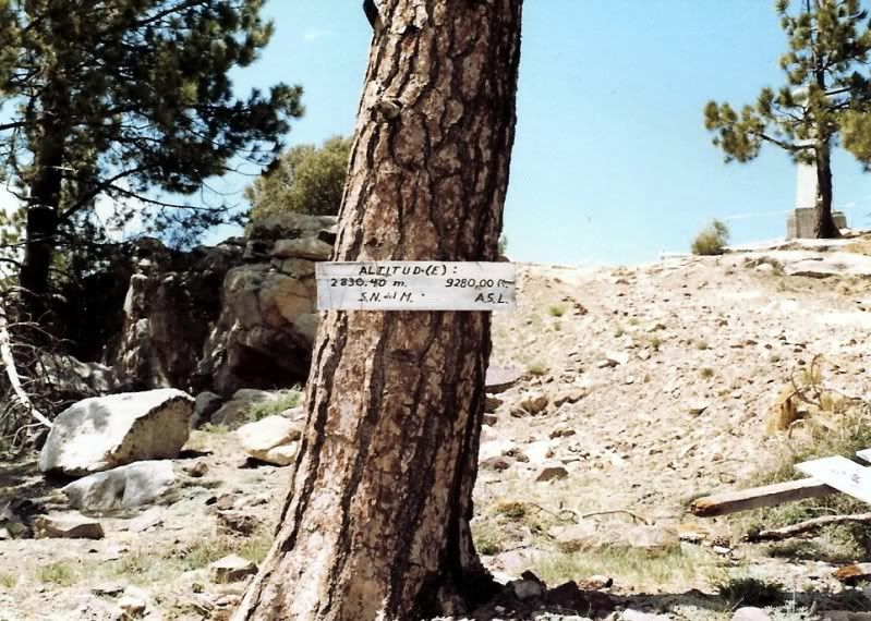
. I turn south and follow the coast.


In the distance you can see Punta (Cabo) Colonet.


The road south from Cuatro Casas to San Jacinto. Many people are mining the coast for beach rocks used in decorative gardening and landscaping. See these stones at a Home Depot or Lowes near you!

2.2 miles south on the coast road is a camping place called Las Lagunitas.
3.0 miles south is the shipwreck at San Jacinto, several beach homes.
3.6 miles, a road heads east, back to Hwy. 1 (4.0 miles) at Km. 149.5+.


It is noticeably reduced in size from when I was here last, in 2014, on Trail of Missions #1:


Here is the ship when it ran aground in 1982, The Isla del Carmen.


Photo from Walt Peterson's Baja Adventure Book.

South on Highway 1 to Km. 169+ and the signed road east to Mission Santo Domingo (founded in 1775). It is 4.6 miles to the mission and the road is wide and graded, but pretty bumpy. This large red hill on the south side of the arroyo is where the Dominicans first had services, in a cave at the base. The mission was moved up the canyon by 1798 for better water and farming potential.


There is an HR painted up on the mountain, right side 2/3 way up, that stands for 'Hamilton Ranch'. This was a popular fly-in guest ranch often frequented by Hollywood types to party as they wished without being photographed. The remains of the cabins near the runway and near that hill have all been removed, I was told. I drove across the riverbed to get a close look and saw nothing. They were in the group of trees still there. Erle Stanley Gardner often stayed at the Hamilton Ranch and wrote about the place in the 1960s.

MISSION SANTO DOMINGO in 2017:


Back out to Hwy. 1 as the sun gets low in the sky, I have to think about where I am going to spend the night, as part of my research I go to the nearby Posada Don Diego at Km. 173, and 0.6 mile in (west).

I have stayed here a couple times back in the 1980s with Tom Miller's Mexico West Travelers Club. In fact, I met the future mother of my children there! She was also with the Mexico West group traveling with her parents... that was in 1984!

Well, much has changed since 1984, including the RV Park that was at Posada Don Diego. The place was empty with only the restaurant there looking filled with many cars in front. I know the owner is a Nomad "Irene", but she hasn't posted in a long time. I don't want to be the only camper and all the trees were gone, I just wouldn't rest easy in my tent, I thought. The other RV park that used to be near the highway in Colonia Vicente Guerrero, Meson Don Pepe (?), has vanished or I couldn't find it.

I was going as far as San Quintín for this research trip. With only 30 more miles to El Rosario, I used my inReach device to ask Antonio if he had a vacancy that night at his Baja Cactus Motel (admittedly the finest run and most comfortable motel along the 1,000 miles of Highway 1). I was in luck, but sadly, Antonio was in Tijuana, so I wouldn't be able to visit with him.

I was a dozen miles from El Rosario when I crested a hill on the long, straight road, only to see a Federal Highway Police holding a radar gun toward me and stopped me. So be careful, the ridiculously slow 80 kph (49.6 mph) is enforced here! I was going closer to 60 at the moment, and not in any hurry, just cruising and listening to my XM Radio.

The officer was super cool, I apologized, told him I must have been anxious to get to my comfortable room in El Rosario and didn't pay attention to my speed. His English was good, he even showed me how his radar gun worked, pointed at other motorists. I was let go. I asked if he wanted a cold water bottle, and he accepted. Officer Juan and I are amigos now!

I arrive at Baja Cactus and see a big construction project going on in the front of the motel. The office is now accessed from the parking lot on the south. This construction is for Antonio's new restaurant. The building will also block highway noise to the motel.


End of DAY 3 Report.

Coming up next, Sierra San Pedro Mártir National Park, and camping at 8,200 feet.


DAY 4 (Friday Oct. 13, 2017) San Pedro Mártir

David K - 10-20-2017 at 09:16 AM

I left El Rosario at 9 am after filling my gas tank at Antonio's service station. It is still a Pemex station, but things are changing in Mexico. The price per liter of Magna (87 octane) was 16.39 pesos (62.03 per gallon or US$3.56).

Driving north, I noted that the road up into the Sierra San Miguel (lower San Pedro Mártir), passing near San Isidoro, is paved now where it leaves Hwy. 1. This is at Km. 187.5. TW, The squarecircle, and John M recently traveled this route: http://forums.bajanomad.com/viewthread.php?tid=81801

I passed by the observatory highway (Km. 140.5, San Telmo de Abajo) to top my fuel tank before going up the mountain. The Pemex station is at Km. 139, just north of town. The price here was 16.29 pesos/liter. It is 71 miles from El Rosario and it took 3.7 gallons to top the tank. That was 19.2 miles/gallon (I love ethanol-free gasoline) which is good for about 2-3 mpg better than I ever get on California gasoline highway driving!

Back to the highway junction to head up to the San Pedro Mártir. The junction is 130 feet above sea level. This (now) paved road goes 100.5 kilometers (62 miles) and climbs to 9,280 feet above sea level!


The junction, northbound. Red cross was on the highway asking for donations here.


Overhead signs after making the turn.


This is the distance to the observatory complex. There is a gate at Km. 97.5 (elev. 8,705') only open for three hours (10 am-1 pm) unless there is work going on at the telescopes. There is no view other than of the trees at the gate. Time your trip to arrive early and hope you can get through. A call box is at the gate where you are to ask it be opened. The call box was out-of-order.

ROAD LOG:

0.0 Highway 1, elevation 130'.
4.2 Narrow bridge
5.6 San Telmo (now a ghost town) was an important visita od Mission Santo Domingo and a farming supply center until recent years when many have moved down to Highway 1 for more opportunity.
11.3 (Km. 18+) Hacienda Sinaloa a town of farm workers with one small store.
17.0 (Km. 27.5) Road right goes into the hills to Valladares and Santa Cruz.
17.6 Signed road left to Ranchos (Las Choyas, Cortez, El Papalote). Road begins a steep climb.
22.0 1,000' elevation.
24.0 2,000' elevation.
30.3 (Km. 49) Road north to El Coyote guest ranch (rooms, camping, meals).
30.6 (Km. 49.5) Road to right to Meling Ranch, a guest ranch with a long history. Rooms, meals, camping, airstrip.
34.0 3,000' elevation.
39.0 4,000' elevation.
39.3 (Km. 63.5+) Road south to El Potrero.
40.6 (Km. 66) Socorro mine site. Not much left from the early 1900s when the Meling/Johnson family worked the placer goldfield. A water ditch was constructed about 1896 by Harry Johnson for some 20 miles along the mountainside from the San Rafael River for the water needed at Socorro.
41.6 (Km. 67+) Road left, signed to La Joya. Badly eroded from last winter's rains, this ranch and the former Dark Skys Inn (Rancho La Concepción) was once reached this way, but today may be impassable.
43.4 (Km. 70) 5,000' elevation.
45.0 6,000' elevation.
45.2 (Km. 73) Fire break road to the right (yellow gate).
Km. 73.5+ Road right 0.3 mi. to the former Los Manzanos RV Park/Campground. Abandoned.
Km.74.5+ La Cienega de Soto resort project.
48.1 (Km. 77.5) Former park entrance payment gate, ex-ranger station (6,800').
48.6 7,000' elevation.
51.0 8,000' elevation.
51.7 (Km. 83.5) Park Entrance Payment Ranger Station 'La Corona'. Elevation: 8,259'.
Km. 84 Campo Cacomixtle, El Condor, Cimarron, and more, on both sides of the highway.
Km. 86.5 Capilla San Pedro. A small chapel on a hilltop.
56.3 (Km. 91) Road south for La Tasajera (10 km.). Locked gate at Mile 1.9.
56.8 Museum (closed).
57.8 (Km. 93+) The Aguaje del Burro road to the right goes 2.0 miles to a covered spring. This was an old cattle camp.
58.2 (Km. 93.5+) Mirador El Altar road right (elev. 8,000'). It is 0.3 mi. to the El Mirador trail. A right fork just off the highway goes 2.2 miles to a pretty area.
58.9 (Km. 94.5+) Pass a military camp and a side road left to the Venado Blanco trail.
60.3 (Km. 97.5) Parking area (left) and gate restricting access to the observatories. 8,705'. A phone box on the left (out-of-order) to request passage. It is 3 kilometers and over 500' higher to the end of the road at Mexico's largest telescope.
61.2 (Km. 99) 9,000' elevation.
62.1 (Km. 100+) Elev. 9,280'. The highest point reached by automobile in Baja California. The national observatory.


Two condors are circling above! The black and white wings set them apart from common vultures.


The road north 4.9 miles to Rancho El Coyote is at Km. 49 (2,622').


The Meling road is just 1/4 mile past the El Coyote road and drops down to the ranch, 0.9 mi. I stop by on my way down the mountain and take photos and get rates.


Begin the next steep climb.


View back down to Meling Ranch. The 0.9-mile dirt road from the highway down to the ranch is clearly seen. The airstrip is on this side of the ranch, the line running to the right edge of the photo.


Don't bother the condors!

TO BE CONTINUED...


[Edited on 10-21-2017 by David K]

mtgoat666 - 10-20-2017 at 09:51 AM

La Cienega de Soto looks interesting. Did you visit it?

David K - 10-20-2017 at 10:04 AM

Yes, it is a new development right on the highway, not looking ready to be in business, yet... Km. 74.5+, just above the former Los Manzanos campground/ RV park (Km. 73.5+)... It will be in the trip report yet to come.

David K - 10-20-2017 at 11:38 AM


Only 64 pesos per day to enter and stay in the park (US$3.68).

The former park entrance is passed near Km. 78 and the new entrance ranger station is at Km. 83.5 at La Corona, 8,259'.


Aspen trees are really outstanding!

More to come!!

David K - 10-20-2017 at 02:50 PM

Just past the ranger station are several camping areas, each named for forest animals. Some are near the paved road and others are a ways off the road. Most have trash cans, pit toilets, and a few have fire pits and bar-b-ques. Note, that once you pass these signed camping places around Km. 84/85, there is no camping allowed. The rest of the park is for day use only.


The park museum, it was open at least once, when the governor was here to cut the ribbon. Graham Mackintosh attended. His excellent book, 'Nearer my DOG to Thee' is wonderful reading: http://www.grahammackintosh.com/Pages/NearerMyDogtoThee.aspx


At least three new observatories have been added since my last visit. They are over on the ridge to the right.


Km. 97.5 The gate, 8,705'... says open 10 am to 1 pm. I get there just a few minutes after 1. I hadn't planned on camping in the high altitude, but the close-up photos of the observatories and one of the world's best viewpoints were worth the cold night sleep.

I turned around and took the time to check out many of the signed side roads off the paved road.


Notice the size of these trees compared to the road.


Aguaje del Burro, a spring.


Some tall trees!


To Be Continued...


David K - 10-20-2017 at 04:03 PM


The twin peaks of Baja's highest mountain, El Picacho del Diablo (10,154').


La Tasajera road gate.


Diablo Mountain top.


END OF DAY 4.

Tomorrow, the observatory (I hope)!


[Edited on 10-26-2017 by David K]

David K - 10-20-2017 at 04:53 PM


Please ignore those straight lines that the inReach GPS device adds to the actual traveled route (which has the small circles in the lines).

DAY 5: Observatories, Meling, El Coyote, and what the heck?

David K - 10-23-2017 at 04:31 PM

Saturday October 14, 2017:

The overnight at 8,200 feet was not so bad. I had a fire for awhile then a warm bed in my tent for the night. I heard coyotes just once and some distant camper's noise, but not bad.

I let the morning sun shine on the tent while I had hot cocoa, OJ, and some Life cereal. All was good!


Leaving camp before 10 am, I did take note of the many camping area names. Each area has several camping spots.
They include:
Campo de Cimarron
Campo el Condor
Campo Cacomixtle (where I stayed)
There are also cabins for rent near the ranger station (entrance gate).


My goal was to get to the observatories, more to see the view of Diablo Mountain and the desert below than the telescope buildings.

I arrived at the gate shortly after 10 am (when it was advertised to be open), and it was closed! There was another car parked over to the side in the parking area with a few people and one soldier from the base below. I just stayed in the road at the gate waiting for someone to come down and (hopefully) open it for all of us. Another family arrived while I waited.

Maybe 20 minutes passed and a vehicle came down from the telescopes (which are 3 kilometers away and 500 feet higher, on the ridge). After he chatted with the others through the gate I walked to him and learned it wasn't open yesterday or this morning because of some maintenance going on with the telescopes. Because I only wanted to take photos for all of you and the new guidebook and get a GPS reading, he said for me to wait 30 minutes. The other two vehicles full of people left and 45 minutes later, he came down. I noted he was wearing a Superman shirt and he said that was because he was the "supervisor"! :lol:

He couldn't get the electric gate to open so he invited me to ride in his truck. How cool was that! He told me that normally the gate is closed but during those three hours each day (10-1), you can use the call box to get the gate opened... only the call box was currently out-of-order.

I recall he said he has been working there for 9 years. 15 days a month up at the observatories and 15 days in Ensenada at sea level. Prevents elevation sickness.


This sign once gave the altitude at the end of the road as 9,280 ft. I have a photo of it from 1978. The supervisor wondered what it was and was very appreciative to hear it has been there at least 40 years. Up close, I could make out the 9,280'.

In 1978:

Cool, huh?


Bummer it was so hazy. In the past you could see Arizona.


Mexico's largest telescope is here.


Diablo Mountain is 10, 154', alomst 900 ft. higher than this spot.


I am very happy to have been able to be here in 2017.


In June 1978, photo taken by a friend when we came up to the observatories after watching the Baja 500 near Mike's Sky Rancho. The big one was not yet constructed.


The three newest telescopes are a joint Mexico/Taiwan program. Located on the ridge just southeast. San Felipe is beyond, out-of-sight.


One more look at the desert below.


That is the graded road off Hwy. 3 to the top end of Diablo Dry Lake.


Looking back down the road to the gate.


Almost tame coyotes... this pack (there were many more) have been spoiled by the astronomers who feed them (yes, they know it is wrong).


Capilla San Pedro (chapel).


The gate and driveway to the former Dark Skys Inn and Rancho La Joya. The road has been reported as nearly impassable since last winter's rains.


To Be Continued...


[Edited on 10-26-2017 by David K]

BajaNomad - 10-23-2017 at 06:55 PM

Pretty awesome.

David K - 10-23-2017 at 09:17 PM

Thanks Doug. I will try to post the rest tomorrow.

John Harper - 10-24-2017 at 06:11 AM

Great photos and story. Thanks for posting up!

John

TMW - 10-24-2017 at 07:42 AM

Beautiful country on the mountain. Are the new telescopes bigger than the the existing ones. As I recall the original three telescopes were 24 inches, 36 inches and 84 inches. It's been 15 years or more since I've been up there, I need to go back.

David K - 10-24-2017 at 08:21 AM

The buildings don't appear to be bigger than the 84" scope observatory. But, they were a ways away. The supervisor didn't mention mirror diameters, only that it was a Mexico-Taiwan project.

mtgoat666 - 10-24-2017 at 08:54 AM

Quote: Originally posted by David K  
The buildings don't appear to be bigger than the 84" scope observatory. But, they were a ways away. The supervisor didn't mention mirror diameters, only that it was a Mexico-Taiwan project.


They recently finished building 3 telescopes, called TAOS II project - don't know if it's online yet. I think they are also working on a 6.5 m telescope? The observatory also installed a fiber optic line and electric transmission line to service the facility.

[Edited on 10-24-2017 by mtgoat666]

surfhat - 10-24-2017 at 11:06 AM

David K, your travel contributions here are always appreciated for those of us who can't be there as much as we would like to, and the out of the way spots some of us couldn't reach anyway without such a capable and reliable vehicle.

There was test video I watched recently of the traction system for the Tacoma, where they buried the truck to the axle and it crept out without any digging or sand tracks. Impressive, to say the least. TLF, TLR, is something close to the group who was doing the testing.

Please don't take this as a criticism, but when I see you and your truck camping in some very out there places, one of those fold out truck mounted tent set ups always comes to mind. It gets you off the ground, and still allows the truck bed to carry all of your gear, and if you had to pack up and leave in a hurry for some weather or whatever, you could be on the road in no time.

These could be useful and keep you drier than a tent on the ground and keep the train off your gear in the bed. I suppose I am looking at it from a more comfortable position than camping on the ground with whatever creepy crawlies there may be around.

Thanks for sharing your love of Baja. Peace, love and fish tacos.

David K - 10-24-2017 at 11:49 AM

Quote: Originally posted by surfhat  
David K, your travel contributions here are always appreciated for those of us who can't be there as much as we would like to, and the out of the way spots some of us couldn't reach anyway without such a capable and reliable vehicle.

There was test video I watched recently of the traction system for the Tacoma, where they buried the truck to the axle and it crept out without any digging or sand tracks. Impressive, to say the least. TLF, TLR, is something close to the group who was doing the testing.

Please don't take this as a criticism, but when I see you and your truck camping in some very out there places, one of those fold out truck mounted tent set ups always comes to mind. It gets you off the ground, and still allows the truck bed to carry all of your gear, and if you had to pack up and leave in a hurry for some weather or whatever, you could be on the road in no time.

These could be useful and keep you drier than a tent on the ground and keep the train off your gear in the bed. I suppose I am looking at it from a more comfortable position than camping on the ground with whatever creepy crawlies there may be around.

Thanks for sharing your love of Baja. Peace, love and fish tacos.


I agree with you that those above rack tent setups for the Tacoma are very cool. As you see, I have a Coleman Instant Tent and there just isn't anything easier for sleeping outdoors but covered from the wind/rain or privacy other than a camper or set up like you mentioned.

The A-TRAC (now called MTS/CRAWL) traction system is amazing... all 4 wheels working to get you up, over, or through most anything and if you do bury yourself in sand because you forgot to put it in 4WD or the correct button pushed... then it will crawl you out of a stuck, like the video shows.

Thanks for the positive feedback!
I still have another day and a half of trip to report here... soon!!!

David K - 10-24-2017 at 01:44 PM

Quote: Originally posted by mtgoat666  
Quote: Originally posted by David K  
The buildings don't appear to be bigger than the 84" scope observatory. But, they were a ways away. The supervisor didn't mention mirror diameters, only that it was a Mexico-Taiwan project.


They recently finished building 3 telescopes, called TAOS II project - don't know if it's online yet. I think they are also working on a 6.5 m telescope? The observatory also installed a fiber optic line and electric transmission line to service the facility.

[Edited on 10-24-2017 by mtgoat666]


Thanks for that...
TAOS (Transneptunian Automated Occulation Survey)

Here is a post from Facebook (August 2017):

Three Ash-Domes have been lifted into place this week at the Observatorio Astronómico Nacional - Sierra de San Pedro Mártir in Baja California, México for the TAOS II project.

TAOS II, the Transneptunian Automated Occultation Survey, will measure the size distribution of small objects (~1 km diameter) in the Kuiper Belt and beyond. More information can be found at https://taos2.asiaa.sinica.edu.tw/

Day 4, continued...

David K - 10-24-2017 at 02:50 PM

The new development (this sign was down by the El Coyote road junction):


Just past Km. 74.5...

I am making many notes of the kilometer markers and elevation as well as taking a small side road to see if I could find the (former) Los Manzanos Campground and tiny RV park... I did!

There is a big gate in a wide open field on the south side of the highway (Km. 73.5+ (just downhill a bit from the Km. 74 marker. Traffic can access the location by driving right past the gate into the abandoned facility.

Los Manzanos was named for the apple trees once here. A ranch house, shower/bathroom building, and the camping area were around it all. Now, the ranch house and bathroom building are all that remain. Weeds have filled in and some gardening looks to have been going on, with drip irrigation tubes.

There was a big spring here, against the hillside and the astronomers used to get their water from it. This was back in 2000 when I was here last.

Once off the larger mountain, I went down the dirt road from the highway to check out the Meling Ranch. It is a guest ranch with an airstrip and people have enjoyed the hospitality of the Meling family for over 100 years.


Beautiful Meling dining room. Meals are Breakfast US$8; Lunch $10; Dinner $15.


Rooms are US$70 and camping is $10. http://ranchomeling.com/


The original family home.

Back to the observatory highway, it is just a half kilometer to the Rancho El Coyote-Meling road junction at Km. 49.


Go 4.5 miles north then 0.4 mile west:


El Coyote camping area... nice grass to set up a tent on. $10. Showers and flush toilets.


Swimming pool.


Rooms are US$65/pp and include dinner and breakfast (the food is excellent).

It is about noon and Larry and his friends have not yet arrived. The chase truck with two ladies was there and Andrea was enjoying the poolside sundeck. I collected the price details then went over to meet Michael Diogo, who is a friend to dirt bike riders and a solar electric specialist in this region of Baja, down to the coast. Larry told me to look him up before trying to go to Mike's Sky Rancho.

Michael was very nice but believed the road was too badly destroyed by rains and the recent Baja 500 for my nearly stock truck. I told him I would be careful and see how far I would get if not to the Sky Ranch, about 12 miles away. To complete my data collecting on this trip for the future road guide, getting to Mike's and on the Hwy. 3 was pretty important.

Well, almost immediately, the road was very 'dippy' with ravines that almost wanted to hang up my rear bumper or stub my front. That didn't happen, but at Mile 3.7 from El Coyote was a short steep climb up a granite boulder and was easiest done with the A-TRAC* in low range.
(*Active Traction Control, a system that nearly locks the front and rear tires to rotate equally and eliminating the spinning caused by open differentials.)

The Tacoma mastered the climb. I stopped on top.

When I parked to get a visual of what was ahead, for tire placement, and got back in, released the e-brake and put the truck in Drive... the brakes on one side (left) stayed locked. Thinking the hot front disc was just sticky, I rolled on. However, there was a distinct thump-thump and feel!

I then thought the brake pad was either cracked or a rock got lodged in it?

I parked and thought about the situation, sent a couple emails (using the inReach satellite device) alerting my friends to contact me (for advice). Knowing lots of help was less than 4 miles away, I decided to see if I could drive it back to El Coyote, and I did.

I parked by the pool and visited with Andrea as we waited for Larry ('bajatrailrider') and the guys to show up. Maybe an hour later I decided to plan on camping there and was going to drive onto the grassy area for camping. That's when I noticed the liquid on the inside of my left rear tire... brake fluid. Until then, I presumed the problem to be my front brake pad, not the rear drum brakes (which get very little wear and these were the original brakes that came on the truck). Yes, my mechanic checked them last time I replaced the front pads and they did not need replacing.

Larry and the guys riding with him arrived and he gave me a pair of vise grips (adding a strip of rubber from Michael) to pinch off the rubber brake line going to the rear wheel. That was all I could do until getting to a mechanic. Nobody had brake fluid up there so I would watch the remaining half inch in the reservoir as I drove down the mountain, the following day.

I set up camp and had a fantastic dinner with Larry and his friends that evening... followed by a huge campfire outside the cabins, with fun conversations. I slept well but was seriously bummed that my last full day of research and the drive back to the border from where I planned to be (Laguna Hanson) was not going to happen.

End of Day 5.
To be continued...

David K - 10-24-2017 at 03:07 PM


The road going from El Coyote east (to Mike's Sky Rancho) is badly eroded and may not be passable to full-size 4WD vehicles.


[Edited on 10-24-2017 by David K]

DAY 6 (Sunday Oct. 15, 2017) Cautious Drive Home

David K - 10-24-2017 at 05:40 PM

Was loaded up and left El Coyote at 9:40 am. Said goodbye to Larry and his friends with last-minute warnings to me to not use brakes heavily and downshift instead. Stop frequently to check brake fluid level. If it drops then I could add engine oil, coke, even urine... just so long as to not let air get introduced into the system!


I checked it three times coming down the mountain and there was no problem or drop in the fluid level.

At Hwy. 1 in the town by the observatory junction (San Telmo de Abajo, in the Almanac), the auto parts store was closed (Sunday) that Larry said I could find brake fluid to buy. Next, the Pemex station just north at Km. 139. They sold little bottles of brake fluid for under $2 (32 pesos)... I got two.

Gas was 16.25 pesos/ liter and I took on 46 liters for 750 pesos (178 miles traveled = 14.6 mpg).

In Ensenada (and Maneadero) with so many full stops to make, it was really taxing the brakes to begin rolling each time as there was usually some grabbing or rubbing of the shoe to the drum.

At one intersection in Ensenada was this guy juggling shovels on a step stool! >>>


I got to the Tecate borderline wait at 3:15 Sunday afternoon and was across the border at 5:00.

Home at 6:30.
I took this photo of the Baja-Fix that got me home... Thank you, Larry, I owe you (vise grips +):


END OF TRIP #7
Need to go back once more for the Sierra Juarez and Hwy. 3 wrap-up!

David K - 10-25-2017 at 09:21 AM

Here are the previous 2017 6 trip links:

2017 Baja Bound Road Guide & Map Research Trips

TRIP #1 (San Felipe to Punta San Francisquito via L.A. Bay): http://forums.bajanomad.com/viewthread.php?tid=85374
TRIP #2 (San Ignacio to Loreto, Ligüí, San Javier, Comondú, La Purísima): http://forums.bajanomad.com/viewthread.php?tid=85756
TRIP #3 (Mexicali to San Felipe, Valle Chico, Matomí, Parral, + El Rosario area): http://forums.bajanomad.com/viewthread.php?tid=85989
TRIP #4 (Valle de Trinidad crossover, San Quintin to Laguna Manuela and 7 Sisters coast road): http://forums.bajanomad.com/viewthread.php?tid=86376
TRIP #5 (Central Baja: El Arco, El Barril, San Francisco de la Sierra, Abreojos, Asuncion, Tortugas, Eugenia, Pronghorn Reserve): http://forums.bajanomad.com/viewthread.php?tid=86781
TRIP #6 (Southernmost Baja: San Ignacio to San Juanico, Loreto to Cabo San Lucas, San Evaristo, and more): http://forums.bajanomad.com/viewthread.php?tid=87323
TRIP #7 Tijuana to San Quintín and San Pedro Mártir: http://forums.bajanomad.com/viewthread.php?tid=87976
TRIP #8 (Both sections of Hwy. 3, Laguna Hanson roads, Hwy. 5 revisit): http://forums.bajanomad.com/viewthread.php?tid=91029


[Edited on 3-20-2019 by David K]

fishbuck - 10-25-2017 at 04:52 PM

Thanks David.

David K - 10-30-2017 at 10:29 AM

Quote: Originally posted by fishbuck  
Thanks David.


You're welcome, Mike...
I hope you can move south soon and then you will be much closer to these wonderful mountains to explore!

gueribo - 11-1-2017 at 08:07 AM

Quote: Originally posted by David K  
South on Highway 1 to Km. 169+ and the signed road east to Mission Santo Domingo (founded in 1775). It is 4.6 miles to the mission and the road is wide and graded, but pretty bumpy. This large red hill on the south side of the arroyo is where the Dominicans first had services, in a cave at the base. The mission was moved up the canyon by 1798 for better water and farming potential.


Here's a photo looking out from the cave in "red rock."

SD cave1_1.JPG - 216kB

David K - 11-1-2017 at 08:46 AM

Great contribution to the thread, thank you!

Update on La Cienega de Soto

David K - 11-1-2017 at 05:57 PM

Quote: Originally posted by mtgoat666  
La Cienega de Soto looks interesting. Did you visit it?


Previous reply:
Yes, it is a new development right on the highway, not looking ready to be in business, yet... Km. 74.5+, just above the former Los Manzanos campground/ RV park (Km. 73.5+)... It will be in the trip report yet to come.


When I wrote the chapter for the new guidebook on this road, I examined the Facebook page, advertised on the sign... https://www.facebook.com/lacienegadesoto/

They show photos of one cabin.

I messaged them and asked if there was more to the place or more cabins planned?

They responded that the one cabin can sleep 9 people, has a kitchen, and two bedrooms. No others are planned now. The construction going on on the south side of the highway is a family ranch being built and not for rent.


[Edited on 11-2-2017 by David K]

David K - 11-7-2017 at 09:58 AM

Rancho El Coyote web page: http://www.ranchoelcoyote.com/

BornFisher - 11-22-2017 at 09:00 PM

Finally had a chance to read. This report did not disappoint!! Loved the superman shirt story. Pics were great, thanks!!

David K - 11-22-2017 at 09:22 PM

My pleasure, Baja is so bountiful in adventures and outdoor fun.
I hope you also enjoyed the other trips in 2017. I can't get enough, but it has been a physical ordeal and I have been working every day on the guidebook set up. I am very happy how it is looking.

David K - 7-23-2018 at 01:26 PM

:biggrin:

TRIP #8 (Both sections of Hwy. 3, Laguna Hanson roads, Hwy. 5 revisit): http://forums.bajanomad.com/viewthread.php?tid=91029

[Edited on 3-20-2019 by David K]

David K - 6-5-2021 at 10:28 AM

Here on Nomad, the Photobucket images are no longer sized to fit the page and have watermarks, but not where I also shared the trip report on Tacoma World... odd?? I have been paying to prevent that.
Here is the trip report, as it should appear: https://www.tacomaworld.com/threads/2017-baja-expedition-7-t...