BajaNomad

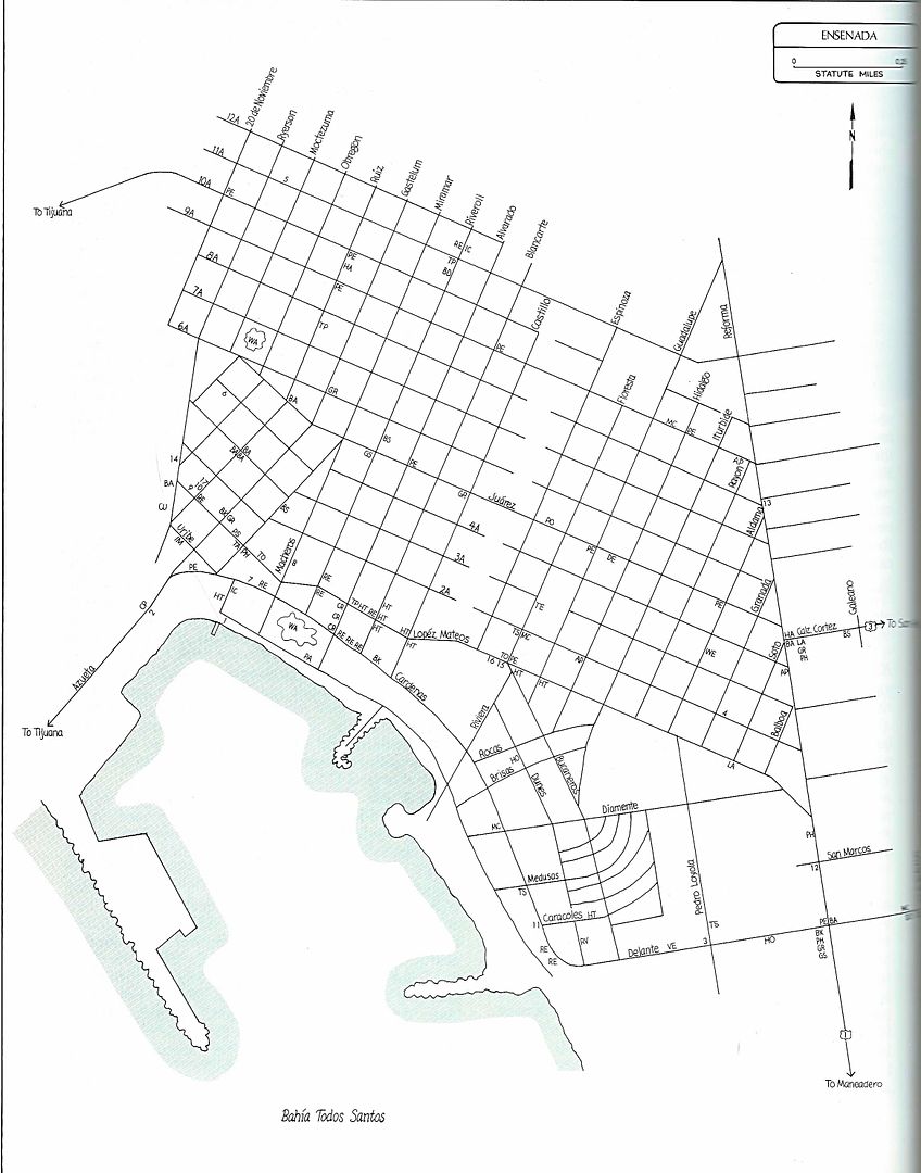
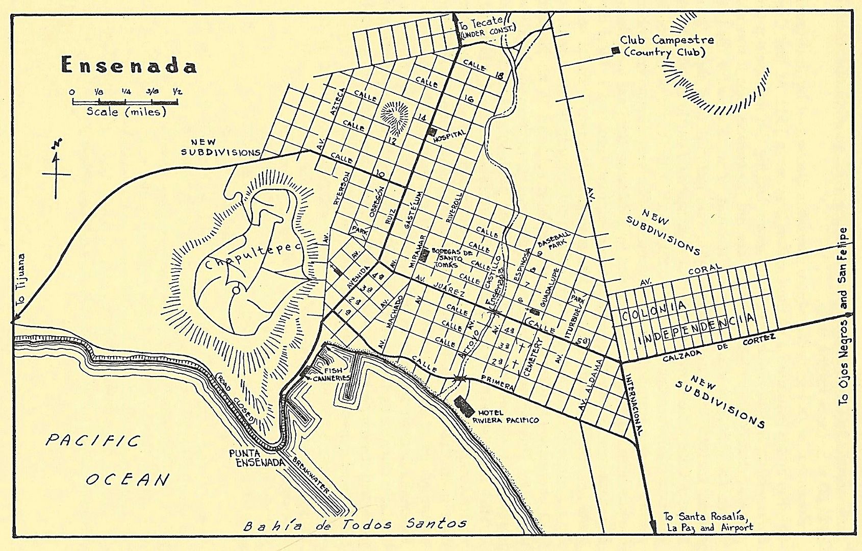
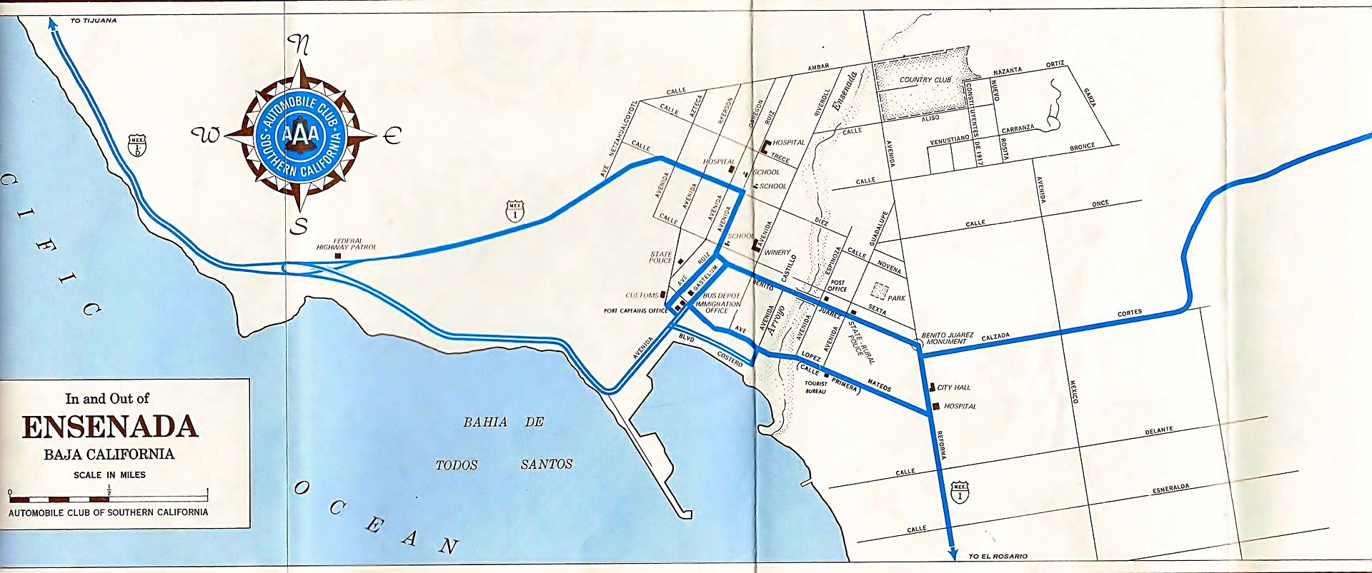
Ensenada Street Maps

David K - 11-13-2017 at 10:34 AM

I received a request for old Ensenada street maps.

1956 Lower California Guidebook:


1974 Auto Club:


1987 Baja Adventure Book:

Udo - 11-14-2017 at 09:12 AM

That last one does the trick, DK.

But any GPS that handles Mexico roads will give you all the streets for many blocks as you drive the area. I have a Garmin in every vehicle now. Yes, my vehicles came with GPS installed in them but once past the border, Mexico disappears. The factory upgrades to include the Mexico streets are $300-$500 USD, and it was cheaper to buy a Garmin for about $75.00 USD.
BTW...the Garmins also show the dirt roads.

David K - 11-14-2017 at 09:18 AM

Quote: Originally posted by Udo  
That last one does the trick, DK.

But any GPS that handles Mexico roads will give you all the streets for many blocks as you drive the area. I have a Garmin in every vehicle now. Yes, my vehicles came with GPS installed in them but once past the border, Mexico disappears. The factory upgrades to include the Mexico streets are $300-$500 USD, and it was cheaper to buy a Garmin for about $75.00 USD.
BTW...the Garmins also show the dirt roads.


Hi Udo, this thread was a request by a new Nomad that sent me a u2u and who was interested in seeing old Ensenada city maps and maybe the growth to today? I think Google Maps and other programs show the city as it is now if one needs a map for driving assistance?

BajaTed - 11-15-2017 at 09:39 AM

I liked the note for the coast road to the docks (road closed), the boulders from that hillside were as big as two story house.:o
Always terrified of those rocks as a kid

David K - 11-15-2017 at 10:08 AM

You also can see the Hotel Riviera Pacifico was on the waterfront back then. I think the Bahía Hotel was also on the beach before the harbor project, landfills, etc.

AlanDavid90 - 11-15-2017 at 10:39 PM

Thank you David K for posting the Ensenada's Street Maps, How my city has changed seen through the maps