Quote: Originally posted by Tomas Tierra  |
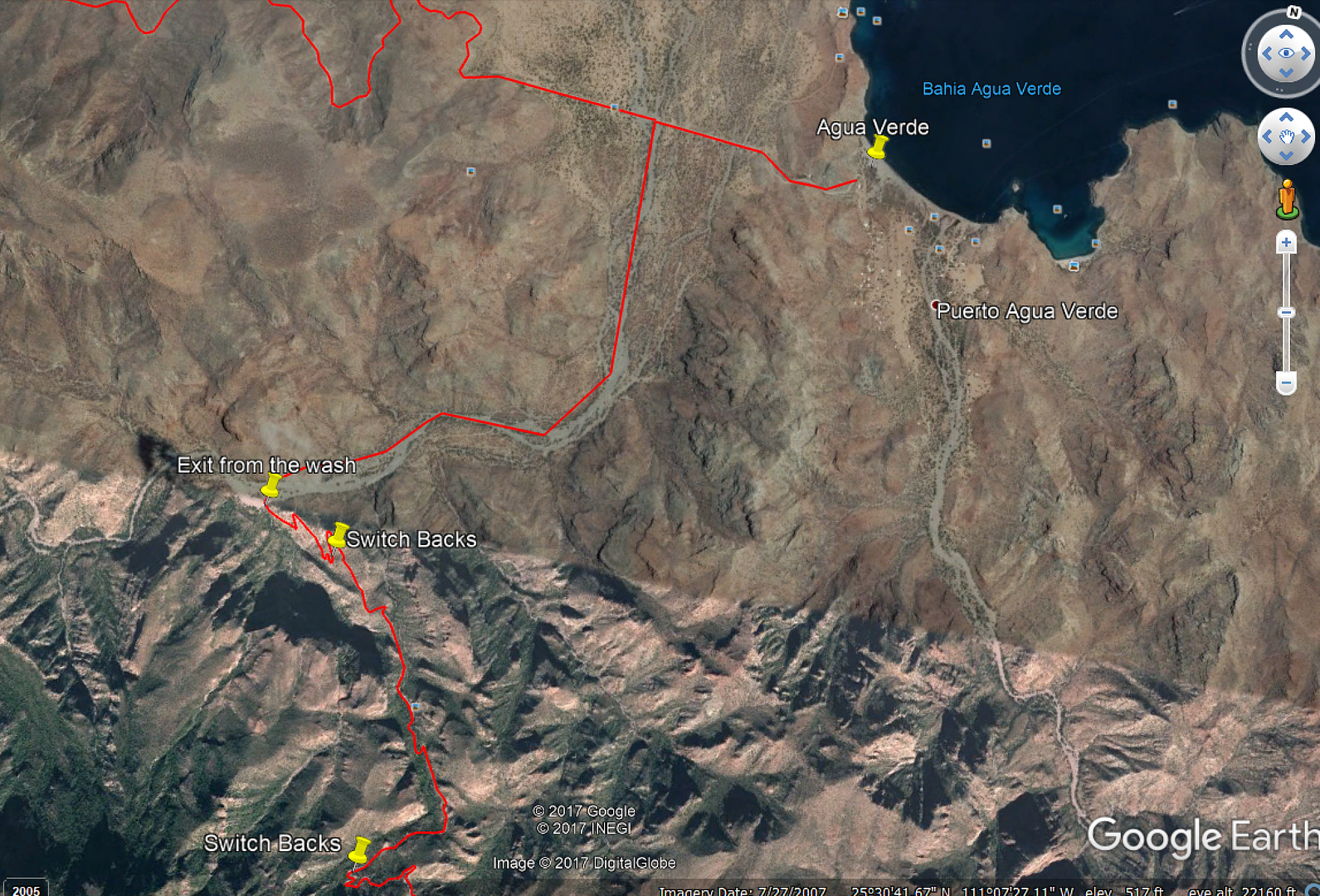
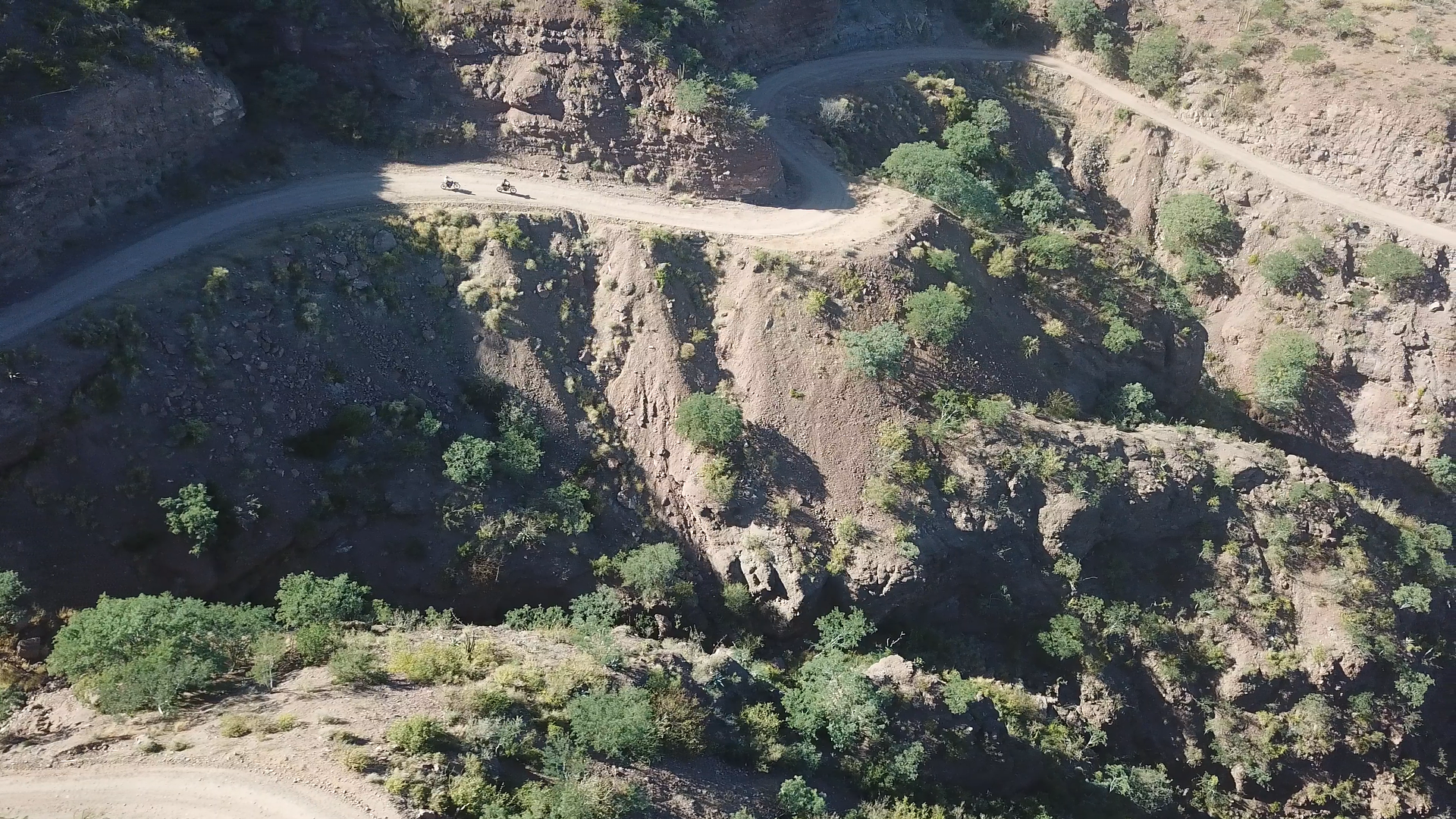
That first part in the arroyo is by far the worst part of the whole thing.. Once you get on the up hill/switchbacks, it's not bad. I know they have
had a few decent rains since I went through in April, but it was just worked with at that point and in excellent condition.. Once you get up on top
it's kinda Ho hum.
Suerte!
Fwiw, I was n a mostly stock 05 tundra with a four wheel camper on the back..no prob.
TT |
Thx, thinking we are just gonna ride up it with the bikes and then come back down. Have a huge ride into San Evaristo 2 days later, so gonna save up
for that.
Will video the ride up.
|