BajaNomad

Pioneer Mine Road

PaulW - 3-20-2018 at 03:14 PM

Documenting this trip so persons searching Nomads can find it.

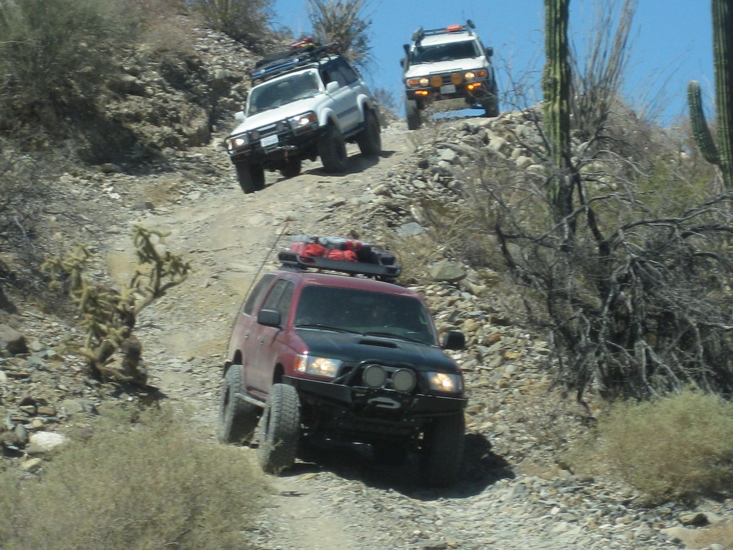
This was the original road before Highway 5 was built. It went from Hwy1 at El Crucero thru Calamajue canyon past the Pioneer Mine and on to Punta Final. The hard portion when heading north starts just north of the mine at the summit.
People interested in the details go to the report at:
edit
http://forums.bajanomad.com/viewthread.php?tid=82414
Look near the last message
On my settings it was on page 3. Your page is probably different?

[Edited on 3-20-2018 by PaulW]

TMW - 3-22-2018 at 12:28 PM

Paul where is the roughest part of the trail between Lacy's grave and the road to Cocos or is all about the same.

[Edited on 3-22-2018 by TMW]

PaulW - 3-22-2018 at 02:35 PM

Hi Tom,
About the track. Coming from Hwy5 we joined the P Final road junction at 29 42.443, -114 19.766. And headed southeast. The road became difficult after that.
We stopped at a summit for lunch and after that the road got much easier. If you start at Coco's join my track at 29 32.771, -114 16.215. then head up the track.
Sure enough I neglected to make any WPs. Good luck in finding that lunch place on GE. Anyway the place were we stopped for lunch was wide and flat to allow an easy turn around.
At the mine area we did not stop due to time constraints, but for sure the road was easy both before and after the mine.
I need to add all the WPs to my track. Can you provide Lacy's Grave and the Pioneer mine?
I note that my track has a unexplained dropout. I wonder if that was lunch?? Dropout is at 29 24.144, -114 12.395.

JZ - 3-22-2018 at 03:00 PM

How long would it take you to rip through this on a bike from Punta Final to Cocos?

PaulW - 3-22-2018 at 03:13 PM

Don't know
Rich T is down there now with a bunch of bikes. Unless I misunderstood they are doing that track and green door and Cordorines. Ask him next week when they get back.

willardguy - 3-22-2018 at 03:25 PM

from the Lacy side where the road on the flats ends at an old corral, i've never been able to spot the trail from there...any photos?

PaulW - 3-22-2018 at 05:03 PM


Several ways to the start of the trail from the north
Get to our track from the coast area near Molino Lacy
Follow the road to the 90 deg turn at the blue line


After that there is another 90 deg left. And so on to the track up the canyon.


[Edited on 3-23-2018 by PaulW]

David K - 3-22-2018 at 05:12 PM

Lacy's Grave, Molino de Lacy: 29.708324, -114.327739

The road south to Pioneer Mine leads away from the Molino hill to the south from the road that circles the hill.

Here is a GPS point on the road, just south of Molino de Lacy, easy to see on Google Earth: 29.701837, -114.322915

Here's a photo of the road as it leaves Molino de Lacy, taken from the top of the hill. The road is along the right side of the south-facing photo:


TMW - 3-22-2018 at 05:25 PM

Quote: Originally posted by PaulW  

I need to add all the WPs to my track. Can you provide Lacy's Grave and the Pioneer mine?
I note that my track has a unexplained dropout. I wonder if that was lunch?? Dropout is at 29 24.144, -114 12.395.


Lacy's grave is at 29-42.49x114-19.62. On GE I see either a concrete pad or some buildings. Could that be the mine area. It is near 29-36.12x114-16.46. Your dropout at 29-24.144x114-12.395 is in the Calamajue wash a little more than a mile from the mission site.

PaulW - 3-22-2018 at 06:31 PM

The hill and grave

willardguy - 3-22-2018 at 06:46 PM

okay when you drop down to the military checkpoint and look south there's a road, straight as an arrow that dead-ends at the base of the mountains....is this the trail head?

PaulW - 3-22-2018 at 06:50 PM

Looked it up


Thanks Tom Here is the mine


[Edited on 3-23-2018 by PaulW]

[Edited on 3-23-2018 by PaulW]

David K - 3-22-2018 at 06:56 PM

Quote: Originally posted by willardguy  
okay when you drop down to the military checkpoint and look south there's a road, straight as an arrow that dead-ends at the base of the mountains....is this the trail head?

No. That is not the road to the mine, but you do use a short section of it get to Molino de Lacy, where the mine road begins.


[Edited on 3-23-2018 by David K]

PaulW - 3-22-2018 at 07:01 PM

Quote: Originally posted by willardguy  
okay when you drop down to the military checkpoint and look south there's a road, straight as an arrow that dead-ends at the base of the mountains....is this the trail head?

=======
That is correct. That straight line puts you at the our first 90 deg turn. Trail head could be any of the road intersections on our track. Best landmark would be the Lacy grave hill.

The easy way Leave Hwy5 at ~K156 and head east along good roads to the start of the trail. Find the break in the fence with a road and make the two 90deg turns. Then pass by the Lacy grave hill. A short distance later you enter the overgrown difficult wash.
More description on the first post link.


[Edited on 3-23-2018 by PaulW]

[Edited on 3-23-2018 by PaulW]

PaulW - 3-22-2018 at 07:06 PM

FIXED Thanks David

Quote: Originally posted by David K  
Paul, the mission is on the east side of the arroyo, across from where the road drops down into the arroyo.

=====
Cannot trust the web. Have you got some coords so I can correct my post?

[Edited on 3-23-2018 by PaulW]

David K - 3-22-2018 at 07:09 PM

Yes, in my book... lol, also in Nomad, but easiest in my website at www.vivabaja.com/bajamissions and go to the Calamajue/Santa Maria page.

Here is the direct page link: www.vivabaja.com/bajamissions/page8.html

Paul, I just bumped up my Baja Missions from Space post, which has the GPS for each with the space photo.

[Edited on 3-23-2018 by David K]

willardguy - 3-22-2018 at 07:24 PM

Quote: Originally posted by PaulW  
Quote: Originally posted by willardguy  
okay when you drop down to the military checkpoint and look south there's a road, straight as an arrow that dead-ends at the base of the mountains....is this the trail head?

=======
That is correct. That straight line puts you at the our first 90 deg turn. Trail head could be any of the road intersections on our track. Best landmark would be the Lacy grave hill.

The easy way Leave Hwy5 at ~K156 and head east along good roads to the start of the trail. Find the break in the fence with a road and make the two 90deg turns. Then pass by the Lacy grave hill. A short distance later you enter the overgrown difficult wash.
More description on the first post link.


[Edited on 3-23-2018 by PaulW]

[Edited on 3-23-2018 by PaulW]


gracias, now im on board! I couldn't believe you guy could ramble up that mountain!

4x4abc - 3-22-2018 at 07:24 PM

the new mining camp in the image is not Pioneer Mine
Pioneer mIne is at 29.624992°, -114.268906°

PaulW - 3-22-2018 at 07:40 PM

Thanks Harald
With all the help from the others I think I now have all the images corrected?

4x4abc - 3-22-2018 at 09:19 PM

the camp south of Pioneer Mine is a different entity
could never find out whether it had a name - not even Coco had one
it was quite active for some years
the digging was around 29.628014°, -114.284146°

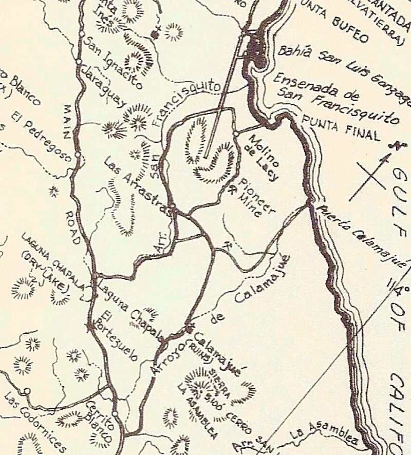
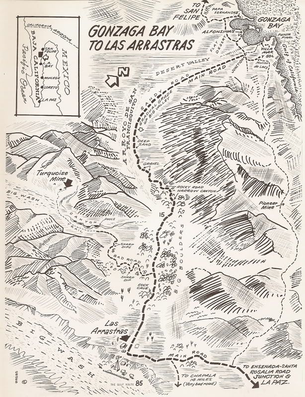
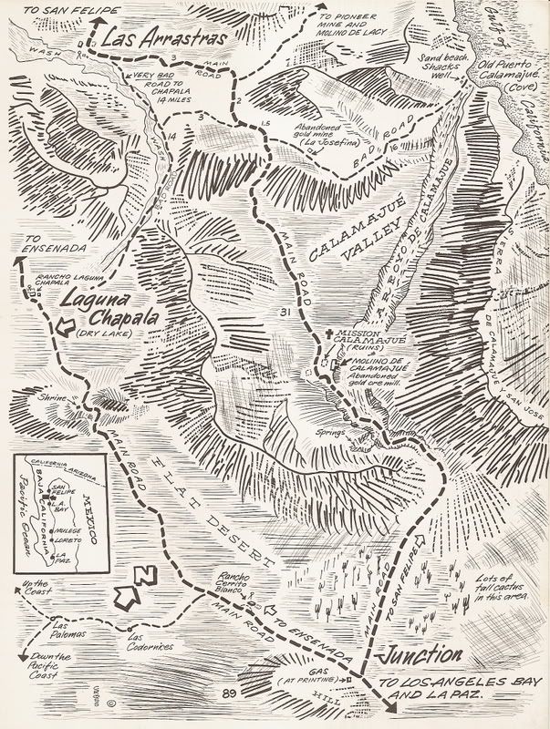
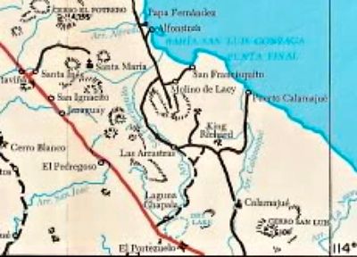
Old Maps are a look back in time... they help to make new discoveries!

David K - 3-23-2018 at 09:15 AM

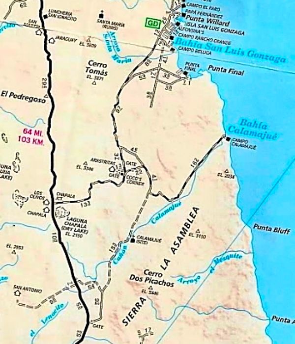
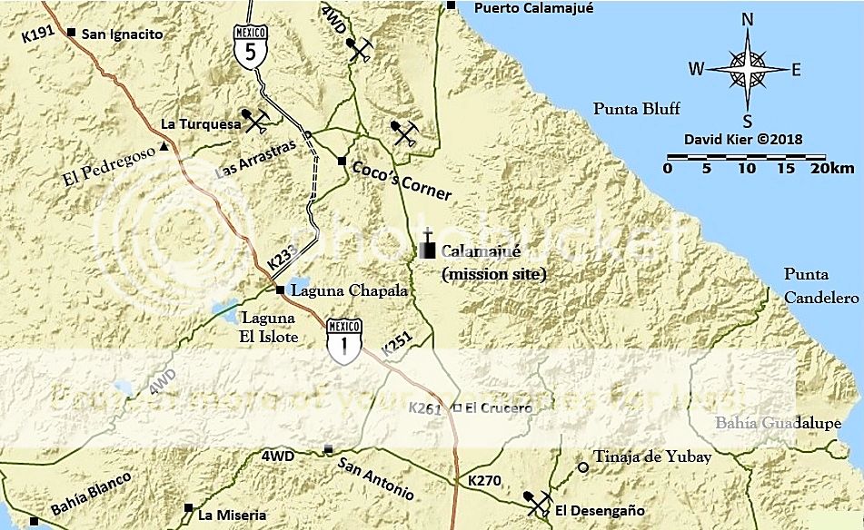
Howard Gulick (1962 Lower California Guidebook) map of the area of discussion.


1970 Cliff Cross Maps:


Note: Mission Calamajué incorrectly located.

1975 Baja California Guidebook map (Wheelock & Gulick):


2010 AAA Map, same region:


Now, 2018:


[Edited on 3-23-2018 by David K]

Pioneer mine trail GPS file update

PaulW - 3-24-2018 at 02:20 PM

I have revised the GPS file to add the WPs that all the contributors provided. The basic track is unchanged.
Please use your tool to create a .KML or .GPX file from the attached .USR file.

Attachment: Pioneer Mine Rd WPs.usr (80kB)
This file has been downloaded 337 times


JZ - 3-24-2018 at 07:04 PM

Quote: Originally posted by PaulW  
I have revised the GPS file to add the WPs that all the contributors provided. The basic track is unchanged.
Please use your tool to create a .KML or .GPX file from the attached .USR file.


It would be helpful to all if you converted .usr files to .gpx or .kml.

PaulW - 3-24-2018 at 07:11 PM

Sorry about that.
GPX files are way to big for attachments
Compare 80kB for USR and 657kB for GPX which is above the Nomad limit of 250kB

TMW - 3-24-2018 at 07:13 PM

JZ the conversion is easy at http://www.gpsvisualizer.com/

JZ - 3-24-2018 at 07:13 PM

We are going to ride it in the next two weeks. Been planning it out on GE. We'll swing out to Bahia Calamajue after riding through.


[Edited on 3-25-2018 by JZ]

JZ - 3-24-2018 at 07:39 PM

Quote: Originally posted by TMW  
JZ the conversion is easy at http://www.gpsvisualizer.com/


Yeah, I hear ya. But then everyone has to convert it.

I have the route, just giving a suggestion for others.


4x4abc - 3-24-2018 at 08:52 PM

I hate those usr files
GPSBabel does not translate them correctly

actually I hate it even more that every GPS manufacturer has to have their own software
so, moving data in the field from one machine to the other is usually impossible

PaulW - 3-25-2018 at 06:38 AM

Bable does have an issue.
I now use Trackmaker with success.
Tom uses http://www.gpsvisualizer.com/ with success.
The Lowrance Gen3 usr files are a problem due to the new format the some conversion SW have not adapted to.

TMW - 3-25-2018 at 09:27 AM

I don't use usr files since all my devices are Garmin so I use gpx files. Paul can correct me but most off road racers use usr files since most have Lowrance GPS units. In the beginning they were marine fish finding systems converted to off road use since they had big screens. I haven't looked into todays race cars/trucks for the past couple of years to see what is being used.

JZ - 3-25-2018 at 10:16 AM

Broken record here, but this is another huge reason to use a GPS app on your smartphone.

Back Country Navigator emails you a .gpx file of your track.

Ppl, throw your out-dated standalone GPS systems in the trash (or sell them on craigslist) and get a good phone!


[Edited on 3-25-2018 by JZ]

TMW - 3-25-2018 at 11:00 AM

Smart phone are too expensive for me. I'm just a poor investor living on a pension.

willardguy - 3-25-2018 at 11:09 AM

what did you folks do before your electronic umbilical cord....have an adventure?:light:

David K - 3-25-2018 at 11:46 AM

It is just one road, no choices once you leave Molino de Lacy.

PaulW - 3-25-2018 at 11:54 AM

I have mentioned it before that I am using a low price Andriod tablet, woks ok with some drawbacks. Most of them use Garmin format.
As mentioned there are many gps apps for both phones and tablets. Yes I do send GPX files via email. Just ask via U2U with an email address. The conversion take less than a minute.
The answer to Tom's question is that the serious racers are most all using the large screen Lowrance GPSs (fish finder with stuff like radar and sonar disabled). They are still the best, but way to expensive for me. I have several small older ones and they do not get used much. They are very hard to find used on the web. Figure the small Lowrance (5") sold new for double the cost of a Nuvi,but the Lowrance units are full featured to make trails and import and export via SD card.

PaulW - 7-15-2018 at 07:57 PM

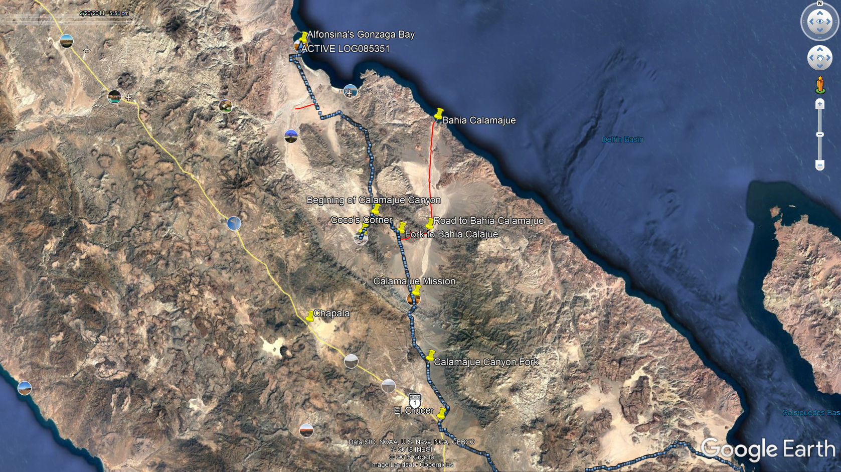
Here is a screen shot for most of the trip.


==== =
Quote: Originally posted by PaulW  
I have revised the GPS file to add the WPs that all the contributors provided. The basic track is unchanged.
Please use your tool to create a .KML or .GPX file from the attached .USR file.


Pioneer Rd Trip.jpg - 92kB

David K - 7-15-2018 at 08:52 PM

'Yubay' on that map is incorrect, just fyi. :biggrin:

Ken Cooke - 7-15-2018 at 10:17 PM

10 or 11 years ago on my Baja Grande run, I remember traveling near this route, but it was a mild dirt road with a muddy crossing. No rocks, but lots of dirt roads that we encountered.

JZ - 7-15-2018 at 11:04 PM

Quote: Originally posted by Ken Cooke  
10 or 11 years ago on my Baja Grande run, I remember traveling near this route, but it was a mild dirt road with a muddy crossing. No rocks, but lots of dirt roads that we encountered.


We just went to ride it in April. Got a few miles in before my kid's bike had a problem and we decided to turn back. I can confirm it is rocky as hell.

JZ - 7-15-2018 at 11:11 PM

Quote: Originally posted by PaulW  
I have mentioned it before that I am using a low price Andriod tablet, woks ok with some drawbacks. Most of them use Garmin format.
As mentioned there are many gps apps for both phones and tablets. Yes I do send GPX files via email. Just ask via U2U with an email address. The conversion take less than a minute.
The answer to Tom's question is that the serious racers are most all using the large screen Lowrance GPSs (fish finder with stuff like radar and sonar disabled). They are still the best, but way to expensive for me. I have several small older ones and they do not get used much. They are very hard to find used on the web. Figure the small Lowrance (5") sold new for double the cost of a Nuvi,but the Lowrance units are full featured to make trails and import and export via SD card.


Trust me on this one. If you have an Android tablet you want to be running Back Country Navigator on it. Way better than anything else, including a Lowarance GPS. I've owned all the standalone GPSs. They are all garbage now compared to a good phone or tablet app. No messy conversions necessary.

If you are on the water, you should be using Navionics on your phone or tablet. Crushes all standalone marine GPSs. I haven't used my built in dash mounted GPS with radar in years.

Google Earth + Back Country Navigator is the ta taas for navigation.


[Edited on 7-16-2018 by JZ]

PaulW - 7-16-2018 at 05:39 AM

Quote: Originally posted by David K  
'Yubay' on that map is incorrect, just fyi. :biggrin:

===
Yubay is just background garbage from the Trackmaker map. The only things that are valid are my WPs and the GPS track

[Edited on 7-16-2018 by PaulW]

David K - 7-16-2018 at 09:45 AM

I figured...

PaulW - 7-16-2018 at 10:30 AM

I have explained before.
This site has a 250k limit on attachments so I cannot post a GPX or KML file. So if you have trouble converting the USR file send me a U2U with your email address and I will forward you the files.

BTW Trackmaker always gets conversions correct. The only thing Trackmaker cannot deal with is the Lowrance GEN3 format. And the other tools off the web try to do the new format conversion, but many get it wrong. Trackmaker is for PCs only.
The USR attachment to this message is a repeat of the last one I posted.
========= =
Quote: Originally posted by PaulW  
I have revised the GPS file to add the WPs that all the contributors provided. The basic track is unchanged.
Please use your tool to create a .KML or .GPX file from the attached .USR file.


Attachment: Pioneeer Road WPs.usr (80kB)
This file has been downloaded 306 times


Ken Cooke - 7-16-2018 at 05:07 PM

Quote: Originally posted by David K  
Howard Gulick (1962 Lower California Guidebook) map of the area of discussion.


K]


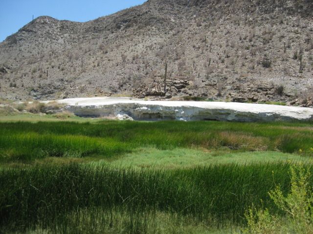
My last trip into this area, my group traveled to Cocos, backtracked about 1 mile to a dirt road on the east side of the Gonzaga-Chapala road, then entered a small canyon route that was spring fed, filled with standing water and mud. A virtual oasis in this desert region.

ehall - 7-16-2018 at 08:15 PM

Probably Calamajue wash Ken.

4x4abc - 7-16-2018 at 08:34 PM

Enchanted Valley - right at the mission ruins

David K - 7-16-2018 at 08:39 PM

Quote: Originally posted by 4x4abc  
Enchanted Valley - right at the mission ruins


Haven't you been in Calamajué Canyon, Ken???

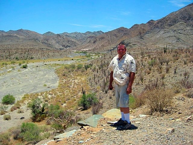
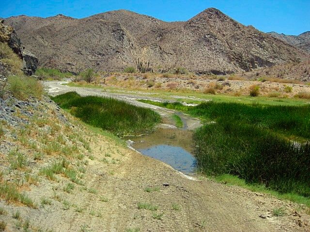
2012:


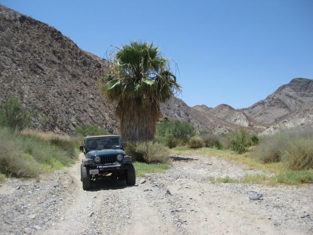
It is safe for Jeeps!

2016:


Mission site is across from where the road drops to the arroyo and up on the opposite terrace.


[Edited on 7-17-2018 by David K]

PaulW - 7-17-2018 at 05:04 AM

10+ years ago I drove thru the wash and the water came up to the top of my tires and the grass was up as high as the top of the hood. The last several trips there was nothing more than puddles. When the racers drove thru they splashed a lot and they were unhappy because they got wet and it made for a very cold drive after that. Now at normal speeds you probably wont even get mud on your tires and any kind of rig can pass the wash with no issues. How times have changed.
David's pictures are still accurate for Jan 2018.

TMW - 7-17-2018 at 09:47 AM

Ken there is gold in the hills, you don't want to miss that.

JZ - 7-17-2018 at 09:56 AM

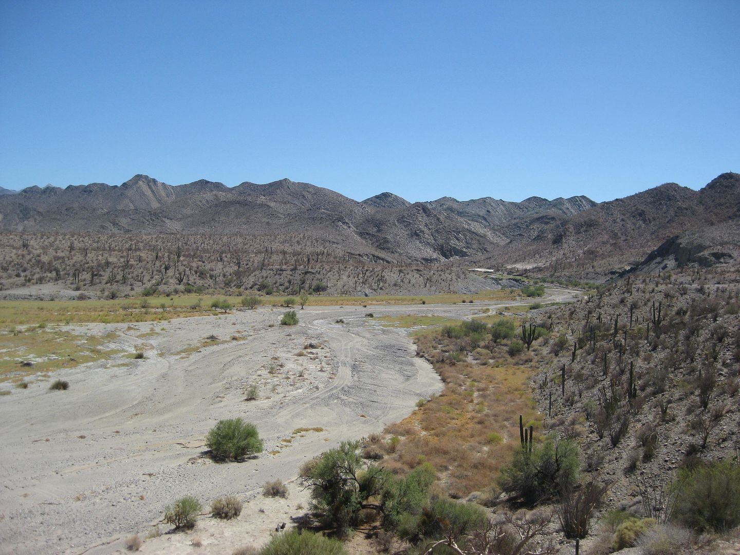
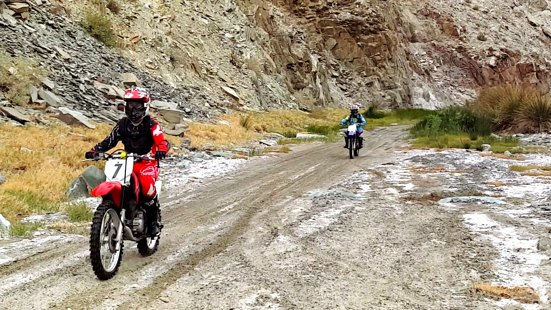
Pic of the kids flying through Calamajué Canyon.


[Edited on 7-17-2018 by JZ]

Ken Cooke - 7-17-2018 at 02:37 PM

Quote:
[quote=1128182&tid=89928&author=David K]

Haven't you been in Calamajué Canyon, Ken???


I have been through Calamajue Canyon in 2008 with 10 Jeeps and 3 Toyotas. It was a very good run. Mud was about 2 feet deep in places. Time is short as I'm preparing for a week trip south of the border. Photos can follow, but they will have to wait.

[Edited on 7-17-2018 by Ken Cooke]

Ken Cooke - 11-4-2018 at 08:18 AM

This is looking like a great alternate to Mission Santa Maria due to increased travel times and a finite amount of vacation time in February.

David K - 11-4-2018 at 12:30 PM

Quote:
Quote: Originally posted by Ken Cooke  
[quote=1128182&tid=89928&author=David K]

Haven't you been in Calamajué Canyon, Ken???


I have been through Calamajue Canyon in 2008 with 10 Jeeps and 3 Toyotas. It was a very good run. Mud was about 2 feet deep in places. Time is short as I'm preparing for a week trip south of the border. Photos can follow, but they will have to wait.

[Edited on 7-17-2018 by Ken Cooke]


I was in the canyon in 2016 and 2012 (as well as many other times back to 1967). Both times were very easy to drive but even less water in 2016 than 2012, which only had one deep puddle. Let me know if you want photos. Keep in mind, the 1766-1767 Jesuit mission site is up on the ledge, directly across from where the road drops into the arroyo at the gold mill ruins (which require you park and look over the edge of the cliff to see). So much history there you can easily miss if you are not informed.

Pioneer mine road again

PaulW - 2-2-2020 at 04:43 PM

Feb 1 Pioneer road drive
From the new H5 Coco turn at k180 we turned off the new H5 onto the old H5 graded road then took a turn off Old H5 to the north east direction to get to the Pioneer mine road. The only thing new on the Pioneer track is we took the path to the newest digs and found a marker dated 1990. This west loop has some route finding and one difficult place which required stacking rocks.
The attached KML file has more details. Zoom way in to see the details


Attachment: coco exit, pioneer enter.kml (149kB)
This file has been downloaded 264 times

Ken Cooke - 2-2-2020 at 08:43 PM

Quote: Originally posted by PaulW  
Feb 1 Pioneer road drive
From the new H5 Coco turn at k180 we turned off the new H5 onto the old H5 graded road then took a turn off Old H5 to the north east direction to get to the Pioneer mine road. The only thing new on the Pioneer track is we took the path to the newest digs and found a marker dated 1990. This west loop has some route finding and one difficult place which required stacking rocks.
The attached KML file has more details. Zoom way in to see the details


Thank you for the update PaulW!

David K - 2-3-2020 at 08:58 AM

Quote: Originally posted by PaulW  
Feb 1 Pioneer road drive
From the new H5 Coco turn at k180 we turned off the new H5 onto the old H5 graded road then took a turn off Old H5 to the north east direction to get to the Pioneer mine road. The only thing new on the Pioneer track is we took the path to the newest digs and found a marker dated 1990. This west loop has some route finding and one difficult place which required stacking rocks.
The attached KML file has more details. Zoom way in to see the details


On my PC and just looked at your track, thanks. Your pin for Km. 180 is 1/2 km south of your pin for the old Hwy. 5 route (Coco's north road). Is that correct?
Did you take photos of the Pioneer Mine or any others on this trip? I would like to see them, thanks!

Pioneer west loop

PaulW - 2-3-2020 at 10:12 AM

The Pioneer west loop had us out of our rigs many times dealing with where to drive and how to find the road. Not much to see because the digs are on the left up the hill side with no roads. I only got one image at 29 37 25.380, -114 16 54.48 - date 23 Jan 1990


Here is an image of the north exit New H5 to Old H5. We were driving northbound when the track was created.

Coco.jpg[/img][/url]


[Edited on 2-3-2020 by PaulW]

JZ - 2-4-2020 at 07:06 PM

We tried to ride the Pioneer Mine trail in 2018. Made it a couple miles. Pretty rocky, but not too bad.

My kid's bike over heated. Turns out there was a problem with the radiator. So we turned around.

One of the only trails in Baja that I feel defeated us. Want to have another run at it this year.


[Edited on 2-6-2020 by JZ]

PaulW - 2-5-2020 at 09:55 AM

Do it from the south for an easier trip. Down hill is good for a hot bike.

bkman211 - 2-5-2020 at 06:52 PM

Me and a few guys rode up it last weekend, very rocky for sure which caught us a bit by surprise, thankfully all riders were experienced enough to make it through without incident. I had never even heard of it before so funny to see two threads about it here today.


IMG_5960.jpg - 219kB

Cleaning up my files

PaulW - 12-10-2020 at 10:45 AM

Also attached is a GE KML to allow the user to get the detailed coordinates I got rid of less needed tracks and WPs.

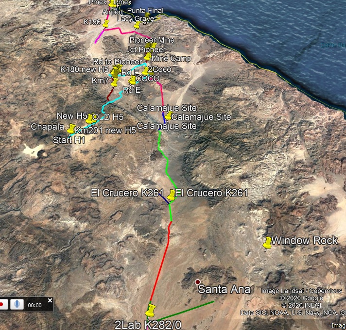
Pioneer composite – 1
Large area

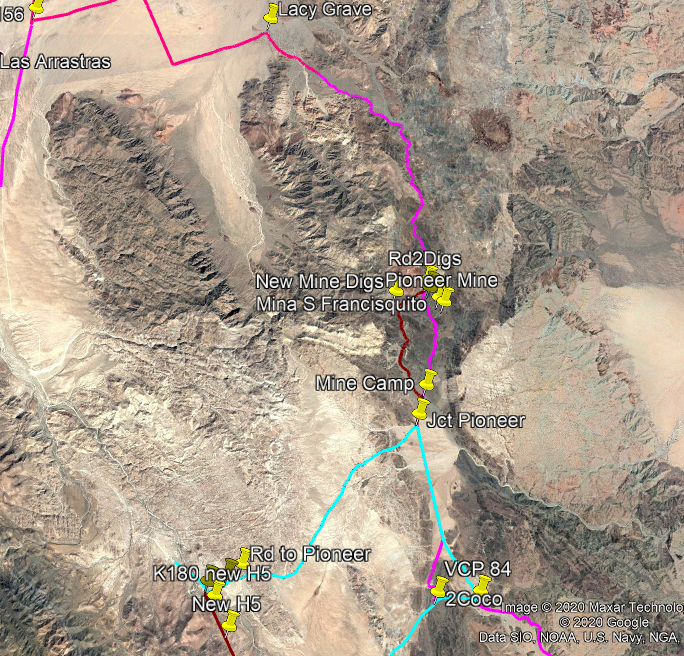
Pioneer composite – 2
Details

Pioneer composite – 3


[Edited on 12-11-2020 by PaulW]

David K - 12-10-2020 at 11:12 AM

:bounce::bounce::bounce:

Ken Cooke - 12-11-2020 at 08:14 AM

That was a fun trail. I hope to run it in the future. Thanks for the coordinates, Paul.

PaulW - 12-11-2020 at 09:38 AM

OPPS Found an error in my KML
Standby

Pioneer Mine Area Waypoints

PaulW - 12-12-2020 at 11:16 AM

I deleted many of the tracks to cut the file size, but with my images aboveI should still make sense?
Anyway the critical junctions are shown along with the tracks close to the mine area.

Attachment: Pioneer Composite.kml (235kB)
This file has been downloaded 213 times

Ken Cooke - 12-13-2020 at 09:49 AM

Quote: Originally posted by PaulW  
I deleted many of the tracks to cut the file size, but with my images aboveI should still make sense?
Anyway the critical junctions are shown along with the tracks close to the mine area.


Thanks once again, Paul. What software program do you use to manage these files and waypoints?

PaulW - 12-13-2020 at 11:07 AM

It is a PITA for composite result. I use trackmaker (free) which will merge tracks from various formats and convert the result to other formats I choose.

I load many tracks into Trackmaker then break the trails so I can delete many trails and still have some sense of what I am trying to depict.
Trial and error to get a file small enough for Nomad. Each time I save my trial to a KML and check the size.
My first version I had deleted the main track past the mine deleted, no wonder the file was so small.
Remember I make tracks using Lowrance or Inreach (usually both) and all my tracks have a huge number of track points. This Is the reason I no longer publish GPX files as they are way huge.

Of course I leave the WPs at places where I deleted the tracks for completeness.
This means the user can click on the GE WP for coords. For other WPs zoom in on GE to find intersections of the shown tracks. Any track shown can be saved on GE to get a KML for that track. But then Trackmaker or other SW can be used to make a GPS track. The pitfall of this is the large file when creating a GPX file.