Here is my report from March 2012:
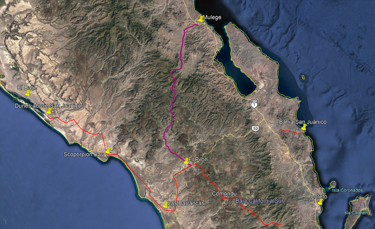
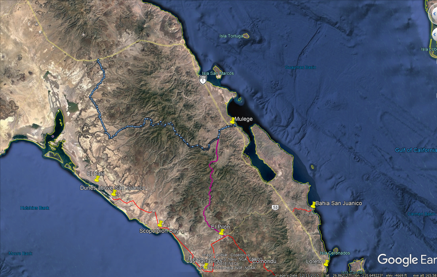
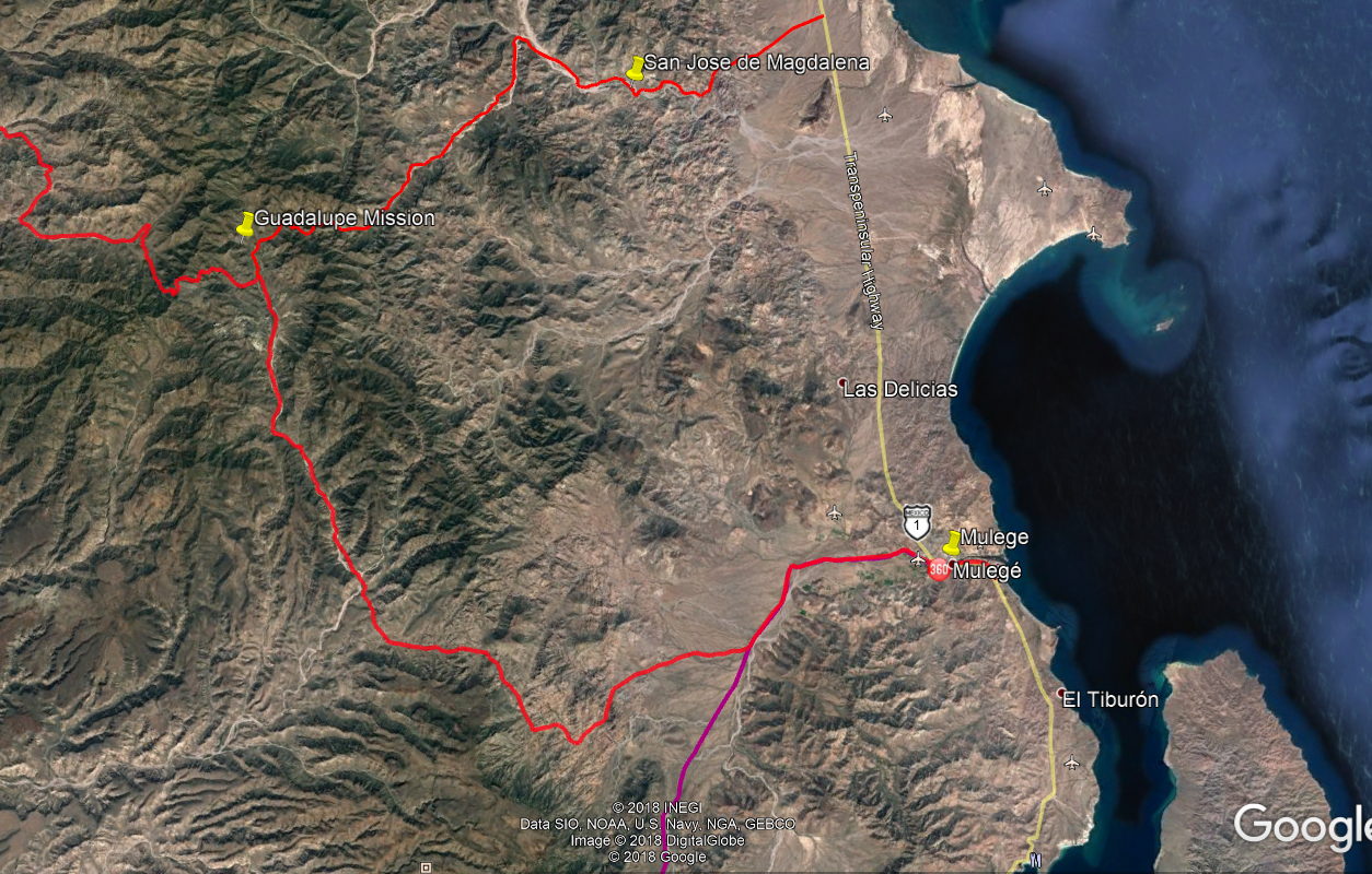
Trip Report/road log San Isidro-Mulege Mountain Route 3/22/2012
For reference our vehicle is a 2000 Explorer stock Bauer Ed. with 255/70/16 Michelin street tires run at about 22#.
The report is a mileage log and includes GPS data and elevation for key points. The log is as accurate as Garmin and Ford's odometer could provide.
Mile Zero is starting North from San Isidro at 26.12.866x112.01.577.
Excellent road to:
Mile 12.3 Purisima Vieja then to
Mile 15.4 Paso Hondo. Both are oasis villages with some great scenery.
Mile 17.8-Springs and ponds on left.
Mile 18.3-Small village.
Mile 21.2-water crossing/palms and on to Buenos Aires at mile 25.9.
Mile 29.1-Agua Grande
Mile 32.2. 26.32.962x112.06.834. Elev.2100. Sign: El Llano straight, Guajadami to the right. Go straight.
From here the road is steep and rocky with a lot of erosion. Low range used to:
Mile 36.7 the top of high plateau. Elev. 3350 at 26.35.899x112.07.222.
Mile 37. Incredible views of deep gorge on right. Continue to climb to:
Mile 39.1. 26.37.146x112.06.743. Elev. 3765. High point overlooking the broad expanse of El Llano below.
This is where the road ended when I attempted this route some 15 years ago. The descending cuesta was the most difficult of the entire trip. Steep,
sometimes narrow and off camber and rough eroded rock with lots of loose stuff. This is an area to use extreme caution. We crept down in low
range, 1st gear to arrive in the flats of El Llano at:
Mile 40.6. 26.37.786x112.07.153. Elev. 2616.
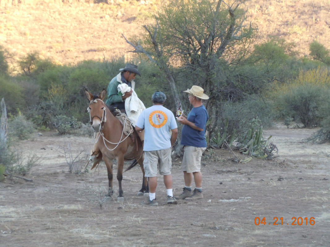
At this point we met a rancher with a Ford F350 4wd and a cattle rack who had 3-4 cattle loaded. We told him we were going to Mulege and he said he
was as well. That gave us a better feeling about actually completing the trip since I didn’t feel we could climb back up that previous cuesta or at
least really didn’t want to attempt it. He confirmed that that plateau is El Llano. As we started up the next grade we saw him starting behind us.
A rough ride for those cows! The road continues up and down a bit before a gate at the top of the final cuesta at:
Mile 43.1. 26.39.029x112.08.07. Elev. 3429. Now down the cuesta, steep and rough but not nearly as bad as the earlier one. There has been traffic
up and down this area since we were on it and turned back a few months ago. I think we could now go up this one ok.
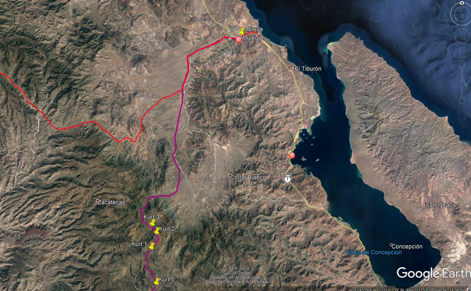
Mile 46.2. 26.40.320x112.07.130. elev. 1346. This position is right by the ranch at the bottom of the cuesta. Rancho El Llanito. It is relatively
new. This is the important coordinate for anyone doing this trip north to south since it is not shown on the maps and in my experience the Baja Atlas
and other maps are only an approximation of the roads in this area.
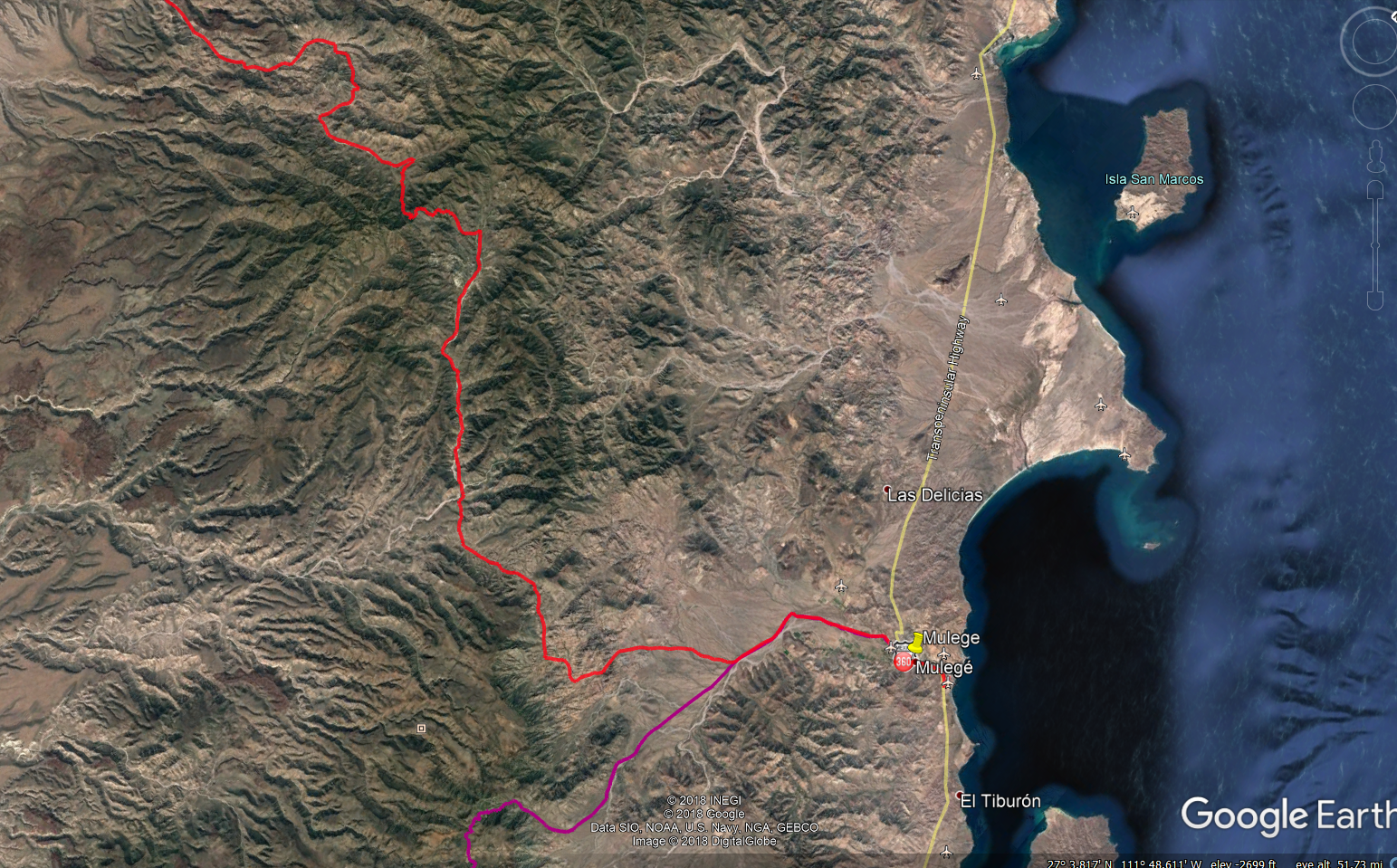
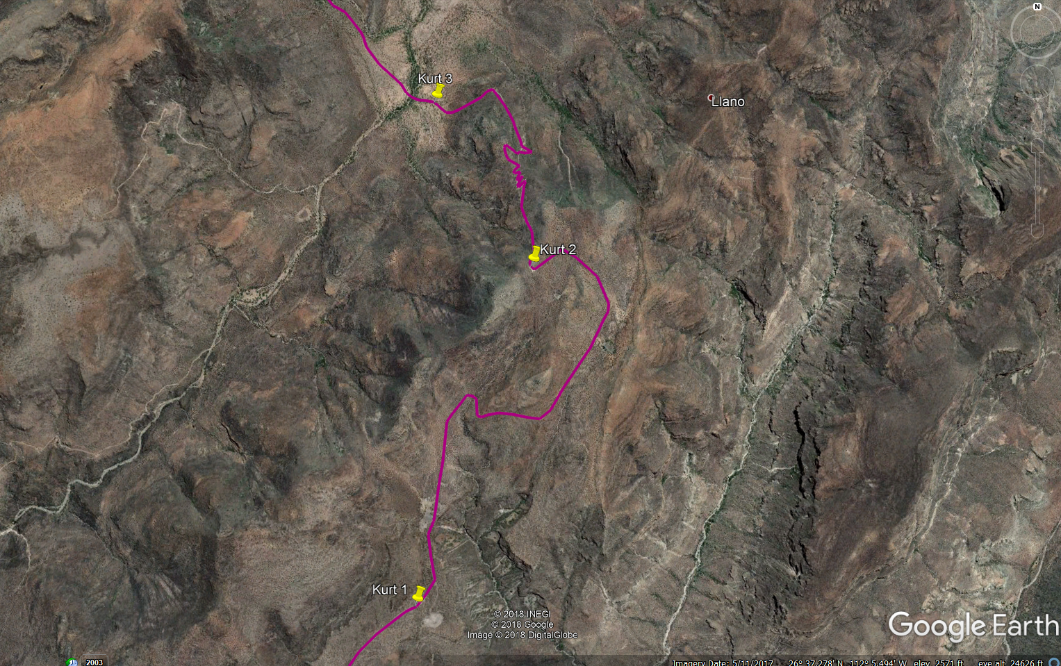
From this point you are on the road that goes straight to Mulege. There are occasional roads that come in from both side notably at:
Mile 50.8 which has a sign pointing back to Rcho El Llanito. I believe the other fork here leads to the area of El Potrero and El Batiqui and Pia de
la Cuesta Guajadami. I have motorcycled in that area but not since the hurricanes changed some of the roads a few years ago. Note that I have not
called this the Guajadami Road since it splits off from the old mission route and is generally to the west of it.
Continue straight into Mulege arriving at Hwy 1 (icehouse road junction) at MILE 67.3.
This trip took about 6 hours so an average speed of about 10 mph. Thanks to Mulegena for the trip report on Baja Nomads that inspired us to do this
trip. The scenery was wonderful although I would still rank the San Juan de la Pila road as the slightly more spectacular but I am really splitting
hairs on that call. Do them both and tell me what you think!
Kurt and Kathy, March 22, 2012 |