Hi all, I'm looking for some advice. The wife and kids and I (and hopefully a couple of others) are doing some exploring the week of Thanksgiving,
and we are trying to plan our route a little bit. But I'm running up on some information that I think I need some advise on from some of you who are
more familiar with things..
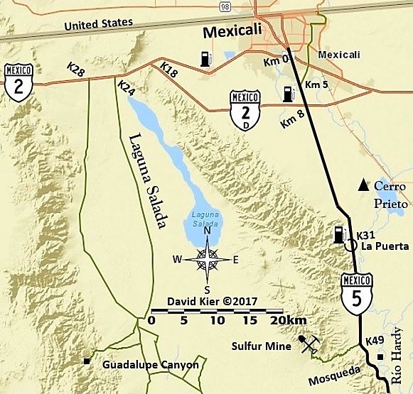
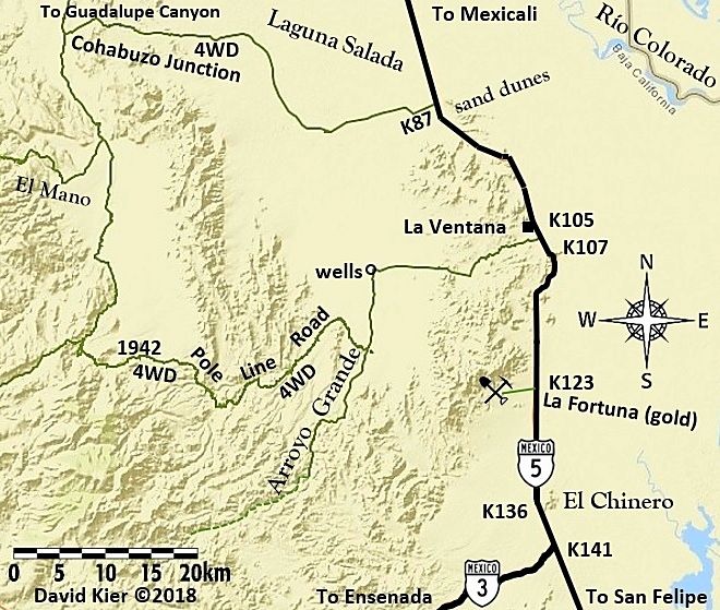
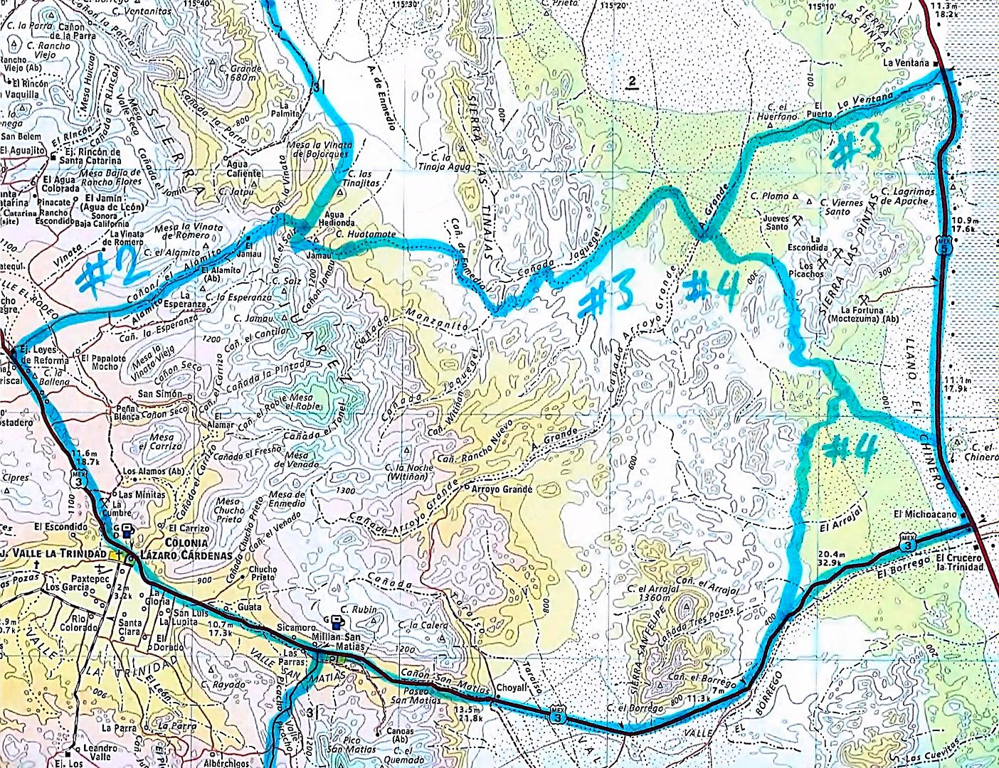
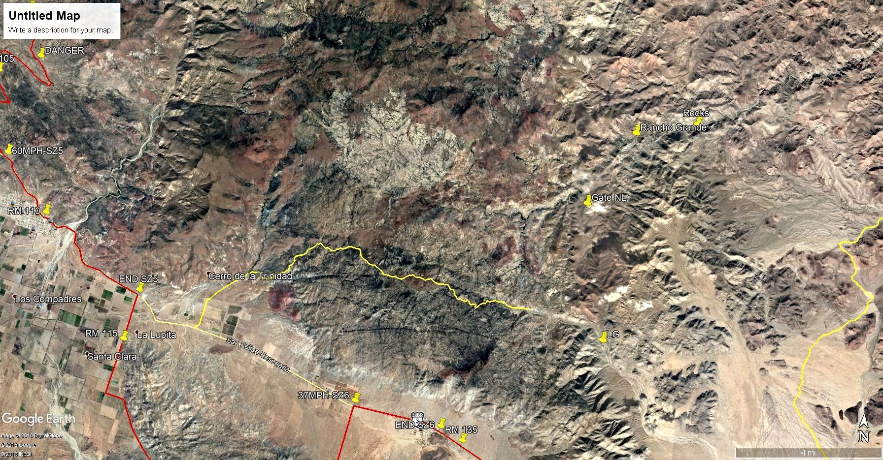
We're leaving Guadalupe Canyon, and are trying to get to Mike's that night. We will be in a Razor and a very capable jeep. From looking at a 2003
Baja Almanac, it looks like this route through Arroyo Grande will connect us up to Highway 3 (see red line along route) .. However from looking at
DavidK's 2018 map of the area, it appears that this peters off into nothing. Google Earth seems to more agree with DavidK's maps, but I can't exactly
tell, and I've never gone through this area.
Does anyone have any thoughts for me on this? Best route to take from Guadalupe Canyon to Mikes? The least road miles possible is preferred.
Thanks guys!!
|