BajaNomad

Anyone done the No Wimps trail this year?

JZ - 10-30-2018 at 07:38 PM

Tells us about it.

ehall - 10-31-2018 at 04:07 AM

Haven't heard of anyone doing it for a few years. I have a GPS track of where the trail used to be if you want it. PM me an email address.

TMW - 10-31-2018 at 08:27 AM

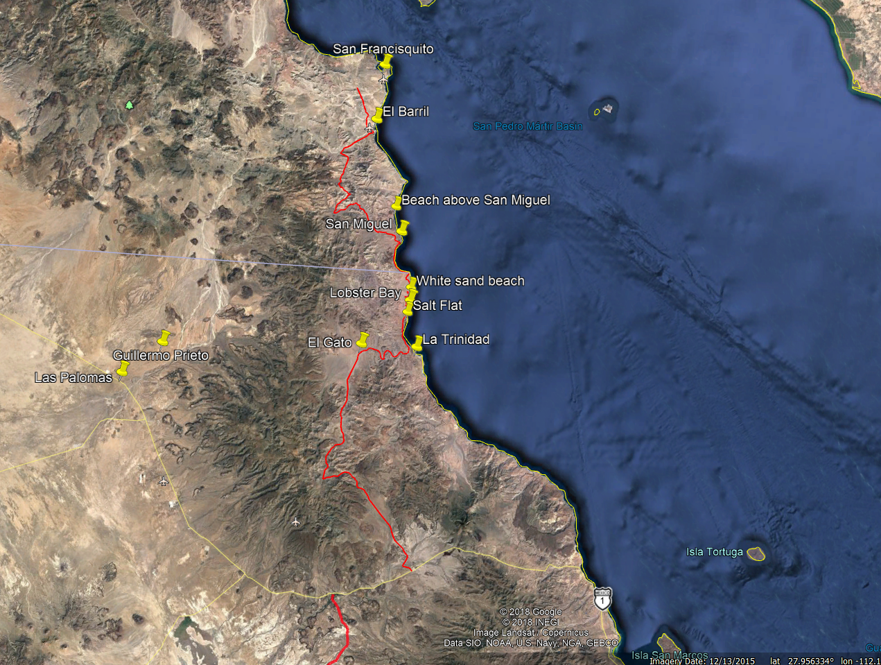
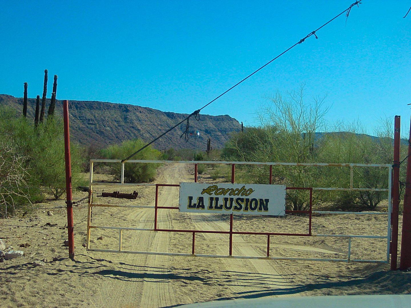
Fences and gates were put up for a Mtn Goat preserve or what ever it's called. The gates may or may not be locked. If anyone is in the El Barril area head out to Rancho La Ilusion and asked about the gates and if it is OK to pass thru.

The south entrance from San Ignacio to Santa Marta and El Gato out to La Trinidad and north to the 28th parallel is open.

There are plans to put in an Electric Power Line from the La Virgin area north to El Barril/San Francisquito and under the sea to the mainland.

To my knowledge Desert Bull was the last to run the No Wimp Trail and said they had graded a good road in the El Gato area to the sea. Maybe that was in prep for the power line.

JZ - 10-31-2018 at 09:53 AM

Yeah I was reading some of that in the thread from November.

I wonder if you could play someone to let you through if the gate is in fact locked.

ehall - 10-31-2018 at 02:09 PM

Talked to a guy online that said they did it from El Barril in 5 hours on bikes and a lot of it is fast and graded. Can anyone confirm or refute that?

JZ - 10-31-2018 at 04:53 PM

What's the farthest down the trail from the North a truck can "easily" go?

We don't have great range on our bikes. I want the chase truck to fuel us up at the North end and drive around and meet us on the South end. On the South side, again, coming up as far as it's fairly easy for a non-lifted and heavy truck.

David K - 10-31-2018 at 05:36 PM

There is the first gate at Rancho La Ilusion, not locked. The rancher is friendly... ask him. I did in 2017 and as TW said, gates will not be locked unless there becomes a reason to. So don't leave one bit of trash when you break camp!


TMW - 10-31-2018 at 05:38 PM

If it's a 4x4 you can go all the way. There are a couple of place where you get into some soft sand in an arroyo and on the beach. If you have a rear locker and let air out your probably OK.

PaulW - 10-31-2018 at 06:04 PM

Lets go do it

JZ - 10-31-2018 at 06:10 PM

Quote: Originally posted by TMW  
If it's a 4x4 you can go all the way. There are a couple of place where you get into some soft sand in an arroyo and on the beach. If you have a rear locker and let air out your probably OK.


Really, thought there was a ton of rocks?

JZ - 10-31-2018 at 06:21 PM

Ok, just saw this from DesertBull November of last year:

Quote: Originally posted by Desertbull  
drove thru a couple weeks ago the entire No Wimps ... a tractor / grader has cleaned it all up ... a new side road thru El Gato bypasses all the crappy rock trail ... it was less then a full day from San Ignacio to Punta San Fransiquito ... good times.


[Edited on 11-7-2017 by Desertbull]


advrider - 10-31-2018 at 06:48 PM

Please post up if anyone has any luck, I've wanted to run this for a few years...

blackwolfmt - 10-31-2018 at 07:29 PM

Cmon Bajatrailrider chime in with some current info

dirt-bike-smiley-emoticon.gif - 43kB

JZ - 10-31-2018 at 07:43 PM

Quote: Originally posted by advrider  
Please post up if anyone has any luck, I've wanted to run this for a few years...


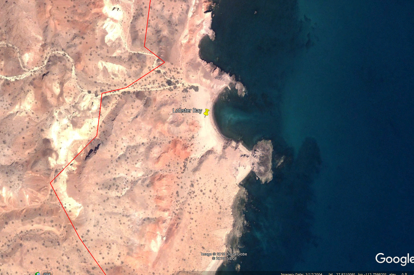
Just spent like 3-4 hrs reading old posts about it. We are gonna run it in December. I want to catch and cook some lobsters at Harald's Lobster Bay.


[Edited on 11-1-2018 by JZ]

twgracing - 10-31-2018 at 10:01 PM

We did it in May. Graded through San Miguel, then got back to it’s no wimps reputation until El Gato. Lots of feeders and hunting/observation blinds until remodeled hunting lodge at San Miguel. We were fortunate to run into forest service who let us through.

ehall - 11-1-2018 at 06:56 AM

Quote: Originally posted by JZ  
Quote: Originally posted by advrider  
Please post up if anyone has any luck, I've wanted to run this for a few years...


Just spent like 3-4 hrs reading old posts about it. We are gonna run it in December. I want to catch and cook some lobsters at Harald's Lobster Bay.


[Edited on 11-1-2018 by JZ]


When in Dec.? I will be in the area the Dec. 2nd or 3rd .

JZ - 11-1-2018 at 09:19 AM

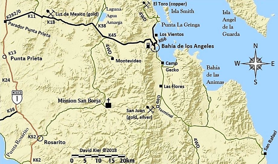
Late December over the kids' winter break. Thinking to come in directly from Hwy 1 from Las Palomas instead of BoLA, so we can get right at it.


[Edited on 11-1-2018 by JZ]

StuckSucks - 11-1-2018 at 09:30 AM

And JZ, when you go, video the hell out of the trip, from bikes and ground and air. Maybe put something together that's 20-30 mins long?

I'm monitoring this thread, we hope to do this trail in the next year or so.

TMW - 11-1-2018 at 10:02 AM

Quote: Originally posted by JZ  
Quote: Originally posted by TMW  
If it's a 4x4 you can go all the way. There are a couple of place where you get into some soft sand in an arroyo and on the beach. If you have a rear locker and let air out your probably OK.


Really, thought there was a ton of rocks?


After the hurricane in 2014 the road from the Jct to R. San Miguel and R. Santa Barbara was wiped out and only the arroyos to follow which were loaded with rocks. That's what 4x4abc used when he got thru in March of 2015. Since then others have went thru making it easier to follow.

twgracing says the road to San Miguel has been graded. There was a short area after San Miguel and before Los Corrales that you had to drop down on the beach cross an arroyo then back up. Deep sand and lots of softball size rocks. The first time I did it, it was a bit of a problem. The second time no problem. The next problem area was from the ocean following La Trinidad arroyo to El Gato. There were rocks but not the problem. The problem was finding your way with out always back tracking. The ground was hard with rocks and it was hard to follow tracks. The second time I did it we had a GPS track but it was off in places. Getting out and walking ahead was the ticket. That's where your drone would come in handy maybe.

[Edited on 11-1-2018 by TMW]

David K - 11-1-2018 at 10:29 AM

Quote: Originally posted by JZ  
Late December over the kids' winter break. Thinking to come in directly from Hwy 1 from Las Palomas instead of BoLA, so we can get right at it.


[Edited on 11-1-2018 by JZ]


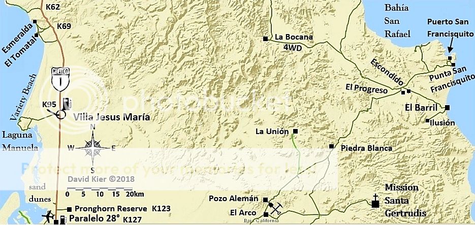
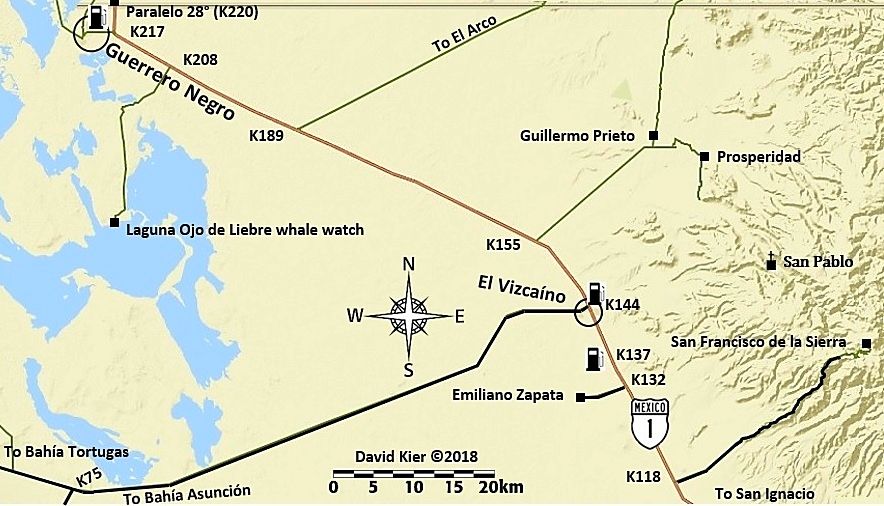
The distance to the Trail start (La Ilusion) from Hwy 1 via Guillermo Prieto is 57 miles. Coming south from L.A. Bay is 82 miles. However, driving to 'Las Palomas' (Km. 154.5) where the Guillermo Prieto road begins is a lot longer than driving to L.A. Bay... from the north.


twgracing - 11-1-2018 at 01:11 PM

Trinidad to El Gato was the biggest challenge . Had multiple GPS tracks but we’re only used for reference to pick our way through. Glad we were able to do it, and easily done from PSF to San Ignacio in a day.

JZ - 11-1-2018 at 01:41 PM

Quote: Originally posted by David K  


The distance to the Trail start (La Ilusion) from Hwy 1 via Guillermo Prieto is 57 miles. Coming south from L.A. Bay is 82 miles. However, driving to 'Las Palomas' (Km. 154.5) where the Guillermo Prieto road begins is a lot longer than driving to L.A. Bay... from the north.


Hmmm, yeah it is a lot further South to Las Palomas than I was thinking. The route through El Arco is 21 mile above it.

But extra 25 miles in the dirt is a lot further than highway miles though. And it's a super fast track in from Hwy 1, we were running parts of it 60-70 mph the last time I drove it. The BoLA route is good, but not near that fast.

Close call. Went South of BoLA a couple times last year, so not that important to do it again, especially w/o Pancho!


[Edited on 11-1-2018 by JZ]

4x4abc - 11-1-2018 at 04:42 PM

I so wish I could join you on a December trip - but I have 3 more months of daily treatment.

ehall - 11-1-2018 at 04:55 PM

Quote: Originally posted by blackwolfmt  
Cmon Bajatrailrider chime in with some current info


We were planning a trip about 18 months ago but I crashed and broke my wrist and had to cancel.

David K - 11-1-2018 at 05:40 PM

Roy, The squarecircle, called me today as he is reading this but is not been able to use his computer keyboard. This is a favorite area of Roy's as it is so remote and requires 4WD... places that I also like!

He has wanted me to see the beaches near Los Corrales for as long as I can remember.

Some points that Squrecircle wanted to relay was:
* that he has never seen anyone at La Ilusión.
*That Rancho Santa Barabara is abandoned as the family had passed on or moved on and the road to it is toast.
*Roy also wanted to ask about the graded road to San Miguel (from La Ilusión?): is that for real?

JZ - 11-1-2018 at 05:55 PM

Do you have GPS for Rancho Santa Barabara?

David K - 11-1-2018 at 06:20 PM

On Google Earth...
28° 3.451'N
112° 58.932'W

blackwolfmt - 11-1-2018 at 06:37 PM

Quote: Originally posted by ehall  
Quote: Originally posted by blackwolfmt  
Cmon Bajatrailrider chime in with some current info


We were planning a trip about 18 months ago but I crashed and broke my wrist and had to cancel.


IMG955473[722].jpg - 28kB

JZ - 11-2-2018 at 12:10 AM

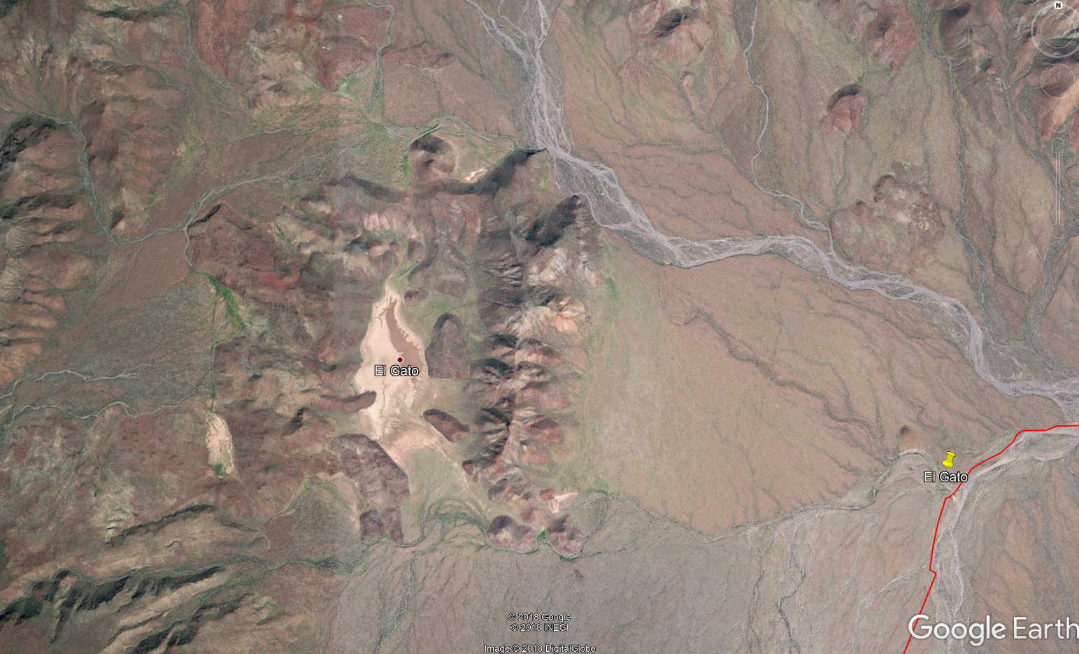
Anyone ever been out to the El Gato lake bed? Looks like a pretty interesting spot. About a 1.25 mile long. Could get some bad ass drone shots there I'd think.

I also spotted a good sized ranch about 20 miles Southwest of El Gato and 20 miles North of Hwy 1. Anyone popped in there? It's only about 3/4 ths of a mile off the trail.


[Edited on 11-2-2018 by JZ]

JZ - 11-2-2018 at 12:23 AM

Quote: Originally posted by TMW  


After the hurricane in 2014 the road from the Jct to R. San Miguel and R. Santa Barbara was wiped out and only the arroyos to follow which were loaded with rocks. That's what 4x4abc used when he got thru in March of 2015. Since then others have went thru making it easier to follow.

twgracing says the road to San Miguel has been graded. There was a short area after San Miguel and before Los Corrales that you had to drop down on the beach cross an arroyo then back up. Deep sand and lots of softball size rocks. The first time I did it, it was a bit of a problem. The second time no problem. The next problem area was from the ocean following La Trinidad arroyo to El Gato. There were rocks but not the problem. The problem was finding your way with out always back tracking. The ground was hard with rocks and it was hard to follow tracks. The second time I did it we had a GPS track but it was off in places. Getting out and walking ahead was the ticket. That's where your drone would come in handy maybe.

[Edited on 11-1-2018 by TMW]


Thanks for the info Tom.

StuckSucks - 11-2-2018 at 09:54 AM

Quote: Originally posted by JZ  
Anyone ever been out to the El Gato lake bed? Looks like a pretty interesting spot.


If you zoom in on the SW shore of the lake, there are streaks -- are these cow trails? They seem much too random to be dirt bike tracks.

David K - 11-2-2018 at 10:02 AM

The El Camino Real... See the link for its many routes on my website.

http://caminorealbaja.com/

[Edited on 11-2-2018 by David K]

TMW - 11-2-2018 at 10:18 AM

R. Santa Barbara is just south of a new ranch called Rancho Crestone. The lady there told Roy about R. Santa Barbara being abandoned.

JZ the ranch you saw about 20 miles SW of El Gato was probably Santa Marta. I haven't been to it but they have a chain link fence across where the road in meets it.

David K - 11-2-2018 at 01:42 PM

There is also El Rosarito, a ranch on El Camino Real, north of Santa Marta and south of El Gato.

JZ - 11-2-2018 at 02:14 PM

I see where it says El Rosarito, but don't spot a ranch there.

mtgoat666 - 11-2-2018 at 02:47 PM

Quote: Originally posted by StuckSucks  
Quote: Originally posted by JZ  
Anyone ever been out to the El Gato lake bed? Looks like a pretty interesting spot.


If you zoom in on the SW shore of the lake, there are streaks -- are these cow trails? They seem much too random to be dirt bike tracks.


Random? Well-used cow trails are never random, cows always have a purpose for repeating a path enough to make a visible trail.
On the other hand, motorcycles pick offroad paths that I would say are statistically more random relative to cow trails (those motorcyclists are more prone to whimsical routes than cows, though i have noticed that motorcyclists often display herd mentality in some ways).
Just sayin'....

JZ - 11-2-2018 at 06:26 PM

Quote: Originally posted by David K  


Are you using the El Camino Real GE link I have provided?

Here is the ranch, El Rosarito: 27° 39.919'N, 112° 54.417'W


I see it now. At least on the 2014 GE map it looks like the remnants of a deserted ranch.


JZ - 11-2-2018 at 06:36 PM

Quote: Originally posted by 4x4abc  
I so wish I could join you on a December trip - but I have 3 more months of daily treatment.


We tend to do each trip 2 or 3 times over about 6 months or so. Because I always miss something and want to go back. Or I crash the drone or the GoPro fails to record, lol.

So get well and we'll do it.

advrider - 11-2-2018 at 07:50 PM

Do follow up if you make it, I would love to try it in March when we are down that way...

Ken Cooke - 11-4-2018 at 08:12 AM

I am famous for not leaving camp B4 9am, so this t-shirt is factual! Would this Jeep make it? Asking for a friend.:lol:


IMG_20181104_070951.jpg - 79kB

TMW - 11-4-2018 at 01:36 PM

Yes

Fuel concern

John M - 11-5-2018 at 12:39 PM

Obviously the range for the bikes will determine your chances insofar as re-fueling. Once concern I'd have is that if there is a gate you simply cannot bypass, now what? Return to the start - would you have fuel to do that - of course it depends on where the gate is.

Reports of better roads replacing the rocky slow stuff we encountered will help to determine at the time just how far in your chase vehicle will want to go.

I assume you will be in communication with the chase crew in the event you'd need to turn around to where you "started."

From Rancho La Ilusion on the northern end the dirt road was in and out of washes, a couple of very rocky dry wash crossings and then somewhere about 4 miles south of La Ilusion was a steep rutted hill climb of 1/4 mile.

From the San Ignacio side it was, in 2017, a decent dirt road as far as El Gato, slow in spots for a pick-up, 4WD wasn't necessary for that section.

Remember that this was April of 2017 and Desert Bull's report was after our adventure and he is one of those who reported much better conditions.

Our group encountered no locked gates, the gate at La Ilusion south of El Barril has been open the several times we went through it. Desert Bull made no mention of gates either as far as I recall.

John M

4x4abc - 11-5-2018 at 02:48 PM

if there are locked gates, they will be close to Rancho San Miguel.
So, no problem to turn around when you come from El Barril.
Coming from the south and turning around at locked gates around San Miguel will require extra gas.
One locked gate reported here:
28° 1'33.33"N, 112°48'16.47"W

No problem Harald - unless

John M - 11-5-2018 at 03:40 PM

Unless the chase vehicle has gone on to the San Ignacio to wait for them. John

JZ - 11-5-2018 at 03:48 PM

Based on TWM's input and DesertBull's post, gonna try to take my truck through. Camp out a little North of Trinidad.


[Edited on 11-5-2018 by JZ]

David K - 11-5-2018 at 05:41 PM

Quote: Originally posted by John M  
Unless the chase vehicle has gone on to the San Ignacio to wait for them. John


InReach, satellite 2-way communication (or Sat phones) for the win!

BajaRun - 11-6-2018 at 10:35 AM

Are all of the mentioned trails wide enough for a Big Wide Prerunner Buggy ?

4x4abc - 11-6-2018 at 10:50 AM

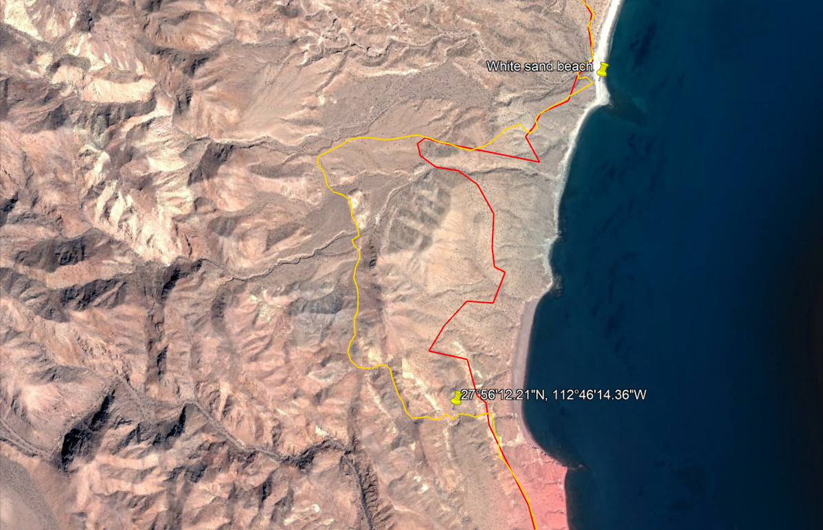
it gets very tight around here:
27°56'12.21"N, 112°46'14.36"W
would not take any wide vehicle on that trail
that is with knowledge from 2 years ago

if CFE has already dozed the new access trail for the proposed power line it will be wide enough for big trucks

JZ - 11-6-2018 at 11:31 AM

Quote: Originally posted by 4x4abc  
it gets very tight around here:
27°56'12.21"N, 112°46'14.36"W
would not take any wide vehicle on that trail
that is with knowledge from 2 years ago

if CFE has already dozed the new access trail for the proposed power line it will be wide enough for big trucks


That spot isn't on either of the set of of tracks I have. So, we'll see.


4x4abc - 11-6-2018 at 01:49 PM

on a bike you would run a different track (too narrow for cars though)
http://baja101.com/Baja-GPS/NoWimp.kmz

JZ - 11-6-2018 at 02:37 PM

Which one is the truck route, yellow?


geoffff - 11-6-2018 at 03:43 PM

Yes, if you look at the file contents/properties of the track 4x4abc just posted, the route you colored red is labeled "bike", and the yellow one is labeled "4x4 rural".

JZ - 11-6-2018 at 03:52 PM

Ok, I see that now.

4x4abc - 11-6-2018 at 03:56 PM

when the road to Rancho La Trinidad was built, a shortcut n the canyon was also established.
Haven't driven it yet, but for the next group of adventurers this would be cool.
http://baja101.com/Baja-GPS/shortcut.kmz

La Trinidad must have had some importance as it has an airstrip

JZ - 11-6-2018 at 05:19 PM

Quote: Originally posted by 4x4abc  
when the road to Rancho La Trinidad was built, a shortcut n the canyon was also established.
Haven't driven it yet, but for the next group of adventurers this would be cool.
http://baja101.com/Baja-GPS/shortcut.kmz

La Trinidad must have had some importance as it has an airstrip


Keep the knowledge coming!!

4x4abc - 11-6-2018 at 07:05 PM

some secrets need to be kept

JZ - 11-6-2018 at 08:17 PM

Quote: Originally posted by 4x4abc  
some secrets need to be kept


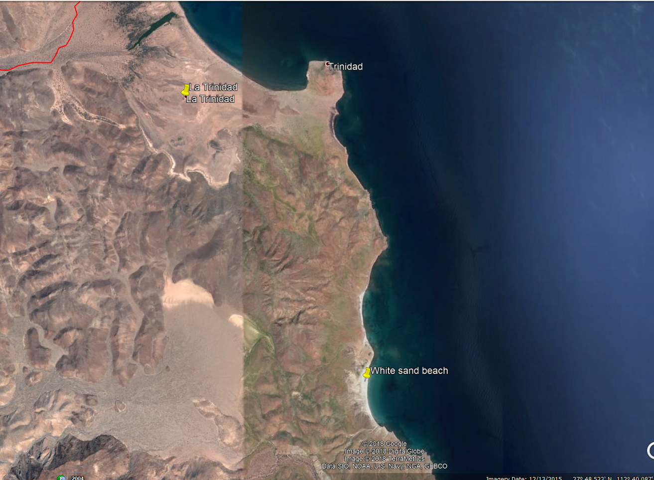
Have you ever gone to the beach 2.5 miles below Trinadad? Wonder if there is a route.

Looks really nice. I went by there once in a boat, but we just flew by.


4x4abc - 11-6-2018 at 08:48 PM

yes, you can get with a 4x4 to the beaches south of La Trinidad
adventurous drive

south of that is a trail from missionary times following Arroyo Portezuelo to Arroyo San Carlos

twgracing - 11-7-2018 at 08:41 AM

I wouldn't suggest taking anything other than 4x4. Plenty wide but the wash after trinidad is rock crawling.

Quote: Originally posted by BajaRun  
Are all of the mentioned trails wide enough for a Big Wide Prerunner Buggy ?

PaulW - 11-7-2018 at 09:44 AM

Time to do it. Sadly my schedule wont allow until early January
Anybody available in Jan?

4x4abc - 11-7-2018 at 10:05 AM

Quote: Originally posted by twgracing  
I wouldn't suggest taking anything other than 4x4. Plenty wide but the wash after trinidad is rock crawling.


Arroyo La Trinidad between Rancho El Gato and Rancho La Trinidad has a couple of bulldozed tracks on higher grounds - no need to rock bash all the way
you only need to find them, which has been hard the last few years due to the devastation of hurricane Odile in 2014.
We drove through it 2 years ago with stock Grand Cherokees. Don't remember it as rock crawling - it was pretty smooth.
Although we spent considerable time to find the entrance to the road around here 27°49'34.21"N, 112°46'6.26"W.
Close to El Gato ( 27°49'55.41"N, 112°50'20.26"W) finding a suitable track was difficult as well

4x4abc - 11-7-2018 at 10:52 AM

this is the latest reliable track for Arroyo La Trinidad I have:
http://baja101.com/Baja-GPS/A.LaTrinidad.kmz

here is an exciting bike shortcut in Arroyo La Palmita:
http://baja101.com/Baja-GPS/LaPalmita.kmz

JZ - 11-7-2018 at 11:16 AM

Quote: Originally posted by 4x4abc  
this is the latest reliable track for Arroyo La Trinidad I have:
http://baja101.com/Baja-GPS/A.LaTrinidad.kmz

here is an exciting bike shortcut in Arroyo La Palmita:
http://baja101.com/Baja-GPS/LaPalmita.kmz


Man, it looks like you could fool around in this area for weeks.

How difficult is that bike shortcut? Got any tracks to get from El Gato to the lake bed?

Fernweh - 11-7-2018 at 01:53 PM

Guys, it has been now verified, that the beach/trail access via Rancho San Miguel to Los Corrales is locked off.
It is now a private wilderness protection area, not sure how large, but apparently huge.....

Here is the note my friend (manager of that wilderness area) just send to me:

"It is correct, there is no access by the coast. Access to adventure vehicles, motorcycles is prohibited.
There are padlocked doors in my work area"

David K - 11-7-2018 at 03:01 PM

So so sad when 'public land' is closed to the public (at least on "adventure vehicles").

Thanks for the news Karl. Best to know before going in that far.

JZ - 11-7-2018 at 03:06 PM

We aren't giving up that easily.

StuckSucks - 11-7-2018 at 03:21 PM

Quote: Originally posted by Fernweh  
Guys, it has been now verified, that the beach/trail access via Rancho San Miguel to Los Corrales is locked off.
It is now a private wilderness protection area, not sure how large, but apparently huge.....

Here is the note my friend (manager of that wilderness area) just send to me:

"It is correct, there is no access by the coast. Access to adventure vehicles, motorcycles is prohibited.
There are padlocked doors in my work area"


Do you know what the name of that protected area is?

mtgoat666 - 11-7-2018 at 03:34 PM

Quote: Originally posted by David K  
So so sad when 'public land' is closed to the public (at least on "adventure vehicles").

Thanks for the news Karl. Best to know before going in that far.


Probably not public land. Very little public land in baja.
Wealthy people are buying up land and putting up fences.
If you want public land to explore, stick to canada and usa, and vote for the party that doesnt want to privatize public lands!

PaulW - 11-7-2018 at 05:09 PM

Studying Google Earth. I can see San Miguel and I plotted Harald's lock gate on the beach trail. Still trying to find the portion of the trail that is referred to and no access from San Miguel to Los Corrales. What are the coords for Los Corrales and San Miguel
Thanks

David K - 11-7-2018 at 05:44 PM

Quote: Originally posted by PaulW  
Studying Google Earth. I can see San Miguel and I plotted Harald's lock gate on the beach trail. Still trying to find the portion of the trail that is referred to and no access from San Miguel to Los Corrales. What are the coords for Los Corrales and San Miguel
Thanks


San Miguel (Boleo structure): 28° 5.698'N, 112° 50.130'W
Los Corrales: 28° 3.705'N, 112° 47.630'W

There may be more than one spot known by these names, but the above two are in the area. I have not personally been there but Roy (The squarecircle) has told me about these places so much, I feel I have been! I would like to see them.

4x4abc - 11-7-2018 at 05:45 PM

Mexico has the same rules as the US - if you have an established road running through your property, you can not block it.
But like most rich people, they will do it anyway.

JZ - 11-7-2018 at 05:54 PM


[Edited on 11-8-2018 by JZ]

blackwolfmt - 11-7-2018 at 06:28 PM

Boy with that attitude JZ, I bet You never...Catch and release:coolup:

mtgoat666 - 11-7-2018 at 06:35 PM

Quote: Originally posted by JZ  


[Edited on 11-8-2018 by JZ]


I carry a universal key in my truck, and spare padlocks, but I am respectful and wise enough to rarely use them. I have noticed that a lot of off-roading knuckle draggers don’t respect fences, and it is no wonder that off-roading knuckle draggers are despised by many

mtgoat666 - 11-7-2018 at 06:37 PM

Quote: Originally posted by 4x4abc  
Mexico has the same rules as the US - if you have an established road running through your property, you can not block it.
But like most rich people, they will do it anyway.


These mostly abandoned tracks are so little used that prescriptive easement rights are probably tenuous

bajatrailrider - 11-7-2018 at 10:48 PM

Quote: Originally posted by mtgoat666  
Quote: Originally posted by 4x4abc  
Mexico has the same rules as the US - if you have an established road running through your property, you can not block it.
But like most rich people, they will do it anyway.


These mostly abandoned tracks are so little used that prescriptive easement rights are probably tenuous
The Village Idiot has spoken anybody care. Nope:bounce:

PaulW - 11-7-2018 at 10:59 PM

Mentioned places
More coords please
Ilusion gate
Rancho Crestone
Santa Marta
Rancho El Rosarito
Thanks

motoged - 11-7-2018 at 10:59 PM

So....how many "off-roaders" here think cutting fences is cool?

JZ - 11-7-2018 at 11:08 PM

Quote: Originally posted by motoged  
So....how many "off-roaders" here think cutting fences is cool?


Expected to get someone like goat, but you?


PaulW - 11-7-2018 at 11:53 PM

Thanks
We are both doing the same research, but with slightly different tracks
Still looking for a go-around the private area with the gates. Looks like cross country with some big mountains.
I will use your WPs.
Thanks.

JZ - 11-8-2018 at 12:09 AM

Quote: Originally posted by PaulW  
Thanks
We are both doing the same research, but with slightly different tracks
Still looking for a go-around the private area with the gates. Looks like cross country with some big mountains.
I will use your WPs.
Thanks.


Worst comes to worst we are going to come up from the South and go North until we hit a gate.

Still investigating options and who we need to give a couple bones to.


ehall - 11-8-2018 at 07:36 AM


Screenshot_20181108-072823_Samsung Internet-540x1110.jpg - 114kB

4x4abc - 11-8-2018 at 07:39 AM

Quote: Originally posted by PaulW  
Mentioned places
More coords please
Ilusion gate
Rancho Crestone
Santa Marta
Rancho El Rosarito
Thanks


http://baja101.com/Baja-GPS/NoWimpsPoints.kmz

4x4abc - 11-8-2018 at 07:46 AM

Quote: Originally posted by ehall  


how about a precise location?
where is "back gate"?

BajaRun - 11-8-2018 at 07:51 AM

Quote: Originally posted by twgracing  
I wouldn't suggest taking anything other than 4x4. Plenty wide but the wash after trinidad is rock crawling.

Quote: Originally posted by BajaRun  
Are all of the mentioned trails wide enough for a Big Wide Prerunner Buggy ?


So a group (3) of very capable prerunners with 37" tires is not recommended? We have recently gone from Mikes to Coyote through the rock garden without issues. Is this section less passable then that Mikes to Coyote section? Thanks

ehall - 11-8-2018 at 08:07 AM

Quote: Originally posted by 4x4abc  
Quote: Originally posted by ehall  


how about a precise location?
where is "back gate"?


Just copied the screenshot from thumpertalk. Dont know the guy.

4x4abc - 11-8-2018 at 08:07 AM

the question was related to "wide" not to "capable"

motoged - 11-8-2018 at 09:04 AM

Quote: Originally posted by JZ  
Quote: Originally posted by motoged  
So....how many "off-roaders" here think cutting fences is cool?


Expected to get someone like goat, but you?


Okay, that's "1"....

Fernweh - 11-8-2018 at 03:40 PM

Please respect the property of others, as you normally wine about yours.

BTW If you enter UMA designated lands without authorization, you will land in jail and your vehicles will be confiscated.....if they catch you, or have your license plates.

Good luck

twgracing - 11-8-2018 at 04:15 PM

Harald I had your track through the arroyo as reference when I went through in May. We were able to jump out and follow it at points but in the wash there was no signs of any tracks before us. Trinidad to El Gato by far the most challenging trail wise. The 4x4 route before the salt flats was also a challenge but just slow going 2 track.

Maxtrax I would say at minimum in a 2wd prerunner, maybe even a winch. We found ourselves doubling back after taking smoother routes to only have it be a dead end finger or rock garden. Clutch and location would be my biggest concern. There is help within reason anywhere around Mikes and Coyote. There is nothing but the best of baja between San Miguel and Santa Lucia on Highway 1.

We took this road around Illusion dropping us right at the first locked gate. These guys were kind enough to let us through.
28°20'1.37"N 113° 1'39.42"W

Good luck!


Quote: Originally posted by BajaRun  
Quote: Originally posted by twgracing  
I wouldn't suggest taking anything other than 4x4. Plenty wide but the wash after trinidad is rock crawling.

Quote: Originally posted by BajaRun  
Are all of the mentioned trails wide enough for a Big Wide Prerunner Buggy ?


So a group (3) of very capable prerunners with 37" tires is not recommended? We have recently gone from Mikes to Coyote through the rock garden without issues. Is this section less passable then that Mikes to Coyote section? Thanks


IMG_2124 (2).JPG - 94kB IMG_2125.JPG - 111kB

[Edited on 11-9-2018 by twgracing]

twgracing - 11-8-2018 at 04:22 PM

Gate after Laguna Amador 28°16'37.06"N 113° 0'48.30"W was there, not locked.

Quote: Originally posted by 4x4abc  
the question was related to "wide" not to "capable"


[Edited on 11-8-2018 by twgracing]

JZ - 11-8-2018 at 05:00 PM

twgracing, can you post the route you went to get to the locked gate?

I see your GPS, but that's a good ways West of El Barril.

Any gates on the South end around Los Corrales?


twgracing - 11-8-2018 at 05:30 PM

We stayed in PSF the night before, only reason we went this way instead of going through El Barril and Rancho Illusion. Yes gate just south of Los Corrales. I believe Harald gave coordinates already.

Quote: Originally posted by JZ  
twgracing, can you post the route you went to get to the locked gate?

I see your GPS, but that's a good ways West of El Barril.

Any gates on the South end around Los Corrales?


Attachment: ELBarrilSC12.5.kmz (2kB)
This file has been downloaded 236 times

[Edited on 11-9-2018 by twgracing]

PaulW - 11-8-2018 at 05:33 PM

When we did the trip San Ignacio/Gato to Trinidad in 2009 one of the trucks was a 2wd Blazer prerunner. He did fine in the rocks, but we had tow him out of the sand. These 4WD trips we are discussing are not appropriate for 2wd. Even if you have a capable 4WD for support is is still quite a burden on everyone.
Cannot tell you how many times I have pulled a 2WD prerunner out of the sand. Very inappropriate for rock crawling and going slow in the sand.

JZ - 12-7-2018 at 08:11 PM

We are doing final prep for the run. Any more suggestions?

Still trying to figure out a way past the gates to run it North to South, but if our outreach fails we'll run it South to North until we hit a gate.