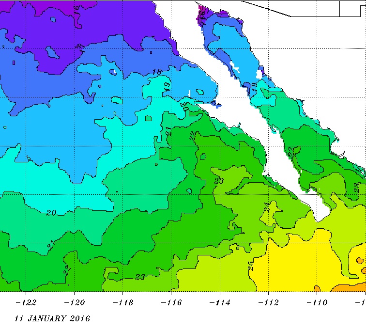
| There are no ATMs between San Felipe and Vizcaino using Gulf side roads and none between San Quintin and Guerrero Negro using Pacific-side roads
(200-300 mile stretch). All my trips of 1-2 weeks long last year, I never used an ATM once (if it gobbled my visa card, I would be toast). Buy the
pesos you need at a money exchange before entering Mexico. That way, if there is a problem, you won't yet be out of the United States. IF you run out
of pesos before the trip is over, ATM it or use dollars, everyone in Baja takes dollars, and sometimes at a better rate than the banks give.
|