BajaNomad

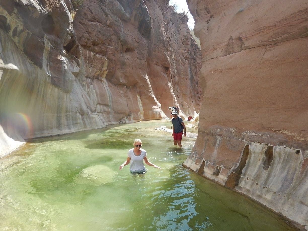
Where was this picture taken at?

JZ - 12-11-2018 at 10:11 PM

?


advrider - 12-11-2018 at 10:16 PM

Utah?

JZ - 12-11-2018 at 10:20 PM

That's what I was thinking. But saw it posted on a well know Baja site and was wondering if I some how missed a great spot on the peninsula.


[Edited on 12-12-2018 by JZ]

4x4abc - 12-11-2018 at 10:25 PM

I know a number of those narrow canyons with water in Baja - this one looks like around Loreto

willardguy - 12-11-2018 at 10:29 PM

mesquite

JZ - 12-11-2018 at 10:37 PM

Quote: Originally posted by 4x4abc  
I know a number of those narrow canyons with water in Baja - this one looks like around Loreto


Really?

4x4abc - 12-11-2018 at 10:42 PM

yup, the colors match Mezquite Canyon

JZ - 12-11-2018 at 10:51 PM

Drop us some coordinates my friend.

4x4abc - 12-11-2018 at 10:54 PM

will do

Barry A. - 12-11-2018 at 10:55 PM

Quote: Originally posted by advrider  
Utah?


To be more precise--------the Escalante???

JZ - 12-11-2018 at 11:10 PM

Well, you learn something every day.


https://writzofpassage.com/2016/07/06/water-hiking-in-mesqui...

David K - 12-11-2018 at 11:40 PM

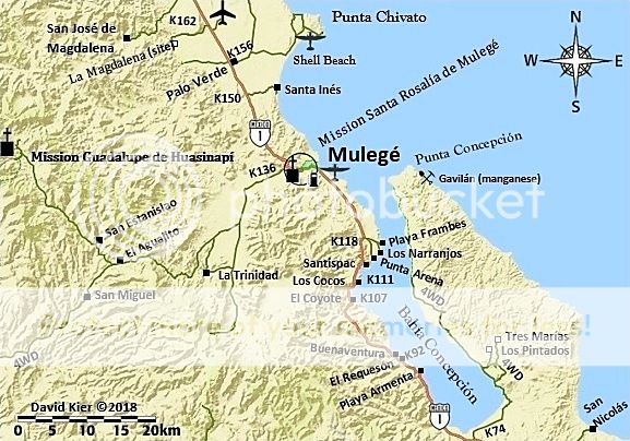
JZ, that looks like the Rancho Trinidad route to the cave art site, west of Mulegé.

Bubba - 12-12-2018 at 06:05 AM

Quote: Originally posted by JZ  
Well, you learn something every day.


https://writzofpassage.com/2016/07/06/water-hiking-in-mesqui...


Interesting!

John Harper - 12-12-2018 at 06:45 AM

What a cool little canyon. Thanks for sharing that spot.

John

gueribo - 12-12-2018 at 07:04 AM

Yes, that is Trinidad Canyon. It's not always this full of water. Pretty photo.

pacificobob - 12-12-2018 at 08:01 AM

as one might guess, those areas get used by cattle,goats and other critters.(more as time goes by since the last rains)and become a Petri dish of fecal bacteria. i have had pals swim/wade and become hosts of parasites.

advrider - 12-12-2018 at 08:56 AM

Nice find, thanks for posting. Looks like it would be an awesome hike.

nbentley1 - 12-12-2018 at 10:08 AM

Quote: Originally posted by David K  
JZ, that looks like the Rancho Trinidad route to the cave art site, west of Mulegé.


I was thinking the same thing but apparently not. Trinidad is a great trip that is also well worth the effort.

David K - 12-12-2018 at 10:20 AM

Quote: Originally posted by gueribo  
Yes, that is Trinidad Canyon. It's not always this full of water. Pretty photo.


I have not been there so only could say it looks like Trinidad as I had seen photos and videos of it. So, I guess Baja has two in-the-water walking canyon trails?

I guess JZ already knew as he got the photo from the link he later posted of Mesquite Canyon?

gueribo - 12-12-2018 at 11:48 AM

Does look like Trinidad, but there's more than one canyon that looks alike. Trinidad is a really special place--both for the cave paintings and the drive out. (Make sure you sign in with INAH before going.)

We had to do a bit of water-wading in some places, but it can be almost dry depending on the year.

Trinidad1.JPG - 244kB

gueribo - 12-12-2018 at 11:51 AM

Trinidad cave paintings and our guide, who no longer lives at the ranch.

Trinidad2.JPG - 236kB

JZ - 12-12-2018 at 12:11 PM

Quote: Originally posted by David K  

I guess JZ already knew as he got the photo from the link he later posted of Mesquite Canyon?


I found the pic first. It was on Doug's Baja Nomads FB page.


[Edited on 12-12-2018 by JZ]

David K - 12-12-2018 at 12:13 PM

It's a cool place indeed! Thanks for reposting here.

JZ - 12-12-2018 at 12:33 PM

So how do we get to Mezquite and Trinidad canyons?

StuckSucks - 12-12-2018 at 01:27 PM

Quote: Originally posted by JZ  
So how do we get to Mezquite and Trinidad canyons?


Or just a lat/lon, and I can take it from there.

David K - 12-12-2018 at 01:32 PM

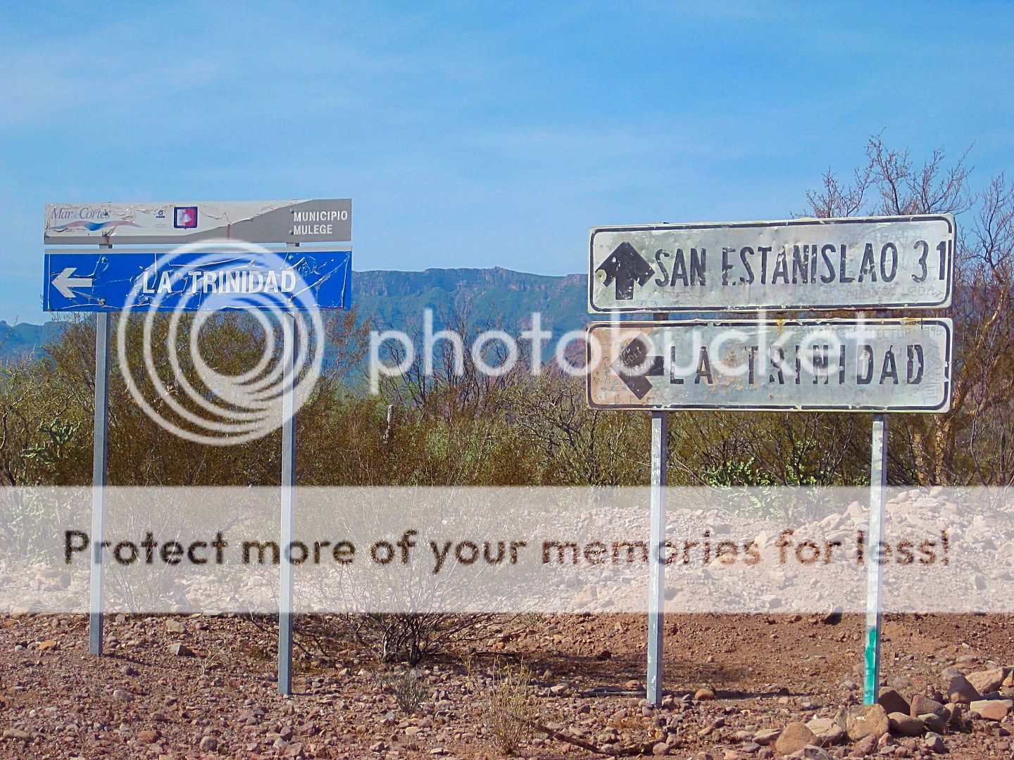
Rancho La Trinidad is well signed, west from Mulegé... You need a permit and a guide from the ranch to view the cave art. I did not have time to go, but others on Nomad can fill you in on how this is obtained.


4x4abc - 12-12-2018 at 02:01 PM

Mezquite Canyon (officially Arroyo Ligüi)
25°41'42.72"N, 111°17'56.15"W

Cañon de la Trinidad, part of Arroyo la Trinidad
26°45'18.86"N, 112° 7'57.08"W

JZ - 12-12-2018 at 02:43 PM

Quote: Originally posted by 4x4abc  
Mezquite Canyon (officially Arroyo Ligüi)
25°41'42.72"N, 111°17'56.15"W

Cañon de la Trinidad, part of Arroyo la Trinidad
26°45'18.86"N, 112° 7'57.08"W


Nice. I guess for Mezquite Canyon you just follow a trail along the wash from the hwy. to get there? Looks like about 4 miles off MX 1.

StuckSucks - 12-12-2018 at 03:59 PM

Quote: Originally posted by 4x4abc  
Mezquite Canyon (officially Arroyo Ligüi)
25°41'42.72"N, 111°17'56.15"W


Ah, what I was thinking. About 4-5 years ago I drove a couple miles up that canyon but had to abort due to a garden of basketball-sized rocks. Time to go back (and pick a better line). About a mile up-canyon from the highway, I left a photo sphere.

bajadogs - 12-12-2018 at 04:16 PM

This is 12 years old may give some info on Trinidad. Skip to Day 3. I was so glad we decided to hire Salvadore. My 4x4 would have made it but whatever he charged was worth it to avoid the hassle of proper paperwork and his knowledge of everything local. Pay the locals -

2006 Trip

4x4abc - 12-12-2018 at 04:38 PM

Quote: Originally posted by StuckSucks  


Ah, what I was thinking. About 4-5 years ago I drove a couple miles up that canyon but had to abort due to a garden of basketball-sized rocks. Time to go back (and pick a better line). About a mile up-canyon from the highway, I left a photo sphere.


you can drive about 2 1/2 miles into the canyon, right about then it gets narrow

BajaMama - 12-12-2018 at 04:42 PM

We did the Trinidad cave paintings tour with Salvator a few years ago. Interestingly, the part of the hike to the paintings that had water in the stream area was full of rocks and sand from a hurricane the previous year, hence no water. I would be surprised if it got dug out!

Anyhow, here is a link with his phone number. Las Casitas also has info I think.
http://www.hiddencorners.com.mx/cave-paintings-in-mulege/


[Edited on 12-12-2018 by BajaMama]

willardguy - 12-12-2018 at 04:49 PM

just out........


gueribo - 12-12-2018 at 05:11 PM

Where can that be purchased?

willardguy - 12-12-2018 at 05:21 PM

Quote: Originally posted by gueribo  
Where can that be purchased?


ad just came out a couple hours ago on facebook "baja classifieds"

advrider - 12-12-2018 at 06:12 PM

Quote: Originally posted by bajadogs  
This is 12 years old may give some info on Trinidad. Skip to Day 3. I was so glad we decided to hire Salvadore. My 4x4 would have made it but whatever he charged was worth it to avoid the hassle of proper paperwork and his knowledge of everything local. Pay the locals -

2006 Trip


Thanks for re-posting, very good trip reports. Could we not pin some of the better trip reports so they were easy to find?

Mulege Canuck - 12-12-2018 at 08:12 PM

It looks like the canyon we hiked. The residents of rattlesnake beach called it “Steinbeck Canyon”. Intead of turning left to Puerto Escondido go right. A short drive to the road end. You pass a great spot to get water.

There is a rope you have to use to get through a boulder pile. Sure looks like the same spot. We met some people from Loreto with a guide on our way out. They did not go up the rope.

gueribo - 12-12-2018 at 10:44 PM

Quote: Originally posted by willardguy  
Quote: Originally posted by gueribo  
Where can that be purchased?


ad just came out a couple hours ago on facebook "baja classifieds"


Found it...also available online at http://hikingloreto.com/

Skipjack Joe - 12-13-2018 at 11:05 AM

Quote: Originally posted by Mulege Canuck  
It looks like the canyon we hiked. The residents of rattlesnake beach called it “Steinbeck Canyon”. Intead of turning left to Puerto Escondido go right. A short drive to the road end. You pass a great spot to get water.

There is a rope you have to use to get through a boulder pile. Sure looks like the same spot. We met some people from Loreto with a guide on our way out. They did not go up the rope.


That's a different hike. It's more difficult but the pools are clearer. There's also a hike between the two canyons that you have to drive through a gate.