
David K - 3-7-2019 at 03:46 PM
On my Facebook Baja Missions page, I rotate through different mission photos and facts every so often. Today, I put up a different mission building,
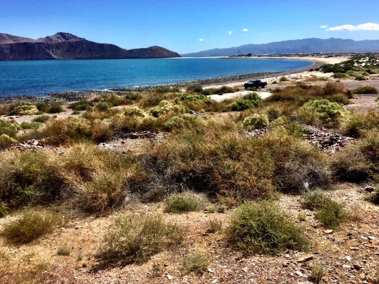
one that only a few know much about but has been the source of study by archeologists... the mission warehouse on Gonzaga Bay.
Link to Baja California Land of Missions Book Group:
https://www.facebook.com/groups/bajamissions/
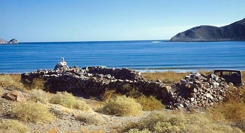
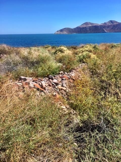
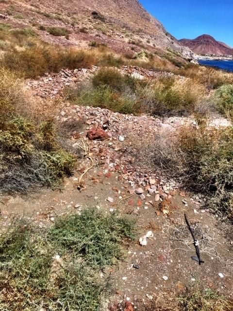
These are the ruins of the mission-era warehouse on the edge of Bahía San Luis Gonzaga as seen in 1958. The ruins date to the Franciscan period
(1768-1773) and were likely used by the Dominicans who followed (1773-1849). Extensive archeological work has been performed here by Dr. Eric Ritter
who published a paper on it. https://docs.wixstatic.com/ugd/488b16_d6a1399d09974ddd9dd3b0...
Many expeditions and supply ships landed on Gonzaga Bay with supplies brought north from Loreto. The supplies mainly served the missions from San
Fernando de Velicatá and north. Mission Santa María is in a different canyon, south of the cargo trail from Gonzaga Bay and after 1769, declined in
importance. The cargo trail is also known as the Antelope Spring Trail as Junípero Serra called it, seeing either Bighorn sheep or Pronghorn and
mistaking them for antelope.
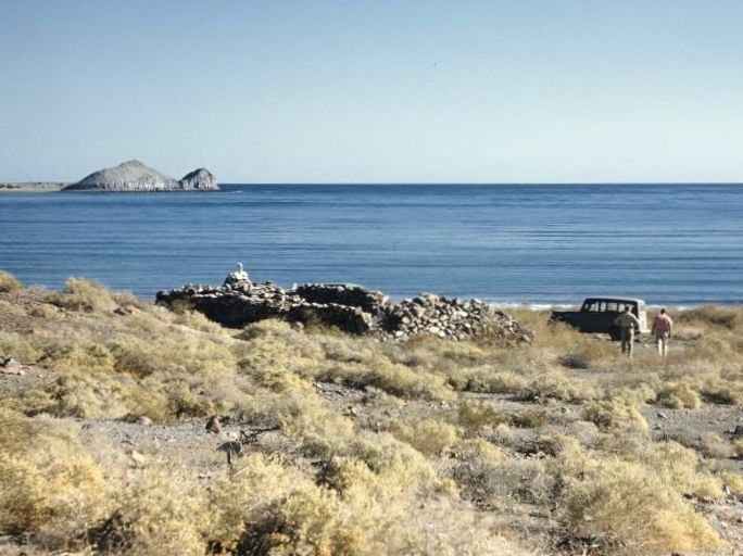
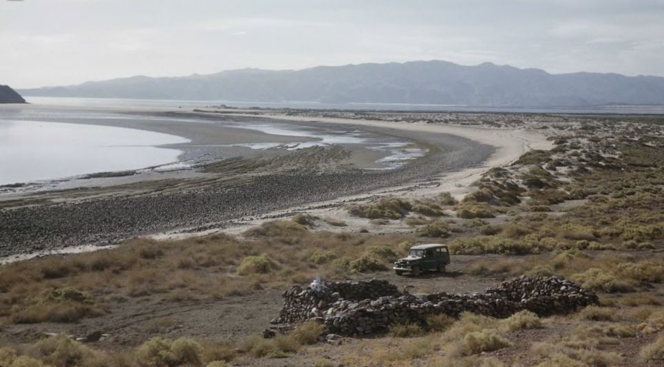
Photos from Howard Gulick in November 1958. The lower photo is looking towards where Alfonsina's would be established. The upper photos show Punta
Willard, next to Papa Fernandez' camp.
When I visited the site in November 2002:
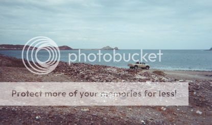
This is located about due east from the military checkpoint, over a hill. I drove to it from near the Pemex station using one of the many tracks
heading north, towards the bay. See Dr. Ritter's paper for newer photos and a sketch as to what the warehouse may have looked like.
2019 Photos at the 250 year old site.
David K - 3-24-2019 at 11:15 PM
Thanks to a Baja Nomad (I will let him ID himself if he wants), here are some new photos of the ruins that date back to a time shortly after Junípero
Serra founded his first (Baja) California mission at Velicatá, and named it San Fernando... then established San Diego, etc.
The mission program warehouse on the shore of Bahía San Luis Gonzaga in 2019, nearly invisible from the weeds...
Alfonsina's in the background.
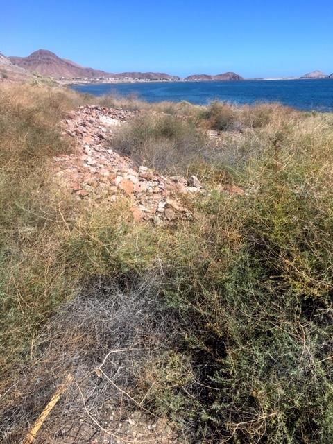
Papa Fernandez' in the background.
[Edited on 3-25-2019 by David K]
David K - 3-25-2019 at 08:36 AM
Thank you (Gonzaga Nomad) for the larger image!
BajaRat - 1-12-2020 at 11:19 AM
Is it just me or does the sea level appear to be higher in the later photos 
I’m ribbing you David and thanks for the cool shots.
It looks like the last 50 years haven’t been so kind to this arch site
Lionel
David K - 1-12-2020 at 02:06 PM
Time erases much...
It was just a thrill for me to see the ruins as described by Howard Gulick in the outstanding Lower California Guidebook when I went to them in 2002,
and then be able to see his 1958 photos on the internet.
A Nomad who had a home at Papa Fernandez' claimed the ruins were not there but then, Eric Ritter did an archeological dig in 2011 and documented it in
the fine paper I linked above.
The 2019 photos show if you go to the site, the perimeter wall is still very visible. The warehouse likely was built in late 1769 or soon after by the
Franciscans in support of the expansion into Alta California.
David K - 12-25-2020 at 06:37 PM
In our generation (Nomads and parents of Nomads) we are literally watching history vanish... adobe missions like San Fernando and Santo Tomás, visita
ruins like San Juan de Dios and La Magdalena, and more.
Please take photos of all historical sites and post on the Internet, the only way to preserve a site from the time you saw it.


