Quote: Originally posted by larryC  | | The old road from BoLA to San Francisquito, it goes through La Bocana. You turn off of the graded road at about K35 (where there are 2 tires stood up)
south of Bola and go through a couple of ranchos and then at La Bocana you have to navigate a washed out portion and then on south to meet up with the
graded road to San Francisquito at about K80. Fun little out of the way loop. |
As there were no kilometer markers, do set your trip odometer to zero when you leave the pavement in L.A. Bay town (tire shop/ Xitlali market).
Pass Las Flores jailhouse (see it off to the right) at Mile 9.7.
The old road going right, via La Bocana valley, is at Mile 22.1.
I would have to rate this road as 4WD only and very slow/ rough. You will pass by some of the largest cardón cactus in Baja along the way.
If you pass it, the Bahía las Animas road is about 4 miles further.
The old road rejoins the graded road at Mile 56.3 (on the new road). The old road is very difficult to spot, coming in from the right-rear. Only
motorcycle tracks on it. GPS: 28°26.057', -113°10.444'.
This old road was made famous in the 1967 Erle Stanley Gardner book, Off the Beaten Track in Baja. They opened/ repaired the old road in Feb. 1966. It
does not appear on any maps before then.
This 1989 AAA map has both the old and new roads shown:
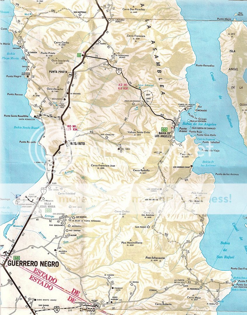
Note that the ranch showed as "San Pedro" is actually La Bocana. |