BajaNomad

Trails to the San Juan Mine, south of L.A. Bay.

David K - 10-29-2019 at 09:13 AM

Let's post here all the trail notes for getting up the mountain to see the ghost town and mine of San Juan.
I will copy and paste here any of interest...

From 2012 (note GPS was set at map datum NAD27 Mexico to match with topo maps. Google Earth is at WGS84, so it will not be the same spot, but close):

The railroad line runs 5.4 miles from the ruins of Las Flores (south of Bahia de los Angeles) to the bottom of El Terminal canyon where a cable bucket tram line brought the ore down from the San Juan mines high atop the sierra.

Here is the railroad bed at Las Flores heading south...


========================================================

Here is the railroad bed near the terminal (south end)...


=======================================================

As the railroad approaches the terminal platform, the line is elevated via this ...


=========================================================

Here is the terminal platform where Dr. Abraham Vasquez ('Doc' of Camp Gecko) shows me where giant wheels were once mounted at the bottom of the cable tram line. Here the ore was dumped into train cars for the trip north to Las Flores where the ore was processed...


======================================================

Doc and I pose by one of the tram tower timbers as we hike up the canyon...


======================================================

One of the ore buckets that litter the canyon bottom (the good stuff has already been removed and some is on display at the museum in Bahia de los Angeles...


=========================================================


In 2003 my daughter and I went back for another look...


========================================================

GPS and Mileage Notes (map datum NAD27 Mex.)

0.0 Camp Gecko Driveway (4.1 mi. so. of pavement/ town): 28°53.96', 113°31.85'

5.7 The old Las Flores jail is 0.3 mi. to right.

8.1 Top of long grade, a poor road continues ahead (28°46.98', 113°32.00'). Main road to Punta San Francisquito bends left.

11.1 Park where railroad crosses, now going from south to north, uphill. Platform at 28°44.73', 113°32.54' a short walk north from the road.

The auto road continues a short distance ahead to the trail going up Terminal Canyon to the San Juan mines. Before the cable tramline, pack animals brought the ore down the mountain.

===========================================================

The museum of Bahia de los Angeles... on the outside, to the right, is a display of the railroad and ore tram bucket system... In front of the town plaza is the locomotive that was left at Las Flores and an ore car that came from the smaller gauge train line up at San Juan...


-----------------------------------------------------------------------------------

Years ago, at Las Flores...


Erle Stanley Gardner, 1966.


From Marv Patchen's 'Baja Adventures' (1970's photo)


Railroad map from this book...


Rail bed, looking south 2009.


Looking north, 2009.


The railroad bed, just west of the Las Flores jail...


2002 notes:


---------------------------------------------------------------------------------------


Map for reference.... stars placed by Las Flores and San Juan mines, terminal platform noted with arrow. Mileages from Las Flores (east of jail house on graded road) to the junction with the road that continues uphill to the terminal (2.4)... and then 3.0 on to the terminal on the minor road (overgrown brush will scratch vehicle).

It should be noted that the original topo map is incorrect with the placement of the graded road south of Las Flores (I doctored the map to correct its location), and in naming Arroyo el Terminal: It is labeled at the next arroyo south of where it really is! Too faint to see in this reproduction...

Google Earth allows you to see the railroad line route as it circles at the terminal, otherwise hidden by vegetation on the ground... next!


Terminal Platform at south end of railroad.

Here ore buckets came down the mountainside using a cable tram (see L.A. Bay museum for display).


Here's a look at the mountain the ore came down from... Originally using mules, then the cable tram bucket system.


Here is the San Juan Mine, on the top of the 4,200' mountain where gold and silver were extracted... there were other mines, as well... A tiny railroad line went from here to the top of Terminal Canyon where the ore buckets were loaded.


Tiny railroad line in the San Juan Valley... elev. 3,836'


Here's the top of the cable tram line route...


From the bottom of the tramline, the Las Flores Railroad took the ore to Las Flores for processing into ingots...

Here is where the San Francisquito road makes a bend, 2.4 miles from Las Flores and the road and railroad to the terminal:


Here is near Las Flores at the north end of the railroad line:


Now, about that 'road' up to Las Flores... I recall that Larry said it was pretty well gone, after reviewing previous posts.


================================================================================

From Neal Johns in 2012:

Quote: Originally posted by Neal Johns  
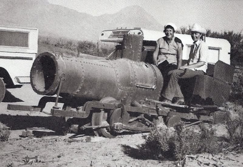
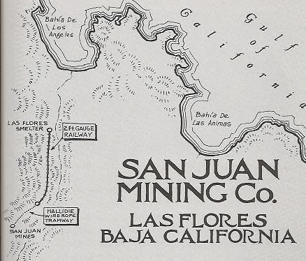
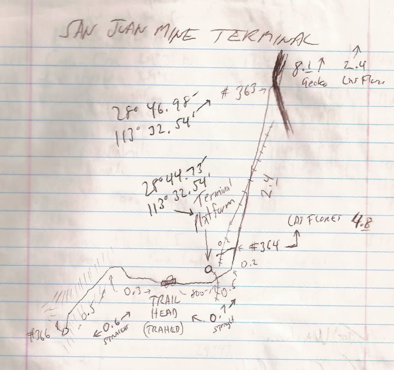
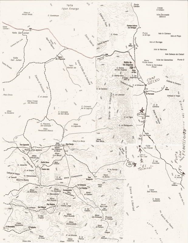
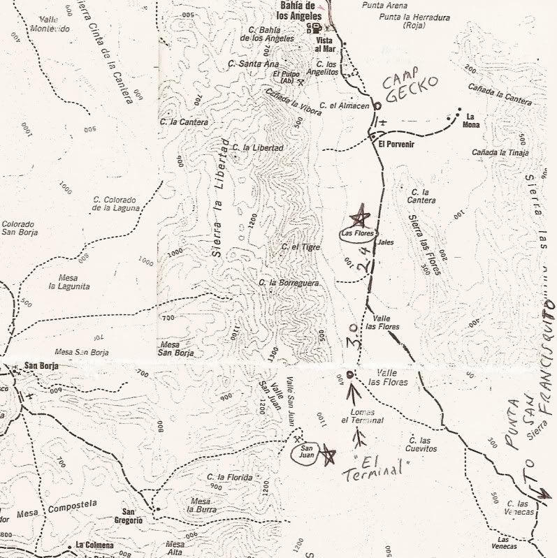
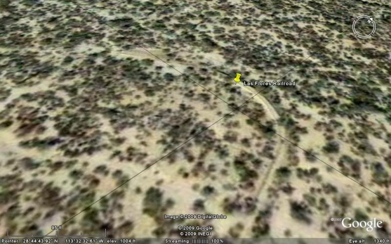
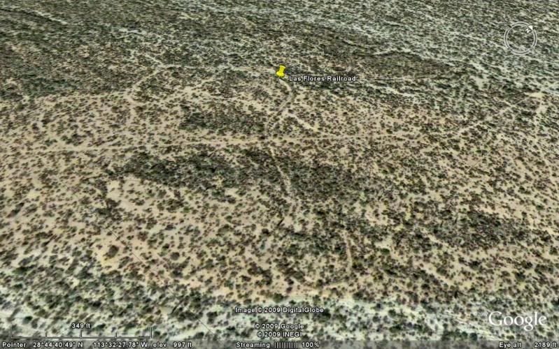
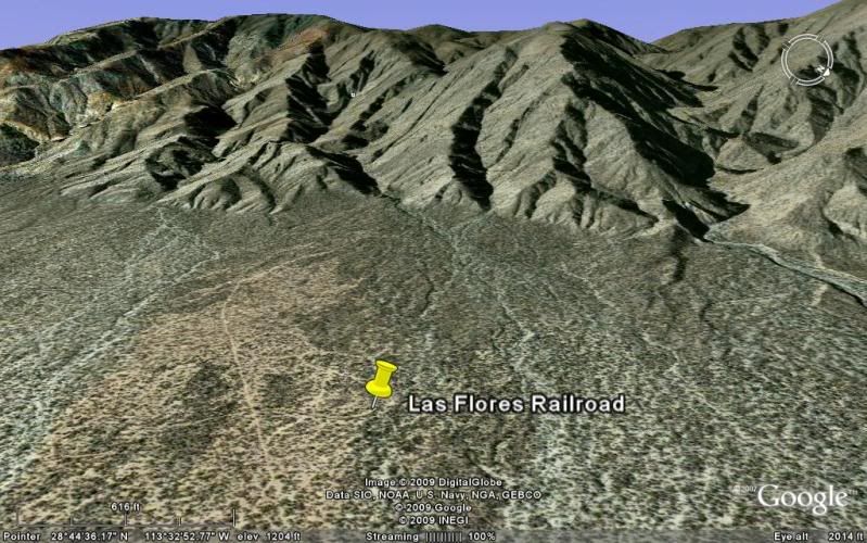
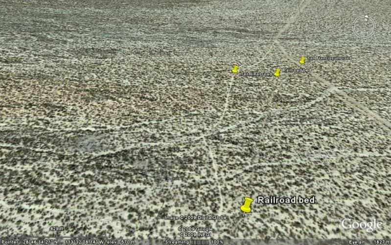
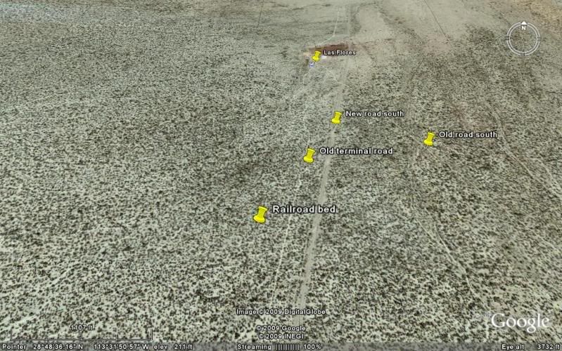
About that road to Los Flores (San Juan) mine....

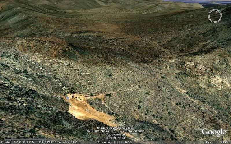
The reason we stopped was my friend in a 4Runner was handicapped (no useful legs) and we had a little trouble with a tire that rolled off a rim. We got about 2/3 of the way up and the road was still passable. I had my pop-top camper on my Tacoma. A little brushy the first half mile.

Time for a Jeep to try it! Ken?

At Mission San Borja, drive straight through the compound, up a short rocky hill to go along the left side of Arroyo San Borja for 0.3 miles where the road goes right and crosses the arroyo and climbs up to the mesa/airport. At the far end of the airport, take the left fork SE toward San Gregorio. 
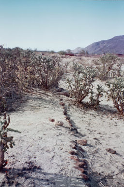
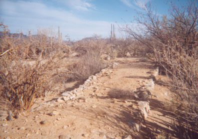
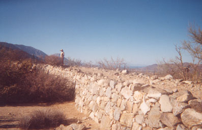
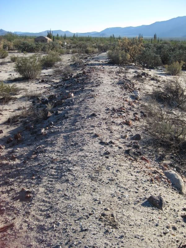
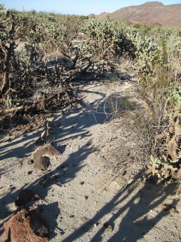
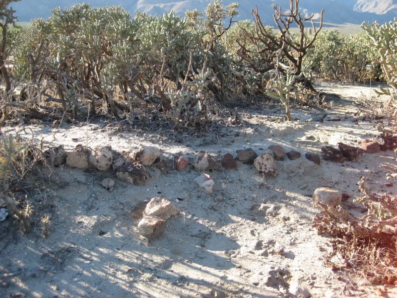
About seven miles from the Mission the road goes over some white soil (probably an old spring) and for sharp eyes there is an old stone wall corral on the left. This is the area of San Juan (Rancho). The faint road to the mine is on the right side of the corral and goes NE away from the road which continues to Rancho San Gregorio and Rancho Nuevo (about a mile further).


[Edited on 10-29-2019 by David K]

San Juan corral [640x480].jpg - 48kB

mtgoat666 - 10-29-2019 at 09:54 AM

here is the san juan mine. lots of old roads/trails visible on GE in that area

28°42'38.35"N, 113°34'40.41"W

[Edited on 10-29-2019 by mtgoat666]

David K - 10-29-2019 at 01:19 PM

Quote: Originally posted by mtgoat666  
here is the san juan mine. lots of old roads/trails visible on GE in that area

28°42'38.35"N, 113°34'40.41"W

[Edited on 10-29-2019 by mtgoat666]


That is the mountain, and there are diggings in more than one place, but the main mine entrance is on the east side and you can follow the train tracks right to it: 28° 42.650'N, 113° 34.495'W

From the Mysterious airstrip thread, Oct. 2019

David K - 10-29-2019 at 01:38 PM

Quote: Originally posted by VermilionSeaInstitute  
Sure thing, yes, we're available to accept visitors and provide meals and lodging. It's $30 per person per night. Just shoot me an email to arrange dates.

We don't plan regular excursions to San Juan mines, but do have other excursions available. San Juan Mines are better accessed from Bahia de los Angeles. There's no direct route between Rancho San Gregorio and Bahia other than through San Borja and the main highway.


[Edited on 10-27-2019 by VermilionSeaInstitute]