H5 on 2/1
San Felipe to ~k61 new paving some with stripes. All the dips - vados remain as before.
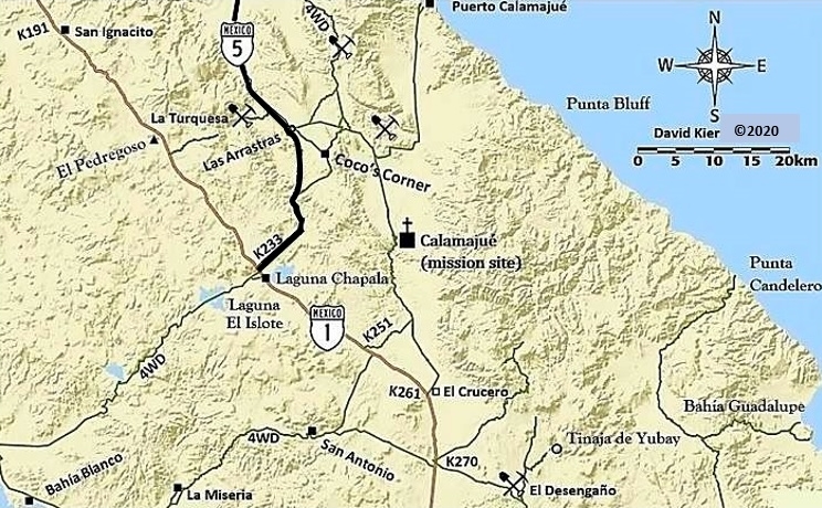
~k61 – k62 new bridge, K65- k66 new bridge, K70 – k71 new bridge. Matomi turn not affected.
Mostly dirt from ~k61 - k71 – not measured. In the dark the dirt exits are hard to see but slowing down works. Good dirt road bypasses.
No unpaved sections south of the Coco turn all the way to Hwy 1. Some areas are signed and striped. Other areas are newly paved. Did not drive H5
from Km180 to Gonzaga. We were in the dirt to the east for that section.
The new H5 has very few km markers, just south of the Coco turn is signed k180. Big Coco sign.
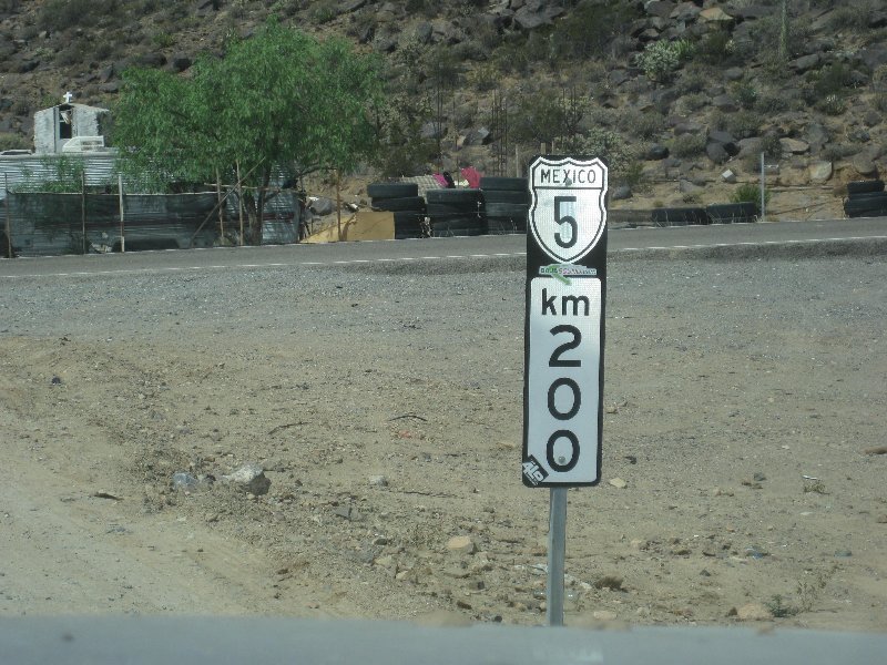
Approximately 100-200 feet north of Hwy 1 is the Km 201 sign for the new Hwy 5.
|


 Coco.jpg[/img][/url]