Dan makes it sound like the Covid check is south of the toll both and south of the free road connection... but if it is north of the Hwy. 3 junction
on Hwy. 1, then using the El Tigre cut across between Hwy. 1 & 3 will do it! Easy peasy... LOL
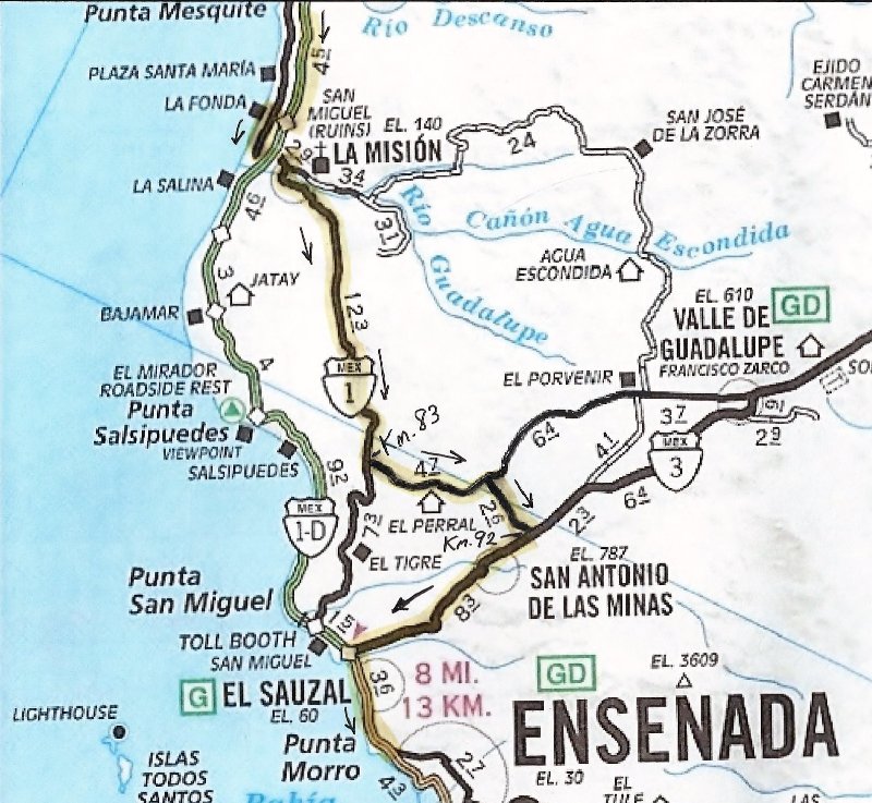
On this 2010 map, the road is not paved, but it is the one above El Tigre that passes El Perral, 4.7 & 2.6 miles long...
KM. 83 on Hwy. 1 and KM. 91.5+ on Hwy.
Save for the very first comment on my question, the comments and suggestions that follow are what this site is all about. You guys rock. Been
traveling to baja since I was 10...47 years now. Being a creature of habit, I always take the same routes; hence my lack of knowledge on other routes.
Is there any way that someone can highlight the exact route to take on the map that DK provided? Thank you kindly.
[Edited on 5-20-2020 by David K] |