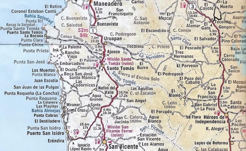
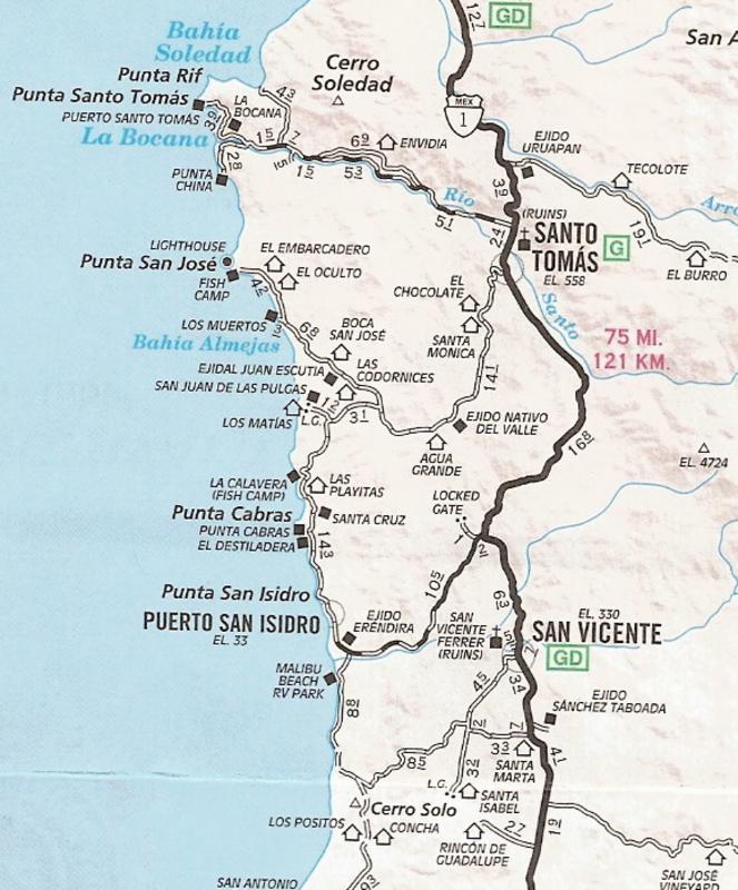
You can access that area or get damn close to it, via moto or agile 4x4, from the "old dump road" just past Vonny's Fishing in the Campo La Jolla area
(on the way to La Bufadora). Turn left toward Arborlitos and left at the old campground. Follow the ridgeline to where you are forced to turn right
(as the road to the peak with the signal equipment is gated). From there you head down to the beach. Not many directions are needed as you can see
where you need to go. Then just follow the beach south. There are some steep inclines up out of the assorted washes that empty to the sea. A skilled
moto rider and/or 4x4 person would probably do okay.
I don't don't know formal directions, but you can kind of intuit where to go as you are up on the top of the peninsula most of the time and once down
on the beach - just head south. I've seen old 50s-60s Chevy pickups back in there, so there much be an easier road.
|