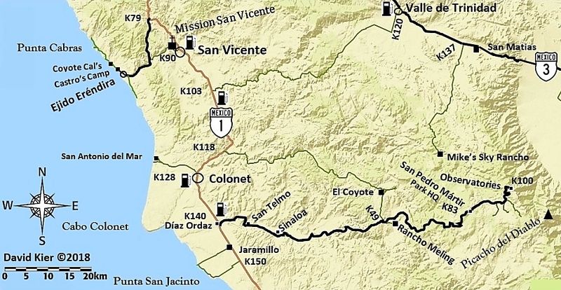
Covid 19 pending... planning on cycling to the top of Parque Nacional Sierra De San Pedro Martir, maybe 9000ft plus, sometime in late May of 2021. At
age 64 it's better now than later. Depending on fitness, in either one or two days.
Would like to attend the Sea Otter Classic either before or after, the Classic is May 20-23rd. Just in the planning stages, may go hardcore and
use my Dodge Caravan, or my more comfortable Mini Winnie Winnebago 21fter. Depends on who I can whip up.
This would be my 41 trip to Baja since about 1978, mostly spent on the East Cape fishing, diving, and surfing. La Ventana to Nine Palms and
everything in between. Love La Paz. Hope to spend at least a few days to several in the area...camp at Meling ranch and at the top.
Like to gather more info as I have never been there, such as any gravel sections of the road, temperature at the bottom and top, total distance,
favorite ceverza drinking spot, etc.
If anybody is crazy enough to try this, let me know, should be a good flogging.
Thank you for any good information, Ron |


 Not trying to be picky with the road log. Somewhat off-topic for those few of us who geek out on Baja trivia.