Hi guys. I am looking for a easy to use GPS for recording dive sites from the boat ⛵.
Thanks liguiBajazly - 1-17-2021 at 02:03 PM
Gaialigui - 1-17-2021 at 02:26 PM
Just looked Gala looks good. Will look into it more. Thanks learned something New today. JZ - 1-17-2021 at 03:36 PM
Navionics is the top boating GPS app.
Gaia is an offloading app. It is good for satellite imagery of bays if you have cell service or have downloaded the imagery. Back Country Navigator
is very similar.
Navionics should be your first go to. We use Navionics and BCN.
Mulege Canuck - 1-17-2021 at 04:24 PM
I use navionics for my boat and when I am Boonie Bashing in the mountains. It enables you to use satellite imagery for off road stuff. You can plot
courses ahead of time, download maps for offline use and save waypoints. It also gives you tide and current data.
I recommend it.JZ - 1-18-2021 at 10:14 AM
You can import way points and tracks in GPX format into Navionics.
It also has turn by turn navigation, almost like a road app. Super smart. It worked like a champ in finding routes through challenging Florida keys
with all the islands and shallow water.
You can search for islands, bays, way points, and even businesses and marinas.
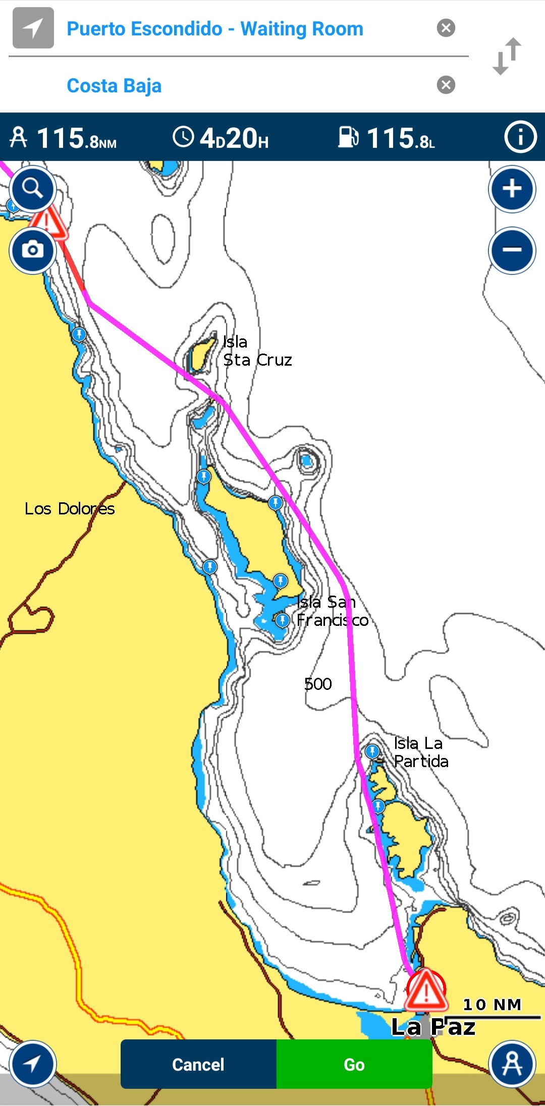
This is an auto route it made by searching for Puerto Escondido and Costa Baja. It will go right between channel markers, and every thing.
[Edited on 1-18-2021 by JZ]Sunman - 1-18-2021 at 06:42 PM
Gaia.
I have officially retired my old garmin 60csx.
I’ve yet to find a remote dirt road that doesn’t show up on the usgs topo layer. It’s too easy to use. mtgoat666 - 1-18-2021 at 07:39 PM
Hi guys. I am looking for a easy to use GPS for recording dive sites from the boat ⛵.
Thanks ligui
Most any gps app on your phone can record waypoints.
If you want navigation on water too, navionics will run on your iPad or iPhone (or android or attached to a chart plotter) and subscription is about
$30 per year.