
bajaric - 7-31-2021 at 11:47 AM
Juarez trip last week:
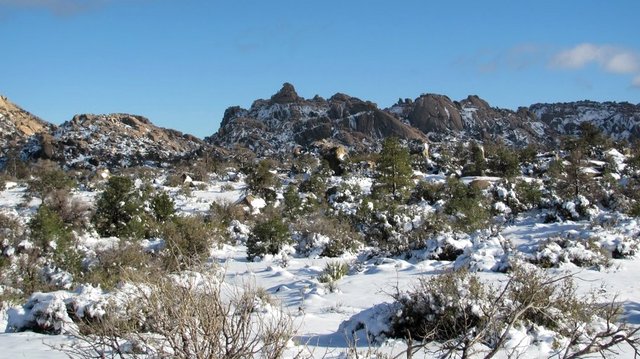
Crossing south at Tecate got the red light, quick search, and I was on my way. Camped on the uninhabited plateau north of Rancho el Topo.
Considering how close it is to the border, not to mention Tijuana and Mexicali, it is remarkable how few people visit this area.
In this area the only noise is from an occasional jet on the approach to SoCal. The stars are not quite as bright as in other parts of Baja but they
are still pretty bright compared to Southern California.
I noticed the vegetation is drought-stressed. Some of the cactus and shrubs I have seen before at my little secret camping spot have died. However,
the white sage is doing well; thousands of sage plants are pushing out tender new leaves. White sage can be used for cleansing ceremonies. It also
goes great with chicken!
On the return crossing northbound at Tecate (Wednesday 9:30am) there were only three cars ahead of me in the line. Wow! Quite an improvement from
the last time I crossed when the wait was 2.5 hours. The Ejido gate south of La Rumorosa was open, as it usually is. (Someone reported it was closed
in the initial stages of the pandemic a year ago)
Picture shows the granite mountains at the headwaters of Canyon Tajo a well known rock climbing area.


[Edited on 7-31-2021 by bajaric]
David K - 7-31-2021 at 12:00 PM
Wonderful report. Glad you got to enjoy that 'Baja feeling'.
BornFisher - 7-31-2021 at 03:13 PM
Sounds like a great trip. Good call!
BTW I crossed at Tecate Thurs. morning around 10. Same deal, 2 cars in line!
JZ - 7-31-2021 at 03:20 PM
Nice little get away. Thanks for sharing.
John Harper - 7-31-2021 at 03:32 PM
That looks like a really cool spot! Those mountains are spectacular.
There's nothing like the sounds of...nothing.
Glad you had a relaxing trip. Looks like a Jeffery pine behind truck, maybe another species, too?
John
[Edited on 7-31-2021 by John Harper]
AKgringo - 7-31-2021 at 04:54 PM
I have only spent one night camped in the northern Baja mountains, and that was near Laguna Hanson.
If I lived a little closer to the border, it would be fun to do a bit of exploring around there, but so far I just pass through the area on my way
south!
Thanks for posting this!
Maderita - 8-2-2021 at 04:43 PM
bajaric, Glad to see that you enjoyed the area. Did you go in to the climber's base camp? Looks like you missed the monsoonal afternoon thunderstorms.
It rained heavily there later in the week.
Here's a similar view from January 2010:
bajaric - 8-3-2021 at 07:31 AM
Hi Maderita, I was near the base camp, but off by myself some distance away. There is a whole network of dirt roads that fan out across this old
mining area offering numerous spots to camp. The habitat is called the 'pinion-juniper" forest. Not sure what kind of trees the tall straight pines
are. The pinion pines are more scraggly and bent, not tall and straight.
I guess I dodged the monsoonal rains. At one point a big cloud was overhead and heard some thunder. Suddenly the air felt like it was electrically
charged and I there I was sitting under a tall tree under a metal-framed sun shade so I got in the truck just in case but after a while the thunder
clouds drifted away.
DK, you should include Rancho el Topo on your travel guide map. It is the about only place to stay in this area that offers some semblance of
security. Otherwise it is primitive camping, no cell signal, complete isolation. Did not see another person for the 2 days I was there, though I did
hear a few vehicles bouncing along the washboard on the main road 1/2 mile away. It is so quiet that you can hear a vehicle approaching from a long
distance away. Then you wonder who might show up; a free spirited rock climber, a friendly ranch hand, or, someone else.....
Did not have to worry about snow on this trip. It was about 89F during the day dropping into the mid 50's at night. Not so bad in the shade with the
breeze but out in the sun it was hot.
[Edited on 8-3-2021 by bajaric]
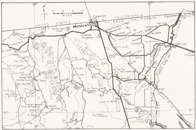
Maps maps maps
David K - 8-3-2021 at 08:50 AM
Hi Ric,
Thanks for the suggestion!
In my road guide, I do have the side road to Rancho el Topo (Mile 35.6 north of Hwy. 3... or 15.8 miles north of Laguna Hanson).
On the new Benchmark Baja Atlas, it is shown as "Rancho el Topo Sierra Juárez" and lots of mine symbols are in that are!
Here is how the 2009 Baja Almanac shows the area:
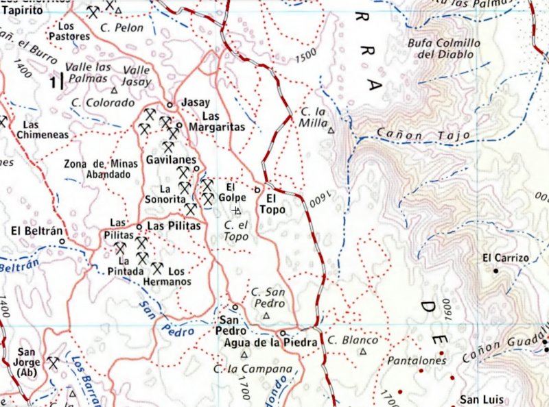
The main road bypasses the ranch now, so it is a mile or so to the west.
In 2010, AAA map:
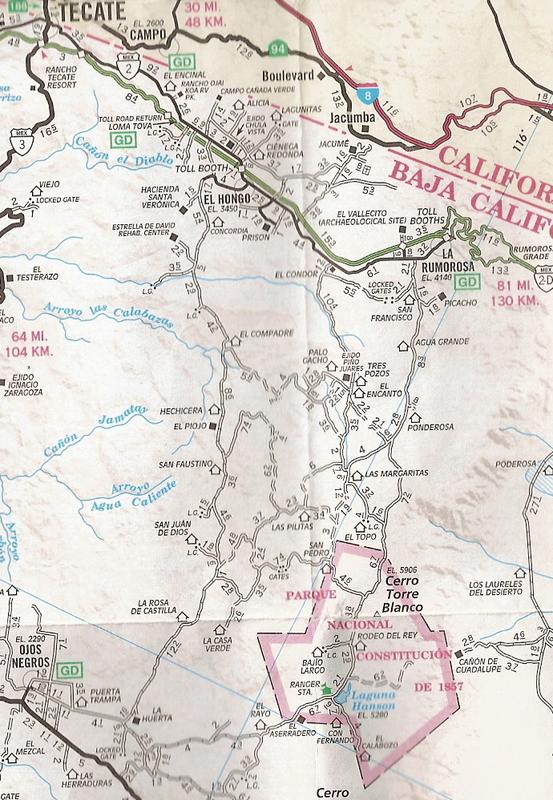
In 1974, AAA map:
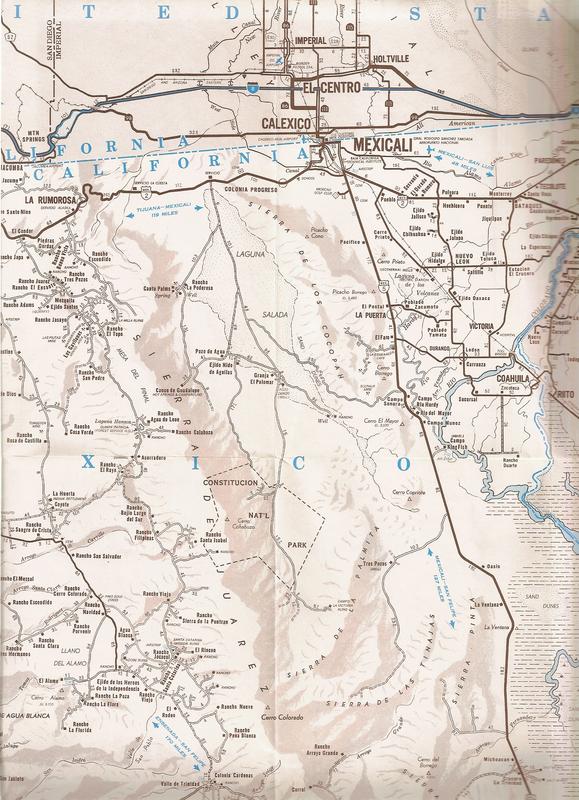
In 1962, AAA Map:
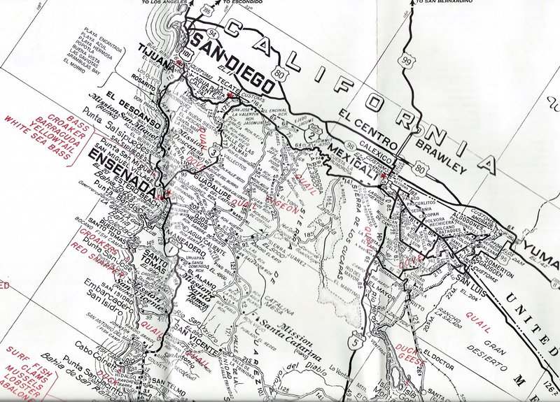
In 1962, Lower California Guidebook Map:
Maderita - 8-4-2021 at 01:50 AM
Hola bajaric,
The tall pines are Jeffrey pines. It's sad that so many have fallen victim to drought and bark beetles over the decades. It was a much wetter climate
when I started climbing there in the early 1970s. I'd guess that 75% of the big pines are now gone. Even the hardy pinyon pines and oaks have been
hard hit.
Did you make it over to Rancho El Topo this trip? If so, we missed each other by 2 days. Yes, it is a secure and lovely place to camp under the pines
at 5,000' elevation. Entrance is through a main gate to the working cattle/horse ranch. Camping is 100 pesos per night, per adult (younger children
free). We've had satellite internet at El Topo for the past year.
An old barn has been converted to have 8 small rustic rooms; very simple and inexpensive. Also good for hosting a group event. The Sandoval family
welcomes visitors. A cafe is open on weekends, serving basic ranch meals. The family has been stretched thin with help this year, so mid-week the gate
could be locked, with everyone away.
Most weekends groups arrive with their 4WD/Jeeps, dirtbikes and SxS (side by side) stop over, en route to Laguna Hanson/Parque Nacional or Mike's Sky
Ranch.
Horseback riding is available on weekends (or mid-week for groups by arrangement) at very reasonable prices. One scenic easy ride to a small lake is
about 1.5 hours total time. Riding to Canyon El Tajo is an interesting longer trail ride, about 1.5 hours each way.
If there are any climbers in your group, the ranch has an outdoor "climbing gym" - artificial holds bolted to a 35' granite cliff. My vision was to
accommodate novice to intermediate level with anchors for both top-rope and lead climbing. Climbing shoes and harnesses of all sizes are available.
There are also a half-dozen single-pitch routes on the ranch, 5.8 to 5.10c. Canyon El Tajo climbing is 4 air miles away (6 or 7 miles driving).
Approximately 400 routes on high-quality granite.
https://www.facebook.com/RanchoElTopoSierraDeJuarez