BajaNomad

Salina Cuarenta

4x4abc - 8-5-2021 at 07:43 PM

why is Salina Cuarenta called Salina Cuarenta?

Salina Cuarenta .jpeg - 155kB

David K - 8-5-2021 at 08:09 PM

Because it's between Salinas 39 and 41?

No laughs?

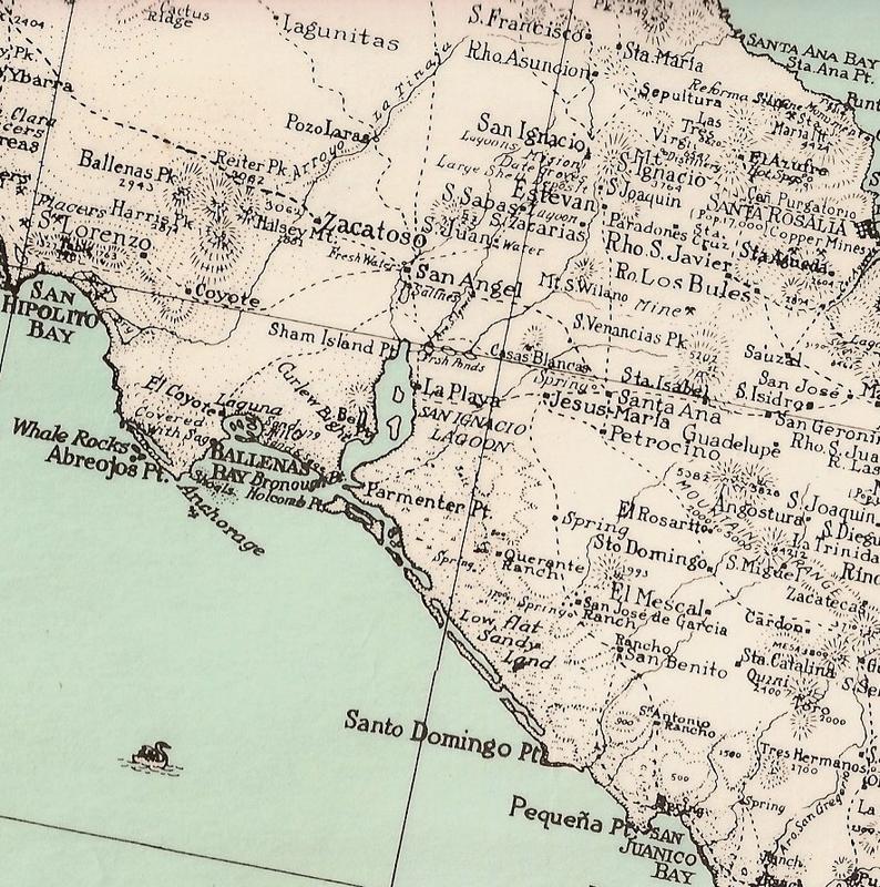
Maybe simply named after the ranch? Which came first the ranch or the salt flat?

OK, well here we see the 'Quarente Ranch' on a 1930 map:


[Edited on 8-6-2021 by David K]

mtgoat666 - 8-5-2021 at 09:06 PM

Quote: Originally posted by 4x4abc  
why is Salina Cuarenta called Salina Cuarenta?


‘Cause it’s below Cuarenta Mesa. Why Cuarenta? A story about 40 soldiers buried a treasure there, or some such tale…

4x4abc - 8-5-2021 at 09:43 PM

no, it is not below Mesa Cuarenta
Salina, Mesa, Arroyo, Rancho and Estero with that Cuarenta name are many miles apart - but within 15 miles of each other


[Edited on 8-6-2021 by 4x4abc]

Screen Shot 2021-08-05 at 10.53.40 PM copy.jpg - 302kB

David K - 8-5-2021 at 10:54 PM

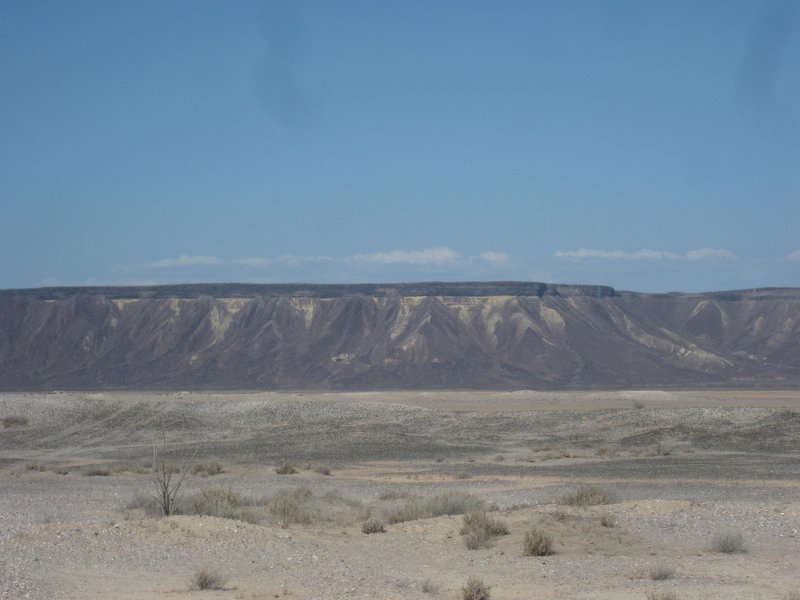
The map label is wrong, Mesa Cuarenta is the mesa not the salt flat or low desert. It is called Mesa La Salina on most modern maps

Here is a photo I took of it, a few days before I was at your house:


[Edited on 8-6-2021 by David K]

mtgoat666 - 8-6-2021 at 05:48 AM

Quote: Originally posted by 4x4abc  
no, it is not below Mesa Cuarenta
Salina, Mesa, Arroyo, Rancho and Estero with that Cuarenta name are many miles apart - but within 15 miles of each other


[Edited on 8-6-2021 by 4x4abc]


The salina is below a big flocking mesa, call it what you like.

4x4abc - 8-6-2021 at 06:19 AM

Quote: Originally posted by mtgoat666  


The salina is below a big flocking mesa, call it what you like.


how does that help to figure out where the name came from?

mtgoat666 - 8-6-2021 at 11:33 AM

Quote: Originally posted by 4x4abc  
Quote: Originally posted by mtgoat666  


The salina is below a big flocking mesa, call it what you like.


how does that help to figure out where the name came from?


I explained cuarenta above. Go read it again.

4x4abc - 8-6-2021 at 05:43 PM

seems like we have an answer
Salina del Cuarenta is 40 miles away from San Ignacio
on the old (mostly impassable) road along the bottom of Mesa La Salina


Screen Shot 2021-08-06 at 9.02.16 AM copy.jpg - 258kB

mtgoat666 - 8-6-2021 at 07:36 PM

Quote: Originally posted by 4x4abc  
seems like we have an answer
Salina del Cuarenta is 40 miles away from San Ignacio
on the old (mostly impassable) road along the bottom of Mesa La Salina


40 miles, 40 soldiers, same same, eh?


David K - 8-6-2021 at 08:00 PM

Odd a distance in miles was used? However, given that the first vehicles (1920s) may have been from the states and their odometers read in miles... who knows?

4x4abc - 8-6-2021 at 10:30 PM

got that input from a local resident on one of the Baja history sites.

4x4abc - 8-8-2021 at 09:48 PM

to give you an update
one of my Mexican friends claims he has a map from the 1860's
saying "Salina de Cuarenta Martires"
now, Cuarenta Martires is a well known event for active religious people
https://en.wikipedia.org/wiki/Forty_Martyrs_of_Sebaste

waiting for a copy of that map

David K - 8-9-2021 at 09:11 AM

Quote: Originally posted by 4x4abc  
to give you an update
one of my Mexican friends claims he has a map from the 1860's
saying "Salina de Cuarenta Martires"
now, Cuarenta Martires is a well known event for active religious people
https://en.wikipedia.org/wiki/Forty_Martyrs_of_Sebaste

waiting for a copy of that map


Great discovery, if true. Sounds more plausible than 40 miles.

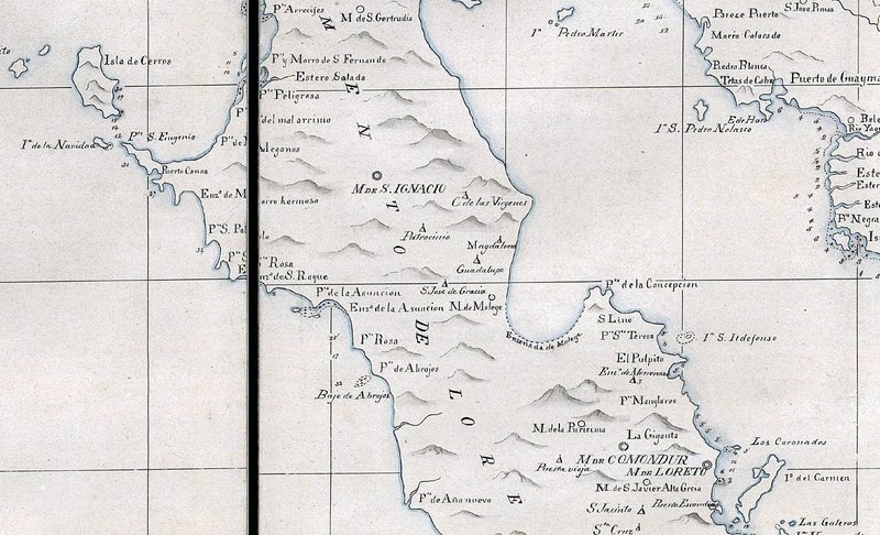
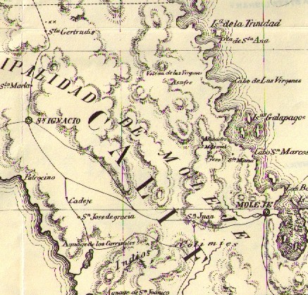
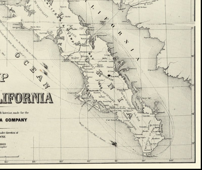
No Cuarenta on these maps... but nearby (10 miles from Rancho Cuarenta) Patrocinio sure is!

1823 Map:


1864 Map:


1868 Map:


4x4abc - 8-9-2021 at 11:12 AM

we'll find it

mtgoat666 - 8-9-2021 at 11:20 AM

Quote: Originally posted by 4x4abc  
to give you an update
one of my Mexican friends claims he has a map from the 1860's
saying "Salina de Cuarenta Martires"
now, Cuarenta Martires is a well known event for active religious people
https://en.wikipedia.org/wiki/Forty_Martyrs_of_Sebaste

waiting for a copy of that map


I already told you the source of the name, 40 soldiers (or sailors?) buried a treasure somewhere on the mesa…

This is story told by locals at the lagoon


4x4abc - 8-9-2021 at 01:05 PM

Mexicans love fairy tales as much as Americans savor conspiracy theories

del mar - 8-9-2021 at 01:11 PM

Quote: Originally posted by 4x4abc  
Mexicans love fairy tales as much as Americans savor conspiracy theories


and always involve hidden gold!

4x4abc - 11-2-2021 at 11:40 AM

found the 1860's map - it is indeed Salina Cuarenta Martires

David K - 11-2-2021 at 11:51 AM

Quote: Originally posted by 4x4abc  
found the 1860's map - it is indeed Salina Cuarenta Martires


Please post or email it to me, if you can!

4x4abc - 11-2-2021 at 12:29 PM

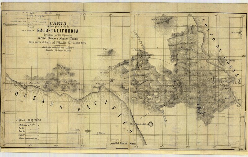
1871 Santa Rosalia survey map

https://en.wikipedia.org/wiki/Forty_Martyrs_of_Sebaste

Screen Shot 2021-11-02 at 12.12.09 PM.png - 196kB

The full map... detail may not be visible.

David K - 11-2-2021 at 02:19 PM


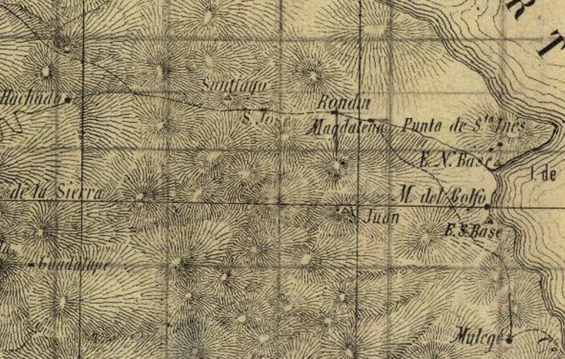
When one zooms in on parts, like Harald did with Salina Cuarenta Mátires, you can read the place names. I have sent it to geoffff to see if he can work some magic on it.

For example...

David K - 11-2-2021 at 03:33 PM


Roads (trails) are dashed lines and arroyos are solid lines.

*We can see Mulegé, in the lower right corner.
*Punta de Santa Inés (Punta Chivato).
*The trail from Mulegé meets the arroyo at Magdalena (ruins washed away in 2014).
*Up the arroyo a bit is Rondin (where the arroyo exits the mountain, later called Boca de Magdalena). Rondin is mentioned in one of my old books.
*San José (San José de Magdalena)
*The trail splits and one continues to Palo Hachada (Palo cut off)
* Mission Guadalupe is on the left, lower side.

Rondin:
Sebastian Viosca (United States Consul in La Paz, 1861) wrote a report saying "the Jesuits founded the abolished mission of La Magdalena on these plains, about 5 leagues distant from Mulegé." He continues, "On the north of these plains is the place called Rondin."


David K - 11-2-2021 at 03:48 PM

I bumped up a thread showing all the before and after Magdalena photos and discussion. Try and see through the Photobucket water marks.

geoffff - 11-5-2021 at 04:52 PM

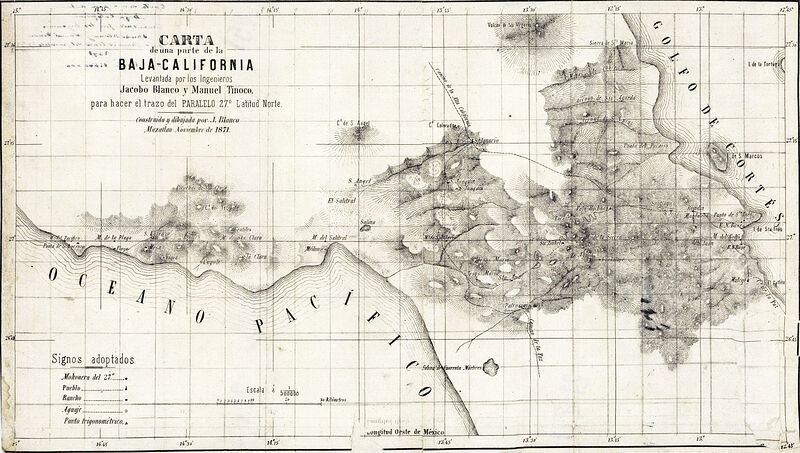
Here is my update of the 1871 map.
Click to enlarge.


David K - 11-5-2021 at 06:52 PM

Great fine tuning!