Inland from Las Animas there is a place called Santa Marita. In th Anybody know where that is? I see Paraiso and La Tinaja in the Baja Almanac but
cannot find Santa Marita in between. I'm probably way off but could that be David's lost mission site?
Mis-named Tinaja de Santa Maria. Just off the Golfo Camino Real. Arthur North mis-named the Tinaja in his 1910 book.4x4abc - 9-18-2021 at 07:43 PM
this map also puts San Ignacio (San Ignacito) north of San Borja (it is due west)David K - 9-18-2021 at 10:11 PM
I put the Tinaja de Santa María on the new Baja Atlas, being a 'famous' water hole. Tinaja de Yubay and Agua Dulce are also shown... all making
travel on El Camino Real possible.David K - 9-19-2021 at 12:57 PM
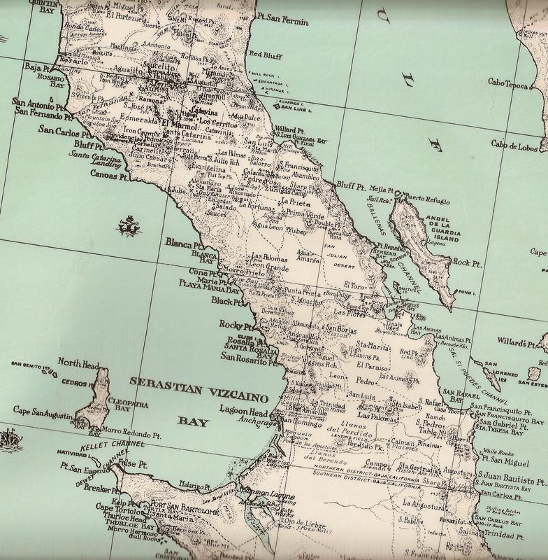
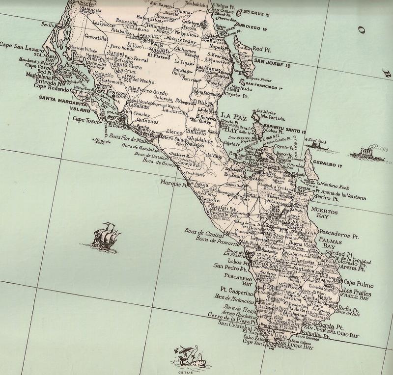
I have the 1922 map now added onto VivaBaja.com for easy viewing.
Here are all the 'zoom-in' maps there now:
MAPS!!
Currently, I have several maps of Baja California linked at www.VivaBaja.com with 'zoom- in' ability to show maximum detail:
is there any way to download those maps? So I can work on a map and study it without being tied to a server?
The links are on my site to do with as you like. Go for it.David K - 9-19-2021 at 05:40 PM
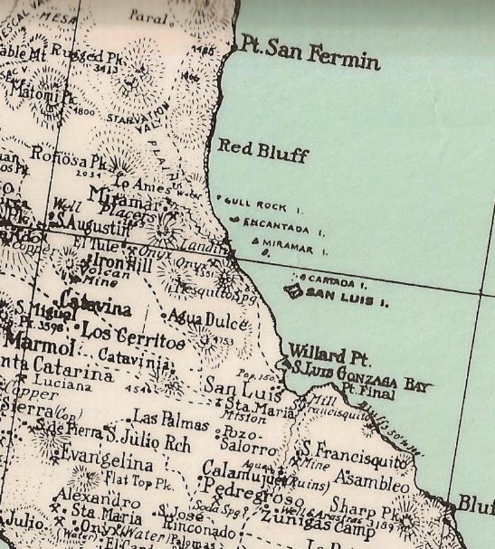
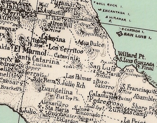
There was a Rancho Agua Dulce out on the main road near the junction to the spring side road. It was abandoned in the 1956 printing of the Lower
California Guidebook. Noted as 'ruins' on the Gulick map...
The modern Rancho Agua Dulce is next to the gully containing the spring, on the short side road. It was established after 2004 sometime.
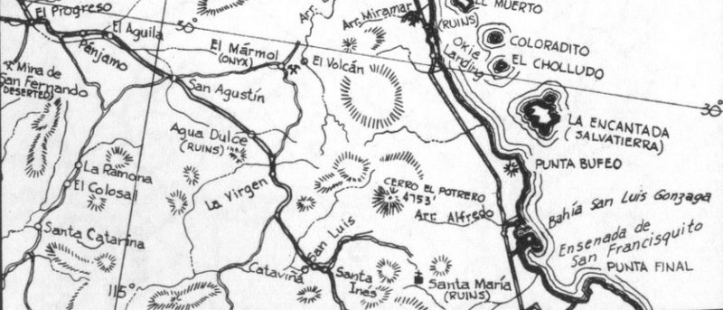
The map location for Muleginos is not anywhere close to Agua Dulce, being on the wrong side of 'Onyx' (El Mármol)? However, as with other weird
things on maps, it isn't the only off-mark location.
This 1930 map also has Agua Dulce off just a bit when compared to San Augustin (Agustin) and El Tule (old name for 'Onyx' or 'El Mármol'), but north
of Cataviña and south of El Tule.
[Edited on 9-20-2021 by David K]BajaBruno - 9-19-2021 at 10:00 PM
What are the red arcs with the red blocks colored in? For example, around San Jose del Cab, La Paz and other towns. There also seems to be a range
distance written in red.4x4abc - 9-20-2021 at 12:16 AM
visibility of lighthouse firesDavid K - 9-20-2021 at 07:29 AM
even shows the sequence of the light bursts 4x4abc - 9-20-2021 at 06:51 PM
sooo many Santa Isabel
sooo many Santa Maria
sooo many Dolores
cool map - but one of the most inaccurateDavid K - 9-22-2021 at 04:35 PM
Lance, it might be fun to do a side by side with the 1922 or 1946 map against more modern, accurate maps... The 1962 Howard Gulick maps were the first
mostly accurate maps and then we have the modern INEGI (Baja Almanac) and Benchmark Road Atlas maps.
We can see that the 1922/ 1946 map placement of some locations is not close to reality but most are places we can find today. Codornices is Rancho San
Antonio, for example. The 'Marmol' is the onyx mine of Cerro Blanco or San Telmo... and today, signs point it out as 'El Marmolito' (not to be
confused with the El Marmolito south of (Nuevo) Rosarito that shipped the blocks out from Miller's Landing.
Isn't this all fun??
[Edited on 9-22-2021 by David K]BajaBruno - 9-22-2021 at 11:19 PM
That's what I thought until I saw the arc at Bahia de la Magdalena, which only includes the bay and not the sea outside it. 4x4abc - 9-23-2021 at 12:59 PM
remember that Puerto Magdalena was a US military installation
it needed a reliable locator.bajaric - 9-24-2021 at 11:43 AM
cool map, thanks for posting
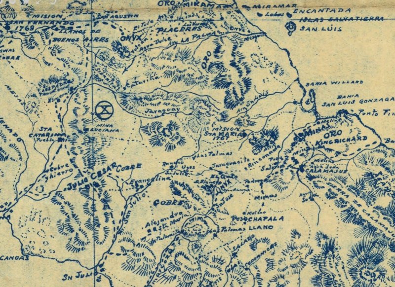
I think "El Tule" (The Reeds) was referring to the "Geyser" (soda springs) in Arroyo Volcan. Or is was there a different El Tule west of "Onyx" (El
Marmol) ?David K - 9-24-2021 at 12:20 PM
In one of my old sources, the place where they began getting onyx was named 'El Tule'... which indeed was also the early name for Arroyo El Volcán.
The next name used was simply 'Onyx'... before the name El Mármol.
El Volcán is 4 (road) miles from El Mármol. So, not too distant from each other.
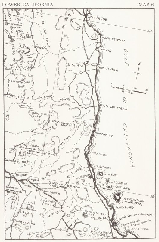
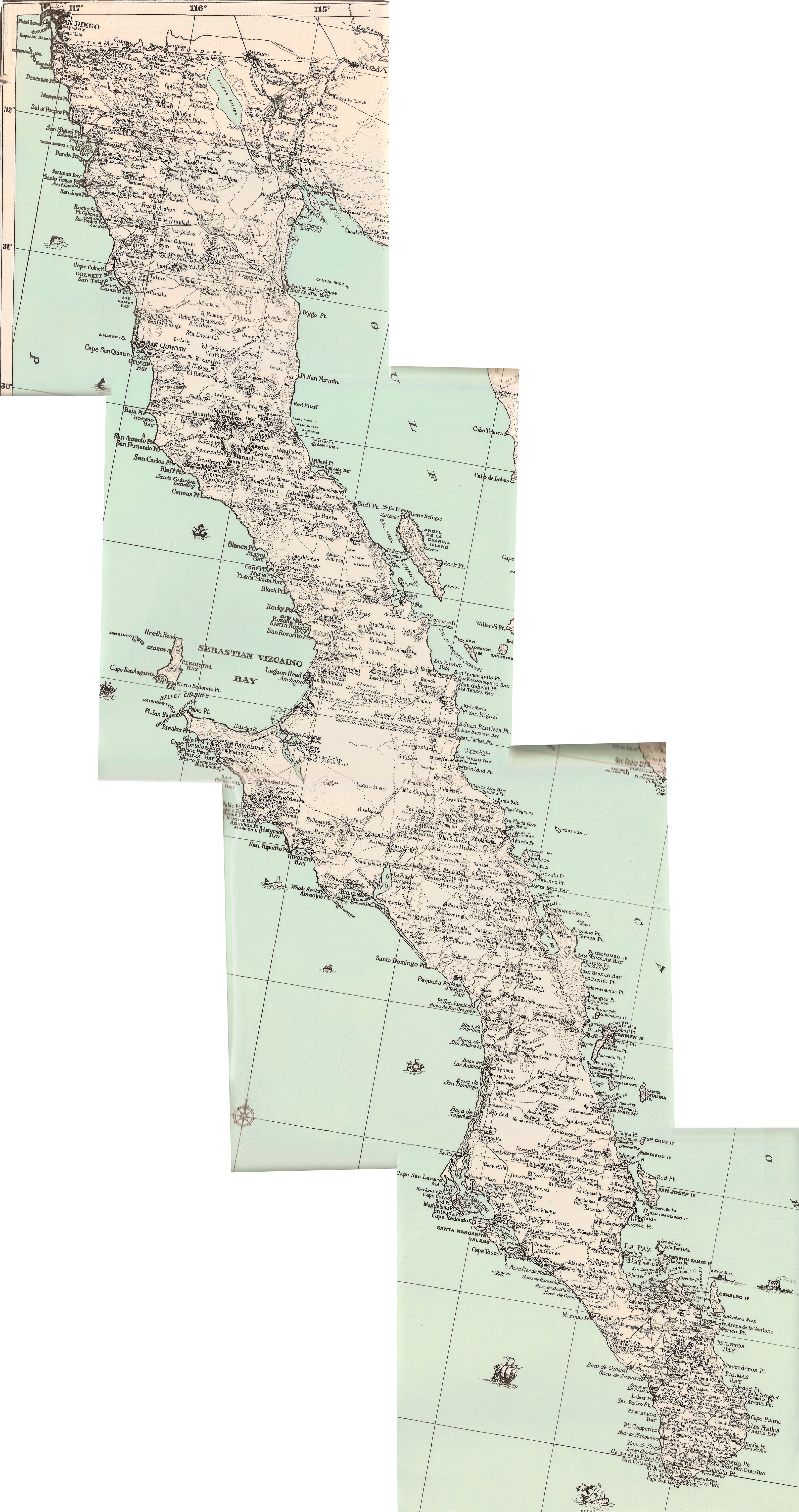
Maps compared 1918 to 1962
David K - 9-24-2021 at 03:14 PM
I tried to crop the maps so they each show the same area of Baja. 1918, 1919, 1922, 1930 all have north at the top. The 1962 Gulick maps are sectional
and oriented so the most area fits, with the different top directions going northwest. The Gulick maps are the most accurate as for road and rancho
placements.
Perhaps some of you who are better at this can play around a bit more with lining things up? I can email you the scanned images if you like.
1918
1919
1922
1930
1962 (2 part)
'Fish Camp' is Puerto Canoas today and San Julio on the older maps. geoffff - 9-25-2021 at 12:28 AM
The 1922 and 1946 maps look pretty much identical to me, except for a few additional roads drawn in on the 1946 map. These are the only differences I
could spot:
geoffff - 9-25-2021 at 12:33 AM
Oh, here is the Punta Final area discussed earlier (1922/1946):
David K - 9-25-2021 at 08:20 AM
Thank you geoffff!
Lance, does this work for you?
Good job, Geoff!!
Q: Do you have this 1930 Baja map preserved on your site the same way the 1922 and 1946 maps are above? If not I can send you the high res scans. Here
are the Postimages.org images:
geoffff - 9-25-2021 at 10:05 AM
no, I don't have the 1930 map scan yet. That would be great! Also, I can share with you a list of what I have collected so far.David K - 9-25-2021 at 10:22 AM
Super!
This interesting map was for sale at the Birch (Scripps) Aquarium giftshop several years ago.
I had it laminated. So glad my scans of it could be made into a single image.
Thank you, geoffff!David K - 9-26-2021 at 12:37 PM
I know have the 1930 map at VivaBaja.com for anyone's quick find.
Here are the maps now linked, all of which have a zoom-in or enlargement ability for close study!