I was walking through the brush in Tamaulipas state one time looking for a fishing pond and ran across a small twin engine jet. It wasn't much
damaged from landing but it had been stripped of anything valuable in the years since. No doubt a drug craft, but it was a shame to see it in that
condition. AKgringo - 10-5-2021 at 08:47 AM
Imagine the planning it must have taken to photo bomb a satelite! 4x4abc - 10-5-2021 at 12:11 PM
here is a cool one:
30°56'16.61"N, 115° 2'25.65"W
not sure why it also shows a ghost
does not seem to be the shadow on the ground
4x4abc - 10-5-2021 at 12:18 PM
we could start identifying the plane models
32°20'46.32"N, 116°17'25.21"W
geoffff - 10-5-2021 at 11:14 PM
I googled it up. The satellite quickly takes multiple images with different filters, and combines them later into an image. The satellite (and/or
airplane) is in a different position for each shot.
[Edited on 10-6-2021 by geoffff]4x4abc - 10-6-2021 at 11:19 AM
that's the info I like - thank you!Chup - 10-6-2021 at 03:43 PM
Give me a time and place I'll fly by with a HARALD ROCKS banner for you to enjoy..
[Edited on 10-6-2021 by Chup]StuckSucks - 10-7-2021 at 09:01 AM
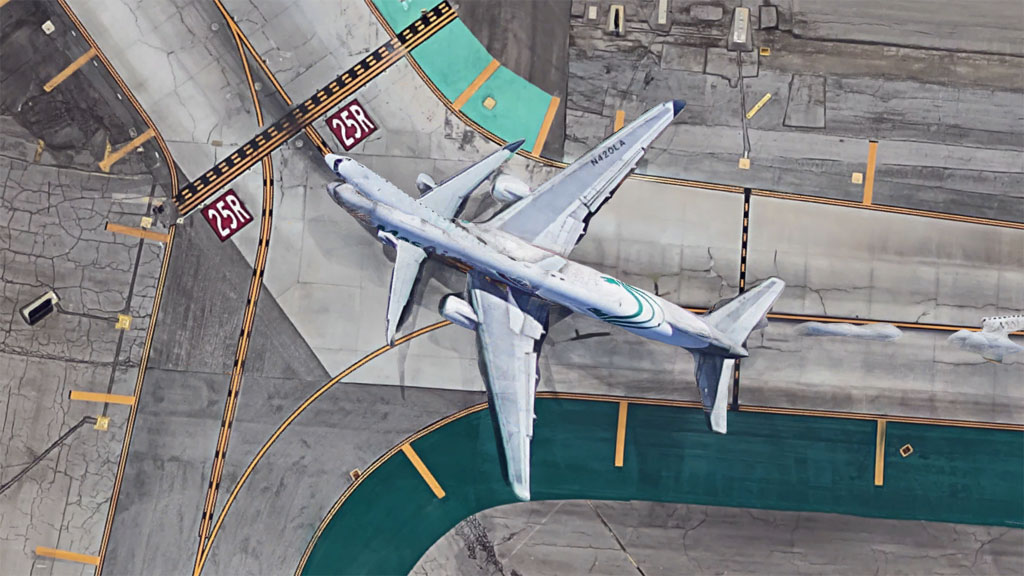
Do runway incursions count?
AKgringo - 10-7-2021 at 09:11 AM
Making baby airplanes? 4x4abc - 10-7-2021 at 10:06 AM
the airport on Isla Guadalupe had a crashed airplane on either end of the runway for years.
Early Google Earth images show both of them.
They are gone by now
StuckSucks - 12-20-2021 at 04:17 PM
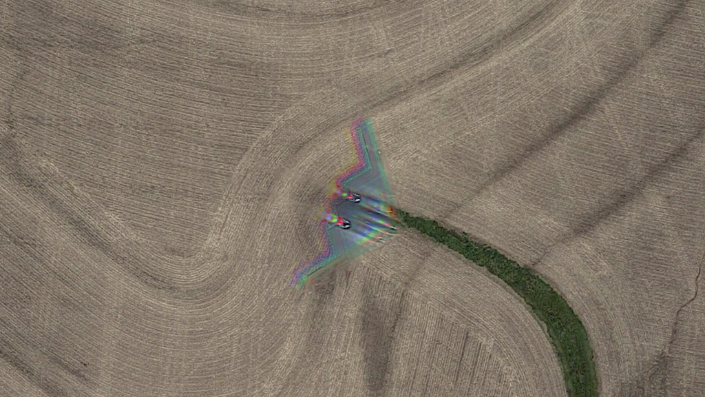
Hummm ... look what we found in the airspace above Davis Township, MO: