
David K - 2-18-2022 at 08:56 AM
In 1787, Diego Troncoso of Mexico drew a map of the Californias that named all the missions as they were in 1786 (prior to the founded of San Miguel
in 1787, Santo Tomás in 1791, San Pedro Mártir in 1794, and Santa Catalina in 1797). Also this was prior to the abandoning of the missions of
Guadalupe and Santiago (both in 1795).
It took me some careful studying to make out the handwritten names!
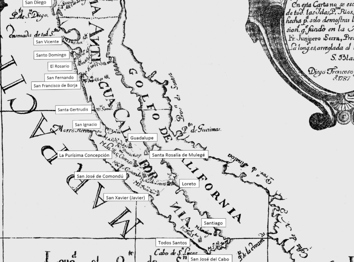
Enjoy the full map, and 200 others at: https://vivabaja.com/maps/
[Edited on 2-18-2022 by David K]