BajaNomad

Photos and Fun from the past...

David K - 8-3-2022 at 01:57 PM

Come on Baja Nomads... Let's pump some life into this almost 20-year-old forum... Post your Baja Fun Photos!


1966 and I am on my way to the tip of Baja!


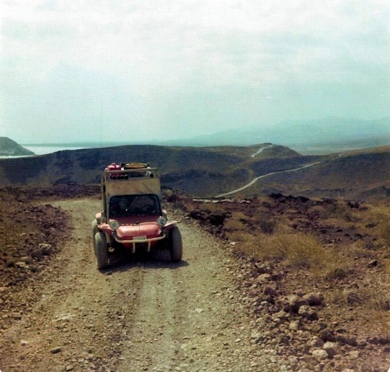
1974... I am driving northbound from Gonzaga Bay. On the steep grades that some call the Sisters.


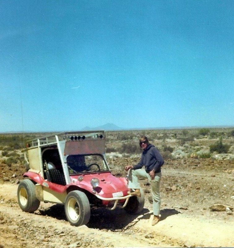
1975 on the road to El Mármol.


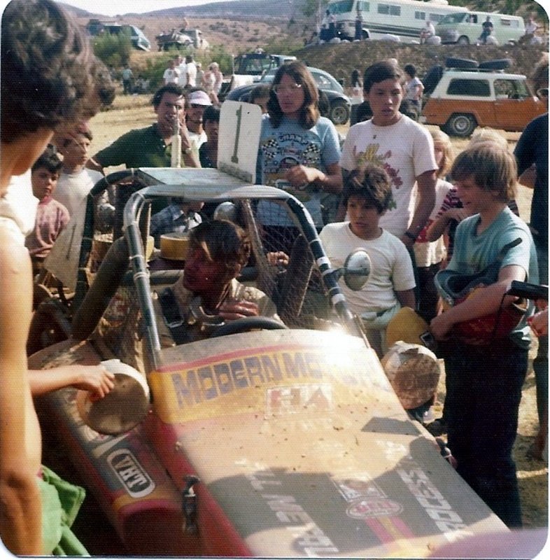
1975 Baja 300, Santo Tomás, and Ivan Stewart wins!


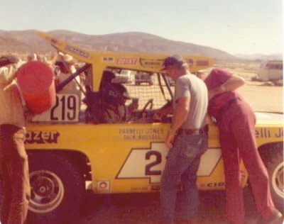
1975 Baja 1000 and Parnelli Jones makes a pit stop at Valle de la Trinidad.


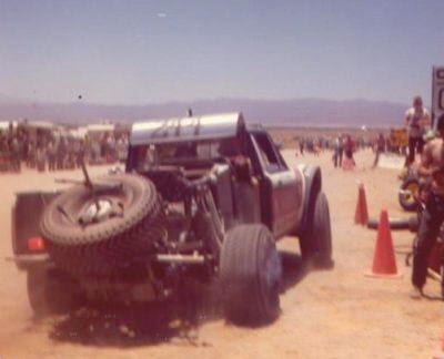
Mickey Thompson pulls in and is looking pretty battered in his rear-engine Chevy-LUV.


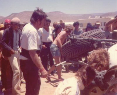
Mickey, and Danny Thompson having a close look.


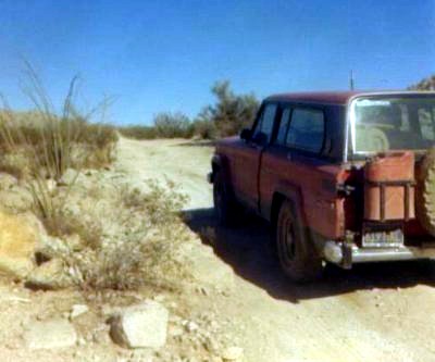
From Valle de la Trinidad, I drive on to San Felipe in my Jeep Cherokee Chief, then south to watch the race at the sulfur mine, as it loops back to Ensenada the next morning.


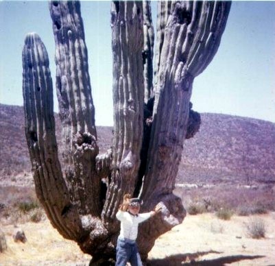
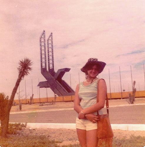
1976: My high school girlfriend poses by the Eagle Monument, long before it was taken over by the military and nearly hidden by trees and a giant flag!


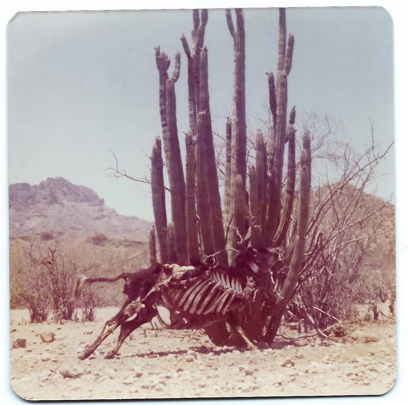
1976, on the road to San Javier, this cow died in its tracks (i.e. local humor)


BajaGringo - 8-3-2022 at 03:16 PM

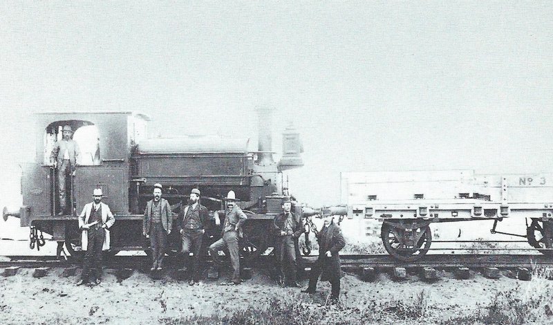
When the English abandoned their Federal Concession here in San Quintin over a century ago, they tried to remove and pack up everything they could including Baja's very first railroad system. They loaded all the train cars, lifting them one by one from the tracks using a crane mounted on the barge until they got to the very last one - the locomotive - which they ended up dropping into the bay due to miscalculating its weight. It still sits underneath a centuries worth of mud to this day, confirmed by divers a few years ago.

From there they proceeded to remove a few dozen miles of track and finally the railroad ties. I heard from some old timers here that the English had left behind some ties which were in bad shape and could be found in some areas around the bay. After a few attempts, we finally located one!


English RR Tie.jpg - 319kB

David K - 8-3-2022 at 03:49 PM

Thanks Ron... A very cool image!

I wrote about the San Quintín railroad in this Baja Bound article: https://www.bajabound.com/bajaadventures/bajatravel/a_tale_o...

"In 1909, the rails were removed and sent to be used in Arizona for a mine there. The train engine was lost, falling into the outer bay while being hoisted onto a ship. A Japanese diver was employed to attach lines to the engine but failed. The train engine lies 43 feet down, on the seafloor."


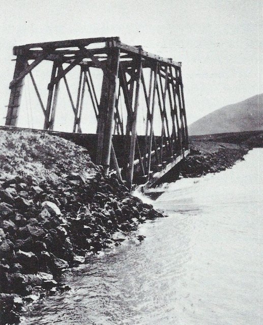
Construction of the bridge over the narrows cost the railroad far more than anticipated. In this 1908 view, the partially collapsed structure has been brought up to grade with the use of ties. The reason it crossed the bay at the Old Mill using this causeway and bridge was for a future town to be built over there. The remains of the causeway are still in place by the Old Mill Hotel. The tides keep eating away at the rocks that created it.

BajaGringo - 8-3-2022 at 04:17 PM

Quote: Originally posted by David K  


"The train engine lies 43 feet down, on the seafloor."


I don't know who came up with that number but it's closer to 20-25 feet and covered in about 6 feet of accumulated mud. After they completed the survey of the engine by divers a few years back a decision was made to leave it in place as it is currently (covered in the mud) to minimize any further degradation while they are trying to put enough money together to do a proper extraction and restoration, if that's even possible at this point.


[Edited on 8-3-2022 by BajaGringo]

David K - 8-3-2022 at 05:48 PM

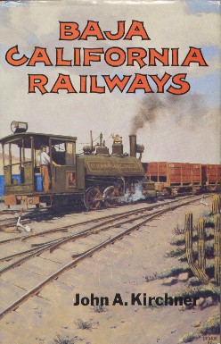
That data came from the book, Baja California Railways, over 30 years ago. Same place as the photos...


©1988

[Edited on 8-4-2022 by David K]

Howard - 8-3-2022 at 06:36 PM

Quote: Originally posted by BajaGringo  
Quote: Originally posted by David K  


"The train engine lies 43 feet down, on the seafloor."


I don't know who came up with that number but it's closer to 20-25 feet and covered in about 6 feet of accumulated mud. After they completed the survey of the engine by divers a few years back a decision was made to leave it in place as it is currently (covered in the mud) to minimize any further degradation while they are trying to put enough money together to do a proper extraction and restoration, if that's even possible at this point.


[Edited on 8-3-2022 by BajaGringo]


I guess that blows off David's theory that there is no global warming and the sea level is not changing.

photo posting

BigOly - 8-3-2022 at 10:37 PM

AFTER ALL OF THESE YEARS, I wish that I could just "click and drag" a photo from my albums. I know, I know...I could just go back to school. Ain't gonna happen!

David K - 8-4-2022 at 08:16 AM

Quote: Originally posted by BigOly  
AFTER ALL OF THESE YEARS, I wish that I could just "click and drag" a photo from my albums. I know, I know...I could just go back to school. Ain't gonna happen!


Trust me, it is not difficult...
Postimages.org is free.
The only setting you need to change is the upload size to fit on Nomad (800 pixels or less).
Here are the instruction steps (from the top post in this forum:

*Go to www.Postimages.org, make an album if you want to organize your photos to find them easily in the future (by date or by subject). No cost to use Postimages.org.

*Change the upload setting from "Do not resize my image" to 640x480 (recommended for forums) or 800x600 (max. on Nomad). You click on the little arrow to see the size choices.

*Click "Choose images" and select the photos you want to put on Nomad from your Pictures folder.

*Click on the image you want on Nomad and click on "Share" at the top of the screen.

*Choose "Hotlinks for forums" (down next to the last one). You can click the little box at the right end of the link and it is now saved on your mouse.

*Go to Nomad and paste that link onto the place where you are typing on Nomad. You can put text in below the photo for a caption for your post and if you double space between photo links (for clarity), you can put several photos and captions in a single post on Nomad. You can click "Preview" on Nomad to check and see how it will look before posting to the board.

If you need to fix a post after it is done, click on "Edit" along the edge of your post, and change or delete your post. If you edit more than once, you can delete the previous Edited on tags so only one edit tag will appear after you edit the post.
==============================================================

Vince - 8-4-2022 at 09:12 AM

Thanks for the photos and instructions, David. I should try again with the photo posting. Vince

Don Pisto - 8-4-2022 at 12:21 PM

Quote: Originally posted by BajaGringo  
Quote: Originally posted by David K  


"The train engine lies 43 feet down, on the seafloor."


I don't know who came up with that number but it's closer to 20-25 feet and covered in about 6 feet of accumulated mud. After they completed the survey of the engine by divers a few years back a decision was made to leave it in place as it is currently (covered in the mud) to minimize any further degradation while they are trying to put enough money together to do a proper extraction and restoration, if that's even possible at this point.


[Edited on 8-3-2022 by BajaGringo]


Ron did these divers produce any photo's? was there anything other than a mound of mud? fascinating story about greed and corruption, very little about wheat.

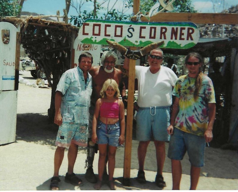
July 2001 at Coco's Corner

David K - 8-5-2022 at 10:51 AM


Let to right: David K (Me), Coco, Sarah K, David Eidell ('Dah-veed'), and Miguelito Humfreville.

BajaGringo - 8-5-2022 at 12:44 PM

Quote: Originally posted by Don Pisto  

Ron did these divers produce any photo's? was there anything other than a mound of mud? fascinating story about greed and corruption, very little about wheat.


No, as I understand it they were operating in nearly zero visibility conditions once they started to disturb the mud layer covering the old locomotive. As it was explained to me, they pushed long steel rods down hundreds of times into the mud to first locate it and then continued doing so to determine it's depth and position as well as size and shape to verify it was indeed the lost engine.

And you are correct on the second part - many have written that the English abandoned the San Quintin area due to years of drought when the real truth is not that cut and dried. What has happened is that many who call themselves "historians" took the easy route and simply copied what someone else wrote and after so many sharing the "drought excuse" as the main reason, it has become an accepted fact for many.

The British Land Company was not given ownership of the land but a concession that clearly stated in the clauses of the agreement the requirement they were not to remain with the land but instead be allowed to develop business opportunities for themselves while subdividing the large land concession to sell to Mexicans who would begin populating the area and provide a source of labor.

Remember the time period; it was right before the Mexican Revolution when the social unrest was peaking in Mexico over the economic inequality and unequal distribution of land where only a relative few held large land holdings relegating the majority of the remaining population into a life as a form of indentured servants to the Hacienda that owned all of the land in the area including where they lived and farmed.

During the period of their concession in San Quintin, the British Land Company did little subdividing other than what they parceled out among themselves and the Federal government - feeling the heat of the coming revolution - would eventually order them to begin following the concession agreement or risk losing it completely.

Some of the English settlers who worked farming wheat had dealt with several consecutive years of drought but work was in progress to build damns to capture rain and snow melt runoff from the mountains above along several of the riverbeds that crossed the valley as well as drilling water wells to be operated by windmills running off the constant wind that is prevalent in San Quintin.

Wheat was not the only commodity in the area as there was a very successful salt harvesting business in addition to some promising activities in local mines they had been prospecting and the British Land Company was working on plans to further dredge the bay and build an important port to open the region up for additional trade opportunities to commercialize the other resources available in the area.

The San Quintin area was not abandoned for a lack of viability but a combination of political pressure from the Mexican Federal government and the growing wave of violence on the mainland that many of the English settlers feared would spread to the peninsula.

I saw one letter where one of the settlers had written their family back home in England with their concerns of being killed by angry mobs, as they had heard of such things happening already on the mainland.

They feared they would be seen as akin to the Hacienderos by the mobs that were growing each day in anger and size. So they packed up everything they could carry, sold what they could with many going back to England while others headed further north seeking other opportunities,

The truly ironic thing is that the same situation repeated itself in some ways a half century later with the Orendain Concession, where the Orendains also failed to live up to much of what they were stipulated to perform in their concession agreement for the region in 1947, leaving us with some of the legal battles over land that are still being fought out in court here today.

[Edited on 8-5-2022 by BajaGringo]

Don Pisto - 8-5-2022 at 01:57 PM

thanks Ron, refreshing to actually get some history!

bajatrailrider - 8-5-2022 at 03:32 PM

Great history thanks guys

David K - 8-5-2022 at 04:40 PM

No doubt that the lack of rainfall was only part of the story. Thanks Ron!

The Americans were there first, and fooled the English into taking over the wheat farms. Just like now, a season or two of heavy rain is followed by a few seasons of little rain. Maybe the only difference is that 100+ years ago, it wasn't called 'climate change'... just 'weather change'. Nothing new, as we experience that every 10 years (+/-).

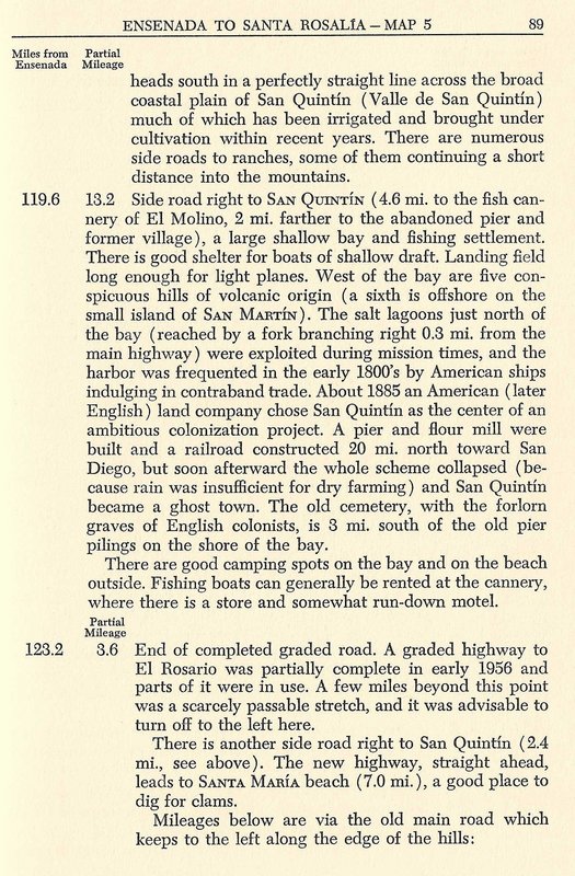
Here is a page from the 1956 (First Edition) Lower California Guidebook:


David K - 8-5-2022 at 04:50 PM

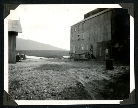
In 1925, the flour mill (Old Mill) by Peveril Meigs:


BajaGringo - 8-5-2022 at 06:18 PM

Quote: Originally posted by David K  


Here is a page from the 1956 (First Edition) Lower California Guidebook:


Yeah, I have Howards book and remember seeing that. As he was trying to cover the entire peninsula and this was a relatively minor detail in the greater scheme of things, I'll overlook him just copying it from somewhere else rather than investigate it much deeper.

And that is often how such things become accepted as fact over time; it just takes them getting repeated enough times.

David K - 8-5-2022 at 06:31 PM

I did copy the 1956 edition to show where other guides may have gotten their data. Howard's co-author was historian Peter Gerhard.
Howard was the map maker and road log author. I will guess it was Gerhard who researched the history.
I will study books from before 1956 to see if there is a source that may have been used.
Thank you, Ron.