This will be a short version, to be updated when I get to a WIFI site that is not like a sauna, filled with flies. This weather agrees with them!
I drove both roads in my Isuzu Trooper, which is stock except for oversize tires (265/75/16). It has 4x4 and a limited slip or posi traction type
rear end.
There are some excellent sections that did not get wiped out, but they all come to an abrupt end sooner or later, and nothing has been
repaired or marked!
I chose to drive the entire length in 2wd just to see if that was an option, and it worked for me, but just barely. I would not drive any heavy
camper rigs even with 4x4, because some of the washouts and self designed detours would take a lot of work to get any thing larger than my Trooper
through.
The same advice goes double for towing even a utility trailer. There is lots of loose sand, a bit of rock crawling, and at the time I drove it there
was tll a bit of mud that seems to be drying fairly quickly.
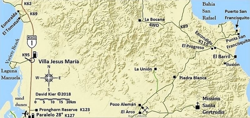
The road down to San Francisquito is actually pretty good, but the steep grade between Bahia San Raphael and the junction with the El
Alamo road is a challenge. |


 )
)