So much Baja, so little time!AlanDavid90 - 10-22-2022 at 04:57 PM
Don't forget to include the maps of the cities and the regions of the peninsula please.
From the 1900s to present
[Edited on 10-22-2022 by AlanDavid90]David K - 10-22-2022 at 05:04 PM
Most of the maps I scanned are of the entire peninsula... Have a look. If there are maps you would like to see, send me a link or the map to consider
adding!David K - 10-24-2022 at 02:28 PM
Don't forget to include the maps of the cities and the regions of the peninsula please.
From the 1900s to present
A Nomad from East Cape has been scanning a 1987 Mexican made Baja map and it has city maps on it, too. Look for it to be added when we are done with
prepping it for the page!AlanDavid90 - 10-27-2022 at 10:37 AM
All right, for nomads like him, your map library (actually it is our map library) will grow like foam and will be the most complete.David K - 10-27-2022 at 01:19 PM
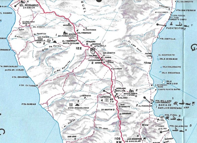
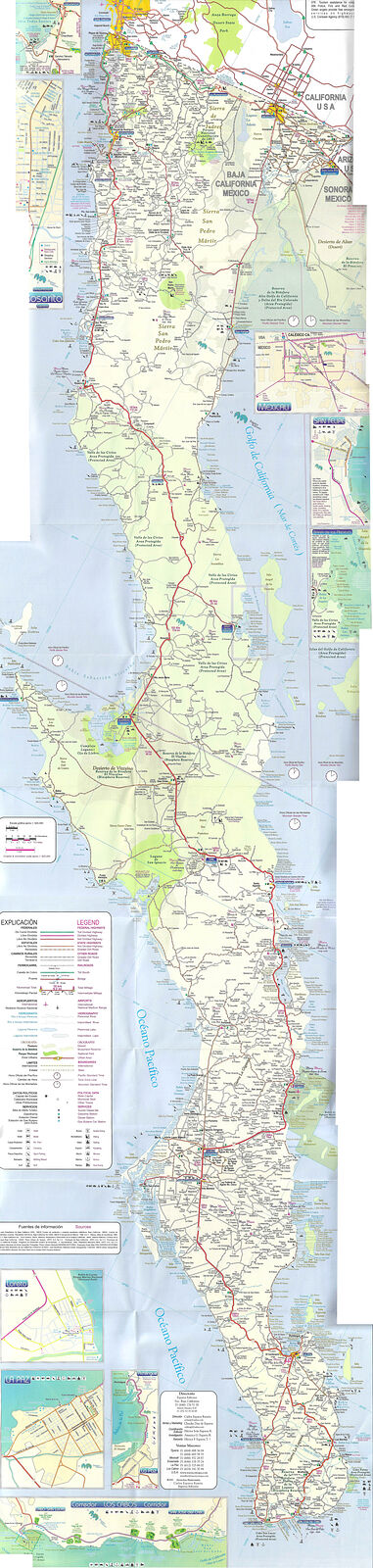
2004 Mapa Turístico Baja California Road & Recreation Map
1998 Auto Club Map of Baja California
1987 Pronto Mapa: Peninsula Baja California
2004 map (sized to fit on Nomad, go to VivaBaja/maps for max detail size):
[Edited on 10-27-2022 by David K]David K - 10-31-2022 at 10:15 AM
The 1984 AAA map was just added... a few more to go and we will have all the Auto Club maps (less the ones we still need) online to view.
Please look for the 1970 edition. It is important to show the transpeninsular highway progress from La Paz north.
Here is the request at the top of the maps webpage:
Missing some Auto Club Maps, can you help?:
IF they exist, I would love to have or get your scans of:
1970, 1976, 1977, 1981, 1986, 1993, 1999, 2002.
Plus, any editions from 1935 to 1954;
Also, a better 1972 map than I have, would be nice.
Feel free to private message or email me (info@vivabaja.com) if you have any of these maps and would be willing to loan them so I can scan and return,
or you scan them, or send them to me (maybe for an exchange or discount on one of my Baja books at www.old missions.com?). Thank you!
Once all the auto club maps are online, we can have fun seeing what was changed from year to year... either to show actaul changes found or to fix
mistakes... all maps have errors, sometimes they are intentional to prove copyright violations.David K - 10-31-2022 at 11:04 AM
And also if anyone has the folded map made by Esparza Editores (a successor of HFET, S.A. de C.V.) published in 2001 (the first edition) please share
it
And also if anyone has the folded map made by Esparza Editores (a successor of HFET, S.A. de C.V.) published in 2001 (the first edition) please share
it