BajaNomad

Baja topo maps

4x4abc - 3-23-2023 at 11:36 AM

looking for 5 volunteers to try out a map package that I created a few years back
want to double check whether the process is smooth or not

the 222 Baja topo maps are yours to keep

topo.jpeg - 201kB


[Edited on 3-24-2023 by 4x4abc]

baja-chris - 3-24-2023 at 10:39 AM

Are these something that would run on an iPad or windows laptop, or Garmin or Lowrance or paper?

4x4abc - 3-24-2023 at 12:00 PM

Quote: Originally posted by baja-chris  
Are these something that would run on an iPad or windows laptop, or Garmin or Lowrance or paper?


it is an interactive collection of pdf documents - big!
(2.1 GB)
designed to run on a computer with file and folder structure
all desktops - all laptops - might work on iPad
probably would not run on phones
but that defeats the purpose of having a large map view
by the way, you can get the same topos with GaiaGPS on your phone
https://www.facebook.com/groups/651595359982880

geoffff - 3-24-2023 at 02:55 PM

Quote: Originally posted by 4x4abc  

by the way, you can get the same topos with GaiaGPS on your phone


Except GaiaGPS did a half-assed job of integrating the INEGI topo maps. CalTopo has much better INEGI maps. I have opinions.

[Edited on 3-24-2023 by geoffff]

geoffff - 3-24-2023 at 03:07 PM

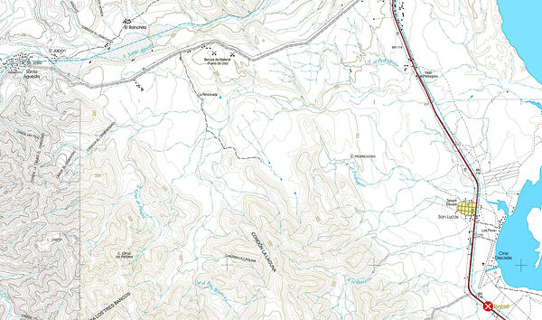
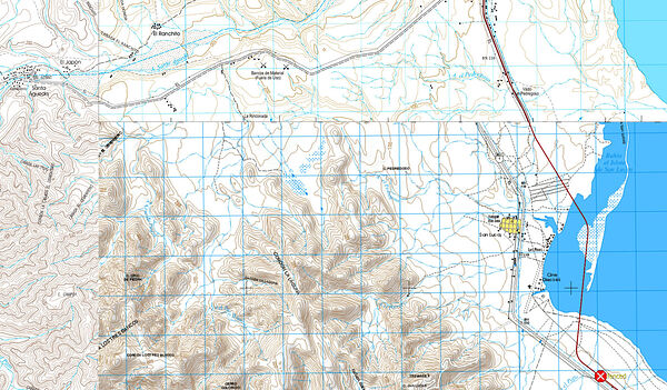
For example, here is CalTopo vs GaiaGPS just south of Santa Rosalia


CalTopo


GaiaGPS

And, yes yes, I am not exactly impartial here.

David K - 3-24-2023 at 03:33 PM

Things aren't lining up well on the Gaia map, are they?

geoffff - 3-24-2023 at 04:45 PM

Yeah, and some maps are totally missing.

And I removed the blue grids and map-edge markers from the maps for CalTopo -- for a more seamless experience.


[Edited on 3-24-2023 by geoffff]

WideAngleWandering - 3-24-2023 at 04:53 PM

Quote: Originally posted by 4x4abc  
looking for 5 volunteers to try out a map package that I created a few years back
want to double check whether the process is smooth or not


What kind of help/feedback are you looking for?

4x4abc - 3-24-2023 at 05:00 PM

Quote: Originally posted by geoffff  
Quote: Originally posted by 4x4abc  

by the way, you can get the same topos with GaiaGPS on your phone


Except GaiaGPS did a half-assed job of integrating the INEGI topo maps. CalTopo has much better INEGI maps. I have opinions.


can you preload CalTopo for offline use?

4x4abc - 3-24-2023 at 05:06 PM

Quote: Originally posted by David K  
Things aren't lining up well on the Gaia map, are they?


pretty embarrassing for a big company like GaiaGPS

4x4abc - 3-24-2023 at 05:08 PM

Quote: Originally posted by WideAngleWandering  


What kind of help/feedback are you looking for?


looking for a feedback on ease of use from download to using the package
especially from Win users


WideAngleWandering - 3-24-2023 at 06:18 PM

I'd be glad to help but won't be in front of my PC until the 4th. I can also offer Linux and MacOS feedback if it is useful. I have a software background (whether that is a good or bad thing is up for debate).

4x4abc - 3-24-2023 at 06:38 PM

Quote: Originally posted by WideAngleWandering  
I'd be glad to help but won't be in front of my PC until the 4th. I can also offer Linux and MacOS feedback if it is useful. I have a software background (whether that is a good or bad thing is up for debate).


that would be great!
The package was created in MacOS - downloads and runs with a few clicks.
Windows seems a bit more involved. I do occasional test runs on a Win machine. Works OK with a few additional choices and clicks.
But different users may have different user experiences - that's why i am asking for more feedback. So that I can make things as smooth as possible.
The download is from Dropbox and that can be confusing I hear.

I'll pm you for more

geoffff - 3-24-2023 at 08:07 PM

Quote: Originally posted by 4x4abc  
can you preload CalTopo for offline use?


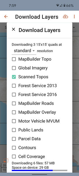
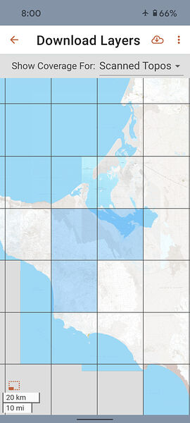
I just tried the CalTopo app, and -- yes -- it looks like you can use the INEGI maps offline. You click on which maps you want, and they are downloaded for offline use. I switched my phone to Airplane Mode to make sure it works.


I'm not actually an expert on the Caltopo app itself. I was just involved with processing the maps. I have my own way of using those maps offline.

4x4abc - 3-24-2023 at 11:02 PM

Quote: Originally posted by geoffff  

I'm not actually an expert on the Caltopo app itself. I was just involved with processing the maps. I have my own way of using those maps offline.


what is your preferred way of using those maps offline?

One of Harald's test subjects and the final tutorial.

David K - 3-25-2023 at 08:13 AM

Being a map guy, and a friend... I purchased Harald's map package and then together had dozens of email exchanges. I am on a PC (Windows) and Harald is on a Mac. Eventually, we got it to work on my machine. Harald made a newer, easier for Windows version. Geoffff also helped us make it work. I am not a smart computer guy, so I needed more help than most, perhaps.

Thankfully, the newest edition worked easily to see over 200 topographic maps from INEGI (Mexico's government maps). Here are the steps (that worked easily for me) to see the maps from the Dropbox download that Harald emails to you when you buy his product:

Baja California Topo Collection 11.3.9 Download

1) Click: Add to Dropbox
2) In Dropbox, click: Download
3) In Downloads, click: Baja California Topo Collection 11.3.9
4) In Baja California Topo Collection 11.3.9.zip, click: Extract.
5) Open new folder 'Baja California Topo Collection' and click: 'start here'
6) Peninsula Map with squares for each topo map (can be made full screen and enlarged), click on a square area to see topo map.


baja-chris - 3-25-2023 at 08:56 AM

Are these passive maps or are they designed to show your position if you have a gps receiver plugged into your laptop usb port? (ie moving map)?

David K - 3-25-2023 at 09:52 AM

Quote: Originally posted by baja-chris  
Are these passive maps or are they designed to show your position if you have a gps receiver plugged into your laptop usb port? (ie moving map)?


To have that kind of moving map, download the Avenza Baja California Road Atlas from Benchmark. Uses GPS in your phone or tablet.

4x4abc - 3-25-2023 at 10:37 AM

Quote: Originally posted by David K  


Baja California Topo Collection 11.3.9 Download

1) Click: Add to Dropbox
2) In Dropbox, click: Download
3) In Downloads, click: Baja California Topo Collection 11.3.9
4) In Baja California Topo Collection 11.3.9.zip, click: Extract.
5) Open new folder 'Baja California Topo Collection' and click: 'start here'
6) Peninsula Map with squares for each topo map (can be made full screen and enlarged), click on a square area to see topo map.


good instructions David!

4x4abc - 3-25-2023 at 10:40 AM

Quote: Originally posted by baja-chris  
Are these passive maps or are they designed to show your position if you have a gps receiver plugged into your laptop usb port? (ie moving map)?


they are passive maps intended for research and trip planning

the same INEGI map set is active for navigation with GPS in GaiaGPS

not sure if the INEGI map set ob CalTopo shows your location
Geoff will know

geoffff - 3-26-2023 at 12:00 PM

Quote: Originally posted by 4x4abc  
Quote: Originally posted by baja-chris  
Are these passive maps or are they designed to show your position if you have a gps receiver plugged into your laptop usb port? (ie moving map)?


they are passive maps intended for research and trip planning

the same INEGI map set is active for navigation with GPS in GaiaGPS

not sure if the INEGI map set ob CalTopo shows your location
Geoff will know


Yes, the CalTopo app serves the same purpose as the Gaia GPS app. CalTopo also uses your device's GPS to show your current location on the map (INEGI topo, or other)

chippy - 3-26-2023 at 02:36 PM

Quote: Originally posted by geoffff  
Quote: Originally posted by 4x4abc  
Quote: Originally posted by baja-chris  
Are these passive maps or are they designed to show your position if you have a gps receiver plugged into your laptop usb port? (ie moving map)?


they are passive maps intended for research and trip planning

the same INEGI map set is active for navigation with GPS in GaiaGPS

not sure if the INEGI map set ob CalTopo shows your location
Geoff will know


Yes, the CalTopo app serves the same purpose as the Gaia GPS app. CalTopo also uses your device's GPS to show your current location on the map (INEGI topo, or other)


Can you do this with the free cal topo or does it have to be a paid subscription?

geoffff - 3-26-2023 at 05:40 PM

It looks like a basic subscription is needed for the offline maps feature.

https://training.caltopo.com/all_users/mobile/offline

[Edited on 3-27-2023 by geoffff]

chippy - 3-27-2023 at 05:07 AM

Quote: Originally posted by geoffff  
It looks like a basic subscription is needed for the offline maps feature.

https://training.caltopo.com/all_users/mobile/offline

[Edited on 3-27-2023 by geoffff]


cool. Thanks!