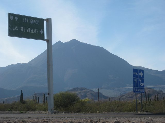
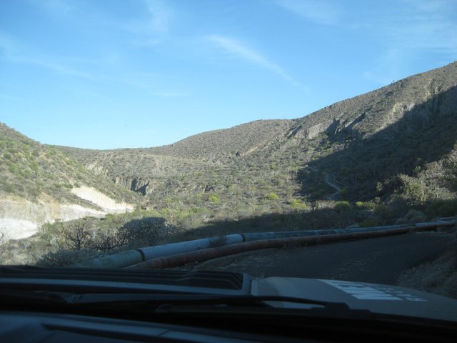
location is Volcan las Tres Virgenes at El Azufre
See the coordinates on the image
AKgringo - 4-5-2023 at 09:18 AM
Isn't Azufre Spanish for sulfur? David K - 4-5-2023 at 09:30 AM
27°31.6312', -112°33.7188' for those who want to copy and paste onto Google Earth or see it on a satellite image straight down...
1) Highlight the GPS figure (waypoint).
2) Click the Search Google for ... option.
3) Click on the small map to make it full size.
4) Click on the thumbnail image in the lower corner to see the satellite image.
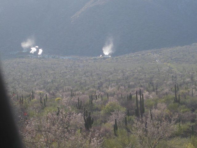
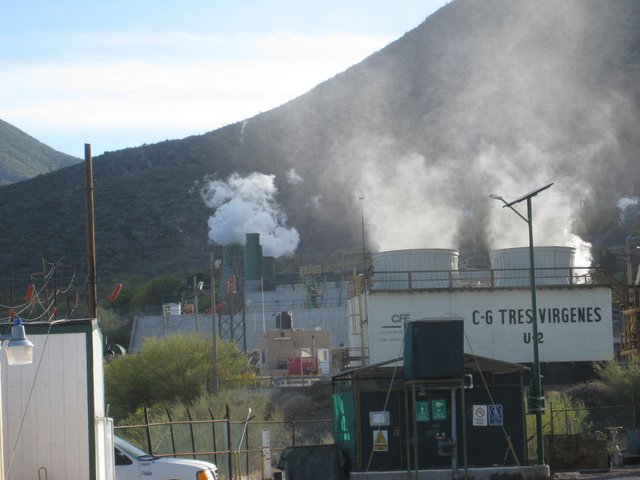
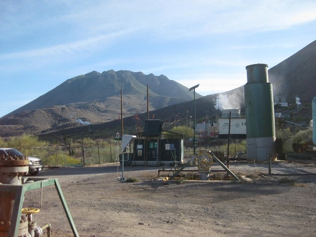
Unlike the fumarole near Mexicali/ Rio Hardy, there is no visible steam in this satellite image. It is right by the geothermal electric facility. The
gate was open in 2019... so here is a rare look, form ground level. The last photo is in the area of the GPS waypoint:
Yes! Score even used it as a nickname for the pass the topo maps called Cañon el Parral, just south of the sulfur mine: 'Azufre Wash'4x4abc - 4-5-2023 at 09:38 AM
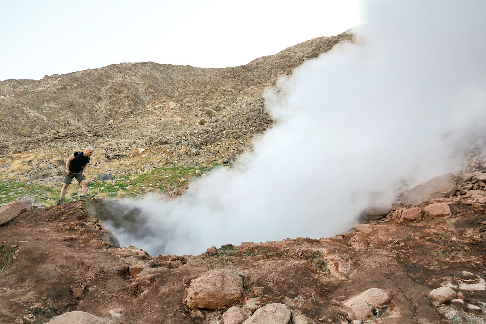
Yes! Very good... The ground is definitely warm in the area... as the magma lake is not that far down under the volcano complex... Ground water gets
heated and rises as hot springs, fumaroles, or geysers!
Last recorded eruption was in 1746... That's like 'yesterday' in geologic time!
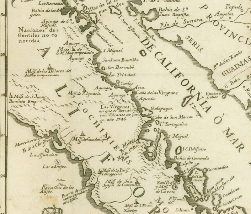
It was recorded on the 1757 Jesuit California Map:
IMO, the Fumarole north of San Felipe is much more impressive than the one down south.
The volcano one is to far away and a very difficult hike to get to it. Thus my far away view. mtgoat666 - 4-5-2023 at 11:49 AM
Last recorded eruption was in 1746... That's like 'yesterday' in geologic time!
in some ways that is like yesterday. In others, not like yesterday. We recently experienced an epohk change on the geologic time scale, many
scientists would place 1746 in the Holocene, and we are today in the Anthropocene epoch.geoffff - 4-5-2023 at 09:52 PM
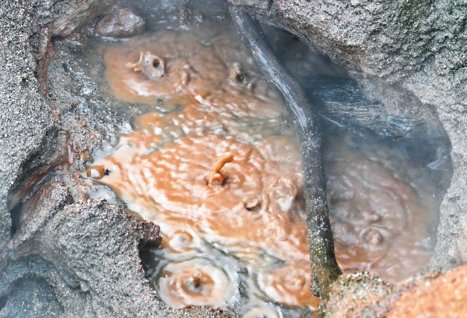
Here's more on the Fumarole near Mexicali, from when I visited it in 2019