Arnes is recorded by by Del Barco, it is either in his chapter on founding Calamajue or the chapter on moving the mission.
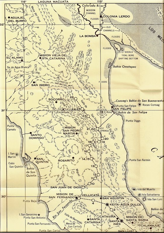
So what do you think? If Linck crossed at modern Catavina going north (which would make sense given that he was headed to Agua Dulce) then the
rancheria called Catavina must have been at La Bocana, the old Rancho San Julio, and Linck was following the La Sierrita route to return to San Luis
from Vellicata.
|