edevart
Junior Nomad

Posts: 41
Registered: 3-30-2004
Location: Medio Camino
Member Is Offline
|
|
Saving Google Map images as jpegs?
I've noticed that some of you have posted satellite images taken from google maps on the forum here... I am wondering how this is done, as I would
very much like to save some of the images to documents, my hard drive etc. Can anyone help me here? David K??
thanks
[Edited on 7-6-2005 by edevart]
|
|
|
Ken Bondy
Ultra Nomad
Posts: 3326
Registered: 12-13-2002
Member Is Offline
Mood: Mellow
|
|
Just right click on the image and use the "Save Picture As" option. A window will open and you can save it in any folder you want in the same format
as the original image (jpg, tif, gif etc.).
[Edited on 7-6-2005 by Ken Bondy]
|
|
|
edevart
Junior Nomad
Posts: 41
Registered: 3-30-2004
Location: Medio Camino
Member Is Offline
|
|
No, the right-click, save as method doesn't work with google maps. There has got to be another way, however, because I am seeing google map images
being posted all over the place. I'll try the bitmap technique and see if that works for me.
PS If you think google maps are cool, check out google earth http://earth.google.com This takes google maps to a whole other level!!
|
|
|
Ken Bondy
Ultra Nomad
Posts: 3326
Registered: 12-13-2002
Member Is Offline
Mood: Mellow
|
|
I just saved one from that link
using the right-click, save picture as... method. Here's the photo (I had to reduce the size a little to get it down to 50kb):
[Edited on 7-7-2005 by Ken Bondy]
|
|
|
Sharksbaja
Elite Nomad
Posts: 5814
Registered: 9-7-2004
Location: Newport, Mulege B.C.S.
Member Is Offline
|
|
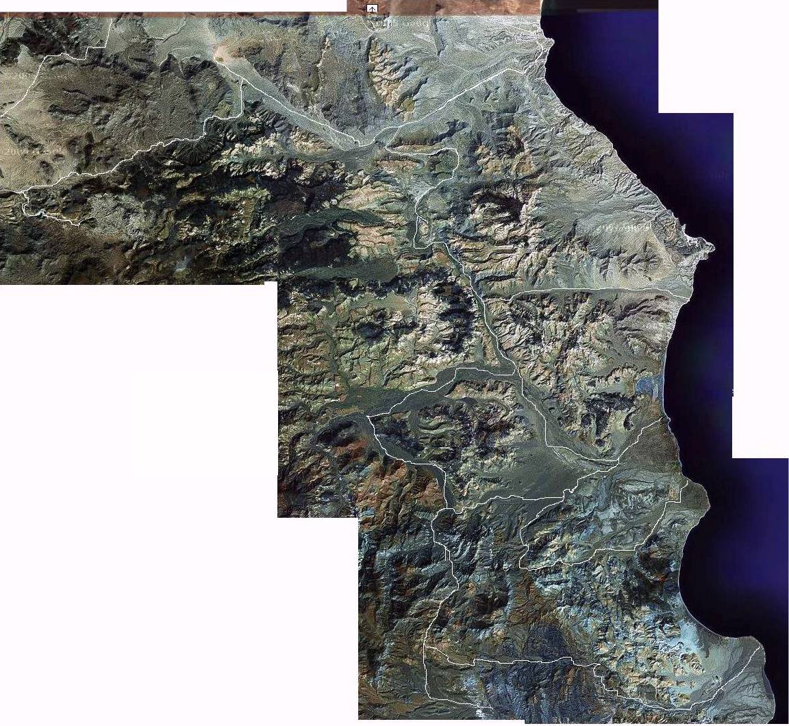
Here is a mosaic composite I generated with the maps.
The key to thois is the ability to work off a program that provides tools to line up and create a viable map. It is difficult and requires practice.
Basically, copy screen(print screen) paste this onto a digital canvas(a presized window)
Now repeat this process over and over. The biggest problem I had was cropping so I always cropped each segment to the same demensions. When laying a
pasted image onto an adjoining one you must zoom way in in order to match the new image up with the existing one(s)
In this image I identified possible tracks and then traced over them. The original is one zoom larger:
|
|
|
Roberto
Banned
Posts: 2162
Registered: 9-5-2003
Member Is Offline
|
|
Ken, they are asking about the satellite shots from http://maps.google.com . Indeed, the right click does not work there. What you posted was from a bitmap image, which the satellite images are not.
|
|
|
Ken Bondy
Ultra Nomad
Posts: 3326
Registered: 12-13-2002
Member Is Offline
Mood: Mellow
|
|
Roberto, you are absolutely right. Sorry I didn't pay closer attention. grover's method works. I just used the "Prnt Scrn" key to copy one of the
maps into the clipboard, and then copied it into a Word document, where it can be manipulated. That does work and seems to be pretty easy.
++Ken++
|
|
|