| Pages:
1
..
3
4
5 |
David K
Honored Nomad

Posts: 64488
Registered: 8-30-2002
Location: San Diego County
Member Is Offline
Mood: Have Baja Fever
|
|
Oh sure, it's on the map as little black squares. It just never had any signage to invite clients that I saw. As for the names on the Mexican topos,
they are often not correct or make sense, as if nobody traveled there to ask.
|
|
|
4x4abc
Ultra Nomad
Posts: 4165
Registered: 4-24-2009
Location: La Paz, BCS
Member Is Offline
Mood: happy - always
|
|
so glad we have you accurate maps
Harald Pietschmann
|
|
|
JZ
Elite Nomad
Posts: 9260
Registered: 10-3-2003
Member Is Offline
|
|
I checked this out, and you are correct, but how to trace a route on Bing?
It wasn't obvious to me.
|
|
|
David K
Honored Nomad
Posts: 64488
Registered: 8-30-2002
Location: San Diego County
Member Is Offline
Mood: Have Baja Fever
|
|
JZ: Correct, Bing often has newer images and better images... but there is no tools to measure or place waypoints, etc. At least that I could see last
I was there.
Harald: I am not competing with Inegi or any complete topo maps. My maps are ONLY made to help see your location while using my road guide. I am a
visual person. I like road logs but I also like to have an area map to see where I am in relation to other places.
Inegi or anyone's maps should at least check places out or try and be more accurate. Their mistakes with Gonzaga Bay and Arroyo el Volcán are just
two examples in the area of discussion that show a lack of professionalism or at least research.
|
|
|
TMW
Select Nomad
Posts: 10659
Registered: 9-1-2003
Location: Bakersfield, CA
Member Is Offline
|
|
Quote: Originally posted by JZ  |
I checked this out, and you are correct, but how to trace a route on Bing?
It wasn't obvious to me.
|
JZ when I'm looking at a trail or tracing one on Google Earth and come to a place where I can't see the route I'll look at the Bing image to see where
it goes then trace that part on GE.
[Edited on 6-15-2019 by TMW]
|
|
|
4x4abc
Ultra Nomad
Posts: 4165
Registered: 4-24-2009
Location: La Paz, BCS
Member Is Offline
Mood: happy - always
|
|
I sometimes use Bing or Zoom to check whether I can get a better view of something I am looking for
Sometimes works
Google is unbeatable for many reasons
I use the 3D function often to see the terrain better
looking for old trails I often use the time slider
years with much vegetation hide trails
years with sparse vegetation reveal what's there
Bing has none of that
besides, tracing roads and saving waypoints is essential for me


[Edited on 6-15-2019 by 4x4abc]
Harald Pietschmann
|
|
|
David K
Honored Nomad
Posts: 64488
Registered: 8-30-2002
Location: San Diego County
Member Is Offline
Mood: Have Baja Fever
|
|
Is that El Camino Real?
|
|
|
4x4abc
Ultra Nomad
Posts: 4165
Registered: 4-24-2009
Location: La Paz, BCS
Member Is Offline
Mood: happy - always
|
|
possibly
Harald Pietschmann
|
|
|
David K
Honored Nomad
Posts: 64488
Registered: 8-30-2002
Location: San Diego County
Member Is Offline
Mood: Have Baja Fever
|
|
That would be the "really" old road then!
The El Camino Real on Google Earth from Mission Loreto to Mission El Rosario: http://caminorealbaja.com/
|
|
|
4x4abc
Ultra Nomad
Posts: 4165
Registered: 4-24-2009
Location: La Paz, BCS
Member Is Offline
Mood: happy - always
|
|
what those 2 hikers accomplished over the years is senzational
even though they recorded only a small portion of Camino Real - they covered amazing ground
in parts, I believe, they are wrong (north of Calamajue for example), but with so few signs on the ground it is difficult to determine what is what
cool is the documentation of the early trail version from San Javier to Comondu
Harald Pietschmann
|
|
|
David K
Honored Nomad
Posts: 64488
Registered: 8-30-2002
Location: San Diego County
Member Is Offline
Mood: Have Baja Fever
|
|
Yep... they have been working on that GPS list for 10 years.
The ECR north from Calamajué has been tricky to find.
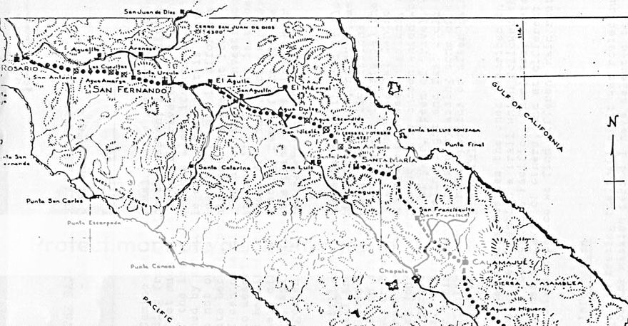
Howard Gulick had it going through a canyon to the west a bit north from Calamajué in his 1950's paper. He relied on local input from people like
Dick Daggett and Arturo Grosso who had been mining that area for many years. Harry Crosby's maps seem to agree more with our Canadian friends on it
staying closer to the auto road to Las Arrastras from Calamajué mission.
Gulick 1955:
Crosby 1974:
Crosby 1977:
I don't think the Calamajué mission is located correctly on this map?
|
|
|
4x4abc
Ultra Nomad
Posts: 4165
Registered: 4-24-2009
Location: La Paz, BCS
Member Is Offline
Mood: happy - always
|
|
there are a couple of factors that promote the Gulick route:
A the padres always chose the most direct and straight route
B there is at least one significant source of water en route
Harald Pietschmann
|
|
|
David K
Honored Nomad
Posts: 64488
Registered: 8-30-2002
Location: San Diego County
Member Is Offline
Mood: Have Baja Fever
|
|
| Quote: Originally posted by 4x4abc | there are a couple of factors that promote the Gulick route:
A the padres always chose the most direct and straight route
B there is at least one significant source of water en route |
Is that water source the ranch west of Coco's?
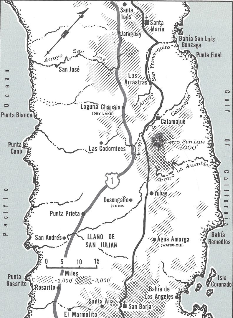
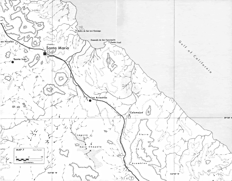
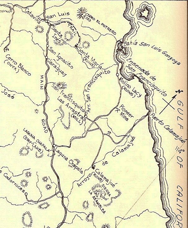
Otherwise, the water hole of San Francisco (later renamed San Francisquito) is just beyond Las Arrastras, where they got water. Serra camped there on
his way to San Diego, I recall.
1956 Gulick Map showing San Francisquito water hole.
|
|
|
4x4abc
Ultra Nomad
Posts: 4165
Registered: 4-24-2009
Location: La Paz, BCS
Member Is Offline
Mood: happy - always
|
|
yes, Rancho las Arrastritas
also, just north of Calamajue is a canyon called Arroyo Tinaja de los Frailes indicating water found/used by the padres
this canyon is on the more direct route
Harald Pietschmann
|
|
|
David K
Honored Nomad
Posts: 64488
Registered: 8-30-2002
Location: San Diego County
Member Is Offline
Mood: Have Baja Fever
|
|
The next water source on El Camino Real, north of San Francisco (San Francisquito), is Las Palmitas. Then not until the Santa María mission valley
(post 1769). 1767-1769, the Camino Real was in the canyon, with the beautiful pools of water.
|
|
|
David K
Honored Nomad
Posts: 64488
Registered: 8-30-2002
Location: San Diego County
Member Is Offline
Mood: Have Baja Fever
|
|
Bumping up a nice post from Sharksbaja.
|
|
|
| Pages:
1
..
3
4
5 |


