| Pages:
1
2 |
PaulW
Ultra Nomad

Posts: 3005
Registered: 5-21-2013
Member Is Offline
|
|
Thinking back on my hiking experience. I have climbed and hiked around the world and no matter how much homework I had done and even with the maps in
hand it is all to frequent that I found I am in the wrong drainage and from my position I ID the summits nearby wrongly. Now we have Google earth and
cannot place ourselves in Hendersons situation.
I have my suspicions and believe the answer to find a rock pile is to trace his steps to not from AG or what ever he thought was AG. From the ground
all kinds of incorrect impressions can be derived. The real problem is on the ground you are to close to picture the overall big view.
Having said that I will do my hikes from both ends meaning start at the model A and continue my AG hikes.
Paul
|
|
|
David K
Honored Nomad
Posts: 64479
Registered: 8-30-2002
Location: San Diego County
Member Is Offline
Mood: Have Baja Fever
|
|
Great Paul... I think BajaGeoff and I will try and drive up and into the Sierra Pinta the same way, as well... Begin from the SCORE road where it
crosses Arroyo el Arrajal and see how far to the 'divide' we can drive. Best of luck to you and any others who go lucking. Please take many photos of
the rock pile if you find it!
|
|
|
David K
Honored Nomad
Posts: 64479
Registered: 8-30-2002
Location: San Diego County
Member Is Offline
Mood: Have Baja Fever
|
|
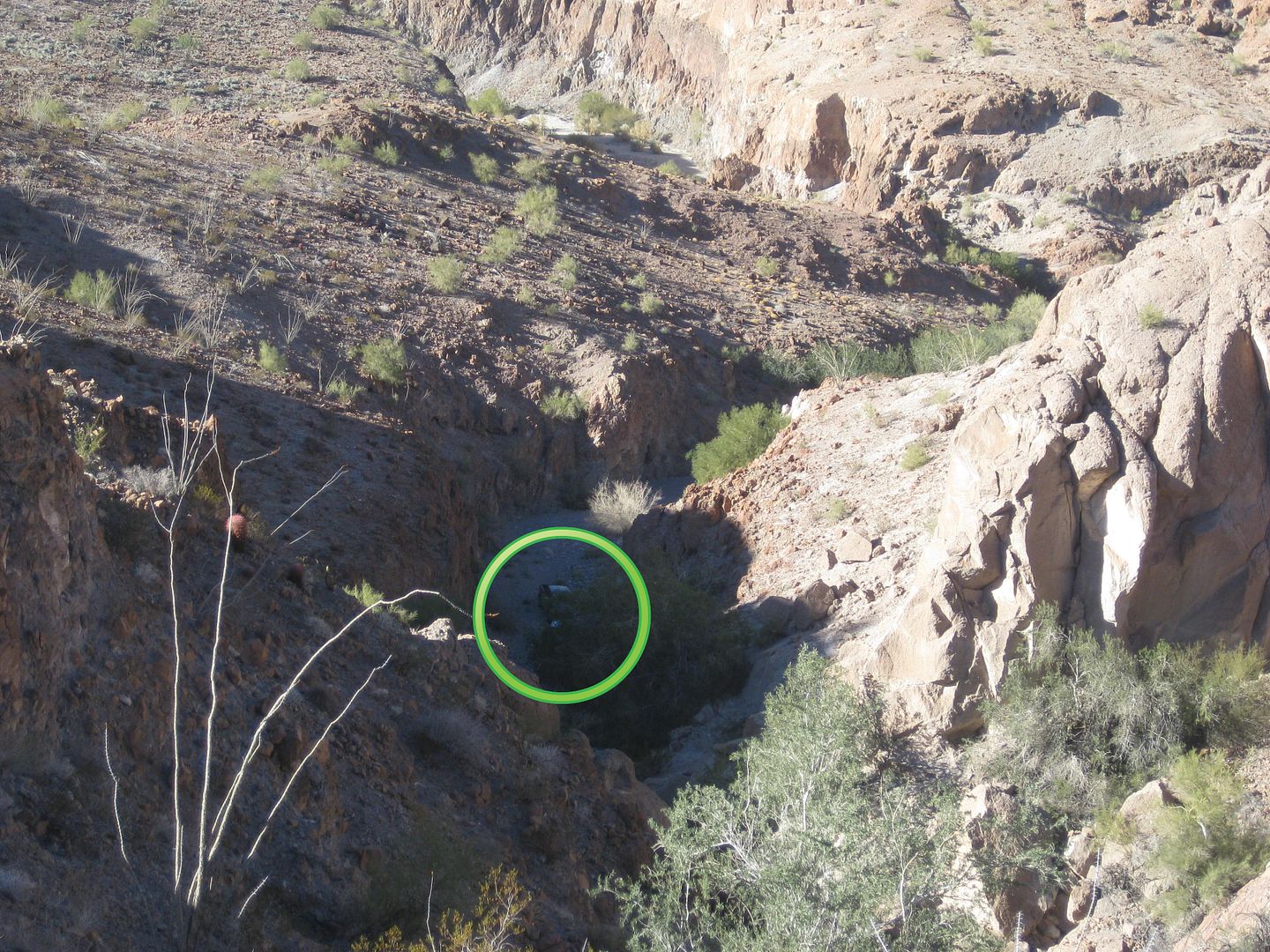
Last Arroyo Grande Search
Two days after Christmas 2016, Baja Geoff and I drove up Arroyo Grande from the mine wells west of La Ventana on one final Arroyo Grande-side based
search.
Geoff had seen a possible target on Google Earth and it was on a ledge above the southern-most of the west flowing arroyos going into Arroyo Grande.
Here is the location (red circle) of our last search. I added a blue (uphill) and red (downhill) arrow of Henderson's possible route to this place...

HERE IS a REPOST from my 2017 Expedition #1 trip report covering our search for the "rock-pile"...
The first day I caravaned with Baja Geoff as he has become very intrigued by the Melchior Diaz 1541 Grave Mystery, as told in this article: https://www.bajabound.com/bajaadventures/bajatravel/searchin...
Geoff has been going over Google Earth in the region myself and four other Nomads explored in April 2015 looking for possible sites. He had a hot
target he wanted to see, and it was very near where we could get our Toyota trucks to, northwest of San Felipe.
After that search and camping one night with Geoff, I continued on south on my trip while he returned to run operations at Baja Bound.
DAY 1 (TUE. JAN. 27, 2016):
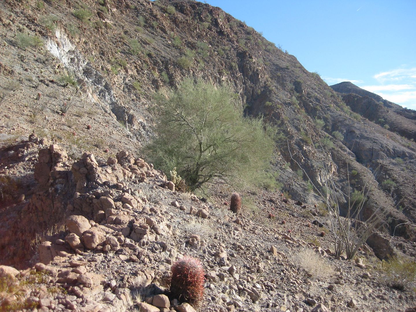
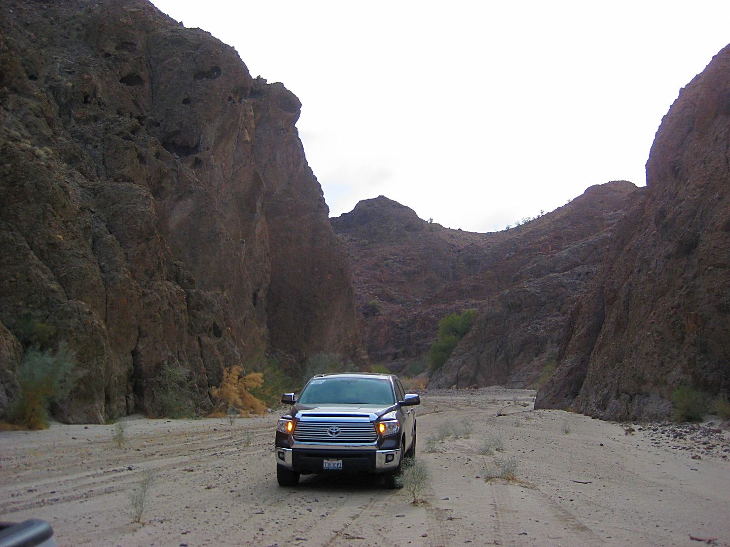
I meet Geoff near El Centro and we drive down Hwy. 5 to La Ventana (1 km. south) then turn west and go 28 miles to the target wash and the object
Geoff GPS'd was on a steep bluff, just beyond our trucks. He saw a round or oval object 8-10 feet in diameter overlooking the land to the west, just
as Walter Henderson described in his 1967 letter to Choral Pepper.
It was a lot higher up from the arroyo than Google Earth indicated. I managed to climb to the top, sometimes on all fours, sometimes sliding back 2
feet for every three forward, but made it. Geoff had attempted another route up, but it quickly proved impassable.
Our two trucks from the top of the bluff... looking west.
Looking east, there was the 10 ft. wide object...
Not a pile of rocks like for an important grave of a 16th Century Spanish explorer, but a mesquite tree!
Here is from the other side of it, looking west...
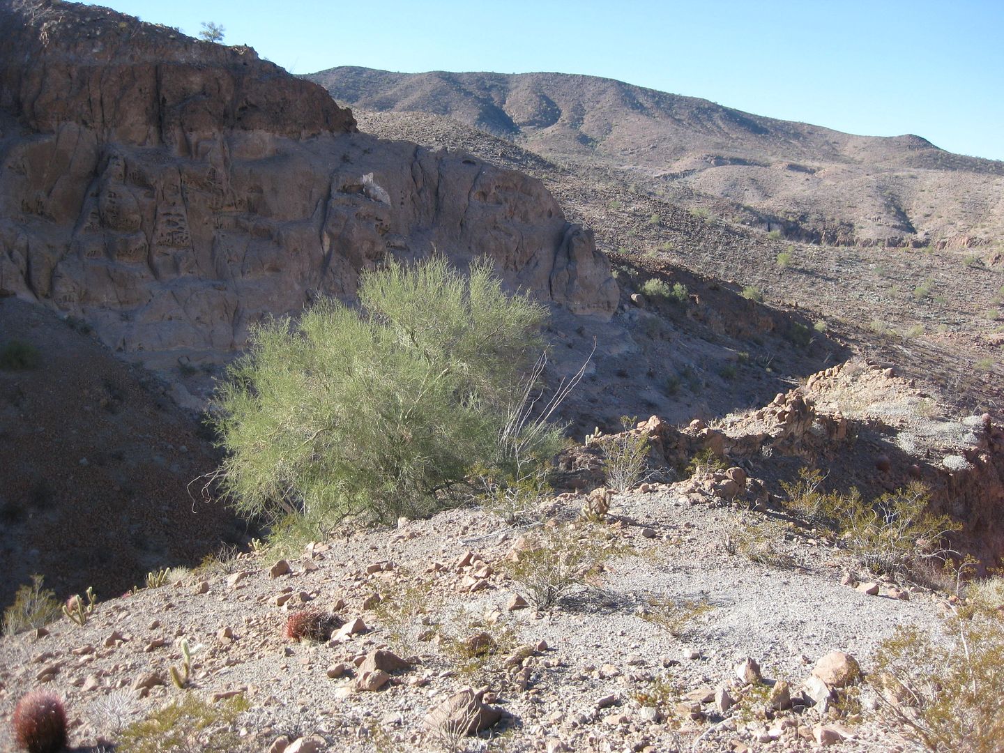
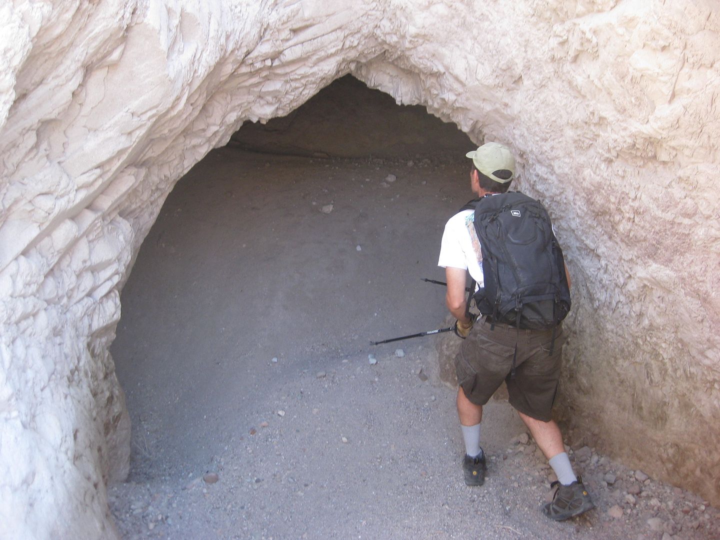
Further east and higher up, I saw an exciting object!
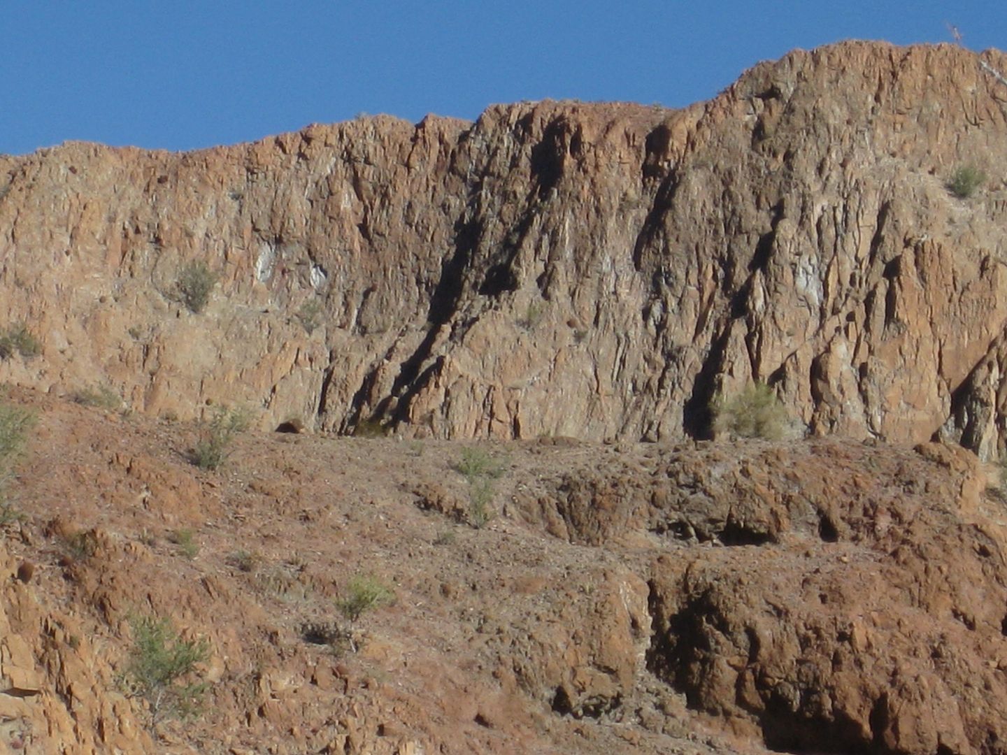
See it?
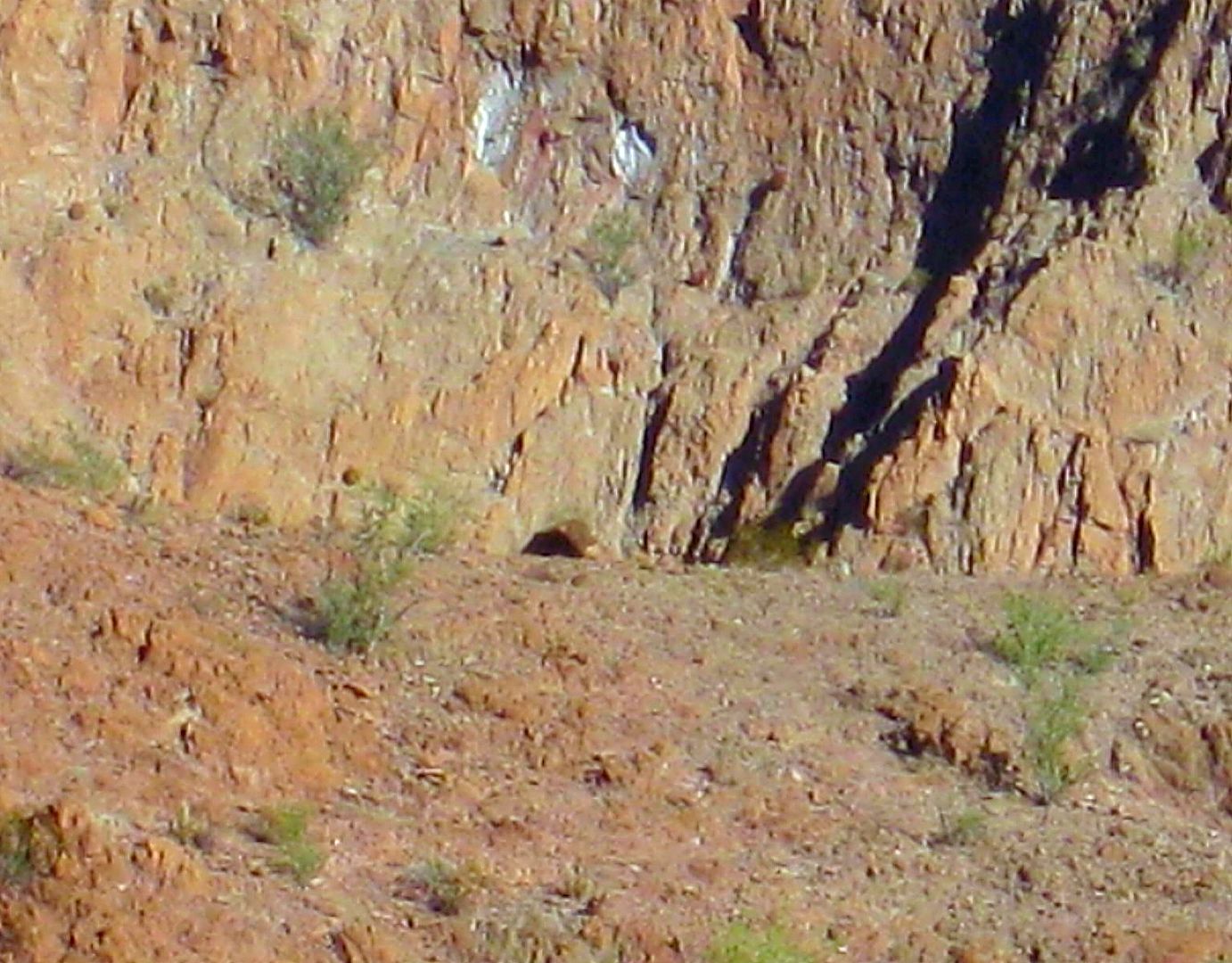
Could that be a cave? Frigatebird and I found a cave on the last Diaz Grave search, just north of here. Remember...
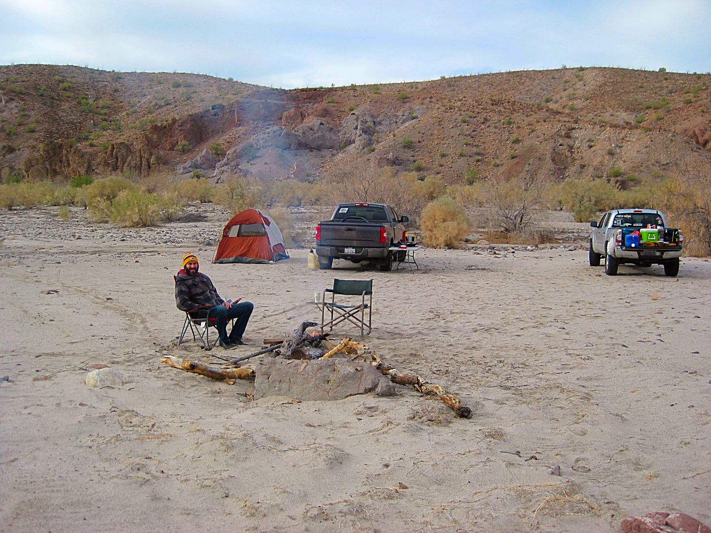
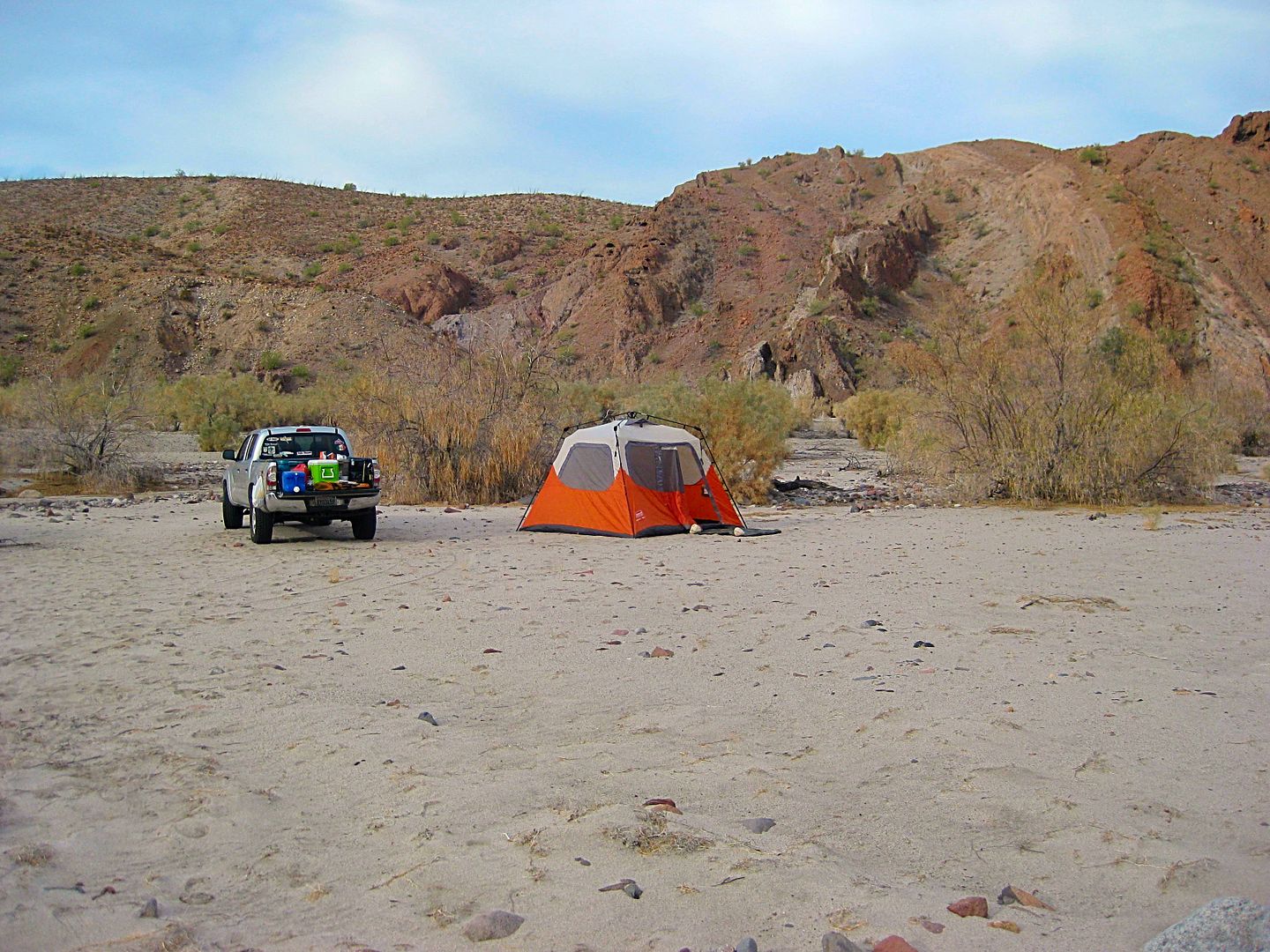
Bummed that the grave or 'rock pile' still alludes us, we drove up the wash and made camp where we Nomads had back in 2015... Geoff made the most
awesome beef stew for the trip and breakfast burritos the next morning!
Geoff says the shrubs on top of the mountain are moving? Is the wind blowing up there, I wonder? I will see if the zoom on my camera helps...
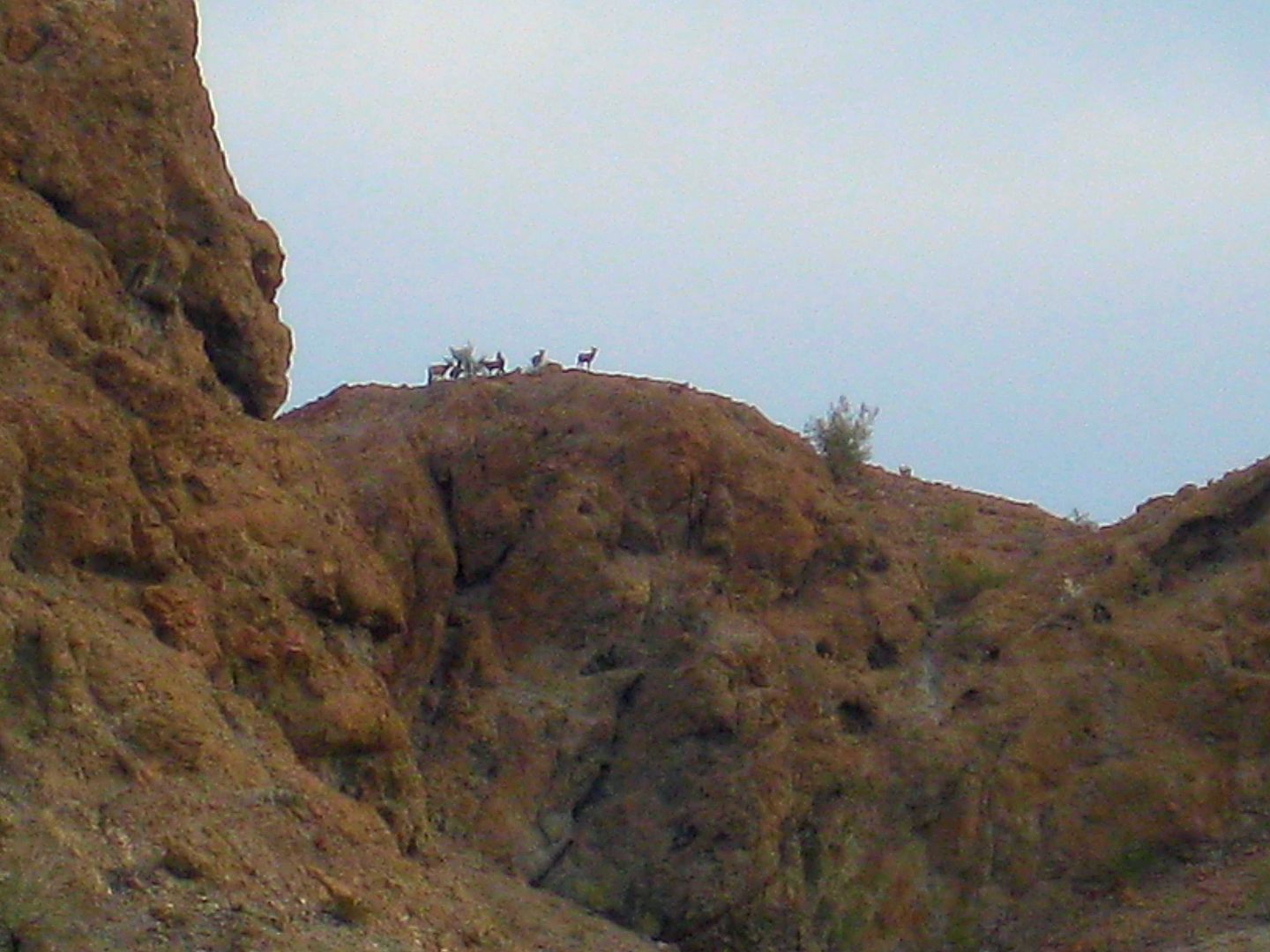
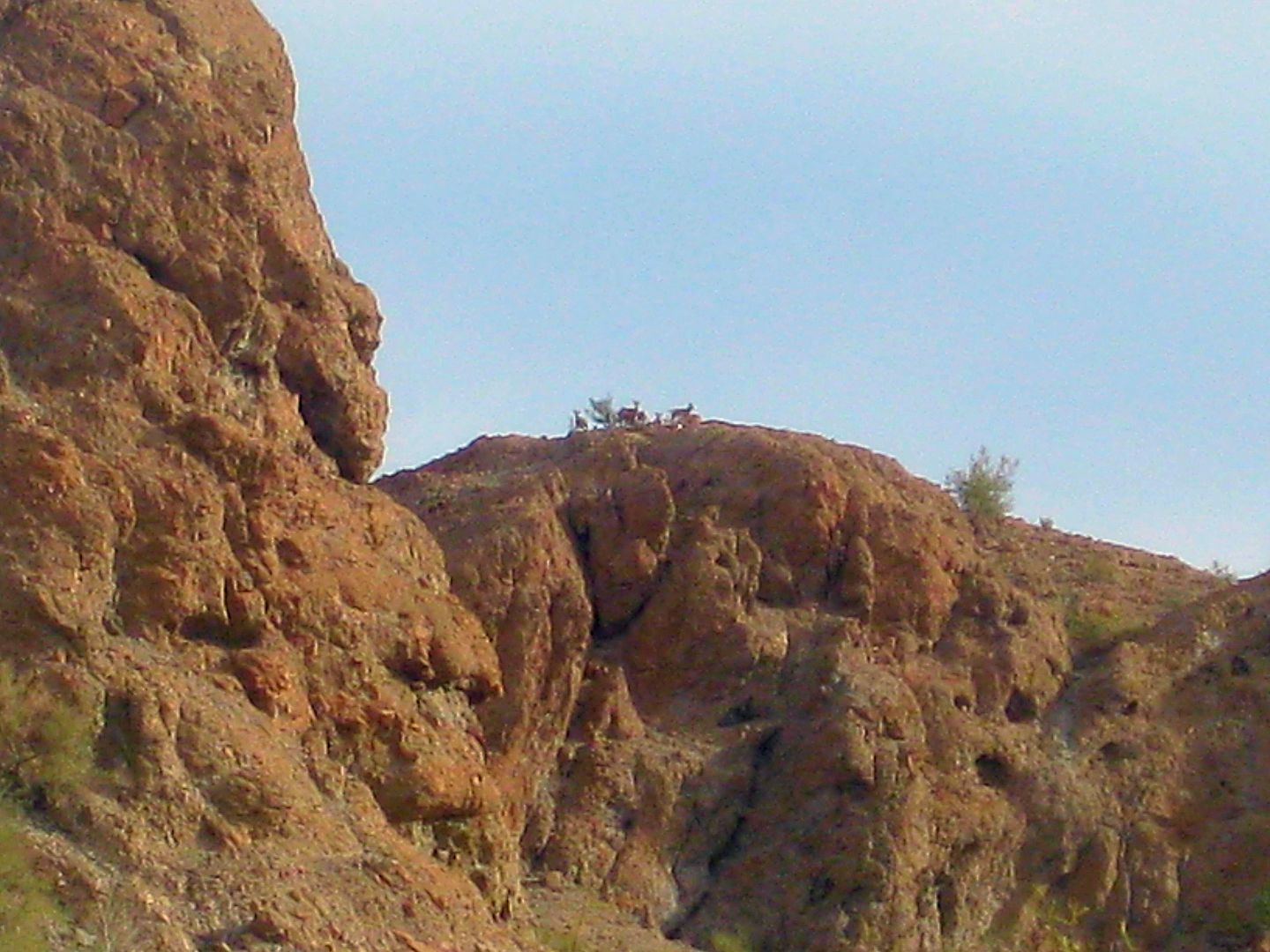
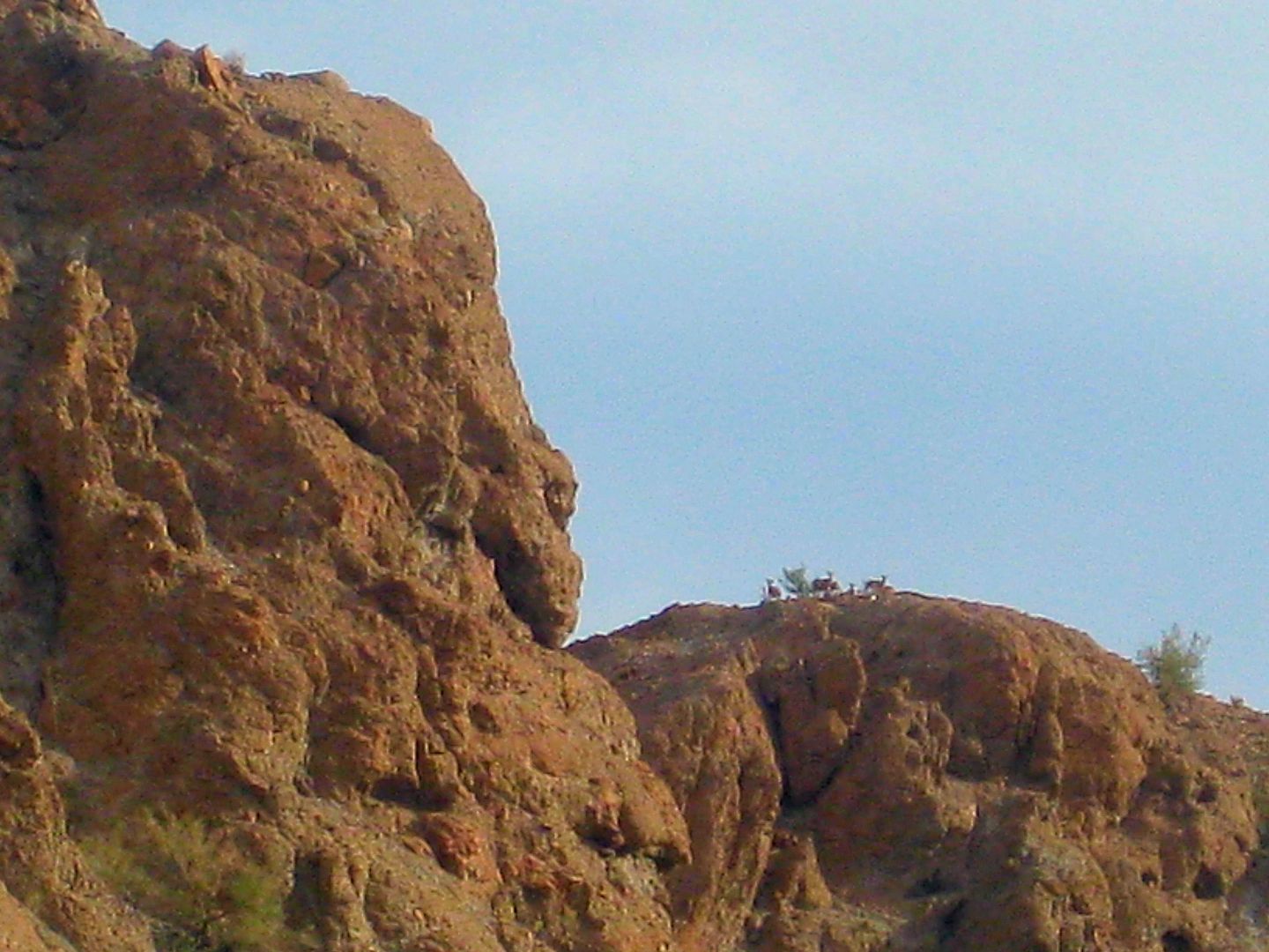
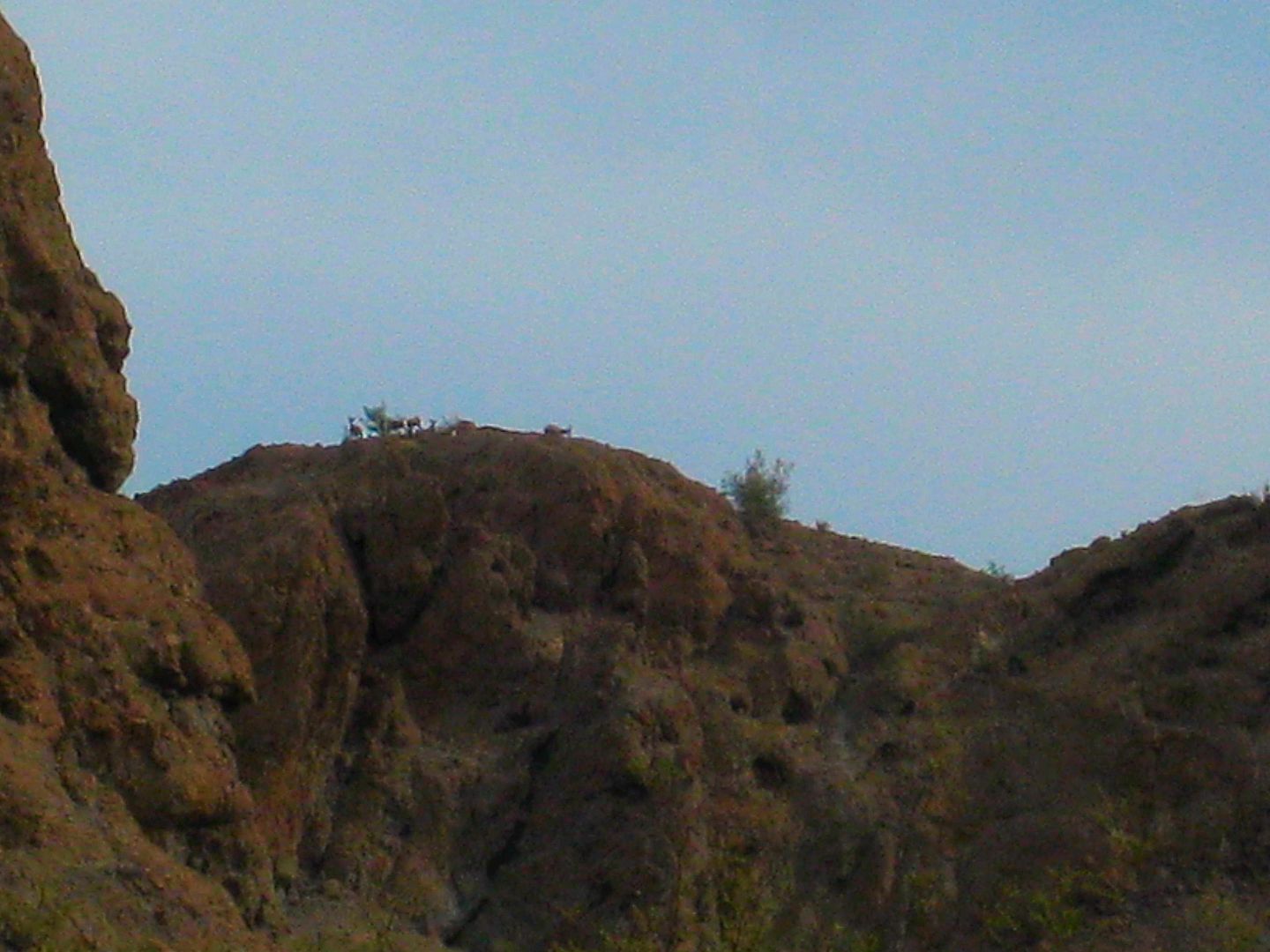
The herd of Borrego's were feeding on that shrub and watching us far below.
Packed up the trucks and headed north in Arroyo Grande...
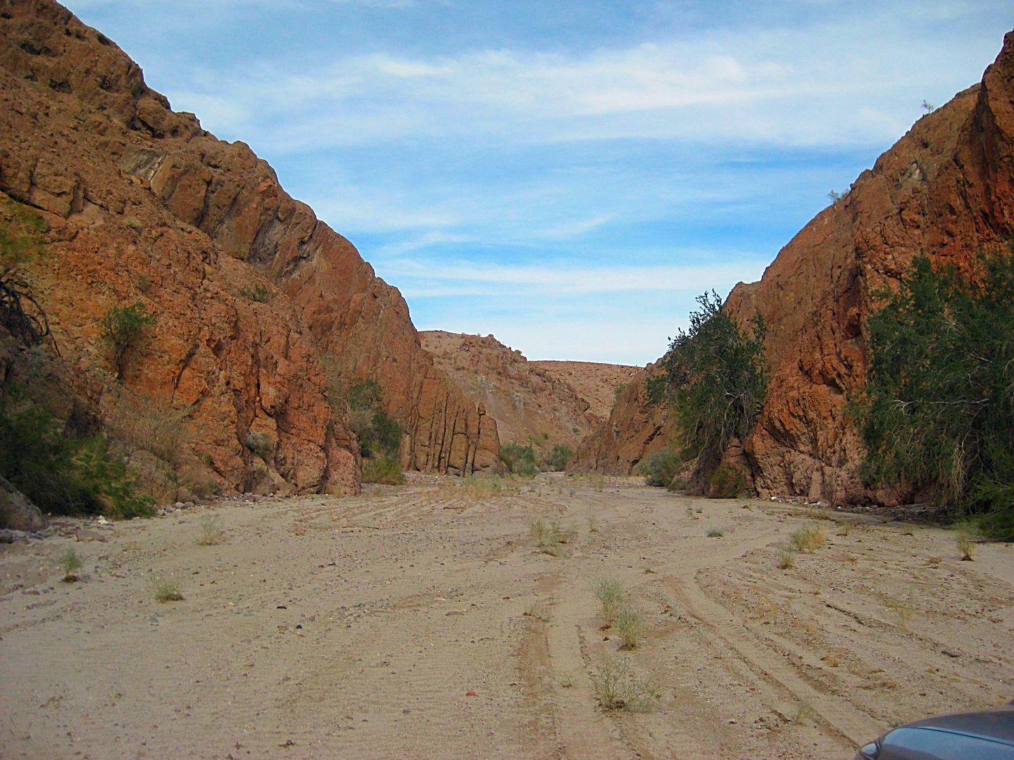
Even with the heavy rain just days before, the sand did not stay wet and there was very little mud.
I showed Geoff were the Pole Line Road reaches Arroyo Grande (17.5 miles from Hwy. 5) and it was a great short time with Geoff exploring Baja for a
common fascination we have... the mysteries of the past!
|
|
|
BajaGeoff
Super Nomad
Posts: 1727
Registered: 1-11-2006
Location: San Diego and Campo Lopez
Member Is Offline
Mood: Heading To Baja!!!
|
|
Such a fun trip!
|
|
|
David K
Honored Nomad
Posts: 64479
Registered: 8-30-2002
Location: San Diego County
Member Is Offline
Mood: Have Baja Fever
|
|
Hey, I didn't see you up at that tree! LOL
|
|
|
BajaGeoff
Super Nomad
Posts: 1727
Registered: 1-11-2006
Location: San Diego and Campo Lopez
Member Is Offline
Mood: Heading To Baja!!!
|
|
Hahaha....I was trying to not slide down the back side of that bluff. That was some brutally rough terrain!
|
|
|
David K
Honored Nomad
Posts: 64479
Registered: 8-30-2002
Location: San Diego County
Member Is Offline
Mood: Have Baja Fever
|
|
I am ready to try FatBoy's side of the Sierra Pinta... in case Henderson didn't know Arroyo Grande from any other major wash. I think he did... but we
haven't found the rock pile yet, so it can't hurt!
|
|
|
Fatboy
Senior Nomad
Posts: 711
Registered: 6-28-2005
Member Is Online
|
|
New evidence that Walter Henderson was never in Arroyo Grande that April day?
In February 1947 Randall Henderson of Desert, and no relation to Walter, wrote and published an article titled "Palms of Palomar". In this he recounts
a trip he recently made to this canyon that is about 80 miles south of Mexicali and drains into Laguna Salada.
Now, I have not read that article yet, but I will soon to see what sort of directions he gives. The interesting part about this though is an article
Randall wrote for the February 1955 issue of Desert, 8 years later to the month.
The article is titled "Cattle Ranch Among the Palms" were he states that he recently found out that he WAS NEVER IN PALOMAR CANYON!
That due to the lack of official maps they were actually in Santa Isabel Canyon which is about 3 miles south of Palomar reported Randall.
So here we have another desert explorer that visited Northern Baja 15 years after Walter did and was confused about where he really was, so was Walter
Henderson ever in Arroyo Grande that April day when he stumbled upon "The Rockpile"?
|
|
|
David K
Honored Nomad
Posts: 64479
Registered: 8-30-2002
Location: San Diego County
Member Is Offline
Mood: Have Baja Fever
|
|
Walter was using Howard Gulick's map, in his 1967 letter to Choral Peppe, to describe where he and his friend went.
Now, on 1930-era maps, Arroyo Grande is hard to mistake as it is pretty prominent and named. Arthur North explored it in 1905, by name and mentioned
the petroglyphs in it.
That Walter describes the rockpile as in a ravine that drops down, westward, pretty much limits where to search. The Sierra las Pintas (Pinta) has
several west flowing ravines.
The reason I began my searching in the northern washes flowing west into Arroyo Grande is that Walter wrote he and is friend wanted to get to the
Sierra las Tinajas (to find blue palms) and they realized they drove in (west) from the San Felipe road, too far south.
So, when they parked, they would hike northwest instead of west. UNLESS, he realized he was too far south AFTER they hiked to the top of the Las
Pintas range... and dropped into Arroyo Grande. ???
The key missing part of the story was how did they walk BACK to the Model A, exactly??? He mentions the base of Borrego Mountain and that they
obviously did not return using the same ravine the rock pile was in.
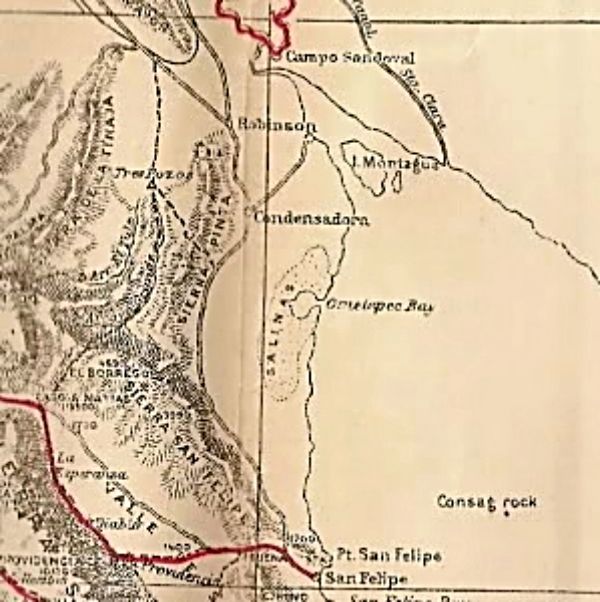
Now, here is a map that Walter may have had...
It was published in 1919 by Edward Nelson (researched in 1905).
It clearly names El Borrego Mountain, Arroyo Grande, Arroyo El Tule (Jaquegel), etc. Sorry, this blow up is a tad blurred...
[Edited on 4-3-2017 by David K]
|
|
|
kevin_in_idaho
Nomad
Posts: 143
Registered: 12-13-2016
Member Is Offline
|
|
I was listening to NPR the other day and someone that was some type of Archaeologist stated that you can get high resolution (nasa?) satellite maps of
just about any area in the work for $15? You guys seem to have the right spot, I wonder if these maps would help? I'm not sure of the map scale so
they may be too focused?
|
|
|
Fatboy
Senior Nomad
Posts: 711
Registered: 6-28-2005
Member Is Online
|
|
Quote: Originally posted by David K  | Walter was using Howard Gulick's map, in his 1967 letter to Choral Pepper, to describe where he and his friend went.
[/rquote
Yes, and think about it for a minute, say that you go to a place you believe is Arroyo Grande and years later someone shows you a map and
asks, where did you go? You are going to find Arroyo Grande ON THE MAP and say I went there, but it does not mean you were actually there, only that
you believe you were there.
| Quote: Originally posted by David K |
Now, on 1930-era maps, Arroyo Grande is hard to mistake as it is pretty prominent and named. Arthur North explored it in 1905, by name and mentioned
the petroglyphs in it.
|
15 years later and with access to the same maps Walter would have had plus any newer ones made since 1933 Randall Henderson still went to the
wrong canyon, not once, but THREE TIMES!
| Quote: Originally posted by David K |
That Walter describes the rockpile as in a ravine that drops down, westward, pretty much limits where to search. The Sierra las Pintas (Pinta) has
several west flowing ravines.
|
Yes, and if you look at the area I marked as a possible search area, you will see a spur of hills flowing North/South which means the
drainages are East/West just as Walter described. Along with the secondary directions of flying from Sharps peak to an unnamed peak which you do not
discuss.
| Quote: Originally posted by David K |
The reason I began my searching in the northern washes flowing west into Arroyo Grande is that Walter wrote he and is friend wanted to get to the
Sierra las Tinajas (to find blue palms) and they realized they drove in (west) from the San Felipe road, too far south.
So, when they parked, they would hike northwest instead of west. UNLESS, he realized he was too far south AFTER they hiked to the top of the Las
Pintas range... and dropped into Arroyo Grande. ???
|
The impression I get is they realized they were to far south AFTERWARDS, if they knew it at the time why even continue? Why not get back in
the car and drive closer, since they would have to drive North to get closer and North was the way home anyways?
| Quote: Originally posted by David K |
Now, here is a map that Walter may have had...
It was published in 1919 by Edward Nelson (researched in 1905).
It clearly names El Borrego Mountain, Arroyo Grande, Arroyo El Tule (Jaquegel), etc. Sorry, this blow up is a tad blurred...
|
Or not had or misread or....?
[Edited on 4-3-2017 by Fatboy] |
|
|
|
David K
Honored Nomad
Posts: 64479
Registered: 8-30-2002
Location: San Diego County
Member Is Offline
Mood: Have Baja Fever
|
|
| Quote: Originally posted by kevin_in_idaho | | I was listening to NPR the other day and someone that was some type of Archaeologist stated that you can get high resolution (nasa?) satellite maps of
just about any area in the work for $15? You guys seem to have the right spot, I wonder if these maps would help? I'm not sure of the map scale so
they may be too focused? |
Well, the last search that Baja Geoff and I did was based on what Geoff saw on a satellite image... So, we need a little better resolution than Google
earth or Bing Maps has of that part of Baja. A tree is just a roundish blur, but that's not bad... I think the rock pile would be a tad smaller, and
rectangular.
By sharing the letter, it is my sincere hope one of us finds it and shares the site with photos. It was one of Choral Pepper's prized stories that she
wanted closure on... I found her lost mission, with Nomad help, in 2009 (www.vivabaja.com/109). Just this Melchior Diaz grave mystery and the black gold nuggets of Peg Leg Smith, in the Borrego Desert, remain unsolved
(as far as I know)!
[Edited on 4-3-2017 by David K]
|
|
|
David K
Honored Nomad
Posts: 64479
Registered: 8-30-2002
Location: San Diego County
Member Is Offline
Mood: Have Baja Fever
|
|
Fatboy, I am all in favor of your working on this... The more minds the better. I obviously have a way of thinking how it might have been, but I am in
no way discounting your thinking... If I counter it, it is only to help us find it by discussing and researching more.
I did not search 'Arroyo B' other than the place where it meets Arroyo Grande (and found that huge log) because PaulW hiked into it a week earlier and
reported an impassable waterfall that would have prevented passage to or from Arroyo Grande. Arroyo B is what I put the most faith in as it seemed to
fit many of the descriptions (of have knobs of land, etc.). Yes, it is more than 5 miles from Borrego Mountain... but, as you say, Walter may have
been wrong or forgot.
Here is the 2007+ thread on the Diaz Grave. You may like to see PaulW's topo maps in it... he provides the divide to show drainage direction of all
the washes into Arroyo Grande... http://forums.bajanomad.com/viewthread.php?tid=26703
|
|
|
PaulW
Ultra Nomad
Posts: 3005
Registered: 5-21-2013
Member Is Offline
|
|
There is a lot of territory above Arroyo b. I did not get to the divide and when one does get near the divide it opens up for great areas. To much to
do in one day for me. More eyes would be a good plan.
|
|
|
David K
Honored Nomad
Posts: 64479
Registered: 8-30-2002
Location: San Diego County
Member Is Offline
Mood: Have Baja Fever
|
|
Let's give Fatboy's idea a shot and search closer to Borrego Mountain, too. I have no favorites, but it would be wonderful to have closure and get a
smile from Choral up in Desert Heaven!
|
|
|
David K
Honored Nomad
Posts: 64479
Registered: 8-30-2002
Location: San Diego County
Member Is Offline
Mood: Have Baja Fever
|
|
The years are passing by and Covid-19 robbed us of one more Winter to explore the desert hills north of Hwy. 3 and west of El Chinero (Hwy. 5).
Maybe satellite imaging will improve over that part of Baja...
Maybe a drone with a long range of travel will help...
Maybe we can talk Jim McCoy to fly us in his helicopter and put an end to this real fast!??
|
|
|
RFClark
Super Nomad
Posts: 2331
Registered: 8-27-2015
Member Is Offline
Mood: Looking forward to 2024
|
|
DK,
Since you have standing as a author and these folks have a new satellite with 1/2 Meter resolution they might be able to spot your rock pile. They can
also see disturbed ground. Palm tees will also show up.
They would like publicity, you have something interesting to find.
https://www.capellaspace.com/first-light-images-from-capella...
|
|
|
David K
Honored Nomad
Posts: 64479
Registered: 8-30-2002
Location: San Diego County
Member Is Offline
Mood: Have Baja Fever
|
|
Wow... maybe there is hope? Do you know anyone in particular at that place I should address it to?
|
|
|
RFClark
Super Nomad
Posts: 2331
Registered: 8-27-2015
Member Is Offline
Mood: Looking forward to 2024
|
|
On their site, contact us, media inquires. Tell them an interesting story!
|
|
|
RFClark
Super Nomad
Posts: 2331
Registered: 8-27-2015
Member Is Offline
Mood: Looking forward to 2024
|
|
DK,
Upon spending more time on the Sat Co website I found this. You can propose public good projects that they will support with near real-time data. You
and others are always working on maps which are always out of date and incomplete.
Perhaps these people would support a Baja mapping project. We could do it as a community effort and also use the information ourselves. Mexico could
use the same information to monitor roads and tourism to beach and other camp sites.
There’s a reason they say “the map is not the territory” because usually it’s out of date and isn’t! We can fix that!
It would be more interesting than arguing politics!
Humanitarian Missions
Open data has a positive impact on the lives of many people and communities when it is used to improve their welfare and living conditions. The
Capella Open Data Program is designed to support those in need with best-in-class SAR data need for economic development to disaster response and
recovery. Consequently, as part of the Open Data Program Capella will release high-quality SAR imagery products for major humanitarian crisis events
and natural disasters in a timely manner. Do you want to help solve some of the world’s most pressing and challenging problems with open data? Join
Capella’s Community.
[Edited on 3-20-2021 by RFClark]
[Edited on 3-20-2021 by RFClark]
|
|
|
| Pages:
1
2 |


