kbrauner
Newbie
Posts: 12
Registered: 3-5-2013
Member Is Offline
|
|
San Francisquito to Mex 1 (through El Arco)
Does anyone have semi-current information on the road from San Francisquito to Mex 1 (through El Arco)?
|
|
|
JZ
Elite Nomad

Posts: 9217
Registered: 10-3-2003
Member Is Offline
|
|
December 2016 you could drive it 50+ mph once you got about 1/2 way. Fastest dirt road I've ever seen in Baja towards the end.
[Edited on 2-4-2018 by JZ]
|
|
|
David K
Honored Nomad
Posts: 64476
Registered: 8-30-2002
Location: San Diego County
Member Is Offline
Mood: Have Baja Fever
|
|
June 2017, it was excellent. Maybe on of the best graded dirt roads in Baja!
|
|
|
PaulW
Ultra Nomad
Posts: 3005
Registered: 5-21-2013
Member Is Offline
|
|
Drove there 1/21. Same as the other roads. Good shape And nothing unusual.
|
|
|
David K
Honored Nomad
Posts: 64476
Registered: 8-30-2002
Location: San Diego County
Member Is Offline
Mood: Have Baja Fever
|
|
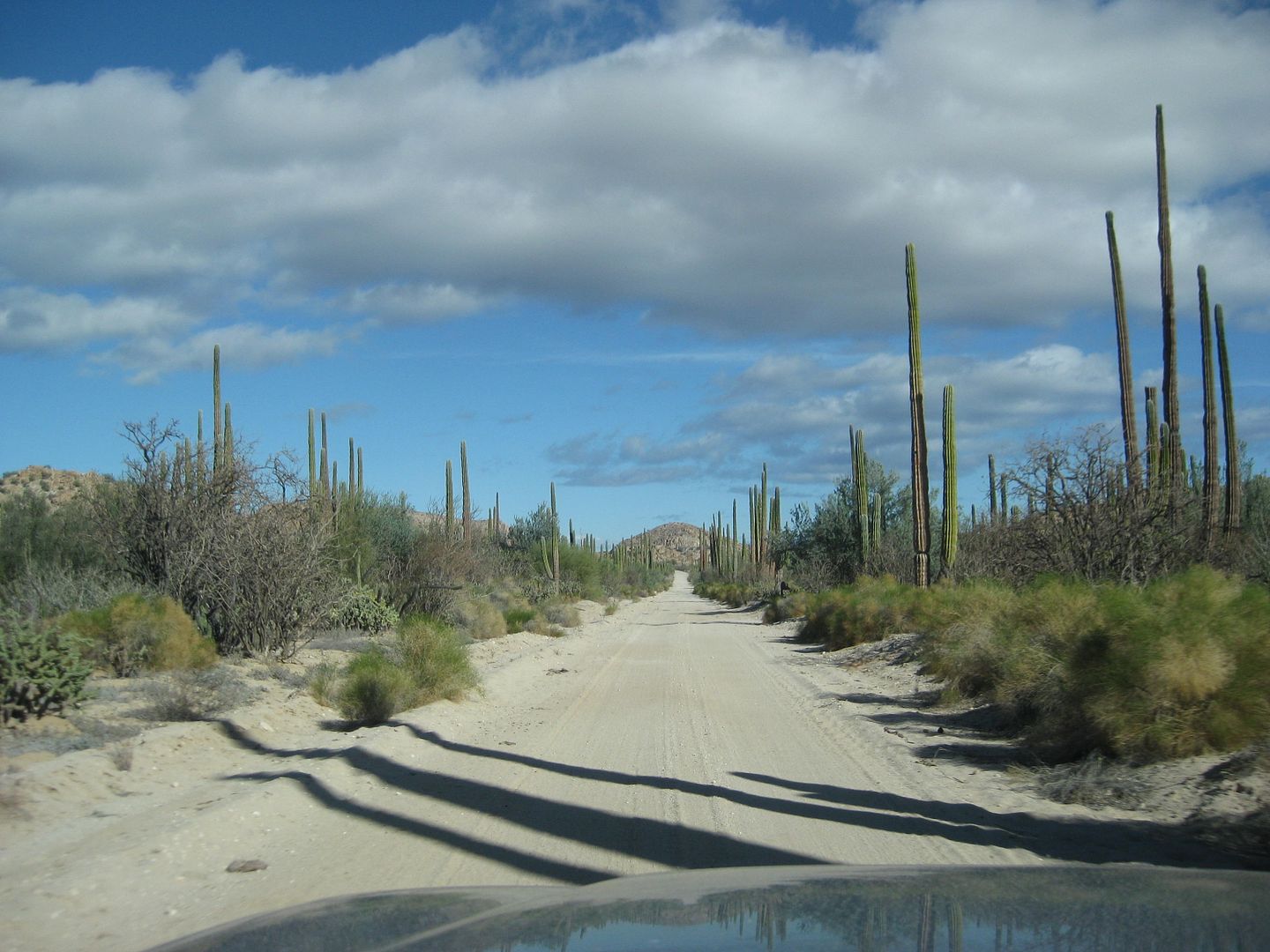
El Arco/San Francisquito Road photos
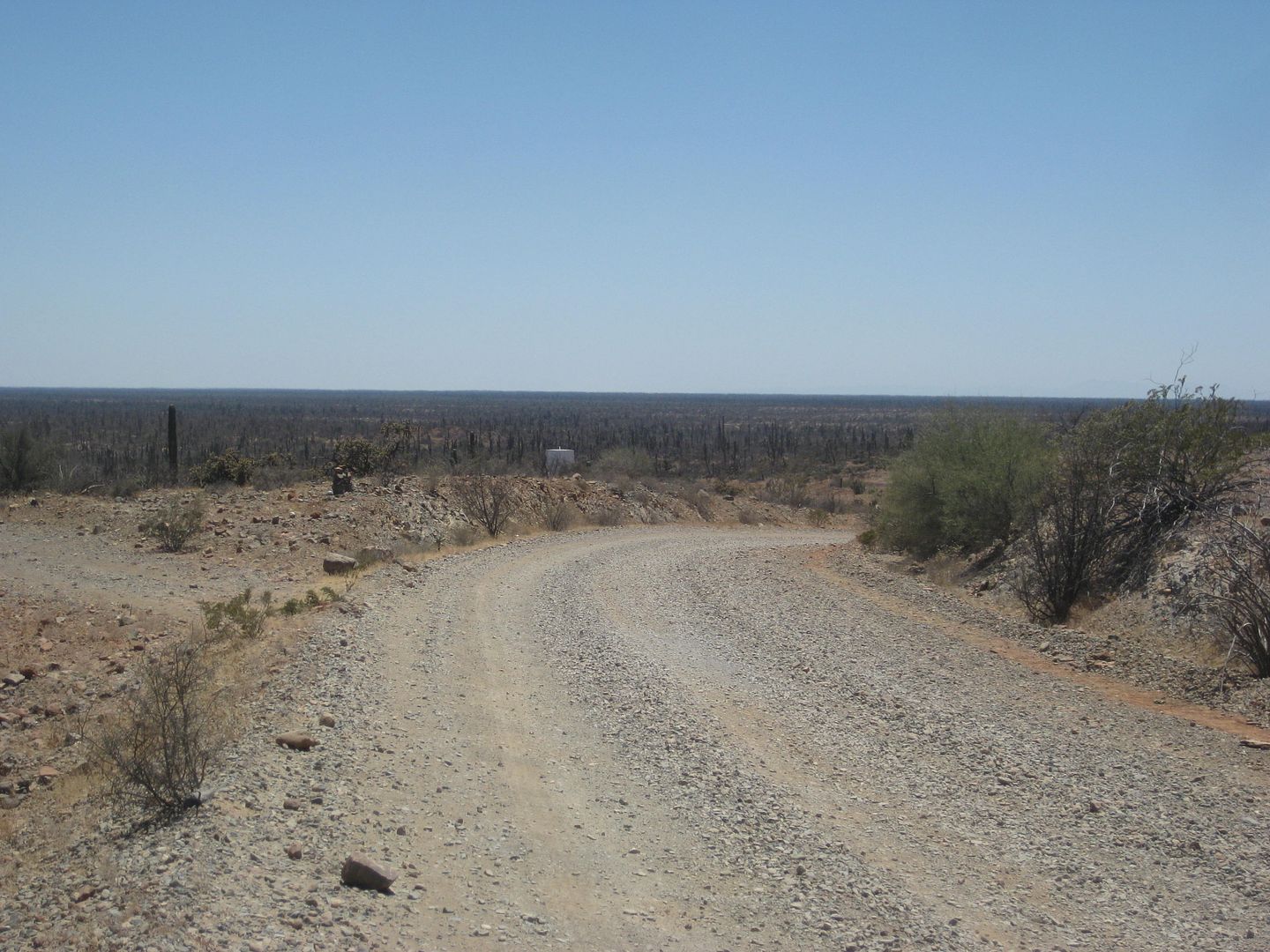
Crossing the state border, near El Arco (looking south).
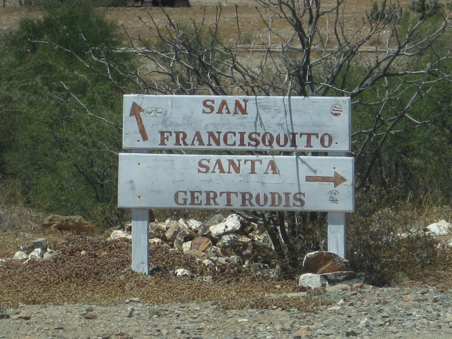
Directions in El Arco
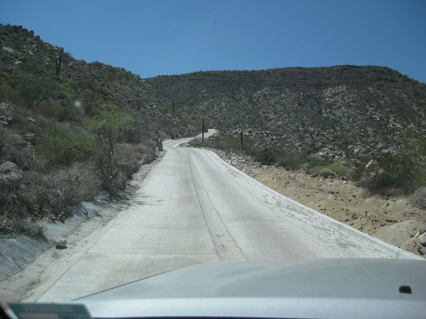
Concrete Grade "Cuesta de la Ley" westbound

Major junction eastbound
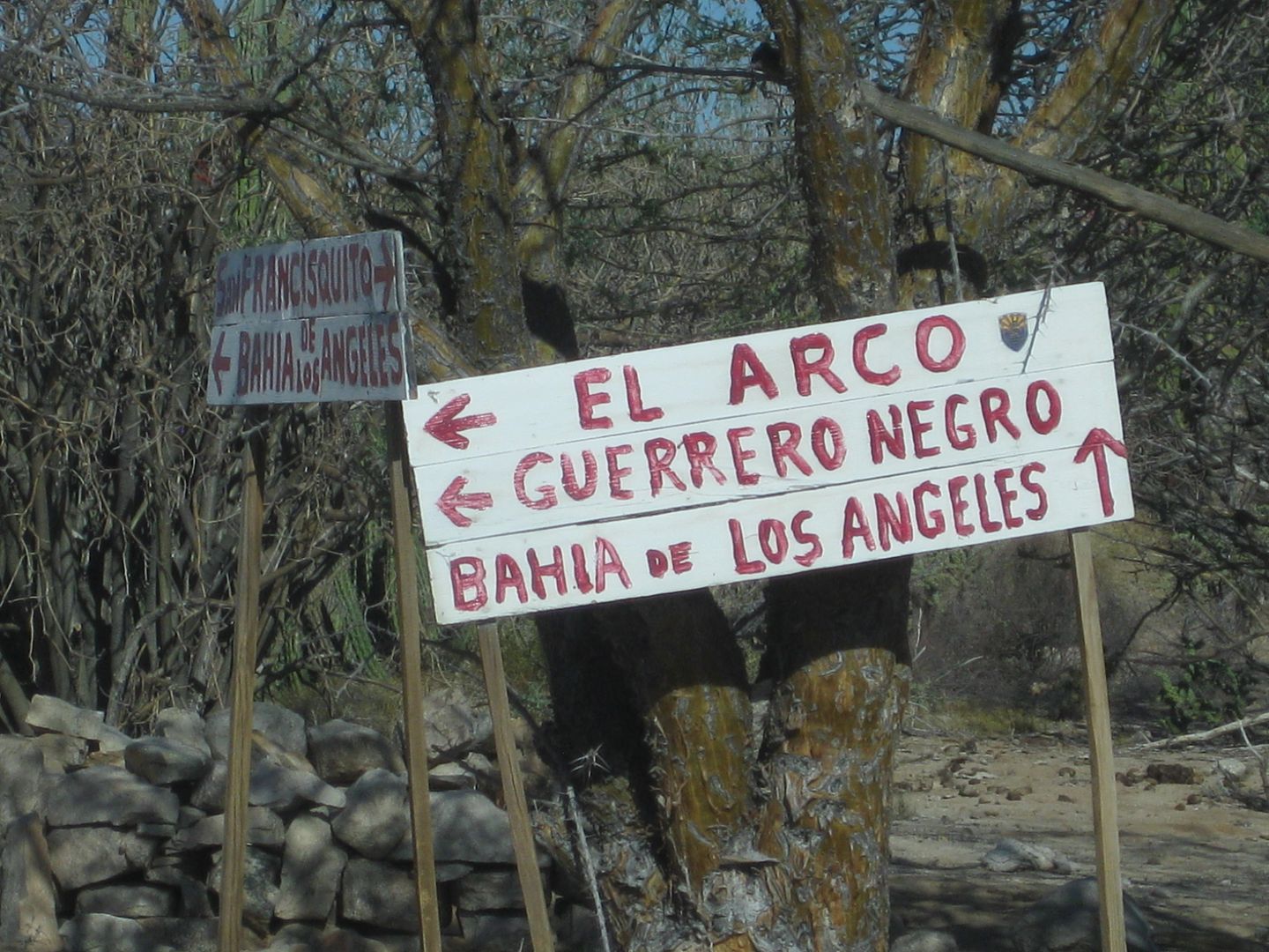
Major junction westbound
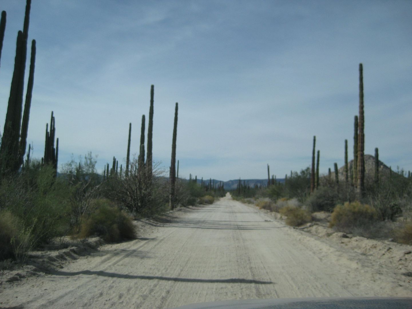
Smooth graded road, better than some of the paved roads in Baja!
|
|
|
kbrauner
Newbie
Posts: 12
Registered: 3-5-2013
Member Is Offline
|
|
On March 9, I drove from Bahia de los Angeles to Hwy 1 via Rafael, San Francisquito, and El Arco. From El Arco to reach Hwy 1, I traveled due south
and then southwest. The portion from Bahia de los Angeles to San Francisquito was the worst. The portion from San Francisquito to Hwy via El Arco
was a dream. I was able to travel 50 miles per hour quite frequently on that stretch. I was driving a 2007 Toyota 4Runner. As I recall I needed its
clearance and probably its 4-wheel drive (in any case I used it) for the drive to San Francisquito, but not thereafter. My times were as follows:
Bahia de los Angeles to San Rafael - 2.5 hrs
San Rafael to San Francisquito - 1 hr
San Francisquito to El Arco - 2 hrs
El Arco to Hwy 1 - 1 hr
(For the unaware: all of these roads are unpaved.)
[Edited on 3-30-2018 by kbrauner]
[Edited on 3-30-2018 by kbrauner]
|
|
|
AKgringo
Elite Nomad
Posts: 5805
Registered: 9-20-2014
Location: Anchorage, AK (no mas!)
Member Is Offline
Mood: Retireded
|
|
I drove it heading north on Saturday 3/24. It is in pretty good shape, nearly as good as the report JZ described, with a few detours around the
culverts that washed out a couple of years ago. 4x4 was not necessary.
They are working on the road just east of Rancho Piedra Blanca, and west of the cemented portion of the grade. I don't know what the intent is, but
where they should have been installing a culvert, or cemented vado, they are using wire mesh baskets filled with large rocks!
I don't get it! They are way worse than any tope, or vado I have ever driven over, and are an extreme hazard for anyone that hits them at speed.
Especially on two wheels!
The first heavy rain will probably wash out the fill material on one or both sides of the baskets, leaving a stone wall across the road!
I should also add that the washed out culverts were between the junction with the road to San Francisquito and Bahia San Rafael.
[Edited on 3-30-2018 by AKgringo]
If you are not living on the edge, you are taking up too much space!
"Could do better if he tried!" Report card comments from most of my grade school teachers. Sadly, still true!
|
|
|
bajaric
Senior Nomad
Posts: 601
Registered: 2-2-2015
Member Is Offline
|
|
Thanks for posting updates on road conditions. I drove from G. Negro to El Arco about a year ago so this is old news but there is a long section of
elevated roadway just after you leave Hwy. 1 gong east, it is U shaped from being graded and at that time there had been some recent rains that
accumulated on the road and where the water flowed off it had cut several deep gullies that reduced the width of the road down to one lane. Don't
know if they have fixed that yet but just wanted to throw in my 2 cents; no problem in daylight but would be a bummer to hit in the dark at speed.
|
|
|
bajaric
Senior Nomad
Posts: 601
Registered: 2-2-2015
Member Is Offline
|
|
G. Negro - El Arco road, mar. 2017 edit: pic was too large and would not load so resized it:

[Edited on 3-30-2018 by bajaric]
|
|
|
kbrauner
Newbie
Posts: 12
Registered: 3-5-2013
Member Is Offline
|
|
A clarification: In my "3-30-2018 at 03:21 AM" post above, from El Arco to Hwy 1 I describe the route that goes first south and then southwest. I
did NOT use the route that travels WSW (westsouthwest) from El Arco. That is the route that travels most directly from El Arco to Guerrero Negro.
This latter route is (I think) in much worse shape as commented upon by bajaric immediately above.
|
|
|
David K
Honored Nomad
Posts: 64476
Registered: 8-30-2002
Location: San Diego County
Member Is Offline
Mood: Have Baja Fever
|
|
Quote: Originally posted by kbrauner  | | A clarification: In my "3-30-2018 at 03:21 AM" post above, from El Arco to Hwy 1 I describe the route that goes first south and then southwest. I
did NOT use the route that travels WSW (westsouthwest) from El Arco. That is the route that travels most directly from El Arco to Guerrero Negro.
This latter route is (I think) in much worse shape as commented upon by bajaric immediately above. |
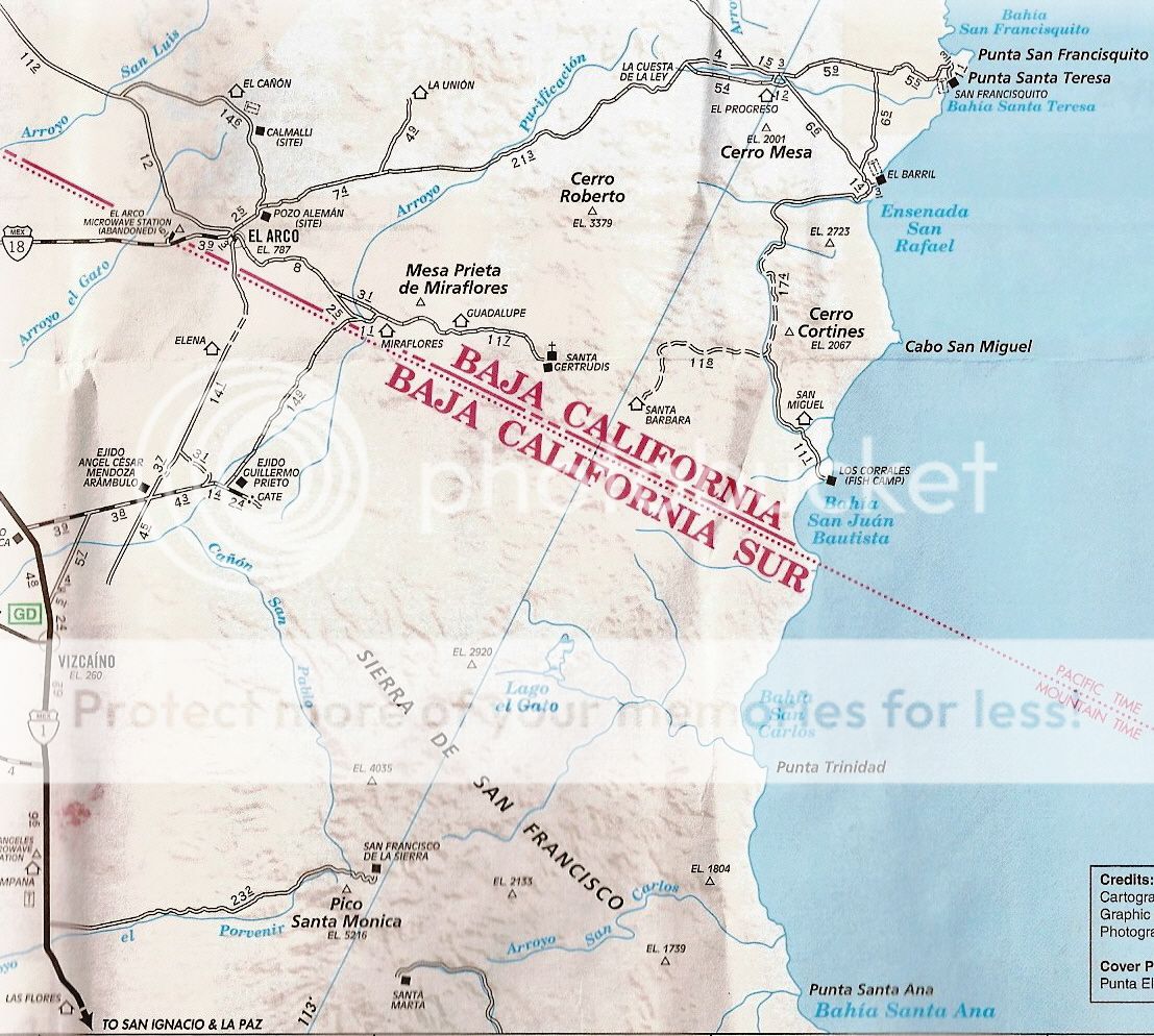
The road that goes straight south from El Arco is the original (pre-1973) Baja Main Road to La Paz. It went directly to cross Highway 1 south of
Vizcaino. However, with El Arco getting its own paved highway (Mexico #18) in 1974, the use of the old road diminished. Eventually, farms began to
fence across it on the southern end (the map below has removed that southern end of it. You met the graded road to Guillermo Prieto and turned SW to
meet Highway 1, a few miles north of Vizcaino.
The pavement to El Arco was never maintained and was badly potholed by the early 1980s. You cannot see any asphalt at all, anymore. The road (except
for the rain erosion) is excellent when driven last summer.
Today the once important mine town of El Arco is abandoned, The big military base there is deserted and only a cattle rancher lives in the center of
the former 'city'.
Here is the AAA map that illustrates the roads south from El Arco:
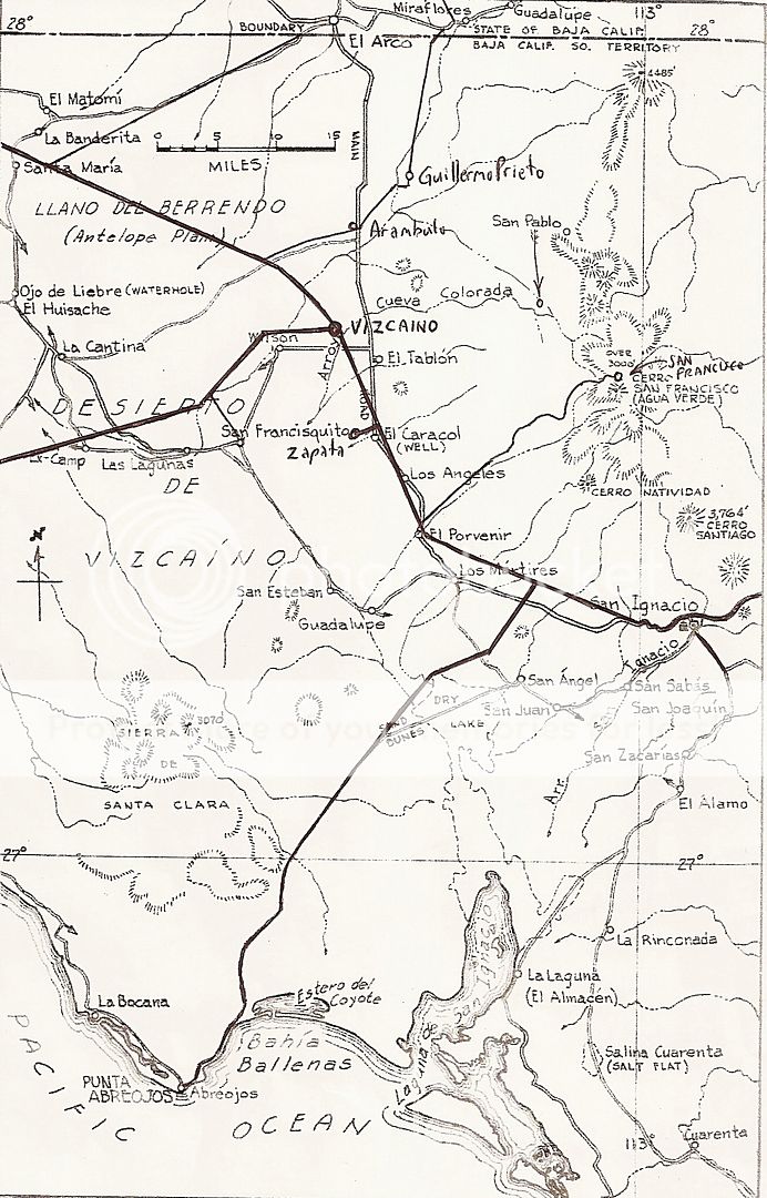
Here is the roadmap from 1962, with modern roads added in:
[Edited on 3-30-2018 by David K]
|
|
|
bajaric
Senior Nomad
Posts: 601
Registered: 2-2-2015
Member Is Offline
|
|
For clarification, my pic above is shown on map as HWY 18, that departs HWY 1 just south of turnoff to Benito Juarez. Really, the road was in fine
shape aside from those little washouts that were no problem to negotiate in daylight. That was a year ago and for all I know it has been fixed. I
believe this was the infamous paved highway that almost immediately deteriorated to dirt conditions after it was built.
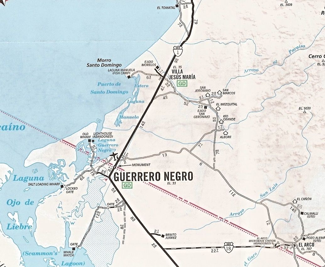
As long as we are talking road conditions in that area, has anyone driven the road to El Arco that departs HWY 1 at Villa Jesus Maria recently?
Doable in 2WD pickup? That would be a nice shortcut to avoid the bug spray / check point just before G Negro.
|
|
|
David K
Honored Nomad
Posts: 64476
Registered: 8-30-2002
Location: San Diego County
Member Is Offline
Mood: Have Baja Fever
|
|
| Quote: Originally posted by bajaric | For clarification, my pic above is shown on map as HWY 18, that departs HWY 1 just south of turnoff to Benito Juarez. Really, the road was in fine
shape aside from those little washouts that were no problem to negotiate in daylight. That was a year ago and for all I know it has been fixed. I
believe this was the infamous paved highway that almost immediately deteriorated to dirt conditions after it was built.
As long as we are talking road conditions in that area, has anyone driven the road to El Arco that departs HWY 1 at Villa Jesus Maria recently?
Doable in 2WD pickup? That would be a nice shortcut to avoid the bug spray / check point just before G Negro. |
Just turn to the airport and the road goes around the west end of the runway and drops into the west end of Guerrero Negro, by the bank.
There was a thread a few months ago on using the old main road between Jesus Maria and El Arco, but don't recall if it was driven by any Nomads. I am
guessing while less miles, it will take you longer?
|
|
|


