okiebaja
Newbie
Posts: 24
Registered: 8-27-2015
Member Is Offline
Mood: Excited.
|
|
Got the fever - 2nd trip - Going to El Rosario
Ok, to be truthful, been going to TJ/Ensenada for years, even Cabo/LaPaz (avoiding tourist areas as much as possible). But only drove down 2 years
ago from TJ to Cabo (loved it).
That being said, I am between jobs for a week and am looking to go down from SD (flying in there) and travel to El Rosario then back eventually.
(seeing what you suggest on the way down).
Why El Rosario you ask, well - while in Catavina on previous trip this guy was showing(trying to sell) me the fossils he had found near(Rosario -
including tales of very large ones in a museum of sorts - I thought - Id like to see this (the canyon and the museum). Like a good gringo I didn't
buy what he was selling, but doesnt mean I dont want to see some on my own. I have explored a few canyons, and they never fail to disappoint.
Problem is my old 4x4 wont make it from okieville to there and back. Ill be driving rental from TJ.
So - here it is.
Any recommendations on who could maybe give me pointer in this area (maybe even a ride while there 4x4). I suspect locals know canyons better than I
can find based on a beer from 2 years ago.
Any recommendations for area or on way down?
I have a orphanage I see around Santo Tomás, that I like to drop in and help, but after that its more or less unknown to me. Thinking about the
observatory on way back.
Thanks
Okiabaja
Sorry to be a little vague, I have had opportunity to see several sites around northern baja that generally only locals know - so I don't like to
share to everyone - they tend to be destroyed if to many people visit. The description of this site seems to be known to many in area.
|
|
|
BajaBlanca
Select Nomad

Posts: 13165
Registered: 10-28-2008
Location: La Bocana, BCS
Member Is Offline
|
|
I have not been to the observatory but the trip reports make me want to go. I think that is a great idea on your part!
Are you interested in seeing the cave paintings?
|
|
|
okiebaja
Newbie
Posts: 24
Registered: 8-27-2015
Member Is Offline
Mood: Excited.
|
|
I ad seen some near catavina and surrounding area, a little over near border, and outside of Ensenada. Fossil watching this trip 
|
|
|
mtgoat666
Select Nomad
Posts: 17295
Registered: 9-16-2006
Location: San Diego
Member Is Offline
Mood: Hot n spicy
|
|
There are a couple arroyos south of el rosario with cretaceous fossils, some ammonites. But i think its pretty slim pickings.
I think there i a canyon with some petrified wood.
Lots of coastal outcrops with miocene, pliocene bivalves and snails.
The fossil hunting isnt that great. Dont have high hopes, you may be disappointed.
A bit hot this time of year. Stick to the coast. If you get disappointed with fossils, do head into the mtns for spm park.
Ask dk for maps.
[Edited on 7-21-2018 by mtgoat666]
Woke!
“...ask not what your country can do for you – ask what you can do for your country.” “My fellow citizens of the world: ask not what America
will do for you, but what together we can do for the freedom of man.”
Prefered gender pronoun: the royal we
|
|
|
thebajarunner
Ultra Nomad
Posts: 3687
Registered: 9-8-2003
Location: Arizona....."Free at last from crumbling Cali
Member Is Offline
Mood: muy amable
|
|
A few years back one of our zanier traveling crew did some serious negotiations in the fossil market in El Rosario. He paid some fairly good bucks
for some strange looking stuff that he was convinced was legit. He has not gone again, nor have we heard how legit his big buy turned out to be.
The drive to the observatory area is fabulous. They have pretty tight control on the actual observatory, Some years back we had a tour, last month
the upper gates were locked and no one seemed to know when and if we could go on up. Still a very worthwhile place to visit.
We were told that at 10 a.m. at KM 74 we would see condors. Wow!! Exactly at 11 a.m. (guess the condors don't do daylight saving time) they came and
they were awesome. More were sitting along the road on the ridge a few miles above Meling.
Stop at Meling and have a meal, or even overnight. Good people and a good place to stay.
Orphanage....are you talking about Rancho Santa Marta, just south of San Vicente? Amazing place, I have been helping them on a regular basis since
1972 when they were located down past Camalu (Colonio Guerrero to be exact) Say hello to Rod for me. Their work with "special needs" people is
admirable.
|
|
|
David K
Honored Nomad
Posts: 64479
Registered: 8-30-2002
Location: San Diego County
Member Is Offline
Mood: Have Baja Fever
|
|
I went to many of these places last year. Look at my trip reports of 2017 in the Nomad trip reports forum. I will list specific days and photos
later...
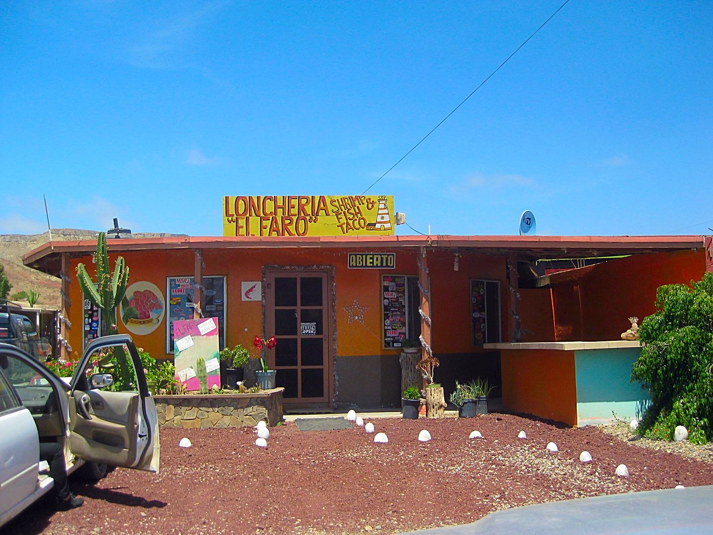
In El Rosario, the Baja Cactus Motel is incredible (next to Pemex). The El Faro restaurant a mile beyond, on the left is very good! Tacos Misión, as
well!
|
|
|
David K
Honored Nomad
Posts: 64479
Registered: 8-30-2002
Location: San Diego County
Member Is Offline
Mood: Have Baja Fever
|
|
Posts out of my 2017 Trip Report #3 (March):
http://forums.bajanomad.com/viewthread.php?tid=85989
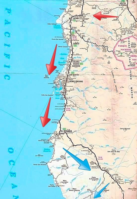
DAY 5: March 6, 2017 Monday EL ROSARIO, a settlement older than the United States!
First off, I top my gas tank, which is just below half full. The price for Magna at Baja Cactus Pemex is 16.09 pesos/liter ($3.24/gallon @ 18.80
pesos: dollar).
My fuel mileage from Puertecitos (192 miles) is 17 mpg.
This morning, I record motels, markets and restaurants along Hwy. 1 going through El Rosario. There are more, actually, there are so many. Not all are
open in the morning. Going southbound through El Rosario:
Km. 56.5+ Wence Market
Km. 57 Car Wash El Popeye
Km. 57+ PEMEX
Km. 57+ Baja Cactus Motel
Km. 57+ Las Cabañas Motel
Km. 57+ Mama Espinoza's Restaurant
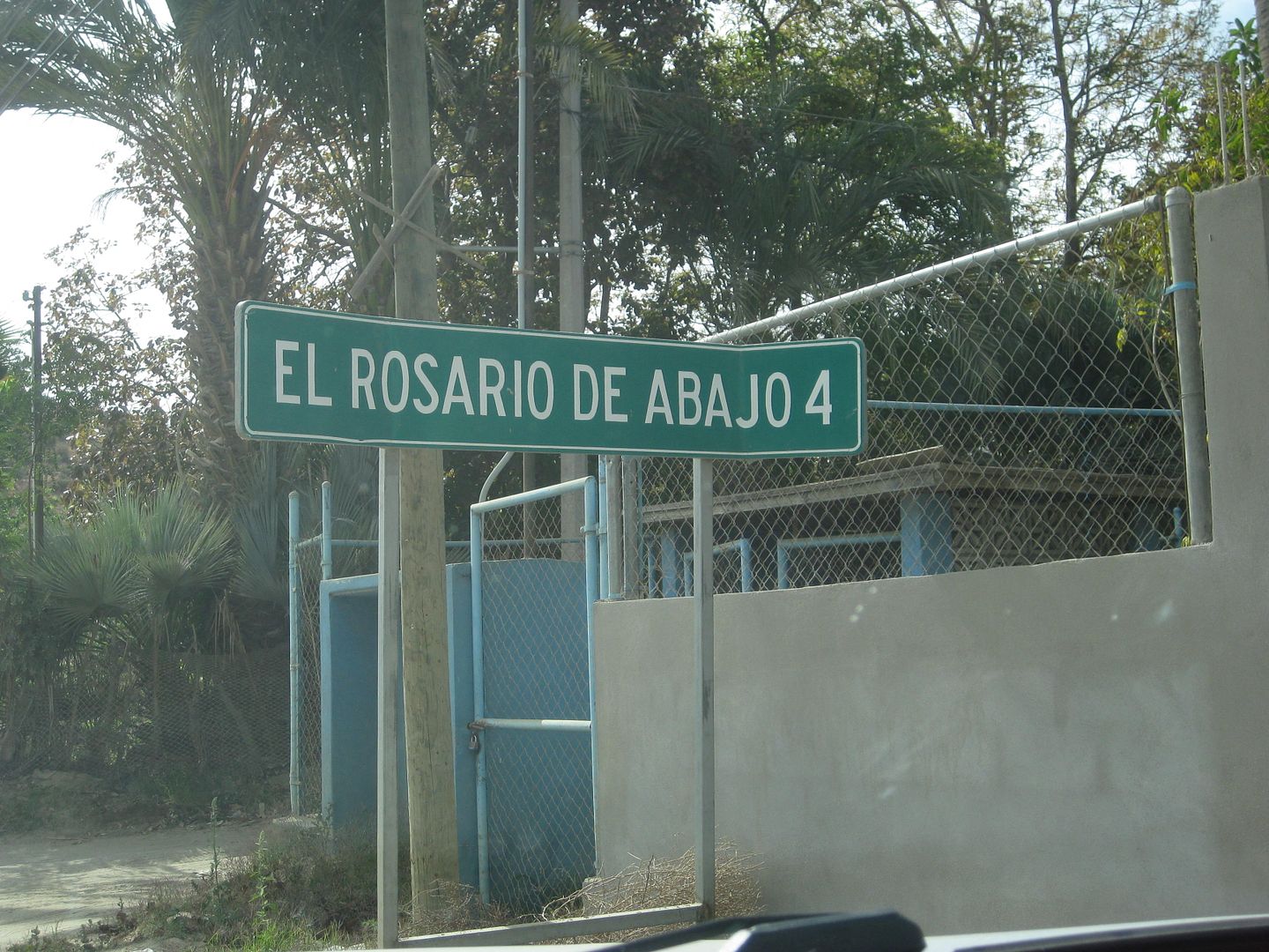
Km. 57.5 Highway turns left. To the right is the road to El Rosario de Abajo (1802 mission location) and on to the coast.
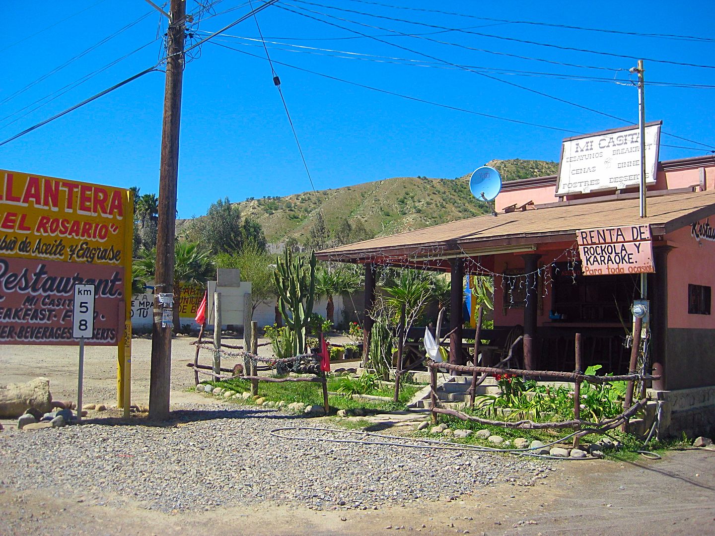
Km. 57.5+ Oxxo Market, El Grullense Restaurant/Pizza
Km. 58 Mi Casita Restaurant, Town Plaza, Police Station
Km. 58.5 Mi Pueblito Restaurant
Km. 58.5 Concrete street left to Mission El Rosario, 1774.
Km. 58.5 Taqueria El Rosario (Tacos)
Km. 58.5+ Restaurant Sinahi, Motel Sinahi, RV Park Sinahi
Km. 59 Luncheria El Faro
Km. 59.5 Restaurant La Pasadita
Km. 60.5 Baja's Best Bed & Breakfast/ Restaurant
Km. 60.5 Turista Motel, Valentino's Restaurant
I have breakfast at Baja's Best, owned by Ed Lusk. He has the best quality chorizo for breakfast burritos.
PHOTOS:
The first Dominican Baja California Mission, founded on July 24, 1774:

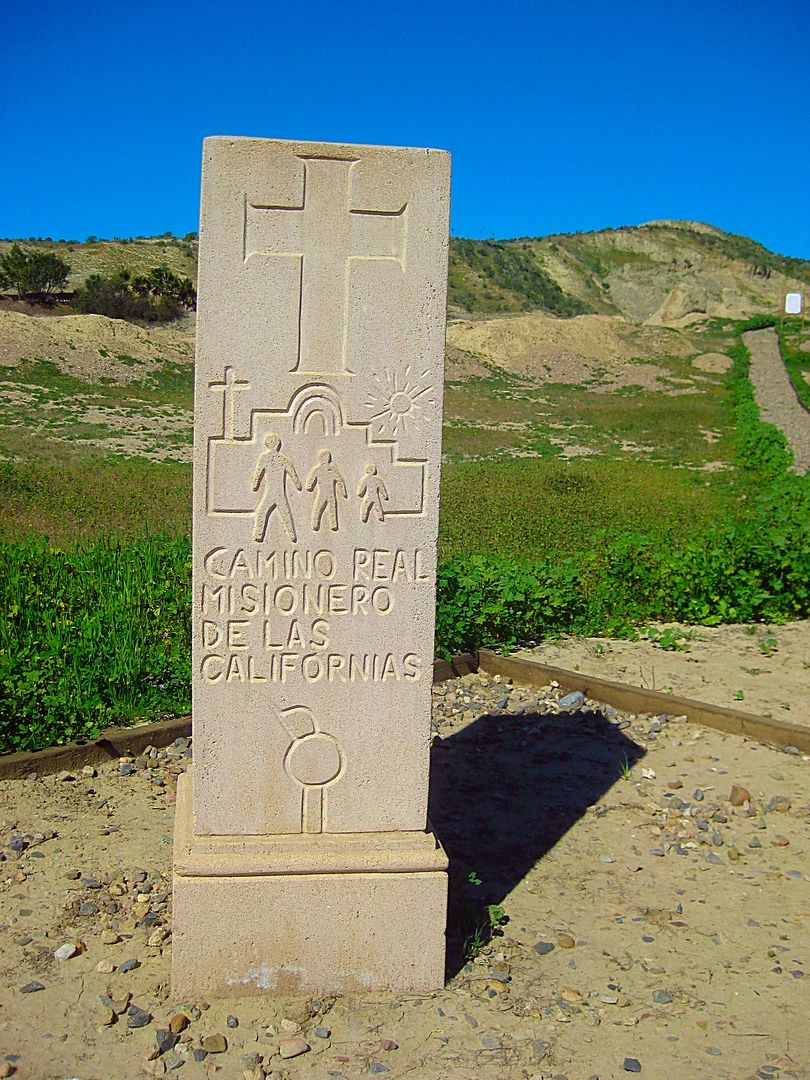
El Camino Real, the first "highway" through California (Baja and Alta).
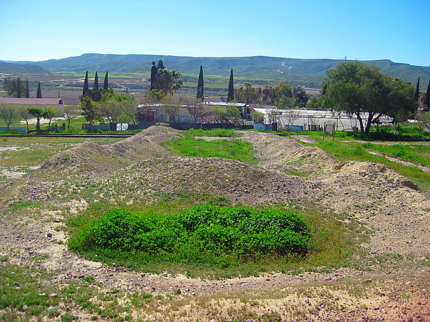
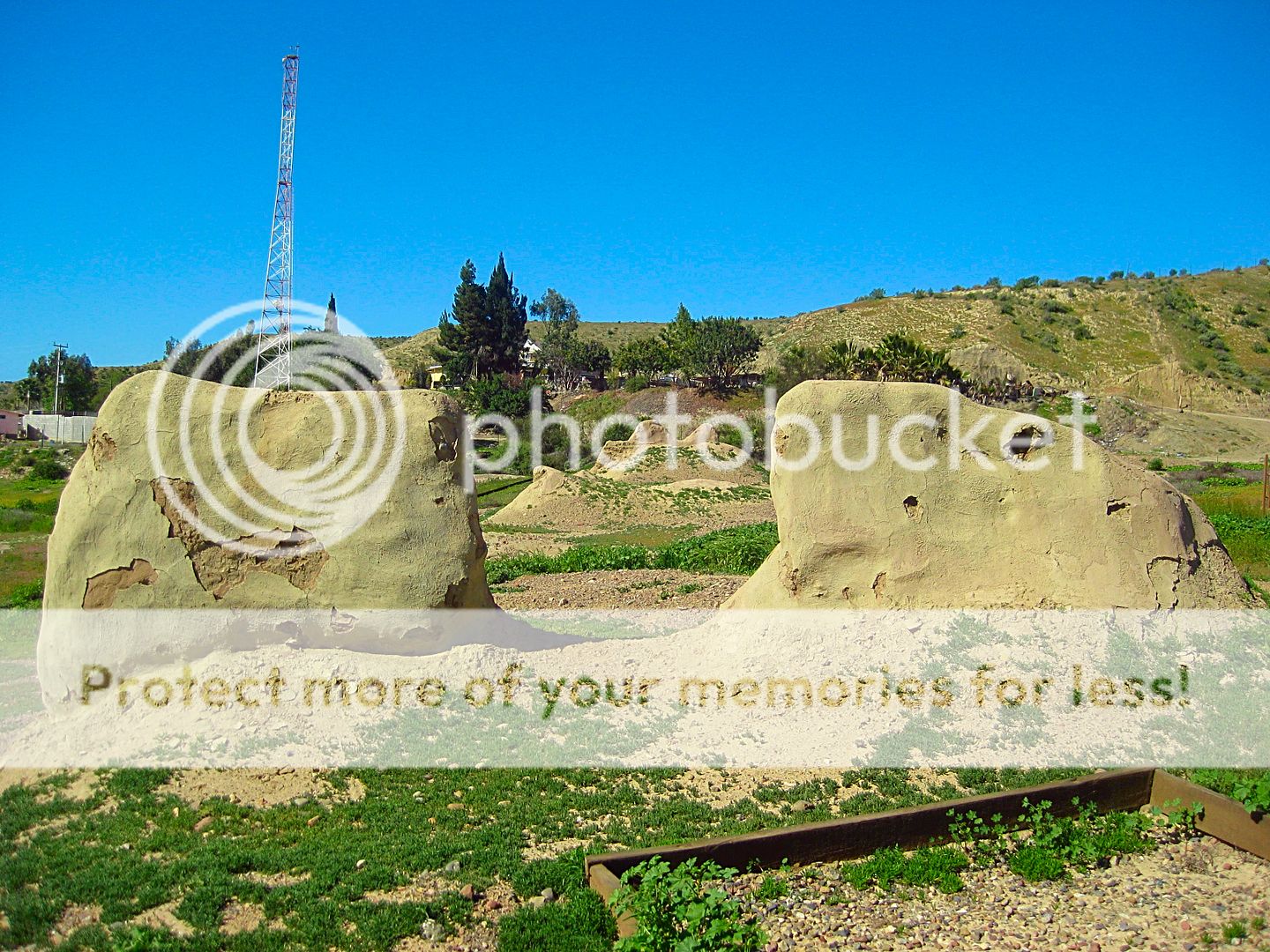

The Rosario mission was a large complex of buildings. The site is made into a park with walkways, signs (in Spanish) explaining each area, and a view
of the large valley. In 1802, the spring located in the gully here suddenly dried up and forced the padres to relocate the mission about 2 miles to
the west, and closer to the river.
Just west (northbound) of the mission street, is Km. 58 at this restaurant and a tire repair next door.
----------------------------------------------------------------------------------------------------------------
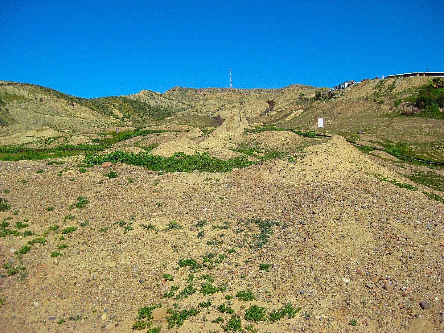
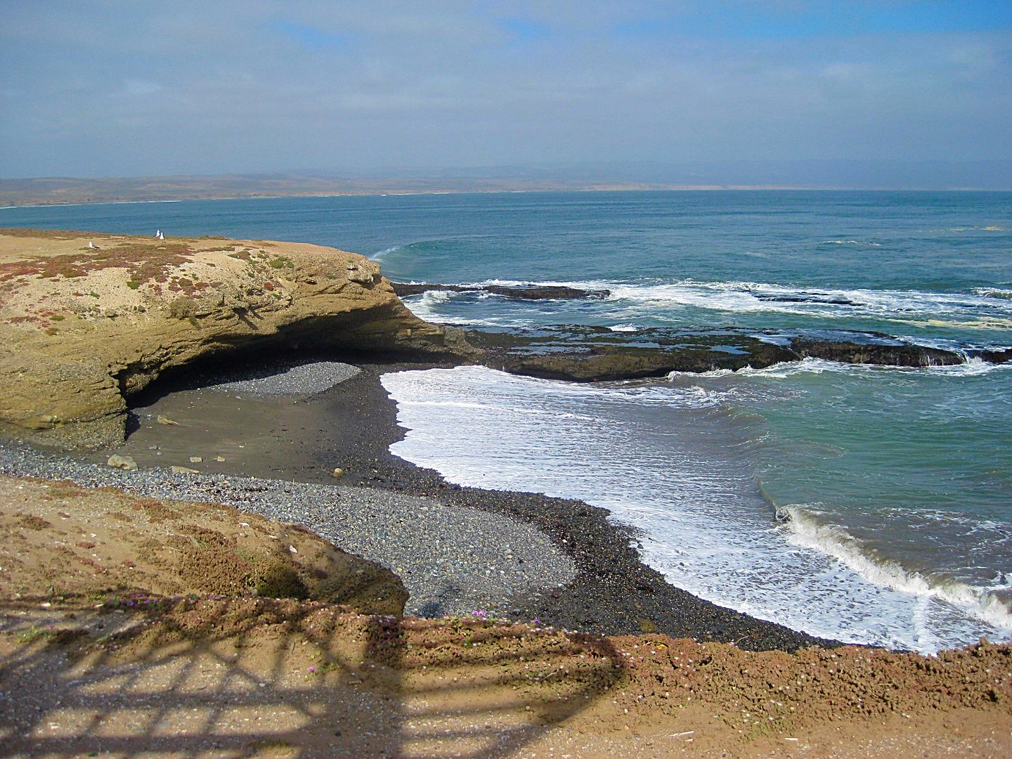
El Rosario de Abajo, La Bocana Beach, Petrified Forest
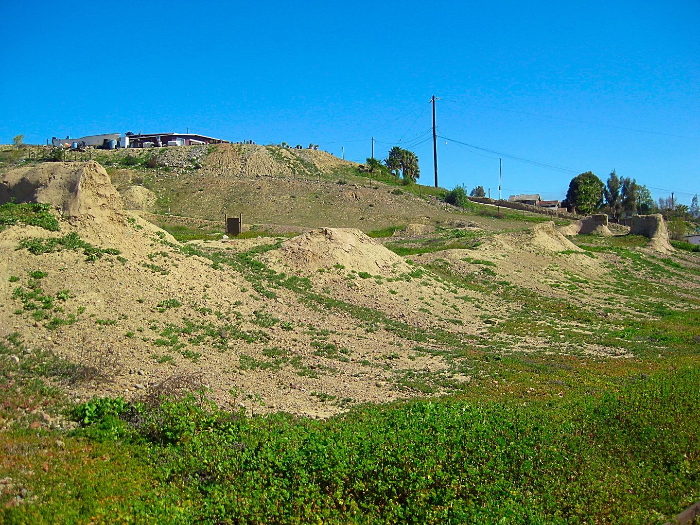
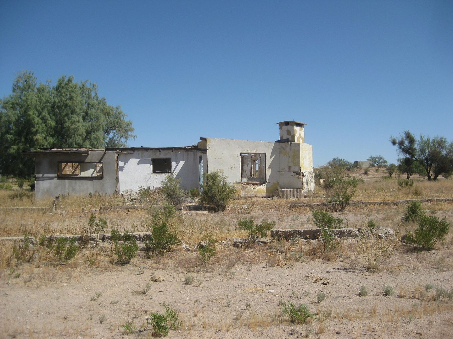
Next, I am off to investigate is the old town of El Rosario de Abajo (Lower El Rosario). This is where the mission moved in 1802 and the post-mission
town was primarily located. With the coming of automobiles, a second Rosario developed along the route that in 1973 would become a paved highway. The
newer town was called El Rosario de Arriba (Upper El Rosario) to distinguish it from the older town, across the river and 2 miles west.
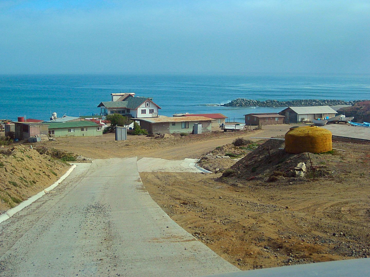
Set odometer to 0.0 at the sharp curve in Hwy. 1, across from Mama Espinoza' Restaurant and drive west.
In a couple hundred feet the street to the left was the main road to Abajo, but traffic has mainly gone to a new crossing ahead.
0.4 End of paved (concrete) road surface.
0.8 Fork. Right to Las Palapas recreation area, 0.6 mi. The road beyond once went to Diamante Del Mar project. Road now badly damaged by rains. Go
left.
1.2 Junction in the middle of the river valley. Left is route back to Hwy. 1. Ahead to continue on.
1.9 ADB Market, center of town of El Rosario de Abajo.
2.0 Mission Ruins, on the right. Park setting, signs. Mission moved to this spot in 1802.
2.9 Fork. Left goes south to Agua Blanca, San Antonio, San Carlos. Go right.
3.3 Junction. Left goes to Punta Baja (7 miles). Go straight ahead.
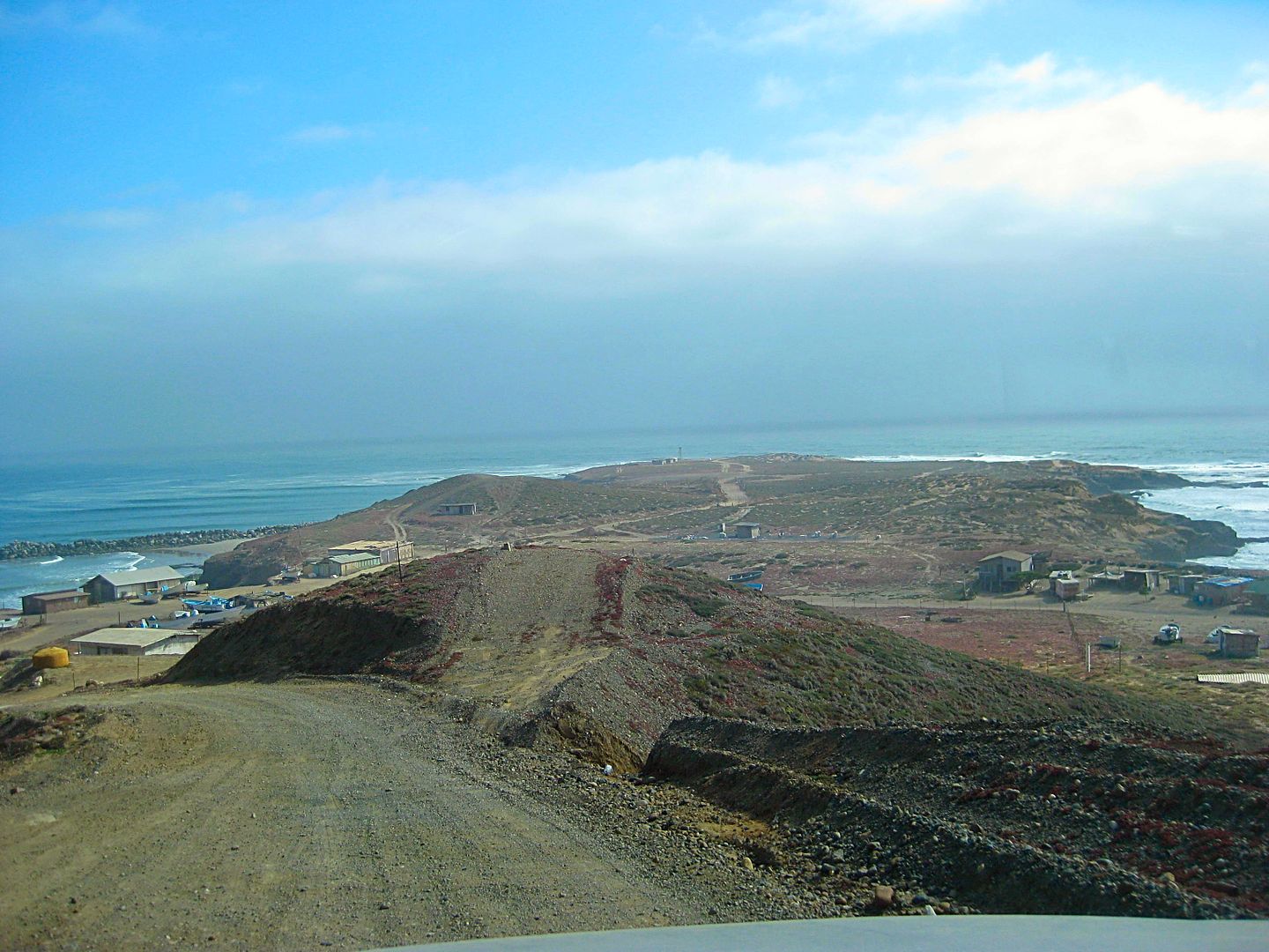
5.3 Parking for beach of La Bocana.
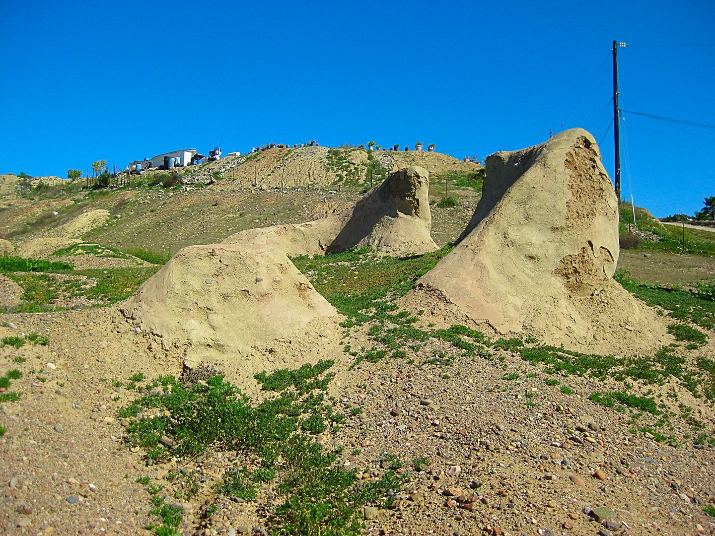
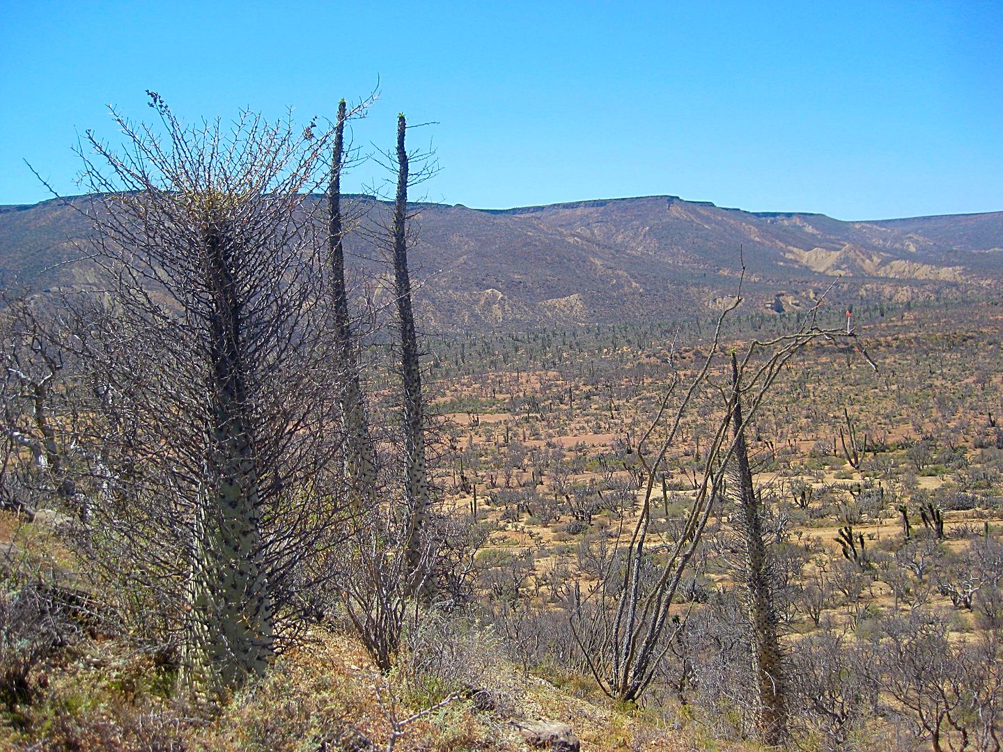
A drive north then turning into the hills goes 2.3 miles to the edge of a small canyon. A hike into the canyon will take you through a prehistoric
forest (using your imagination). Petrified wood is scattered about. Look but do not remove.
I drive back into town on the former Diamante Del Mar high road, but it is not maintained and large gullies in the road make travel a challenge. 4WD
and large tires only. La Palapas is passed returning to town.
Photos:

El Rosario de Abajo ruins as seen from the road.

La Bocana Beach
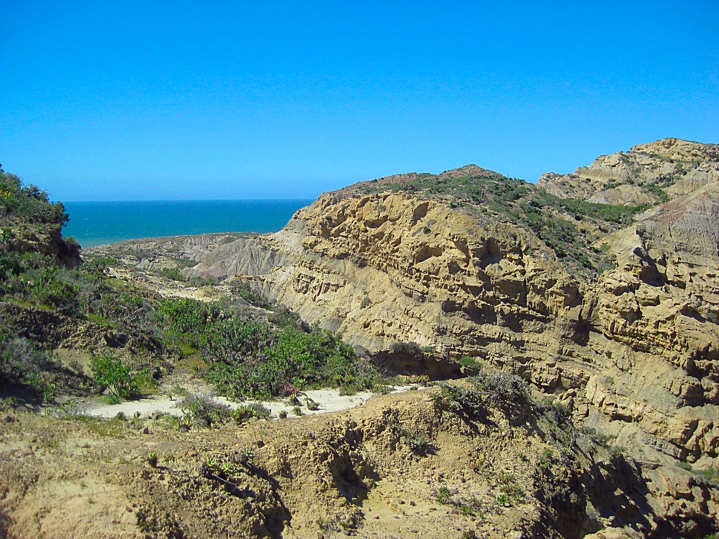
Just over 2 miles north from the beach are the canyons that cut through a former forest, whose trees have turned to stone.
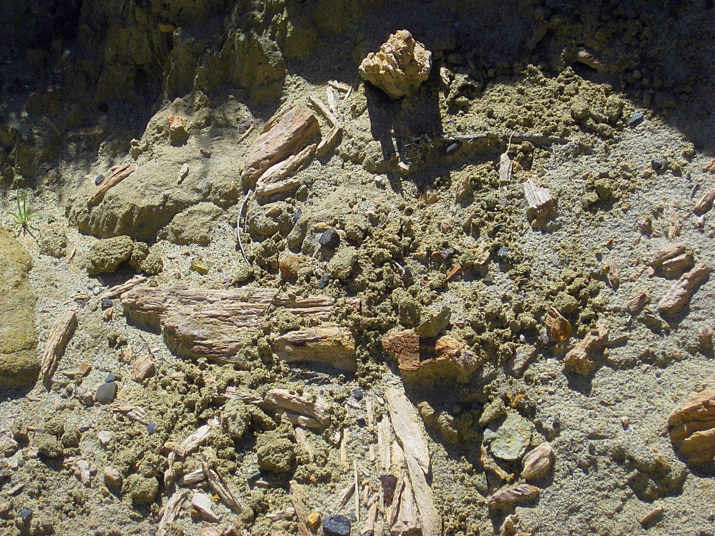
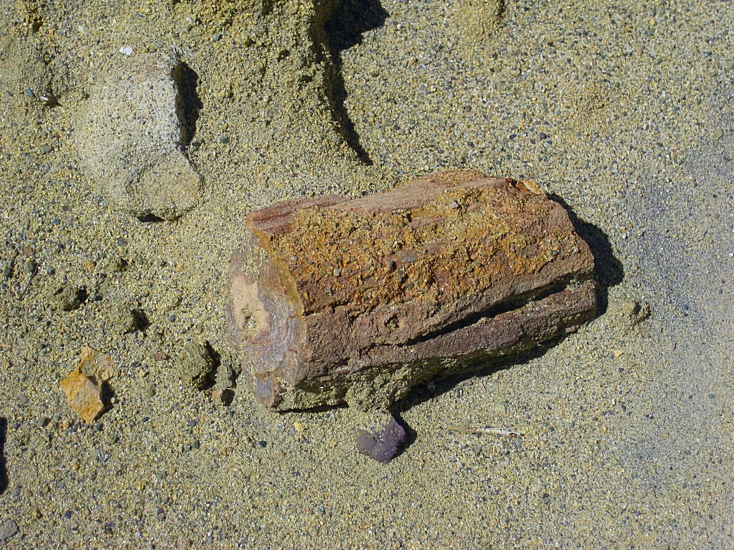
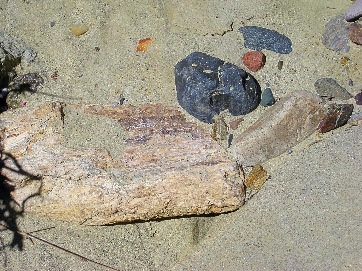

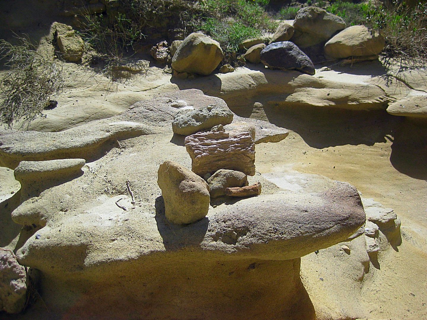
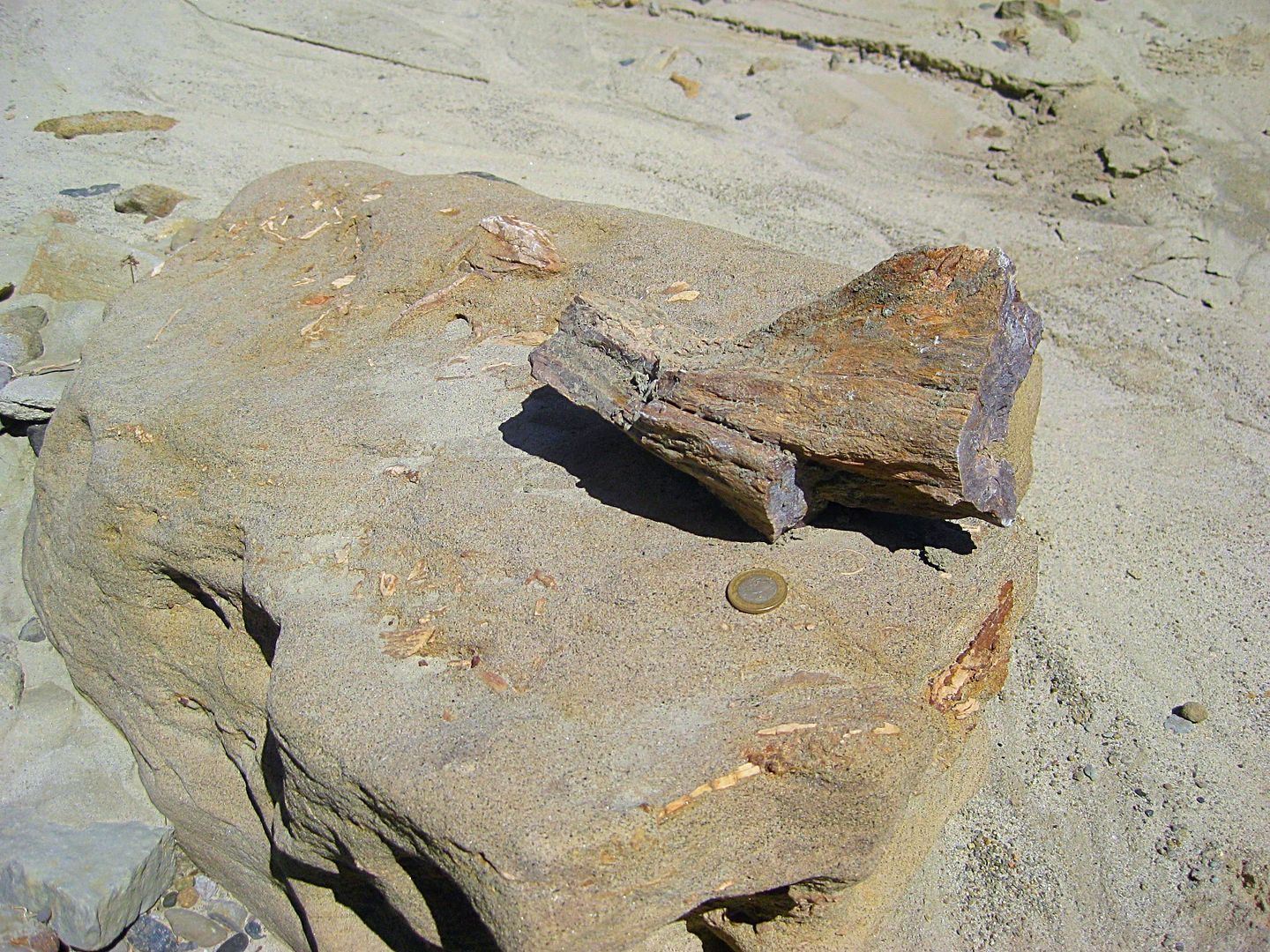
A Mexican coin added for scale.
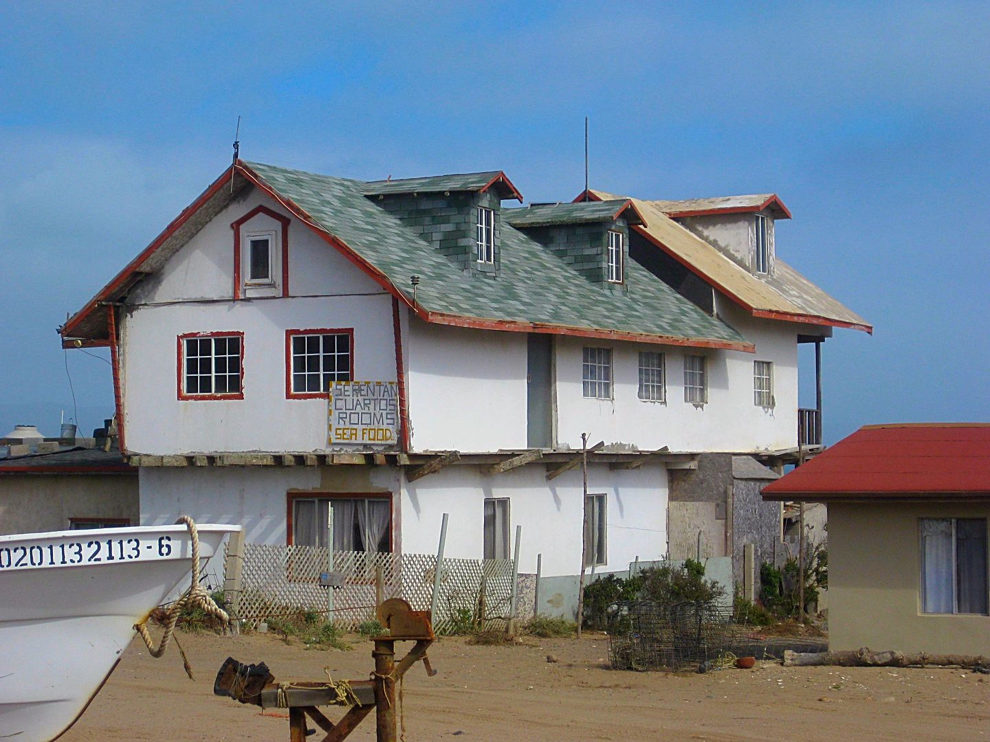
Returning back to Baja Cactus Motel, I find Antonio. He is a busy man having been part of an emergency rescue after midnight (an off-road motorcycle
tour member hurt), as well as his two businesses in town.
We get together for dinner that evening at La Pasadita with Isela and daughter Itzel, who is doing fine and growing fast since her heart surgery of
2010: http://forums.bajanomad.com/viewthread.php?tid=48946
After dinner, we stopped at the Hot Dog stand (very busy place) between the La Pasadita and Sinahi restaurants. There Isela asked for several cups to
go, of a hot Mexican dessert drink, that is similar in concept to hot chocolate, thick and hot. It is called Champurrado and was quite good. https://en.wikipedia.org/wiki/Champurrado
Monday is now in the bucket! Two more days in Baja...
------------------------------------------------------------------------------------------------------------------
Trip #4 April 2017: http://forums.bajanomad.com/viewthread.php?tid=86376
AMMONITES: DAY 2 (THU APR 20)
My lobster burritos from last night were still providing energy and I was ready to get down into the 'Never-Never' of Baja! (Never-Never means no
paved roads, no cell phone service, and not much civilization)
On the road at 8:30 after topping my tank and my extra 5-gallon can. 87 octane gas here was $3.459/ gallon. I averaged 17.7 mpg for the 287 miles
traveled yesterday. Starting today, my truck now has mostly ethanol-free gas in the tank. That usually bumps up my mileage 1-2 mpg. However,
off-roading and four wheeling will knock that gain down.
Last month I made notes on the points of interest and road junctions between El Rosario and Laguna Chapala (~100 miles south, where Hwy. 5 from San
Felipe meet Hwy. 1). I knew there were more points I wanted to add... Here they are:
Km. 108+ Loncheria El Descanso (popular with truckers, for meals and tire repair)
Km. 116.5 Monument to Hector the young truck driver killed on this curve.
Km. 129 Café La Pasadita (a newer place)
Km. 131 Rancho Los Cuates tire repair.
Km. 132+ Road south to Puerto Santa Catarina, Puerto Canoas, and south.
Km. 132.5 Road north to Guayaquil, 0.5 mi. A ghost town where a delegation office, schools and weekday housing for area ranch children, and an
airstrip once existed. The town was created around 1970 and the town's 50-80 people expected the new paved highway to pass right through their little
place to provide prosperity. In mid-1973, the highway engineers put the highway up on the ridge, a half mile away and that placed Guayaquil out of
sight of travelers.
Since I am bound for the remote Pacific region, I return to Km. 132+ and drop my tire pressure once again (I dropped it for the 40 dirt miles between
Valle de Trinidad and Hwy. 1, yesterday).
Dropping tire pressure has three major effects, one is that the ride is softer as some of the bouncing is absorbed in the tires. The other, more
important reasons are flats due to sharp rocks are greatly reduced as the tires can wrap around, rather than force a sharp rock into its tread.
Traction is enhanced as softer tires can climb/ grab without slipping and float on sand much better. I don't lower them as much as others, but
dropping the normal 34 psi to 24 psi seems to work very well. Of the hundreds of dirt, rocky miles, not one flat (that came later, on the highway, at
full pressure)!
The roads into Puerto Santa Catarina and most of the way to Puerto Canoas were excellent, and that's considering the extremely wet winter and spring
we just had that has damaged so many other roads in Baja.
It was 10:38 am when I was on my way in the dirt.
On the highways, I use the kilometer markers to help everyone locate a point. But, on the dirt roads (most don't have markers, or they aren't
consistent) I have no choice but to use my trip odometer. While my odometer is a bit slow on the highway (I am running 1" taller than stock tires),
when I drop the pressure they seem to be pretty close to correct (on the dirt roads with kilometer markers, my odometer matched them).
However, many of you may have vehicles with less-than-accurate odometers, so the mileages are just an approximate location spot to help you find
points.
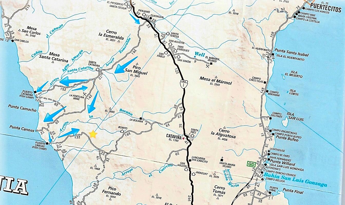
0.0 Hwy. 1 Km. 132+ (Signed for Santa Catarina) 10:38 am.
7.0 Road in from the left was the original route to Puerto Santa Catarina from El Mármol, whose blocks of onyx were transported to the coast and
placed on ships using a very difficult looking system! The system was used from the early 1900s to maybe the 1940s when an automobile road allowed
trucks to ship the onyx to San Diego.
18.4 Santa Catarina, a ranching settlement. It was once much bigger!
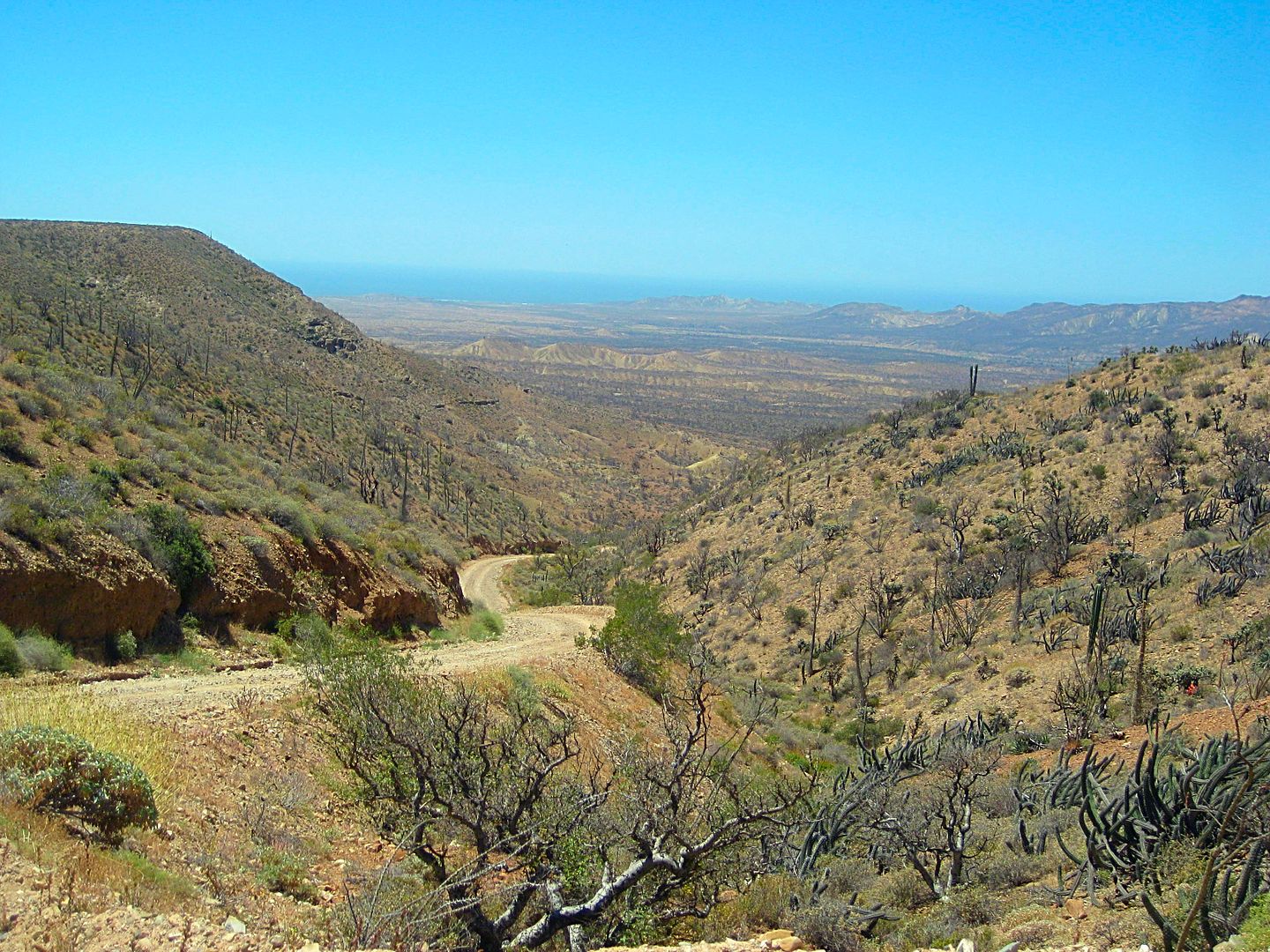
20.3 FORK: Puerto Canoas left, Puerto Santa Catarina right. 11:25 am. The right branch travels high on a ridge offering great vistas of the
surrounding country and the Pacific coast (hidden by clouds or fog) before dropping down to the large arroyo valley. A farm's gated entrance is 11.2
miles from the fork and the famous ammonite hill was nearby. Ammonites are fossil snails found in great quantity at one time, near here. One is on
display in Mama Espinoza's Restaurant, El Rosario.
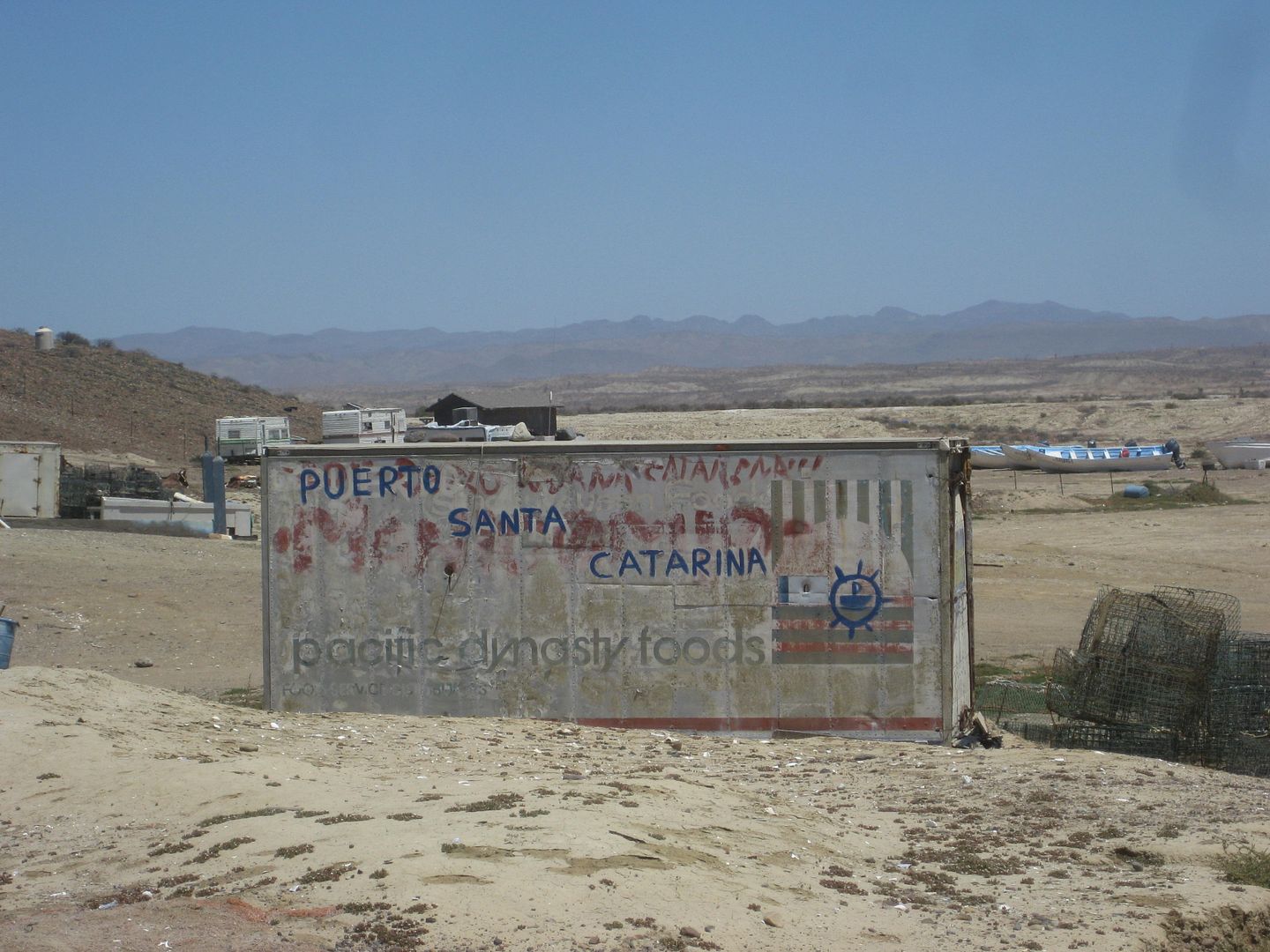
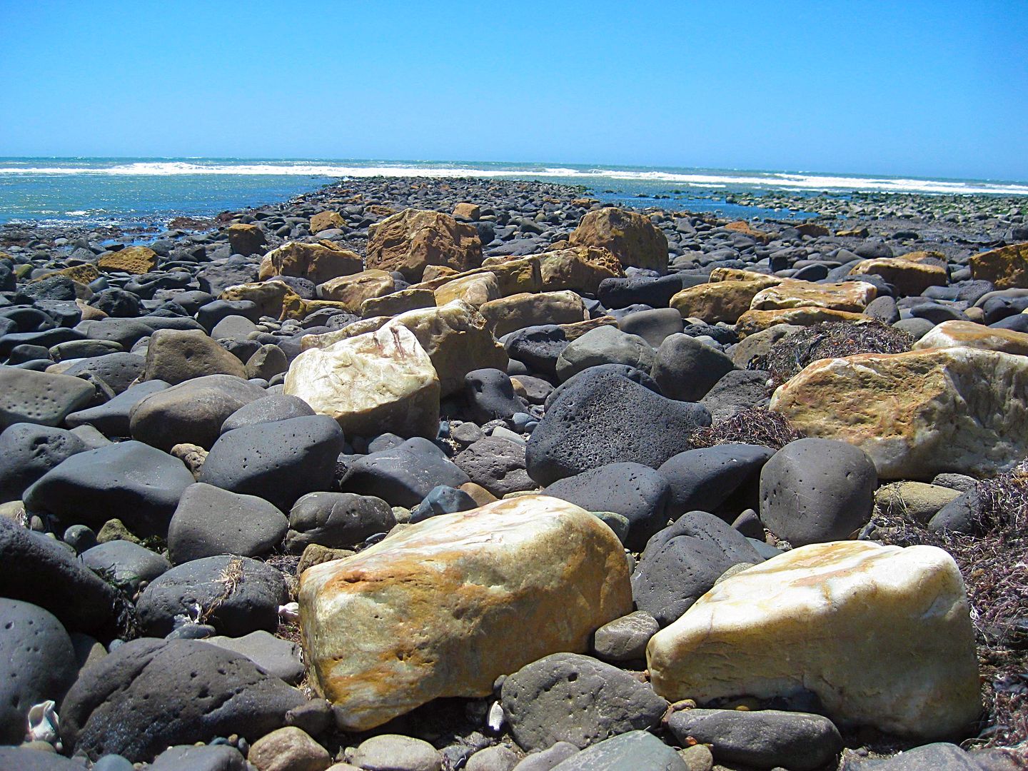
37.0 (16.7 miles from the fork) is the fish camp and landing of Puerto Santa Catarina. Many blocks of onyx are littered about on the tidal rocks. It
is 12:45 pm and the time includes photo stops and a short walk to try and find fossils to photograph (removing fossils is illegal for foreignors).
Photos:
Loncheria El Descanso (Km. 108+)
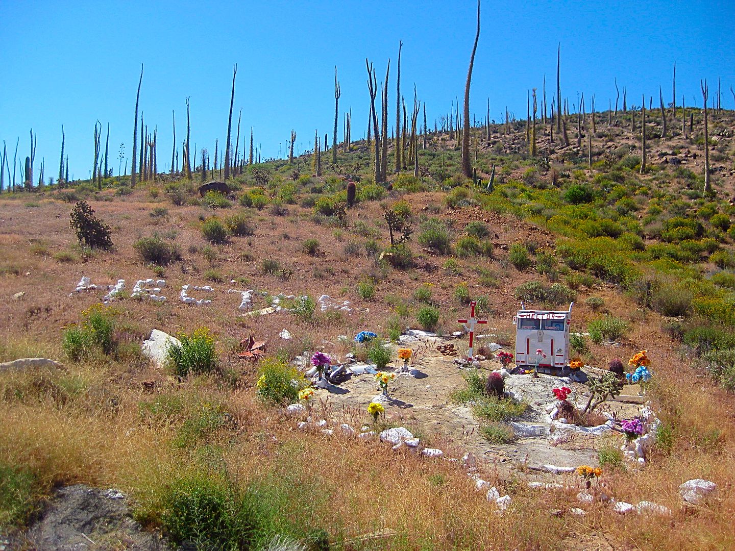
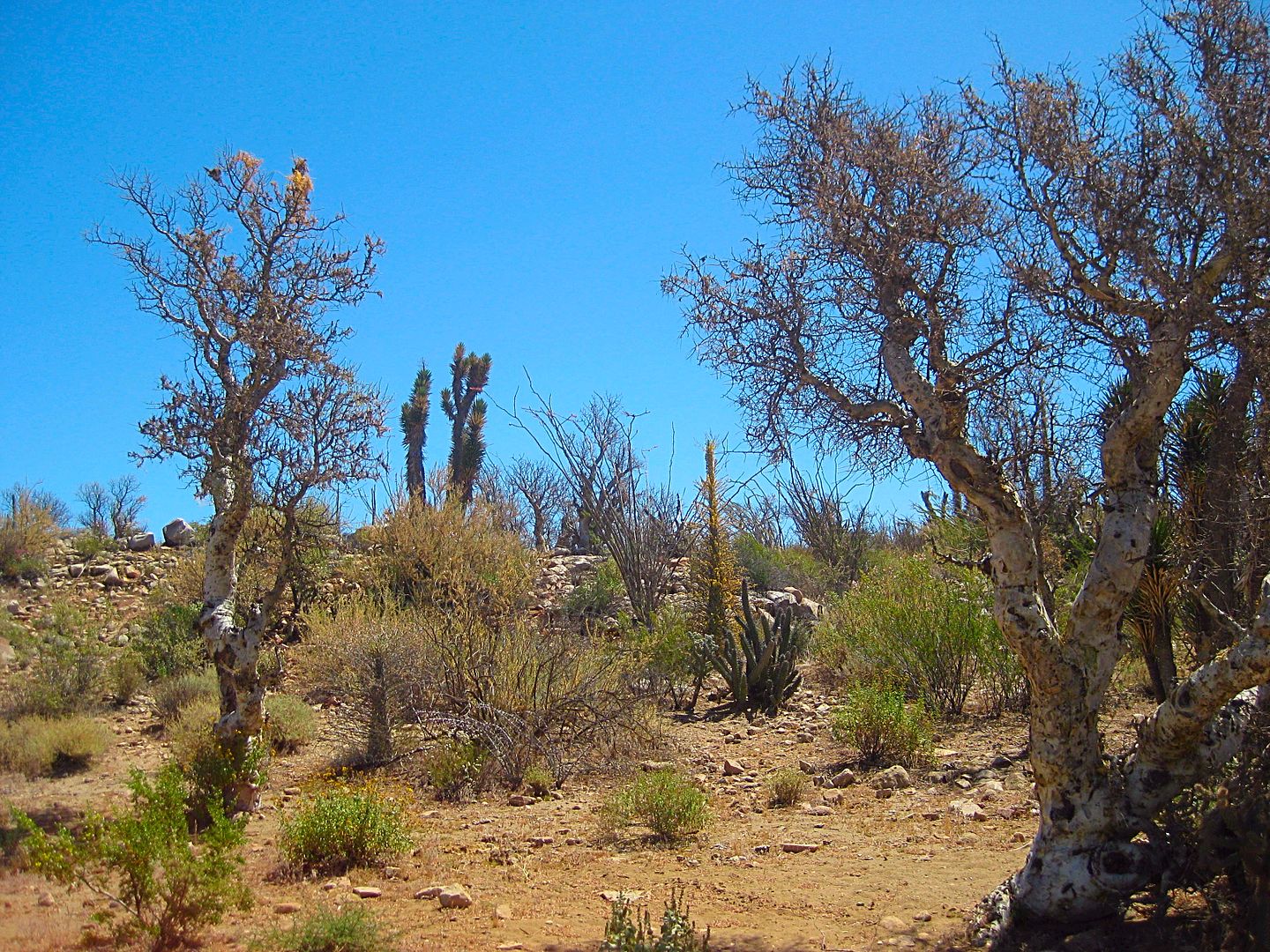
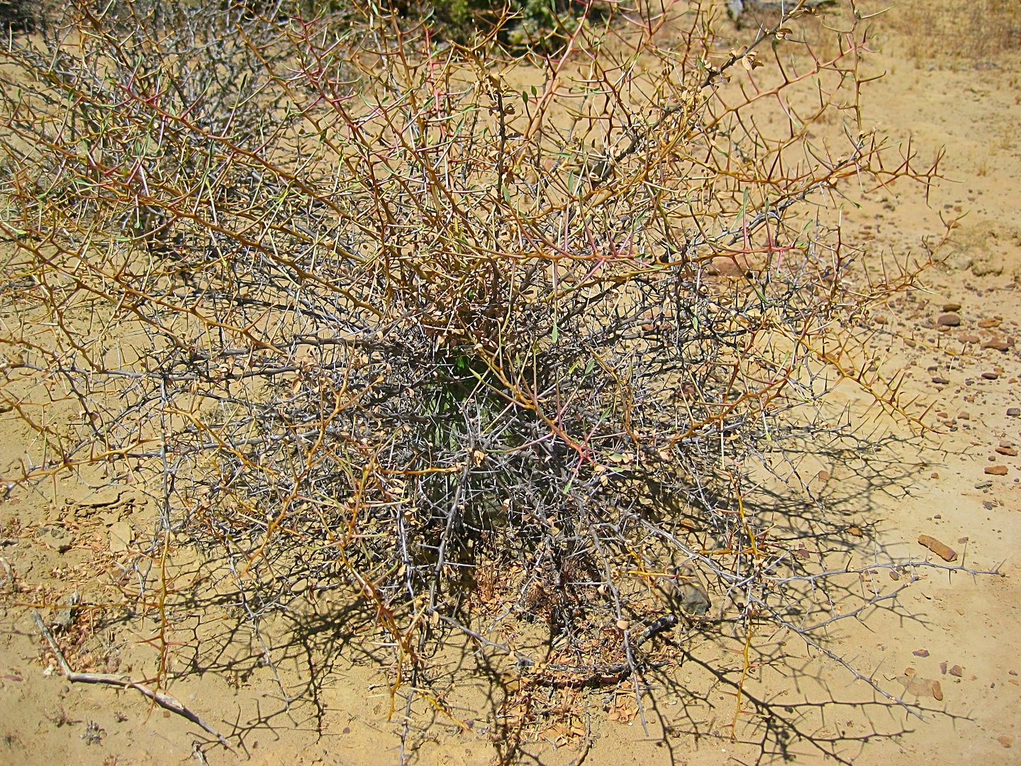
Monument to Hector (Km. 116.5). The boojum trees seem to me to be keeping watch over him, like angels.
Guayaquil (Km. 132.5 & 0.5 mi north)
Guayaquil
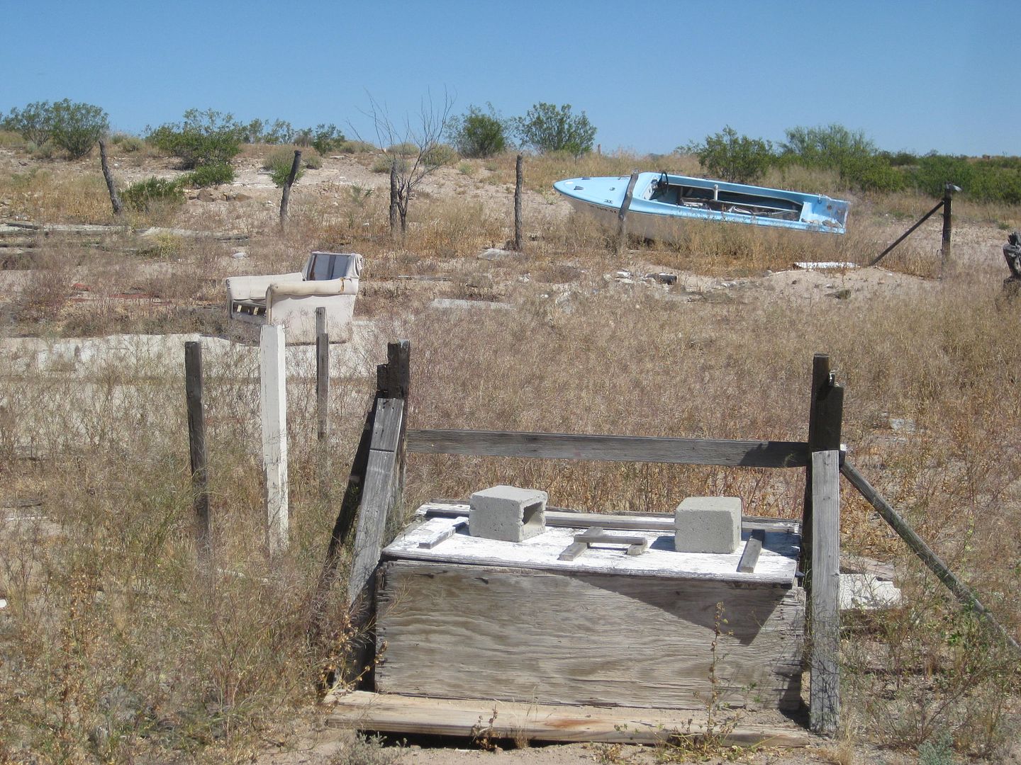
Guayaquil... with all that anyone in Baja needs, water from the well, a sofa to relax and a boat to go fishing!
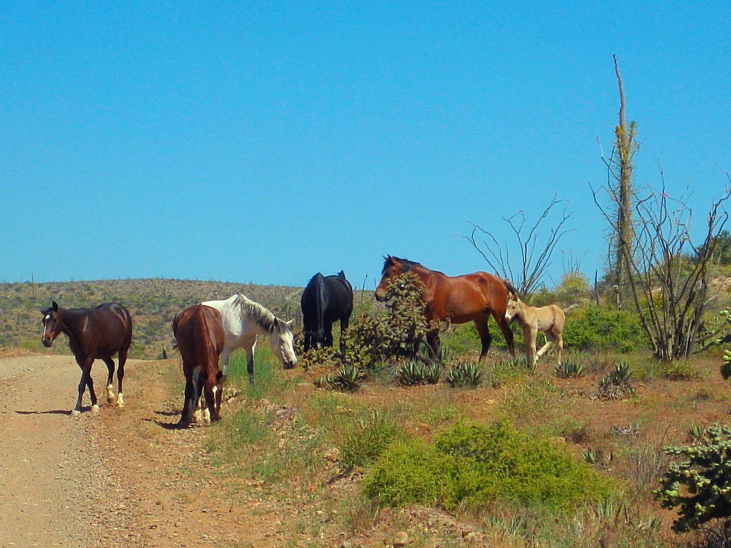
I saw many wild (free roaming) horses on this trip.
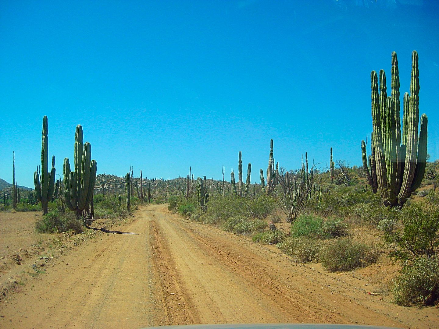
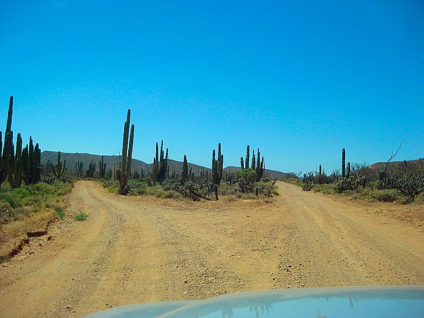
A sample of the nice road... nice if you like good roads!
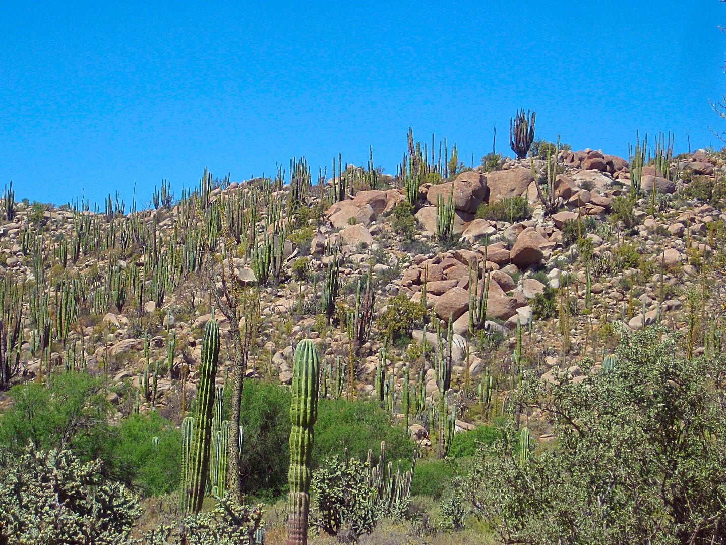
Such a great living museum of desert vegetation!
A couple of baby Elephant Trees.
The Fork: Canoas left, Santa Catarina right. (Mile 16.7)
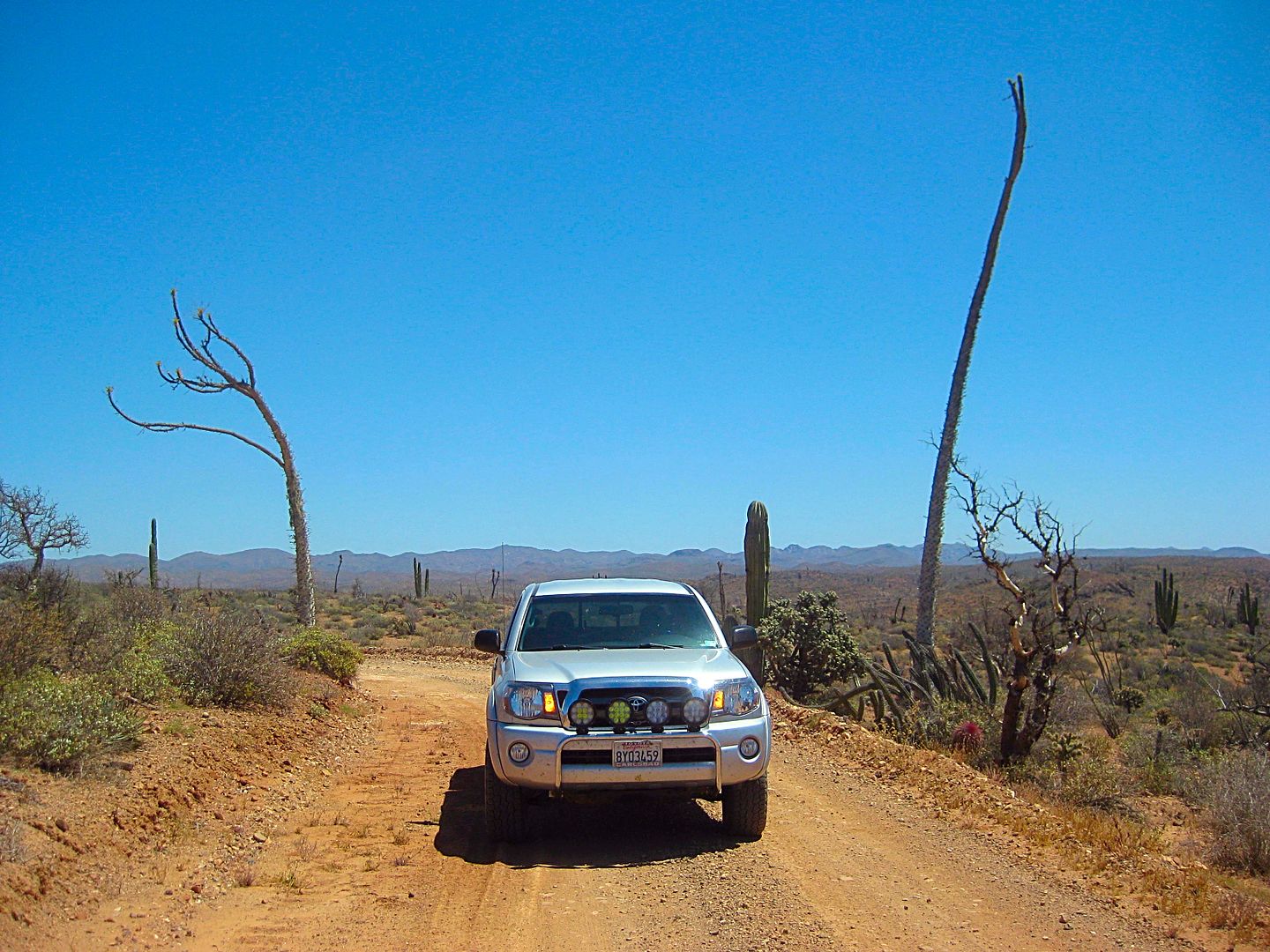
Oh, I didn't forget... so many of you love to see my Tacoma having fun!
Dropping off the ridge and down to the arroyo valley.
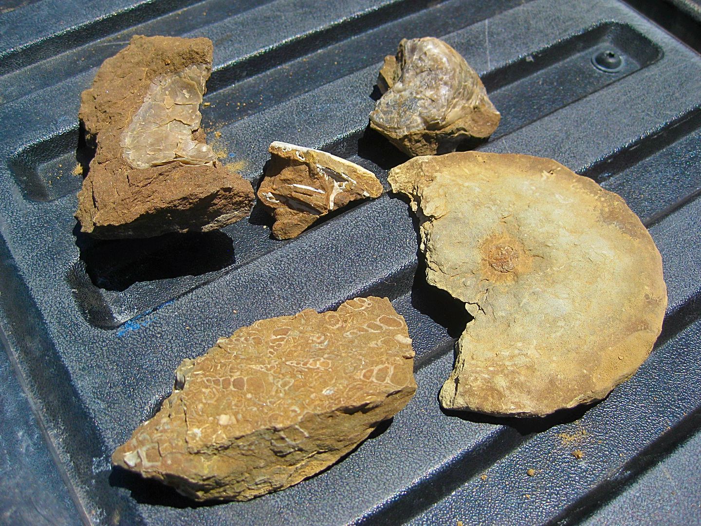
It didn't take me very long to find these. I am not sure if the round thing is a portion of a small ammonite, but it made me happy to find and photo.
I stopped when heading back at another spot and hiked for a while, but no luck finding any more fossils.
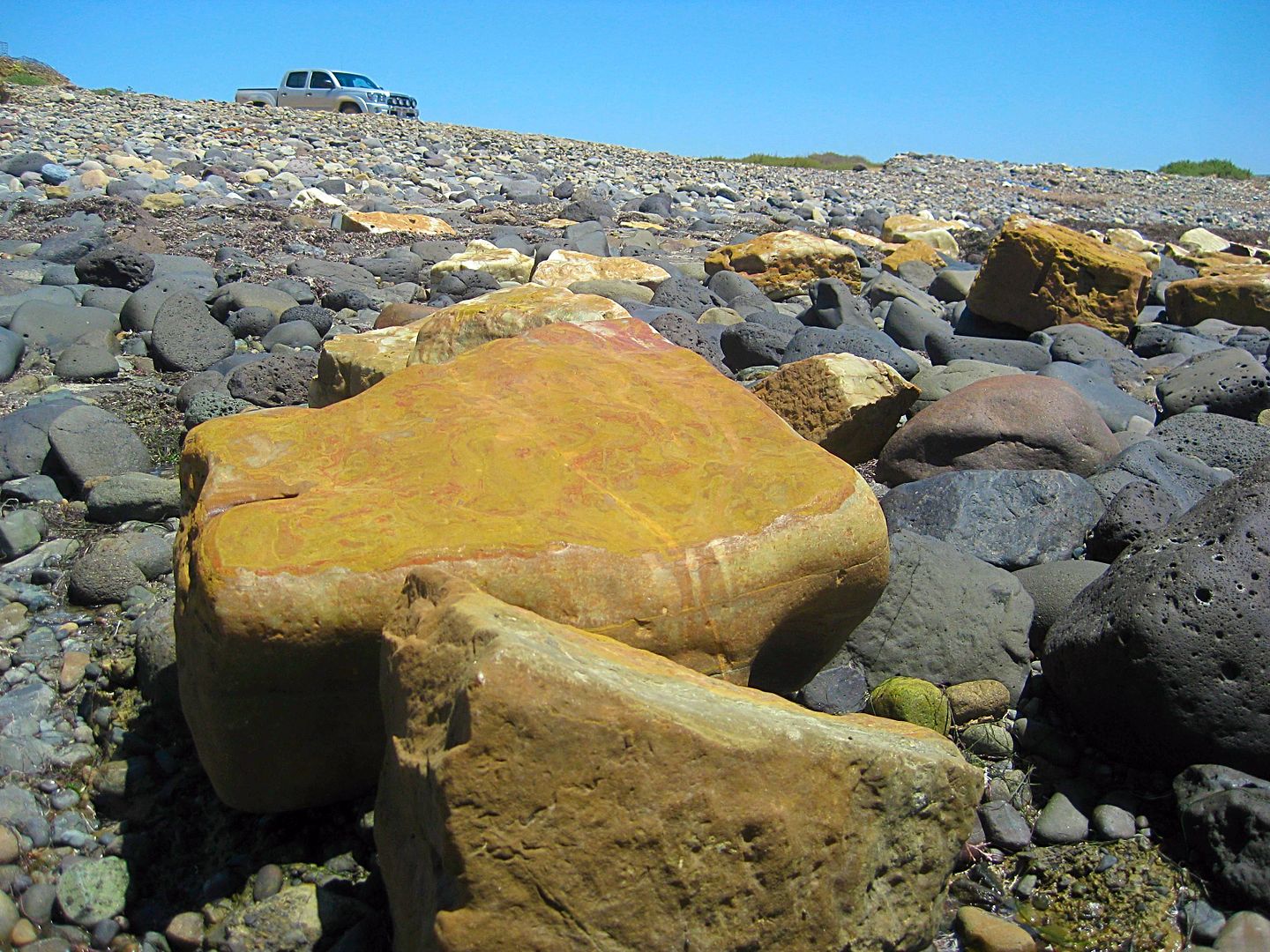
Come at low tide to see the onyx blocks that missed getting on the boat.
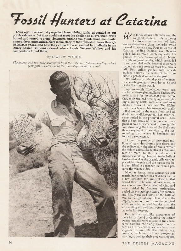
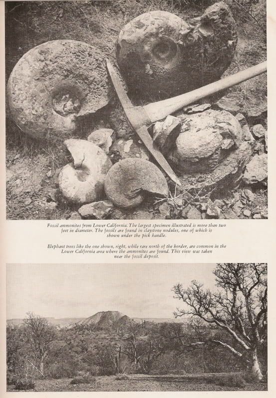
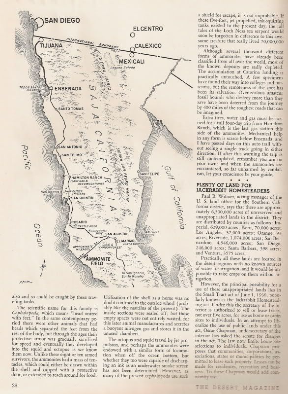
May 1948 issue of Desert Magazine:
======================================================================
Can you tell I like boojums? In Spanish, they are known as Cirios (candles).
I spot a tiny boojum tree, surrounded by thorny branches for protection...
Someday, perhaps hundreds of years from now, this could grow to 60 feet!
Next, the road to Puerto Canoas... stay tuned!
Red=Wed. Blue=Thur.
Old photo of the onyx loading at Santa Catarina...
[Edited on 7-21-2018 by David K]
|
|
|
David K
Honored Nomad
Posts: 64479
Registered: 8-30-2002
Location: San Diego County
Member Is Offline
Mood: Have Baja Fever
|
|
DAY 6 (MON APR 24, 2017)
Having driven all night and arrived at Baja Cactus Motel, El Rosario, at 3:40 am, I was inclined to sleep in as much as possible. Since I was still
working, I wanted to get in at least one side trip for the guide that I hadn't been to since 2011, Punta Baja.
However, the first thing was to get my tire properly repaired and have some breakfast. I was out of my room after 10 am and saw that my plugged tire
(passenger side, rear) held air since the second repairs I made on it around 2 am! I thought I would need to pump it up again. Great!
The tires shop called 'San Borjas' (Km. 58.5+) is on the left (southbound) just past the town plaza and Pueblo Viejo restaurant, before the Km. 59
marker.
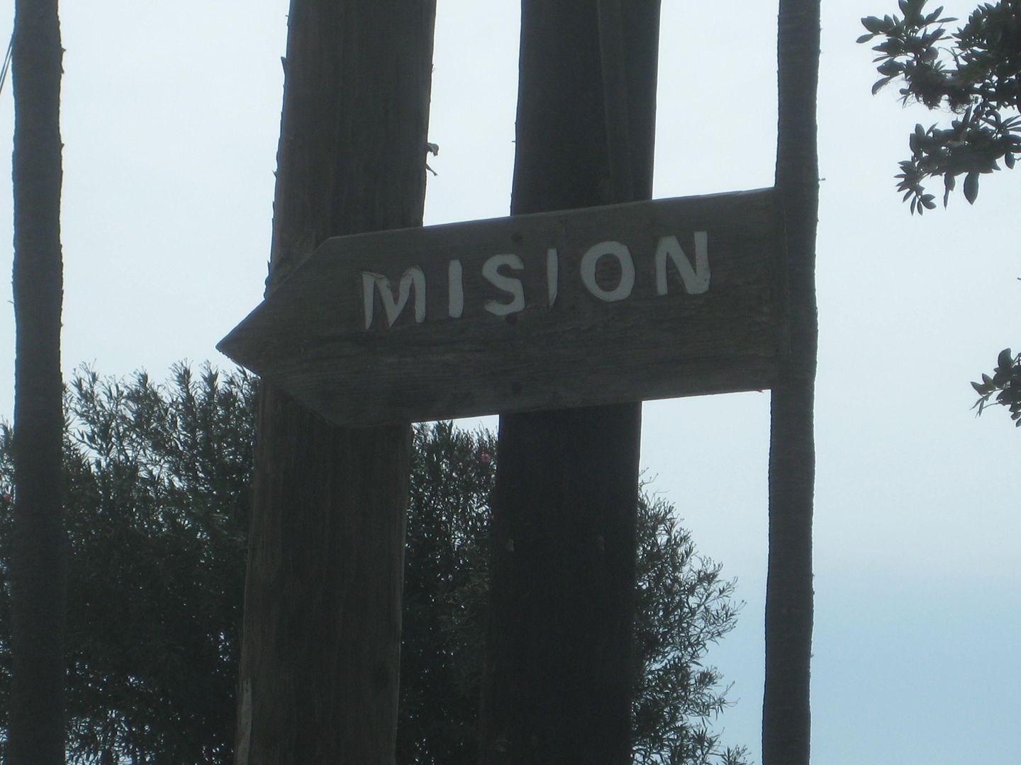
A patch was put in the tire. Then, I tried a new (to me) place, El Faro (The Lighthouse) located just past the Sinahi motel, about Km. 59.5, on the
left.
I had a good breakfast of hotcakes and eggs with some excellent coffee. 100 pesos, incl. tip.
I drive up and down Hwy. 1 making notes of the many restaurants, motels, etc. as to their location along the 4 kms. of town that is along the highway
(just before Km. 57 to Km. 61).
Much more town is to the west of where the highway makes the sharp turn by Mama Espinoza's plus there is El Rosario de Abajo, the older town that is 2
miles west and across the river. Developed around the mission that was moved there is 1802 when the water spring failed at the 1774 mission site,
which is just a block north of the highway at Km. 58.5+ on the concrete street that goes uphill from the highway (only a fumigation sign is next to
that street).
Then, I take a drive out to Punta Baja... the road is wide, smooth, and fast!
The owner is from Faro San José, where I had been to recently, far south.
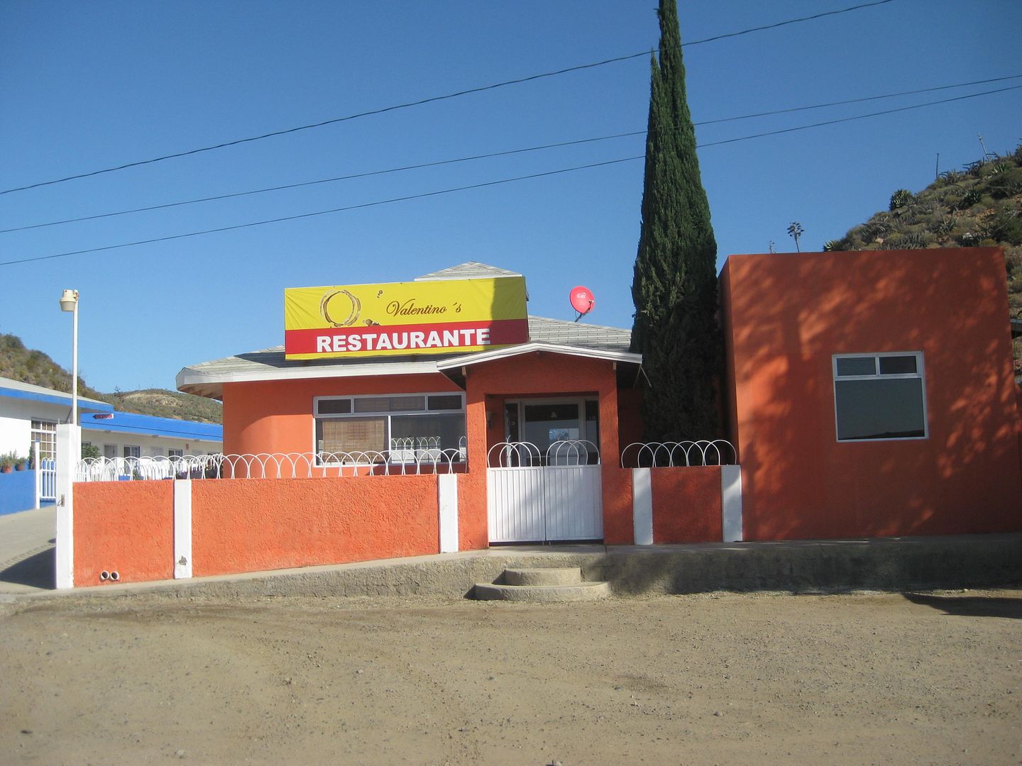
Another 'new' place to eat (I did not try it) is in front of the Turista Motel at the far end of town, Km. 60.5+. Valentino's.
The road to the "other" El Rosario turns right where Hwy. 1 curves sharp left at Mama Espinoza's.
The second Rosario mission is in Abajo.
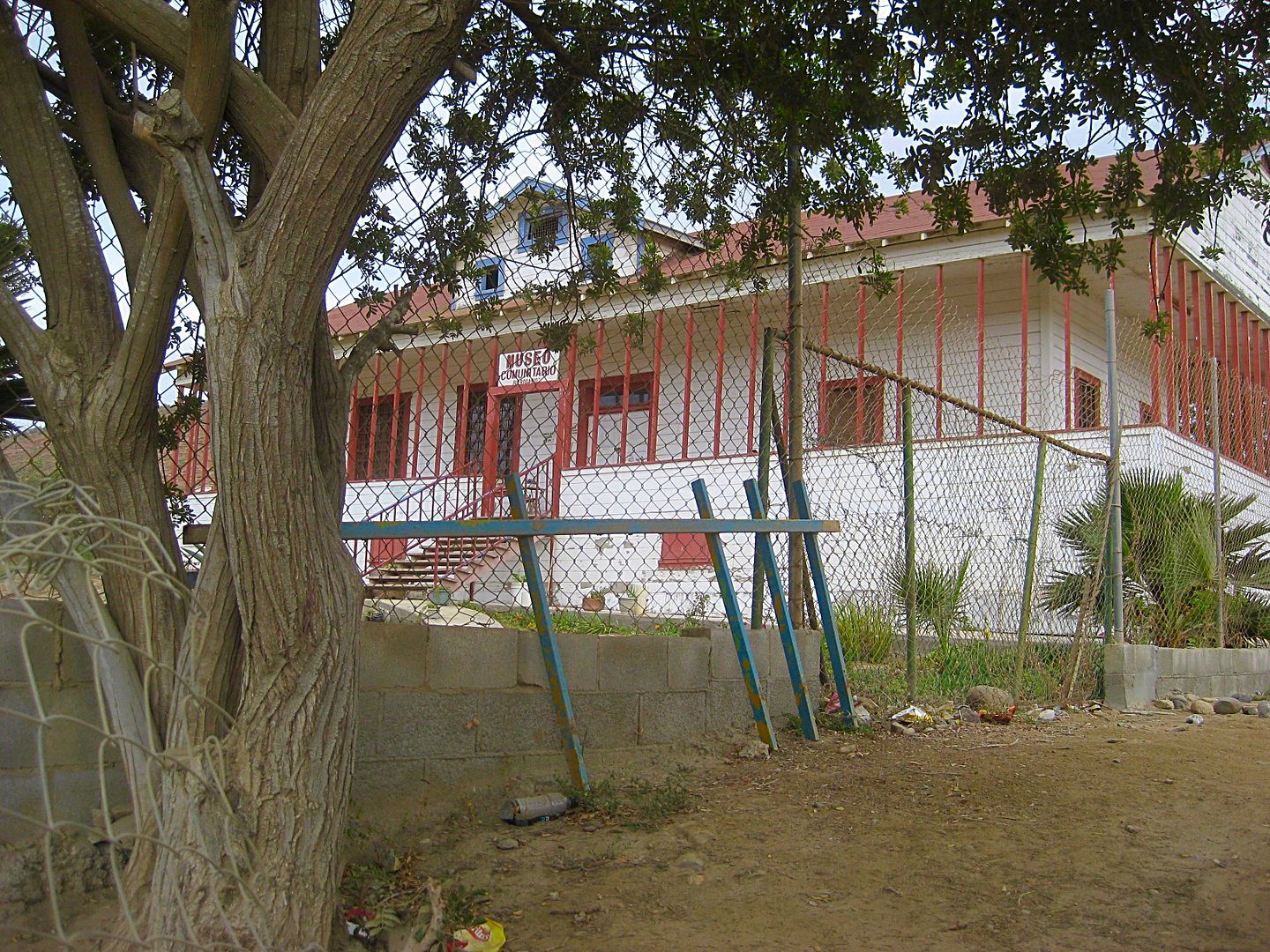
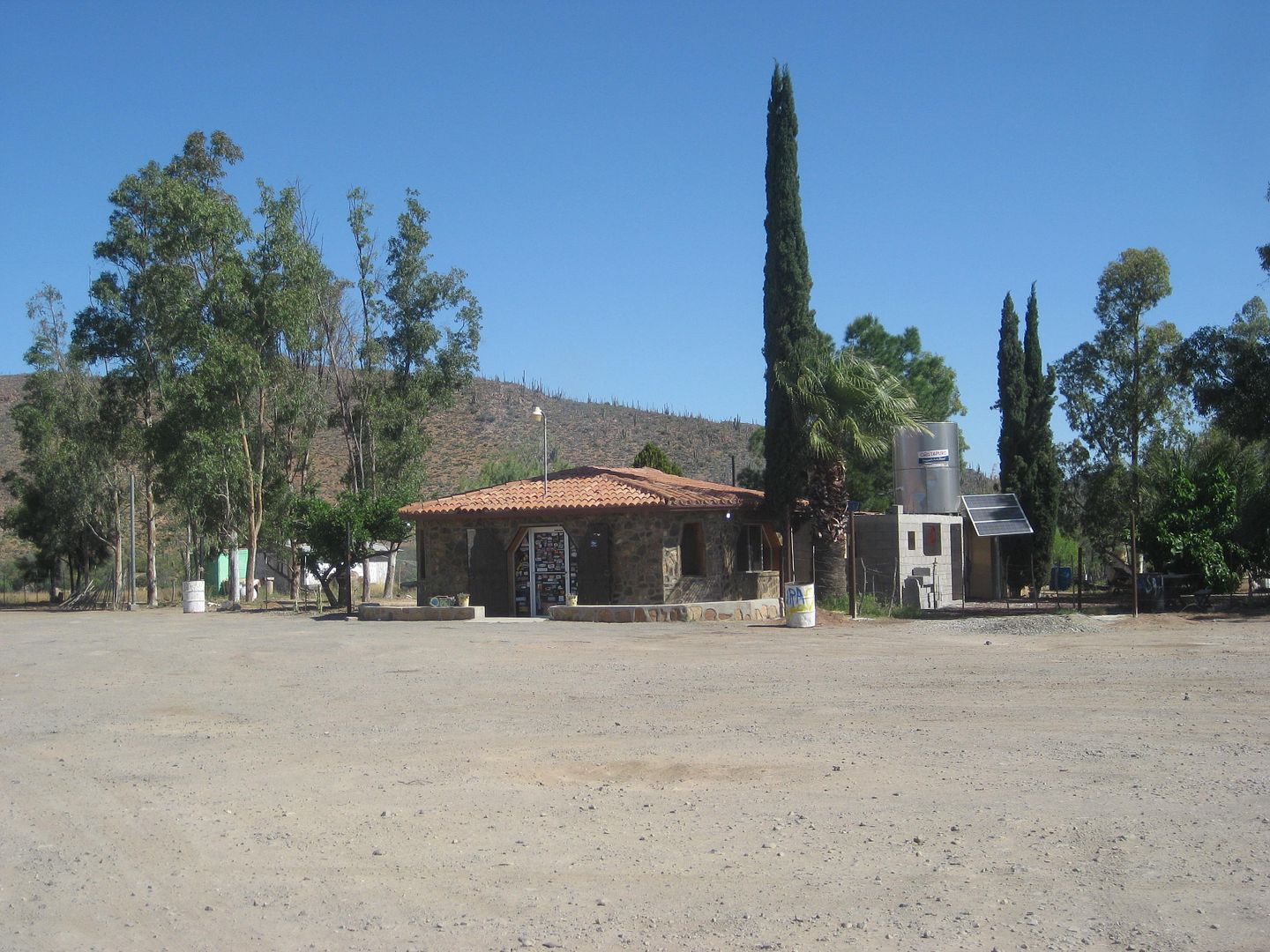
The town museum in an old school building, in Rosario de Abajo. It was closed, but in 2005, Antonio showed it to Elizabeth and I: Photos on this page
and the following: http://vivabaja.com/505/page6.html
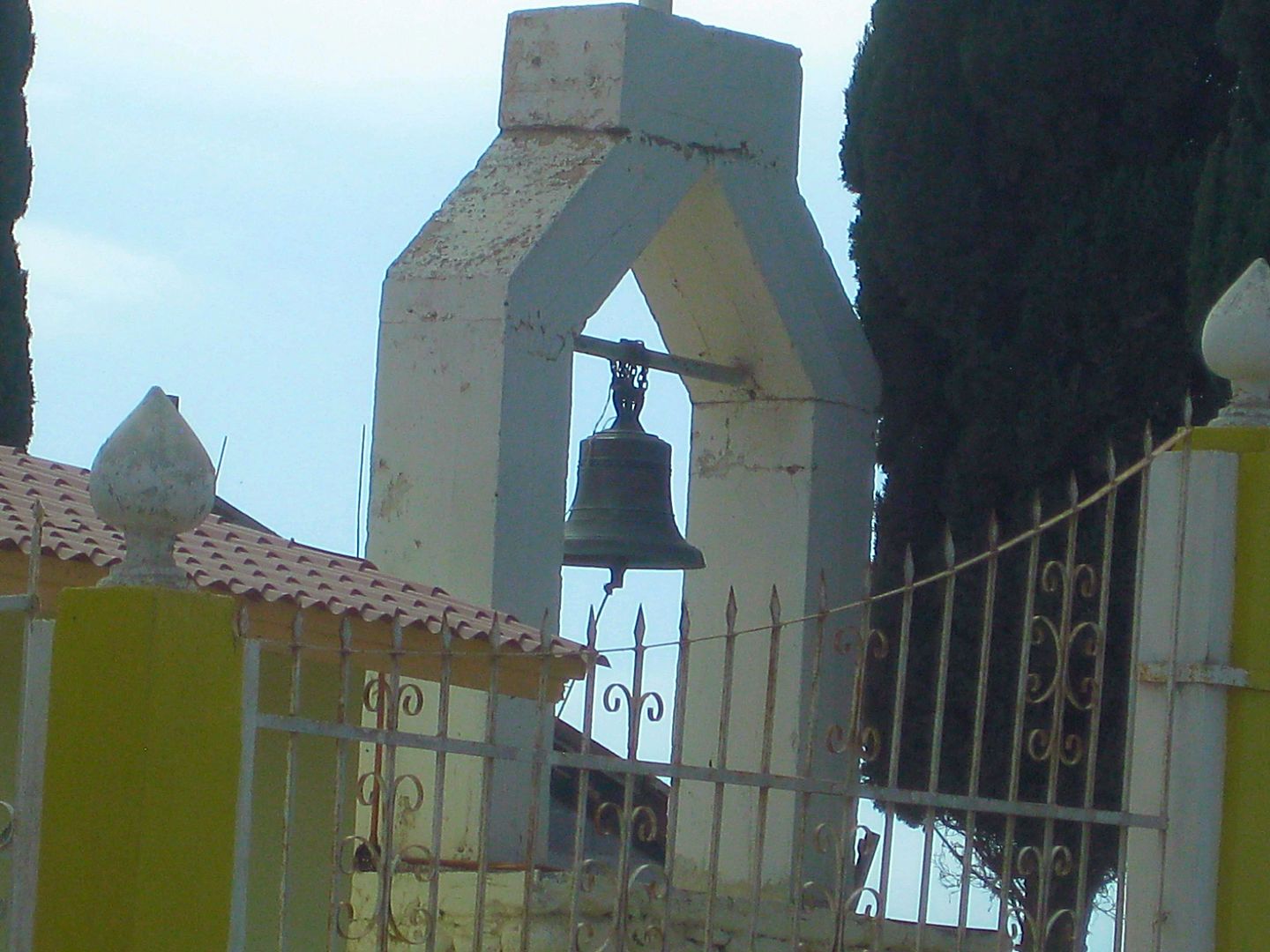
One mission bell is preserved and hangs at a church near the mission ruins in Rosario de Abajo.
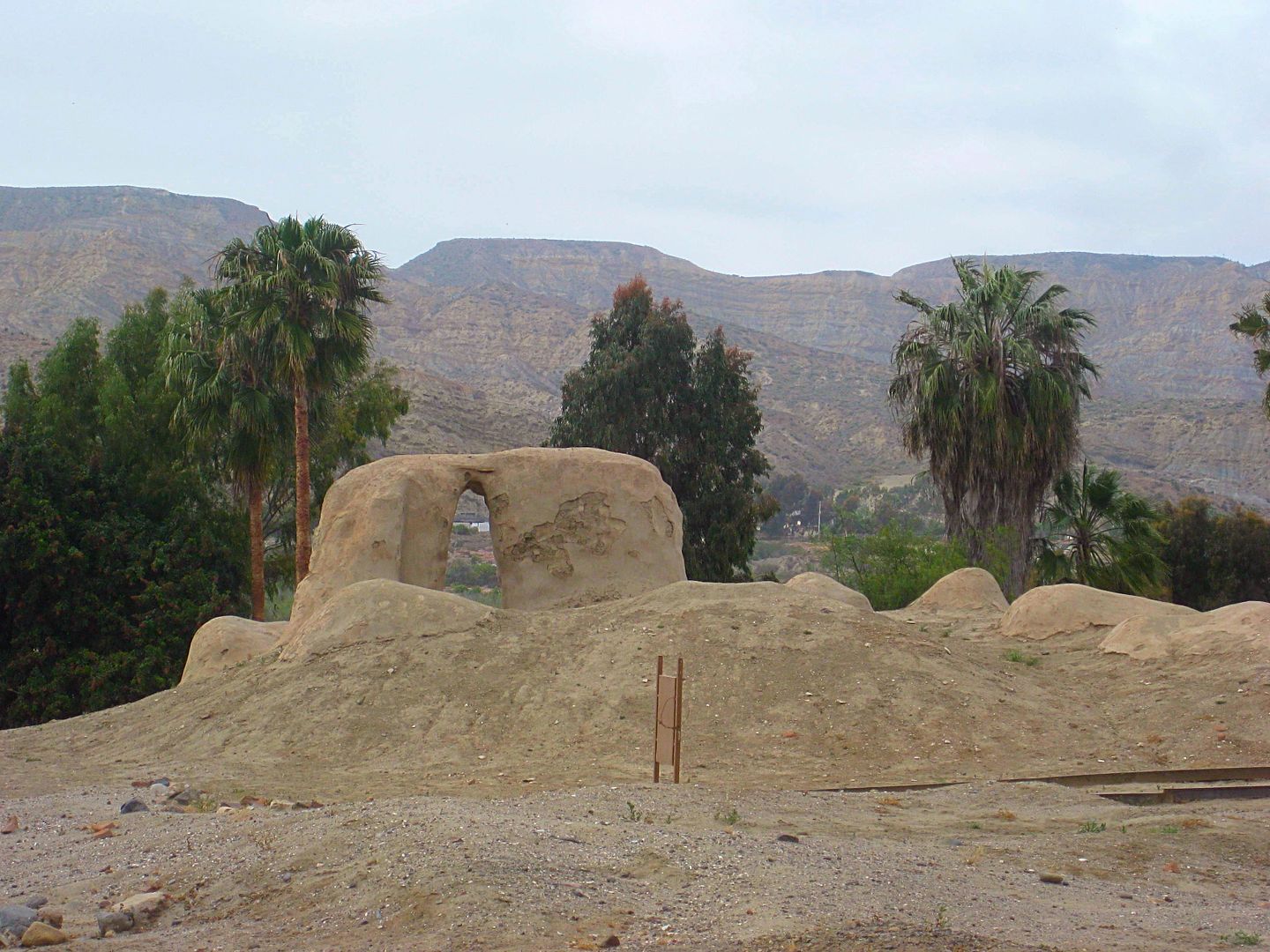
The road passes by the mission ruins, preserved in a park setting with gravel walks and information signs.
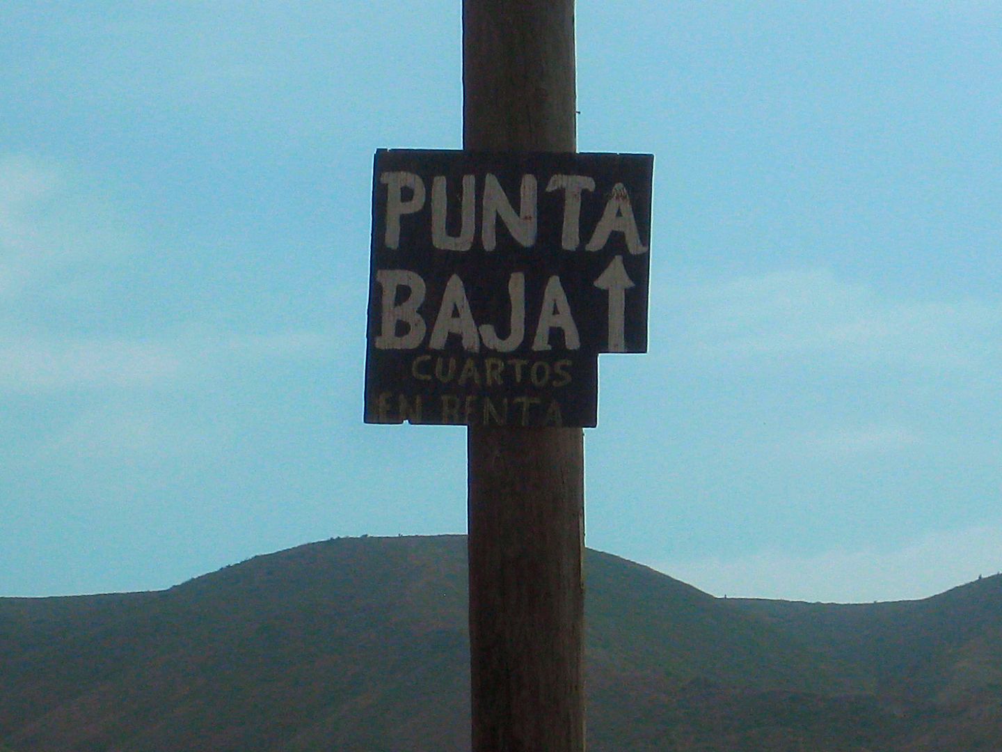
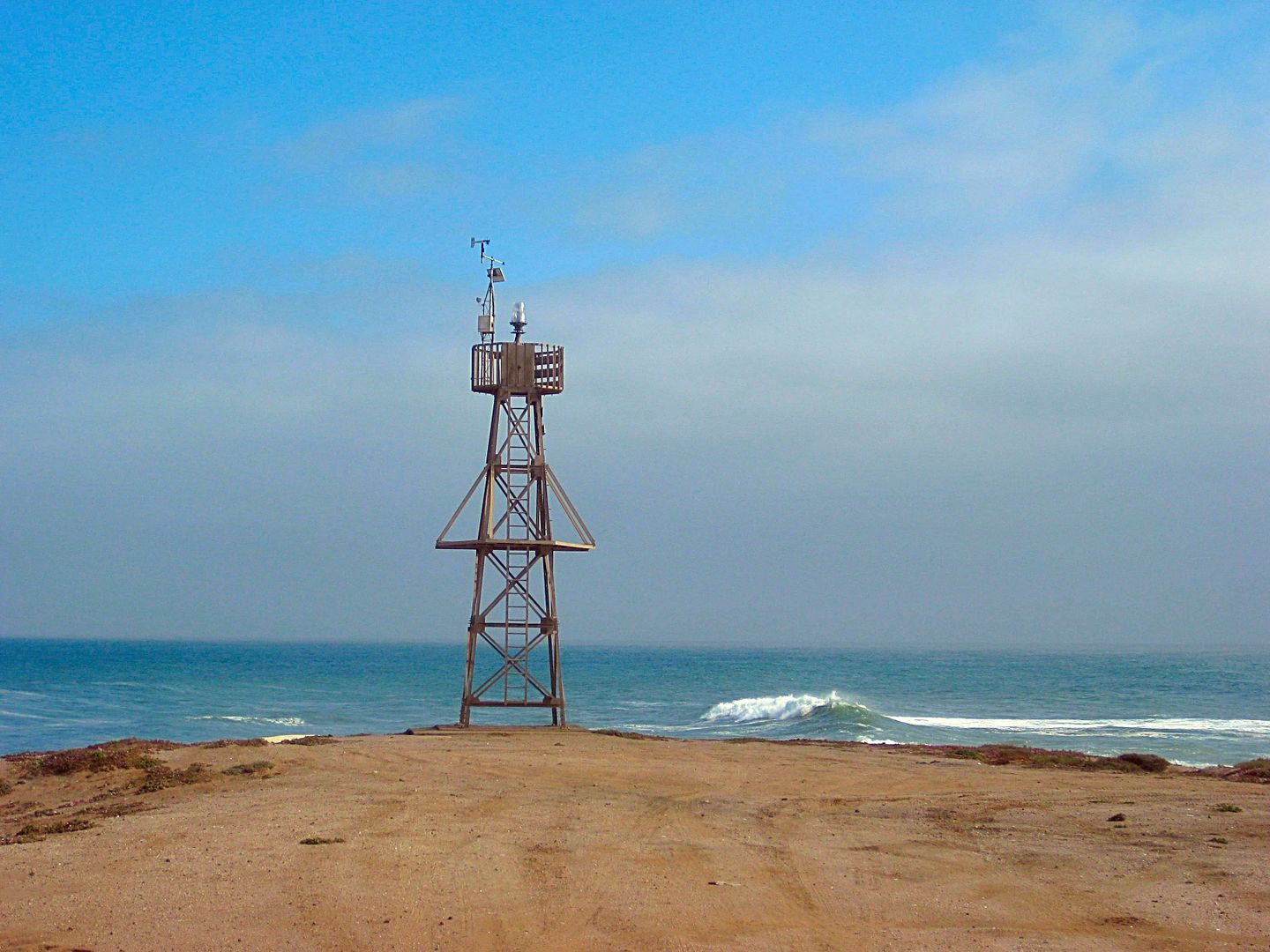
Punta Baja lighthouse
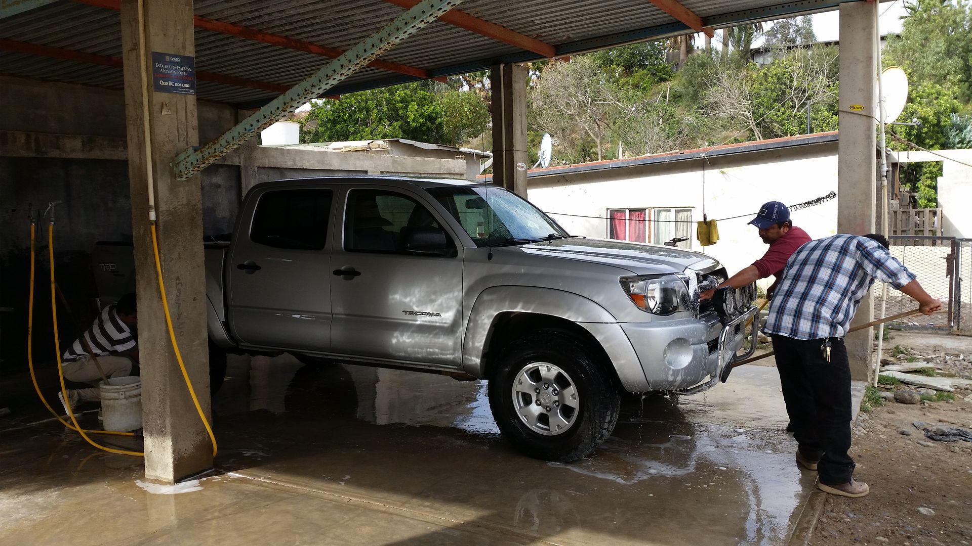
After my dusty run to Punta Baja, I have my truck washed at El Popeye (Km. 57) just north of the Pemex. They had up to four guys working on it, and I
do this not just because it was dirty, but because excessive dirt can be a reason to not allow your car back in the United States (bugs live in dirt
being the reason). The charge for an excellent exterior wash was only 120 pesos, which I bumped up to 200 for great service.
Well, that was a good day after quite a night and early morning!
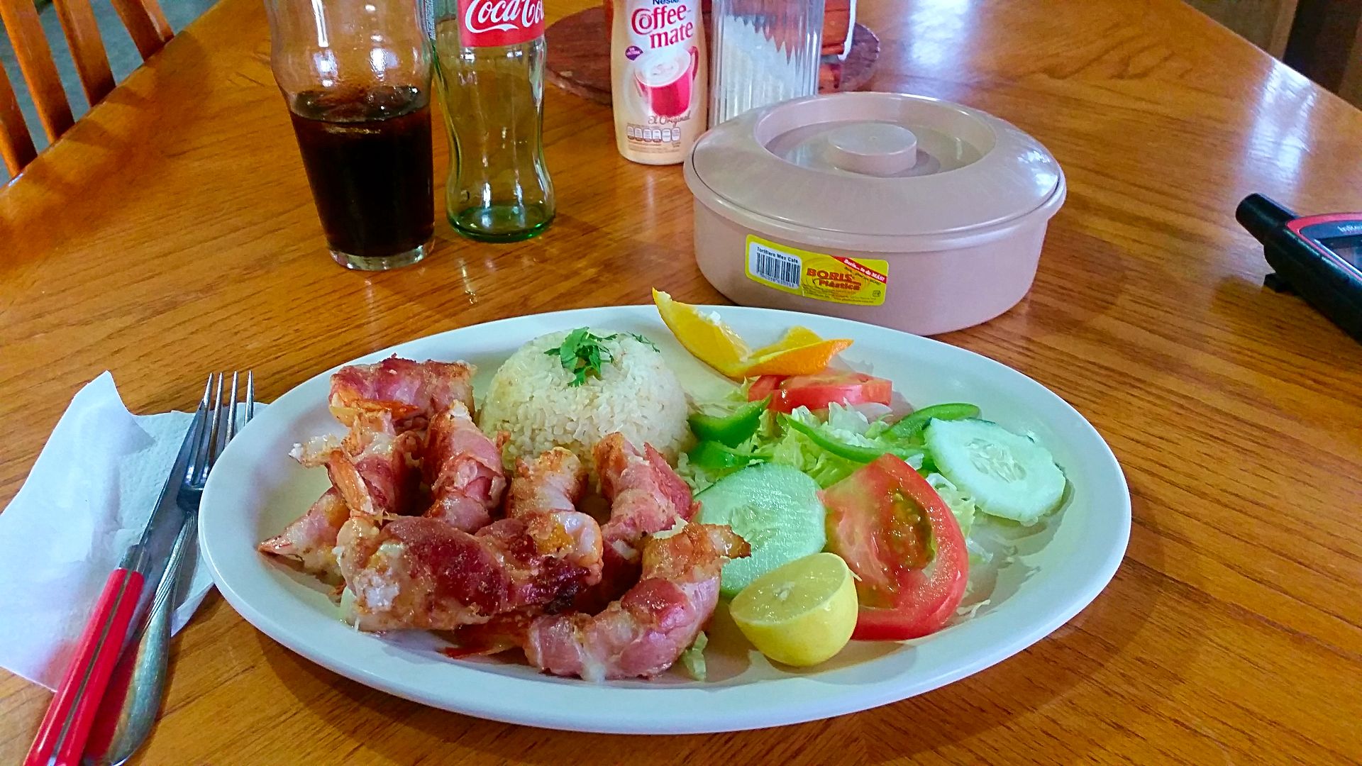
For dinner, I go back to El Faro and have the bacon-wrapped shrimp dinner. It was great... and almost too much to eat!
Had a great sleep at te Baja Cactus Motel, again. Tomorow, I am going home. But, not without doing some research in San Quintin!
A single Baja Cactus Motel Room is under $40, features a king bed and now all LED lights, flat screen satellite TV, coffee maker, pressure boosted
shower, bottled water, phone, wifi, secure parking...


[Edited on 7-21-2018 by David K]
|
|
|
David K
Honored Nomad
Posts: 64479
Registered: 8-30-2002
Location: San Diego County
Member Is Offline
Mood: Have Baja Fever
|
|
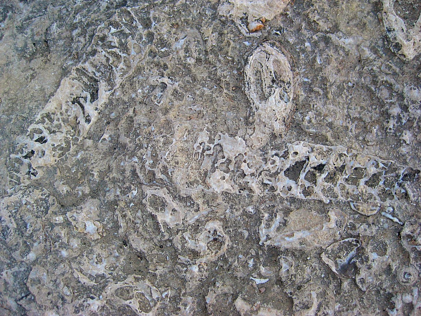
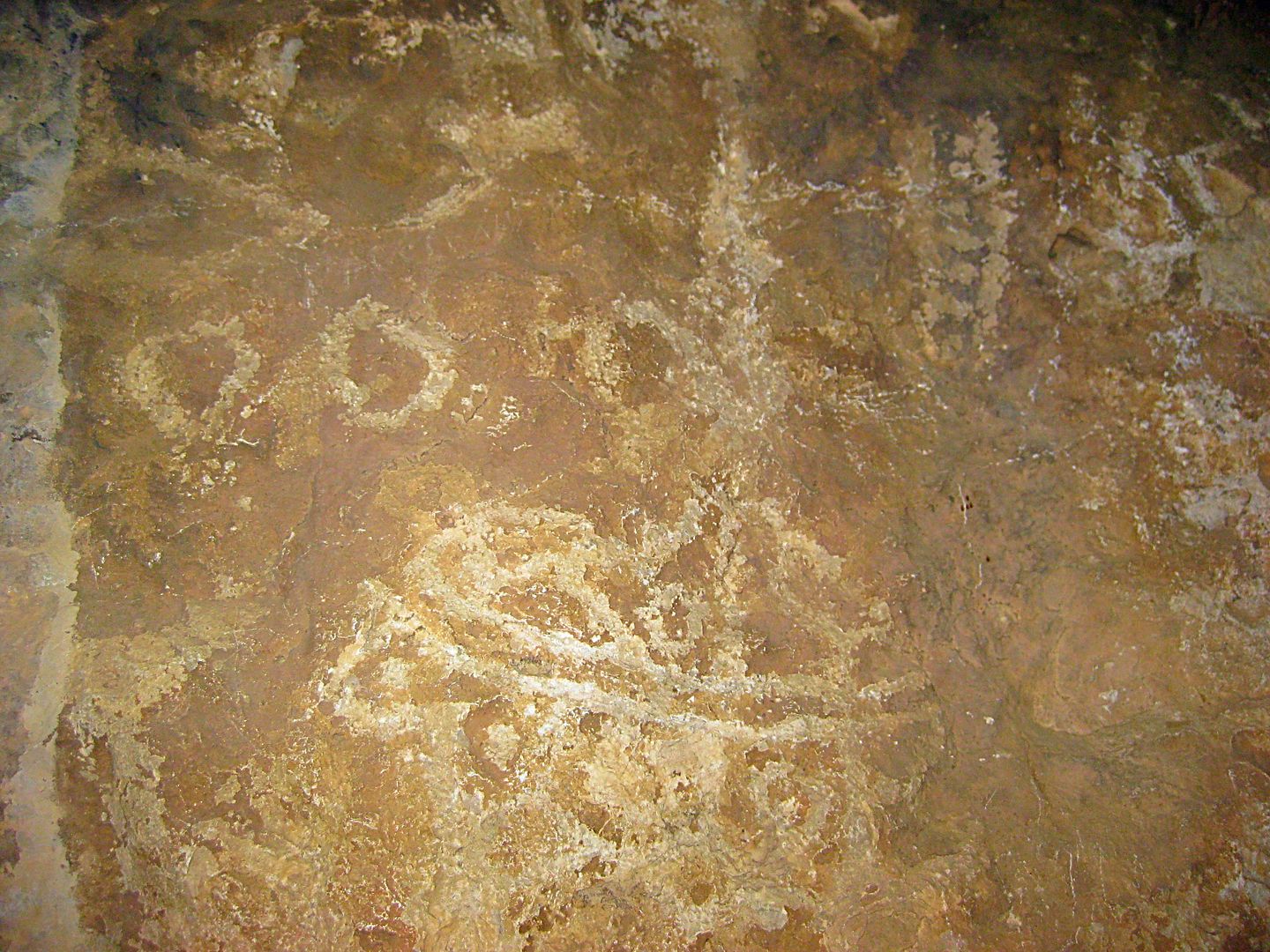
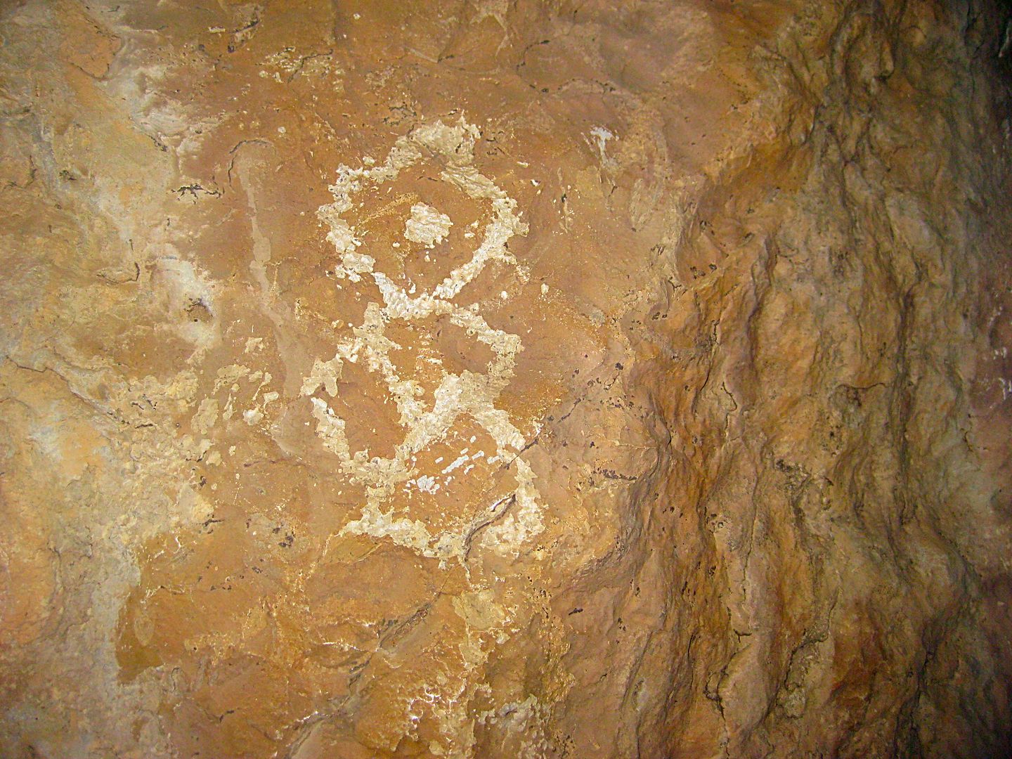
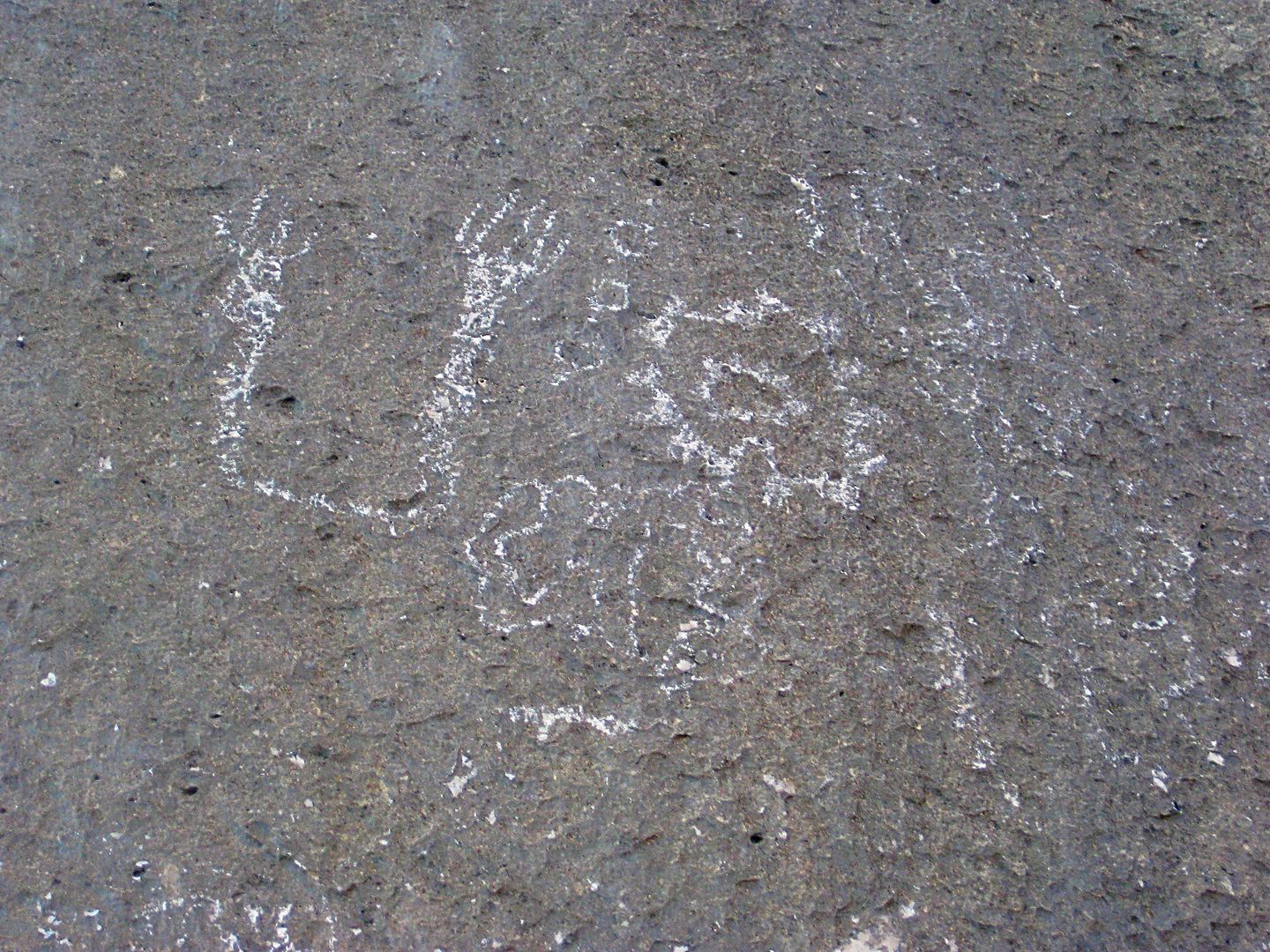
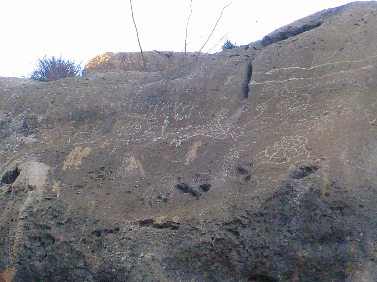
Las Pintas Fossil Grotto
The Las Pintas fossil grotto and petroglyph site is an easy drive fro El Rosario. Here are a couple of web pages I made from trips there.
2010: http://vivabaja.com/Las%20Pintas%20Fossil%20Grotto/
2005: http://vivabaja.com/pintas/
My last time camping at the site was September 2016...
|
|
|
Alm
Ultra Nomad
Posts: 2716
Registered: 5-10-2011
Member Is Offline
|
|
As usual with animal products - even if it's thousand years old - they are subject to detailed inspection. With fossils they will want to see that
it's sparky clean. That is, if your purpose is to bring something back, not just admire it in their natural setting.
|
|
|
David K
Honored Nomad
Posts: 64479
Registered: 8-30-2002
Location: San Diego County
Member Is Offline
Mood: Have Baja Fever
|
|
Fossils should remain where they have been for 10,000,000 years. Take photos, that's all. There is a law about non-Mexicans taking fossils (and now
sea shells) all considered national property. However, if a Mexican takes them and sells them to you, that is fine... (they say)! Get a receipt!
|
|
|
okiebaja
Newbie
Posts: 24
Registered: 8-27-2015
Member Is Offline
Mood: Excited.
|
|
Yes - know rules for fossils! I avoided the fellow gringo trying to sell me some in catavina (didn't feel right). But I believe this is the area he
suggested.
All that being said, I am driving a rental (not 4wd) think I can find a local to pay to go looking who has a more appropriate ride?
//From Davids description above //
The right branch travels high on a ridge offering great vistas of the surrounding country and the Pacific coast (hidden by clouds or fog) before
dropping down to the large arroyo valley. A farm's gated entrance is 11.2 miles from the fork and the famous ammonite hill was nearby. Ammonites are
fossil snails found in great quantity at one time, near here. One is on display in Mama Espinoza's Restaurant, El Rosario.
|
|
|
David K
Honored Nomad
Posts: 64479
Registered: 8-30-2002
Location: San Diego County
Member Is Offline
Mood: Have Baja Fever
|
|
I would ask Ed Lusk, owner of Baja's Best Restaurant (and Bed & Breakfast). It is on the right side at the far end of town (almost across from the
Turista Motel). Starbucks logo. He takes people to see minerals including turquoise in the hills not far away.
|
|
|
mtgoat666
Select Nomad
Posts: 17295
Registered: 9-16-2006
Location: San Diego
Member Is Offline
Mood: Hot n spicy
|
|
Quote: Originally posted by okiebaja  |
From Davids description
Ammonites are fossil snails found in great quantity at one time, near here. One is on display in Mama Espinoza's Restaurant, El Rosario.
|
Not snails. Ammonites were like nautilus (think squid with body in a chambered shell)
Woke!
“...ask not what your country can do for you – ask what you can do for your country.” “My fellow citizens of the world: ask not what America
will do for you, but what together we can do for the freedom of man.”
Prefered gender pronoun: the royal we
|
|
|
David K
Honored Nomad
Posts: 64479
Registered: 8-30-2002
Location: San Diego County
Member Is Offline
Mood: Have Baja Fever
|
|
To the untrained eye, an easy description would be the shell is like a giant snail shell (to someone who never saw one before).


Here is the more accurate description from wiki:
Ammonoids are an extinct group of marine mollusc animals in the subclass Ammonoidea of the class Cephalopoda. These molluscs are more closely related
to living coleoids (i.e., octopuses, squid, and cuttlefish) than they are to shelled nautiloids such as the living Nautilus species. The earliest
ammonites appear during the Devonian, and the last species died out during the Cretaceous–Paleogene extinction event.
Ammonites are excellent index fossils, and it is often possible to link the rock layer in which a particular species or genus is found to specific
geologic time periods. Their fossil shells usually take the form of planispirals, although there were some helically spiraled and nonspiraled forms
(known as heteromorphs).
The name "ammonite", from which the scientific term is derived, was inspired by the spiral shape of their fossilized shells, which somewhat resemble
tightly coiled rams' horns. Pliny the Elder (d. 79 AD near Pompeii) called fossils of these animals ammonis cornua ("horns of Ammon") because the
Egyptian god Ammon (Amun) was typically depicted wearing ram's horns.[1] Often the name of an ammonite genus ends in -ceras, which is Greek
(κέρας) for "horn".
|
|
|
okiebaja
Newbie
Posts: 24
Registered: 8-27-2015
Member Is Offline
Mood: Excited.
|
|
Yep - Ammonoids is exactly what I am looking for.
|
|
|
David K
Honored Nomad
Posts: 64479
Registered: 8-30-2002
Location: San Diego County
Member Is Offline
Mood: Have Baja Fever
|
|
Using the directions provided by The Baja Adventure Book and the Lower California Guidebook and Sunbelt Magazine, I believe I was close to the
ammonite hill, but after much searching on foot, did not see more than what I posted photos of. It should be about where the road comes off the hill
and meets the valley floor, as far as the distances that were provided (measuring from the fish camp back). The road coming in from Highway 1 has
multiple routes, as you can see on Google Earth.
|
|
|
BajaMama
Super Nomad
Posts: 1106
Registered: 10-4-2015
Location: Pleasanton/Punta Chivato
Member Is Offline
Mood: Got Baja fever!!
|
|
Well, everything David K said and... heading south of San Quintin area, there is a turnoff on the right to La Lobera, a fun little side trip. The
turn off is north of El Rosario, a couple miles after the road turns away from the ocean but before the military check point at the top of the hill.
The turn off is well marked with a sign. The views are beautiful and there is a sink hole that has become a sea lion rookery. Less than 2 hours for
the whole in and out and scenery viewing.
|
|
|
|


