David K
Honored Nomad

Posts: 64476
Registered: 8-30-2002
Location: San Diego County
Member Is Offline
Mood: Have Baja Fever
|
|
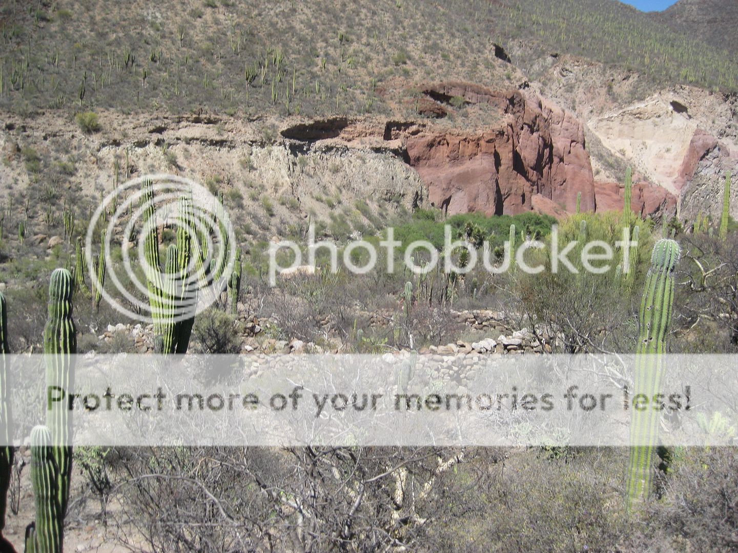
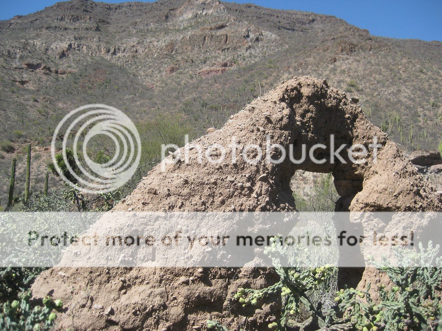
The Visita de San Pablo, over the years...
So major was this adobe complex, in the early 1900s, it was mistaken for being a mission. Some (including INAH) even thought it could be a lost
mission and applied (in error) the name Dolores del Norte to it.
Some attribute San Ignacio missionary, Padre Fernando Consag, as having this built (in Baja 1733-1759). Very little is known. It is usually called a
visita (satellite mission station) of Mission Santa Gertrudis (1752-1822).
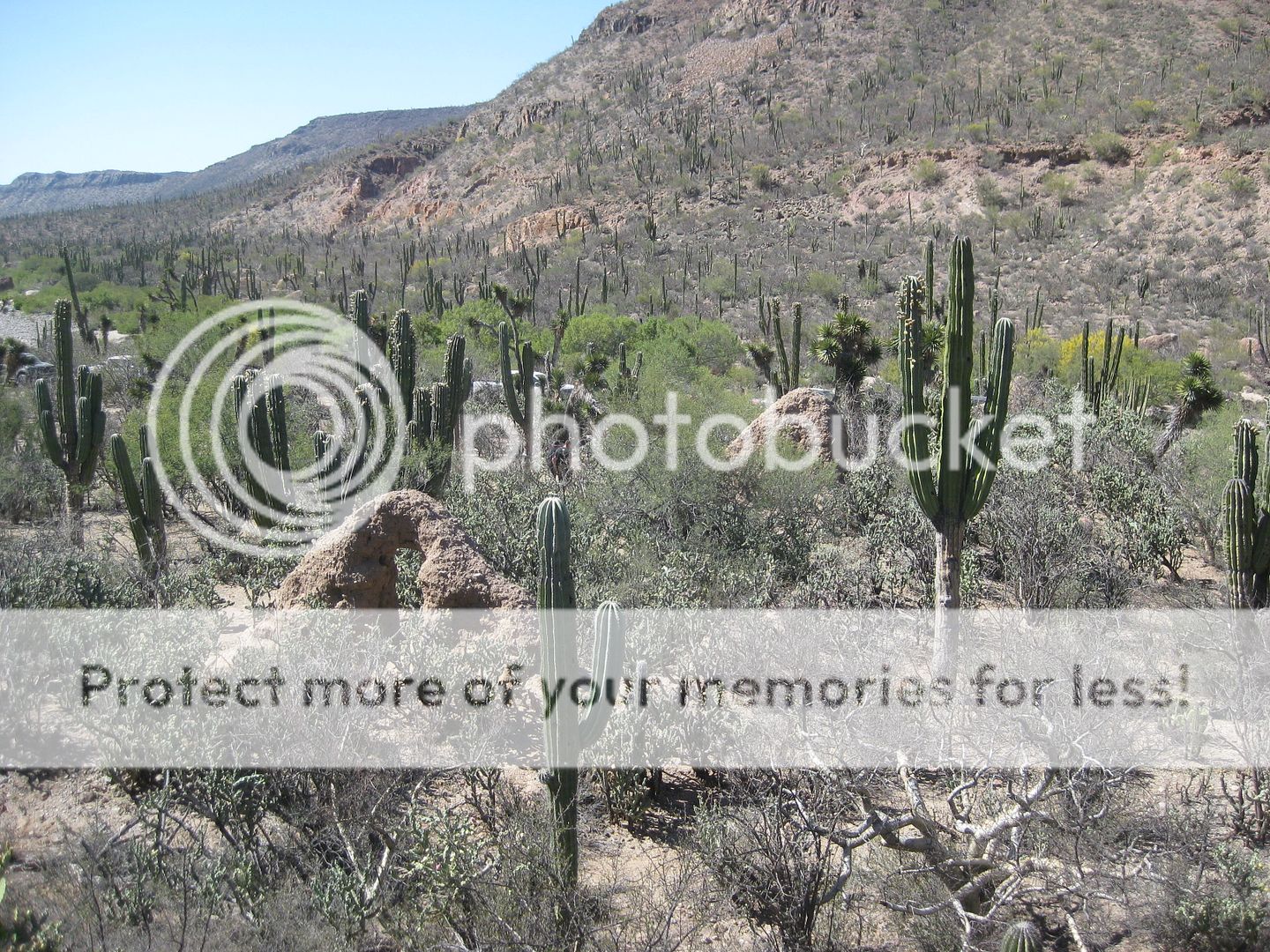
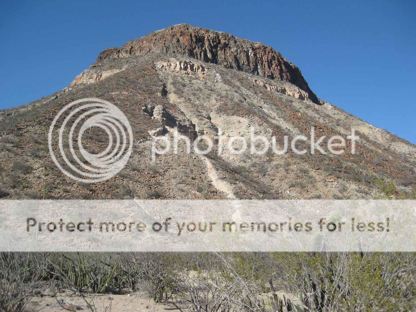
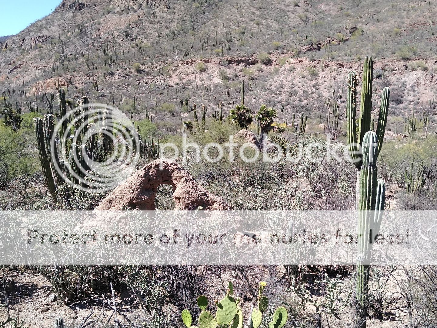
The San Pablo Canyon is the major canyon that flows down from San Francisco de la Sierra towards Vizcaino. The visita ruins are midway in the canyon,
on the floor of the canyon valley.
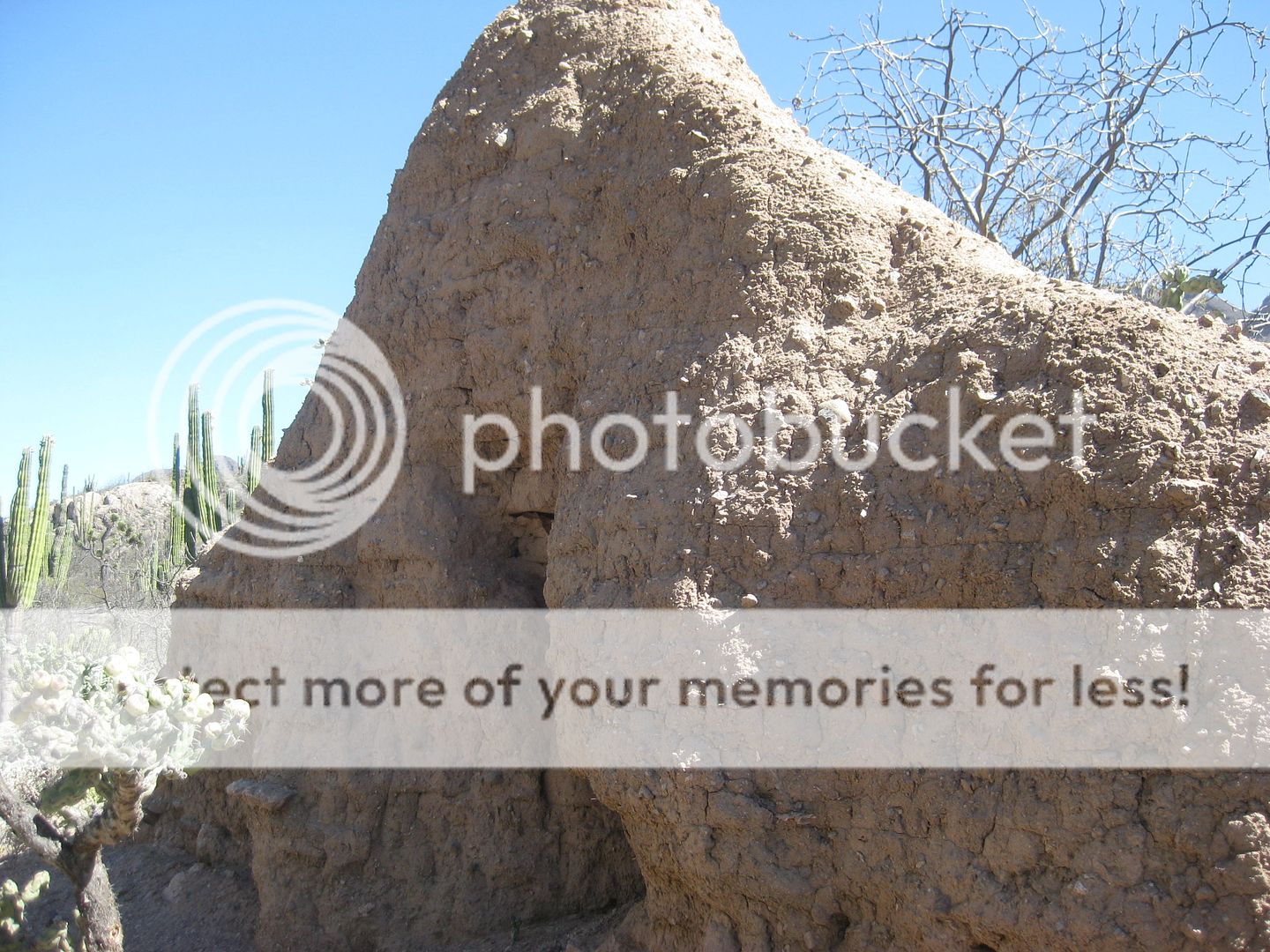
The following 4 photos taken from approx. the same location, facing northwest, show how weather and vegetation are reclaiming these mission-era ruins.
Because it is so remote, it does not get the volume of visitation as other mission sites. Thankfully, photography is the best preservation to see what
this visita church looked like going back over 90 years...
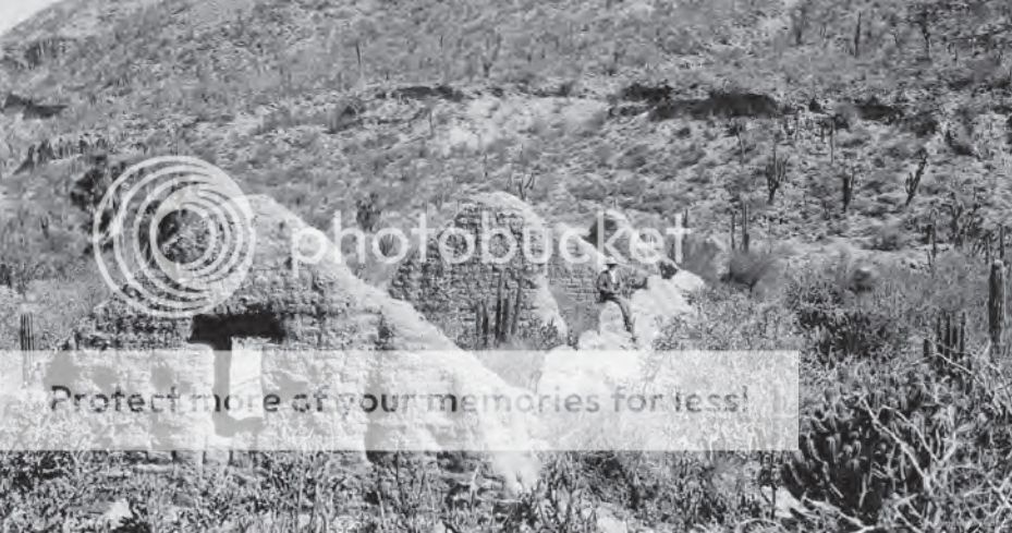
Ed Davis, 1926
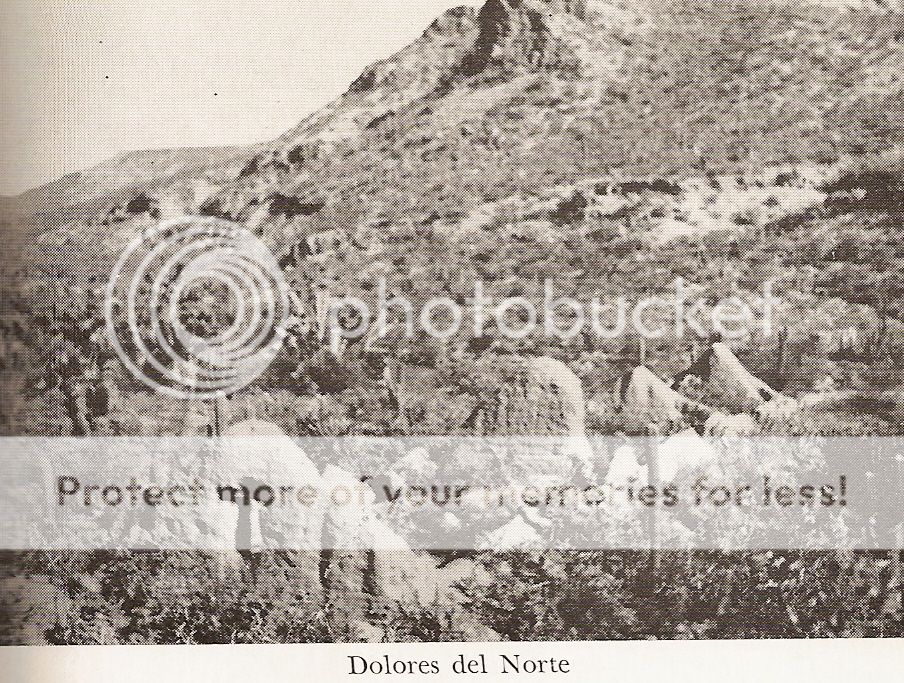
Marquis McDonald, 1949
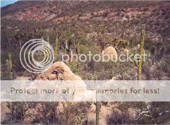
Kevin Clough, 1998
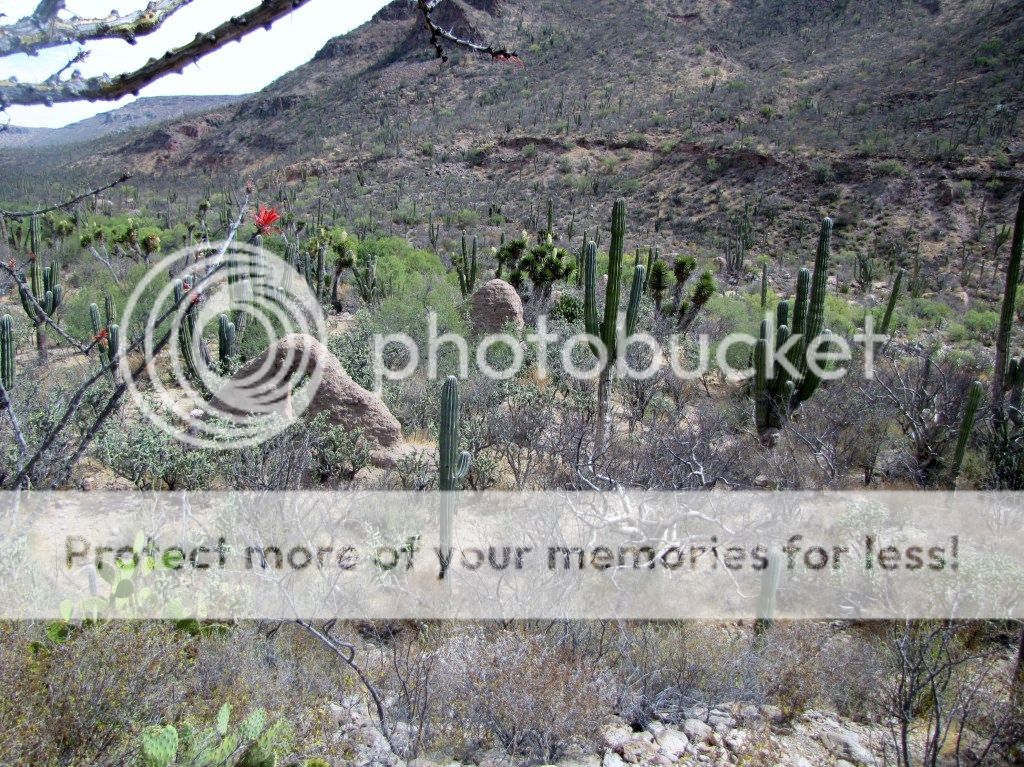
Phil Lang, 2010
David Kier, 2019
The three-branched cardón, on the right, can be seen in all the images. No branches until after 1949... and in the 1926 photo, it is at the far right
edge of the photo.

The northern end, next to the road.
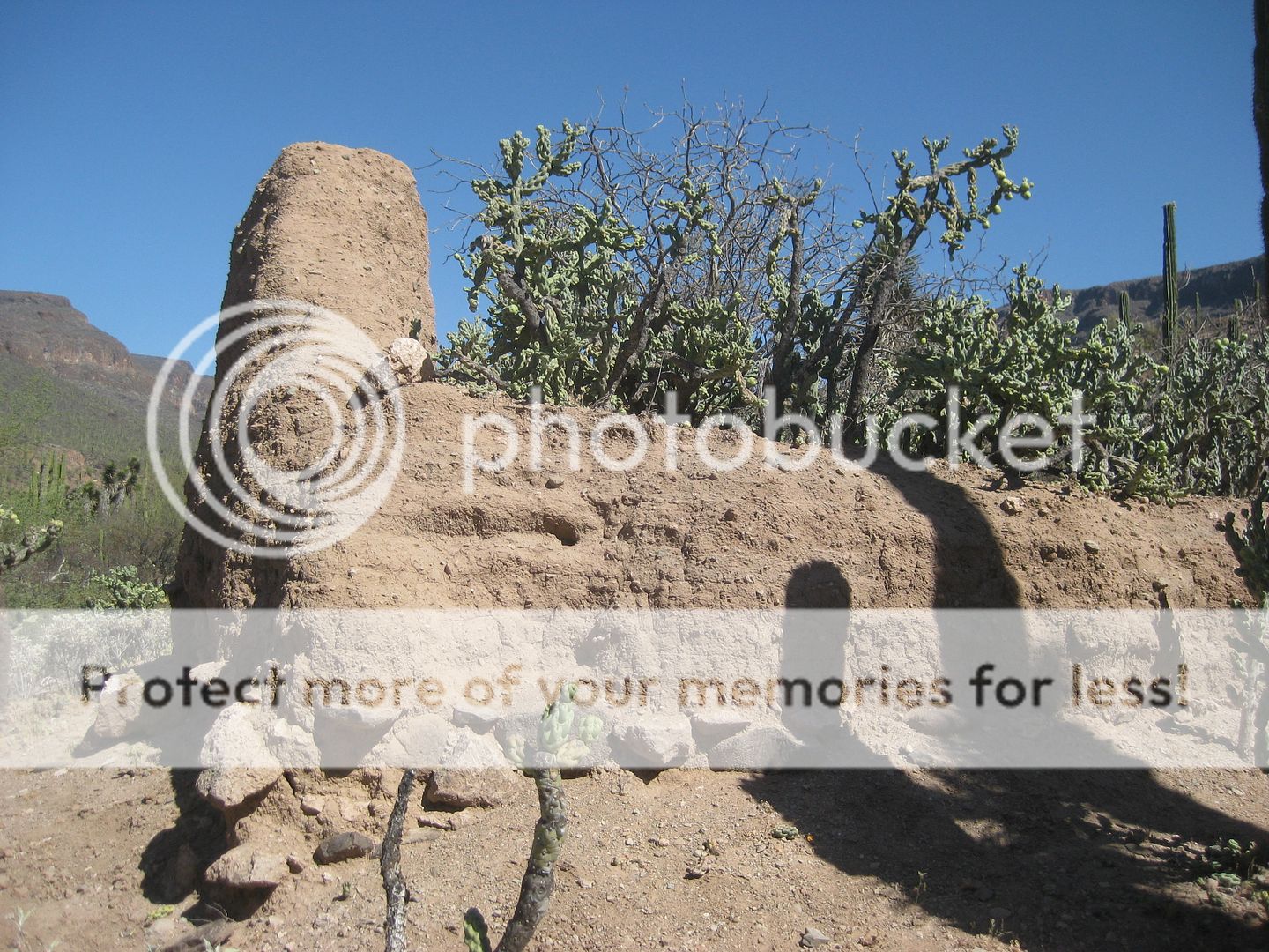
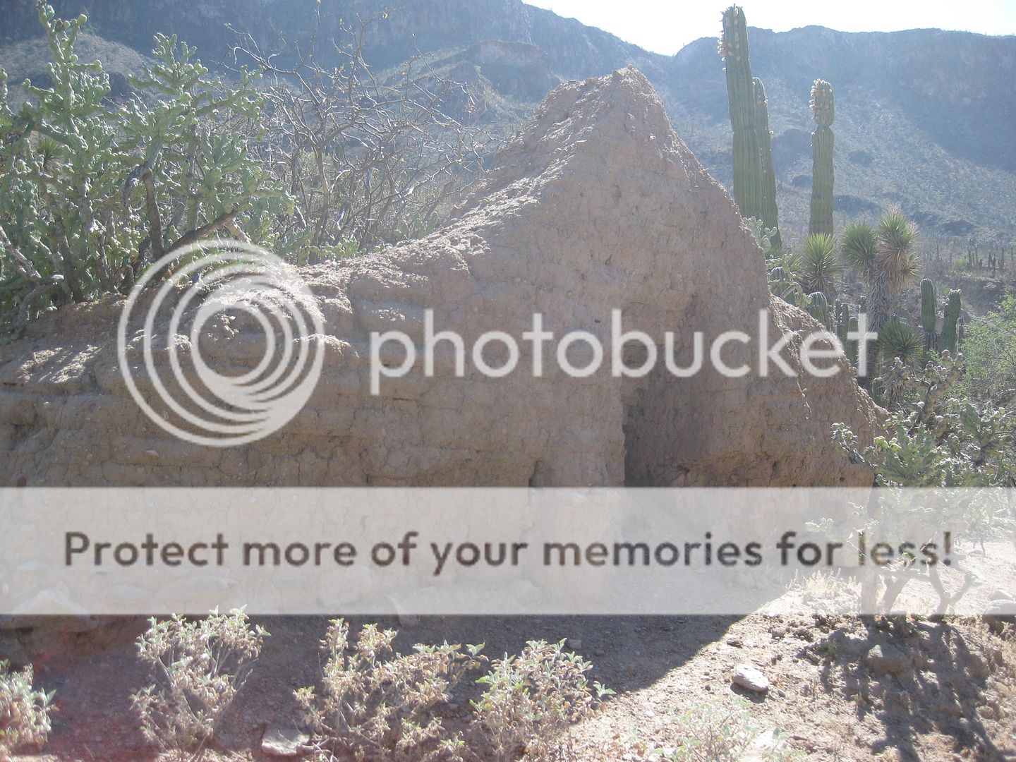
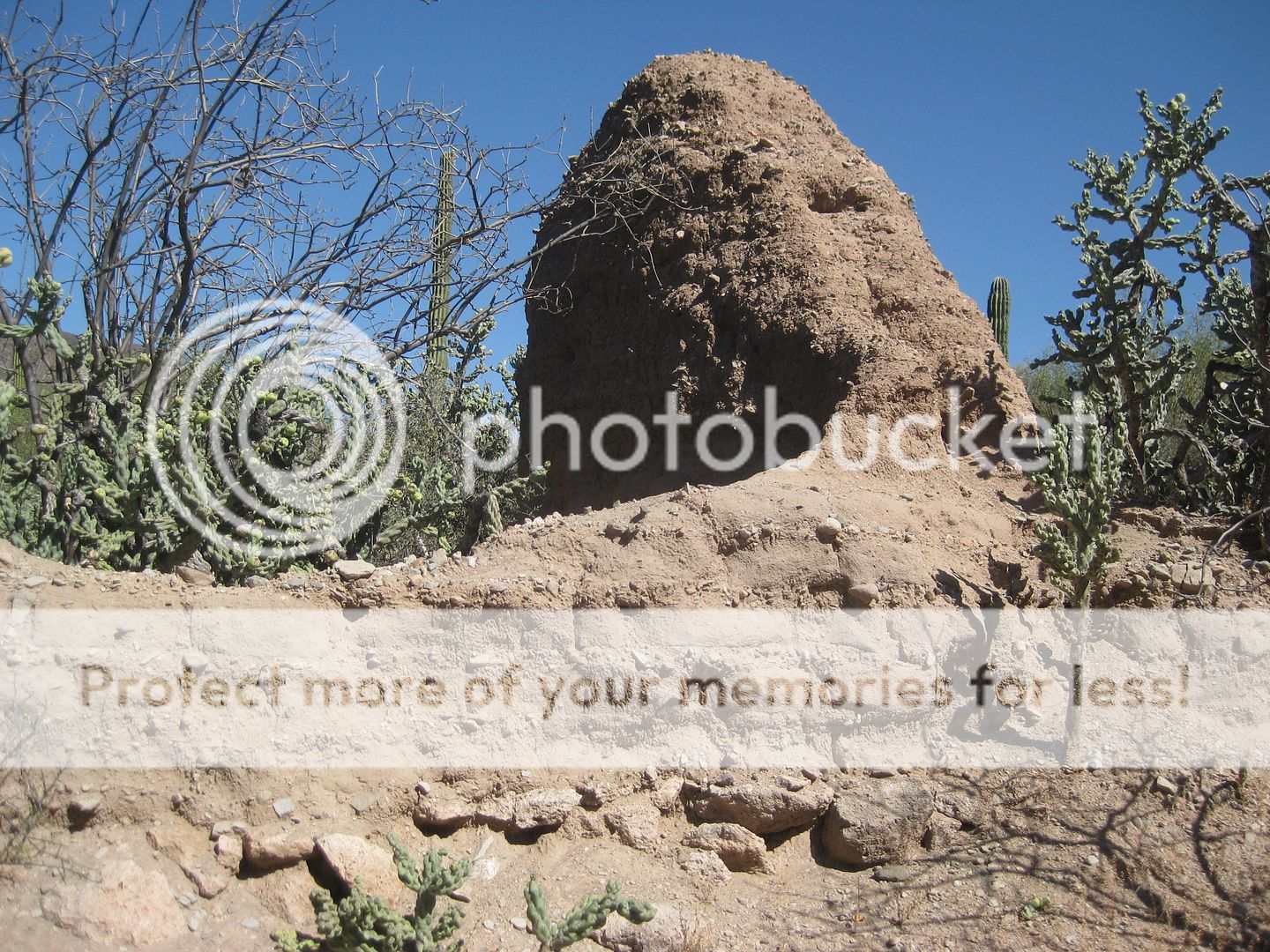
One of the room division walls in the middle.
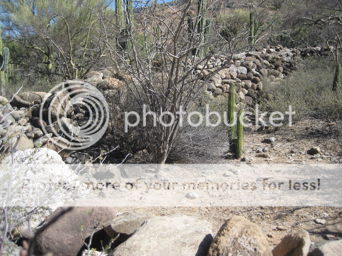
The corral just east of the church.
One of the Baja historic sites I read about as a kid and have always wanted to see, in person.
Well, after more than 50 years of hoping to see it, it was well worth the wait!
The desert will reclaim this entirely unless INAH or a private party sees the value in restoring or at least stabilizing the site by removing the
cholla and coating the walls. It is very similar to the adobe mission ruin of Santa María, built by the Franciscan Padre Juan de Medina Beitia in
1768. The Franciscans also built the final adobe church at San Borja during their 5 years operating the missions on the peninsula. I think we can date
this to either the 1750s or 1760s (Jesuit or Franciscan)? I will continue to seek answers to the past!
If you have a strong history interest and a desire to see this site, go to Junior's automotive repair, to guide you, next door to the Hotel del Sol/
Hotel Martitha, across from the highway to Bahía Tortugas. You may need to return later because Junior will need to get the gate key from the ranch
owner in town. You will need to have room for Junior or ? to ride with you unless they take their vehicle, too.
Leave Hwy. 1 at Km. 154.5. Go 11.8 miles to the Guillermo Prieto and Santa Gertrudis road and pass it. Continue east to the big farm entrance and go
north around it to the opposite side to Prosperidad, 4.9 miles from the Guillermo Prieto junction. 3.5 miles south from Prosperidad (a large brick
house from 1916) is the locked gate (several unlocked gates are passed through before this one). The visita is 8 miles from the locked gate. A goat
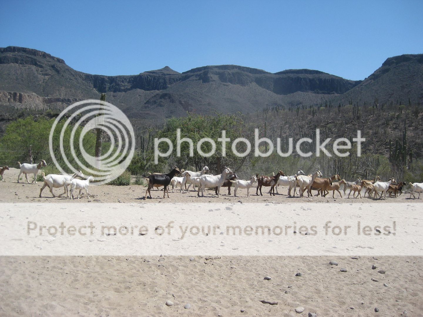
ranch is passed through along the way.
|
|
|
Jack Swords
Super Nomad
Posts: 1094
Registered: 8-30-2002
Location: Nipomo, CA/La Paz, BCS
Member Is Offline
|
|
Nice photos showing the loss of this (and other) sites in Baja, David. I could only get to the canyon wall and needed to use a telephoto lens for a
picture. What has been done to other adobe ruins with the rather weatherproof coating needs to be done here. Sure am glad that there are photographs.
It is amazing how we have witnessed the degradation of these valuable sites in such a short period of time.
|
|
|
David K
Honored Nomad
Posts: 64476
Registered: 8-30-2002
Location: San Diego County
Member Is Offline
Mood: Have Baja Fever
|
|
Thank you, Jack!
You have been such a great wealth to the Baja missions in how well you have preserved them through photography. When I began my website and devoted
part of it to the mission history, it was primarily your photos taken mostly around 2000-2003, which illustrated these artifacts of the past. You
inspired me to keep photographing the mission sites to record them as many are vanishing physically, but are preserved on film or electronically.
I was just looking at my GPS track against the satellite image to calculate additional point to point mileages. As I noted in my post above, it is 8
miles from the locked gate to the Visita de San Pablo.
Here are the additional points:
0.0 Locked Gate at entrance to San Pablo Canyon.
3.4 Merge onto El Camino Real trail.
4.4 Ford Ranger blocked route ahead, take road to right.
4.9 Rancho El Datillo (goat ranch).
5.5 Merge back onto El Camino Real route.
8.0 Visita de San Pablo ruins.
Rancho San Pablo is 1.7 miles further. San Francisco de la Sierra is about 10 miles up the canyon, as the crow flies.
|
|
|
David K
Honored Nomad
Posts: 64476
Registered: 8-30-2002
Location: San Diego County
Member Is Offline
Mood: Have Baja Fever
|
|
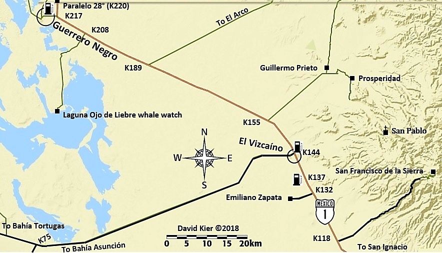
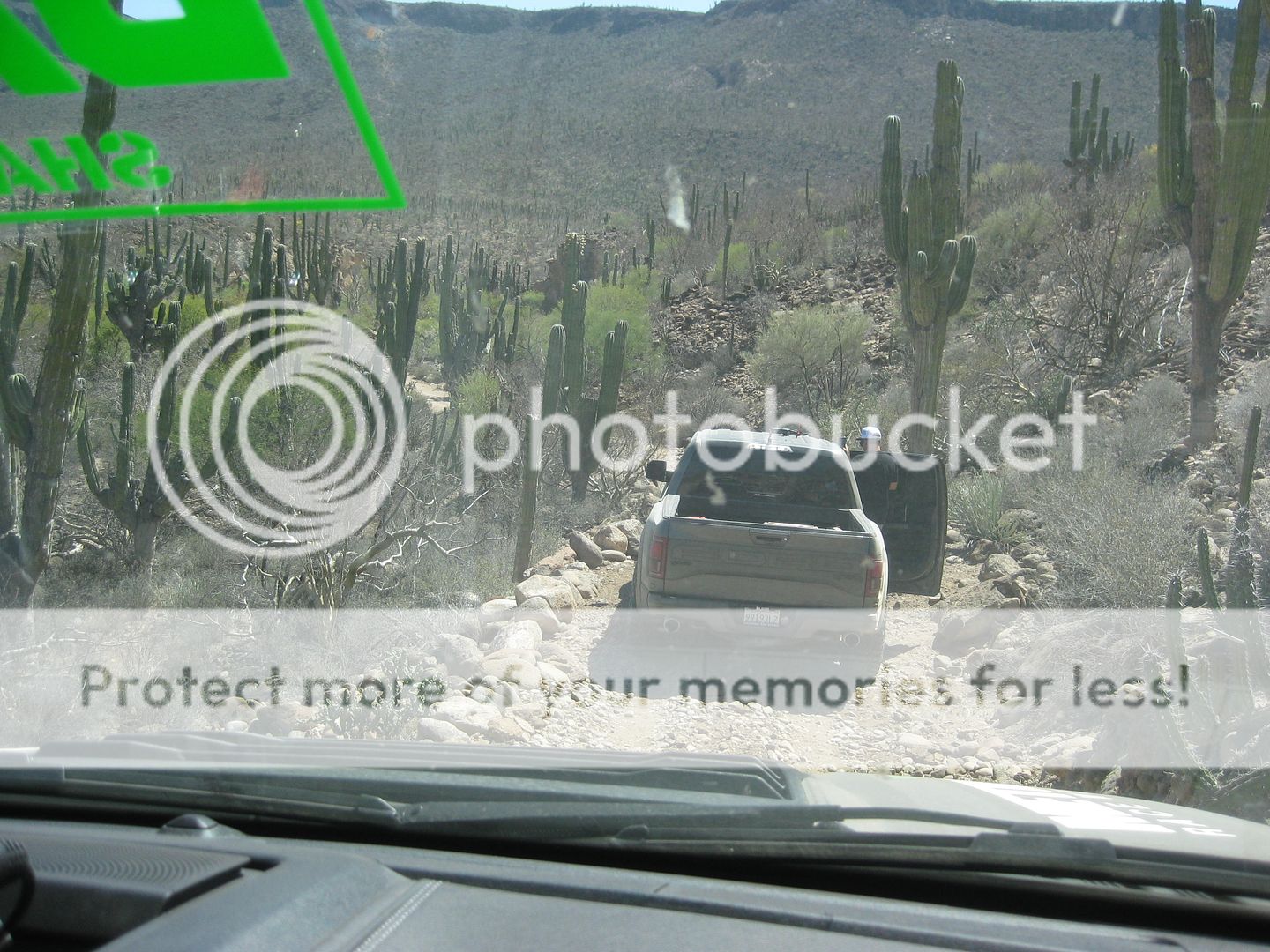
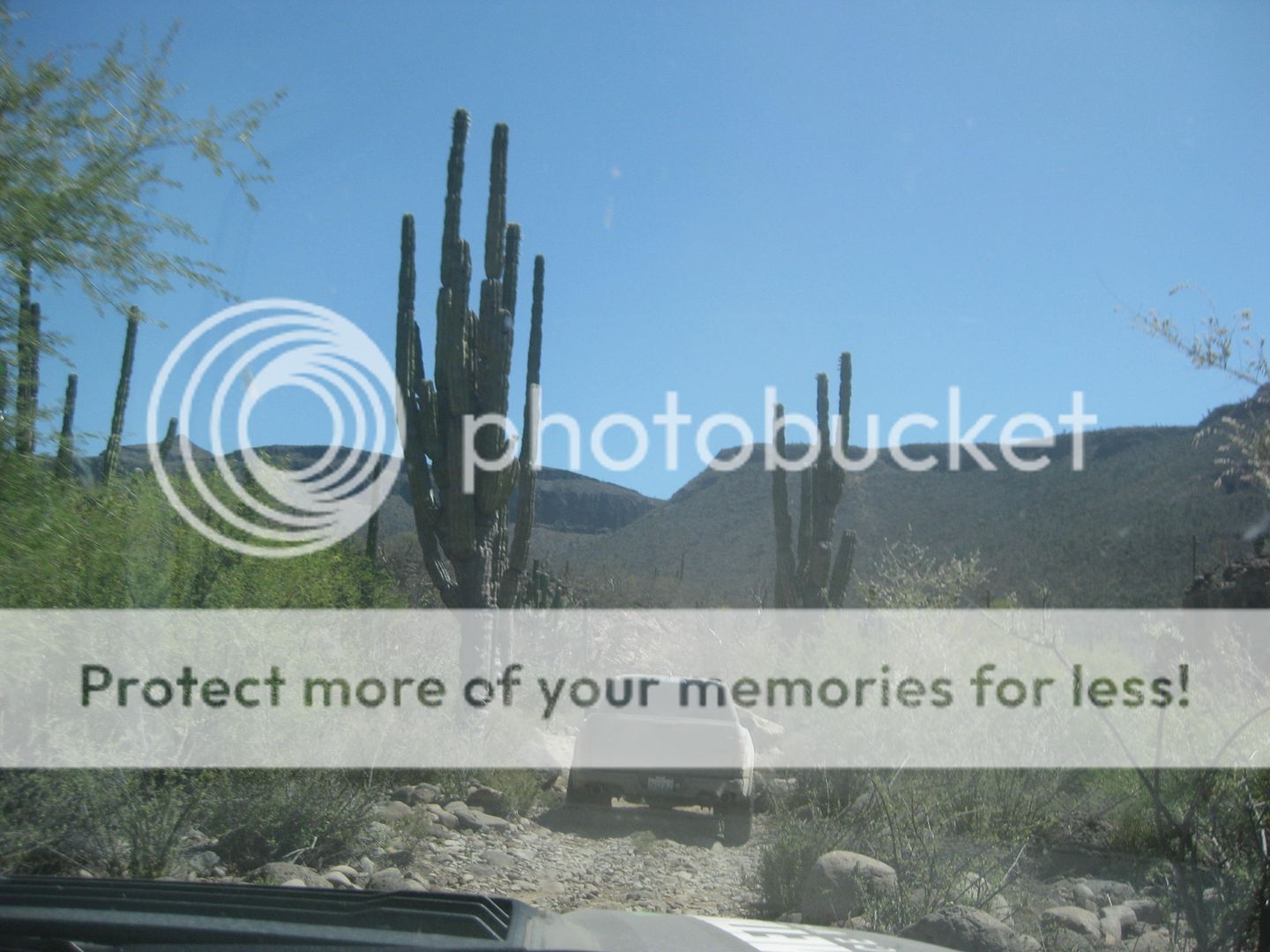
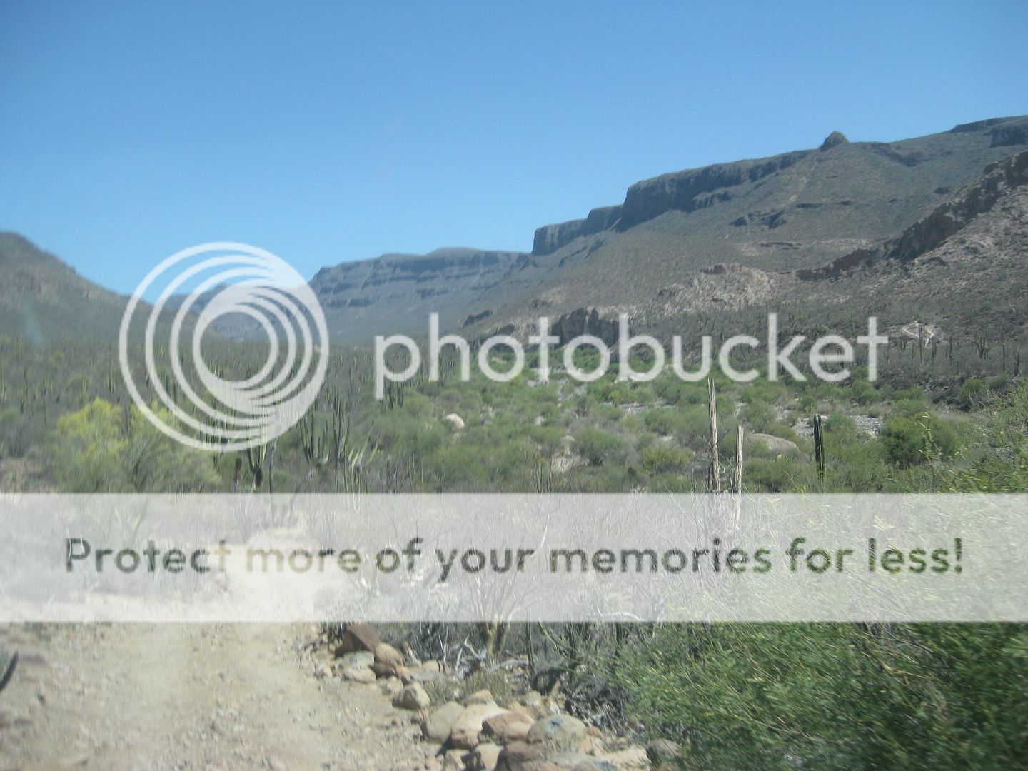
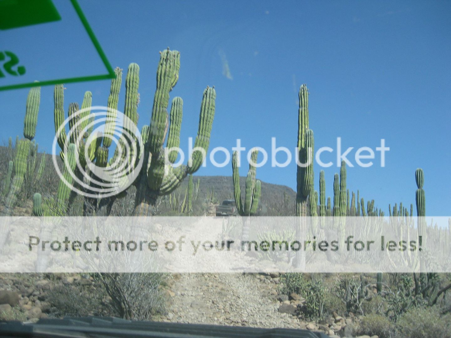
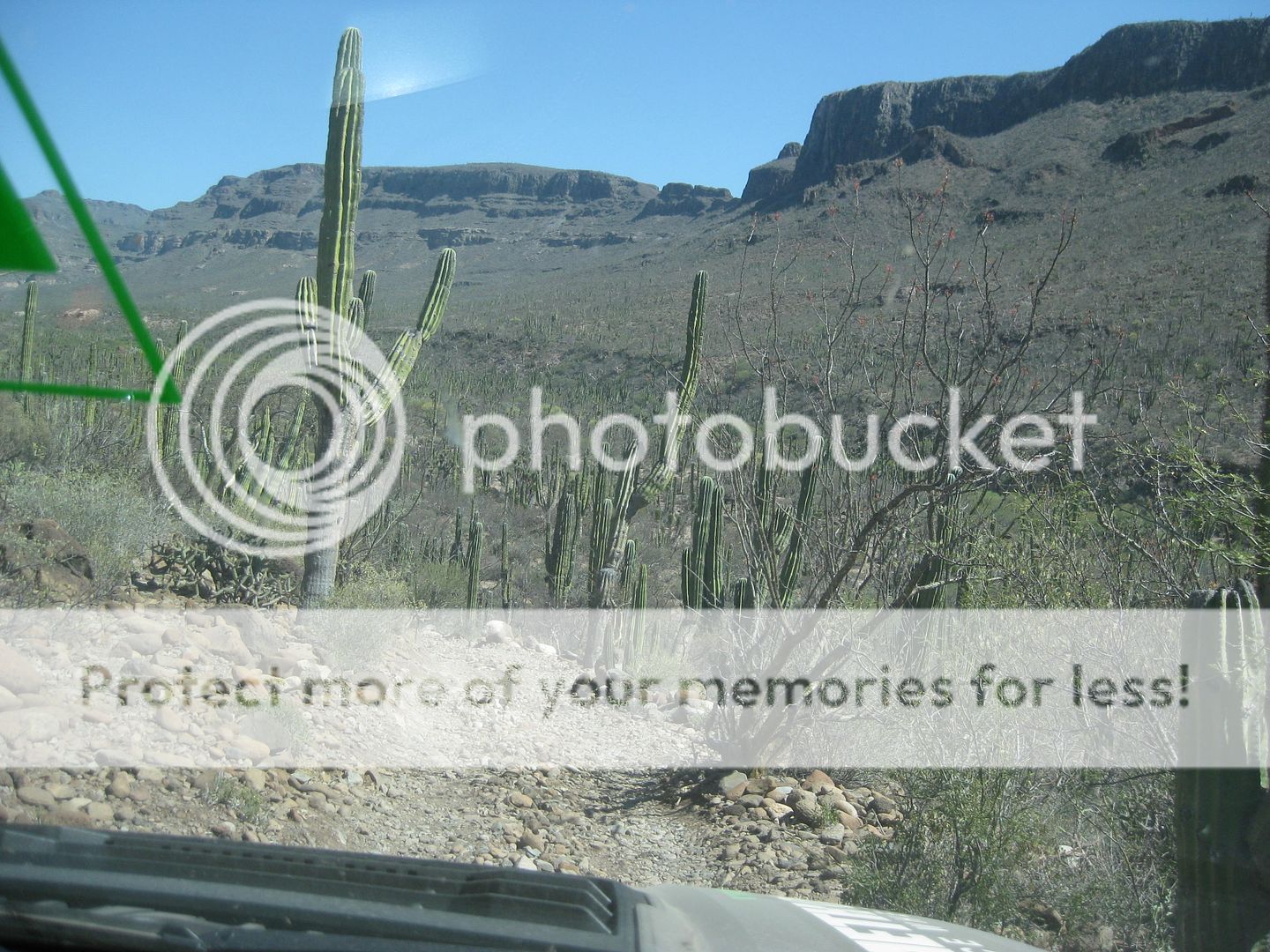
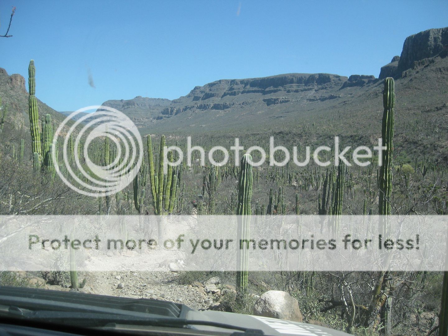
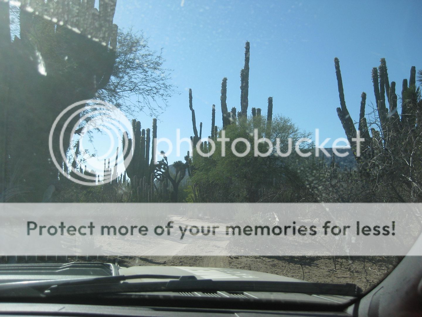
Here are photos on the road going in to San Pablo, after the locked gate:
|
|
|
David K
Honored Nomad
Posts: 64476
Registered: 8-30-2002
Location: San Diego County
Member Is Offline
Mood: Have Baja Fever
|
|
Here are the photos along the road going back out from San Pablo:
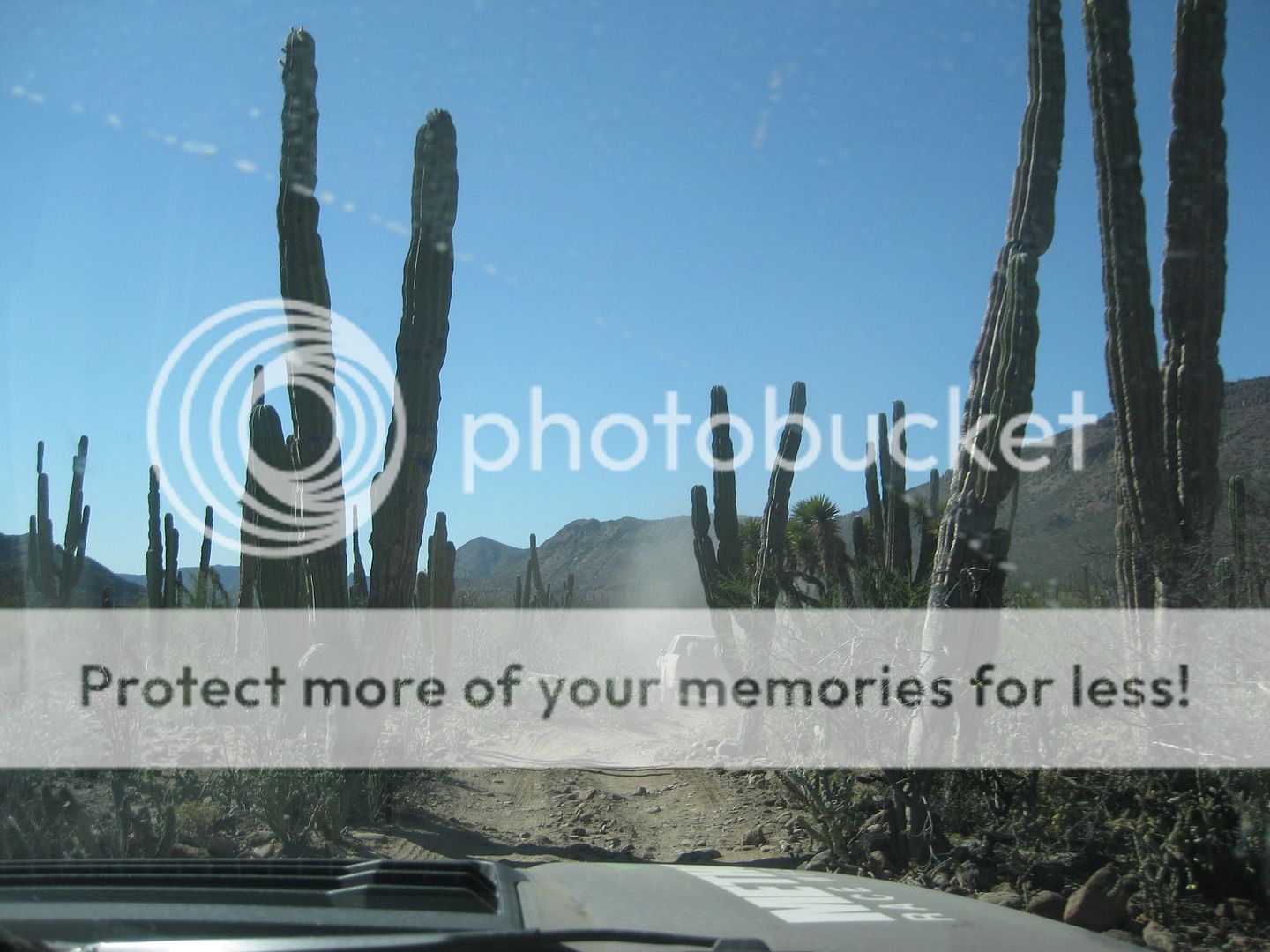
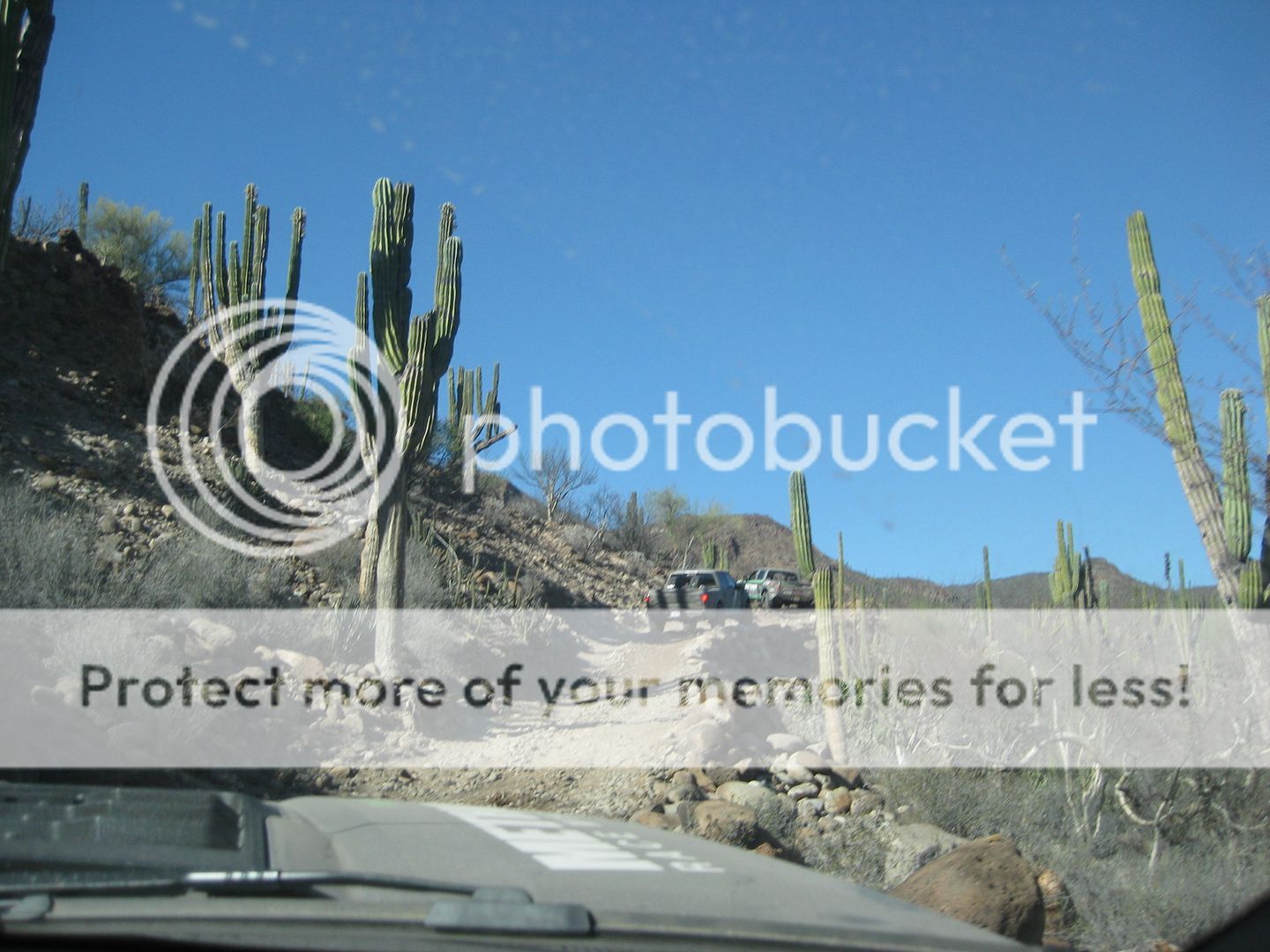
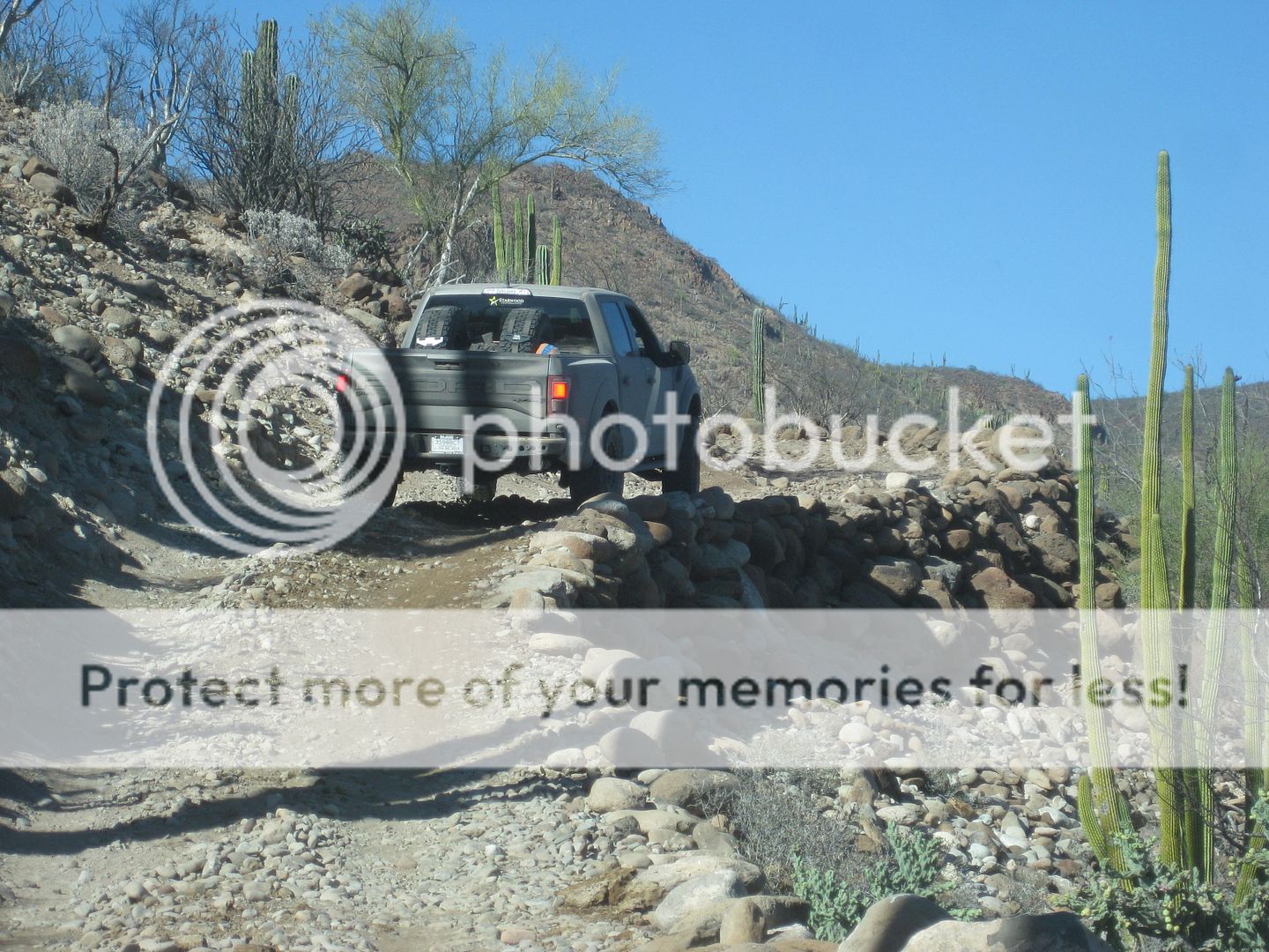
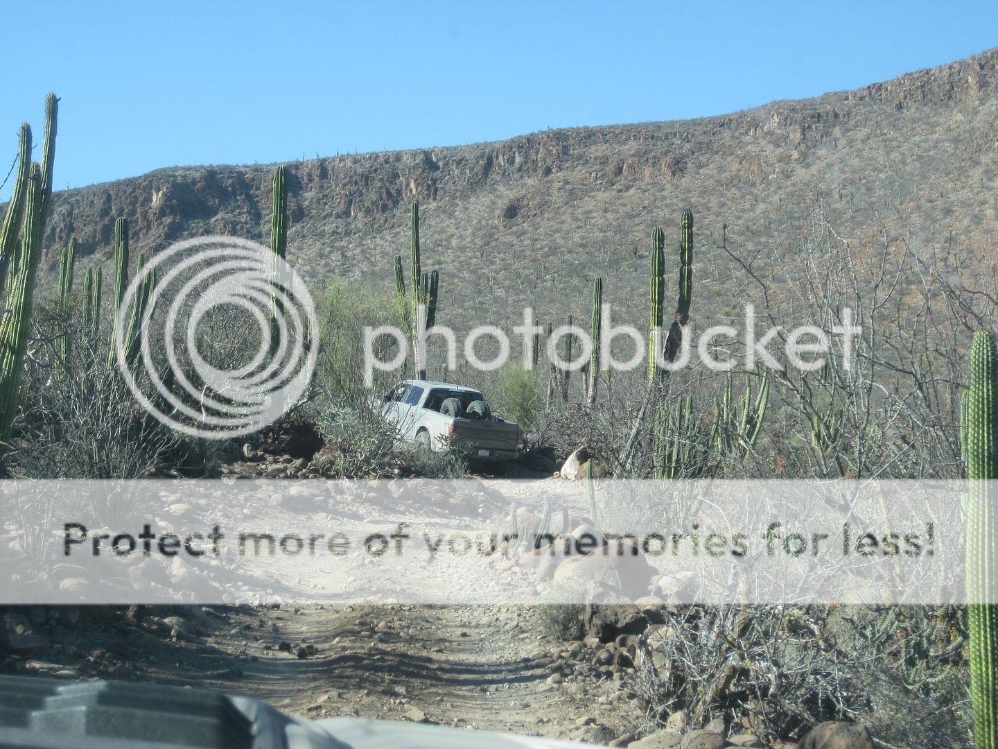
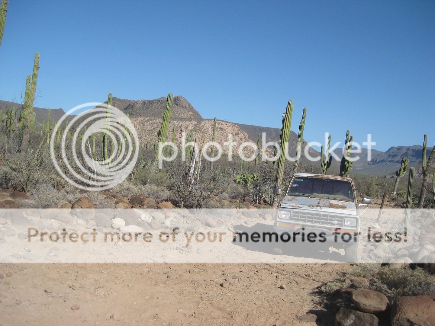
This is the Ford Ranger parked to block the road ahead (on the Camino Real route) and the detour (going in) takes you down to Rancho Datillo, then
back up to the Camino Real route.
This is the view at the locked gate.
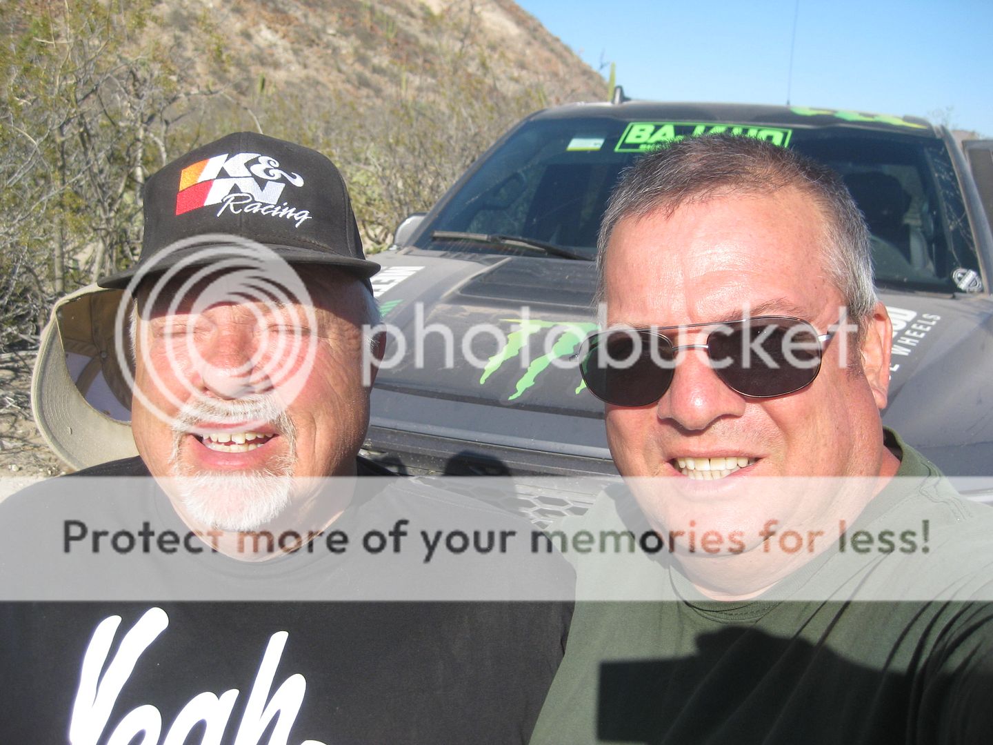
Into the sun selfie with off road champion, Baja 1000 winner, Curt LeDuc who was my driver.
|
|
|
David K
Honored Nomad
Posts: 64476
Registered: 8-30-2002
Location: San Diego County
Member Is Offline
Mood: Have Baja Fever
|
|
A slightly different angle taken on my phone:
2019
|
|
|
Estrella
Nomad
Posts: 115
Registered: 10-12-2005
Location: Mulege and Columbia, Ca
Member Is Offline
|
|
Thank you for sharing this! Another one on the bucket list. Do hope to see this preserved. Please keep us updated as well as what we can do to help
make it happen.
|
|
|
solosancarlos
Junior Nomad
Posts: 64
Registered: 11-11-2010
Member Is Offline
|
|
More great stuff Dave and co.
Thank you!
|
|
|
4x4abc
Ultra Nomad
Posts: 4163
Registered: 4-24-2009
Location: La Paz, BCS
Member Is Offline
Mood: happy - always
|
|
San Pablo/Dolores del Norte is an unlikely Visita.
No water
No arable land
it is not on a main ECR route
but it is undeniably there (like climate change)
so, whoever built the structures had a good reason for it
since builders did not leave instructions, we will have to guess
Harald Pietschmann
|
|
|
David K
Honored Nomad
Posts: 64476
Registered: 8-30-2002
Location: San Diego County
Member Is Offline
Mood: Have Baja Fever
|
|
There were three El Camino Real routes between San Ignacio and Santa Gertrudis: Pacifico, Sierra, and Golfo.
I think the choices were either seasonal (water available) or if certain visitas were in need of a visit by the padre.
San Francisco and San Pablo are along the Pacifico Camino Real.
There is indeed water in San Pablo Canyon, it is in the arroyo just northeast of the visita chapel. I did not get any photos. Maybe Jimmy's drone did?
You may have to look at the show when it is on TV (Sept. 1, ABC)? I hope to see them sooner.
The cholla has covered so much. But, I bet in the 1700s they had cleared a lot of land here?
I am writing a new Baja Bound article and I am very much looking for any documentation. I have been conversing with a Mexican author who wrote books
on Consag and Santa Gertrudis (Dolores del Norte) to see if he had any new sources, especially since he had a far earlier founding date for Santa
Gertrudis. Here is his Consag book, it is in Spanish: http://www.archivohistoricobcs.com.mx/files/libros/pdf/Texto...
|
|
|
4x4abc
Ultra Nomad
Posts: 4163
Registered: 4-24-2009
Location: La Paz, BCS
Member Is Offline
Mood: happy - always
|
|
you are right David - I had one of the layers in Google Earth turned off
Harald Pietschmann
|
|
|
David K
Honored Nomad
Posts: 64476
Registered: 8-30-2002
Location: San Diego County
Member Is Offline
Mood: Have Baja Fever
|
|
It remains a bit of a mystery as to who actually built it, when was it built, and how long was it occupied.
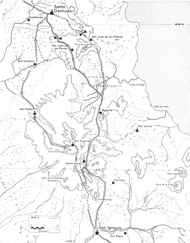
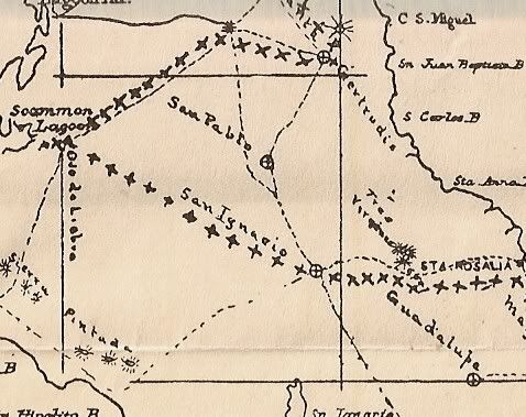
Here it is shown as a mission-era site in a 1930 map:
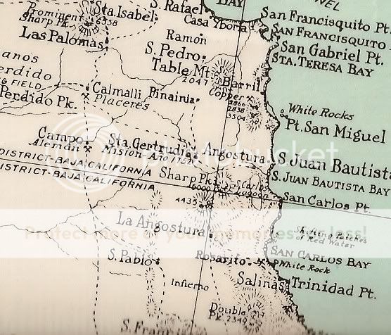
In a 1941 map it is shown along with a Dolores del Norte "mission" next to the main road south of El Arco!:
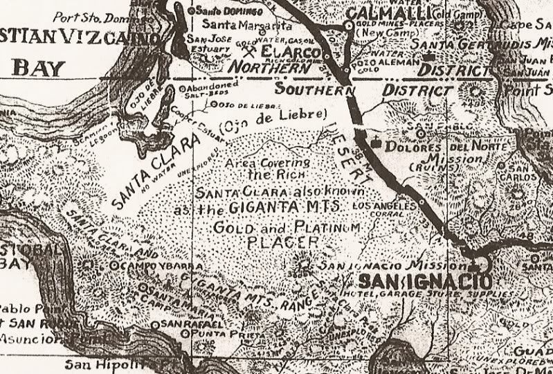
Arthur North included it in his 1907 map even though he did not go there on his Camp and Camino in Lower California book:
|
|
|
4x4abc
Ultra Nomad
Posts: 4163
Registered: 4-24-2009
Location: La Paz, BCS
Member Is Offline
Mood: happy - always
|
|
since there is no documentation we can only speculate and read the signs on the ground
Rancho San Pablo is only 1.5 miles up the canyon
what if the San Pablo Visita site was kind of a warehouse or resupply station?
there is definitely no flat ground to grow anything
the shelfs on both sides of the canyon have a significant slope (more than 10%)
however, maybe the location was only for livestock (the large corral indicates that - 11m by 13 m)
evn Rancho San Pablo has no flat ground for fields - it is for animals only
Harald Pietschmann
|
|
|
David K
Honored Nomad
Posts: 64476
Registered: 8-30-2002
Location: San Diego County
Member Is Offline
Mood: Have Baja Fever
|
|
Correct... not much farmland. However, it was not a mission so perhaps there was a large Native population to justify this church. How often the padre
from Santa Gertrudis (or San Ignacio) came here would be interesting to know. I will keep looking for more documents...
|
|
|
David K
Honored Nomad
Posts: 64476
Registered: 8-30-2002
Location: San Diego County
Member Is Offline
Mood: Have Baja Fever
|
|
In Harry Crosby's Cave Paintings book, he mentions a huerta (orchard) and irrigation works, from mission times, is located across the arroyo from the
chapel.
|
|
|


