| Pages:
1
2 |
David K
Honored Nomad

Posts: 64479
Registered: 8-30-2002
Location: San Diego County
Member Is Offline
Mood: Have Baja Fever
|
|
Do you mean the washout cliff is long gone? My picture is still there 
Here is my Garmin/ inReach track map of the Agua Caliente entrance in March 2017. I added the waypoint markers for the three places in discussion...
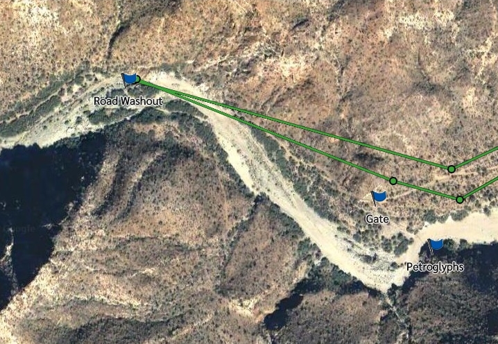
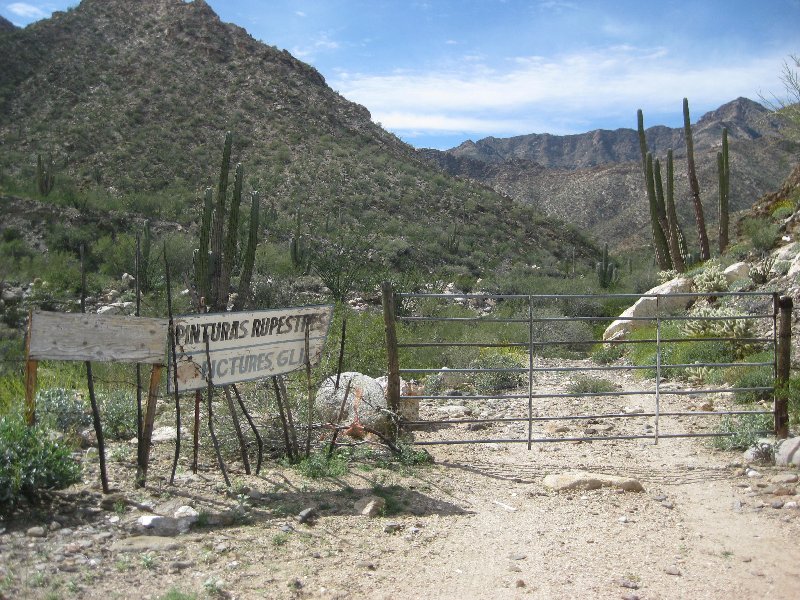
The Gate:
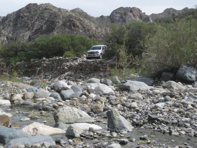
The Road Washout:
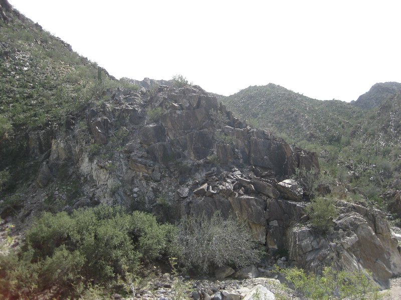
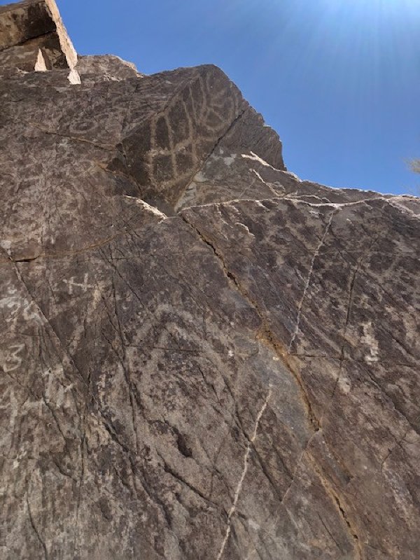
The Petroglyph Cliff "Pinturas" (seen from the gate):
|
|
|
PaulW
Ultra Nomad
Posts: 3005
Registered: 5-21-2013
Member Is Offline
|
|
I am saying there is a steep bank, but no boulders between the bank and your truck. For me it was not a significant deal so I did not make note of the
location, and memory already fades.
|
|
|
PaulW
Ultra Nomad
Posts: 3005
Registered: 5-21-2013
Member Is Offline
|
|
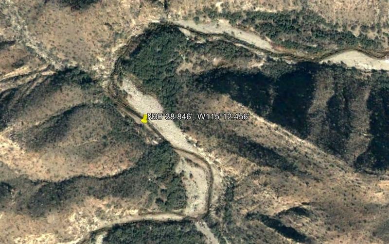
Back looking for the A Calienty Spring
David s spring: 30 38.857, -115 12.451
The other spring: 30 38.84, -115 12.446
Wp nearby on the road 30 38.8, -115 12.425
So, I drove with John B. up there again on 4/8. Conditions noted were flowing water and deep mud on several stream crossings.
We stopped at WP 17 and we noted that the springs were way over to the west and to get there we noted a tangle of trees and sticker bushes. No way I
was going over to those locations. I thought about finding a way to drive up the drainage, but once again we would have had to make a new road to get
to the water flow area.
If you study the KML file you can see that almost every crossing of the wash caused us to make hard turns. Other places where we had difficulty
finding the overgrown road shows up in the track without backing, etc.
Looking at the track on Google Earth one would never know that the wash was so overgrown with trees and bushes.
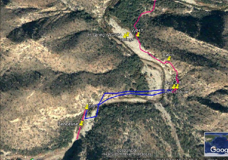
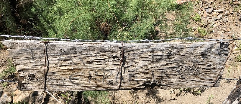
I used my handheld GPS and walked up the drainage to the fence line and took a picture of the sign. The fence crosses the wash for mountain to
mountain to mountain. That walk would have been a difficult drive.
On the way back we stopped at the gate and walked down the fence line to the rock art. There is a hole in the fence down by the wash, and it is an
easy hike. Much easier than walking from the corral up the wash.
More precise location for the cabin is 30 38.914, -115 11.722
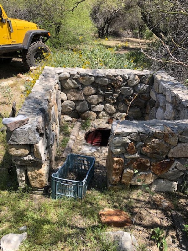
Unusual item probably not related to a spring? Location of a cistern is 30 38.941, -115 12.124
Stream bank images in order when heading West:
Attachment: A Caliente 4-8-20.kml (130kB)
This file has been downloaded 183 times
   
 
|
|
|
David K
Honored Nomad
Posts: 64479
Registered: 8-30-2002
Location: San Diego County
Member Is Offline
Mood: Have Baja Fever
|
|
Nice work... I like the GPS on the photos.
The hot springs, regardless of GPS or satellite images, is not in the middle of the arroyo (as your image shows 'DK Spring'. It is up on the berm
along the west side (left side in your image) of the arroyo at this location.
You can smell the hot water before you get there... sulfur, but not real strong. The hot water stream drops down the berm from the source spring and
creates its own hot stream which runs hundreds of feet to where it finally meets the cool-water stream in the middle of the arroyo.
[Edited on 4-17-2020 by David K]
|
|
|
PaulW
Ultra Nomad
Posts: 3005
Registered: 5-21-2013
Member Is Offline
|
|
I get the coords off my phone and have yet to validate them. Easy to do but not done yet.
There is water flowing almost as far west as the fence, but it stops flowing somewhere west of the corral. The first bank crossing would be close. The
cisterns are empty as the plumbing is in disarray.
Seems like it would be a big deal to walk up the creek bed to find a spring.
It is not like years before when the undergrowth was only ankle high. I had to laugh when I reviewed Lou's ariel photo depicting a farm area. Nothing
even remotely like that any more.
Times have changed.
|
|
|
David K
Honored Nomad
Posts: 64479
Registered: 8-30-2002
Location: San Diego County
Member Is Offline
Mood: Have Baja Fever
|
|
I am sure flash floods change things a lot!
I would really like you to find the hot spring and hot stream and photograph it to compare to 2004.
The volume of hot (140°F) water pouring out of the ground and creating a hot stream, right there, was amazing.
|
|
|
PaulW
Ultra Nomad
Posts: 3005
Registered: 5-21-2013
Member Is Offline
|
|
Also note the GE image is now 17 years old.
|
|
|
PaulW
Ultra Nomad
Posts: 3005
Registered: 5-21-2013
Member Is Offline
|
|
Quote: Originally posted by David K  | I am sure flash floods change things a lot!
I would really like you to find the hot spring and hot stream and photograph it to compare to 2004.
The volume of hot (140°F) water pouring out of the ground and creating a hot stream, right there, was amazing. |
=== =
Your descriptions compare favorably with my first visit in the early 2000s.
|
|
|
| Pages:
1
2 |


