David K
Honored Nomad

Posts: 64479
Registered: 8-30-2002
Location: San Diego County
Member Is Offline
Mood: Have Baja Fever
|
|
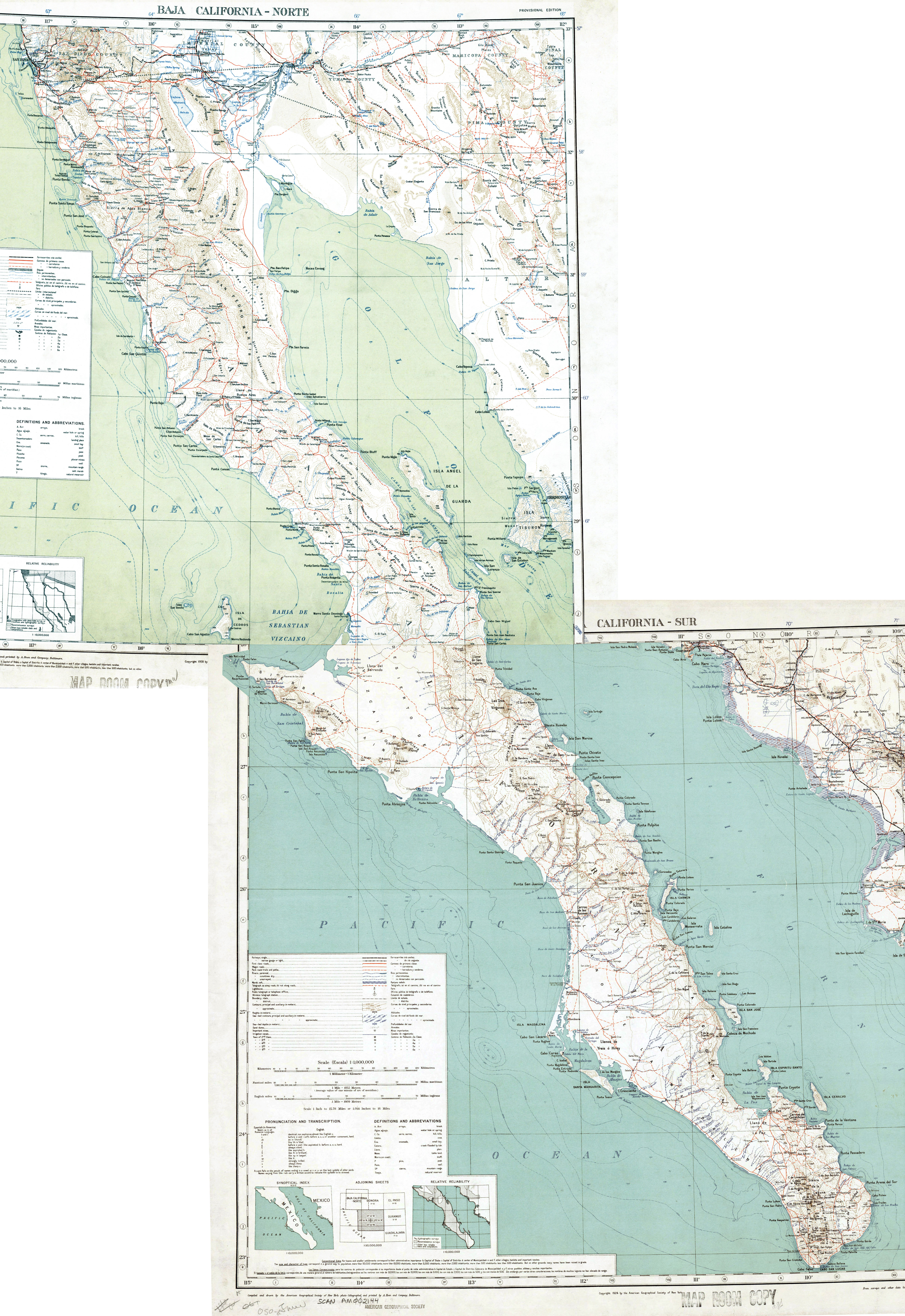
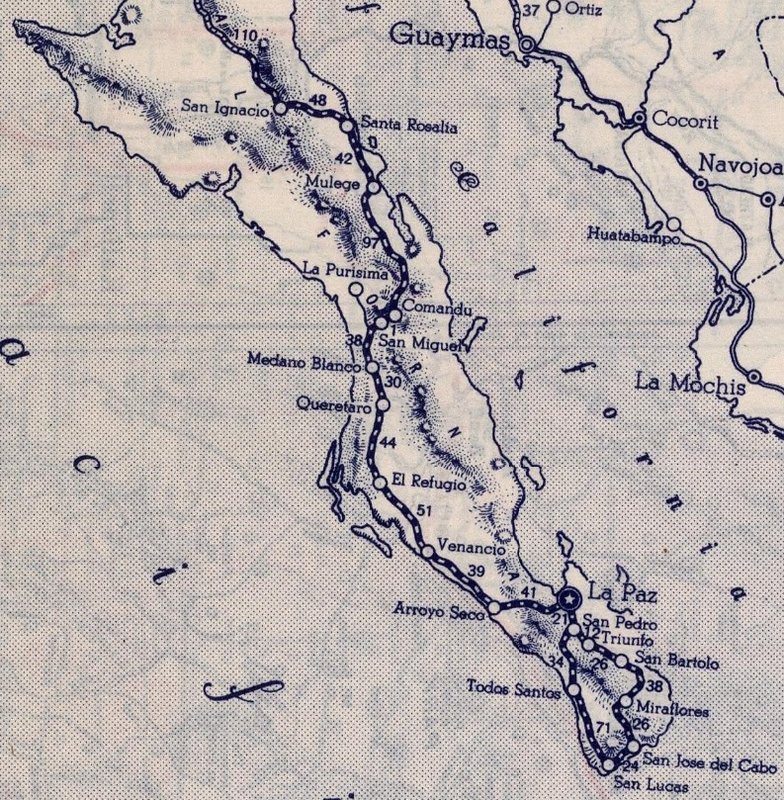
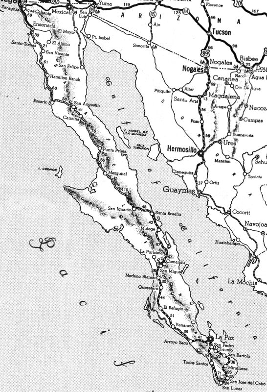
1939 Rand McNally Mexico: Baja California close ups + 1923 & 1928 maps
[Edited on 10-21-2021 by David K]
|
|
|
geoffff
Senior Nomad
Posts: 643
Registered: 1-15-2009
Member Is Offline
|
|
Apparently I can't resist messing around with map images. Here is my stitched / cleaned version of David's scans above:
1939--Rand-McNally--Mexico--Baja.jpg
|
|
|
David K
Honored Nomad
Posts: 64479
Registered: 8-30-2002
Location: San Diego County
Member Is Offline
Mood: Have Baja Fever
|
|
Oh... nice! You got rid of the bleed through, too.
|
|
|
geoffff
Senior Nomad
Posts: 643
Registered: 1-15-2009
Member Is Offline
|
|
Yeah! With my blur & subtraction trick.
|
|
|
David K
Honored Nomad
Posts: 64479
Registered: 8-30-2002
Location: San Diego County
Member Is Offline
Mood: Have Baja Fever
|
|
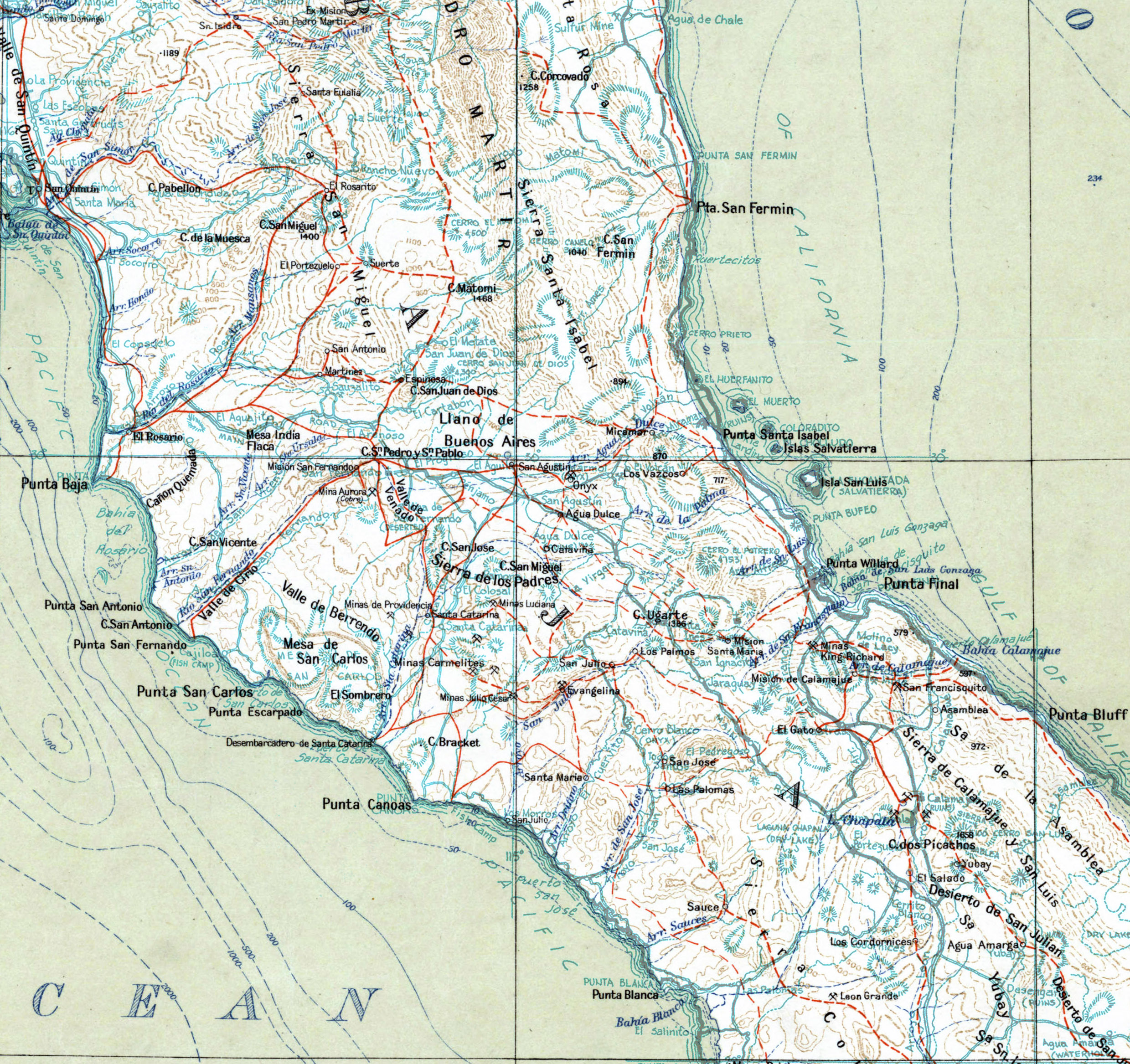
Based on where it is placed, on the road to Punta Prieta, I would say it is an error and meant to be Cataviña. There is a Rancho Santa Catarina not
too far away, but on the road to the coast, well off the main road south.
|
|
|
David K
Honored Nomad
Posts: 64479
Registered: 8-30-2002
Location: San Diego County
Member Is Offline
Mood: Have Baja Fever
|
|
Thanks for the map links... Fun fun fun to look at old maps... But wow, are they ever off target with ranch, arroyo, and trail placements!
*Cool that El Metate/ San Juan de Dios is labeled 'Espinosa'.
*Santa Catarina appears pretty true, midway between San Agustin and Desembarcadero de Santa Catarina.
*The Cataviña is shown south of Agua Dulce pretty true, but way too north and distant from Mission Santa María.
*Look how badly they located Arroyo Calamajué and then Mission Calamajué and/or Laguna Chapala!
*Laguna Chapala is actually closer to what is called El Gato on the 1928 map.
This is great fun since we know the true locations of these places, thanks mostly to the first really accurate road maps of Baja, from Howard Gulick
(1956-1962 maps).
1928 vs. 1962:
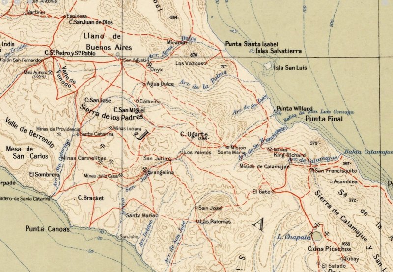
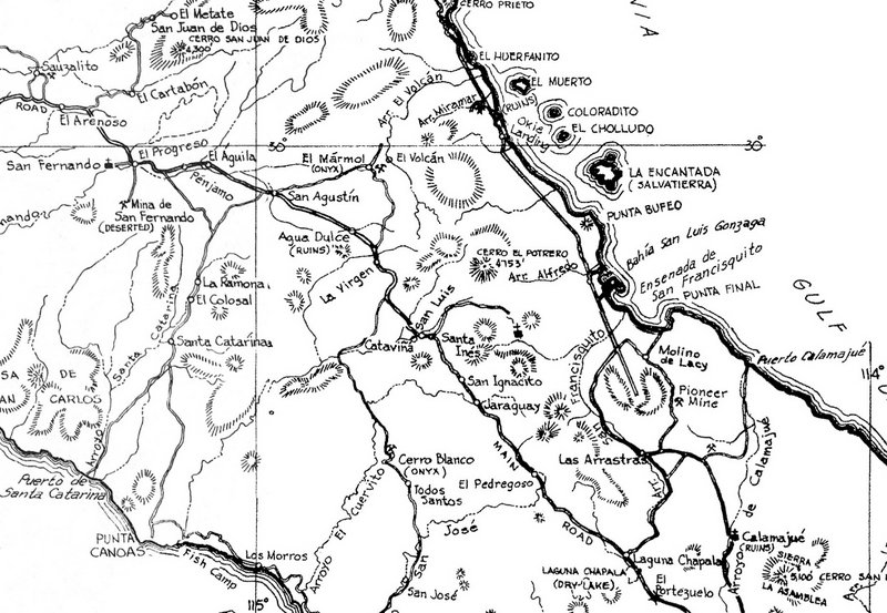
I tried to get close to showing the same areas on both...
Places to match or compare may include Punta Final, Punta Canoas, Cerro San Juan de Dios, San Agustin, Onyx (El Mármol), Agua Dulce, Laguna Chapala,
the Missions of San Fernando, Santa María, and Calamajué.
|
|
|
geoffff
Senior Nomad
Posts: 643
Registered: 1-15-2009
Member Is Offline
|
|
Hey David, I'm not sure I've seen that 1928 map yet. What is it? Do you have more scans?
-- Geoff
|
|
|
David K
Honored Nomad
Posts: 64479
Registered: 8-30-2002
Location: San Diego County
Member Is Offline
Mood: Have Baja Fever
|
|
Lance provides the whole map with this link: https://collections.lib.uwm.edu/digital/collection/agdm/id/4...
Geoff, can you overlay the Gulick map onto the 1928 map... maybe just the area I posted above? I believe the Gulick maps are very close to correct but
some of the 1928 points are wildly off.
Thanks!
|
|
|
David K
Honored Nomad
Posts: 64479
Registered: 8-30-2002
Location: San Diego County
Member Is Offline
Mood: Have Baja Fever
|
|
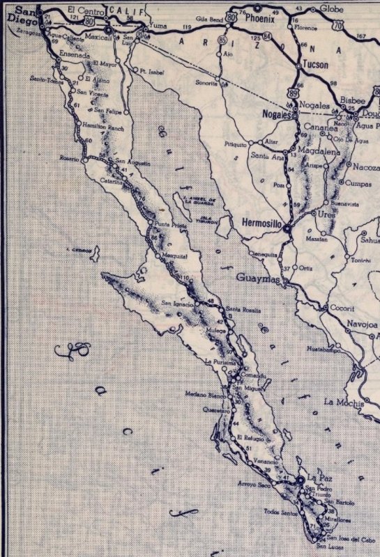
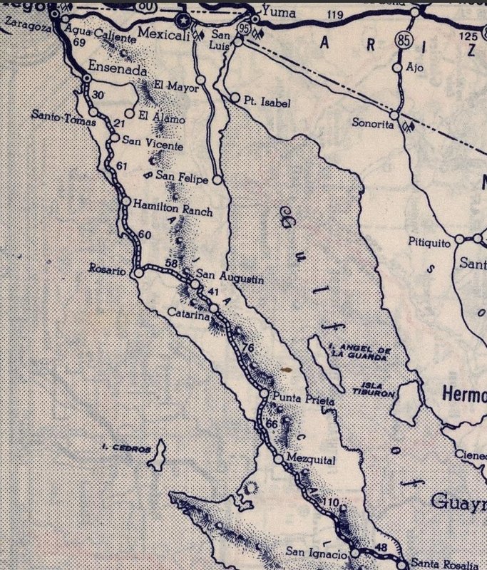
This appears to be the the same map, but of southern Baja, and is dated 1923 and copyright 1924:
https://collections.lib.uwm.edu/digital/collection/agdm/id/4...
|
|
|
geoffff
Senior Nomad
Posts: 643
Registered: 1-15-2009
Member Is Offline
|
|
Cool, thanks!
Looks like I never found these in my previous searches as they are indexed under their titles as "Hispanic America" instead of "Baja California".
Too bad they don't seem to have the south half of the 1928 map or the north half of the 1923 one. (I searched!)
|
|
|
David K
Honored Nomad
Posts: 64479
Registered: 8-30-2002
Location: San Diego County
Member Is Offline
Mood: Have Baja Fever
|
|
My guess is it was just that many years between the two?
Can you splice them into one?
|
|
|
geoffff
Senior Nomad
Posts: 643
Registered: 1-15-2009
Member Is Offline
|
|
Here is the overlay, with the Gulick map in blue-green.
Click image to open bigger image.

|
|
|
geoffff
Senior Nomad
Posts: 643
Registered: 1-15-2009
Member Is Offline
|
|
Click image for larger version:

|
|
|
David K
Honored Nomad
Posts: 64479
Registered: 8-30-2002
Location: San Diego County
Member Is Offline
Mood: Have Baja Fever
|
|
Wonderful work!
On the overlay, pretty spot on between the two coastlines... Missions San Fernando and Santa María are pretty close but most other known spots are
5-10 miles off or more... like Cataviña!
|
|
|